effects of global warming on coastal cities: a katrina case...
TRANSCRIPT
Effects of Global Warming on Coastal Cities: A Katrina Case Study
Introduction
This lesson was created to discuss the possible effects of temperatures increasing worldwide, with a focus on the events that made hurricane Katrina a deadly storm. In this lesson students will review hurricane formation and the mechanisms that cause global warming. Students will also make predictions about future weather problems while using hurricane Katrina as a model for future hurricanes. The first activity is a WebQuest (students go to designated websites and answer specific questions about information from that site) where students will manipulate data in different models to see how it will potentially affect coastal regions. The second activity is one where students will answer questions after reading the Hurricane Katrina incident. At the end of the assignment they will determine and predict possible effects for the future.
Learning Outcomes
Upon completion of this activity, students will be able to: - Describe the formation and degradation of hurricanes. - Describe the factors that limit growth to hurricanes. - Determine how rising sea levels will affect coastal regions. - Analyze current scientific models (Sea level Rise viewer) and make predictions based
on those models.
Curriculum Alignment
2010 North Carolina Essential Standards for High School Science Earth and Environmental Science EEn.2.6.4 Explain how changes in global temperature have and will impact sea level. EEn.2.5.3 Explain how cyclonic storms form based on the interaction of air masses. EEn.2.6.4 Attribute changes to Earth’s systems to global climate change (temperature
change, changes in pH of ocean, sea level changes, etc.).
Classroom Time required
90 minutes total
Activity 1: WebQuest* 20-25 minutes
Activity 2: Article Synopsis 55 minutes
Activity 2: Film excerpt 10 minutes
Materials Needed
Activity 1
- Computer Lab (computers with Internet access, can use with partners or individual) - Red colored pens or pencils

- WebQuest worksheet (One sheet per student, another option is to email students the webquest which will make it easier for them find the sites because they can copy and paste or just use the hyperlink to find the site).
Activity 2
- DVD player (with capability to fast-forward) - DVD copy of “An Inconvenient Truth” - Chart Tablet Paper (24x32in/ 61x81.3cm) (If not available can use notebook paper) - Chart Paper Suggested Template - Katrina Technical Report Questionnaire, one per student or student group - Dictionaries - Hurricane Katrina A Climatological Perspective”(1 copy per student group)
o http://www.ncdc.noaa.gov/oa/reports/tech-report-200501z.pdf - Permanent Markers
Procedure Prior to conducting the activity, students should have a basic understanding of global warming and the mechanisms responsible. Activity 1: Webquest 1. Distribute the student WebQuest worksheets and tell students they will be investigating the
effects of global warming on coastal regions. 2. Provide students 20-25 minutes to complete the WebQuest either individually or in pairs. 3. Conclude this activity by asking the class what they learned and if they have any questions.
Activity 2: Article Synopsis/ Video Note: This activity would be preferably done in a classroom and not computer lab. 1. Ask students to recall what they remember about Hurricane Katrina and to speculate about
why the storm was deadly. 2. See if students have any lingering questions about the hurricane. 3. Place students into groups of three and assign each student a role:
Researcher/Time Keeper is responsible for looking up words that they are unsure about Recorder is responsible for placing the thoughts of the group on the chart paper. Spokesman is responsible for highlighting key points in article and answering questions asked by teacher.
4. Then, distribute copies of the NOAA report, Hurricane Katrina A Climatological Perspective, and ask students to review in small groups. The report is NOAA’s overview of what happened during Hurricane Katrina from the formation of the hurricane to its first landfall in Florida to the events that caused it grow to a category 5 storm and its dissipation.
5. Have students read the following sections of the report: Introduction, Storm Chronology 2.1, and Contributing Factors.
6. On chart paper have each group write the 3 most important points for each section or summarize each section in 3 sentences. A section of their paper should be devoted to recording vocabulary words they think are important from the article. Note: a suggested template for how to organize the chart paper is included in this lesson.

7. Give the students 20-25 minutes to discuss amongst themselves the article and answer questions on the Katrina Technical Report Questionnaire.
8. Allow each group to share their thoughts on the report aloud with the class. The student discussion normally takes about 10-15 minutes depending on the number of groups (3 min./Group).
9. After the last group presents have students return to their seats and conclude by showing a 4 minute clip from “An Inconvenient Truth” (28 minutes -32 minutes). This portion of the video depicts how global warming influences ocean temperature and tropical cyclone formation.
10. Conclude this lesson by discussing the current science on hurricanes and global warming or invite your students to conduct research on the relationship between hurricanes and global warming. Potential resources include:
Global Warming and Hurricanes http://www.gfdl.noaa.gov/global-warming-and-hurricanes What is the link between hurricanes and global warming? http://www.skepticalscience.com/hurricanes-global-warming.htm
Assessment 1. Activity 1: Completed WebQuest worksheet. An answer key is provided. 2. Activity 2: Assess students by their closing remarks on their chart paper with their groups
and their responses to the Katrina Technical Report Questionnaire.
Differentiation • Place students in mixed ability partners. • Provide additional time to complete activities.
Resources
WebQuest
http://climate.nasa.gov/ClimateTimeMachine/climateTimeMachine.cfm http://climate.nasa.gov/evidence/#no9 http://climate.nasa.gov/SeaLevelViewer/seaLevelViewer.cfm Hurricane Katrina A Climatological Perspective http://www.ncdc.noaa.gov/oa/reports/tech-report-200501z.pdf
Teachers NASA’s Sea Level Rise Viewer (Hurricane Katrina) http://climate.nasa.gov/SeaLevelViewer/seaLevelViewer.cfm NASA Sea Surface Temperature Visualization http://earthobservatory.nasa.gov/GlobalMaps/view.php?d1=MYD28M National Hurricane Center Glossary http://www.nhc.noaa.gov/aboutgloss.shtml

About the author Justin Lewis is an Earth/Environmental Science teacher Dudley High School in Greensboro, NC. He successfully completed the NC Climate Fellows Program in 2012. This lesson was reviewed and edited by Dana Haine, MS, K-12 Science Education Manager for UNC-Chapel Hill’s Institute for the Environment and Program Director for the NC Climate Fellows Program, a teacher professional development program made possible with support from NASA’s Innovations in Climate Education (NICE) project.

Name: _____________________________________ Period:____ Date: ________
Instructions: In order to complete this worksheet you need to type the web address (underlined in blue) into the address bar. Once you have located the website follow the instructions and record your answers to the questions.
Visit NASA’s Climate Time Machine http://climate.nasa.gov/ClimateTimeMachine/climateTimeMachine.cfm Click on the tab that reads “Sea Ice”
1. Between which years do you notice the greatest reduction in the amount of sea ice? 2. Why do you think the extent of sea ice cover in 1993 is dramatically different than the ice cover in
1994? 3. Based on the pattern make a prediction about the extent of sea ice cover in the Arctic Sea in year
2020. 4. Where do you think the water goes that has melted from the sea ice over the summer months? 5. What geographic areas do you think will be influenced the most by summer melting?
Next, click on the tab that reads “Average Global Temperature”
Go to the year 1890 and with a red colored pencil shade on the map which regions of the Earth experienced warmer than average temperatures.
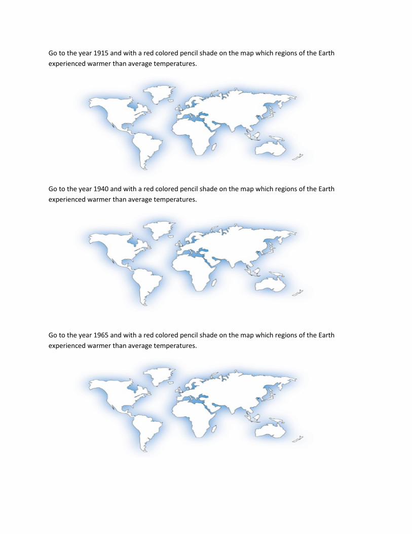
Go to the year 1915 and with a red colored pencil shade on the map which regions of the Earth experienced warmer than average temperatures.
Go to the year 1940 and with a red colored pencil shade on the map which regions of the Earth experienced warmer than average temperatures.
Go to the year 1965 and with a red colored pencil shade on the map which regions of the Earth experienced warmer than average temperatures.

Go to the year 1990 and with a red colored pencil shade on the map which regions of the Earth experienced warmer than average temperatures.
Go to the year 2007 and with a red colored pencil shade on the map which regions of the Earth experienced warmer than average temperatures.
6. What would be some effects of warming taking place at the poles?
7. What would be some effects of warming taking place near the equator?
8. Why do you think there is variation between the years?
9. Make a prediction about possible consequences for a warmer Earth. (3 sentences)

Click on the bottom tab that reads “Sea Level”
10. How much will sea levels rise if the ice sheet in Greenland melts completely? 11. For the “Southeast United States” how many meters does the sea need to rise for Miami and New
Orleans to be flooded? 12. Look at “Northern Europe,” how many meters does the sea need to rise for Amsterdam to be
flooded?
Visit NASA’s Sea Level Rise Viewer http://climate.nasa.gov/SeaLevelViewer/seaLevelViewer.cfm
Click on “Hurricane Katrina” (use headphones to hear the synopsis)
13. What does the video say may result in higher water temperatures? 14. What happened to hurricane Katrina as it passed over Cooler waters? 15. What might you predict about hurricanes in a warmer world?
Visit: http://climate.nasa.gov/evidence/
16. Scroll down to the section that reads “Sea level rise.” According to the text, how high has the ocean risen the last century?
17. Scroll down to the section that reads “Warming Oceans.” According to the text, how is the ocean affected by increasing air temperatures?
Conclusion: 18. Based on the information presented and what you have learned from this worksheet , predict the negative effects of a warmer Earth. (3 sentences)

Katrina’s Technical Report Questionnaire Name:
Introduction 1. What was the estimated death toll and cost of damages for Hurricane Katrina? 2. Why do you think 250,000 people were displaced after the storm?
Storm Chronology
1. What was the classification of Hurricane Katrina as it hit Florida? 2. What was the largest wind speed recorded while Hurricane Katrina was in
Florida? 3. What does the report say was the cause for Hurricane Katrina to become
‘major hurricane’? 4. What was the highest recorded wind speed for the Hurricane? 5. What was the classification of Hurricane Katrina when it hit New Orleans 6. Why do you think the hurricane began to weaken as it traveled northeast?
Contributing Factors
1. What were the reasons for the increase in Hurricane intensity? 2. Do you believe that these factors were influenced by global warming? Why?

Reading: Hurricane Katrina A Climatological Perspective Chart Paper: Suggested Template Introduction Group member: ______________________ Storm Chronology Group member: ______________________ Contributing Factors Group member: ______________________ Important Vocabulary Closing Remarks Person 1 Person 2 Person 3

Name: TEACHER ANSWER KEY Period:____ Date: ________
Instructions: In order to complete this worksheet you need to type the web address (underlined in blue) into the address bar. Once you have located the website follow the instructions and record your answers to the questions.
Visit NASA’s Climate Time Machine http://climate.nasa.gov/ClimateTimeMachine/climateTimeMachine.cfm Click on the tab that reads “Sea Ice”
Click the tab that says “Sea Ice”. If you look under the globe you will notice a panel that has dates on it. You should drag the tab on that panel to see the changes in the amount of sea ice based on the year.
1. Between which years do you notice the greatest reduction in the amount of sea ice? Between 2006- 2007
2. Why do you think the extent of sea ice cover in 1993 is dramatically different than the ice cover in 1994? Having a cooler summer will result in lower temperatures which means there will be more ice.
3. Based on the pattern make a prediction about the extent of sea ice cover in the Arctic Sea in year 2020? If the pattern continues there will be little of any at all
4. Where do you think the water goes that has melted from the sea ice over the summer months? Its displaced into the surrounding ocean
5. What geographic areas do you think will be influenced the most by summer melting? Coast
Next, click on the tab that reads “Average Global Temperature”
Go to the year 1890 and with a red colored pencil shade on the map which regions of the Earth experienced warmer than average temperatures.
Go to the year 1915 and with a red colored pencil shade on the map which regions of the Earth experienced warmer than average temperatures.

Go to the year 1940 and with a red colored pencil shade on the map which regions of the Earth experienced warmer than average temperatures.
Go to the year 1965 and with a red colored pencil shade on the map which regions of the Earth experienced warmer than average temperatures.

Go to the year 1990 and with a red colored pencil shade on the map which regions of the Earth experienced warmer than average temperatures.
Go to the year 2007 and with a red colored pencil shade on the map which regions of the Earth experienced warmer than average temperatures.
6. What would be some effects of warming taking place at the poles? A decrease in the amount of ice and sea levels gradually increasing.
7. What would be some effects of warming taking place near the equator? Warmer surface temperatures and increased evaporation.
8. Why do you think there is variation between the years? Could be solar activity and sometimes you just have cooler years
9. Make a prediction about possible consequences of a warmer Earth. (3 sentences) Answers will vary but should include ice melting and increase surface temperatures.
Click on the bottom tab that reads “Sea Level”
10. How much will sea levels rise if the ice sheet in Greenland melts completely? 5-7 meters (16-23 feet) 11. For the “Southeast United States” how many meters does the sea need to rise for Miami and New
Orleans to be flooded? 3 meters

12. Look at “Northern Europe” how many meters does the sea need to rise for Amsterdam to be flooded? 1 meter
Visit NASA’s Sea Level Rise Viewer http://climate.nasa.gov/SeaLevelViewer/seaLevelViewer.cfm
Click on “Hurricane Katrina” (use headphones to hear the synopsis)
13. What does the video say may result in higher water temperatures? If you have higher sea levels it could cause warmer water.
14. What happened to hurricane Katrina as it passed over Cooler waters? It decreased in power 15. What might you predict about hurricanes in a warmer world? If the water continues to increase it
will increase the power of the hurricanes
Visit: http://climate.nasa.gov/evidence/
16. Scroll down to the section that reads “Sea level rise.” According to the text, how high has the ocean risen the last century? 17 centimeters (6.7 inches)
17. Scroll down to the section that reads “Warming Oceans.” According to the text, how is the ocean affected by increasing air temperatures? It says that the oceans have absorbed most of the increased heat in the top 700 meters of the ocean.
Conclusion: 18. Based on the information presented and what you have learned from this worksheet , predict the negative effects of a warmer Earth. (3 sentences)
Answers will vary and should include ice melting and increase surface temperatures. Should also make references to the weather extremes - focusing on hurricanes becoming stronger due to increased ocean temperature.