the history with marine science
DESCRIPTION
The History with Marine Science. Navigation/Exploration; Early Science; Modern Era 3000 BC: Polynesians (mid-Pacific Islands) or Phoenicians (Mediterranean, Britain, West Africa) 700s BC: Greeks as first cartographers (chart makers); word ocean from okeanus (river). - PowerPoint PPT PresentationTRANSCRIPT
The History with Marine Science
• Navigation/Exploration; Early Science; Modern Era
• 3000 BC: Polynesians (mid-Pacific Islands) or Phoenicians (Mediterranean, Britain, West Africa)
• 700s BC: Greeks as first cartographers (chart makers); word ocean from okeanus (river).
• 300s BC: Chinese invented the compass, which did not arrive in the West until 1100s AD by Arabs. Admiral Zheng He 1403-1433, good will expeditions.

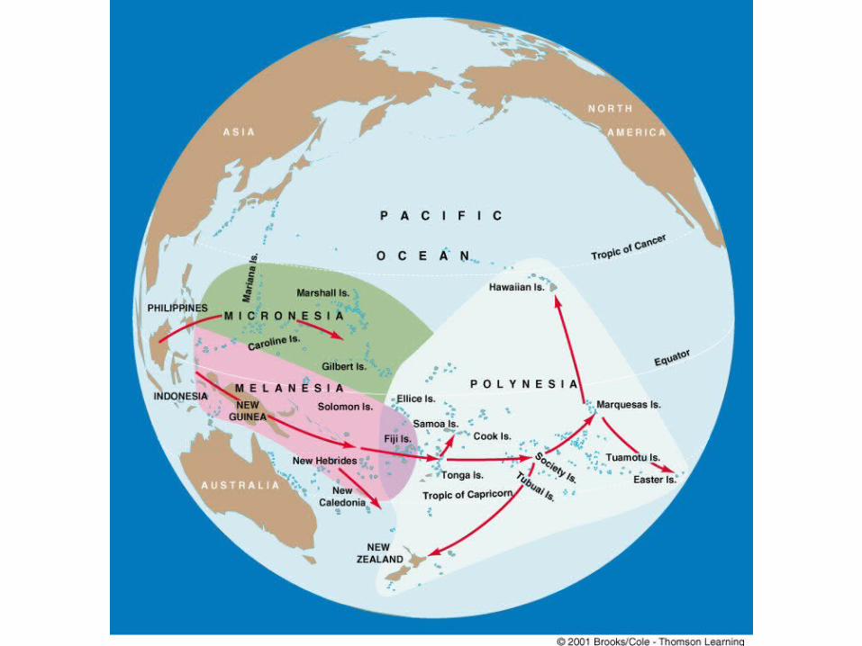
Polynesian Exploration:
From Indo-china eastward into the Pacific 30,000 years ago to New Guinea and Philippine Is. by 20,000 years.
Expansion to mid-Pacific island about 2,500 years ago, reaching Hawaii by 450-600 AD (or about 1,500 years ago).

Mediterranean Advances:
Library of Alexandria (235BC to 415 AD) housed all knowledge of the region. Ancients may have been more advanced than remaining records suggest.
Eratosthenes (second librarian) was first to calculate the circumference of the earth (230 BC). His estimate was 46,250 km and the actual is 40,000 km.
He was also the first cartographer to place longitude and latitude lines of orientation on his charts.
= 7.2º

Later Hipparchus (ca 120 BC) divided the globe in 360º of arc.
Ptolemy (ca 150 AD) defined the present coordinate system (W-E; N-S), and divided degrees into 60 minutes and minutes into 60 seconds
Eratosthenes’ chart (ca 300 BC)

Early European Advances:
Prince Henry of Portugal (“the Navigator” mid-1400s AD), encouraged the use of the compass. Established first known institute of marine science and navigation.
Not until after Columbus “discovered” the New World in 1492 did the Americas appear on charts.
First circumnavigation of the globe was performed by Ferdinand Magellan between 1519-1522.
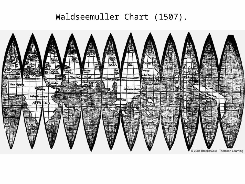
Waldseemuller Chart (1507).
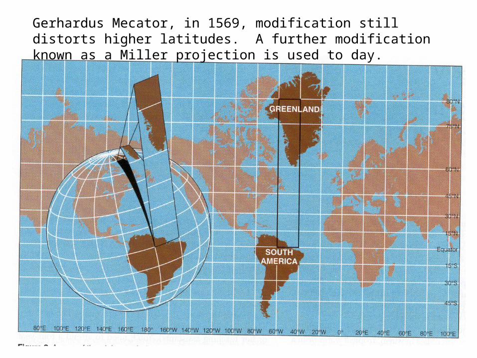
Gerhardus Mecator, in 1569, modification still distorts higher latitudes. A further modification known as a Miller projection is used to day.

Magellan was seeking trade routes to the Orient. He died in 1521 while in the Phillipines Islands. Only 13 % of his crew circumnavigated Earth.
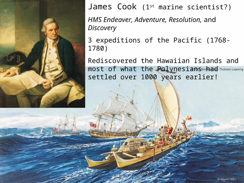
James Cook (1st marine scientist?)
HMS Endeaver, Adventure, Resolution, and Discovery
3 expeditions of the Pacific (1768-1780)
Rediscovered the Hawaiian Islands and most of what the Polynesians had settled over 1000 years earlier!
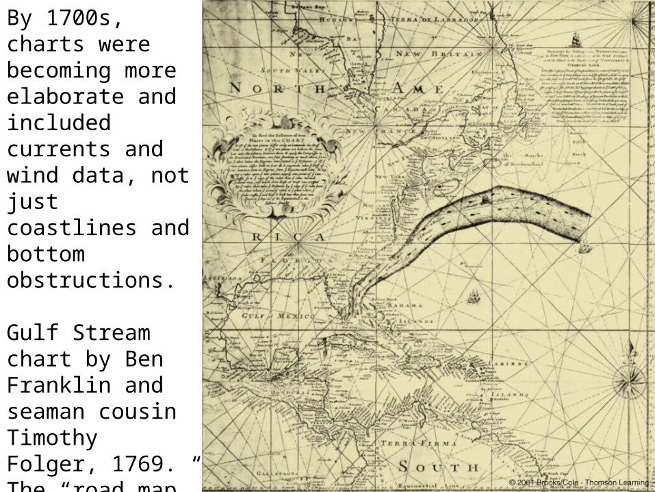
By 1700s, charts were becoming more elaborate and included currents and wind data, not just coastlines and bottom obstructions.
Gulf Stream chart by Ben Franklin and seaman cousin Timothy Folger, 1769. The “road map” to fast trans-Atlantic travel.
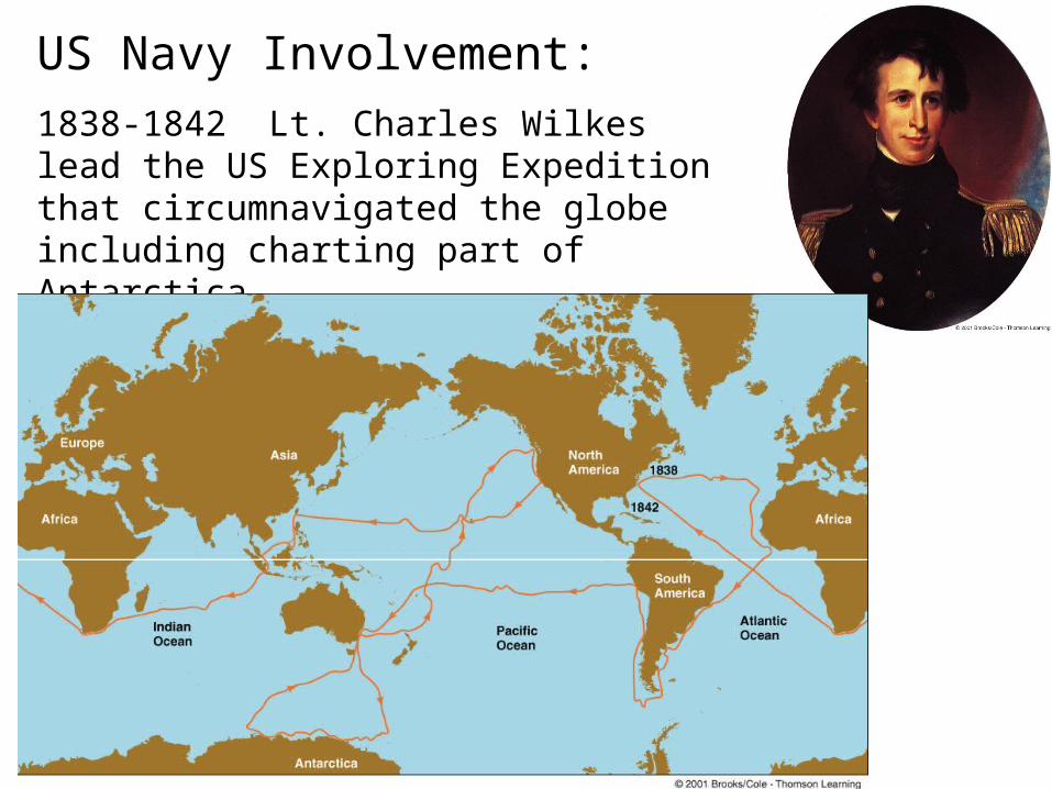
US Navy Involvement:
1838-1842 Lt. Charles Wilkes lead the US Exploring Expedition that circumnavigated the globe including charting part of Antarctica.

Formal Database Established on Navigation Charts.
Matthew Maury, 1847, as Director of Bureau of Charts.
Launched research into understanding current and wind systems globally.
Maury was a “pencil pusher”, a cartographer not a mariner.
Revised charts were distributed free of charge in exchange for more ship log data from captains.

Challenger Expedition (1872-1876):Charles Thompson and John Murray lead the first purely oceanographic expedition to focus on life at sea, as well as physical and chemical conditions where it was found. Over 362 sampling stations resulted in discovery of more than 4000 species. Searched to depths of >3000 m and found organism! There was life below 600 m.
Charles Darwin’s voyages on HMS Beagle (1831-1836) were less extensive.

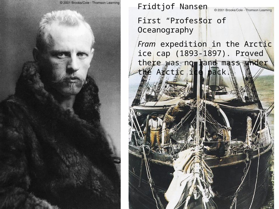
Fridtjof Nansen
First “Professor of Oceanography”
Fram expedition in the Arctic ice cap (1893-1897). Proved there was no land mass under the Arctic ice pack.
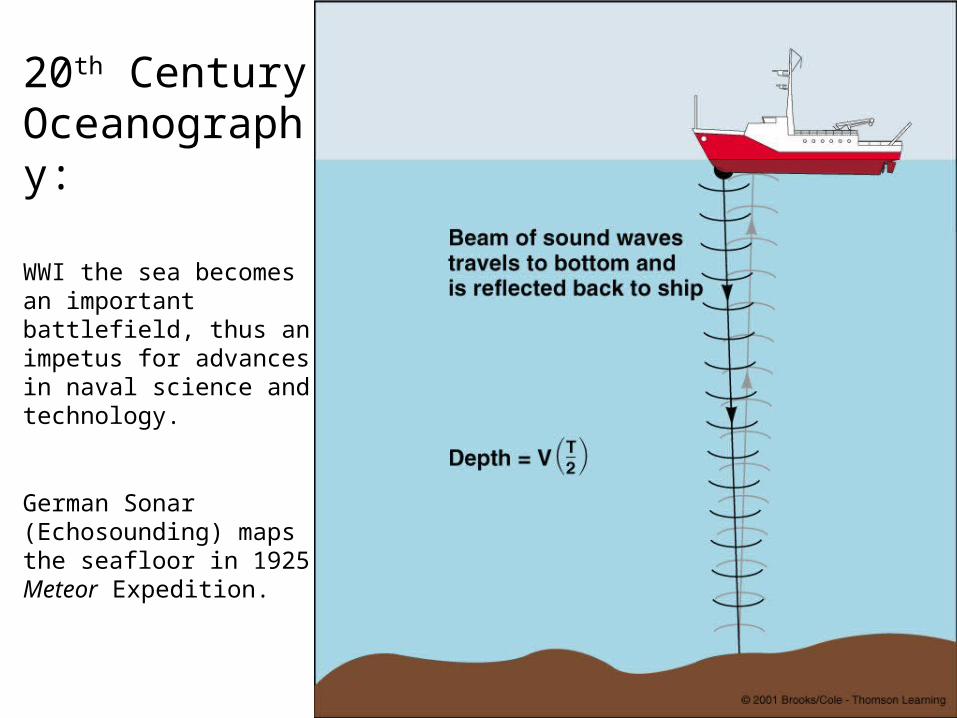
20th Century Oceanography:
WWI the sea becomes an important battlefield, thus an impetus for advances in naval science and technology.
German Sonar (Echosounding) maps the seafloor in 1925 Meteor Expedition.

Glomar Challenger, 1960s
Ocean floor drilling to study seafloor formation and age.

Kaiko
JAMSTEC = Japanese marine science consortium
ROV = remote operated vehicle; Depth of 11,000 m
Alvin
WHOI = Woods Hole Oceanographic Institute
Manned submersible; depth of 4,500 m; deep sea vent studies.
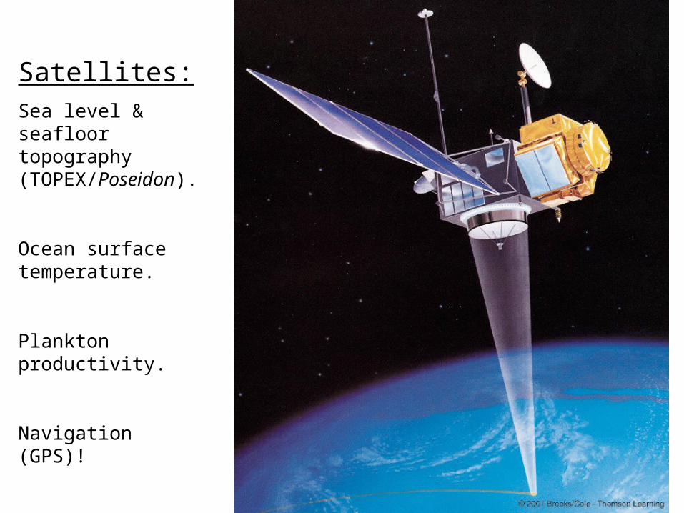
Satellites:Sea level & seafloor topography (TOPEX/Poseidon).
Ocean surface temperature.
Plankton productivity.
Navigation (GPS)!