marine science - amazon s3...marine science laboratory manual the marine science laboratory manual...
TRANSCRIPT
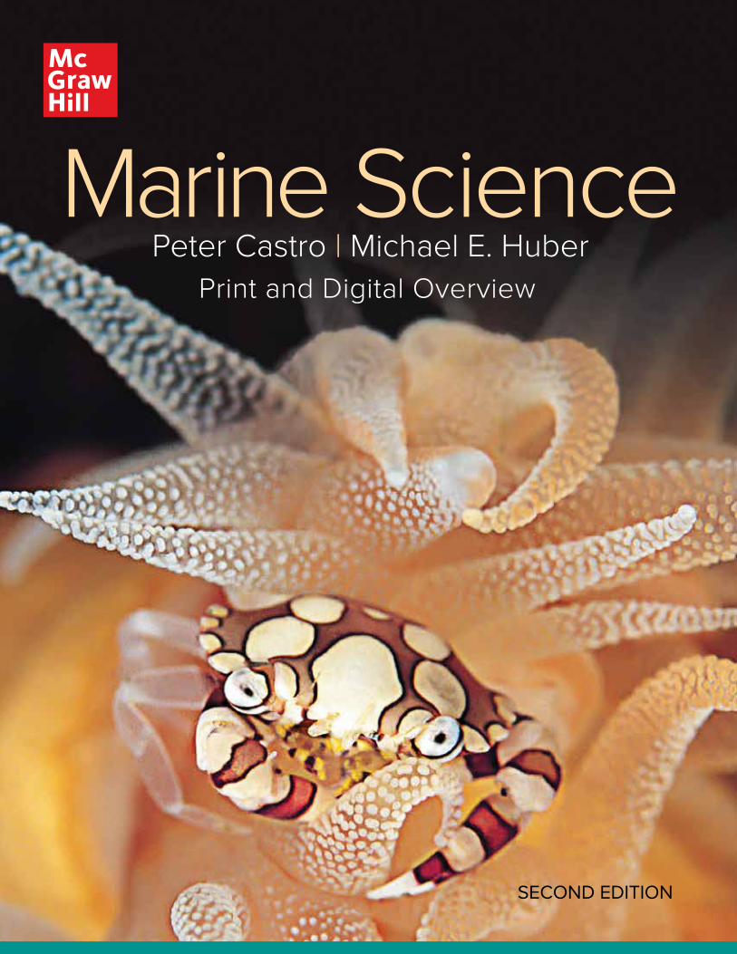
SECOND EDITION
Print and Digital Overview
Marine SciencePeter Castro | Michael E. Huber

Marine Science was written specifically for a high school course by field experts whose fascination with oceanography and marine biology is infused in every lesson of the text. The second edition offers an easy-to-read design, up-to-date scientific data, and an interdisciplinary focus. Marine Science offers a broader focus on human and environmental interaction by pinpointing the impact of human interaction with marine environment. The Marine Science Lab Manual allows every student to experience the wonder of the world’s oceans, while the new Teacher’s Manual helps guide instruction for any teaching style.
Students’ and teachers’ favorite features include:
Study Strategy activities, including listening, speaking, reading, and peer interactions, that help to support a variety of learning styles.
Vocabulary activities and support that help students acquire and understand the key terminology of marine science.
Inquiry activities that allow students to expand upon what they’ve studied in the Nature of Science, Marine Science in Action, Habitat Spotlight, and Humans and the Ocean features.
Teacher’s Manual, available in print and online, includes a detailed pacing guide for each chapter, chapter summaries, answers to the section and chapter review questions, and differentiated instruction support and activities.
A Lab Manual with 42 labs — no ocean needed!
The first edition of Marine Science became an instant, beloved text with its full coverage of oceanography, stunning design, student-friendly learning system, and data analysis labs. Now in its second edition, the program further expands its coverage through chapter-level NGSS integration, more robust chapter reviews, additional unit projects, and ELL support.
EXPLORINGTHE INTERCONNECTED AND GLOBAL PERSPECTIVE OF THE WORLD OCEAN
mheonline.com /marinescience
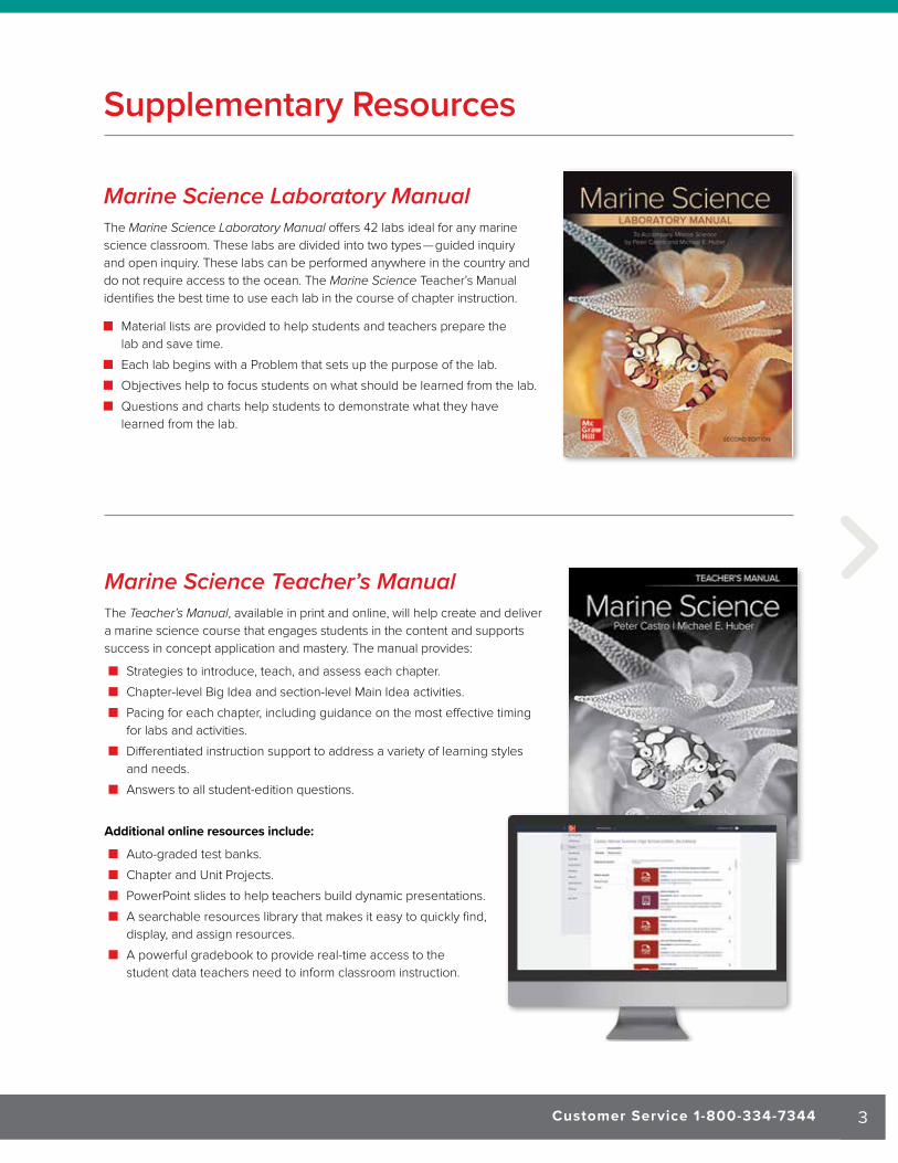
Supplementary Resources
Marine Science Laboratory ManualThe Marine Science Laboratory Manual offers 42 labs ideal for any marine science classroom. These labs are divided into two types —guided inquiry and open inquiry. These labs can be performed anywhere in the country and do not require access to the ocean. The Marine Science Teacher’s Manual identifies the best time to use each lab in the course of chapter instruction.
Material lists are provided to help students and teachers prepare the lab and save time.
Each lab begins with a Problem that sets up the purpose of the lab.
Objectives help to focus students on what should be learned from the lab.
Questions and charts help students to demonstrate what they have learned from the lab.
Marine Science Teacher’s ManualThe Teacher’s Manual, available in print and online, will help create and deliver a marine science course that engages students in the content and supports success in concept application and mastery. The manual provides:
Strategies to introduce, teach, and assess each chapter.
Chapter-level Big Idea and section-level Main Idea activities.
Pacing for each chapter, including guidance on the most effective timing for labs and activities.
Differentiated instruction support to address a variety of learning styles and needs.
Answers to all student-edition questions.
Additional online resources include:
Auto-graded test banks.
Chapter and Unit Projects.
PowerPoint slides to help teachers build dynamic presentations.
A searchable resources library that makes it easy to quickly find, display, and assign resources.
A powerful gradebook to provide real-time access to the student data teachers need to inform classroom instruction.
3Customer Service 1-800-334-7344

Mobile Ready Access to course content on-the-go is easier and more effective than ever before with the ReadAnywhere mobile app.
Marine Science is enriched with multimedia content including videos, animations, and simulations that enhance the teaching and learning experience both inside and outside of the classroom.
Authored by the world’s leading subject-matter experts and organized by chapter level, the resources provide students with multiple opportunities to contextualize and apply their understanding. Teachers can save time, customize lessons, monitor student progress, and make data-driven decisions in the classroom with the flexible, easy-to-navigate instructional tools.
Best-in-Class Digital Resources
Intuitive DesignResources are organized at the chapter level. To enhance the core content, teachers can add assignments, activities, and instructional aids to any lesson. The chapter landing page gives students access to:
Assigned activities.
Resources and assessments.
Interactive eBook.
Adaptive SmartBook®.
Chapter landing page links students to resources that support success.
mheonline.com /marinescience

Harness technology, unlock success with the digital resources for Marine Science.Visit My.MHEducation.com
Adaptive Study Tools is the online adaptive
study tool. The interactive features engage students and personalize the learning experience with self-guided tools that:
Assess a student’s proficiency and knowledge.
Track which topics have been mastered.
Identify areas that need more study.
Improve reading comprehension by highlighting key content that needs additional study.
Present focused content specific to the student’s individual needs.
Teacher ResourcesTeachers have access to the interactive eBook, adaptive SmartBook®, plus a wealth of customizable chapter resources and powerful gradebook tools.
Resources include:
The Teacher’s Manual, available in print and online, that will help create and deliver a marine science course that engages students in the content and supports success in concept application and mastery.
Student performance reports to help teachers identify gaps, make data-driven decisions, and adjust instruction.
Customizable PowerPoint presentations.
Labeled diagrams, visual aids, animations, and additional ideas for lecture enrichment.
Searchable library makes it easy to find and assign resources.
Customizable assignments and quiz banks are automatically graded and populate easy-to-read reports.
Practice questions measure depth of understanding and present a personalized learning path based on student responses.
Highlighted content continuously adapts as students work through exercises.
5Customer Service 1-800-334-7344
Marine Science Guided Tour
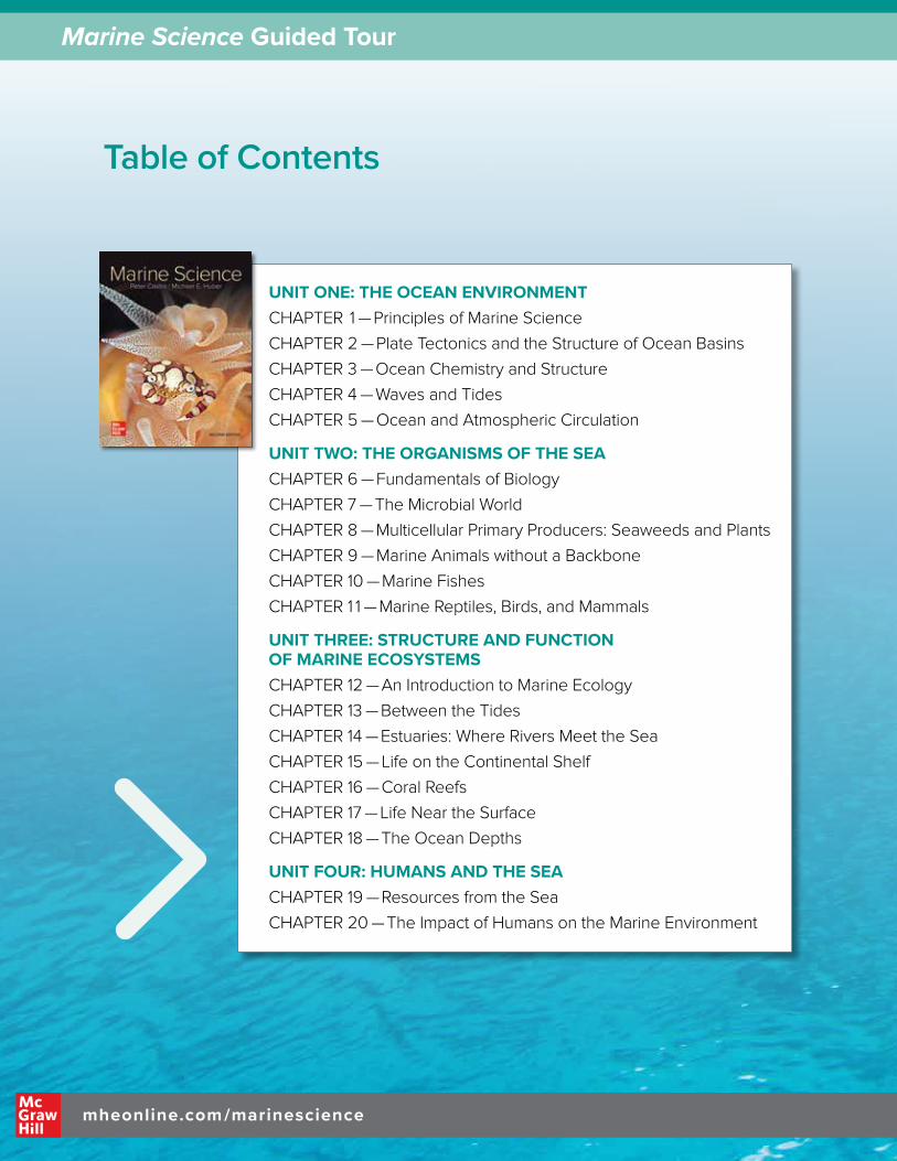
UNIT ONE: THE OCEAN ENVIRONMENTCHAPTER 1 — Principles of Marine ScienceCHAPTER 2 — Plate Tectonics and the Structure of Ocean BasinsCHAPTER 3 — Ocean Chemistry and StructureCHAPTER 4 — Waves and TidesCHAPTER 5 — Ocean and Atmospheric Circulation
UNIT TWO: THE ORGANISMS OF THE SEACHAPTER 6 — Fundamentals of BiologyCHAPTER 7 — The Microbial WorldCHAPTER 8 — Multicellular Primary Producers: Seaweeds and PlantsCHAPTER 9 — Marine Animals without a BackboneCHAPTER 10 — Marine FishesCHAPTER 1 1 — Marine Reptiles, Birds, and Mammals
UNIT THREE: STRUCTURE AND FUNCTION OF MARINE ECOSYSTEMSCHAPTER 12 — An Introduction to Marine EcologyCHAPTER 13 — Between the TidesCHAPTER 14 — Estuaries: Where Rivers Meet the SeaCHAPTER 15 — Life on the Continental ShelfCHAPTER 16 — Coral ReefsCHAPTER 17 — Life Near the SurfaceCHAPTER 18 — The Ocean Depths
UNIT FOUR: HUMANS AND THE SEACHAPTER 19 — Resources from the SeaCHAPTER 20 — The Impact of Humans on the Marine Environment
Table of Contents
mheonline.com /marinescience

144_145_MS_S_U02_C06_692818_46358.indd 22/08/18 02:35PM144_145_MS_S_U02_C06_692818_46358.indd 22/08/18 02:35PM
Unit
2The Organisms of the Sea
Chapter 6 Fundamentals of Biology
Chapter 7 The Microbial World
Chapter 8 Multicellular Primary Producers: Seaweeds and Plants
Chapter 9 Marine Animals without a Backbone
Chapter 10 Marine Fishes
Chapter 11 Marine Reptiles, Birds, and Mammals
The oceans are home to diverse assemblages or organisms adapted to the challenges of life in the sea. Kelp forests, like this one off the coast of Monterey, California, are composed of several species of kelp, a seaweed. Seaweeds are distinct from plants, but are still photosynthetic organisms that gain their energy from the sun. Kelp forest form an important habitat for many species of fish, mammals, and invertebrates, including this seven-gill shark.
U N I T P R O J E C T
Healthy oceans: how do we solve complex problems?Global challenges are often too large and complex to address as a single problem. When viewed as collections of challenges that are smaller in scope, the grander problems can feel more approachable, with solutions more achievable. Some solutions might need simultaneous implementation, while others might need to be completed in a step-wise fashion.
GO ONLINE to break down one of the many marine challenges currently facing society into a more approachable problem. In this project, you will break a complex real-world problem facing the marine environment down into identified sub-problems and identify their stakeholders and constraints through research.
144
Program: Castro 2e ©2019 Component: SEPDF Pass
Vendor: Lumina Grade: 9–12
Yim
ing
Che
n/M
omen
t/Get
ty Im
ages
7
The Unit Opener sets up chapter
content that will be
covered. It lists the
chapters included in
the unit to give the
students a preview of
what they will study.
Marine Science Learning SystemCastro’s Marine Science incorporates a variety of study aids to help students better understand the ocean and all its complexities.
Four Unit Projects, one for each unit, are introduced. These
projects build upon each other and allow students to develop
their research and analysis skills in the study of a global
challenge related to the material they are covering in the text.
Teachers can use these as independent study for individual
students or groups of students or as a classroom activity.
Customer Service 1-800-334-7344
082_087_MS_S_C04_L01_692818_27640.indd 17/08/18 02:10PM082_087_MS_S_C04_L01_692818_27640.indd 17/08/18 02:10PM
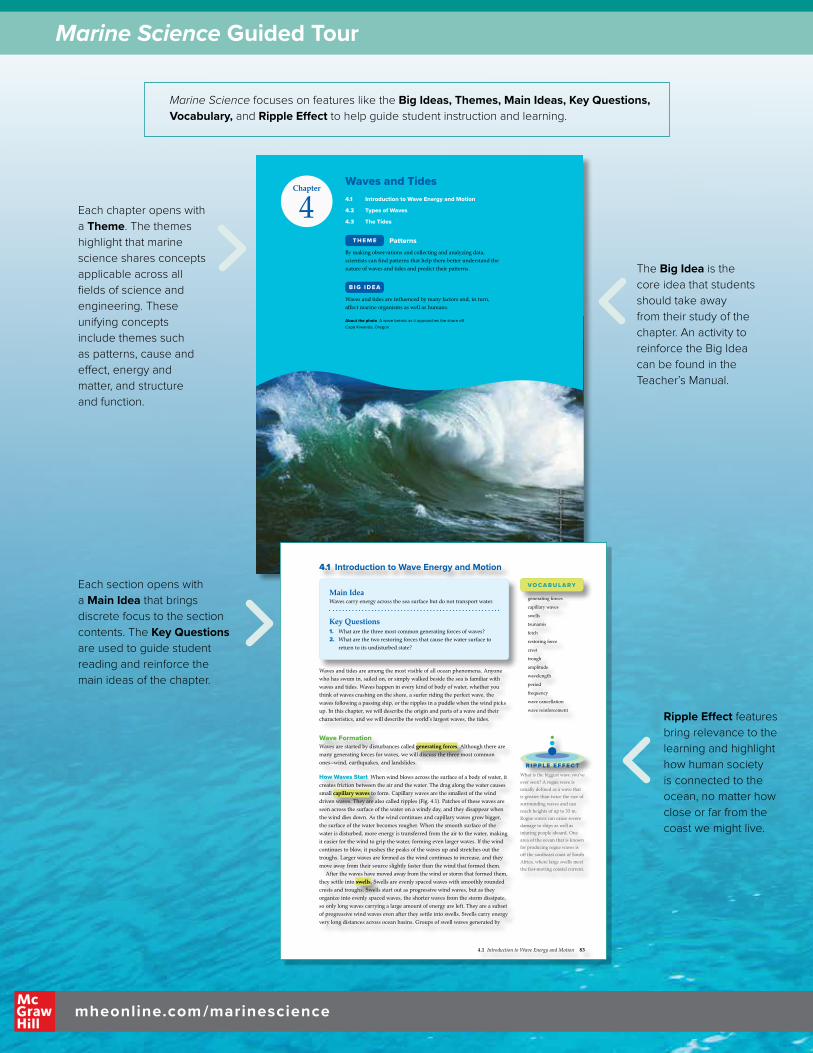
Chapter
4Waves and Tides4.1 Introduction to Wave Energy and Motion
4.2 Types of Waves
4.3 The Tides
T H E M E PatternsBy making observations and collecting and analyzing data, scientists can find patterns that help them better understand the nature of waves and tides and predict their patterns.
B I G I D E A
Waves and tides are influenced by many factors and, in turn, affect marine organisms as well as humans.
About the photo A wave breaks as it approaches the shore off Cape Kiwanda, Oregon.
Program: Castro 2e ©2019 Component: SEPDF Pass
Vendor: Lumina Grade: 9–12
82 Chapter 4 Waves and TidesD
esig
n Pi
cs/N
atur
al S
elec
tion
Cra
ig T
uttle
082_087_MS_S_C04_L01_692818_27640.indd 17/08/18 07:52PM082_087_MS_S_C04_L01_692818_27640.indd 17/08/18 07:52PM
4.1 Introduction to Wave Energy and Motion
Main IdeaWaves carry energy across the sea surface but do not transport water.
Key Questions1. What are the three most common generating forces of waves? 2. What are the two restoring forces that cause the water surface to
return to its undisturbed state?
Waves and tides are among the most visible of all ocean phenomena. Anyone who has swum in, sailed on, or simply walked beside the sea is familiar with waves and tides. Waves happen in every kind of body of water, whether you think of waves crashing on the shore, a surfer riding the perfect wave, the waves following a passing ship, or the ripples in a puddle when the wind picks up. In this chapter, we will describe the origin and parts of a wave and their characteristics, and we will describe the world’s largest waves, the tides.
Wave FormationWaves are started by disturbances called generating forces. Although there are many generating forces for waves, we will discuss the three most common ones—wind, earthquakes, and landslides.
How Waves Start When wind blows across the surface of a body of water, it creates friction between the air and the water. The drag along the water causes small capillary waves to form. Capillary waves are the smallest of the wind driven waves. They are also called ripples (Fig. 4.1). Patches of these waves are seen across the surface of the water on a windy day, and they disappear when the wind dies down. As the wind continues and capillary waves grow bigger, the surface of the water becomes rougher. When the smooth surface of the water is disturbed, more energy is transferred from the air to the water, making it easier for the wind to grip the water, forming even larger waves. If the wind continues to blow, it pushes the peaks of the waves up and stretches out the troughs. Larger waves are formed as the wind continues to increase, and they move away from their source slightly faster than the wind that formed them.
After the waves have moved away from the wind or storm that formed them, they settle into swells. Swells are evenly spaced waves with smoothly rounded crests and troughs. Swells start out as progressive wind waves, but as they organize into evenly spaced waves, the shorter waves from the storm dissipate, so only long waves carrying a large amount of energy are left. They are a subset of progressive wind waves even after they settle into swells. Swells carry energy very long distances across ocean basins. Groups of swell waves generated by
V O C A B U L A R Y
generating forces
capillary waves
swells
tsunamis
fetch
restoring force
crest
trough
amplitude
wavelength
period
frequency
wave cancellation
wave reinforcement
R I P P L E E F F E C TWhat is the biggest wave you’ve ever seen? A rogue wave is usually defined as a wave that is greater than twice the size of surrounding waves and can reach heights of up to 33 m. Rogue waves can cause severe damage to ships as well as injuring people aboard. One area of the ocean that is known for producing rogue waves is off the southeast coast of South Africa, where large swells meet the fast-moving coastal current.
Program: Castro 2e ©2019 Component: SEPDF Pass
Vendor: Lumina Grade: 9–12
4.1 Introduction to Wave Energy and Motion 83
Marine Science Guided Tour
Each chapter opens with a Theme. The themes highlight that marine science shares concepts applicable across all fields of science and engineering. These unifying concepts include themes such as patterns, cause and effect, energy and matter, and structure and function.
The Big Idea is the core idea that students should take away from their study of the chapter. An activity to reinforce the Big Idea can be found in the Teacher’s Manual.
Each section opens with a Main Idea that brings discrete focus to the section contents. The Key Questions are used to guide student reading and reinforce the main ideas of the chapter.
Ripple Effect features bring relevance to the learning and highlight how human society is connected to the ocean, no matter how close or far from the coast we might live.
Marine Science focuses on features like the Big Ideas, Themes, Main Ideas, Key Questions, Vocabulary, and Ripple Effect to help guide student instruction and learning.
mheonline.com /marinescience
Rip current
Wave direction
Water transportedin surf zone
Wavecrests
088_095_MS_S_C04_L02_692818_28508.indd 17/08/18 02:11PM088_095_MS_S_C04_L02_692818_28508.indd 17/08/18 02:11PM
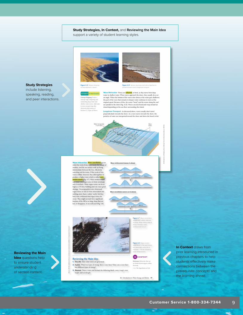
Figure 4.12 Waves refracting as they approach a beach
Figure 4.13 Various structures are built on beaches to prevent erosion due to longshore transport.
Wave Refraction Waves are refracted, or bent, as they move from deep water to shallow water. When waves approach the shore, they usually do so at an angle. When the bottom of the waves slow down as the water gets shallower, the part of the wave that remains in deeper water continues to move at the original speed. Because of this, the waves “bend” and the waves along the surf are parallel to the shore (Fig. 4.12). Waves can also bend and wrap around an island depending on the sea floor surrounding the island.
Longshore Transport As discussed above, waves usually don’t travel perpendicularly towards the shore. As a wave moves towards the shore, the particles of water are transported toward the shore and down the beach in the
Concept Mapping Create a concept map comparing and contrasting deep water and shallow water waves. Add notes to your concept map after classroom discussions of Section 4.2, Types of Waves.
STRATEGIESS T U DY
Figure 4.14 The formation of a rip current
Program: Castro 2e ©2019 Component: SEPDF Pass
Vendor: Lumina Grade: 9–12
90 Chapter 4 Waves and Tides
(tl)©
iSto
ckph
oto.
com
/Wol
fgan
g_St
eine
r, (tr
)Des
ign
Pics
/Joh
n D
oorn
kam
p, (b
)Sou
rce:
Bill
Obe
r
Wave 1
Wave 1
Wave 2
Wave 2
Wave reinforcement (waves in phase)
Wave cancellation (waves out of phase)
082_087_MS_S_C04_L01_692818_27640.indd 17/08/18 02:11PM082_087_MS_S_C04_L01_692818_27640.indd 17/08/18 02:11PM
Wave Interaction Wave cancellation occurs when the crest of one wave meets the trough of another, and the sea surface ends up being intermediate between the two, effectively canceling out the waves. If the crests of two waves collide, however, they add together to produce a higher wave which is called wave reinforcement (Fig. 4.7). Wave reinforcement can cause very large waves to form seemingly out of nowhere. These rogue waves can be as high as a 10 story building and can cause great damage. Oceanographers once dismissed rogue waves as rare or even nonexistent and nothing more than a sailors’ myth, but they have now confirmed that rogue waves do occur. They might account for a significant fraction of the 100 or so large ships that are lost, or disappear, at sea each year (Fig. 4.8).
Reviewing the Main Idea1. Describe how wind waves are generated.
2. Explain What two types of energy does a wave have? How can a wave have two different types of energy?
3. Illustrate Draw a wave and include the following labels: crest, trough, wave height, and wavelength.
Figure 4.7 Wave cancellation results when waves meet out of phase. When waves meet in phase, however, wave reinforcement occurs.
Figure 4.8 Rogue waves – large waves in the open ocean that seemingly come out of nowhere – can be caused by wave reinforcement.
Program: Castro 2e ©2019 Component: SEPDF Pass
Vendor: Lumina Grade: 9–12
4.1 Introduction to Wave Energy and Motion 87
(t)So
urce
: Bill
Obe
r, (b
)Nat
iona
l Oce
anic
and
Atm
osph
eric
Adm
inis
tratio
n (N
OAA
), U
.S. D
epar
tmen
t of C
omm
erce
.
the “male.” Hermaphroditism also is found among several deep water fishes, an adaptation to the depths of the ocean where it can be difficult to find members of the opposite sex.
A variation of hermaphroditism among fishes is sex reversal or sequential hermaphroditism, in which individuals begin life as males but change into females (protandry) or females change into males (protogyny). These changes are controlled by sex hormones but triggered by social cues such as the absence of a dominant male. Sex reversal occurs in several groups of marine fishes, but it is most prevalent among sea basses and groupers, parrotfishes, and wrasses. Some rather complicated reproductive strategies have been discovered among these fishes.
In at least some species of anemone-fishes, all individuals begin as males. Each sea anemone is inhabited by a single, large female that mates only with a large, dominant male.
All the other fishes that live on the anemone are small, non-breeding males. If the female disappears or is experimentally removed, her mate changes into a female and the largest of the non-breeding males becomes the new dominant male. The new female can start spawning as soon as 26 days after her sex change. Males of some wrasses form harems of many females. If the male disappears, the largest, dominant female immediately begins to act as a male and within a relatively short period of time changes color and transforms into one that is capable of producing sperm.
Section Review1. Explain How do marine fishes stay hydrated in such a salty external
environment?
2. Compare What adaptations are common across groups of marine fishes?
I N C O N T E X T
Hormones Molecules that act as chemical messengers within the body.
• 6.1, The Ingredients of Life
Opening of lateralline canal
Scale Sensoryorgan
Canal Skin
Nerves
(a)
(b)Sensory organ (with neuromast cells)Ampullae of Lorenzini
Jelly-filled canal
Scale
Ampullaeof Lorenzini
Lateral line
Pore
Ampulla of Lorenzini
Nerve
Figure 10.15 (a) Cross section
through the skin of a fish,
showing the lateral line
sensory system. The nerves
collect nerve impulses from
the sensory organs and
transmit the information to the
brain. (b) In addition to the
lateral line, cartilaginous fishes
have ampullae of Lorenzini, a
network of jelly-filled canals
capable of detecting electrical
fields in the water.
284 Chapter 10 Marine Fishes
Program: Castro 1e © 2016 Component: SE Printer PDF ProofVendor: SPi Global Chapter: 10
275_284_MS_S_C10_L02_142265.indd 284 06/08/15 1:01 pm
9
Study Strategies include listening, speaking, reading, and peer interactions.
In Context draws from prior learning introduced in previous chapters to help students effectively make connections between the prerequisite concepts and the learning ahead.
Reviewing the Main Idea questions help to ensure student understanding of section content.
Study Strategies, In Context, and Reviewing the Main Idea support a variety of student learning styles.
Customer Service 1-800-334-7344
Marine Science Guided Tour
Throughout the text there are four feature strands — Nature of Science, Marine Science in Action, Habitat Spotlight, and Humans and the Ocean. Each strand includes Think Critically questions and explores a unique topic in marine science such as habitats, human and ocean interaction, and other relevant areas of interest. Each of these features has a corresponding activity available online that allows students to expand upon and further explore what they have studied in the text.
Portugal
CanaryCurrent
AFRICA
BenguelaCurrent
Equator
Gyre currents
Return voyage
Outward voyage
0 1000 mi
0 1000 km
kk
115_119_MS_S_C05_L02_692818_46659.indd 27/08/18 09:15PM115_119_MS_S_C05_L02_692818_46659.indd 27/08/18 09:15PM
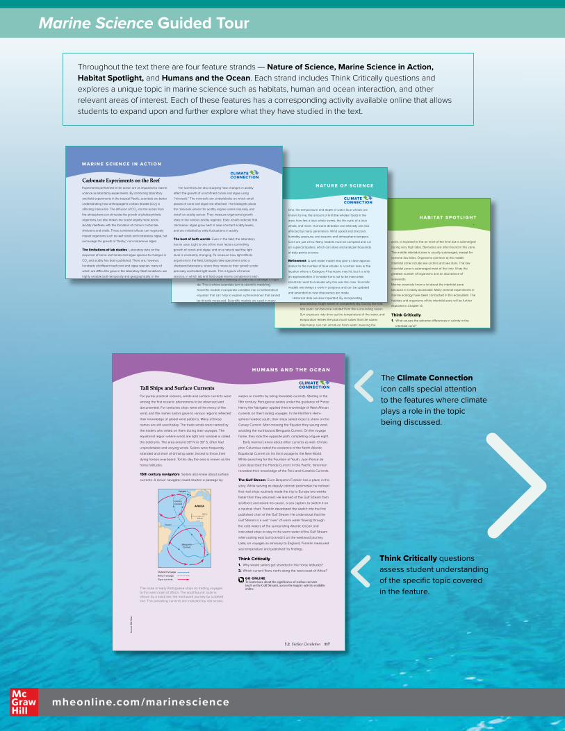
Tall Ships and Surface CurrentsFor purely practical reasons, winds and surface currents were among the first oceanic phenomena to be observed and documented. For centuries ships were at the mercy of the wind, and the names sailors gave to various regions reflected their knowledge of global wind patterns. Many of these names are still used today. The trade winds were named by the traders who relied on them during their voyages. The equatorial region where winds are light and variable is called the doldrums. The area around 30° N or 30° S, often had unpredictable and varying winds. Sailors were frequently stranded and short of drinking water, forced to throw their dying horses overboard. To this day the area is known as the horse latitudes.
15th century navigators Sailors also knew about surface currents. A clever navigator could shorten a passage by
weeks or months by riding favorable currents. Starting in the 15th century, Portuguese sailors under the guidance of Prince Henry the Navigator applied their knowledge of West African currents on their trading voyages. In the Northern Hemi-sphere headed south, their ships sailed close to shore on the Canary Current. After crossing the Equator they swung west, avoiding the northbound Benguela Current. On the voyage home, they took the opposite path, completing a figure eight.
Early mariners knew about other currents as well. Christo-pher Columbus noted the existence of the North Atlantic Equatorial Current on his third voyage to the New World. While searching for the Fountain of Youth, Juan Ponce de León described the Florida Current. In the Pacific, fishermen recorded their knowledge of the Perú and Kuroshio Currents.
The Gulf Stream Even Benjamin Franklin has a place in this story. While serving as deputy colonial postmaster he noticed that mail ships routinely made the trip to Europe two weeks faster than they returned. He learned of the Gulf Stream from seafarers and asked his cousin, a sea captain, to sketch it on a nautical chart. Franklin developed the sketch into the first published chart of the Gulf Stream. He understood that the Gulf Stream is a vast “river” of warm water flowing through the cold waters of the surrounding Atlantic Ocean and instructed ships to stay in the warm water of the Gulf Stream when sailing east but to avoid it on the westward journey. Later, on voyages as emissary to England, Franklin measured sea temperature and published his findings.
Think Critically1. Why would sailors get stranded in the horse latitudes?2. Which current flows north along the west coast of Africa?
GO ONLINE To learn more about the significance of surface currents (such as the Gulf Stream), access the inquiry activity available online.
H U M A N S A N D T H E O C E A N
The route of early Portuguese ships on trading voyages to the west coast of Africa. The southbound route is shown by a solid line, the northward journey by a dotted line. The prevailing currents are indicated by red arrows.
CLIMATECONNECTION
Program: Castro 2e ©2019 Component: SEPDF Pass
Vendor: Lumina Grade: 9–12
5.2 Surface Circulation 117
Sour
ce: B
ill O
ber
The Climate Connection
icon calls special attention
to the features where climate
plays a role in the topic
being discussed.
Think Critically questions
assess student understanding
of the specific topic covered
in the feature.
096_106_MS_S_C04_L03_692818_29945.indd 23/08/18 12:11AM
Between the TidesThe intertidal zone is the area that is below water at high tide and above water at low tide. It is often called the littoral zone and can contain many different types of habitats. One of those habitats is the tide pool, which form when the tide recedes and water is left in depressions in the rocks. They vary in size, depending on the substrate and the type of tides in the area.
Life in the intertidal Organisms that live in tide pools lead a challenging life. Tide pools go through many different extreme conditions over the course of one day. Temperature and salinity can vary, and organisms can be alternately pounded by rough waves or completely dry. During low tide, tide pools can become isolated from the surrounding ocean. Sun exposure may drive up the temperature of the water, and evaporation leaves the pool much saltier than the ocean. Alternately, rain can introduce fresh water, lowering the salinity in the pools. During neap tides or when there is little wave action, tide pools may dry up completely. During high tides, or when wave action is particularly strong, fresh sea water is introduced to the pools, This water brings much needed nutrients and balances the temperature and salinity. Sometimes, though, the waves are strong enough to wash tide pool residents away, so organisms must have a way to stay in place during times of strong wave action.Tide pool living isn’t just about tolerating unfavorable conditions. Organisms adapted to such a volatile environ-ment can survive quite well. Seaweeds grow easily because of high light levels and a regular supply of nutrients. Many animals, like snails and sea urchins, feed on this abundant food source. Tide pools often form in rocks, so there are many nooks and crannies in which animals can avoid predators. Some species of fish even use tide pools as nurseries.
Zonation Life in the intertidal zone is a competition for light, space, and food. Many organisms are adapted to live in one of four zones: the splash zone, or the high, middle, or low intertidal zone. The splash zone is highest up on the shore, and receives the least input from the sea. It may only be submerged during spring tides. Lichens and snails are common here. The high intertidal zone, below the splash
zone, is exposed to the air most of the time but is submerged during very high tides. Barnacles are often found in this zone. The middle intertidal zone is usually submerged, except for extreme low tides. Organisms common to the middle intertidal zone include sea urchins and sea stars. The low intertidal zone is submerged most of the time. It has the greatest number of organisms and an abundance of seaweeds.Marine scientists know a lot about the intertidal zone because it is easily accessible. Many seminal experiments in marine ecology have been conducted in this ecosystem. The habitats and organisms of the intertidal zone will be further explored in Chapter 13.
Think Critically1. What causes the extreme differences in salinity in the
intertidal zone?2. What are some benefits to living in the intertidal zone?3. What are the four zones of the intertidal environment?
GO ONLINE To learn more about the physical features that shape the intertidal zone, access the inquiry activity available online.
Organisms in the intertidal occur as specific zones based on their ability to withstand desiccation and wave action. Here, different types of seaweed form bands.
H A B I TAT S P O T L I G H T
Program: Castro 2e ©2019 Component: SEPDF Pass
Vendor: Lumina Grade: 9–12
4.3 The Tides 103
Man
dy L
inde
berg
, NO
AA/N
MFS
/AKF
SC
018_029_MS_S_C01_L02_692818_12440.indd 17/08/18 05:05PM018_029_MS_S_C01_L02_692818_12440.indd 17/08/18 05:05PM
Ocean ModelingOceanographers deploy an incredible number of instruments into the oceans to collect data on ocean currents, species distribution, ocean-atmosphere exchange, and more. These analytical instruments are usually placed in specific locations to answer a specific question. For example, a scientist might have a hypothesis concerning how many blue whales live in the North Pacific Ocean or need to make a prediction regarding the intensity and direction of a hurricane. Instru-ments deployed in carefully chosen locations would help the scientist collect data to support or refute their hypothesis.
Since the ocean is such a large place, it would be nearly impossible to locate and count all the blue whales. Likewise, scientists cannot just look at one instrument to determine where a hurricane is heading or how much damage it might do. This is where scientists turn to scientific modeling. Scientific models incorporate variables into a mathematical equation that can help to explain a phenomenon that cannot be directly measured. Scientific models are used in many studies of the marine environment, such as estimating changes in a population, describing biogeochemical pro-cesses, and predicting the impacts climate change.
Variables Scientific models, especially ones that look at ecosystem processes, are complex. Think about all the variables that might affect the estimated blue whale popula-tion in the North Pacific. They might include: the number of whale calls heard in a certain location over a certain period of
time, the temperature and depth of water blue whales are known to live, the amount of krill (the whales' food) in the area, how fast a blue whale swims, the life cycle of a blue whale, and more. Hurricane direction and intensity are also affected by many parameters. Wind speed and direction, humidity, pressure, and oceanic and atmospheric tempera-tures are just a few. Many models must be compiled and run on supercomputers, which can store and analyze thousands of data points at once.
Refinement A well-made model may give a close approxi-mation to the number of blue whales in a certain area or the location where a Category 4 hurricane may hit, but it is only an approximation. If a model turns out to be inaccurate, scientists need to evaluate why this was the case. Scientific models are always a work in progress and can be updated and amended as new discoveries are made.
Historical data are also important. By incorporating historical data into their hurricane models, scientists can predict the approach of storms earlier, giving residents plenty of time to know if they need to board up their homes or evacuate. Scientists are continuously adding data from new technology to increase the accuracy of their models as well. Recently, scientists have also started to provide storm surge predictions, modeling how high the ocean levels will rise based on the geography of the coastline. Predicting storm surges may lead to increased awareness of where evacua-tions are necessary, where to build new communities, and the importance of natural coastal buffers, such as coral reefs and wetlands.
Think Critically1. What are the some of the ways model accuracy can be
improved?2. What are models?
GO ONLINE To learn more about how scientists use models to study the oceans, access the inquiry activity available online.
N AT U R E O F S C I E N C E
This image, captured by the Tropical Rainfall Measuring Mission (TRMM) satellite, shows the height of rain columns within Hurricane Irene. The higher the rain column, the more energy a storm can generate. The red color indicates a higher rain column.
kkCLIMATE
CONNECTION
Program: Castro 2e ©2019 Component: SEPDF Pass
Vendor: Lumina Grade: 9–12
1.2 The Scientific Method 27
Hal
Pie
rce,
SSA
I/NAS
A-G
SFC
kk
018_029_MS_S_C01_L02_692818_12440.indd 17/08/18 02:09PM018_029_MS_S_C01_L02_692818_12440.indd 17/08/18 02:09PM
M A R I N E S C I E N C E I N AC T I O N
CLIMATECONNECTION
Carbonate Experiments on the ReefExperiments performed in the ocean are as important to marine science as laboratory experiments. By combining laboratory and field experiments in the tropical Pacific, scientists are better understanding how anthropogenic carbon dioxide (CO2) is affecting marine life. The diffusion of CO2 into the ocean from the atmosphere can stimulate the growth of photosynthetic organisms, but also makes the ocean slightly more acidic. Acidity interferes with the formation of calcium carbonate skeletons and shells. These combined effects can negatively impact organisms such as reef corals and calcareous algae, but encourage the growth of “fleshy,” non-calcareous algae.
The limitations of lab studies Laboratory data on the response of some reef corals and algae species to changes in CO2 and acidity has been published. There are, however, hundreds of different reef coral and algae species, many of which are difficult to grow in the laboratory. Reef conditions are highly variable both temporally and geographically. In the ocean, reef organisms and water chemistry aren’t static; the growth and death of reef-builders have a direct impact on the surrounding water chemistry. These complex interactions can’t be replicated in the lab, so biologists perform field experiments to determine the effects of increasing CO2 on natural reefs.
Field experiments In one series of experiments, biologists placed clear plastic pyramids over different combinations of corals and algae growing on a reef. The pyramids let natural light through, but trapped the water surrounding the organ-isms. Electronic sensors and water samples measured acidity, oxygen levels, and calcium carbonate chemistry as the organisms grew.
The scientists are also studying how changes in acidity affect the growth of unconfined corals and algae using “minireefs.” The minireefs are cinderblocks on which small pieces of coral and algae are attached. The biologists place the minireefs where the acidity regime varies naturally, and install an acidity sensor. They measure organismal growth rates in the various acidity regimes. Early results indicate that calcareous algae grow best in near-constant acidity levels, and are inhibited by wide fluctuations in acidity.
The best of both worlds Even in the field, the laboratory has its uses. Light is one of the main factors controlling growth of corals and algae, and on a natural reef the light level is constantly changing. To measure how light affects organisms in the field, biologists take specimens onto a shipboard laboratory, where they measure their growth under precisely controlled light levels. This is typical of marine science, in which lab and field experiments complement each other to answer complex questions about life in the sea.
Think Critically1. How does CO2 affect organisms with calcareous skeletons
and shells?2. Why are field experiments necessary to understand the
impact of CO2 on coral reefs?3. What is one variable for which a coral reef laboratory
experiments can control?
GO ONLINE To learn more about how increasing CO2 and ocean acidification affect marine life, access the inquiry activity available online.
To prevent a variable from affecting the experiment, the scientist has two options. One is to artificially keep the variable from changing—for example, by giving all the mussels exactly the same food. The other is to make sure that any changes that do occur are identical for both groups. By supplying both tanks with seawater from the same source, for example, our scientist ensures that any changes in the quality of the water affect both groups of mussels equally. Variables that are prevented from affecting an experiment are said to be controlled, and the experiment is called a controlled experiment (Fig. 1.20). Since the biologist has controlled the effects of other variables while growing the mussels at different temperatures, she can be confident that differences in growth between the two groups are due to temperature.
Program: Castro 2e ©2019 Component: SEPDF Pass
Vendor: Lumina Grade: 9–12
24 Chapter 1 Principles of Marine Science
mheonline.com /marinescience
11
10°S–0.8
–0.4
0
Rela
tive
Sea
Leve
l (m
)
0.4
0.8
5°S 0°Latitude
5°S 10°N 15°N 20°N
SatelliteModel
096_106_MS_S_C04_L03_692818_29945.indd 17/08/18 02:11PM096_106_MS_S_C04_L03_692818_29945.indd 17/08/18 02:11PM
Chapter 4 Review continued
DATA A N A LY S I S L A B
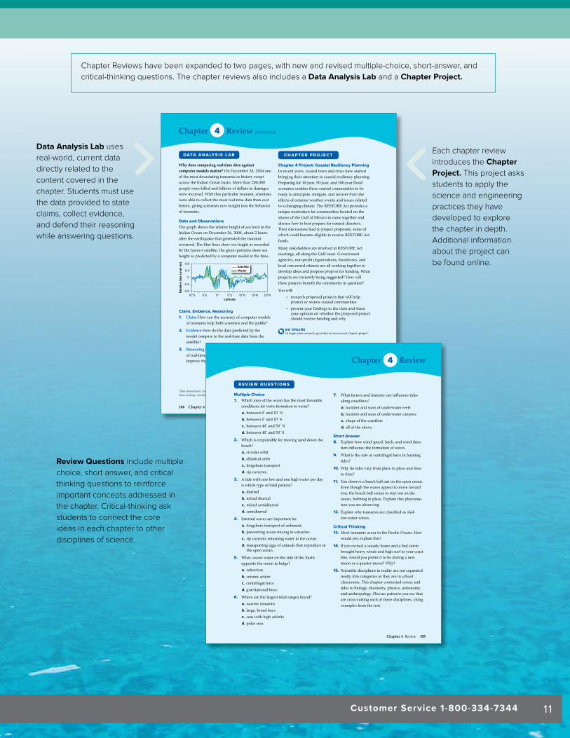
Why does comparing real-time data against computer models matter? On December 26, 2004 one of the most devastating tsunamis in history swept across the Indian Ocean basin. More than 200,000 people were killed and billions of dollars in damages were incurred. With this particular tsunami, scientists were able to collect the most real-time data than ever before, giving scientists new insight into the behavior of tsunamis.
Data and ObservationsThe graph shows the relative height of sea level in the Indian Ocean on December 26, 2004, about 2 hours after the earthquake that generated the tsunami occurred. The blue lines show sea height as recorded by the Jason-1 satellite, the green portions show sea height as predicted by a computer model at the time.
Claim, Evidence, Reasoning1. Claim How can the accuracy of computer models
of tsunamis help both scientists and the public?
2. Evidence How do the data predicted by the model compare to the real-time data from the satellite?
3. Reasoning How might the continued comparison of real-time data to computer models help improve the accuracy of future models?
C H A P T E R P R O J E C T
Chapter 4 Project: Coastal Resiliency PlanningIn recent years, coastal town and cities have started bringing their attention to coastal resiliency planning. Preparing for 10-year, 50-year, and 100-year flood scenarios enables these coastal communities to be ready to anticipate, mitigate, and recover from the effects of extreme weather events and issues related to a changing climate. The RESTORE Act provides a unique motivation for communities located on the shores of the Gulf of Mexico to come together and discuss how to best prepare for natural disasters. Their discussions lead to project proposals, some of which could become eligible to receive RESTORE Act funds.
Many stakeholders are involved in RESTORE Act meetings, all along the Gulf coast. Government agencies, non-profit organizations, businesses, and local concerned citizens are all working together to develop ideas and propose projects for funding. What projects are currently being suggested? How will these projects benefit the community in question?
You will:
• research proposed projects that will help protect or restore coastal communities
• present your findings to the class and share your opinion on whether the proposed project should receive funding and why.
GO ONLINE To begin your research, go online to access your chapter project.
*Data obtained from: Geist, E. L., V. V. Titov, and C. E. Synolakis, 2006. Tsunami: Wave of change. Scientific American, vol. 294, no. 1, January, pp. 56–63.
Program: Castro 2e ©2019 Component: SEPDF Pass
Vendor: Lumina Grade: 9–12
106 Chapter 4 Waves and Tides
096_106_MS_S_C04_L03_692818_29945.indd 22/08/18 03:30PM096_106_MS_S_C04_L03_692818_29945.indd 22/08/18 03:30PM
R E V I E W Q U E S T I O N S
Multiple Choice 1. Which area of the ocean has the most favorable
conditions for wave formation to occur?
a. between 0° and 10° N
b. between 0° and 10° S
c. between 40° and 50° N
d. between 40° and 50° S
2. Which is responsible for moving sand down the beach?
a. circular orbit
b. elliptical orbit
c. longshore transport
d. rip currents
3. A tide with one low and one high water per day is which type of tidal pattern?
a. diurnal
b. mixed diurnal
c. mixed semidiurnal
d. semidiurnal
4. Internal waves are important for
a. longshore transport of sediment.
b. preventing ocean mixing in estuaries.
c. rip currents returning water to the ocean.
d. transporting eggs of animals that reproduce in the open ocean.
5. What causes water on the side of the Earth opposite the moon to bulge?
a. refraction
b. seismic action
c. centrifugal force
d. gravitational force
6. Where are the largest tidal ranges found?
a. narrow estuaries
b. large, broad bays
c. seas with high salinity
d. polar seas
7. What factors and features can influence tides along coastlines?
a. location and sizes of underwater reefs
b. location and sizes of underwater canyons
c. shape of the coastline
d. all of the above
Short Answer8. Explain how wind speed, fetch, and wind dura-
tion influence the formation of waves.
9. What is the role of centrifugal force in forming tides?
10. Why do tides vary from place to place and time to time?
11. You observe a beach ball out on the open ocean. Even though the waves appear to move toward you, the beach ball seems to stay out on the ocean, bobbing in place. Explain this phenome-non you are observing.
12. Explain why tsunamis are classified as shal-low-water waves.
Critical Thinking13. Most tsunamis occur in the Pacific Ocean. How
would you explain this?
14. If you owned a seaside home and a bad storm brought heavy winds and high surf to your coast line, would you prefer it to be during a new moon or a quarter moon? Why?
15. Scientific disciplines in reality are not separated neatly into categories as they are in school classrooms. This chapter connected waves and tides to biology, chemistry, physics, astronomy, and anthropology. Discuss patterns you see that are cross-cutting each of these disciplines, citing examples from the text.
Chapter 4 Review
Program: Castro 2e ©2019 Component: SEPDF Pass
Vendor: Lumina Grade: 9–12
Chapter 4 Review 105
Data Analysis Lab uses real-world, current data directly related to the content covered in the chapter. Students must use the data provided to state claims, collect evidence, and defend their reasoning while answering questions.
Each chapter review introduces the Chapter Project. This project asks students to apply the science and engineering practices they have developed to explore the chapter in depth. Additional information about the project can be found online.
Review Questions include multiple choice, short answer, and critical thinking questions to reinforce important concepts addressed in the chapter. Critical-thinking ask students to connect the core ideas in each chapter to other disciplines of science.
Chapter Reviews have been expanded to two pages, with new and revised multiple-choice, short-answer, and critical-thinking questions. The chapter reviews also includes a Data Analysis Lab and a Chapter Project.
Customer Service 1-800-334-7344

McGraw-Hill: Your partner in Advanced Placement,
Honors and Electives Education
Visit mheonline.com /marinescience
To contact your Sales Representative, get more information about our programs, request a sample, demo digital resources and more!
AP19 M 16463