professional land surveyors of colorado volume 46, issue 3 ... · 4 side shots • august 2015...
TRANSCRIPT

Professional Land Surveyors of Colorado Volume 46, Issue 3
SIDE SHOTS
SIDE SHOTSAugust 2015
PLSC GPS DAY 2015 see page 7
Becky RolandExecutive DirectorPLSC, IncPO Box 441069Aurora, CO 80044
Prst stdU.S. Postage
PAIDDenver, CO
Permit No. 1222
STATE MEMBER ORGANIZATION OF NSPS


SIDE SHOTS • AUGUST 2015 3
Professional Land Surveyors of Colorado, Inc.
AFFILIATE—NATIONAL SOCIETY OF PROFESSIONAL SURVEYORS
MEMBER—COLORADO ENGINEERING COUNCILMEMBER—WESTERN FEDERATION OF
PROFESSIONAL SURVEYORS
OFFICERS (2015)
Todd BeersPresident
[email protected]: 720-225-4646
kayce d.w. keaneVice President
[email protected]: 720-525-8312
Alan BlairSecretary/Treasurer
[email protected]: 303-808-0981
Becky RolandExecutive Director
PO Box 441069, Aurora, CO 80044 • [email protected] AMC O: (303) 551-3266 F: (720) 230-4846
2015 PLSC CHAPTER ORGANIZATION
CENTRAL COLORADO PROFESSIONAL SURVEYORSPresident, David Kuxhausen;
Vice President, Kevin Kucharczyk; Secretary, Mark Wilson; Treasurer, Aaron Willis
Directors: Anthony Perazzo, Shawn Clarke, Devon Arnold,Brian Socia
NORTHERN CHAPTER - PLSC, INC.President: Laine Landau
President-elect: vacant; Secretary/Treasurer, Kevin BowmanDirectors: Pete Paulus, Nate Keane, Steve Parks, Ron Perkins
President Emeritus: Kayce Keane
NORTHWEST 1/4 COLORADO LAND SURVEYORSPresident: Brian T. Kelly
Vice President, William Whelan; Secretary/Treasurer, Jeff Gustafson;Gordon Dowling, Immediate Past President and Director
Directors: Thomas H. Effinger, Skidge Moon, Walter Magill, Lloyd Powers, Peter Epp
SOUTHERN COLORADO PROFESSIONAL LAND SURVEYORS
President: Steven ParkerVice President: Don Hulsey; Secretary: Mark Johannes;
Treasurer: Dan HantenDirectors: Jon Tessin, William Brooks, Dennis Craig,
Tom Shaughnessy, Spencer BarronPresident Emeritus: Joseph Alessi
SOUTHWESTERN Chapter - PLSC, Inc.President: Joshua Casselberry
Vice President, Robert L. Trudeaux; Secretary, Parker NewbyTreasurer, Ed Young
WESTERN COLORADO LAND SURVEYORSPresident: Richard Bullen
Vice President: Jonathan Kobylarz; Secretary-Treasurer: Brian BowkerDirectors: Tom Sylvester, Mike Drissel, Scott Thompson Les Doehling, Pat Green, Peter Krick, Rick Mason (Ret.)
Side Shots is the official publication of the Professional Land Surveyors of Colorado, Inc. and is published quarterly for the betterment of the surveying profession.
Todd Beers Kayce D.W. Keane President Vice President
For Editorial Correspondence, contact:John B. Guyton
Editor: Side Shots5385 Centennial Trail, Boulder, CO 80303
303-443-7001 • [email protected] publication is not copyrighted and articles may be reprinted with due credit.
Statements made and opinions expressed are from the contributors and do not necessarily express the official views of the Professional Land Surveyors of Colorado, Inc.
Deadlines for editorials, articles, pictures and advertising are January 1, April 1, July 1 and October 1. All material received after the current deadline will appear
in the next issue of Side Shots.
We would like to invite anyone who is interested to advertise in Side Shots. Do you have something you want to sell, trade or buy? Why not use Side Shots for your
next ad? We can also reproduce business cards for advertising. Ad space reservation must be arranged with Becky Roland, PO Box 441069, Aurora, CO 80044; 303-551-3266.
(Deadlines: January 1, April 1, July 1 and October 1).
Current Advertising Rates:Business card size or less - Member $25.00; Non-member $30.00
One-Half Page - Member $115.00; Non-member $150.00Full Page - Member $225.00; Non-member $300.00
Color advertisements — add 33 percent
SIDE SHOTSAugust Journal 2015
Volume 46 Number 3
■ President’s Letter ................................................................4■ From the Editor ...................................................................5■ PLSC GPS Day 2015 ..........................................................7■ Control Points Number 29 – The Chinese
South-Pointing Chariot ........................................................9 ■ Clean Water for Nepal: How a Group of Students is
Working to Improve Water Quality Overseas ....................12■ 2016 Colorado Land Surveying Refresher Course ...........16■ Rule of the Month: Rule 6.5.1 – Find and Flag .................18■ The County Surveyor Debacle ..........................................21■ BLM Cadastral Letter ........................................................23■ Obituary: Larry T. Connolly, PLS .......................................24■ Western Federation of Professional Surveyors
Meeting Report .................................................................25■ NSPS Meting Highlights ....................................................27■ Legislative Committee Report ...........................................29■ PLSC Board of Directors Meeting Notes ..........................30■ Chapter News ...................................................................32■ Sustaining Members .........................................................34
ON THE COVER: TOP ROW, L TO R: Dean Glorso, Michael Van Deren, Steve Parker, Chuck Hutchins, Becky Roland, Myles McReynolds, Peter Kistler. MIDDLE ROW, L TO R: Paul Bacus, Tyler Parker, Sierra Parker, Laine Landau, Pam Fromhertz, Todd Beers, Eric Carson. FRONT ROW, L TO R: Mel Philbrook, Wade Stewart, Kelly Liberi, Mark Johannes, Brian Dennis. Photograph by Matt Minton

4 SIDE SHOTS • AUGUST 2015
PROFESSIONAL LAND SURVEYORS OF COLORADO, INC.PO Box 441069, Aurora, CO 80044
AFFILIATE – NATIONAL SOCIETY OF PROFESSIONAL SURVEYORSMEMBER- WESTERN FEDERATION OF PROFESSIONAL SURVEYORS
OFFICERS (2015-2016)
KAYCE D.W. KEANEVICE PRESIDENTO: (303) 443-3616
ROGER NELSONPAST PRESIDENTO: (303) 353-3916
TODD BEERS president
O: (720) 225-4646 [email protected]
BECKY ROLANDEXECUTIVE DIRECTOR
O: (303) [email protected]
ALAN BLAIRSECRETARY- TREASURER
O: (303) 808-0981 [email protected]
DIRECTORS (2013-2016)
ALAN BLAIRO: (303) 808-0981
PATRICK GREENO: (970) 244-1821
LEIF JOYO: (970) 878-5292
TOM SYLVESTER O: (970) 255-7386
DIRECTORS (2015-2018)
PAUL BACUSO: (720) 890-0182
ERIC CARSONO: (303) 980-9104
JAMES RIHANEKM: (303) 204-5769
STEVE PARKERM: (719) 641-3355
WFPS DELEGATES (2015-2016)
MIKE BOUCHARDO: (719) 590-9194
ROGER NELSONO: (303) 353-3916
NSPS DIRECTOR(2015-2016)
JOHN B. GUYTONO: (303) 443-7001
DEDICATED TO THE IMPROVEMENT OF LAND SURVEYING EDUCATION AND PRACTICE.
Dear Fellow Members of PLSC:It is hard to believe that we are in the heart of the summer
already – how quickly time passes! We have made it through record-setting precipitation in the month of May that hindered construction projects and unfortunately saw the return of flooding in our state. I am hopeful that we have seen the worst of the weather and we can return to some normalcy in our daily work environment. I continue to hear from all fronts how busy everyone is which is fantastic, given the challenges of the past several years.
It has been a very busy last 3 months for the PLSC. We were successful in stopping passage of SCR15-001 which was introduced to eliminate the position of County Surveyor in Colorado. The introduction of this bill was unknown to the PLSC until the very last minute. I was very pleased and grateful to see the level of concern and responsiveness by the BOD and other PLSC members in formalizing a game plan to defeat the proposed bill. Once the intention of the bill was identified, Paul Bacus was able to contact the bills’ sponsor in order to understand the reasoning behind the bill. Peg Ackerman (PLSC lobbyist) kept us updated on the opportunities to provide input to the State Legislature and on voting results. Jason Emery, Kayce Keane, Paul Bacus, Rob Snodgrass and Warren Ward all provided testimony to the committee to plead the case for defeat of the bill. Robert Boehm, Mark Ruzzin and Alan Blair provided input and support throughout the process. Jason Emery penned an email for all to use to contact their State Representatives. Becky Roland coordinated the communication with the PLSC membership and provided updates to the website for links to the PLSC membership and example emails for use in contacting their respective representatives. The end result was that the bill was defeated by a narrow margin (2 votes). The legislative committee and PLSC BOD are working on potential language modifications to address the concerns expressed by the bill sponsor and others in order to be proactive when and if a similar bill returns to the legislature in the future. Some of the chapters dedicated their meetings to enlighten their membership on the role of the County Surveyor in Colorado. We have invited the sponsor of the bill to meet with the PLSC in order to have an opportunity to educate them regarding the role of a County Surveyor and to hear any input on their concerns. This is a great example of the organization acting in the interest of the Land Surveying Profession in Colorado—congratulations to all!!
Other business that is being addressed is the continuing education requirement for surveyors. The legislation committee and the BOD have begun discussions of the background on prior attempts for continuing education and we are formulating a plan to move forward.
Kacey Keane and the Executive Planning Committee are working hard on the planning of the 6th annual Rocky Mountain Surveyor’s Summit (RMSS) to be held at the Arvada Center March 2-4, 2016. The program format has been modified to a Wed-Fri conference and we will have 3 tracks for all three days.
Please enjoy the various articles included in this edition of Side Shots. I look forward to hearing from members and seeing you at the various PLSC events in the coming months.
Todd Beers, PLSPLSC President

SIDE SHOTS • AUGUST 2015 5
F R O M T H E E D I T O R
I received an unusually large quantity of contributed articles for this issue of Side Shots, which should contain something of interest to everyone.
Brian Dennis and his capable team of volunteers hosted another GPS Day event at the Trimble headquarters in Westminster,
and provided a nicely written summary of the day. A collection of photographs from the event, taken by Matt Minton, is included. Matt also took the group shot that appears on the cover. This is one of the most important and enthusiastic PLSC events of the year for promoting education and interest in surveying careers. They did an outstanding job.
Warren Andrews has contributed a Control Points article on the gearing of the ancient Chinese South-Pointing Chariot, and mentions the model I have had in my office for years. Then there is an article submitted by Brittany Earle, a Program Manager with Engineers Without Borders, who wrote about the surveying and engineering challenges to bring fresh water to Nepalese villages, using total stations donated by Flatirons, Inc. Soon after this was received, Nepal suffered that devastating earthquake in April, so another EWB participant, Erica Weiner, provided us with an update on the devastation. A friend and restaurant owner in Boulder, Pemba Sherpa, has been active in raising funds for relief efforts, having helped 282 families so far to rebuild their homes, and to distribute food and needed supplies. If you want to make a contribution where 100% of the money goes directly to their aid, visit his donation site at http://www.youcaring.com/emergency-fundraiser/help-boulder-s-pemba-sherpa-rebuild-sengma-nepal/345598 Nepal is no longer in the media headlines, but the need is still very much there.
Earl Henderson has contributed his Rule of the
Month article on the dangers of the “Find and Flag” practice. Vice President Kayce D.W. Keane wrote a story explaining the recent activity to do away with county surveyors in Colorado. And there is news of the sad loss of my friend, Larry Connolly, the La Plata County Surveyor and co-owner of Animas Surveying and Mapping in Durango. He will be missed. Mike Bouchard provided us with a report on the May WFPS meeting, including the reports from other states, and I have a report on my first conference as an NSPS Director, including a fascinating trip to Washington, D.C. for a board meeting, judging a student topography competition, and participating in a lobbying day. I also met Amanda Askren, PLS with NSPS, who is working to establish a Young Surveyors Network in each state, using social media. She has taken an interest in our GPS Day event, and is learning more about it from Brian Dennis.
Alan Blair wrote a legislative committee report on two rule changes proposed by DORA concerning ILC’s and multiple monuments. Just before going to press, I received word that these changes WILL go into effect on September 1st, 2015. The complete, amended rules can be found on “This Month on PLSC.net.” And the minutes of the April 8th Board of Directors meeting is presented, followed by the always interesting Chapter News columns. Included with the ads in this issue, along with the advertisers who deserve your attention and support, is the notice of next year’s Refresher Course program, and an ad for the Certified Survey Technician program presented by the NSPS. Please help spread the word to your associates interested in certification or licensure education, who may not be reading Side Shots.
There was too much material to print it all, so if you are on line at www.plsc.net, be sure to check out the links to the additional articles about the NSPS. As always, thanks for your continued interest in, and support of, this magazine.
JB Guyton, Editor, Side Shots
This Month on PLSC.net• County Surveyor Laws in Colorado, a supplement
to this issue’s article by Kayce D.W. Keane, The County Surveyor Debacle.
• The signed Memorandum of Understanding (MOU) between the National Society of Professional Surveyors (NSPS) and the Professional Land Surveyors of Colorado (PLSC).
• NSPS – It Pays to Belong – listing of benefits that come with your membership, including member discount programs for insurance, tires and car rentals.
• What is the National Society of Professional Surveyors? An excellent summary of the mission and function of the NSPS.
• Updated Bylaws and Rules of the State Board of Licensure for Architects, Professional Engineers and Professional Land Surveyors.


SIDE SHOTS • AUGUST 2015 7
PLSC GPS Day 2015By Brian Dennis, PLS
We had our annual GPS Day event on April 18 at the Trimble Headquarters building in Westminster, Colo., and it was a success! With three days of snow and rain prior to the event, and rain predicted for that day, we still had 70 attendees. Luck was with us; the clouds broke at the beginning of the day followed by beautiful sunshine, although I heard most of the Denver area did not have the same luck that we did.
I want to take a moment to recognize and thank all of the volunteers who helped us with GPS Day: Kelly Liberi, Ashley Limoges, Jeff Dunham, Wade Stewart, John Bacus, Peter Kistler & Dan Colbert (Trimble Corporate), Ken Perry (Hixon Manufacturing), Chuck Hutchins & Michael Van Deer (Vectors, Inc.), David Siddle, Andrew Carey & Myles McReynolds (Compass Tools), Mel Philbrook & Zach Edwards (Frontier Precision), Pam Fromhertz (NGS), Brian Dennis (David Evans Assoc. & Southern Chapter) Eric Carson (CWC Consulting & Central Chapter), Laine Landau (William H. Smith Assoc. & Northern Chapter), Paul Bacus (Bacus Surveying & Northern Chapter), Peter Paulus (City of Fort Collins & Northern Chapter), Steve Parker and Kids (Farnsworth Group & Southern Chapter President), Mark Johannes (Compass Surveying & Southern Chapter), Todd Beers (David Evans Assoc. & PLSC President), Matt Minton (David Evans Assoc. & Photographer), Becky Roland (Phoenix AMC & PLSC Exc. Director), Dean Glorso (Central Chapter), Mike Johnson (Northern
Chapter), Darren & Vincent Wimmer (Northern Chapter), and Kevin Bowman (Northern Chapter).
There were other volunteers that helped from the various chapters and vendors. They deserve as much thanks as everyone else. If not for everyone’s cooperation, this event would not have happened and the kids and their parents would not have received this exposure to land surveying and mapping.
Trimble Corporate was a significant contributor to us this year. Kelly Liberi with Trimble went above and beyond to ensure we had the support for a great event. They provided the first floor of their new building which allowed us to hold classroom activities for the first time. One classroom was occupied by Compass Tools for an orienteering/geocaching class led by Andrew Carey. The orienteering portion was held in the classroom and the geocaching moved to outside. This was specifically designed to meet the Boy Scout badge requirements for orienteering and geocaching and was enjoyed by all. Many of the participants were not in the Boy Scouts and enjoyed the activity equally. The orienteering focused on map and compass orientation and the geocaching focused on locating physical objects with hand held GPS mapping grade units.
Trimble provided a second classroom with laptops and agricultural GPS software for the participants to play and to learn how to cultivate farm fields and such, and how GPS is used for these everyday tasks.

8 SIDE SHOTS • AUGUST 2015
Pam Fromhertz, with the National Geodetic Survey, NOAA, set up a table and gave the folks an introduction to and the history of the NGS, as well as a discussion regarding NGS’s “Adopt a Monument” program. Pam brought a “treasure chest” of old NGS monuments that the kids could see and talk about. Todd Beers and Mark Johannes led the “PLSS Section Breakdown” course. This was a hands-on course for the folks and included poster boards of the townships and section breakdown, and an explanation of how and why we have this land system in place. It also included a “not to scale” mock section on the ground created with rope and nails, where the participants learned how to set the center of section corner. Mark Johannes also provided an inscribed fallen bearing tree that was a great talking point for the activity.
Dean Glorso was in attendance, using his painting to talk about the history of land surveying. This was an interesting feature of our event and the first time we were able to have art work on display, leading to many discussions. Laine Landau and volunteers from the Northern chapter led the GPS navigation course. Several on site features were located by GPS prior to the event and then the lat/long’s were loaded into GPS hand held units. The participants would have to take a hand held unit and begin “staking out” the features. Once a feature was found, they had
to log it to prove they completed each section of the course. Once they located all of the features, they returned to the point of beginning. The log was verified by one of the volunteers and a completion card was signed/sealed by a PLS. The Girl and Boy Scouts were able to turn these cards in to a troop leader for credit towards badging requirements. Mel Philbrook with Frontier Precision led the hands-on surveying course, which was also designed specifically to meet the Boy Scout badge requirements. This course used a Trimble R10 GPS receiver and TSC3 controller. The participants had to locate defined features within the course while the volunteers explained the details of GPS and how land surveyors use this tool every day. Mel is very involved with the Boy Scouts and was a great fit for the event. All who participated had a great time and learned a lot about GPS and data collection.
Chuck Hutchins and Michael Van Deer with Vectors displayed a Trimble UAV. A laptop displayed the current location of the GPS satellite constellation. They went on to discuss how it is always moving and how that may impact your GPS observations at any given time during the day, based on the reception/strength of figure with the constellation at that point in time. Ken Perry with Hixon Manufacturing also displayed a Leica UAV and current models of equipment. Ken was very interactive with the
participants and explained how the equipment works and what functions each model offered for a specific task.
Paul Bacus and volunteers from the Northern chapter led a distance comparison activity. Paul set up comparisons between pacing, nylon clad tape, dual frequency GPS receiver, a total station and an old level with stadia. This was a pretty cool demonstration of the various types of equipment and techniques used by land surveyors to measure distance, and the differences in precision of the distances based on equipment. In addition, Paul discussed the applications and appropriate use of each based on the requirements to be met. Trimble Corporate provided a Kubota RTV that was fitted with a GPS auto drive system to illustrate heavy machine GPS control. Wade & Ashley, with Trimble, led this activity and drove the machine. They explained and demonstrated to the passengers how the system worked and how farmers can pre-program their cultivating route into the system. This allows the program to automate the machine to increase efficiency and production. Everyone enjoyed this activity and it really showed how GPS is used in many other ways that affect everyday tasks you did not even know about but affect you directly. In addition, we had several PLS mentors walking around, engaging the attendees and providing information about land surveying and mapping, and guiding some of the participants through the courses.
We received a lot of feedback from the attendees about how much fun they had and information they received about GPS and land surveying that they did not know, or even know to ask. That is the test of a successful event for me. Our purpose for the event has always been to introduce the youth to land surveying and mapping, and use GPS as a bridge to those discussions. We had many of the Girl and Boy Scouts and their leaders say they would like to come back to next year’s event and want to help promote the event to others because they believe in our cause. Our cause is simple, it is education! ◆

SIDE SHOTS • AUGUST 2015 9
Control Points – Number 29The Chinese South-Pointing Chariot
By Warren Andrews, PLSIn professional surveying, there are two basics,
distance and direction. Distances are pretty straightforward (no pun intended), only the units of measurement sometimes get confusing (such as fathoms and furlongs). Direction is the other half. Of course you can be arbitrary and say the bearing between the northeast section corner and the east quarter section corner is assumed to be due north and south and all bearings shown are relative thereto. Or you can take somebody else’s word for that particular line as bearing S02˚17’27”W and work on that basis. An alternate method I used when I had nothing else to go from in the field was to use the BLM method of solar observation and calculate it by means of Hosmer’s Method to get true bearing within two minutes of arc. (And of course, there is Polaris observation within one-half minute but at most inconvenient hours of the night.)
This brings up the question, what is the overall basis of direction used by surveyors? It is the rotational axis of the earth which supposedly hasn’t changed in some four and a half billion years. Fairly stable for a datum? (Disregard the annual wobble of the earth around the sun or the slow wobble of some 26,000 years of the precession of the equinox. The earth is still turning on its axis regularly).
The discovery that a lodestone or magnetized needle when left free to rotate would point north and south was actively used for many centuries for direction, and still is, but the magnetic poles of the earth don’t quite coincide with the poles of rotation so in most areas it’s only approximate for indicating direction. There may be a large and variable correction factor.
An approximate but reasonably good way to indicate south direction is to take the mid point in the sun’s shadow between sunrise and sunset. This possibly was the way to orient the Chinese mechanical solution to indicating direction, the South-Pointing Chariot.
The concept is used today in every motorized vehicle in the world. It’s the differential gears between the driveshaft coming from the engine and the torque or twisting force transmitted by the axles to the wheels. The cutaway shows this differential. On a straight road, both wheels turn at the same speed but on a turn or curve, one wheel turns faster or more times around than the other wheel. If they didn’t you would skid and lay rubber with one tire or the other every time you varied from straight ahead. This is where the term difference in motion or differential comes from. You sure would wear out a pair of tires in a hurry without a differential. (The oldest automobiles solved the problem by powering only one rear wheel).
On the cutaway illustration of a differential, the small helical gear from the drive shaft drives the large helical ring gear. With small shafts rigidly fixed to the ring gear, the two small bevel gears freely rotate on those small shafts with gear teeth engaged between the ring gear and the two bevel gears rigidly fixed to the axles to transmit power, or torque, to the wheels. When the car is going straight the two small bevel gears do not rotate but power the two axle bevel gears equally. On a turn, though, the axles are turning at different speeds, therefore the small, powered bevel gears are turning between the axle beveled gears.
The Chinese South-Pointing Chariot basically reverses the direction of power through the differential by having the wheels drive the mechanism. As a means of understanding how the mechanism works; the core idea is a planetary gearing with a sun gear in the center with outward teeth meshed with one (or more) planetary gears which are also meshed with a ring gear with internal teeth. The sun and planet gear (or gears) are fixed together with a planet arm. This is shown in Figure 1 with #1 being the sun gear, #2 the planet gear, #3 the ring gear, and #4 the planet arm. The three gears rotate freely on three independent shafts.

10 SIDE SHOTS • AUGUST 2015
If you want the shaft connected to the sun gear to turn at the same speed as the shaft connected to the ring gear then the planet gear does not turn and the whole set rotates as a unit. But if you want the speed to be different between the sun and ring gears, then the planet gears have to turn around the sun gear. You can power either the sun gear or the ring gear and have the potential of a different speed between your input and output shafts when you need it.
Now, what about this Chinese South-Pointing Chariot mechanism based on this planetary gearing concept? Figure 2 is a sketch of the gearing train. It is assumed that you would have a clamp or adjustment on the shaft holding the figure upright to initialize the direction you want the figure to point toward.
Following through in Figure 2, if the chariot is going straight ahead then both wheels are turning at the same rotational velocity. There is a small gear, marked No. 11, between gears No. 1 and No. 2 that reverses the direction of rotation of the shaft connecting gears No. 4 and No. 5 from the direction of rotation of the right hand wheel. Then gear No. 5 acts as the sun gear in a planetary gear system with gears No. 6 and No.7 acting as the planetary gears and U frame 8, which is actually a full ring gear fixed on the arms of the U with internal teeth meshed with gears No. 6 and No.7. The two planetary gears, No. 6 and No. 7 turn freely on two small shafts; the two small shafts are rigidly fixed to gear No. 9 which actually acts as the planetary arm holding the sun and planet gears in contact as indicated in Figure 1. The critical element if you don’t want gear No. 9 to turn is that you have to balance the rotation of gear No. 8 exactly the same as the opposite rotation of gear No. 5. This is done by the number of gear teeth on gears No.’s 5, 6,7 and 8.
If the Chariot turns a corner and goes in a different direction, the rotation of gear No. 9 exactly matches the
amount of angular rotation of the chariot direction due to the gear teeth on gears No. 6 and No. 7 turning gear No. 9 and the pointing figure in the opposite direction with the same angular amount. Again, the whole concept is matching the differential angular velocity of the two chariot wheels with the identical differential, but opposite in rotation, angular position of the pointing figure relative to the chariot through a reverse rotating planetary gear system. Got that?
For anyone wishing to pursue the subject further, there is an exact derivation of the mathematics involved in the ratios of rotation, entitled, “Mechanical Design of South Pointing Chariots” by Professor Ying-Chien Tsai, et al., first published in Mechanical Engineering No. 154, pp. 18-24, by the Chinese Society of Mechanical Engineering, Taiwan, 1986.
Incidentally, J.B. Guyton has the Chinese South-Pointing Chariot model (pictured) in his office in Boulder, if you want to see it. ◆

SIDE SHOTS • AUGUST 2015 11
Proudly SupportingPLSC Since 1999
Buildingrelationships, one monument at a time.
Berntsen International, Inc. • PO Box 8670 • Madison, WI 53704-8670 • Toll Free: 877.686.8561 • Fax: 800.249.9794 • Email: [email protected]
877.686.8561 • www.berntsen.com
PLSC Since 1999
- AutoCAD LT- AutoCAD- Map 3D- Civil 3D- Infrastructure Design Suites- Infrastructure Map Server- Raster Design- Design Review- Subscription
- State of the art training facility- Implementation & customization- Workflow analysis consulting- Styles & standards set-up- License activation support- License compliance- Techincal support- Pilot projects- Transition assistance- On-site consulting- Government Specialist
with customized drafting and design software solutions since 1994
Architecture, Engineering & ConstructionSilver Partner
Authorized Government Partner

12 SIDE SHOTS • AUGUST 2015
Clean Water for Nepal: How a Group of Students is Working to Improve Water Quality Overseas
By: Brittany Earle, Program Manager, EWB CU Nepal Program
If you’ve ever been to Eastern Nepal, then you know that the winding roadways, steep hills, and rocky terrain make engineering projects a unique challenge to tackle. Students from the University of Colorado Boulder chapter of Engineers Without Borders (EWB) know this situation all too well. During their undergraduate studies, these students volunteer their time outside of normal classwork to conceptualize, design, and build engineering projects all over the world. Their work is all part of the national EWB-USA organization, which was founded back in 2002 by CU professor Bernard Amadei. EWB is more than just a university student organization: it is an opportunity for students to learn important, hands-on engineering skills and to try their hands at project management, scheduling, budgeting, and grant writing.
EWB projects begin with an initial community assessment, where a specific community need is identified and a partnership is formed between the student group and the local project stakeholders. The EWB-USA CU Boulder Nepal Program has formed a partnership with a local non-governmental organization (NGO) called the Namsaling Community Development Center (NCDC) in Ilam, Nepal. Once a need is identified and a project is selected to help fulfill that need, the students get to work
on surveying the local terrain and brainstorming ideas for construction.
Although some students on the team are civil engineering majors and have taken courses in land surveying, many are not. This is why the team members partner with a dedicated team of professional engineers and land surveyors in order to learn the necessary skills for implementation of their projects. Students read up on proper surveying techniques and host necessary workshops to learn basic techniques such as setting control points, shooting a backsight, and recording measurements with sufficient detail for project designs. Team members have used both a total station donated by Flatiron’s Surveying and an Amni level at NCDC to collect elevation measurements and create topographical maps of our project sites.
Over the past decade, the team has created topographical maps of over ten spring sites in the Ilam District. The main focus of the group has been designing and building engineering projects aimed at improving the quality of water in Nepal. In the summer of 2012, the team built a spring source protection system at Katuwal Dhara, a project that has generated a lot of community support
continued on page 14
Li-Mae McClellan using the total station in Nepal over summer 2014. Photo credit: Jessica Byrne, EWB student
Danielle Zink using an Amni level in Nepal over summer 2015. Photo credit: Madison Marshall, EWB student

Wagner Equipment Co. is now your service solution for Trimble surveying equipment. With the most experienced service department in the region, we have the resources to fulfill our commitment to total customer satisfaction. Wagner repair services the complete line of Trimble surveying solutions.
• GPS field surveying systems
• GPS infrastructure solutions
• Robotic and servo-driven total stations
• Digital levels
• Trimble Data Controllers
TotalService SolutionsProvider
Your authorized dealer for Machine Control Solutions
www.wagnerequipment.comCall: 1-866-903-2335

14 SIDE SHOTS • AUGUST 2015
for similar projects in the area. Since that time, the team has focused on designing several different spring source protection systems in other parts of the district. This coming summer 2015, the team plans to build at another spring called Karka Dhara.
As you can imagine, coordinating all of the logistics for building these engineering projects takes a team of dedicated students both abroad and back home in the U.S. Students recount the efforts between the travel team and the team stateside as being critical to the project’s success. Masters student Patrick Haas explains that “with the travel team being so far away, it was difficult for them to complete the whole process of creating topo maps with the computing facilities available in Nepal. However, the total station made it easy for the travel team to collect the data then email the team back in the states. We then generated a topo map using that data and sent it back to them so they could verify its accuracy and collect more data in areas that were missing. The total station streamlined the process of collecting the data and, in general, it saved us countless hours between collecting the data to plotting the topos.”
Even with the support team in the US and on site NCDC staff, unforeseen issues can, and do, occur. Last summer, a team of four students planned on collecting data at a new potential site when they realized that the battery for the total station would not hold charge. “Giving up would have meant a six month setback,” explains senior aerospace student Ashley Zerr who was on that trip. “We were fortunate that PE Mike Gill was in country with us. In four hours, he was able to teach us how to use the Amni Level so that we could still gather the data we needed to create an accurate topo.”
Problem-solving and cultural adaptability are at the forefront of attributes that the team looks at when selecting new travel members. As a program, the future success of the team depends on the ability of the travel team to communicate when they are having troubles and seek out the proper support both in Nepal and back home. Fortunately, the team’s in-country partner, NCDC, has a trained staff of engineers who are familiar with local engineering practices used in the area. The EWB-USA national office also provides support for the team by reviewing design sets and
approving the team for travel. In the event that any problems arise, students have resources available to them through EWB to help combat and alleviate any issues.
Students have cited their
Clean Water for Nepal from page 11
Jessica Byrne taking survey data in Nepal over summer 2013. Photo credit: Warren Ruby, professional mentor
EWB students and Nepali counterparts at the completed Katuwal Dhara spring source protection system in summer 2012. Photo credit: Rebecca Gibbons, EWB partner

SIDE SHOTS • AUGUST 2015 15
experiences in EWB as some of the most rewarding work they have completed during their time at the University of Colorado Boulder. From new members to seasoned, travel team veterans, it seems that the culture of EWB and the mindset surrounding sustainable development and creating lasting partnerships with their Nepali counterparts is what keeps students engaged. Senior chemical engineering student Danielle Zink explains, “EWB gave me the opportunity to explore engineering
opportunities that were unrelated to my major and gave me perspective on the entire engineering process. It taught what was expected from a professional engineer in the workplace and in the field.” Junior Abdulaziz AlDossary adds that “Joining EWB this semester was a choice that I’m clearly seeing will benefit me on the long run. I’m helping with the fundraiser and the people I’m working with are absolutely amazing and I can’t wait for the more exciting things to come.”
The Nepal program is always
looking for more support of our projects and the work that we do. If you are interested in learning more or helping out, please email us at [email protected]. More information about our team can be found at http://www.colorado.edu/engineering/ewb/nepal and donations are welcomed at http://www.cufund.org/g iv ing-oppor tun i t ies / fund-description/?id=9013. ◆
[Editor’s Note: The following update was supplied by Erica Weiner, the current program manager from the Nepal team, at the request of Brittany Earle, following the Nepal earthquakes.]
In April 2015, a devastating 7.8 earthquake struck Nepal. The earthquake and resulting aftershocks resulted in more than 8,800 deaths, 23,000 injuries, and massive destruction to buildings and infrastructure. Although Ilam was relatively unaffected by the disaster, the EWB team at CU Boulder was forced to reassess the summer plans to implement at Karka Dhara. Ultimately, due to travel restrictions in place from the university, the team needed to cancel the summer trip entirely. Notifying the community that the students couldn’t travel to implement the project was a difficult but necessary task in order to be able to discuss the future of the project. The students communicated with EWB-USA, professional mentors, and NCDC in order to navigate the complicated situation.
Currently, the local community still looks to implement the project despite the setbacks. In order to do so, the students must coordinate carefully with EWB-USA and NCDC in order to ensure that the project proceeds smoothly. In such unforeseen, difficult situations, proper communication has the utmost importance, and the students hope to maintain such communication in order to try to reach a solution that is reasonable and suitable for the community. ◆

16 SIDE SHOTS • AUGUST 2015
2016 Colorado Land Surveying Refresher CourseThe Professional Land Surveyors of Colorado are offering a comprehensive Land Surveying Refresher Course beginning January 6, 2016. This course offers a review and self-study plan for those taking the National Council of Examiners for Engineering and Surveying (NCEES) Fundamentals of Surveying (FS) and Principles and Practice of Surveying (PS) examinations. The course is designed to aid candidates in developing and expanding exam-taking proficiencies. The Wednesday evening classes will be 3 hours in length, starting promptly at 6:00 PM.
Fundamentals of Surveying Session Date Topic1 Wed., Jan. 6 Overview of NCEES FS and PS Examination
Use of calculators and formulas 2 Wed., Jan. 13 Fundamental Survey Calculations I 3 Wed., Jan. 20 Fundamental Survey Calculations II 4 Wed., Jan. 27 GIS, State Plane, Geodesy 5 Wed., Feb. 3 Public Land Survey System I 6 Wed., Feb. 10 Legal Terms and Definitions
Principles and Practice and Colorado Specific
7 Wed., Feb. 17 Boundary Law 8 Wed., Feb. 24 Public Land Survey System II 9 Wed., Mar. 2 Colorado Survey Law I 10 Wed., Mar. 9 Colorado Survey Law II11 Wed., Mar. 16 Principles and Practice Topics 12 Wed. Mar. 30 Mock PS and FS Examinations
Registration, Fee, Location
The fee for the entire course is $400, or $75 per 3-hour block taken individually. Registration isopen beginning November 1, 2015. See http://www.plsc.net/ for registration information.Classes will be held in one of the conference rooms at the Jefferson County Courts andAdministration Building (Taj Mahal), 100 Jefferson County Parkway, Golden, CO. Use theparking lot and main door on the east side of the building. Signage will lead you to theclassroom. For questions, contact Becky Roland, Executive Director, PLSC, 303-551-3266,[email protected]. Visit the NCEES site at http://ncees.org/exams/ to learn more about the FSand PS examinations.

SIDE SHOTS • AUGUST 2015 17

18 SIDE SHOTS • AUGUST 2015
Rule of the Month: Rule 6.5.1 - Find and FlagBy Earl Henderson, PLS
Rule 6.5.1 is an interesting Rule to review and ponder. It outlines some, but not all actions which will be considered by the Board to fall within the definition of a Land Survey. I’m not going to try to review all the aspects and ramifications in this article of 6.5.1(a)-(f) & 6.5.1.1. I may come back to some others in future articles, but suffice it to say that this is part of what the Board uses to decide if actions by a licensed land surveyor constitute the practice of land surveying and subsequently then if the PLS should be reviewed for possible disciplinary action.
But for the purposes of this article I want to focus on 6.5.1(a) & 6.5.1(c) especially as they relate to the practice commonly referred to in our industry as a “Find and Flag” operation (F&F). In the remote case that you don’t understand what is meant by F&F, consider yourself fortunate. I recommend you don’t even consider doing it, and you might even be better off to stop reading this article right here. But at the risk of informing those PLS’s who would take advantage of their position and the public, F&F is when a PLS, or PLS’s representative, visits a property, finds apparent property corner monumentation, flags that apparent property corner monument for the property owner, and then ceases further activity and departs the site. The property owner likely feels they’ve received a legitimate land surveying service in that they couldn’t find their own property corner monumentation by themselves, but they can now rely on those found monuments to complete whatever it is they intend, i.e. build a fence or determine a setback for a shed, etc. The PLS may feel as though a legitimate service has been provided, yet they’ve avoided the requirements to complete any measurements or draft and deposit a plat, while saving the property owner significant charges and possibly even outsmarting their competition.
But those PLS’s who feel that way should think again. There are so many pitfalls for a F&F on a property it’s almost impossible to outline them all. The most obvious is, what if you’ve just indicated to the property owner that a particular monument marks their corner location, when even a quick measurement would show you that it’s not the right location? How are you going to explain that to your insurance company, or worse a judge? And let’s face it, there’s really no doubt in anyone’s mind, the PLS or the property owner, that the property owner is going to interpret the found monumentation to represent their property corners, agreed?
But the Board isn’t concerned about your insurance policy or what a judge might think. Board Rule 6.5.1(a) reads, “The establishment of boundaries or the restoration or rehabilitation of any monument marking a corner that controls the location of real property.” Think about this in relation to the F&F. During a F&F a PLS is not establishing boundaries. That’s the purview of an original surveyor. But it’s not too difficult to see that a F&F can be interpreted as “restoration or rehabilitation of any monument marking a corner”. If it didn’t mark a corner, why was it shown to the property owner and flagging tied on it?
Board Rule 6.5.1(c) reads, “The determination of the position of any monument, reference point, or any other mark, when such monument or mark controls the location of boundaries or rights of ownership in or use of real property.” How much more clear can it be stated? A F&F is exactly this. Now some may be thinking that “determination of the position” should be interpreted to mean measurements were taken, but that’s not the case because measurements are clearly considered in 6.5.1(e). Others may be thinking that the phrase “controls the location of boundaries...” can be sidestepped by telling the property owner that the PLS is not taking the responsibility that any of the monuments found are correctly marking a corner. But the whole point of a F&F is so the property owner will know their property boundaries and likely use the found monuments to accomplish some task on their property. The property owner is certainly going to use those found monuments to “control the location of boundaries or rights of ownership” for their property. And the F&F PLS just pointed the monuments out to the property owner, thereby taking on that responsibility and liability.
Clearly then, F&F falls within the definition of a Land Survey. A Land Survey is defined under 38-51-102(11). A Monumented Land Survey under 38-51-102(13) is defined as a Land Survey with monuments “either found or set”. And 38-51-107 requires a plat to be prepared and deposited when performing a Monumented Land Survey. So a F&F does not prevent the PLS from having to prepare and deposit a plat. Seems like clear logic to me.
But I’ve found that common sense is often better than logic. First, as Professional Land Surveyors, it is our responsibility to protect and serve the public. That includes protecting your client from themselves sometimes but also protecting all their surrounding neighbors. How can a F&F possibly protect, or in any way serve any of these property owners? Second, let’s hypothetically suppose you happen to know a PLS that performs F&F operations as a routine part of their business. It’s my opinion that it’s likely that at some point during this “fictional” PLS’s career there will be a monument found and flagged that does not represent the correct corner location for a particular property. But the property owner relies on that location because it was found by a “professional” (although I hate using that word in this case). Later it turns out their neighbor gets a Monumented Land Survey and determines that the F&F property owner has encroached upon their property with some improvement, or worse yet, possibly one party or the other has established a fence and now has an adverse possession case worthy of merit. Once the truth comes out, who do you think is going to be in front of the judge, and then the Board, trying to explain the merits of a the F&F “service” they provided? And how much insurance do you think that particular PLS carries? Or a better question may be, what is that PLS’s house worth?
Be safe out there. And please also be responsible. ◆

SIDE SHOTS • AUGUST 2015 19
Professional Land Surveyors of Colorado, Inc.
Membership Application
The PLSC represents land surveyors’ interests in the State, proposes new legisla�on and changes to exis�ng legisla�on as the industry’s needs change, and works with the State Board of Licensure as an advocate for Land Surveyors. PLSC Chapters include: Central Colorado Professional Surveyors (CCPS), Colorado Spa�al Reference Network of the PLSC (CSRN), Northern Chapter—PLSC (NCPLSC), Northwest 1/4 Colorado Land Surveyors (NW1/4CLS), Southern Colorado Professional Land Surveyors (SCPLS), Southwest Chapter PLSC (SWPLSC) and Western Colorado Land Surveyors (WCLS). Vo�ng membership includes NSPS membership. Others can add this op�on.
1. Member Informa�on:
Name:
Company:
Address: Home Work
City, State Zip:
Day�me Phone:
Email:
PLS or LSI Number(s) and State(s):
Please do not include my informa�on in the PLSC Member Directory or online directory.
2. Membership Informa�on:Membership Type: Sustaining—$230 Vo�ng—$150 Associate—$75 Student—$30 Re�red—$60 (Please check.)
Included Chapter: CCPS NCPLSC NW1/4CLS SCPLS SWPLSC WCLS (Each membership includes one free Chapter membership. Please check—see above for descrip�ons.)
Addi�onal Chapter: CCPS NCPLSC NW1/4CLS SCPLS SWPLSC WCLS (addi�onal Chapter memberships are $20 each. Please check.) NSPS Membership (included in Vo�ng Membership): $40 for professionals/$10 for students
3. Payment Informa�on:Membership Type: $ Payment Type:
Add’l Chapters/NSPS: $ Check # Total Enclosed $ Credit Card No.:
Exp. Date: CVV: Credit Card Billing Address: same as above or: Mail to: PLSC, PO Box 441069, Aurora, CO 80044 Phone: 303‐551‐3266 Fax: 720‐230‐4846 [email protected]
20 SIDE SHOTS • AUGUST 2015
The County Surveyor DebacleBy Kayce D. W. Keane, PLS
In April, a concurrent resolution, SCR001-15, was submitted to the Colorado Senate which sought to place on the ballot, the elimination of the County Surveyor position. In this short article, I aim to provide you a summary of this unique elected position and its very direct relationship to SCR001-15. By the end of this article, I hope that you’ll want to share your opinion with me.
Why do we need a County Surveyor?There are many reasons to keep the County Surveyor
position in Colorado. By law, County Surveyors are tasked with the maintenance of survey records. They are also required to review and index submitted plats such as, Subdivision Plats, Land Survey Plats, etc. prior to depositing with the County. The County Surveyor also acts as a public servant. Talk to any County Surveyor and they’ll tell you that they spend hours a week on the phone assisting the general public with questions. County Surveyor serves as an impartial and knowledgeable public liaison to help resolve private property disputes and even to the extent of officially establishing the location of disputed PLSS corners. They are also legally required to assist in surveys along county lines where disputes have occurred. More ambitious County Surveyors find county funding for surveying projects such as establishing and maintaining benchmarks which are critical for flood plain analysis.
As most of you already know, this is an elected position. Due to the nature of this position, it’s important that the public elect (or at least have the opportunity TO ELECT) the person holding this position. This person will truly act as a public servant and, by my thinking, the public should have a say.
CRS Title 30-10-9 (Disputed Boundaries – notice - Establishment of Legal Corner Monument) and CRS Title 38-44-101 (Establishing disputed boundaries) provide the County Surveyor with unique judicial power. How many times have we needed a ‘judge’ to determine a section/quarter corner where there are multiple markers? The County Surveyor can provide a unique solution to this problem. I propose that Colorado Surveyors start putting our local County Surveyors to good use and begin removing ambiguity along Section/Property lines. This is a huge benefit to the public and an avenue that all surveyors should be aware of. Additionally, this is yet another reason as to why this person should be elected by the public and why this position should not be jettisoned.
Your local County Surveyor is not holding this position for the money… they are serving the public because they care about the Land Surveying industry and want to help in a big way. Additionally, they have the exclusive power found in no other entity outside of the court system.
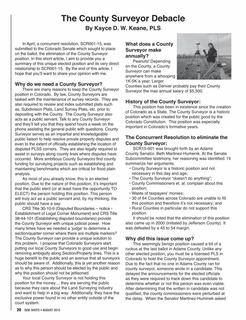
What does a County Surveyor make annually?
Peanuts! Depending on the County, a County Surveyor can make anywhere from a whooping 1K-5K a year. Larger Counties such as Denver probably pay their County Surveyor the max annual salary of $5,500.
History of the County Surveyor: This position has been in existence since the creation
of Colorado as a State. The County Surveyor is a historic position which was created for the public good by the Colorado Constitution. This position was especially important in Colorado’s formative years.
The Concurrent Resolution to eliminate the County Surveyor:
SCR15-001 was brought forth by an Adams County Senator, Beth Martinez-Humenik. At the Senate Subcommittee testimony, her reasoning was identified. I’ll summarize her arguments.
• County Surveyor is a historic position and not necessary in this day and age;
• The County Surveyor “doesn’t do anything”;• County Commissioners et. al. complain about this
position; • Waste of taxpayers’ monies;• 30 of 64 Counties across Colorado are unable to fill
this position and therefore it’s not necessary; and• Rural Counties in particular do not support this
position.It should be noted that the elimination of this position
also came up in 2000 (initiated by Jefferson County). It was defeated by a 45 to 54 margin.
Why did this issue come up?This seemingly benign position caused a bit of a
ruckus at the last ballot in Adams County. Unlike any other elected position, you must be a licensed PLS in Colorado to hold the County Surveyor appointment. Due to the fact that no one in Adams County ran for county surveyor, someone wrote in a candidate. This delayed the announcements for the elected officials as they were required to track down this candidate to determine whether or not this person was even viable. After determining that the written in candidate was not qualified, the county commissioners were perturbed at the delay. When the Senator Martinez-Huminek asked

SIDE SHOTS • AUGUST 2015 21
them what she could do for them, they responded, “eliminate the requirement for the County Surveyor.” That is exactly what the Senator attempted to achieve.
Our current bylaws address what the Commissioners are supposed to do in the event that there is not an elected or appointed County Surveyor.
The Concurrent Resolution Passed in the Subcommittee:
Peg Ackerman, the PLSC lobbyist, reached out to select PLSC leadership regarding SCR15-001 a week prior to the bill’s introduction at the Senate Subcommittee hearing. With less than a week’s notice, the PLSC, Colorado Association of County Surveyors (CACS) and passionate surveyors managed to pull together a small group to fight the concurrent resolution at our state capital. After hearing opposing testimony from five land surveyors (two of which are current county surveyors and a former county surveyor), the resolution passed 3 to 2. Those who testified include the following Professional Land surveyors: Warren Ward, Paul Bacus, Jason Emery, Robert Snodgrass, and myself. Robert Boehm was there for moral support. We realized after this hearing that it passed along party lines; Republicans for, Democrats against. It seemed as though the decision was made before we said a word.
The Concurrent Resolution was Defeated on the Senate Floor:
After the SRC15-001 passed the senate subcommittee, it proceeded to the floor of the senate. As many of you know, the PLSC sent out notices requesting surveyors across the state contact their representatives requesting them to oppose. The bill died on the senate floor by only two votes due in large part to our profession uniting in opposition. Thanks to each of you who reached out to your local congress member.
Next Steps:It’s apparent to me that there are some issues
circling around the County Surveyor position and Senator Martinez-Humenik isn’t completely in the wrong. I testified at the Senate Subcommittee that I wanted the PLSC to be a part of the conversation and solution as we Land Surveyors are natural problem solvers. Since the defeat of SCR15-001, I sent the honorable Senator an email reiterating that statement. She stated that she would be in touch. I believe that the problems and issues for us to address are as follows:
• Some County Surveyors should be more active in County Projects. I believe that the PLSC and CACS should provide ideas and guidance for County Surveyors to benefit local surveyors and the public.
• Encouragement by the PLSC and the CACS should be given to surveyors across the state to run for
these offices; particularly in rural counties.
• In areas where there are not local surveyors, we can contemplate some kind of collaborative effort so that perhaps one County Surveyor can serve several counties.
• Educating all Colorado Surveyors on this position and the benefits to having a County Surveyor (which I’ve attempted to do here).
• Educate the public on the benefits of a County Surveyor in addition to our local County Commissioners. The Legislative Committee is now focused on
addressing this issue. However they need guidance from the PLSC and its constituents. They will be keeping a close eye on proposed legislation along with our lobbyist, Peg Ackerman.
Lastly, the PLSC will be addressing the County Surveyor issue at the 2016 Rocky Mountain Summit Conference at its symposium. As I’ve attempted to do here in a concise manner, we will have a two hour session educating attendees on the benefits of this position and it’s unique power, both judicial and with County officials. The follow up symposium will have a panel and an avenue to propose a solution. Like past symposiums, the solution created by a group of peers will be taken to the PLSC board. The board will then provide the Legislative Committee with a directive on a change in legislation. With good luck, we’ll be able to come up with our own solution to the County Surveyor ‘problem’.
I can guarantee you a solution made by us will be better for the public and the surveying community than a solution created by unknowing politicians. If we don’t come up with something, the lawmakers will!
Let’s unite as a community on this issue. There’s no need to wait until the conference. Send your comments/suggestions to me via email, [email protected] ◆
Author’s Note: This article was written with help from Jason Emery, PLS and Paul Bacus, PLS. Special thanks to both of you for your assistance.
Boulder County Surveyor monument set by Jason Emery, PLS (former County Surveyor) for Benchmark project.

22 SIDE SHOTS • AUGUST 2015
GIS in the Rockies September 23-24 Denver, CO
EXCEPTIONAL CONTENT-RICH CONFERENCE:• Outstanding Professional Workshops & Presentations • Networking • Exhibitors• Presentation Opportunities – Sessions & Posters • Job Fair • Social Events
gisintherockies.org
DISCOUNTED EARLY REGISTRATION THROUGH MAY 31: $250 – A $75 SAVINGS!
Join us for the 28th AnnualGIS in the Rockies Conference -the Intermountain West’s premiergeospatial information andtechnology conference.
Complete Photogrammetric Services
MAP MAP WWORKSORKSContact: Ralph Vomaske, Certified Photogrammetist, ASPRS
7625 W. 5th Ave. #203E • Lakewood, CO 80226
Phone: 303-667-3540
E-mail: [email protected]

SIDE SHOTS • AUGUST 2015 23

24 SIDE SHOTS • AUGUST 2015
We were saddened to hear of the sudden passing of Larry Connolly, PLS on July 6, 2015, of natural causes. He was a former Director of the PLSC, active in the Southwest Chapter, and has served as the County Surveyor of La Plata County since first being elected in 2000. He helped start the Four Corners Area Surveying Seminar Committee, and was the founder and co-owner of Animas Surveying and Mapping in Durango, since 1992. In 2007 he was appointed by the Governor of Colorado to the State Board of Engineering, Architects, and Surveyors where he served until his death.
His last official act as the La Plata County Surveyor was on Independence Day, when Connolly walked in the Bayfield and Durango parades with county-elected officials and staff members. “We extend our condolences to his wife, Stacey DeJong, his daughter, Savana, and his entire family,” said Gwen Lachelt, La Plata County Commissioner in a statement. “Larry exercised his office with commitment, enthusiasm and integrity, and we are so grateful for his service to the citizens of La Plata County.”
Lawrence T (Larry) Connolly was born January 6, 1957 in Oakland, CA to Gerald L and Mary Norma
Connolly. Grew up in Oakland Ca, and graduated from Skyline High School in Oakland in 1974. He was an avid outdoorsman, enjoying rock climbing and hiking through Yosemite National Park as a young man. He moved to Idaho, continuing his love of the outdoors and enjoyed climbing and skiing around the Rocky Mountains of Idaho, Montana and Wyoming. Larry graduated from Idaho State University with a degree in Civil Engineering in 1982. He moved to Denver Colorado to work in Surveying in 1983. In 1992 Larry moved to Durango and co-founded Animas Surveying and Mapping with his partner David Frienmuth. In later years, he and his wife Stacey became avid SCUBA divers, traveling around the islands of the Caribbean photographing and enjoying the wonders of the coral reefs. ◆
Larry T. Connolly, PLS 1957-2015
Photo: The Durango Herald
From the AES BoardAt the July 10, 2015 meeting, the Members and staff of the Board of Licensure for Architects, Professional
Engineers, and Professional Land Surveyors recognized Settlement Specialist, Dennis Rhodes, to provide his report on the activities of the Expedited Settlement Office. During that report Dennis offered the following that captured the feelings of the Board and staff as we struggled with the loss of Board Member, Larry Connolly, PLS. The Board wanted to share Dennis’ words with you…
I only have a few things to tell you on my case status report. I have much more to tell you about a Board member who is no longer with us and who we will all miss terribly. Larry epitomized what I have always so loved about this Board and why you have always been my favorite. He always had something interesting to talk about. Whether about work, Board business, or his most recent exotic vacation. It was always a pleasure to see him, to talk to him and to listen to him. But he was always serious, thorough and conscientious about Board business .... and one of my favorite traits, Larry had a sense of humor and loved to laugh. Needless to say, I like that!! I don’t remember any of my AES Board time without Larry.
When I looked at his obituary I was a little alarmed when I saw that Larry was younger than me, by a few years. Sheesh!!
Well, he would want us to persevere, that’s all we can do .... and he would also want us to laugh.
So I say, “hear, hear” to Larry Connolly. God has a hell of a surveyor in heaven and a good man. When we get there, we know that the boundaries of our lots will be true and accurate. Monuments will be properly placed and our plats duly recorded. ◆

SIDE SHOTS • AUGUST 2015 25
Western Federation of Professional Surveyors (WFPS), representing the surveying profession of the Western United States, including Alaska and Hawaii since 1979.
The WFPS Meeting was in Denver at the Double Tree May 30th, on the 31st the WFSP Delegates traveled to Cheyenne, WY for a memorial service and to set a “Final Points” Monument for Paul Reid, a long time Wyoming Delegate to WFPS.
WFPS NEWS: WFPS has enough teachers enrolled in the TwiST
program so that the educational summit can be held in Washington State. Teaching with Spatial Technology (TwiST), is designed to teach grade 6-12 educators how to use Geographic Information Systems (GIS) and Global Positioning Systems (GPS) in the classroom to create meaningful and challenging lesson plans for your students. Hopefully, fostering interest in surveying. Colorado’s representative is Phyllis J. Janssen (PJ) from Central High School in Grand Junction.
WFPS has submitted a MOU between WFPS and NSPS to create a liaison between them, and a WFPS Officer will attend NSPS meetings to represent the Western Federation of Professional Surveyors. Hopefully, this will Foster common goals and relationships.
Most states are beginning to put together programs for their annual conferences. Did you know: WFPS is developing an online search engine for a speaker’s bureau (a list of available speakers with subject matter information)? This list is available to all member states.
Other subjects of interest to the WFPS include:• QBS/Mini Brooks Act (acquiring information from all
western states to study differences and similarities in state laws)
• Supporting CFedS continuing education (helping to develop or administer classes)
• Supporting TwiST and TrigStar programs• Keeping and updating a matrix of all the states’
information concerning membership and dues for State Organizations, mandatory continuing education, licensing requirements, etc.
Western Federation of Professional Surveyors State news: Alaska (ASPLS):
Legislature is in session and presently no legislation
is pending that would directly affect the practice of surveying.
California (CLSA):CLSA has scheduled several workshops for the
coming months. The next one features Railroad 101, Charlie Tucker, August 7, Santa Rosa, CA, August 14 – Ontario, CA.
The Legislative Committee is monitoring over 40 bills with many of the bills this year relating to UAV’s. They also are monitoring bills that may affect the surveyor’s right of entry.
Montana (MARLS): Montana’s Board of registration:Proposed language for easement exhibits:UNIFORM STANDARDS FOR EASEMENT EXHIBITS(1) An easement exhibit prepared by a licensed
professional land surveyor is a drawing and record of survey of a non-possessory right encumbering the real property of another. When recorded or filed in the public record, an easement exhibit must contain sufficient information such that the retracing land surveyor can establish the easement on the ground.
(2) An easement exhibit must comply with the following requirements:
a. An easement exhibit must be legibly drawn with permanent black ink or printed or reproduced by a process guaranteeing a permanent record. It must conform to medium, page size and margins as required by the filing office.
b. If more than one page must be used to adequately depict the easement, each page must show the number of that page and the total number of pages included.
c. An easement exhibit must show or contain the following information:
c.i. A title or title block including the quarter-section, section, township, range, principal meridian, county and if applicable, city or town in which the easement is located; c.ii Sufficient information to identify which tract of
record is encumbered by the easement; c.iii. The date the easement exhibit was completed
and a brief explanation of the purpose of the easement;
c.iv. A north arrow; c.v. A scale bar. The scale of the easement
Western Federation of Professional Surveyors Report
By Michael Bouchard, PLSColorado WFPS Delegate
May 30, 2015

26 SIDE SHOTS • AUGUST 2015
exhibit must be sufficient to legibly represent the required information and data on the easement exhibit;
c.vi. If applicable, the location and description of other information relating to all monuments that influenced the position of any corner or boundary of the easement shown on the exhibit.
Continuing Education: The Department of Labor and Industry has suspended all audits of continuing education for the last cycle for all boards. There have been discussions to discontinue audits for the BPEL entirely. This issue will be discussed again after the fiscal year.
New Mexico (NMPS): Items that are being discussed concerning legislative
issues include: • Statute of repose.• Minimum Standards Revisions• Review of Continuing Education requirements.
Nevada (NALS):The Great Basin College and the University of
Nevada, Las Vegas (UNLV) talking about the possible creation of a minor in land surveying for students enrolled in UNLV. NALS supports the union and the program.
Oregon (PLSO): Legislative Committee: The committee is
monitoring proposed legislation and responding when appropriate. So far this year there are two issues that keep PLSO hopping: a request to the Oregon Bureau of Labor & Industry (BOLI) by the International Union of Operating Engineers to revise Party Chief designation for prevailing wage, and an amendment to Oregon Senate Bill SB297 requiring topographic and hydrographic mapping to be done under the direction of a Licensed Surveyor.
Young Surveyors Program: This new program is up and running in Oregon with Tim Brown as Chair. Official name: Young Surveyors Network of Oregon. The group has already met once and has come up with some initiatives: (1) Create a mentorship program that
will serve as a model for other states; (2) Modernize outreach by highlighting new technology, coordinating efforts with ASCE, APWA and IRWA, incorporating social media, and creating a page on the PLSO website. It was suggested that Young Surveyors schedule a meeting at the conference and get students involved.
Washington (LSAW): HISTORICAL SOCIETY ACTIVITIES: The LSAW
Historical Society is working in conjunction with the Survey Historical Society (SHS) to coordinate and sponsor their yearly Surveyors Rendezvous in Bellingham, Washington on September 9-12, 2015. The focus of this Rendezvous is “Surveys and Surveyors of the Salish Sea in Washington & British Columbia” and will include speakers from both the Canadian and United States International Boundary Commissions.
UPDATE DEFINITION: The Board of Registration has been moving forward with the “Practice of Surveying“ Washington Administrative Code (WAC) update and has prepared a preliminary draft of the new WAC for our review and support. Stakeholders are encouraged to attend the upcoming public meeting and provide feedback. More to come on this from our new WFPS Delegate, Aaron Blaisdell, who also serves as our Board of Registration Liason.
MONUMENT PRESERVATION: Proposed changes to funding Monument Preservation efforts are continuing at the State level. The Washington Council of County Surveyors (WCCS) is requesting all stakeholders to participate and agree to language supporting Monument Preservation and still attempting to work through funding issues.
Utah (UCLS): The 2015 Fall Forum will be held at the Salt Lake
Community College on September 18th.The 2016 UCLS Conference will be held in St.
George, UT in February, 2016.
For more Western Federation of Professional Surveyor’s news and events, please visit the web site at: www.wfps.org
—End of Report

SIDE SHOTS • AUGUST 2015 27
As the recently appointed Director of the National Society of Professional Surveyors (NSPS) for Colorado, I had the pleasure of attending my first national conference in Arlington, Virginia on April 13-16, 2015. Becky Roland was also in attendance, representing the PLSC for a meeting of Executive Directors of the state surveying organizations.
The NSPS activities were part of a larger function, the NSPS/MAPPS Geospatial Summit, a “conference of conferences,” bringing together surveying, mapping and geospatial professionals, with the theme, “Collaboration: The Map of the Future.” It included a Federal Programs Conference with presentations by Federal agencies, the Obama Administration, and members of Congress. Among the agencies that participated in the conference were the Office of the Secretary of Defense; Departments of Interior, Agriculture and Homeland Security; USGS, Corps of Engineers, NOAA, Forest Service, BLM and the Census Bureau. Over 400 people were registered for the conference. This was the first national geospatial conference of its kind, and the organizers hope that it will become an improved, annual event.
One of my first committee appointments was to be a judge for the annual student competition, on Monday, April 13th, where for the first time included not only student teams from four-year degree programs, but also teams from two-year degree programs as well. The subject was the “Error Study of Topographic Mapping Methods.” Papers, presentations and a poster session were part of the event. All were excellent. The winner among the 4 year programs was the team from the Department of Engineering and Surveying, University of Puerto Rico at Mayaguez. The team from New Mexico Community College won in the 2 year program group. The posters will be on the NSPS website in the near future.
The event included the annual NSPS Board of Directors meeting, where Jon Warren was named as the new President, along with the naming of other new officers. At one point, eleven past presidents of NSPS posed for a picture. Jon is representing NSPS to the
“3DEP coalition” which includes a wide variety of other entities including USGS, NOAA, NGS, FEMA, NGAC, NGIC, ASPRS and MAPPS. The 3DEP program hopes to create, over an 8-year timeframe, a full digital elevation model/tin for the full nationwide coverage. It is expected that the surveying community will play a major role in taking this to a national level.
The third day of the event was “Capitol Hill Day,” an opportunity for the directors to lobby over 200 senators and congresspersons on issues of importance to the survey and geospatial community. I was able to meet with Senator Cory Gardner, and Representatives Mike Coffman, Jared Polis and Doug Lamborn. We also had meetings with Legislative Assistants representing Diana DeGette, Ed Perlmutter and Senator Michael Bennet.
There were four action items I was instructed by NSPS to discuss. One is for funding of the USGS “3DEP” or 3D Elevation Program, a “national enhanced elevation assessment that will satisfy growing demand for consistent, high-quality topographic data and a wide range of other 3D representations of the nation’s
NSPS Meeting HighlightsBy John B. Guyton, PLS
From left, Becky Roland, Richard Serby of GeoSearch, Rep. Cory Gardner, JB Guyton, Gary Outlaw and Brian Raber of Merrick.
JB Guyton with Rep. Paul Labrador

28 SIDE SHOTS • AUGUST 2015
natural and constructed features.” It would use LiDAR to build the most detailed elevation maps ever produced on a nationwide scale. You can read more about this far-reaching mapping initiative at http://www.3dep4america.com. The second item was the “Federal Land Asset Inventory Reform (FLAIR) Act,” which would create a “single, current accurate inventory of all Federal Real Property, to assist in improved Federal land management, resource conservation, environmental protection and utilization of real property.” The third is the “Safe Corridor Utility Distribution,” a bill to recognize the importance of surveying and mapping data and asset information in ensuring pipeline safety, and to assist in the creation of accurate asset inventories. And the fourth item is the “Freedom From Government
Competition Act,” which codifies the “Yellow Pages” test, that says “…if there are private companies to be found in the Yellow Pages providing services in the commercial market that the government is also providing, then the service should be subject to market competition to break up the government monopoly and provide a better value to the taxpayer.”
I learned just a fraction of the complex labyrinth of processes and procedures that must be followed for any such ideas to become law, and funded. There are things being discussed in Washington that have the potential to impact our profession. If any come close to passage, either the PLSC or the NSPS will inform the membership and solicit letters/emails of support or opposition, as needed. ◆
JB Guyton with Rep. Jared Polis
Rep. Mike Coffman and legislative aids meeting with JB Guyton, Becky Roland, and other lobbyists on Hill Day.

SIDE SHOTS • AUGUST 2015 29
Legislative Committee ReportBy Alan Blair, PLS
The PLSC Legislative Committee proposed two changes to the Department Of Regulatory Agency’s (DORA) Architect, Engineers and Surveyors (AES) Board Rules. The rules supplement and define how statutes should be implemented. The proposed rules were endorsed by the PLSC BOD and were discussed by the general membership in symposium format at the 2015 Rocky Mountain Surveyors Summit.
One rule change was proposed to address that most contentious of all commodities created by surveyors, the epitome of all that is evil in surveying, the very scourge of surveying: The Improvement Location Certificate.
That language is a bit strong as there isn’t anything terrible about an ILC when proffered properly. The problem regards the improper use of the ILC as a document declaring definitively, dare I say dimensionally, that future improvements would be entirely within the lot despite the definite disclaimer demanded by CRS 38-51-108.
We decided that one way to prevent the proliferation of the improper use of the ILC would be to remove Board Rule 6.6.2(c) that requires ties to lot lines be shown:
Major improvement locations shall be shown with dimensions to the nearest property lines, with a minimum of two dimensions shown, and shall be sufficient to locate structures.
Despite the disclaimers, the appearance of dimensions from improvements to property lines misleads users and may cause harm.
The removal of the requirement does not preclude the placement of dimensions. If, in the sagacious surmise of the surveyor, the dimensions may be shown with sufficient certainty, they may be shown.
Did we finally fix the ILC? Nope, but we may have patched it a bit. At the very least, the elimination of Board Rule 6.6.2 relieves the surveyor of a requirement to add to the confusion of the general public as to what is being certified by the stamp on an ILC. The lack of dimensions may provide a learning opportunity between the surveyor and the client when some of the differences between the ILC and an actual boundary survey could be explained. CRS 38-51-108 does not require a drawing. All that is required by law is a couple of statements, a stamp and some liability.
Since the first monument was set by a surveyor and disputed by a second surveyor in the form of a second monument in the vicinity of the first declaring its superiority over the first, multiple monuments have plagued the profession. The mystery of multiple monuments the target of the second rule change proposed to the AES Board.
At first, it is comforting to come in contact with another monument near the corner it purports to
represent. Then, it becomes disquieting. Should impeccable measuring skills and incontrovertible calculations prevail and demand the placement of a second, more precise pin?
Whether the location of a monument is right or wrong is a matter of judgement and surveyors are licensed to make judgements with the goal of protecting the public and preserving property lines. The addition of Rule 6.5.4.1 would require surveyors to share their judgments:
6.5.4.1 DOCUMENTING NEW AND EXISTING MONUMENTS. IF A MONUMENT IS SET, AS A RESULT OF A LAND SURVEY, THAT REPRESENTS THE SAME CORNER OR CONTROL CORNER OF AN EXISTING MONUMENT, THE PROFESSIONAL LAND SURVEYOR SETTING THE NEW MONUMENT SHALL MAKE NOTE ON THE RESULTING LAND SURVEY PLAT, THE REASON THE EXISTING MONUMENT WAS NOT ACCEPTED.
The PLSC believes that the addition of this language will force surveyors to consider the reasons for setting a monument in close proximity to another monument at a corner location and may have the effect of reducing the existence of redundant monuments. The existence of multiple monuments is misleading to the public and causes uncertainty in the location of boundaries and may cause harm. It is a long settled principle that a surveyor should attempt to faithfully retrace boundaries that have been previously established. Monuments faithfully set by a surveyor to the standards existing at the time of the survey should be respected and observed. The intent is to provide certainty in boundaries and protect the public.
The rule changes were submitted to the AES Board for review at the May 8 meeting. Owing to the sure and steady pace of government, I would expect to see them in place sometime in the Fall of this year.
Stay tuned Dear Reader as the PLSC BOD, under the leadership of President Beers, will be exploring how to enact legislation requiring continuing education for surveyors and to protect the position of the elected county surveyor as specified in the Colorado constitution. More rule changes may be proposed to assure that there is no disconnect with the language in the statutes. ◆
UPDATE: These two changes will go into effect on September 1, 2015. See From the Editor on page 5.

30 SIDE SHOTS • AUGUST 2015
Call to Order: (Todd) 4:06
Recognition of PLSC Board Members and Officers:Officers: Todd Beers (P-Central), Kayce Keane (VP - Northern), Terry Maw (Treasurer - Southern), and Becky Roland (Exec. Dir.).Board: Paul Bacus (Northern), Alan Blair (Central), Eric Carson (Central), Patrick Green (Western), Leif Joy (NW1/4), Steve Parker (Southern), James Rihanek (Central) and Thomas Sylvester (Western)
Nonvoting: Mike Bouchard, Roger Nelson (Past President), Brian Dennis, J.B. Guyton Laine Landau (Northern), Pam Fromhertz
County Surveyors Representative: Patrick Green – Also Board Member
Present: Todd Beers, Kayce Keane, Terry Maw, Becky Roland, Paul Bacus, Alan Blair, Eric Carson, Patrick Green, Leif Joy, Steve Parker, James Rihanek, Thomas Sylvester, Mike Bouchard, Roger Nelson, Brian Dennis, J.B. Guyton, Laine Landau and Pam Fromhertz
Absent: Determination of Quorum (Terry Maw - 6 voting
members) - DeterminedWelcome of Guests:Additions, deletions and modifications to agenda:
none
1: APPROVAL OF MINUTES FROM PREVIOUS MEETING(S): (TERRY MAW)
MOTION: To accept the Minutes from February 26 as presented (Maw/Blair)Seconded, Approved unanimously
MOTION: To accept the Minutes from January 15 as presented (Maw/Green)Seconded, Approved unanimously
2: THANKS to outgoing PLSC BOD and welcome to incoming BOD (Todd)
3: 2015 BUDGET– Terry Maw & Becky Roland• Review and modifications• Scholarship Funds, Checking & Savings Accts.
MOTION: Move $150,000 to Franklin/American from Wells Fargo Operational Funds contingent upon review of fees within investment account. (Maw/Carson)Approved unanimously• Have Becky summarize fees for moving funds to/from
investment accounts.• Membership Renewals-issues, where are we with 2015
numbers• Becky will send details of calls and renewals.
Membership is down 25%.
4: SCHOLARSHIPS DISCUSSION• Western Chapter $1,500 (Tom Sylvester) (50/50 split
with PLSC)
MOTION: To approve $750 funding from PLSC Scholarship Funds for Western Chapter Scholarship (Sylvester/Maw)Approved by unanimous consent• Becky to send flyer to all members.• Trig Star promotion by Western Chapter (Patrick Green)• Need to give an incentive for kids to participate ($10
gift card for everyone that completes and $100 to overall winner)
• Tom Sylvester has had success with incentive offer turning into invitation to present at local high school
• Board discussed gift cards should be paid out of operational fund and not scholarship
• Estimating 6-8 kids this year on Western Slope• May want to touch base with Jan Sterling on what City
of Aurora is doing – Tom is in contact with her.• Board consensus is that TrigStar is a great program
MOTION: To approve $100 gift card for school winners and $10 gift card for student participants. (Sylvester/Keane)Approved by unanimous consent
MOTION: Modify budget accordingly to pay for gift cards from operational budget (TWiST/TrigSTAR scholarships to $2500 and TrigSTAR incentive to $500).Approved by unanimous consent• CFeds Scholarship for 2015-increase number available
to chapters?• Keep at one scholarship per Chapter for now• Twist Program funding for $2,000• Need a teacher to apply right away – Tom will ask local
teacher• Payment to Lyn Patton & Jan Van Sickle ($300 each)
for refresher course
MOTION: To approve payment to Lyn Patton & Jan Van Sickle $600 each for the 2015 Refresher Course (Blair/Keane)Approved by unanimous consent• Note the payment is an honorarium. • Becky will send the checks with letter/notice from Alan
(Becky to coordinate with Alan).• Other ways to use funds?
5. COLORADO COUNTY SURVEYOR POSITION• Discussed current issue (hearing held 4-7-2015)• Peg Ackerman was able to notify PLSC, but it moved
quickly• A number of PLSC members testified against • Need a 2/3 majority of Colorado Senate/House to pass• Board consensus is to distribute talking points to PLSC
members to make calls/write letters with a link to find
PLSC Board of Directors MeetingApril 8, 2015
Farnsworth Group Office, DTC

SIDE SHOTS • AUGUST 2015 31
their representative. Also PLSC should write a letter. (Jason Emery put together a form letter with talking points.)
• Pam suggested reaching out to the GIS community for support
6: 2016 SURVEYOR’S SUMMIT, (KAYCE KEANE)• Exploring Venue options, Sponsors, Tract assignments,
speakers, advertisements • 2015 RMSS summary of financials• Planning Status Update• Chapter Summit Draft Minutes
7: ESTABLISH PLSC 2015 GOALS & PURPOSE• Increase PLSC Membership overall- All Chapter
Membership Drive? Steve Parker is the PLSC Membership Committee Chair.
• DORA provides name and address only (no emails)• Survey non-member as to why they are not members
and what would get them to join• Need to promote recent legislative action as a rally cry• PLSC needs to provide a Welcome packet/Thank you
for renewing (see 9 below)• Controversy or need for surveyors to get involved in an
issue is a great promotion for membership• Outreach to all chapters for goals, assistance, input
(Beers will make this a personal goal)• Continuing Education requirement• History of prior attempt by AES• How best to approach?
8: CSRN COMMITTEE GPS DAY (APRIL 18, 2015) –BRIAN DENNIS • Event is 10AM-2PM• Promoting to scouts (girl and boy)
9: ITEMS FOR NEW AND CURRENT PLSC MEMBERS• Membership cards (wallet cards)• Certificate of membership (letter size)• Book on statutes (Paul’s book)• Any other ideas?• PLSC logo and Chapter logo to add to email signature of
members• First year PLS/LSIT discounts on PLSC events• Binder with statutes given to each new member• Steve to summarize this list and send it to the Board for
editing/addition via email
10: REPORTS:• NGS/NOAA (Pam Fromhertz)• Pam will send a formal report; has scheduled meetings
with Chapters to present• need ideas on adoptive stations• GIS day at Pikes Peak CollegePresident, Todd Beers – no additional reportVice President, Kayce Keane – no addit ional reportSecretary-Treasurer, Terry Maw – no additional reportExecutive Director, Becky Roland• The State Executive Directors Meeting will be held with
the Congressional Visits next week in Washington DC. Becky will be attending
NSPS Governor – JB Guyton• The NSPS Meeting is next week in Washington DC. JB
will be attending with BeckyWFPS Delegates Mike Bouchard and Roger Nelson• Denver will be next meeting end of May• Paul Reed Memorial Cheyenne following Sunday Final
Point – Mike will send information
11. STANDING COMMITTEESLegislative Committee – Alan Blair, Chair• New Legislation – approved Board Rule changes
previously• other rule change still in discussion• need a legislative committee meeting to discuss County
Surveyor/CE Requirement• Nat’l Surveyors Week approved by Governor lateSurvey Monumentation and Standards - InactiveMembership Committee, Steve Parker, Chair• All Chapter membership drive• New SI’s and LS’s free membership invitation -
Discussed aboveEthics and Fair Practices, Patrick Green, Chair – no additional report• Will work on ethics presentation for 2016 SummitEducation Committee, Kayce Keane, Chair – no additional reportLiaison Committee, (QBS Colorado) - InactiveSpecial Committees - CSRN – Eric Carson• GPS Day-April 18, 2015 Trig Star• GIS-In-The-Rockies – Steve Parker. Sept 23-24
(Surveying Past present and future) Heather Lassner is new track chair and Steve will help with speakers Steve Coast keynote; Melinda Machuri (CSU Professor) Keynote; May 1 deadline for abstracts
• Steve will forward IRWA info and GIS in the Rockies info to Becky to post on web site
12: CHAPTERSSouthern – Steve Parker, President –next members meeting - Fidelity Title and Geoshack 4/21
at FW; June – Arrowtech; Sept/Nov – Pam (in Pueblo); August golf
Central – Dave Kuxhausen, President – not on callNorthern – Laine Landau, President, Beers attended last
meetingNW ¼ – Brian T. Kelly, President – not on callWestern – Richard Bullen
Western Slope exofficio appointment - Peter Krick Spring Seminar May 1
Southwestern – Josh Casselberry, President – not on call
13: NEXT MEETING DATE AND LOCATIONJuly 15 – 4-6PMRespectively submittedTerry Maw, PLS,Secretary/Treasurer PLSC ◆

32 SIDE SHOTS • AUGUST 2015
C H A P T E R N E W S
CCPSGreetings. As most of you are probably aware, the
April 23rd CCPS General Meeting that is usually held at the Aurora Doubletree hotel was cancelled this year due to lack of attendance. This has instigated a lot of discussion with the CCPS board of directors, and we have been kicking around a lot of different ideas on how we can expand the meetings and offer some new and exciting activities for our membership.
As I write this I am preparing for tonight’s June 25th CCPS General meeting. I am excited to announce that we are holding a new, fresh prototype kind of meeting. This event will be a land surveyor-centered social event where all of us can collaborate with our peers and discuss the goings-on within our profession over some dinner and drinks. We think this is a new and exciting way that we can solicit suggestions on how the CCPS can improve as an organization, better serve our members, and update our rolodex. We welcome any new ideas for potential speakers, venues, and activities we could be looking into.
As most of you are aware, the new board of directors is in place, as follows: David Kuxhausen, President; Kevin Kucharczyk, Vice President; Mark Wilson, Secretary; Aaron Willis, Treasurer. The Directors are Anthony Perazzo, Devon Arnold, Brian Socia, and Shawn Clarke. As you may have noticed, we are undersized and short three directors. If any of you are reading this and are interested in serving on the CCPS board, please feel free to contact me or one of the other members. It’s a great way to get to know your fellow surveyors and make friends in the process.
The CCPS is currently in the process of updating our chapter member email address list. If there are some of you out there who have not been getting the General Membership meeting requests please email me at [email protected] and I will make sure you are added to the distribution list. In addition, if there are any of you that are feeling brave and are interested in speaking at one of our general meetings or perhaps you have a topic in mind, please feel free to share that with us and we will do everything in our power to make it a reality.
David J. Kuxhausen, PLSCCPS President
NC-PLSC
The Northern Chapter is on our summer break but there is still some PLSC-NC activity occurring behind the scenes. Paul Bacus has published the 2015 edition of the survey laws book Rights of Way and Easements. The book looks a little different this year. It is bound into a blue cover and it is a little longer than our prior efforts. We’d like to thank Legislative Services for allowing us
to exceed the 199 statute limit we previously adhered to and feel that this is a more complete book because of their permission. Northern Chapter members, please look for the books in your mailbox soon. If you would like to purchase additional copies, please contact me at [email protected] and we’ll get them sent out to you. We have had some interest from survey companies interested in purchasing copies for their employees who are not PLSC members. Larimer County also expressed interest in obtaining a copy. Ask yourself who could benefit from a copy. Perhaps an attorney, a client, or a young surveyor you are mentoring would like this resource. Clients are really tired of getting gift baskets with booze and candy. Get them what they really want - or at least what they really need - their own copy of Rights of Way and Easements!
I’d like to thank the awesome Northern Colorado volunteers who helped with GPS day in May. We were well represented by Darren & Vincent Wimmer, Mike Johnson, Paul Bacus, Heather & Maerron Lassner, Pete Paulus, and me. The weather cooperated in the end, but the threatening skies and dire weather forecasts kept many away. Those who attended learned a lot. Brian Dennis led a great post-event de-brief that will ensure that the event improves each year.
We are trying to add material to our website to get our members to use our website as a resource. So far we have images of the Loveland tie book to scan and upload. We have also added job postings. We are hoping to keep it fairly simple so that maintaining the website does not become too cumbersome. Again, suggestions are very welcome.
I have just started a new job as a Survey Project Manager at Lamp Rynearson. As part of that transition I am getting ready to review the survey department personnel. One of the aims is to look at development of each person both personally and professionally. Professional involvement in the PLSC at both the local and state-wide level will be part of all the plans I am putting together. I would like to suggest that all of you review your company goals and see where you, your staff, co-workers, and peers could benefit from PLSC participation. For those who have little time a volunteer commitment like serving as a guide for GPS Day 2016 might be a good step. Others may benefit from attending all 3 days at the conference. Others may be ready to make their first public presentations to a PLSC group or meeting of realtors. If you are looking for an activity to fit a specific person and need some direction, please give me a call.
I hope you all have a productive and profitable summer season and I look forward to seeing many of you in September. Please see our website https://sites.google.com/site/ncplsc/ for details.
Laine LandauPresident, NC-PLSC

SIDE SHOTS • AUGUST 2015 33
C H A P T E R N E W S
NW ¼ CLSThe NW1/4 will be meeting again in the next month
or six weeks and in the interim, we have some exciting news! Finally, after years of tireless effort by our current County Surveyor, Tom Effinger and one Walter Magill, PE-LS, the City of Steamboat Springs is sponsoring a CORS station. It will be tied into the Grand Junction/Delta network. The next thing for us to work on will be a radio. For those of you who occasionally come into NW Colorado, you may be aware that there is a sizable gap in the network in this area. This should solve that problem. Thank you to both Tom and Walter and the City of Steamboat Springs!
The general economy, both real estate and construction, are continuing their gradual recovery from the depths of the Great Recession. The lagging factor at this moment is oil and gas throughout NW Colorado and Northeastern Utah. It appears oil and gas prices are starting to rebound - gas is up almost 70 cents a dollar at the pump. So there have been a number of surveyors previously employed in the oilfields that are still seeking work.
There is a general trend throughout the government entities, be it City, County, State or Federal, to have a “Surveyor on Call” RFQ. These are widely advertised but poorly utilized by the government entities. It appears that a surveying firm is selected, but the actual scope of services for which the government entity has money is limited, or is nonexistent. This once again points to the general lack of understanding by the public about the importance of surveying and its framework in our society. Given the aging monuments in the public land system, many of which are over 100 years old at this point, we are approaching a crisis as these monuments continue to disappear over time. This trend is readily evident in NW Colorado as many of the GLO brasscaps date back to WWI-or before- and the old stones in Moffat County before the turn…of the prior century! It would behoove us as an association to take on this matter head on. Although many of us may be out of the industry before this matter is resolved, we owe it to future generations to educate the public as to the value of public land survey monuments and the importance of their perpetuation. Replacing them with GPS without a prior tie is not the solution!
Brian T. Kelly, PLSPresident, NW ¼ Chapter
SCPLSIn April the southern chapter hosted guest speaker
Greg Wolff, of Fidelity National Title Group. He shared new language on the policies that favor surveyors and
discussed common issues surveyors encounter when working with title commitments. The meeting was opened by Craig McCoy of GeoShack, showcasing their latest Hyper-SR and affordable robotic solutions. For our June members meeting, 36 members and guests joined the southern chapter while Joe Alessi reviewed the rich history and priceless historic value of the Sawyer & Garstin Collection over a delicious dinner at the Miramont Castle Museum in Manitou Springs. The Castles dining room enjoyed the company of professionals from title companies, a title document plant, surveying & engineering firms and public and private surveyors before retiring to an impressive display of original antique documents in the collections’ map room. The Southern Chapter pays a special thanks to the Manitou Springs Historical Society for a memorable evening. Coming up is our Paul Grout Memorial Golf Outing and BBQ, August 8, also on October 23, the Southern Chapter Tech Meeting in Pueblo. For more information you can find us at www.scpls.net.
Steve Parker, PLS CFMSCPLS President
SWC-PLSC The SWPLSC held our most recent chapter meeting
on Tuesday, May 12 in Durango. Our guest speaker was Michael Boeckman, PLS. Michael works as a BLM Land Surveyor in Southwest Colorado and has been sharing his knowledge of cadastral surveys with us for the past couple of years.
The 2013 Colorado Land Surveying Refresher Course is now available to surveyors in the SW Chapter area. This course offers a review and self-study plan for those taking the National Council of Examiners for Engineering and Surveying (NCEES) Fundamentals of Surveying (FS) and Principles and Practice of Surveying (PS) examinations. These are on DVD and being offered to the Chapters at a 25% discount. Please contact Parker Newby at [email protected] with questions or to request an enrollment form.
Our next meeting is scheduled for Tuesday, August 18 in Durango at the La Plata County Fairgrounds Extension Building. Our guest speaker for the next meeting is Karl Pia of Olympus Aerial Surveys. Karl will be reviewing the three types of aerial sensors in common use today – the film camera, digital camera and LiDAR and their strengths, and how to determine which to use on given projects.
We are planning some changes and will be having a speaker at all of our future chapter meetings. We are trying to accommodate surveyors in our area by having technical, professional and other associated topics. Some of these will be available with continuing education

34 SIDE SHOTS • AUGUST 2015
C H A P T E R N E W Scredits for our Utah and New Mexico professionals that attend. Look for guest speaker information, time and location in the upcoming email. If anyone has any ideas about future speakers or topics, would like to be on the email list or has questions about our upcoming meeting, please contact Josh Casselberry at [email protected] .
We are sorry to announce that we will not be hosting our Four Corners Survey Seminar this year. Our time is being focused the attendance of our chapter meetings, so please be there!
Southwest Chapter members are encouraged to show up and receive a copy of Paul Bacus’ Colorado Land Surveying Laws Booklet.
Josh Casselberry, PLSPresident, SW Chapter
WCLS WCLS held their annual Spring Seminar on May 1st,
2015 with record attendance. One of our guest speakers is a local attorney specializing in estate planning. He spoke about retiring surveyors and the process of selling, transferring or eliminating their business. He was very well received by all in attendance, the majority of which face retirement in a few years. Our July meeting will be held in reserved seats directly behind home plate watching the GJ Rockies in a home game at our local Stocker Stadium.
Our next regular scheduled meeting will be September 9th and will be held at the City of Grand Junction City Hall. All are invited to attend and partake of dinner.
Peter T. Krick, PLSPresident, WCLS
ASSURANCE RISK MANAGERS
10651 E Bethany Dr., Ste. 300Aurora, CO 80014
303-454-9562
AZTEC CONSULTANTS8000 S Lincoln St, #201
Littleton, CO 80122
BERNTSEN INTERNATIONAL, INC.
P.O. Box 8670Madison, WI 53708-8670
608-249-8549
CAD-112130 N. Pennsylvania St.
Thornton, CO 80241303-427-2231
CARLSON SOFTWARE12161 W. Layton AveMorrison, CO 80465
303-979-3519
COMM-TECH5398 Manhattan Circle
Boulder, CO 80303303-530-4976
DAVID EVANS AND ASSOCIATES, INC.
1331 17th Avenue, Suite 900Denver, CO 80202
720-946-0969
DIVERSIFIED UNDERGROUND INC.2851 S. County Rd. 137
Bennett, CO 80102720-490-1321
ENCOMPASS SERVICES, LLC
394 Lake Ave S, Suite 510-DDuluth, MN 55802
218-464-5554
FLATIRONS SURVEYING & ENGINEERING, INC.
3825 Iris Avenue Suite 395
Boulder, CO 80301303-443-7001
FRONTIER PRECISION INC5480 W. 60th Ave Unit A
Arvada, CO 80003720-214-3500
GEOSHACK5385 Quebec St.
Commerce City, CO 80022303-853-0311
HIXON MFG & SUPPLY CO8775 E Orchard Rd, suite 807
Englewood, CO 80111303-694-0012
HOLMAN’S USA, LLC6201 Jefferson St NE
Albuquerque, NM 87109602-725-2302
JACOBS707 17th Street, Suite 2400
Denver, CO 80202720-359-3060
MERRICK & CO.5970 Greenwood Plaza Blvd.Greenwood Village, CO 80111
303-751-0741
POWER SURVEYING COMPANY INC.120 W. 84th Ave
Thornton, CO 80260303-702-1617
SKLD INFORMATION SERVICES
9540 East Jewell Ave, Suite ADenver, CO 80247
303-695-3850
SAM, INC.555 Zang Street, Ste. 210
Lakewood, CO 80228303-988-5852
SURV-KAP LLCP.O. Box 27367
Tucson, AZ 85726520-622-6011
TERRAMETRA RESOURCES
2919 Bryn Mawr PlaceLongmont, CO 80503
303-709-2903
TERRAMETRIX, LLC4852 S 133rd Street, Suite
105Omaha, NE 68137
402-618-3165
UNDERGROUND CONSULTING SOLUTIONS2701 W. Oxford Ave., Suite 6
Englewood, CO 80110303-904-7422
VECTORS, INC10670 E Bethany Dr., Bldg. 4
Aurora, CO 80014303-283-0343
These firms support our organization. Please show
them your appreciation with your patronage.
s u s t a i n i n g m e m b e r s

