land surveyors’ association of washington • … surveyors’ association of washington •...
TRANSCRIPT

EvErgrEEn StatE
Land SurveyorS’ aSSociation of WaShington • Washington State Section of american congreSS on Surveying & mapping
Volume 34 Number 3 Fall 2010
Surveyor
In this issue:Rules, Rules
Passing of Hugh Goldsmith
NORTHWEST
SNOHOMISH
SOUTHWEST
LOWER COLUMBIA
NORTHCENTRAL
NORTHEAST
INLAND EMPIRE
NORTH OLYMPIC
SOUTHPUGET
SOUND
NORTHPUGETSOUND
CASCADECOLUMBIA SOUTH
CENTRAL

kukrank_Mar08_wa_ad.ai 138.00 lpi 45.00° 3/25/2008 2:59:02 PMProcess Black
Fall 2010 Evergreen State Surveyor 1
President................Michael.(Mick).Sprouffske,.Jr..President.Elect.................................Bryan.ThorpVice.President................................. John.Thomas
Secretary-Treasurer............... James.A..Coan,.SrPast.President................................Scott.ThomasExecutive.Director......................Noreen.Peters
Cascade Columbia............................................... Douglas.GrayInland Empire............................................................. Steve.TrippLower Columbia...................................................Gary.FolkertsNorth Central....................................................... Norm.NelsonNortheast...................................................................Grant.ToltonNorth Olympic......................................................... Jim.WenglerNorth Puget Sound..................................................Tim.Griffin
LSAW ChApterS & 2010 preSidentSNorthwest..........................................................................Gil.Laas
San Juan.....................................................................Karl.KuetzingSouth Central..................................................John.ChristensenSnohomish................................................................Jerry.FranklinSouth Puget Sound..............................................Mike.McEvillySouthwest.................................................................... John.Linzee.
Land Surveyors’ Association of Washington (LSAW)
Address.all.correspondence.for.LSAW.to:.Land Surveyors’ Association of Washington.30442.227th.Pl..S.E...•.Black.Diamond,.WA.98010.
Phone:.360/886-5557. Fax:.425/868-1771. e-mail:[email protected]:.http://www.lsaw.org
Address.all.material.for.magazine.to:.Editor/Publisher:.Aaron.B..Blaisdell.
Evergreen State Surveyor.PO.Box.110700.•.Tacoma,.WA.98411.
Phone:.253/404-0983. Fax:.253/404-0984.. e-mail:[email protected]
Washington State Section, American Congress on Surveying and Mapping (WSS/ACSM)Chairman:.............................................................................. Tim.LeachVice.Chairman..............................................................................OpenSecretary:............................................................................... James.Ray
Treasurer:........................................................................Tamara.LeungPast.Chair.......................................................................Gary.Gervelis
Address.all.correspondence.for.ASCM.to:WSS/ACSM.
P.O..Box.3812.•.Bellevue,.WA.98009-3812.•.www.wss-acsm.org
LSAW AUXILIARYPresident,......................................................................... Laura.Walker.Vice.President....................................................................Cary.BakerSecretary..................................................................... Donna.Garland.
Treasurer...........................................................................Ronda.CoanScholarships................................................................ Vicky.Thalacker
Opinions.expressed.by.individual.writers.are.not.necessarily.endorsed.by.the.officers.or.board.of.LSAW,.the.officers.or.board.of.WSS/ACSM,.or.the.editor.of.this.publication..Articles.may.be.reprinted.with.due.credit.given.to.the.author.unless.otherwise.indicated.at.the.beginning.of.the.article.
We.request.all.ads.and.material.(graphics,.fonts,.etc.).be.furnished.on.a.CD.or.emailed.in.a..doc,..pdf,..eps.or..tiff.format..We.readily.process.materials.created.in.Adobe.Pagemaker,.Illustrator,.Freehand,.Photoshop,.Microsoft.Publisher,.Microsoft.Word.
Advertising PolicyThe.magazine.is.published.quarterly.by.LSAW.and.accepts.advertising..Ads.should.be.page-ready.copy.for.photo-offset.printing..The.rates.are.as.follows:
Size Yearly Single IssueFull.Page....................... $466.Gray.Scale,.$885.Full.Color. $148.Gray.Scale,.$250.Full.ColorHalf.Page...................... $326.Gray.Scale,.$620.Full.Color. $104.Gray.Scale,.$175.Full.ColorQuarter.Page.............. $163.Gray.Scale,.$310.Full.Color. $52.Gray.Scale,.$88.Full.ColorDeadlines.for.material.and.advertising.are.one.week.after.each.Board.of.Trustees.(BOT).meeting.(see.the.calendar.on.back.cover.for.those.dates)..Running.an.ad.does.not.imply.endorsement.of.the.advertiser.by.LSAW.or.ACSM..The.editor.reserves.the.right.to.not.accept.ads.or.other.material.which.may.be.in.poor.taste.or.conflict.with.the.policies.of.LSAW..Courtesy.copies.are.traded.with.other.state.and.provincial.organizations.
Layout and graphics in this publication are largely from Kellie Ham Type&Graphics, 253-843-9436. Printed by Doyle Printing, 253-531-7087.
Table of Contents
From the President ..........................3,
From the Editor ..................................4
Highlights of the LSAW Board of Trustees Meeting August 21, 2010 ........6–9
Hugh Goldsmith, PLS #6422 ........... 11–12
Just a Second, I’ve Got to Get a Bigger Hammer! .....13
Foundation Scholarship 2010 Winners .............14
Fall Seminar ..................15
Putting Rules in Context ............ 17–22
Son of a Son of a Surveyor ...............23
Why the Four Corners Monument is in Exactly the Right Place ........... 24–26
And Much More…
ABOUT THE COVER:— photo courtesy of Pat Fox, PLS. See article on page 13.

2 Evergreen State Surveyor Fall 2010
The shortest distance between two points is not a trip back to the tripod.
“Back and forth.” Easily two of the most hated words for any surveyor. Except perhaps, “again”.
Trimble® VISION™ technology brings new levels of productivity to the Trimble S8 Total Station by dramtically reducing trips back to the tripod. Now you can see everything the instrument sees from your controller.
Why walk back? With the longer range EDM you can stay put and use your controller to aim, acquire, and capture measurements to refl ectorless surfaces – at more than twice the distance you’re used to.
The Trimble S8 also gives you live video streaming with surveyed data on the screen to confi rm your task list. With photo documentation, you have visual verifi cation for all data before leaving the site. Eliminating an even costlier form of back and forth.
Trimble VISION is the latest in a long line of innovations designed to make surveying more productive, in the fi eld, in the offi ce, and wherever the next opportunity takes you.
TRIMBLE S8 TOTAL STATION
08340833 0835
0905
© 2010, Trimble Navigation Limited. All rights reserved. Trimble and the Globe & Triangle logo is a trademark of Trimble Navigation Limited, registered in the United States and in other countries. Trimble Access is a trademark of Trimble Navigation Limited. All other trademarks are the property of their respective owners. SUR-185
FOR MORE INFORMATION CALL YOUR
TRIMBLE DEALER
GeoLine Positioning Systems
Bellevue, WA 800-523-6408

Fall 2010 Evergreen State Surveyor �
I hope everyone had a good summer. I know that in my part of Western Washington as far as warm weather summer was relatively
short. Now fall is in the air and daylight is get-ting shorter.
Mt. Rainier is still 14,411 feet in height. For the third time since 1988 members of LSAW measured the height of Washington’s tallest peak. This year’s expedition put nine climb-ers on the summit. Five of the nine chose to spend the night on the summit. Three of the climbers had to abandon their attempt at sum-miting from the west side of the mountain due to severe winds. They were able to get off of the mountain drive around to Paradise and then meet the main party on the summit within 12 hours. Congratulations to the climbing team and all of the volunteers on the success of the expedition. I would encourage the Chapters to invite Bob Anderson and Steve Reding to give a presentation on this year’s expedition.
As a side note even the summit of Mount Rainier is not safe from survey monument destruction. A monument set by the 1988 expedition on the summit has been vandalized. They climb-
i n g t e a m r e c o v e r e d the stainless steel rod for the monu-ment but the cap had been pried off. This is the second monument to be vandalized or destroyed on the moun-tain. In the fall of 2009 a USGS monu-ment that had been missing for years was d i scovered on the sum-mit of the m o u n ta i n . The problem was that it was several hundred feet horizontally out of posi-tion and more than 200 feet vertically out
From thE PrESidEntBy.Mick.Sprouffske,.PLS,.President
of place. This particular monument was set in 1956 by the USGS on the rim of the peak some 200 feet below the summit. According to Larry Signani he had search for this mark unsuccess-fully in 1988 during the first expedition. About the current location of the mark Larry said that someone obviously found the monument loose on the ground and carried it to the summit and set it there.
I would like to thank Greg Brooks and the Walk-er Cup Committee for the time and hard work put into another successful Walker Cup Golf tournament. There were over 110 participants in this year’s tourney. The numbers are not final yet but it looks like over $4,000 was raised for the scholarship fund. All things considered this year’s tournament was a great success.
Have you signed up for the Fall Seminar? The seminar is Friday November 5th in Pasco at the Pasco Red Lion Inn. This will be a two part seminar with Gary Gervelis, PLS presenting” State Plane Coordinates for the Coordinately Challenged” and Daniel Hoekstra, PLS present-ing “Static GPS from Concept to Finish”. Discount rates are being offered for this seminar for those that are unemployed or not working fulltime.
Our overall membership numbers are down again this year. Obviously this is due mostly to the state of the economy. The decline in membership means a decline in revenue. The Excomm has looked at many options to close the gap and one of those was increasing mem-bership dues. We have decided against that option. Instead we are proposing significant cuts to the LSAW State budget for 2011 which will mean less travel and some committees or programs not funded. The funding for those committees and programs will probably be restored once the economy has recovered.
Please contact me with any questions, comments or ideas. Thank you for your support.
The LSAW Legacy Project -Capturing the History of
Surveying in Washington StateYour LSAW is exploring the publication of a Who’s Who / History of Surveying In Washington State. Active sur-veyors will be provided the opportunity to submit their biographies and photos, and become part of the unique legacy of surveying in the Evergreen State. Most im-portantly however we need to track down biographies, obituaries, photos, documents and other information pertaining to past surveyors. We are just in the “let’s-see-what’s-out-there” stage of the project but if you have any leads on families, widows and friends of past surveyors and survey firms, please let us know.
Did you help survey a Washington landmark ? Or work for some of the great survey firms of the past? Do you have some personal memories or unique survey ex-periences to share? Help us capture history. You don’t need to be Hemingway, just brief bulleted memories will do.
E-mail [email protected] or call (425) 313-9378 or fax to (425) 313-9379 and let us know you have some-thing to share. Be part of history.

� Evergreen State Surveyor Fall 2010
From thE EditorBy.Aaron.Blaisdell,.PLS,.Editor
“Motivation is everything. You can do the work of two people, but you can’t be two people. Instead, you have to inspire the next guy down the line and get him to inspire his people.” —Lee Iacocca – Former Chrysler CEO (known for his revival of the Chrysler Corporation in the 1980s)
Through these economic times, business leaders must find a way to motivate their employees. The industry is certainly achieving more with
less. In doing so, how we motivate one person to accom-plish the same as two people; is critical to the survival of the business. I have had to take a step back from the business issues; i.e., invoices, contracts, payroll forms, etc. on multiple occasions in order to clear my head. At times, I get so wrapped up in the management of the business that I forget about the management of its employees. I forget about the motivation, encourage-ments and the mentoring. More importantly, I forget about the small subtleties of motivating the real assets of the business. It’s very frustrating to me.
This also happens within our own organization; LSAW. There are many committee chairs, committee mem-bers, etc. that get so wrapped up into their own “cause”
that they forget about motivating others to become involved. Again, I’m speaking from experience. There are some very talented individuals within our organi-zation that are working on advancing the profession and the organization. As a member of LSAW, I see the motivation and the passion from these individuals. These individuals certainly motivate me to become more involved; however at times, I forget to motivate the next person until I take a step back. This allows me to change my focus and get others motivated. Basically, it brings me back to focusing on a unified profession.
I welcome you to the Fall Issue of the Evergreen State Surveyor. Hopefully, the information will motivate you into becoming more involved in the profession and motivating others.
“It is amazing how much can be accomplished if no one cares who gets the credit.” —John Wooden - Former UCLA Basketball coach (His ten NCAA national championships in a 12-year period while at UCLA are unmatched by any other college basketball coach)
Enjoy!
� Fulfil your business aims with timely,accurate & relevant management reports.
� Accurately cost jobs.� Manage sales leads and quotations.
� Streamline document & file control.� Link to your accounting system.� Capture all billable and non-billable time,
both in the office and on-site.
� Track all client instructions, deliverables,communications and complaints.
� Measure project, employee, client andservice profitability.
BUSINESS SOFTWARE DESIGNED FOR LAND SURVEYORSTOLL FREE 1-866-LATIBIZ TOLL FREE 1-866-528-4249 www.LatiBiz.com [email protected] Latitude
smart businesswa0408/01
LEttErS to thE EditorPlease refer to the Summer 2010 issue, in particular pages 20, 21, and 22. I was mildly surprised to see three full pages given over to another elaborate plea for funds to support what some are calling “The David Thompson Travel and Canoe Club.” With due respect for my friend Denny DeMeyer, I question when will this end? What’s next? Just how much adoration (money) must we shower on the memory of David Thompson?
I’ll bet I can find more than a few students who could use that money to real advantage to themselves and our profession. I’ll also bet there are a few seminar planners wondering why the ‘canoe club’ rates three full pages in this publication while they often have to fight for one.
Respectfully, Dave Berg

Fall 2010 Evergreen State Surveyor �
Surveyors’ Tool Kit
F I E L D T E S T E D . L O W E S T C O S T .
T H E S M A R T S O L U T I O N .
Developed by surveyors for surveyors, the Surveyors’ Tool Kit is a complete electronic data collection and stakeout package combined with a collection of software tools designed to solve a wide range of problems in the fi eld. Robust and reliable, the software has been tested in the fi eld by practicing surveyors for over 15 years. And, incredibly, it’s the most affordable tool of its kind on the market.
Need to replace your HP48? Tired of limited fi eld software solutions from your expensive data collector? Purchase STK Toolkit and gain access to the most useful and comprehensive fi eld survey software package available.
To Order your Surveyors’ Tool Kit today,visit www.stk4hp.com
Call (425) 485-4061 or Toll Free: (866) 203-8389
JMO Solutions LLC · 16928 Woodinville-Redmond Road NE, Suite 210Woodinville, WA 98072 · Phone: (425)485-4061
• Replaces your outdated HP48 with the new, more powerful HP50g
• Field-tested by practicing surveyors for over 15 years• Functions as a computer and calculator simultaneously• Protects data with built-in redundancy• Easily transfers fi les to/from your offi ce PC• Includes an environmental case with RS232 circuitry• Most productive surveying tool – at the lowest
price – on the market!
st

� Evergreen State Surveyor Fall 2010
(Continued.on.page.7)
highLightS oF thE LSAW BoArd oF truStEES mEEting AuguSt 21, 2010Respectfully.submitted.by.Noreen.Peters,.Executive.Director
Call to Order/Roll Call: President Mick Sprouffske called the meeting to order at 10:00 a.m. and by a call of the roll it was determined that a quorum existed. President Sprouffske reminded those on the board that had not yet paid dues for 2010 to please abstain from vot-ing. See list in state headquarters for names of those present.
Agenda Updates (if applicable): Survey Recording/Ownership replaces Condominium Act as discussion item 6c.
Approval of Minutes–May 15, 2010 BOT Meeting: By MO 10-19 it was MSP to approve the draft minutes as published.
President’s Report: President Sprouffske’s report was in the packet.
OLD BUSINESS
2011/2012 Conference: 2011-The memo of understanding is in progress and the com-mittee is moving toward speakers. Two key speakers have been scheduled and the venue has been set at the Double Tree and Conven-tion Center in Spokane. WestFed will be taking 25% of the conference proceeds. Idaho and Washington will split the remainder based on the number of attendees per state. The confer-ence dates are March 2–5. The committee has projected attendance at 500. 2012–The Com-mittee is currently looking at venues.
Prevailing Wage Committee Progress: LSAW sent two letters to their membership and PLS non-members in June and July regarding the L & I prevailing wage survey. Hopefully these spurred firms to participate in the survey. The state has committed to conduct this survey every three years. Some firms have expressed no interest in responding. A show of hands reflected a reasonably good participation rate in the room.
Free Seminar Registration Status: The flyer is completed and posted on the LSAW website. It is hoped that it will be well attended.
NEW BUSINESS
Fall Seminar: Registration is now open for the seminar at the Pasco Red Lion–Nov. 5. Forms are on the website. Two speakers have been scheduled, Gary Gervelis-State Plane Coordinates for the Coordinately Challenged; and Daniel Hoekstra-Static GPS from Concept to Finish. Estimated proceeds are $9,000 with
120 registrants. No registrations have yet been received. An unemployed and underemployed discount is being offered.
Spring Seminar – Final Report: Inland Em-pire Chapter reported $818.05 total proceeds from the Spring Seminar, correcting the final report total which was listed as $668.05.
Survey Recording/Ownership: Tim Griffin reported on an issue that was brought to his attention by one of his Chapter members (the “PLS”). The PLS prepared a condominium plat of an existing building for a client. The condo-minium was submitted to the City of Seattle. The job was very complicated with many extras. The client did not express concerns regarding the extras. The PLS arranged for his client to meet him at the recorder’s office with a check before recording the Mylars. The client failed to show. The PLS took the Mylars back to his office rather than recording. The PLS later received a call from the prosecutor saying he had stolen County property. The PLS asserts it is his property and retained an attorney. A month later he discovered that a paper copy of the Mylar had been picked up from the City and recorded. The client had a scanned version printed out and then recorded it. All signatures were scanned, not originals. The first clerk ap-proached at the recorder’s office said he would not record it because it did not have original signatures as required in the WAC. The clerk kept the document. The client and a deputy prosecutor tried again to record the survey and got a different clerk, and with an affidavit say-ing that it was a copy of the original, were able to get the copy recorded. In this case the WAC was misused regarding electronic signatures. Mick Sprouffske, representing DNR, and Tim Griffin, representing LSAW, will be meeting with the deputy recorder regarding what the WAC actually means and whose property that survey really is. Discussion ensued regarding preference of Mylars versus paper originals, quality of County scanning and the possibility of LSAW getting involved to ensure that the guidelines are followed.
Bank Account Oversight – State Confer-ence: By MO 10-20 it was MSP that LSAW MO 08-34 concerning LSAW Policy State Office & State Conference Bank Accounts Oversight be repealed and that LSAW adopt the new policy in the form attached as Ex. A hereto.
ExComm Actions: None to date

Fall 2010 Evergreen State Surveyor �
Exec. Report:
Q2Financial Report for questions/ap-proval: By MO 10-21 it was moved that the 2010 Second Quarter Budget Report be approved as submitted. Membership status was discussed as well as general budget concerns. Ways to market benefits of membership to members and nonmembers were offered, including Facebook. Suggestions regarding budget cuts were shared. The Board requested a copy of the proposed 2011 budget prior to the November BOT meeting. The motion to approve the 2010 Second Quarter Budget Report was seconded and passed, with one abstention.
By MO 10-22 it was MSP that LSAW revive its program with UPS by entering into a new contract for a discount to LSAW members with a rebate to LSAW. LSAW would advertise UPS in each of its issues of the ESS and provide a link on its website for members to enroll in the program.
State Conference Committee: 2010 Confer-ence Final Report; Proposed Proceeds Distribu-tion: By MO 10-23 it was MSP that proceeds for the LSAW 2010 Annual Conference be declared to be $14,265, and that distribution of those proceeds be as proposed in the State Meetings – 2010 Conf. Final Report as submitted in the packet.
Chapter Reports (written only) – IE: Inland Empire chapter reported that they have been affected by the resignation of one of their members. Issues listed in the resignation were discussed. The board was reminded that LSAW is an education organiza-tion to help surveyors become better at what they do and is a nonprofit organization. They were also reminded that they need to report accurately back to their chapters the things that are discussed at board meetings. Discussion was had concerning respecting points of view and the give and take of the board and LSAW members. LC, NC, NPS, NW, SC, SNO, SPS: As submitted in packet.
Committee Reports:
BOR: There is a new board member, Stephen Schrope, PE/SE, from Spokane. Scott Valentine has been reappointed for another 5 year term. Jim Wengler reported that he is now attending only Practice
Committee meetings which are more produc-tive. He shared with the board a handout with a synopsis of what the BOR will look at when reviewing a complaint. This synopsis/letter will appear on-line when a complaint is filed.
Update Definition: Jim Wengler reported that the committee is getting very close to having a finished product. He provided a handout containing Hawaii’s definition, the form of which the Board has expressed its partiality. The Board is interested only in inclusions of what surveying is, not exclusions of what sur-veying “is not.” The committee will sit down in September with their first solid draft and will bring something back to LSAW to look at. The Survey Committee of the Board will then submit for public comment. It was suggested that hydrography be listed as one of the “inclu-sions.” Jim explained that they are only looking for the Board’s interpretation of existing law in the new WAC. Tom Brewster will send language to Jim to help with more accurately defining the hydrography issue.
NSPS Report : Bill Glassey urges membership to contact their senator and congress person to make an appointment regarding issues facing
Highlights of the Board of Trustees Meeting (continued)
(Continued.on.page.8)
� Evergreen State Surveyor Fall 2010
Highlights of the Board of Trustees Meeting (continued)
the surveying profession. Members can print material from the NSPS/ACSM website to aid in their discussions with legislators. Legislators are in their districts now. Jon Warren, Pat Beehler, and Bill are currently trying to schedule meet-ings with legislators on September 8 and 9. See report submitted for issues to be discussed.
Nominations: Scott Thomas informed the board that any nominations to the Executive Committee for 2011 should be forwarded to him before the November meeting.
AELC: Earl Morriss commented that he real-izes, with the talk of budget concerns, that AELC is one of LSAW’s big budget items. He explained what AELC does for membership and how important continued funding is to lobbying issues on behalf of LSAW and its members. The committee meets every week during legislative session and puts in numer-ous hours. The long-term value of continuing to support AELC is immeasurable.
WestFed: Mike Mickiewicz expressed concern over the NSPS/ACSM split. WestFed had been tasked with going to the State concerning this issue. He asked for a show of hands for NSPS members, and another show of hands support-ing NSPS over ACSM. A discussion of concerns was held. WestFed has submitted a request to
be on any reorganization board.
DNR: There have been no meetings because of vacancies on the board. Those vacancies have now been filled and there will be a meeting on September 30, 2010. The board consists of Tim Kent, Ron Torrence, Walt Dale, Martin Paquette and Bruce Dodds.
Correspondence – 2 Letters on Prevailing Wage; LSAW Foundation Letter – President Sprouffske mentioned the upcoming need for board members for the LSAW Foundation. Mick will be appointing for the open position soon and then again when Walt Dale’s term expires.
Good of the Order:
•Discussion regarding general need for mem-bership goodwill and relief for those struggling was had. By MO 10-24 it was MSP (with one abstention) that LSAW offer members and as-sociates, for whom membership cost is a hard-ship, a temporary reduced membership price. For unemployed and underemployed eligible members, associates, and potential members and associates, a 50% discount membership rate will be offered for the 2011 billing dues year.
(Continued.on.page.9)
Fall 2010 Evergreen State Surveyor �
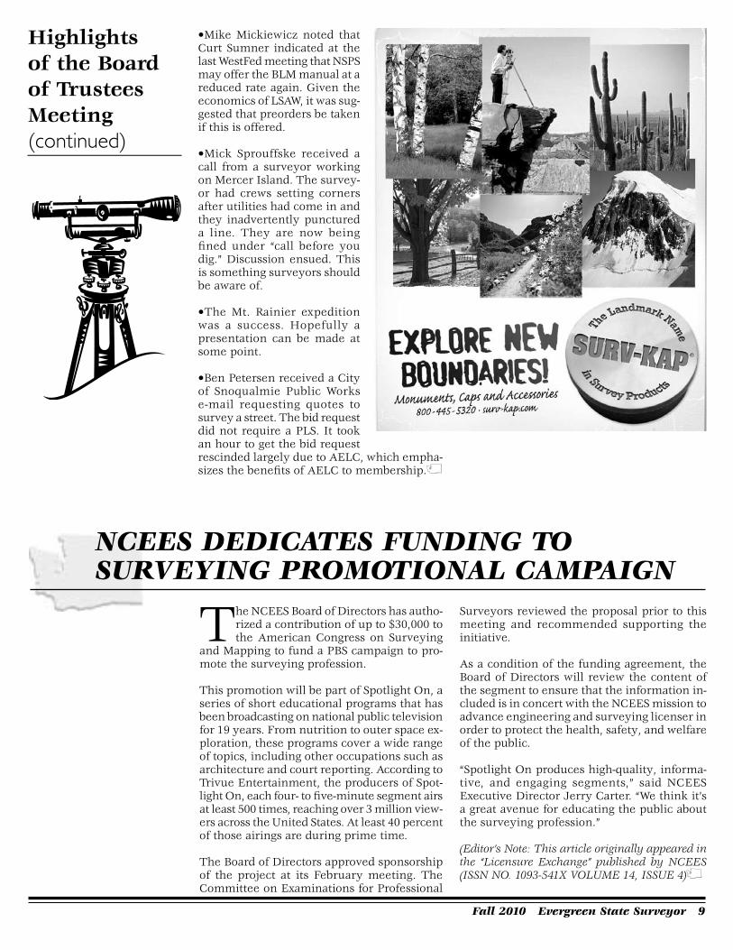
•Mike Mickiewicz noted that Curt Sumner indicated at the last WestFed meeting that NSPS may offer the BLM manual at a reduced rate again. Given the economics of LSAW, it was sug-gested that preorders be taken if this is offered.
•Mick Sprouffske received a call from a surveyor working on Mercer Island. The survey-or had crews setting corners after utilities had come in and they inadvertently punctured a line. They are now being fined under “call before you dig.” Discussion ensued. This is something surveyors should be aware of.
•The Mt. Rainier expedition was a success. Hopefully a presentation can be made at some point.
•Ben Petersen received a City of Snoqualmie Public Works e-mail requesting quotes to survey a street. The bid request did not require a PLS. It took an hour to get the bid request rescinded largely due to AELC, which empha-sizes the benefits of AELC to membership.
Highlights of the Board of Trustees Meeting (continued)
nCEES dEdiCAtES Funding to SurvEying PromotionAL CAmPAign
The NCEES Board of Directors has autho-rized a contribution of up to $30,000 to the American Congress on Surveying
and Mapping to fund a PBS campaign to pro-mote the surveying profession.
This promotion will be part of Spotlight On, a series of short educational programs that has been broadcasting on national public television for 19 years. From nutrition to outer space ex-ploration, these programs cover a wide range of topics, including other occupations such as architecture and court reporting. According to Trivue Entertainment, the producers of Spot-light On, each four- to five-minute segment airs at least 500 times, reaching over 3 million view-ers across the United States. At least 40 percent of those airings are during prime time.
The Board of Directors approved sponsorship of the project at its February meeting. The Committee on Examinations for Professional
Surveyors reviewed the proposal prior to this meeting and recommended supporting the initiative.
As a condition of the funding agreement, the Board of Directors will review the content of the segment to ensure that the information in-cluded is in concert with the NCEES mission to advance engineering and surveying licenser in order to protect the health, safety, and welfare of the public.
“Spotlight On produces high-quality, informa-tive, and engaging segments,” said NCEES Executive Director Jerry Carter. “We think it’s a great avenue for educating the public about the surveying profession.”
(Editor’s Note: This article originally appeared in the “Licensure Exchange” published by NCEES (ISSN NO. 1093-541X VOLUME 14, ISSUE 4)

10 Evergreen State Surveyor Fall 2010

Fall 2010 Evergreen State Surveyor 11
Hugh Gordon Goldsmith died peace-fully, surrounded by loving family, on August 22nd of complications resulting
from his seven year long battle with mesothe-lioma. He was 83. Hugh was born in Charlotte, North Carolina to Hugh N. Goldsmith, Jr. and Miriam Josephine Gavan, on October 9, 1926. Hugh spent his childhood years in Greenville, South Carolina where stories of his running dual paper routes on his bicycle, and a job as a soda fountain clerk “soda jerk”, all while in school, exhibited at an early age his innova-tive and unwavering entrepreneurial spirit. With this success, he soon graduated from his bicycle to his prized blue Model A Ford, and went on to graduate from Greenville High School in 1943. Hugh joined the U.S. Navy in 1945 and served until 1948. After his discharge he made his way to Seattle where under his earned GI Bill, graduated from Seattle Univer-sity with his degree in Civil Engineering in 1952. During his time at Seattle U, Hugh worked part time at Appliance Parts and Service Company where he met and married the love and light of his life, Skitty, and they started a family. Hugh had now made Seattle his home and began his career with an engineering firm. Within a few short years he had become a licensed Pro-fessional Land Surveyor (PLS) and was head of the company’s Survey Department. In this capacity, his in-novation led the company into new territory of private development subdivision of land for Home builders. From the beginning, Hugh saw the potential destiny of the company. By the late 50’s, the Puget Sound Region was ready to grow. By 1958, the City of Seattle and King
County were embarking on Comprehensive Land Use and Metropolitan Sewer plans for the expansion of urban development to the greater east side of Lake Washington. When the owner of the company he worked for became ill, and was forced to close the business, he agreed to allow Hugh to branch off the Civil Engineering and Land Surveying Department into a single business and form Hugh G. Goldsmith and Associates, Inc. Over time, the firm became one of the premier development consulting firms in the Pacific Northwest known for its specialty in master planning and engineering for large scale development. Goldsmith has contributed to the landscape of the region with planning, engineering and survey services for developments such as: Klahanie, Sahalee Country Club, McCormick Woods, Bear Creek Country Club, Redmond Ridge, Fairwood, The Golf Club at Newcastle, Aldarra Golf Club, and countless other neighbor hoods where people
live, work and play. Today, run by the second generation of Goldsmith family, the Company remains a re-spected quality Engineering, Land Surveying and Land Development Consulting firm continuing Hugh’s mission of integrity, personal ser-vice and work ethic. Hugh and Skitty moved the family to Kirk-land in 1963. They loved life and celebrations, and the family home was a magnet for family unity and activities. Family vacations and
Christmas, especially, were planned with a level of detail unsurpassed. The Kirkland home (affectionately known as “the Compound”) was the site of hundreds of birthday celebrations, holiday gatherings, wakes, anniversary parties, and even a wedding. Hugh’s strength of will
hugh goLdSmith, PLS #��22
PLEASE PAY YOUR DUES and JOIN N.S.P.S.
(Continued.on.page.12)
12 Evergreen State Surveyor Fall 2010
and unsurpassed positive mental attitude would regularly make us forget the life threatening cancer that he carried with him these many years. He never dwelled on his condition as be-ing life threatening, he simply continued to focus on the big picture of life and dealt with any acute aspect of his disease as a short term nuisance. He was an inspiration to all, and will be deeply missed. Hugh is survived by his mother- in-law: Dorothy F. Hansberry of Kirkland; his brother: James D. Goldsmith of Seattle; and his sisters: Mary Jane Blanton Shaffer of Easley, South Carolina, Carolyn (Howard) Chapman of Greenville, South Carolina, Margaret (Ron) Stewart of Taco ma, and their families. Hugh was preceded in death by his beloved wife of 58 years: Skitty; his parents: Hugh N. and Miriam Goldsmith, two sisters: Miriam (“Boots”) Shaf-fer and Geraldine Calvert; a son: Gordon, and a daughter: Dorothy. Hugh is survived by seven of his nine children and their families: Jill (Bob) Routt, Brian (Kathleen), Keith (Jennifer), Nancy Goldsmith (Steve Suelzle), Thomas, Janet (Kevin) Cleary, William; and daughter- in-law Beverly Goldsmith; all of Kirkland. He is also survived by 19 grandchildren, two great- grandchildren, brothers-in-law, sisters-in-law, and numerous nieces and nephews. In lieu of flowers, the family suggests donations be made to: c Holy Family School, 7300 120th Ave. NE Kirkland, WA 98033 c Holy Names Academy, the Annajean and Dorothy Gold smith Memo-rial Scholarship Fund, 728 - 21st Ave. E. Seattle, WA 98112 c St. Mary’s Church, 111 Hampton Ave. Greenville, So. Carolina 29601 A funeral mass for Hugh will be held on Friday, August 27, 2010 10:00 AM at Holy Family Catholic Church, 7300 -120th Ave. NE, Kirkland, Washington.
Published in The Seattle Times from August 25 to August 26, 2010
Hugh Goldsmith (continued)

Fall 2010 Evergreen State Surveyor 1�
This monument was set as shown on a 1977 recorded survey. I found the monument on the exterior bound-
ary of our site in 2007 while developing the boundary for a proposed subdivision. It was buried at the end of a sidewalk below the back corner of the walk. We recorded a subdivision map in 2009 showing the found monument. The stak-ing of our subdivision corners was to be performed after construction of site improve-ments per a deferral agree-ment. We returned to the site in April of this year to stake the corners and found the monument and rebar shown in the photograph. As you can see from the grass grow-ing next to the monument it was buried less than a tenth of a foot. The sidewalk had
been removed and a new building was
JuSt A SECond, i’vE got to gEt A BiggEr hAmmEr!By.Pat.Fox,.PLS.CFedS
nearing completion on the adjacent parcel. I looked again today and cannot find a recorded survey by the surveyor whose name is on the cap. The monument had survived for 40 years through two major construction projects on the adjacent property, construction of the sidewalk and removal of the sidewalk, only to be nearly destroyed by a survey crew.
Many of us are guilty of assigning the most junior of our staff the task of setting the monu-ments. Each of them needs to be trained and reminded to search for evidence before setting a monument on an existing boundary. This same situation happened to me about 25 years ago. I was driving a rebar and hit something solid. We dug down and found a concrete monument. Were we smarter? Luckier? I don’t know, but I have never forgotten that episode. I try to pass on all those stories of my failures and successes to my staff but I’m not sure they are understanding why I’m telling the story. Ultimately there is no better teacher than personal experience.
2011 Annual LSAW Conference The dates are set, the speakers are being confirmed,
and our hope is that we will see you at our 2011 Annual LSAW Conference in Spokane!
Additional information, Registration and a Preliminary Schedule of Events
for this Joint Conference with Washington, Idaho, and WFPS
will be available mid-November on www.lsaw.org.
1� Evergreen State Surveyor Fall 2010
A High School Trigonometry Skill
Awards ProgramPURPOSE OF THE CONTEST
❖ To promote the study of Trigonometry in High School, and to promote excellence in the mastery and application of Trigonometry, by honoring the individual student who has demonstrated his or her superior skill among classmates at the High School level.
❖ To acquaint the high school trigonometry student with the use and practical application of Trigonometry in the Surveying and Mapping professions.
❖ To build an awareness of careers in Surveying and Mapping among high school students, guidance counselors, and math-ematics teachers.
SPONSORSHIP APPLICATION
Contact Dan Price, TrigStar Chair, 253-875-8075
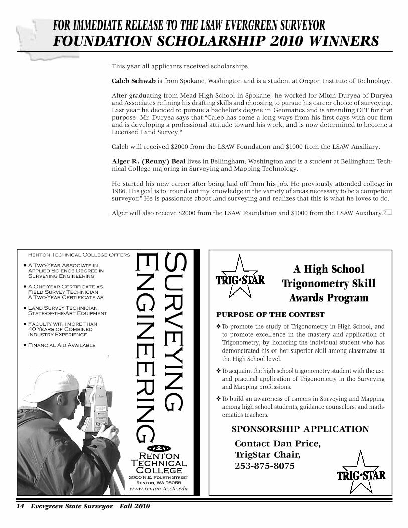
This year all applicants received scholarships.
Caleb Schwab is from Spokane, Washington and is a student at Oregon Institute of Technology.
After graduating from Mead High School in Spokane, he worked for Mitch Duryea of Duryea and Associates refining his drafting skills and choosing to pursue his career choice of surveying. Last year he decided to pursue a bachelor’s degree in Geomatics and is attending OIT for that purpose. Mr. Duryea says that “Caleb has come a long ways from his first days with our firm and is developing a professional attitude toward his work, and is now determined to become a Licensed Land Survey.”
Caleb will received $2000 from the LSAW Foundation and $1000 from the LSAW Auxiliary.
Alger R. (Renny) Beal lives in Bellingham, Washington and is a student at Bellingham Tech-nical College majoring in Surveying and Mapping Technology.
He started his new career after being laid off from his job. He previously attended college in 1986. His goal is to “round out my knowledge in the variety of areas necessary to be a competent surveyor.” He is passionate about land surveying and realizes that this is what he loves to do.
Alger will also receive $2000 from the LSAW Foundation and $1000 from the LSAW Auxiliary.
For immEdiAtE rELEASE to thE LSAW EvErgrEEn SurvEyor FoundAtion SChoLArShiP 2010 WinnErS
Fall 2010 Evergreen State Surveyor 1�

1� Evergreen State Surveyor Fall 2010

Fall 2010 Evergreen State Surveyor 1�
What was your career path? I went straight into surveying out of high school. Mathematics was my favorite
subject and I enjoyed the outdoors. I had no other aspirations. Most surveyors I know come from a mathematical background. Even today, we try to recruit future surveyors through the Trig Star program. These days, I no longer use much trig. Still, I value my training in problem solving and the application of rules.
I need rules – rules of surveying. I’ve spent my entire career searching through text books and court cases trying to decipher the rules governing the practice of my profession. My first surveyor’s license was obtained in Or-egon. I aced the exam. All I had to do was to memorize all the rules and apply them to the questions they asked. Oregon statutes even list out the important rules for surveyors. For example, ORS 93.310 recites the rules for con-struing descriptions of real property: monu-ments, distances, angles, area - in that order. Wattles1 outlines other rules for construing deed descriptions. Brown2 gives us the rules of evidence. The BLM Manual3 is a book of rules for surveyors to follow if it is anything. Here’s
the winning formula: memorize the rules + pass the exam = get to work surveying.
I was pretty pleased with my license. It’s not
that I was arrogant but I can remember think-ing that they should not award a surveyor’s license to anyone who failed the section subdivision question. One of my first projects involved breaking down a section. There was a stone marked “CS” (for County Surveyor) at the center and a quick review of the old field notes revealed that it had been stubbed. Wouldn’t you know it but another local surveyor, whose work I otherwise admired, had surveyed next to my client’s property and he had used the stone! I had prepared a little booklet with a pencil sketch of Abraham Lincoln, a transcription of his letter to some Illinois surveyors on the correct method of subdividing a section, and a stylized illustration of an irregular looking section properly subdivided. I drove out to the other surveyor’s home office on a diplomatic mission to show him my booklet. That grizzled old forest surveyor pierced me through with his one good eye and instructed me on where and how to file it. It was not until my later years that I followed his instructions in spirit, if not to the letter.
Imagine my dismay when I discovered there are no rules of surveying – just guidelines.
“The surveyor should neither rigidly apply the rules…nor accept the position of improvements without question…No definite set of rules can be
Putting ruLES in ContExt By.Robert.Dean,.PLS
(Continued.on.page.18)

1� Evergreen State Surveyor Fall 2010
(Continued.on.page.20)
Putting Rules in Context (continued)
laid down in advance.” 1973 BLM Manual Section 6-15. The rules I learnt are fine if I’m the first surveyor or the original surveyor and there are no conflicting lines of occupation. But when does that circumstance ever present itself? Almost every time, the parties to the deed have acted in accordance with their understand-ings of where the boundaries are or another surveyor has already made a determination that has been accepted and relied on. What value do I bring to the table with my rules at this late date?
Has anyone else noticed that most of the prominent property boundary cases arise af-ter a surveyor enters the scene and disturbs an otherwise peaceful coexistence among neighbors? It reminds me of the Disney tape we used to play for our kids; Mickey and the Beanstalk: Then one day – something dreadful happened! A surveyor came into Happy Valley! All the people had to get boundary line agreements to satisfy the surveyor’s cruel appetite for strict adherence to the rules of surveying.
The Oregon Appeals Court case, Dykes v. Arnold,4 is an example. Two neighbors spent their life savings fighting over 71 feet of brushy hillside after a modern survey correctly ap-plied the rules but ignored the pattern of lines of occupation in their neighborhood. Only a surveyor would find satisfac-tion in that outcome.
When will we learn that it’s not about us and our rules? Why are we so easily lulled into hiding behind the literal interpretation of a deed de-scription? In Washington, the courts afford scant protection by way of literal interpreta-tions of deed descriptions. Deed descriptions are only to identify the property – not to define its limits.5
We know that when people sit down in an escrow office and sign a stack of papers to sell their land most do not know what they just signed. Many of us are aware that very few people out there know how to read a deed description let alone how to write one. How often has a client handed you his deed and said something like, “This is my deed. It has all the latitudes and longi-tudes on it but I don’t have a GPS.”? Unless it’s Snoopy, the world famous county survey-or, people generally do not act on their land with reference to the deed description.
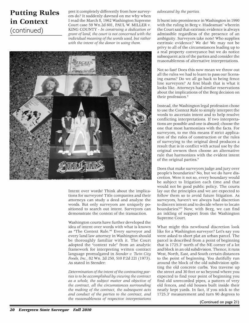
Remember the Bee Gees? One of my favorites of their songs said “It’s only words.” Have you ever wondered why attorneys and title companies may look at a deed and inter-

Fall 2010 Evergreen State Surveyor 1�
· High definition mobile 3D mapping· Dual-frequency GNSS tracking· High-accuracy 6-axis IMU integration· Odometry inputs from on-board vehicle CAN bus or wheel encoders· Supports multiple laser scanner models for operator and application flexibility
Applications include:· Roadway Management· Linear Infrastructure· Disaster Planning & Response· Homeland Security· 3D Street-View City Mapping
PPIGROUP
To see a short video on the IP-S2, visit:www.thePPIgroup.com/ips2
Portland Area 800.247.1927 or Seattle Area 800.558.5368
THERE’S A NEWMOBILE MAPPINGSYSTEM IN TOWN!
mounts on your vehicle
From the world’s leading manufacturer of surveying solutions, comes the NEWTopcon IP-S2, High Accuracy Mobile Mapping System. The IP-S2 provides fast, safeGIS data collection at a cost well below conventional ground mapping methods.And at just 8 lbs. it has flexible options for mounting on a vehicle.
12/21 PPI ad:Layout 1 12/29/09 7:28 AM Page 1
20 Evergreen State Surveyor Fall 2010
(Continued.on.page.21)
pret it completely differently from how survey-ors do? It suddenly dawned on me why when I read the March 8, 1962 Washington Supreme Court case 59 Wn.2d 601, PAUL W. MILLER v. KING COUNTY - In construing a dedication or grant of land, the court is not concerned with the individual meaning of the words used, but rather with the intent of the donor in using them.
Intent over words! Think about the implica-tions for surveyors! Title companies and their attorneys can study a deed and analyze the words. But only surveyors are uniquely po-sitioned to search out intent. Surveyors can demonstrate the context of the transaction.
Washington courts have further developed the idea of intent over words with what is known as “The Context Rule.”6 Every surveyor and every land law attorney in Washington should be thoroughly familiar with it. The Court adopted the “context rule” from an analytic framework for interpreting written contract language promulgated in Stender v. Twin City Foods, Inc., 82 Wn. 2d 250, 510 P.2d 221 (1973). As stated in Stender:
Determination of the intent of the contracting par-ties is to be accomplished by viewing the contract as a whole, the subject matter and objective of the contract, all the circumstances surrounding the making of the contract, the subsequent acts and conduct of the parties to the contract, and the reasonableness of respective interpretations
advocated by the parties.
It burst into prominence in Washington in 1990 with the ruling in Berg v. Hudesman7 wherein the Court said that extrinsic evidence is always admissible regardless of the presence of an ambiguity. Surveyors take note! Who supplies extrinsic evidence? We do! We may not be privy to all of the circumstances leading up to a real property conveyance but we do notice subsequent acts of the parties and consider the reasonableness of alternative interpretations.
Not so fast! Does this now mean we throw out all the rules we had to learn to pass our licens-ing exams? Do we all go back to being fence line surveyors? At first blush that is what it looks like. Attorneys had similar reservations about the implications of the Berg decision on their profession.8
Instead, the Washington legal profession chose to use the Context Rule to simply interpret the words to ascertain intent and to help resolve conflicting interpretations. If two interpreta-tions are possible and one is absurd; choose the one that most harmonizes with the facts. For surveyors, to me this means if strict applica-tion of the rules of construction or the rules of surveying to the original deed produces a result that is in conflict with actual use by the original owners then choose an alternative rule that harmonizes with the evident intent of the original parties.9
Does that make surveyors judge and jury over people’s boundaries? No, but we do have dis-cretion. Were it not so, every boundary would be subject to litigation each time and that would not be good public policy. The courts lay out the principles and we are expected to follow them so to avoid future litigation. As surveyors, haven’t we always had discretion to discern intent and to decide where to locate boundaries?10 Now, with Berg, we can find an inkling of support from the Washington Supreme Court.
What might this newfound discretion look like for a Washington surveyor? Let’s say you were asked to short plat an urban parcel. The parcel is described from a point of beginning that is 1725.3’ north of the NE corner of a lot and block in an old subdivision. Thence, it runs West, North, East, and South certain distances to the point of beginning. You dutifully run around the block of the old subdivision split-ting the old concrete curbs. You traverse up the street and 30 feet or so beyond where you expected to find your point of beginning you find old unrecorded pipes, a pattern of very old fences, and old houses built inside their neatly kept yards. In fact, if you stick to the 1725.3’ measurement and turn 90 degrees to
Putting Rules in Context (continued)

Fall 2010 Evergreen State Surveyor 21
West you run the line right through a couple of those houses. Very few of us would adhere to the deed description and drive rods in the neighbors’ yards. Most of us would call a halt to our survey and start writing up descriptions for boundary line agreements. Problem, now the neighbors have veto power over your client’s timely development. Even so, try.
Viewed through the lens of the Context Rule there might be another solution. 1725.3’ is just a word (all surveyors may now gag and choke). Where did it come from? What does it mean? Perhaps further research might reveal that it is a miscalculation by the original surveyor. Perhaps other deeds call 1752.3’ thus indicating that two of the numbers were transposed. You, the following surveyor, make the call. Pin the corners where you decide the true boundaries are, note the discrepancies on the face of the plat, and thoroughly explain your solution, along with case law citations, in your narra-tive. Will the title company object? Yes. Will you hear from the Assessor? Yes. But tell me, if harmony favors the status quo favors your solution, who will sue? OK, I know – the guy to the North will get a survey.
Does this approach constitute an unauthorized reformation of the deed? Perhaps so, but others would argue that it is merely an interpretation of the deed description.11
If your survey is contested in court perhaps the court will find mutual mistake and accept reformation as the remedy Broadus p 151. Even if the court does not intervene, if your survey is accepted and relied on, especially for ten years, you may be safe at home anyway.12
If the courts are willing to protect the prop-erty rights that accrue from partly erroneous surveys in some circumstances, doesn’t equity demand that they also protect the property rights that accrue from surveys executed un-der exercise of valid discretion in like circum-stances?
Lesson: to properly interpret a deed descrip-tion, step out from behind your desk. Sure, do your research and form your assumptions – but then go out in the field and challenge those assumptions. Apply the deed descrip-tion to the ground and the ground to the deed description.
Can a mathematically inclined surveyor with a proclivity for rules cohabit with the vagaries of the Context Rule? I hope so. Even if it does not make me rich, I hope that by faithfully adhering to its principles I will at least save my clients much grief. This mathematician would prefer a profession based on the wise application of discretion for the public good over a career based on the heartless applica-
tion of rigid rules while waiting to be replaced by a robot.
(Endnotes)
1 Gurdon H. Wattles, Writing Legal Descriptions in Conjunction with Survey Boundary Control, Gurdon H. Wattles Publications, 1976, 1979.
2Curtis W. Brown and Winfield H. Eldridge, Evidence and Procedures for Boundary Location, John Wiley $ Sons, Inc., 1962.
3United States Department of the Interior, Bu-reau of Land Management, Cadastral Survey, Manual of Surveying Instructions for the Survey of the Public Lands of the United States, 2009. Robert W. Dahl, Chief Editor. See also the 1973 edition (Bureau of Land Management Techni-cal Bulletin 6).
4Jerry R. Broadus, Washington State Common Law of Surveys and Property Boundaries, Land Surveyors’ Association of Washington, 2009. Broadus pp 69-71 refers to 204 OR. App. 154, 129 P.3d 257 (2006).
5Broadus p 36 Sengfelder v. Hill, 21 Wash. 371, 58 P. 250 (1899).
6Broadus p 56.
7Broadus pp 56-57 refers to Berg v. Hudesman, 115 Wn 2d 657, (1990).
8See legal commentaries:
http://www.wsba.org/media/publications/barnews/archives/1999/sep-99-strangelaw.htm
http: / /www.sarpl lc .com/Post-Berg.v.Hudesman.pdf
98 Wn. App. 264, COLONIAL INVESTMENT COMPANY et al., Appellants, v. LEONIE VIAL MACKENZIE et al., [No. 611-2. Division Two. Court of Appeals January 22, 1973.]
If possible, effect should be given to each and every part of a deed. If the instrument is susceptible to conflicting interpretations, that one should be selected which, upon consideration of the whole matter, appears most likely to reflect the maker’s intent.
10RCW 58.09.020 - “Survey” shall mean the locating and monumenting…of points or lines which define the exterior boundary or boundaries common to two or more ownerships or which reestablish or restore general land office corners.
116 Wn. App. 684, ISLAH M. VAVREK, Respon-dent, v. WALTER T. PARKS et al., Appellants
Putting Rules in Context (continued)
(Continued.on.page.22)

22 Evergreen State Surveyor Fall 2010
[No. 435-2. Division Two. Court of Appeals, April 10, 1972.]
When seeking to resolve an ambiguity arising out-side a deed, the court’s duty is to interpret the deed to find the true sense of the written words as the parties used them, as evidenced by the facts and circumstances at the time of the transaction and by the practical construction given by the parties while in interest with respect to the ambiguity, and to construe the deed in such a manner as to subject its operation to established rules of law.
1264 Wn.2d 37, JOHN STEWART et al., Re-spondents, v. ELGIE JOHN HOFFMAN et al., Appellants March 26, 1964.
Putting Rules in Context (continued)
An old property survey, even though erroneously fixing the boundary between two tracts, will be considered the true dividing line when the parties have accepted, and acquiesced in, such old survey for a period of time sufficient to secure property by adverse possession.
And also, 8 Wn. App. 264, COLONIAL INVEST-MENT COMPANY et al., Appellants, v. LEONIE VIAL MACKENZIE et al., [No. 611-2. Division Two. Court of Appeals January 22, 1973.]
A survey once having been made, even though er-roneous in some details, vests property rights which are not to be lightly upset. Rohrbach v. Sanstrom, 172 Wash. 405, 20 P.2d 28 (1933); Staaf v. Bilder, 68 Wn.2d 800, 415 P.2d 650 (1966).

Fall 2010 Evergreen State Surveyor 2�
What is a land surveyor?
A land surveyor is, of necessity, part historian, part cartographer, mathematician, grapholo-gist, truck mechanic and mind reader. A sur-veyor is also skilled at contract and boundary law, psychology and collections. A sole propri-etor actually practices all of these disciplines, and many more. When one begins studying to take professional exams, one quickly realizes there is an incredible array of information upon which one could be tested. This dilemma is actually compounded in some states that stub-bornly insist on including some planning or design questions. A land surveyor possesses many qualities essential in ev-ery “renaissance person”.
I believe this aspect of land surveying is at least partially responsible for the broad diversity of practitioners. (Or could it possibly be the other way around?) I have person-ally worked with profes-sional surveyors whose educational backgrounds were in physics, chemis-try, mathematics, geol-ogy, agriculture, forestry, geography, philoso-phy, meteorology, law, land titles, engineering and other disciplines. We seem to have been attracted to surveying from practically every-where, whereas most other professions have considerably more restrictive career paths. Sur-veyors are a diverse bunch indeed, and collec-tively we bring tremendous talent, knowledge and variety of interests to the table.
I often wonder about this, and reflect on how it impacts our professional status. Surveying is fun! Surveyors generally are proud of their work, and enjoy their time in the field, and in the profession. I have always thought that surveying is the perfect blend of physical and mental activity! Many years ago, I worked for a character who was fond of saying, “Surveying
Son oF A Son oF A SurvEyor R..William.Glassey,.P.L.S..
would make a great hobby!” This aspect prob-ably gets us in trouble, as some practitioners are far too quick to lowball a project.
The fact that we enjoy our work should not diminish its value!
Surveyors perform valuable services on most people’s largest investment, that is, their real estate. We would be wise to think of ourselves as real estate professionals, and to work closely with attorneys and title professionals. We should all work together to protect our clients’ best interests. Our clients will appreciate our
mutual cooperation, and I believe all will benefit as a result.
Early in my career, I re-alized that there was a tremendous amount of geographic and spatial information subject to my recall. People would ask apparently simple ques-tions, such as “Have you ever done any projects in Douglas County?”, or “Can you recall if the section corner in ques-tion was a brass cap, or a
stone, when you visited it in 1990?”
Thank heaven for detailed field notes! Being a surveyor is a constant challenge for our memories, and I believe it helps us stay men-tally sharp. This mental exercise also directly leads us toward honesty and truthfulness, as exaggeration and misstatements clearly de-grade and complicate an already impossible challenge. Small wonder that this honesty also creeps into our personal lives and business practices!
Surveyors are fact finders, and we simply re-port the facts. (The truth shall set you free…)
Pleasant surveying!

2� Evergreen State Surveyor Fall 2010
Custom orders your way … when you need them.
When your name is on it, our name is behind it.
Berntsen delivers.
Your deadlines deadlines
The professional’s choice in survey products • www.berntsen.com • 877.868.9176
areour
Why thE Four CornErS monumEnt iS in ExACtLy thE right PLACE
Recent media reports incorrectly stated that the location of the Four Corners survey monument – marking the point
common to Arizona, Colorado, New Mexico, and Utah – is in error by 2.5 miles and sug-gested that the monument therefore does not correctly mark the intersection of the four states. These reports also erroneously attributed the discovery of this supposed er-ror to the National Oceanic and Atmospheric Administration’s (NOAA) National Geodetic Survey (NGS). NGS did not, in fact, make any claim or pronouncement that the monument is incorrectly located or suggest that it should be relocated. NGS has, however, worked with the media to correct inaccuracies in the initial reports, clarifying that the distance between the actual location of the monument and its intended location is substantially less than the reported 2.5 miles, and that – as affirmed by the Bureau of Land Management (BLM) – it does indeed correctly mark the four-state-in-tersection point. Because NGS was specifically named in the reports, this brief document was prepared to present some pertinent facts and history about the Four Corners monument and its placement.
In 1875, a surveyor named Chandler Robbins was contracted by the U.S. General Land Of-fice (GLO), the BLM’s predecessor, to survey the entire boundary between the territories of Arizona and New Mexico, from the U.S.-Mexico boundary to the 37th parallel of latitude north of the equator. He was charged with also estab-lishing, at the boundary’s northern terminus, the Four Corners monument, as it would be known upon completion of the other territorial boundary surveys terminating there. Robbins was directed to base his survey on the geo-graphic coordinates of Ship Rock (a prominent northwestern New Mexico landform), which had been determined the previous year during the decade-long U. S. Geographical Surveys West of the 100th Meridian, led by First Lieu-tenant George Wheeler.
An 1863 Act of Congress, signed by President Lincoln, which separated Arizona from New Mexico, specified that the dividing boundary should be coincident with the 32nd merid-ian of longitude west of the Washington (DC) Meridian. The Washington Meridian, which
(Continued.on.page.25)

Fall 2010 Evergreen State Surveyor 2�
(Continued.on.page.26)
had been in use since 1850, was defined as bisecting the dome of the old Naval Observa-tory, situated at a longitude of 77 degrees 03 minutes West (for simplicity, longitude values presented here are rounded to the nearest arc minute). In fact, the boundaries of 11 western states are similarly longitude-referenced to the Washington Meridian, and not the Greenwich Meridian. This practice was in place in the U.S. until 1912, when our nation adopted Green-wich as its standard longitude reference.
Hence, what Congress had specified for the Arizona-New Mexico boundary, and the Four Corners monument, was that they should be established at a longitude of 109 degrees 03 minutes West, as referenced to the Greenwich Meridian. Therein, we believe, lies the source of the invalid report of a Four Corners monu-ment location error of 2.5 miles. Some people apparently relied on the incorrect premise that the marker was originally intended to be located at a longitude of exactly 109 degrees West. But, Robbins followed his marching orders correctly, and the Four Corners monu-ment was established at the point he deter-mined, to the very best of his ability and using the available technology, to be the prescribed location of 109 degrees 03 minutes West lon-gitude and 37 degrees North latitude. There, his meridian survey intersected the 1868 New Mexico-Colorado boundary survey, which ran along the 37th parallel. Subsequent surveys established the Utah-Colorado and Arizona-Utah boundaries, thereby completing the Four Corners assemblage of territorial (eventually state) lines, as specified by Congress.
It is interesting to note that, upon completion of his Arizona-New Mexico boundary survey, Chandler Robbins went to the effort to write a letter to the editor of The Santa Fe New Mexican (still today’s daily newspaper) explaining the very issue of the difference between longitude values referenced to the Greenwich Meridian and those referenced to the Washington Merid-ian. In this letter of November 1, 1875, Robbins included the following explanation:
It seems to have been the general impression that the line was the 109 degrees of longitude west of Greenwich. Such is not the case, as the law makes it 32 degrees of longitude west from Washington, which corresponds to 109 degrees 02 minutes 59.25 seconds west from Greenwich, and which places the line a small fraction less than three miles farther west than would have been the case if it had been run as the 109 degrees of longitude.
In these few words, Robbins takes the mystery out of a technical issue that has evidently confused and misled some people for more than a century.
Nonetheless, there remains the question of how close the Four Corners monument is rela-tive to its intended location. In fact, there is a discrepancy between the actual location, which we know to a high degree of accuracy, and our best knowledge of where it was intended to be located. But, instead of a 2.5-mile discrepancy, as reported in the initial news items, this offset is in fact only about 1800 feet, or less. Not only is the offset only about one-tenth of the alleged location error, it is in the opposite direction; the intended monument location is west of the actual monument. There is, however, uncer-tainty in precisely quantifying the relationship between the intended and actual monument locations due to changes, since 1875, in some technical details of the geodetic reference sys-tems utilized. The actual offset might in fact be considerably less than our estimate.
Regardless of the technical nuances, we can confidently say that, considering the relatively primitive surveying technology of the day, the remote and difficult prevailing field conditions, and uncertainty in the survey’s beginning coordinates for Ship Rock, Chandler Robbins’ survey was a resounding success. He “nailed” the location of the Four Corners, to the best of his ability, using the tools and information available to him at the time.
Finally, we cannot overemphasize the fact that the aforementioned technical geodetic details are absolutely moot when considering any question of the correctness or validity of the Four Corners monument in marking the intersection of the four states. Indeed, the monument marks the exact spot where the four states meet. A basic tenet of boundary survey-ing is that once a monument has been estab-lished and accepted by the parties involved (in the case of the Four Corners monument, the parties were the four territories and the U.S. Congress), the location of the physical monu-ment is the ultimate authority in delineating a boundary. Issues of legality trump scientific details, and the intended location of the point becomes secondary information. In surveying, monuments rule!
The physical monument marking the Four Corners has been rebuilt multiple times by the GLO and BLM over the years since Robbins installed a seven-foot-tall sandstone shaft to mark the spot. But the same location has been perpetuated now for more than a century and a quarter. The current monument complex was constructed in 1992 and includes a visi-tor plaza area surrounding a commemorative survey disk. The Four Corners monument has been included in modern high-accuracy Global Positioning System (GPS) geodetic surveys, producing three-dimensional coordinates ac-curate to an inch or better. These survey results
Why the Four Corners Monument is in exactly the Right Place (continued)

2� Evergreen State Surveyor Fall 2010
and descriptive information about the monu-ment are included in the database of geodetic control points maintained by NGS. The geo-detic control datasheet for the Four Corners monument (designation: CO UT AZ NM) can be found online here: http://www.ngs.noaa.gov/cgi-bin/ds_mark.prl?PidBox=AD9256.
Hence, in addition to marking the intersection point of four states, the Four Corners monu-ment is also a component of what is known today as the National Spatial Reference System (NSRS), which is maintained by NGS and serves as the nation’s geospatial framework. Through its published geodetic position, the monument provides a mechanism for geospatial profes-sionals (land surveyors, engineers, etc.) to access this framework with a high degree of both accuracy and certainty. The Four Cor-ners monument continues its long-standing heritage of playing an important role in the history and demarcation of the American West – all the while bearing witness as the only point of intersection of four U.S. states – in exactly the right place.
NGS is responsible for defining, maintain-ing, and providing public access to the NSRS – a consistent national coordinate system that
provides the foundation for mapping and chart-ing; some state boundaries; transportation, communication, and land records systems; as well as scientific and engineering applica-tions. More information about NGS and the various components of the NSRS can be found at: http://www.ngs.noaa.gov. NGS is not nor-mally involved in boundary-related issues and is providing the information contained in this document simply as a statement of clarifica-tion of the pertinent facts and background regarding the Four Corners monument. The field notes and plats for the remonumenta-tion of the Four Corners monument and the surveys/resurveys of the state boundary lines can be obtained from the BLM at: http://www.glorecords.blm.gov/.
For additional information, please contact Wil-liam Stone, NGS, at: [email protected].
To listen to a podcast on this subject, click here: Making Waves Episode 25— April 29, 2009 (12 minutes) Where exactly is Four Corners?
(Editors Note: This article was originally printed on Friday, May 15, 2009 – NGS website: http://www.ngs.noaa.gov/INFO/fourcorners.shtml)
Why the Four Corners Monument is in exactly the Right Place (continued)

Fall 2010 Evergreen State Surveyor 2�
FREE SEMINAR*
“FOLLOWING IN THEIR FOOTSTEPS WITH
OUR MODERN EQUIPMENT”
Saturday September 25, 2010
WHERE: Renton Technical College 3000 NE 4th Street, Renton, WA 98056-4195 (425) 235-2352
TIME: 9:00 AM – 4:00 PM (with a lunch break - lunch is on your own)
PROGRAM: This seminar will be part history lesson, and part technical in-struction. It is targeted at those that are working toward their LSIT or PLS. Ever wonder about a sun shot, or how that old highway alignment was calculated.
The morning session will focus historical survey tools and meth-ods used throughout Washington State.
The afternoon will focus the tools and methods used today, and help you understand why we do not always come up with the same results as those who have come before us.
SPEAKERS: To Be Announced
RESEVATIONS: Due to space limitations, reservations will be required. Please email [email protected]
* Seminar is free for LSAW members whose dues are current. All others may attend by joining LSAW. They will get both their membership and the Seminar for the one member-ship price. Applications available online at www.lsaw.org

2� Evergreen State Surveyor Fall 2010
PhotoS From thE ASSoCiAtion LASt SummErPhotos.courtesy.of.Lindy.MacManiman.and.Desirae.Schilling

Fall 2010 Evergreen State Surveyor 2�

�0 Evergreen State Surveyor Fall 2010
Land Surveyors’ Association of Washington30442 227th Pl. S.E.Black Diamond, WA 98010Phone: 360/886-5557
chANge SeRVIce RequeSted
January FebruaryHappy New Year
October November29 – PLS Exam30 – LSIT Exam
DecemberHappy Holidays5 – Fall Seminar hosted by the
South Central Chapter – Pasco, WA
6 – BOT meeting – Pasco, WA
March
LSAW SChEduLE
PRESORTEDSTANDARD
US POSTAGE PAIDTACOMA WA
PERMIT NO. 387
The accuracy of the schedule is based on information submitted to the editor and may not reflect the true date. Check with the actual organizer for a more complete schedule.
2011
2010