professional land surveyors of colorado volume 49, issue 2 ... · 4 side shots • may 2018...
TRANSCRIPT

Becky RolandExecutive DirectorPLSC, IncPO Box 441069Aurora, CO 80044
Prst stdU.S. Postage
PAIDDenver, CO
Permit No. 1222SIDE SHOTS
SIDE SHOTS
SIDE SHOTSNATIONAL SURVEYORS WEEK AT THE STATE CAPITOL
Professional Land Surveyors of Colorado Volume 49, Issue 2
May 2018


SIDE SHOTS • MAY 2018 3
Professional Land Surveyors of Colorado, Inc.
AFFILIATE—NATIONAL SOCIETY OF PROFESSIONAL SURVEYORS
MEMBER—COLORADO ENGINEERING COUNCILMEMBER—WESTERN FEDERATION OF
PROFESSIONAL SURVEYORS
OFFICERS (2018)
Todd BeersPresident
[email protected]: 303-353-3528
steve ParkerVice President
[email protected]: 719-641-3355
Alan BlairSecretary/Treasurer
[email protected]: 303-808-0981
Becky RolandExecutive Director
PO Box 441069, Aurora, CO 80044 • [email protected] AMC O: (303) 551-3266 F: (720) 230-4846
2018 PLSC CHAPTER ORGANIZATION
CENTRAL COLORADO PROFESSIONAL SURVEYORSPresident, Shwan Clarke
Vice President, Robert Boehm; Secretary, Shaun Lee Treasurer, Scott Throm
Directors: Devon Arnold, Brian Socia, Randy Fortuin, Julie Keilman, Gavin Puckett, Derek Brown, Daniel Davis
NORTHERN CHAPTER - PLSC, INC.President: Steve Parks
President-elect: Vacant; Secretary/Treasurer, Heather LassnerDirectors: Pete Paulus, Tony Fendick, Laine Landau
President Emeritus: Kayce Keane
NORTHWEST 1/4 COLORADO LAND SURVEYORSPresident: Brian T. Kelly
Vice President, William Whelan; Secretary/Treasurer, Jeff GustafsonImmediate Past President and Director, Gordon Dowling
Directors: Thomas H. Effinger, Skidge Moon, Walter Magill, Lloyd Powers, Peter Epp
SOUTHERN COLORADO PROFESSIONAL LAND SURVEYORSPresident: Don R. Hulsey
Vice President: Spencer Barron; Secretary: Steve Parker Treasurer: Dan Hanten
Directors: Jon Tessin, Steve Rutzen, Mark Johannes, Eric White,
Joseph Alessi, III, Kenneth Gould, Jr., Nathan LiraPresident Emeritus: Steve Parker
SOUTHWESTERN Chapter - PLSC, Inc.President: Parker Newby
Vice President: Todd Johnson; Secretary: Josh Casselberry; Treasurer: Dave Seiler
WESTERN COLORADO LAND SURVEYORSPresident: Alec Thoas
Vice President: Chris Ransier; Secretary-Treasurer: Alex LheritierDirectors: Brian Bowker, Scott Thompson, Peter Krick,
Tom Sylvester, Les Doehling, Sean Mullen, Kurt Shepherd
Side Shots is the official publication of the Professional Land Surveyors of Colorado, Inc. and is published quarterly for the betterment of the surveying profession.
Todd Beers Steve Parker President Vice President
For Editorial Correspondence, contact:John B. Guyton
Editor: Side Shots5385 Centennial Trail, Boulder, CO 80303303-443-7001 • [email protected]
This publication is not copyrighted and articles may be reprinted with due credit. Statements made and opinions expressed are from the contributors and do not necessarily
express the official views of the Professional Land Surveyors of Colorado, Inc.Deadlines for editorials, articles, pictures and advertising are January 1, April 1, July 1 and October 1. All material received after the current deadline will appear
in the next issue of Side Shots.
We would like to invite anyone who is interested to advertise in Side Shots. Do you have something you want to sell, trade or buy? Why not use Side Shots for your
next ad? We can also reproduce business cards for advertising. Ad space reservation must be arranged with Becky Roland, PO Box 441069, Aurora, CO 80044; 303-551-3266.
(Deadlines: January 1, April 1, July 1 and October 1).
Current Advertising Rates:Business card size or less - Member $25.00; Non-member $30.00
One-Half Page - Member $115.00; Non-member $150.00Full Page - Member $225.00; Non-member $300.00
Color advertisements — add 33 percent
SIDE SHOTSMay Journal 2018
Volume 49 Number 2
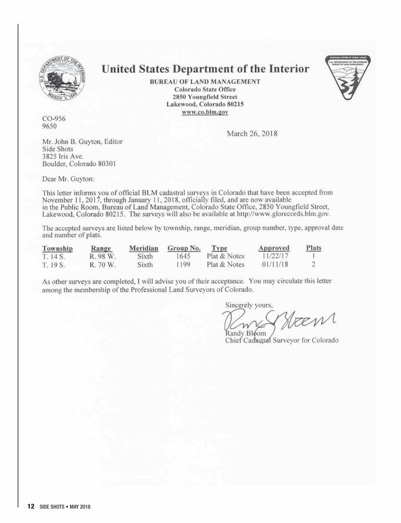
■ President’s Letter ................................................................4■ From the Editor ...................................................................5■ NSPS Benefits .....................................................................6■ National Surveyors Week Celebration .................................8■ Bureau of Land Management Letter ..................................12■ Exact & Measured Numbers –
A Surveyor's Dilemma........................................................14■ Preparing Condominium Plats ...........................................19■ Scenes from the Summit ...................................................20■ Rocky Mountain Surveyors Summit
Award Recipients ...............................................................22■ PLSC Chapter Summit Meeting Minutes ...........................24■ PLSC Board of Directors Meeting Minutes ........................26■ 2019 Colorado Land Surveying Refresher Course ............29■ Rule of the Month: Defining PLS .......................................30■ Chapter News ...................................................................31■ Sustaining Members .........................................................34
ON THE COVER: FROM LEFT: Joey Stone, Paul Bacus, Nick Lewis, Pam Fromhertz, Bryan Douglass, Derek Kumm, John Hunter, Ben Beaty, Todd Beers, Dustin Hoaglin, Representative Donald Valdez, Becky Roland, Representative Chris Kennedy, Ralph Pettit, Phil Woodcock, Michael Van Deren, Thomas Breitnauer

4 SIDE SHOTS • MAY 2018
PROFESSIONAL LAND SURVEYORS OF COLORADO, INC.PO Box 441069, Aurora, CO 80044
AFFILIATE – NATIONAL SOCIETY OF PROFESSIONAL SURVEYORSMEMBER- WESTERN FEDERATION OF PROFESSIONAL SURVEYORS
OFFICERS (2017-2018)
STEVE PARKERVICE PRESIDENTM: (719) 641-3355
ROGER NELSONPAST PRESIDENTO: (303) 589-1875
TODD BEERSPRESIDENT
O: (303) 353-3528 [email protected]
BECKY ROLANDEXECUTIVE DIRECTOR
O: (303) [email protected]
ALAN BLAIRSECRETARY- TREASURER
O: (303) 808-0981 [email protected]
DIRECTORS (2017-2020)
BRIAN DENNISO: (719) 337-1262
LEIF JOYO: (970) 878-5292
TOM SYLVESTER O: (970) 255-7386
TERESA SMITHSON O: (303) 223-5820
DIRECTORS (2015-2018)
PAUL BACUSO: (720) 890-0182
ERIC CARSONO: (303) 980-9104
PAUL DeGRAFFO: (303) 955-6080
RALPH PETTITO: (720) 865-3031
WFPS DELEGATES (2015-2016)
ROGER NELSONO: (303) 353-3916
NSPS DIRECTOR(2017-2018)
JOHN B. GUYTONO: (303) 443-7001
Dear Fellow Members of the PLSC:
Happy Spring to all our members! The weather has already had a mix of snow and 70-degree temperatures so it must be springtime in Colorado!
The beginning of 2018 began in January with the PLS & LSIT refresher course and wrapped up in late March. Many thanks to the instructors/coordinators and to Mike Greer for coordinating the venue! In early March the Rocky Mountain Surveying Summit took center stage and once again a great program was presented to the over 220+ attendees. Thanks go out to the planning committee and the many volunteers who provided invaluable assistance in the execution of the event.
In late February several Colorado land surveyors testified in the State Senate for the proposed bill on mandatory continuing education for land surveyors in Colorado. The group did a great job presenting the case but with very limited time for each person to testify, and with the current political party in the majority, the bill was voted down along party lines. Both of our Senate sponsors did a good job in the defense of the bill. Late March brought National Surveyors Week into focus. The PLSC hosted an event at the State Capitol that proved to be very successful in publicizing the surveying profession to the public at large and to legislators. Please see the article in this issue of Side Shots for more details of the event and to review the House Tribute to Land Surveyors and the Governors proclamation for surveyors week in the State of Colorado.
We have set up a committee to coordinate the various outreach and education task requests from high school and middle school counselors for land surveyors to attend career days in their schools. Brian Dennis from the Southern Chapter has accepted the Chair position for this most important committee. Please contact Brian if you would be interested in participating in career days at the schools.
The long trek to fill the Colorado Geospatial Advisor role to assist Pam Fromhertz, and the state surveying and GIS communities in the future, has been filled. John Hunter and Joey Stone from Denver Water and Tom Breitnauer with DIA Survey have stepped up as the initial members of the advisory working group. As the position evolves we envision an executive council to assist the working group. Their first task was the National Surveyors Week event at the capitol. Upcoming tasks will include a review of the Colorado State Plane System and GPS on benchmarks program. Please contact the working group or Pam if you have any suggestions or would like to participate. Please enjoy the various articles included in this edition of Side Shots, and I hope all members will have a safe Spring/Summer.
Sincerely, Todd Beers, PLS-PLSC President

SIDE SHOTS • MAY 2018 5
F R O M T H E E D I T O R
The PLSC has been busy. We had another very successful Rocky Mountain Surveyors Summit, very productive exam prep/refresher classes, various outreach events to attract young people to our profession, and recognition by a declaration of National Surveyor’s Week in
March. I hope that this issue will allow you, the reader, to keep up with these things, and find articles that are interesting and/or educational.
I wrote a list of advantages you receive from your membership in the National Society of Professional Surveyors, or NSPS, which are included in your PLSC membership. They do so many things on a national level that our state societies could never do, and are worthy of our support.
PLSC President Todd Beers led a group to our state capitol on March 20th to celebrate National Surveyors Week, and he contributed the cover photo and an article of explanation for this issue. Professor Gaby Neunzert gave us another excellent article, this time illustrating the surveyor’s dilemma between the use of exact and measured numbers. Roger Kelly did some research and
received some direction from the DORA board on the sequencing of condominium plats. And Earl Henderson wrote a thoughtful Rule of the Month illustrating the many “hats” we surveyors must wear in the course of our work. Don Hulsey sent some photos from a career expo event in Colorado Springs that was staffed by volunteers from the Southern Chapter – great work.
Becky Roland provided us with minutes from the Chapter Summit, which took place during the Rocky Mountain Surveyors Summit, and minutes from the February 12th Board of Directors meeting. I would also like to point out two important advertisements that appear in this issue. One is for the new land surveying degree program at Western Colorado Community College, for which the PLSC is providing substantial financial support. Please help spread the word of this to potential new students. The other is a notice for the 31st GIS in the Rockies conference in September.
This issue concludes with the excellent chapter news columns from across the state. I hope that there is something of interest for everyone this month.
JB GuytonEditor
A masterful documentation andhistorical perspective of eachinitial surveying point for federalpublic lands in the United States.Published in 9x12 format, InitialPoints of the Rectangular SurveySystem features a 4-color sectionwith more than 130 photosdepicting monuments andlandmarks.
C. Albert White's second book,
INITIAL POINTSOF THE RECTANGULAR SURVEY SYSTEM
Never before, in the history of surveying, has so much pertinent and interesting material been someticulously compiled in one publication. (White personally visited EVERY Initial Point.)
Published by the Colorado Professional Land Surveyors Educational Foundation, Inc., a non-profit foundation, Initial Points of the Rectangular Survey System is undertaken in the spirit of, and dedication to, Mr. White's remarkable contributions to his field.
Net proceeds from its sale will be returned to the Professional Land Surveyors of Colorado Inc. Scholarship Fund.
1 $892-5 $796-10 $69
Number of copies Price
Call 303-428-9529 to order
Mr. White's first book, A History of the Rectangular Survey System, published by theBLM in 1983, is considered the definitive work on the U.S. Public Land Survey System.Arguably the most distinguished authority on the history of nineteenth and twentiethcentury public lands surveying, White began his career with the General Land Office in1946. Both as BLM and a private surveyor, he applied his zeal to a wide range ofactivities. White's expertise represents a bridge between the wisdom and experience ofthe American heritage of land settlement and the contemporary uses of surveyingtechnology.

6 SIDE SHOTS • MAY 2018
As the appointed NSPS Director for Colorado, I serve as your advocate for your interests on a national level. Your individual membership dues for the PLSC includes membership in the NSPS. Here is a partial list of the benefits that the NSPS makes possible:
• As I mention often, they provide a weekly newsletter, NSPS News & Views, delivered to your email, which offers a quick read of things they are working on that are of interest to surveyors. The Director, Curt Sumner, also participates in a weekly radio show.
• They work hard to promote surveying as a career, with information, scholarships, contacts, exam assistance, and anything else that can attract young people to our profession.
• They sponsor the increasingly active Young Surveyors Network, the Boy Scouts Surveying Merit Badge, and National Surveyors Week, which is instrumental in developing the next generation of skilled surveyors.
• They offer several other assorted services, such as provision of Final Point Markers, a stolen equipment registry that covers the entire nation, and an online jobs board.
• They offer insurance programs through Assurance Risk Managers, a Colorado based agency that tailors insurance protection specifically for the needs of survey firms.
• They sponsor competitions, including the Publications Competition and the Map/Plat Contest.
• They coordinate the CST, or Certified Surveyor Technician exam and certificate program; the TrigStar program to promote the teaching of surveying mathematics in high schools; and they are now overseeing the CFedS or Certified Federal Surveyor certification exams that were formerly done by the BLM, and the new Certified Floodplain Surveyor exams as well. These programs help to provide survey managers with competent project supervisors.
• The NSPS provides 15 scholarships a year, as well as information for aspiring professional surveyors about educational programs within their state.
• They have multiple committees comprised of the best minds in the nation on issues of importance to the future of surveying. I serve as a Co-Chair on the UAS, or Unmanned Aerial Systems Committee, along with other committees, that are staying on top of national and local regulations being passed that affect our ability to use UAS in our surveying practices.
• The NSPS hires a very active lobbyist that speaks directly to members of Congress on issues that affect Colorado surveyors, something the PLSC could never afford to do on its own. They also sponsor an annual “Hill Day” where NSPS representatives and directors meet with members of Congress directly to advocate for policies and legislation favoring surveyors’ interests.
• Examples of such issues include the defeat of the former “Light Squared” corporate effort to take over bandwidth that is used by surveyors by their GPS equipment; the repeal of the Department of Labor regulation that classified field surveyors as laborers under the Davis Bacon Wage Act; the promotion of QBS or Quality Based Selection for surveying services on government contracts as opposed to low bids; and legislation that promotes the use of small surveying companies on federal contracts over large corporations or government staff.
I would encourage you to visit their website at www.nsps.us.com to explore all of the information and benefits that are available to you as a member. I think you will find that they are very deserving of our support.
The benefits provided by your $40 membership in the National Society of Professional Surveyors (NSPS)
By J. B. Guyton, Colorado NSPS Director


8 SIDE SHOTS • MAY 2018
On Tuesday, March 20, 2018, the Professional Land Surveyors of Colorado (PLSC) held an event in the rotunda of the State Capitol Building in Denver to celebrate “National Surveyors Week” March 18-24, 2018.
On display was historical surveying equipment, the Mount Rushmore presidents (three surveyors and the other guy), posters describing...why Denver was laid out the way it is...why there are three monuments on the steps of the Capitol all portraying to be 5,280 feet, etc.
Several surveying vendors also brought equipment for demonstration purposes. Denver Water, City & County of Denver Survey staff and the National Geodetic Survey (NGS) had tables/booths with posters and a PowerPoint presentation of projects. The celebration included sandwiches and cake for the public and legislators. At the end of the event, our legislative sponsors had us gather together for a group photo (see cover).
Earlier in the day, the State House of Representatives on the House floor held a tribute to land surveyors read into the House record. The land surveyors who attended this tribute were identified by name. The tribute was read by two House Representatives who have sponsored PLSC bills over the past year.
A proclamation for Surveyor’s Week was signed by Governor Hickenlooper and was on display at the event.
This was the first time that the PLSC has actively celebrated National Surveyor’s Week, and based on the enthusiasm of the participants and the interest of the attendees, the PLSC will provide something similar as an annual event. This event highlighted the land surveying profession and some of the services that we perform, in front of the public and legislators which can only help our exposure.
The PLSC Central Chapter also held a small celebration at a local tavern/restaurant where food and beverages were provided. Copies of the proclamation and tribute were provided to the attendees to take back to their offices. I am also aware of numerous surveying companies who celebrated the week as well.Another event related to Surveyors week will be the recording of GPS data on known vertical (elevation) benchmarks. This data will subsequently be used by the NGS to better define the elevations derived through GPS observations in the future. If you are interested in participating in this event, please contact Pam Fromhertz, the NGS Regional Advisor, or the Colorado Geospatial Advisory working group.
National Surveyors Week Celebration – Capitol Hill Day With The PLSC
By Todd Beers, PLS
From left, Colorado State Representative Donald Valdez, Todd Beers, Paul Bacus, Tom Breitnauer and Representative Chris Kennedy.

SIDE SHOTS • MAY 2018 9

10 SIDE SHOTS • MAY 2018

SIDE SHOTS • MAY 2018 11
Proudly SupportingPLSC Since 1999
Buildingrelationships, one monument at a time.
Berntsen International, Inc. • PO Box 8670 • Madison, WI 53704-8670 • Toll Free: 877.686.8561 • Fax: 800.249.9794 • Email: [email protected]
877.686.8561 • www.berntsen.com
PLSC Since 1999
12 SIDE SHOTS • MAY 2018

If you’re looking for great deals on equipment then call our experts or stop by one of our many locations and see for yourself what products and services GeoShack has to offer. We have everything you need to get the job done accurately and right the first time.
Don’t forget to ask us about our GeoShack Advantage programs – where you can get support, training, and other services along with your equipment purchase.
We Have Everything You Need!
GeoShack Denver 5385 Quebec Street
Commerce City CO 80022
For more info call
(303) 853-0311
For More Information Visit Us At: www.GeoShack.com©2017 GeoShack. All Rights Reserved. 7.31_GS_AOLS_Ad_Denver
Indago MapperPhantom 4 Pro
Phoenix 2
Inspire 1 & 2
Omni
RL-H4C ES Total Station
FC-5000
RL-SV2SGT Robot
HiPer HR

14 SIDE SHOTS • MAY 2018
Exact & Measured Numbers – a Surveyor’s Dilemma By Gaby Neunzert, PLS
“Ah” said Clueless,”maybe my clients will pay more if I report my answers to 4 decimal places”. Well, he could, if he would be using optical tooling to align the frame of a fighter plane in a hangar; otherwise, as a surveyor, he should consider the difference between exact and measured numbers.
The presentation below is intended to stimulate a discussion about numbers obtained from measurements. Without starting an argument, it is the author’s biased opinion that mathematics and especially in a GPS context, a statistical analysis is absolutely essential for surveying. What remains is the question: when should a computer driven statistical analysis be APPLIED or NOT APPLIED ?
The numbers can be defined:
Exact number – is a number which can be counted or is a constant. There is no guessing or estimating. For example, there are 12 inches per foot; the 12 is exact and not 11.98 or 12.05; another example may be that there are 3 sides to a triangle, not about, but exactly 3.
Measured number – is a number where the value has been obtained with a measuring device. Reading or electronically recording any physical measurement always contains an uncertainty (a guess) in the last digit and it also contains an error. By its very nature, a measured number tells the story of its origin, i.e. the type of measurement together with the instrument used, as well as environmental and physical conditions; admittedly the support data is not always recorded, especially with electronic devices.
As just mentioned, the least significant digit of a surveying measurement “tells” the history of how the original measurement was obtained and its precision, but not its accuracy. For example:
264 ft Measurement made to the nearest foot (pacing)
264.70 ft Measurement made to the nearest 1/100 ft. Note: the zero (0) is significant.
260 ft Measurement made to nearest 10 ft interval (estimated), or to the nearest full foot. A knowledge of the original measurement is needed before the least significant digit can be determined for a number ending in zero.
Surveyors, in common with everybody else in modern times, consider the zero as a number, as well as a place keeper. For both remeasuring and stakeout, the zero
after the decimal point is used to indicate the precision, as indicated above. Thus, a measurement made to the nearest 1/100 ft (0.00 ft) would be misquoted if shown as 0.0 ft or equally wrong as 1 ft without the zeroes.
Formalizing the principles just stated above is the topic of Significant Figures. As applied to measured numbers, Sig. Figs. provide the guide for reporting final numbers (answers). In short, the answer is truncated to the same number of Sig. Figs. as used in starting the calculation. For addition and subtraction, the crudest measurement controls; for multiplication and division, the number with the fewest number of Sig. Fig. controls.
Implied in the concept of “surveying measurements” are the number of measurements made and the mathematical treatment of the answer(s). Regardless of the surveying instrument used, the question is:
a) Should the measurement be recorded (made) only once ?
b) Should the measurement be recorded (made) twice?
c) Should the measurement be recorded (made) three times ?
d) Should the measurement be recorded (maybe) more than 3 times, if so how many times ?
a) Only record one answer. Making only a single measurement is absurd. It can only be described as a wild guess since there are no (math or instrument) checks.
b) Two measurements. Ideally by two independent methods, for example by Total Station and RTK GPS. Realistically a double run, i.e. forward and reverse with a Total Station, level, etc. or 2 independent GPS observations should normally be made. Before THE final answer is rendered, the questions (mostly without logic) which must be pondered are:
• How far apart can the values of the 2 observations be to have a meaningful result? Reply: look up at the sky and hope for an inspiration. Most of the time, use a gate based on no logic, but justified by “experience”. Ultimately “average” the two results.
• Or, the 2 observations are too far apart and again “by experience” rerun the cheaper of the 2 methods and again compare the results, etc. Ultimately the outliers are rejected, based

SIDE SHOTS • MAY 2018 15
on “experience” and the remaining values are averaged. Historical note: A large portion of the US was surveyed by the GLO, or its contractors, by a single chaining run. Only after the 1860’s, two chaining crews were run, one after the other, with the measurements compared and reconciled at intervals.
c) Three measurements are made. Since the author knows of no situation where 3 independent methods can be used, rerunning the same procedures (for right or wrong) is the only solution. The procedure, usually “based on experience”, is to inspect the spread, average the 2 closest values and reject the outlier.
d) More than 3 measurements: It is the author’s strong opinion, that about 50 or 100 surveying measurements are the next viable multiple and it is fully realized that this number can and will be debated. With this number of data points, it now makes sense to perform a statistical analysis, i.e. standard deviation, least squares, scientifically reject outliers, etc. On the other hand, it probably should be noted that for a commercial surveying operation, it simply is not cost effective to make 50+ measurements over the same line with a Total Station or a level, etc. Hence, a statistical analysis should NOT be used for anything with less than 50± measurements.
Unfortunately, from the surveyor’s point of view, 50 may not always be the magic number, especially when the geometry or a physical solution(s) is unfavorable. For example, as long as the GDOP (Geometric Dilution of Precision) for the 4 satellites used for the GPS observation stays above 5, every solution calculated by the computer (receiver) is useless, no matter how many measurements are recorded. Very strong solutions for a ground point can be had by recording 50 plus GPS measurements from 4 satellites and then repeating the observation with another set of 4 different satellites. At a 1 Hz cycle rate for a GPS receiver, 60 measurements theoretically should take only 1 minute of time.
Another topic associated with surveying measurements is the accuracy of the original measurement, where accuracy is defined as: “how close is the measurement to the true value”. On the other hand, precision is defined as “how close to each other are the measurements”. As already partially shown above, the recording of the numbers together with the instrument used in the field book, either on paper or electronically, should show the precision of the original measurement. Once again, the definition of accuracy requires the “true value” which is what is wanted, but always is unknown and ideally is bracketed by plus or minus a known error(s).
Following the original measurement, there are several corollaries which must be considered: Since the original measurement was made to a specific precision, NO AMOUNT of subsequent number manipulation (math!) will increase or decrease this precision. As a factually true point made by some surveyors, the “big stick” illustration will be used to demonstrate the concept. With their last battery dead, a surveying crew borrows an unmarked 8 ft 2x4 from a nearby construction site. No matter how many times the length of the foundation is measured with the “stick” and the results averaged with the calculator, it is impossible to get have an true answer to the nearest inch or 1/100 ft.
See the example below.
A) Unrealistic equipment expectations. Every piece of surveying equipment has physical limitations, from the thermal expansion of the tripod, to the internal errors of the electronic equipment. For example: setting up a tribrach within 0.01 ft over a point is a common daily routine; setting it accurately to within 0.001 ft (0.01 in) is possible and certainly not routine, and requires special equipment. Therefore, reading and recording distances to the nearest 1/1000 ft as displayed by some Total Stations is unrealistic and meaningless. This is further illustrated by observing that most electronic distances obtained with a Total Station have a typical system error of ± 0.02 ft and that a reflector mounted on a Jacob’s Staff cannot possibly be held steady to better than the nearest 0.02 ft. Finally, it is always assumed that the infrared light beam enters the reflector horizontally and dead center, a condition probably never seen in the field.
B) Adding or deleting a zero is definitely considered a falsification of record.
C) Often overlooked is the quality of the equipment used. Recording in the field book the name and ID of the equipment used provides access to the maintenance records. When was the instrument last calibrated or when was the optical plummet last checked, etc.?
D) Converting units from one system to another. The classic example is the conversion from the English to the metric system. Maybe truer to home, is the conversion from Gunter chains to English units. As an example, convert 49.86 chains to feet. Thus 49.86 ch * 66 ft/ch = 3290.76 ft (calculated! ). Since the original measurement contains 4 Sig. Fig., the answer also should only contain 4 Sig. Fig., therefore the reported answer is 3291 ft. Another way to look at the solution is that the original measurement was made to the nearest 1/100 chain, i.e. 0.66 ft, therefore the answer can only be good to the nearest foot and NOT to the nearest 1/100 ft.
In passing, it should be noted that when making a measurement with a Total Station or a GPS receiver(s),

16 SIDE SHOTS • MAY 2018
there are two somewhat contradictory concepts involved:
a) what takes place “inside” the instrument and before the final number(s) of the answer(s) displayed, and
b) what takes place “outside the instrument” and what happens to the “answers” with each physical measurement and as the number becomes part of a data set.
a) “Inside the Total Station” Most instrument persons probably give very little thought to the many calculations taking place inside a modern Total Station. In short, the instrument cycles through 3 to 5 frequencies, making in some cases up to 1,000 measurements in each frequency. If the values in each frequency fall within a predetermined tolerance, the next frequency is used, until ultimately a final “composite” answer is calculated based on a statistical mathematical analysis. Before displaying “the answer”, the measurements need to be corrected, either automatically or manually, for atmospheric density (with absolute temperature and absolute pressure) as well as the “mirror correction”. On long shots (½ mile +) it can be argued whether an atmospheric observation at the instrument end only is really representative of the entire line.
b) “Outside the instrument.” Not automatically corrected are: instrument not setup correctly over the point (including optical plumb bob not adjusted), instrument not properly leveled (including level vial not adjusted or level compensator(s) sticking), target not sighted on center, height of instrument (HI) and height of rod (HR) read incorrectly or poorly estimated to nearest 1/100 ft, rod not truly plumbed or reflector “rocks” on an unsteady prism pole, circular level out of adjustment on tribrach and/or prism pole, gradual shift of the electronic center inside the Total Station due to aging and finally variation in air density (wind gusts and shooting too close to the ground). Definitely ignored by most instrument persons is the fact that most reflectors are held “horizontally”, either by tribrach or prism pole. On a non-horizontal shot, the path of the signal through the reflector will be lengthened by some amount. The “some amount” being a variable, will depend on the deviation of the sighting from the horizontal and it will be argued by some that it is negligible; never-the-less the error is probably and randomly, in the 1/1,000 ft range.
Often it is necessary to change one’s paradigm. Historically, when surveying a property, a closed
perimeter traverse was run with a Total Station, i.e. distance and interior angles. As a first check, “latitude and departures” were determined for each leg and then a closure ratio was calculated. Based on some limiting number, for example 1:25,000, the survey was accepted or rejected and rerun. Fast forward to a “modern” approach. Rather than an output of distance and angles, the Total Station or GPS can be set to output coordinates for each corner of the traverse. Little does the unwary user realize that any traverse defined by coordinates is mathematically not checkable and always will yield a perfect closure, no matter how wrong the field data!
Example combining some of the points made above: Assuming pacing is a valid surveying tool, a distance has been paced 5 times and the length on an individual’s pace is 2.9 ft. The number of paces reported are: 107 p. 106 p. 106 p. 108 p. and 104 paces. What is the length of the line in U.S. Survey feet? Undoubtedly many readers will correctly state that pacing is not a major surveying activity and making a statistical analysis is possibly far fetched. This may be correct, but the same points can be made with measurements from a Total Station, since only the decimal point shifts from the nearest foot, but only the visual effect is smaller.
The “correct” solution:
With only 5 measured values on hand, a statistical analysis is impossible, therefore by “inspection” reject the 104 paces value. The calculated average, of the remaining values, is 106.75 paces. The distance is: 106.75 paces at 2.9 ft/pace = 309.575 ft (calculated). Reporting to 3 Sig. Fig. based on the original data (i.e. 106± paces) = 310 ft = Answer.
Another way to look at a solution, would be that pacing can be done at a 1:100 error ratio, i.e. 1 ft of error per 100 ft distance. For a 310 ft distance the answer would be 310 ft ± 3 ft; thus the “correct” value would be between 313 ft and 307 ft and again to the nearest foot.
Critique of correct solution:
• even though “tampering with raw field data is bad practice” it is better to reject an “obviously bad” value, than to carry it through the calculations. When in doubt, reject the “bad” value and remeasure !
• either based on Sig. Figs. or on an error ratio, reporting a paced distance to the nearest foot is correct, especially since nobody can pace to the nearest fraction of a foot.
The “questionable” solution:
Despite that there are only 5 measured values and since it can be so easily done on the computer, a statistical analysis was made. After converting to feet, the most probable answer [the arithmetic mean] = 307.980 ft with

SIDE SHOTS • MAY 2018 17
all values (309.575 ft with the bad data rejected); the standard deviation for all values was ± 4.301 ft (±2.778 ft with the bad data rejected) and the computer display was set at 1/1000 ft.
Critique of questionable solution:
• even though “tampering with raw field data is bad practice”; since the standard deviation of all data is very nearly double that value, the bad value should be deleted.
• by coincidence, the standard deviation of ±2.778 ft is nearly 3 ft as used in the “correct solution”
• since nobody can pace to the nearest 1/1000 ft (the thickness of several hairs) reporting any paced distance to anything less than the nearest foot is absurd and clearly requires rounding by the person making the calculations.
When working with electronic calculation devices (computers, hand calculators, etc.) two items be kept in mind, they are:
a) number of digits used in the calculations, and
b) number of digits displayed.
a) The number of digits used in the calculations is set by the algorithm in the program used. It does not depend on the name brand or model of the computer or calculator. Initially FORTRAN reduced the entire calculation world to 5 digits, regardless what that number represented. Microsoft’s Excel uses 15 digits and some hand calculators use 12 digits. Working with State Plane Coordinates and geodetic work involving the radius of the geoid, will give different results when calculated by different programs. Most probably, the ultimate arbitrator is still a hand solution.
b) All electronic calculators utilize the full width of digits mandated by the program, which is not changed by the display. The display on the other hand, uses a subroutine to truncate the visual output to the number of digits desired and the last digit shown is usually rounded.
GUNTER CHAIN with chaining tabs
Final words:
Because some calculations have been made this way in the past does not make them correct!
Again, answering the initial question; a plat or deed description with values obtained from aerial photos, specifying distances to the nearest thousands of a foot and bearings to the nearest second of arc is clearly WRONG.
References:
Barry, B. Austin, F.S.C.1964, Engineering measurements; John Wiley & Sons, Inc. New York N.Y. 1978, Errors in practical measurement in science, engineering and technology; John Wiley & Sons, Inc. New York N.Y.
Mikhail, Edward M. & Gracie, Gordon, 1981, Analysis and adjustment of surveying measurements; Van Nostrand Reinhold Co. New York, N.Y.
Note: Finding a reference which addresses errors of only a few surveying measurements is difficult at best. All surveying texts seem to start with a discussion of error types, immediately followed by a lengthy presentation of statistical error analysis based on multiple observations. None make mention of errors associated with only two or three data sets.

18 SIDE SHOTS • MAY 2018
- AutoCAD LT- AutoCAD- Map 3D- Civil 3D- Infrastructure Design Suites- Infrastructure Map Server- Raster Design- Design Review- Subscription
- State of the art training facility- Implementation & customization- Workflow analysis consulting- Styles & standards set-up- License activation support- License compliance- Techincal support- Pilot projects- Transition assistance- On-site consulting- Government Specialist
with customized drafting and design software solutions since 1994
Architecture, Engineering & ConstructionSilver Partner
Authorized Government Partner
WCCC OFFERS TWO PROGRAMS:
• Associates in Applied Science Degree in LandSurveying and Geomatics for those without priorcollege coursework. This program is designed to becompleted within two years.
• Post-baccalaureate Technical Certificate for thosewith a minimum of a Bachelor of Science or Bachelorof Arts degree who need the required surveyingcurriculum to meet the education requirements to sitfor the PLS exams. The Technical Certificate programis designed to be completed in one year.
CHANGE YOUR LIFE WITH COLORADO’S ONLY LAND SURVEYING DEGREE PROGRAMSponsored by the PLSC, the Land Surveying and Geomatics programs at Western Colorado Community College are designed for students on a career pathway toward becoming a licensed Professional Land Surveyor.
Learn more at coloradomesa.edu/wccc/programs/land-surveying-geomatics
Contact WCCC Students Services at 970.255.2600 for admissions, registration and financial aid information.

SIDE SHOTS • MAY 2018 19
Preparing Condominium PlatsBy Roger Kelly, PLS
The condominium market is slowly beginning to come back, and I felt that this was a good time to remind my fellow surveyors about the rules we are supposed to follow in doing them. I have had several discussions with Realtors, developers and even some attorneys over the years regarding the sequencing of Condominium Plats. There is always some variant of “Well, my last surveyor stamped my condo plat before the building was built” when I have these discussions, so I thought it was appropriate to ask the DORA Board if they read the Common Interest Ownership Act the same way that I did.
It was my understanding that we cannot prepare a Condominium map until after the building has been substantially completed. I base that on CRS 38-33.3-103 (22.5), which states that it must comply as a Land Survey Plat per 38-51-106, and 38-33.3-201(2), which states that to create a unit it must be structurally and substantially complete. The act makes it clear the declaration and plat are to be considered as one in the last section as well. The Board responded with the following statement, which concurs:
“At its February 9, 2018 meeting, it was the consensus of the Board to provide the following clarification regarding condominium maps: A condominium map, which must be recorded along with the declaration in order to create a condominium community, must depict the vertical and horizontal dimensions of actual, physical units based on gathered measurements of the units as noted in § 38-33.3-201(2),
C.R.S. Therefore, a condominium map must be created after a building is substantially complete.”
This seems to come up more often with commercial condominium projects, so this letter can be provided when the subject comes up. Realtors and developers want to sell or presell these units before construction, but they cannot be legally created until the building is substantially complete. There are other avenues to use at the preliminary stage; agreements, proposed plans, and many other ways to accomplish what they need. They just can’t have the Condominium Plat until we have measured the proposed units in. Construction projects have a way of changing plan locations for walls, LCE’s, and GCE’s during the building process. The public relies on our work to know what they have purchased, and not what they should have purchased.
On a project I finished last year a potential buyer was told by their attorney to get an “Official survey or map” before agreeing to sign a purchase and sale agreement. Realtor, developer, and other interested parties believed that the only “official” survey they could get was the Condo Plat, and I had to do a fair amount of client education. The reason I requested a ruling from DORA was to make it easier for surveyors to educate the other parties in these transactions. Not all attorneys, Realtors and developers are well versed in condominium requirements after a decade of not building them. We, the experts in the art of preparing Condominium Plats, must help them to protect the public.
Southern Chapter Attends Career Expo
Members of the PLSC Southern Chapter attended a career expo on February 6th, 2018, at the Chapel Hills Mall Event Center in Colorado Springs. The Expo was sponsored by the Academy District 20 schools. Don Hulsey reported that the most frequently asked question of the day by attendees was, “How do I start a career in surveying?”
From left, Jon Tessin, Spencer Barron, Mark Johannes, Don Hulsey, Dennis Craig.

Scenes from the Summit
Steve Parrish and class.
Wally Muscott, Becky Roland, Kim Wyatt.
Ken Goff, Kelly Goff
Matt Nawrocki, Ida Hardin
Dave Pehr, Todd Beers
20 SIDE SHOTS • MAY 2018

Pam Fromhertz, Earl Henderson, Laine Landau
Earl Henderson, Joyce Young, Scott Thompson
Dave DiFulvio, Steve Parrish, Robert Boehm
Ira Hardin, Tom Sylvester.
Charlie Tucker
Gary Gable and class
Brian Dennis demonstrating a virtual sandbox to Adam Kelly
SIDE SHOTS • MAY 2018 21

Steve Parker .....................................Surveyor of the YearDave Pehr...............................................Citizen SurveyorAlan Blair ........................................Distinguished ServiceTeresa Smithson ............................ Distinguished ServiceBrian Dennis .................................. Distinguished ServicePaul Bacus .................................... Distinguished ServiceWarren Andrews ............................ Distinguished ServicePam Fromhertz ..............................Distinguished Service
Mike Greer ..................................... Distinguished ServicePatrick Green............................................... AppreciationPeter Krick ................................................... AppreciationRick Mason .................................................. AppreciationGaby Neunzert ............................................ AppreciationPaul DeGraff ................................................ AppreciationIra Hardin with Steve Parker ....Chain throwing champion
Rocky Mountain Surveyors SummitAward Recipients
The following award recipients were presented with plaques for their service during the Rocky Mountain Surveyors Summit on March 8, 2018:
Congratulations and thank
you for your dedicated service.
Steve Parker Brian Dennis
Mike GreerPam Fromhertz
Paul Bacus
Tom Sylvester
Warren Andrews Ira Hardin and Steve Parker
22 SIDE SHOTS • MAY 2018

SIDE SHOTS • MAY 2018 23
SEPTEMBER 19-20 DENVER, COEXCEPTIONAL CONTENT-RICHCONFERENCE:• Outstanding Professional
Workshops & Presentations• Presentation Opportunities:
Sessions & Posters• Networking• Exhibitors• Career Development Academy• Social Events
gisintherockies.org
JOIN US FOR THE 31ST ANNUALGIS IN THE ROCKIES CONFERENCE!
Dreaming of incorporating UAS into your business?
Wanting to get FAA Remote Pilot Certified?
Let the FAASTeam help you build YOUR professional UAS team.
This UAS Certification Training course gives you the tools you need to pass your FAA Remote Pilot written exam. This one-day course will cover the key main elements of the 107 exam and provides you with additional at home study materials, including Air Craft’s proprietary study guide, FAA manuals, practice exams, log book, and even flight exercises.
Join us for our next UAS Certification Class in Denver
Saturday, May 19th
Email [email protected] for more info or to register.
Our Instructors: FAA Certified (Commercial & UAS)
FAA Safety Team Representatives
Hundreds of hours of real – world UAS flight operation experience.
What you get:
Eight hours ground school
Proprietary study guide saves study time.
Practice Exams
All FAA Exam Study Materials
Flight Exercises
Bonus flying techniques

24 SIDE SHOTS • MAY 2018
Attendees:
Todd Beers, President; Becky Roland, Executive Director; Steve Parker, Vice President; Alan Blair, Secretary Treasurer Paul Bacus, Director; Eric Carson, Director Brian Dennis, Director Ralph Pettit, Director Tom Sylvester, Director; John B. Guyton, Facilitator/Side Shots Editor/PLSC Past President; Michael Bouchard, SCPLS; Michael Greer, CCPS; Steve Parrish, Summit Speaker; Reese McKay,CCPS; Scott Thompson, WCLS Julia Keilman, CCPS Robert Boehm, CCPS Kevin Bowman, CCPS Heather Lassner, NCPLS Shawn Clarke, CCPS; Greg Gilbert, CCPS Don Hulsey, SCPLS Shaun Lee, CCPS
1) Opening Remarks – Todd Beers a. Todd and JB welcomed everyone to the meeting b. Purpose is to review what PLSC is doing and
what we should be doing and to get everyone’s feedback
2) Discussion Topics: 1. Update of CMU/WCCC status by Tom Sylvester. a. “We’re in business!” b. 1st semester = 3 students – 2 on campus c. 2nd semester = 8 students – 2 online and 6
on campus d. The current lab is on campus only, so
distance learners will need to adopt a surveying company to complete their lab. It is needed in Intro to Surveying. Tom would like to reach out to PLSC members for assistance.
e. The program will be proposing Survey Ethics as distance learning course for next semester.
f. Tom encouraged everyone to promote the program through the Chapters, members, Side Shots and your companies.
g. Tom asked if PLSC can get this out on the NSPS News and Views one to two times per year.
h. Lab time will be once a week for 2-3 hours. Tom will put together information to “adopt a student” for distance learning for next fall semester to go out to PLSC members.
2. Continuing surveyor education, professional development hours status-Todd Beers, Paul Bacus
a. DORA is clear that the term is continuing education not PDH.
b. PLSC’s bill lost by 2 votes in the Senate committee. Vote was down party lines with Republicans against.
c. PLSC and the Legislative Committee will keep everything done to date and try again after elections, especially if Democrats are in control.
d. Two years ago, legislators did not know what land surveying is. Now we are known and have made great strides. There is lots of support from the House side and several Senators. Email/Phone campaigns work and the legislators noted this during testimony. The WCCC program has done wonders in proving PLSC is in support of continuing education.
e. While the DORA Analyst was against continuing education, DORA's position was neutral.
3. The PLSC website – serving the needs of chapters? What do we need to change/add?
a. PLSC has formed a working committee to make changes to the website. The committee has had one meeting to begin discussion of updates and changes. Anyone is welcome to assist.
b. The committee is developing a scope of work for a web consultant to assist with the business plan for the website.
c. Chapters need to provide updated information on meetings/speakers/BOD meetings at the beginning each year. The update process should be easy for chapters. Minutes and agendas should be posted.
d. PLSC will be developing the membership database in a graphic form for searching.
e. Social media is a part of this process. 4. How to make membership more value added. a. The Chapters reviewed the status of the
membership drive. b. Yearly book (Paul’s series)
PLSC Chapter Summit Meeting Minutes
Wednesday, March 7th, 2018 7:00 P.M. to 9:00 P.M. Arvada Center of the Arts, Arvada, CO
Facilitator: John B. Guyton, former PLSC President

SIDE SHOTS • MAY 2018 25
i. Consider: Dave Pehr – The Lost Lectures 1. Cost would be about $8. Paul Bacus
suggests adding this to the book series and selling it for $20 each. It is 258 pages.
2. Should we consider putting it on Kindle?
3. This will be a PLSC goal for this year c. Insurance discounts (Assurance Risk
Managers) d. Fee reduction for RMSS conference i. Current reduction for member
registration is $100 – should that be $150?
ii. Consider including membership dues if registered by 1/1 for 3-day conference (for 2019 Summit)
e. Quarterly newsletter – Side Shots i. Add legal case studies ii. Continue Rule of the Month iii. Could we extract from the Supreme
Court Book? f. Todd and Becky are asked to go back to the
2017 Chapter Summit and address the ideas that were discussed.
g. Central Chapter has a LinkedIn but PLSC does not have a LinkedIn. Sean Lee is working on getting access.
5. Ideas and actions to increase PLSC membership at the chapter level; outreach, events. Discuss phone call outreach strategy.
a Todd encouraged everyone to review the lists sent to Chapters of PLSC and call to find out why they have not joined yet.
b. PLSC needs the information as to WHY they have not joined, so we can expand on the answers from two years ago and add value to PLSC membership.
c. Becky will add a form on the website to update membership contact information without having to login.
6. Virtual sandbox at each chapter a. PLSC volunteers and staff attended the
national guidance counselors conference that had a virtual sandbox. It was VERY popular.
b. PLSC and Brian Dennis have built a box and it will be complete soon.
c. Chapters can pay for materials and Brian has developed the plans for building one, and he offered to help.
7. Outreach to High Schools for Career Days – Brian Dennis
a. Resources- i. Flyers from NSPS ii. Virtual sandbox iii. PowerPoint presentation iv. Video on Land Surveying
8. Any other topics of concern to chapter representatives.
a. Becky will develop the notes from this and last year’s Chapter Summit with tasks and add deadlines and responsibilities.
b. PLSC to consider adding an ex-officio position on the Board for WCCC input.
c. Capitol Day i. March 20. ii. Eric Carson suggested using
the Capitol Day flier for school presentations/field trips.
d. Steve Parrish provided the following input and advice:
i. Noted the following common topics with other State Societies:
1. Membership 2. Retaining members 3. Scholarships and lack of
applicants ii. Mentorship helps to address some
needs and introduce surveying, education and CFedS.
iii. Steve saw a lowering in grades with online courses due to the lack of contact with other students and the instructors.
3) Next Summit – Consider a Western Slope Summit every other year if there is participation from members
a. Need to publicize the Summit to all members.
4) Adjourned

26 SIDE SHOTS • MAY 2018
1. Call to Order: Beers
Attending:Name Position Chapter Attending
Todd Beers President Central x
Steve Parker Vice President Southern x
Alan Blair Secretary/ Treasurer
Central x
Becky Roland Exec Director n/a x
Paul Bacus Director Northern x
Teresa Smithson
Director Central/ Western
x
Eric Carson Director Central x
Brian Dennis Director Southern x
Leif Joy Director NW ¼ x
Ralph Pettit Director Central x
Paul DeGraff Director Central x
Tom Sylvester Director Western x
Parker Newby Ex-Officio Southwest
Roger Nelson Non-Voting Past Pres. and WFPS Delegate
x
J.B. Guyton Non-Voting NSPS Delegate
x
Guests: Pam Fromhertz
NOAA/NGS x
2. Determination of Quorum (6 voting): confirmed
3. Approval of Minutes from previous MeetingMOTION: To approve the Minutes from the December 2017 Meeting as presented. (Bacus/Blair)Approved unanimously a. Eric Carson asked that Minutes be sent soon
after each meeting. Todd Beers asked that this be done and Board Members then vote to approve via email.
b. Becky Roland is asked to add a recap of action items from previous meetings to the first part of the next agenda.
i. Becky Roland is asked to check with Sam’s Club/Costco for credit card processing service. Eric Carson has membership to both, if needed.
ii. Becky Roland has been purchasing jump drives for the Refresher Course files. She had an issue with transferring files over 4GB and is working with an IT professional to see what the issue is.
iii. Alan Blair has submitted the request for Surveyor’s Week Proclamation to the Governor’s office.
iv. Becky will set up a meeting/call with Todd Beers, Brian Dennis, Shaun Lee, and Paul DeGraff to develop goals and scope of work for web development. Subsequent meetings will be set to review possible contractors for website work.
4. Financial Items a. 2018 Financials b. 2018 BudgetMOTION: To approve the 2018 Budget as presented. (Parker/Sylvester) Approved unanimously i. GIS Colorado is always looking for
sponsorships for meeting. PLSC may want to consider support to raise awareness of PLSC.
c. NSPS Dues Increase i. NSPS is considering a dues increase of $5
- $10 per Voting Member. ii. Becky Roland is asked to add the NSPS
letter to website. iii. Becky Roland is asked to send the NSPS
budget file to Board. iv. JB Guyton is asked to present on NSPS at
the Summit. v. JB Guyton is asked to reach out to
NSPS to communicate the benefits of membership to all members.
vi. Becky Roland will send a summary of the NSPS responses to questions to the Board.
5. Logo final versions a. Logo B is approved.
6. Membership Drive Update (input from chapters) a. Central – no report b. Southern – Don Hulsey has been pushing the
Board to make their calls c. NW1/4 – no progress d. Western – no progress e. Southwestern – no report
7. Capitol Day a. Tuesday, March 20 b. Tables at Capitol Rotunda with displays and
presenters. c. Need volunteers and ideas for the display – Todd
Beers, Tom Sylvester will bring flyers for WCCC to Summit (will send PDF to the Board), Ralph Pettit, Brian Dennis
February 12, 2018 - PLSC Board of DirectorsMeeting Minutes

SIDE SHOTS • MAY 2018 27
d. Brian Dennis is finishing the sandbox and will have it at the Summit. Teresa Smithson is available to assist with the software download.
e. Becky Roland to send times to the Board for consideration.
8. Career Day Coordination/committee chair a. Several Chapters do these Career Days b. Todd Beers asked Brian Dennis to develop a
committee with 1-2 volunteers in each Chapter that can present at Career Days.
c. Todd Beers will write a letter asking each Chapter Board to identify volunteers.
d. The Committee will need to develop fliers and PowerPoint presentations for high school and middle school presentations.
e. Five members presented at the District 20 Career Day in the Southern Chapter. District 11 is next.
9. WorkforceDevelopment a. Wrote letter to each Workforce Development office
in the State. Todd Beers and Becky Roland are following up on meetings.
b. JB Guyton to send Workforce information to Tom Sylvester.
10. QBS Update a. Presentation was made to Mainstreet Colorado
(coalition of local governments). Alan Blair will send an email link to the presentation to the Board.
11. Update on Colorado Coordinator a. Pam, Todd and Becky met with groups and
individuals interested in this position. John Hunter with Denver Water will take the lead. Joey Stone with Denver Water and Thomas Breitnauer with DIA will help support him.
b. They will work on Capitol Day and 2020 Benchmarks to start. Their first meeting/call is tomorrow.
c. Pam Fromhertz will send an email to the original Working Group thanking them for their work and inviting them to stay involved in the process.
12. Reports a. NGS Report was emailed to the Board i. States are asked to make comments on
the State Plane Coordinate Systems 2022. States are asked to provide comments from one source.
b. Scholarship i. Tom Sylvester reminded everyone to
promote the classes at WCCC and the PLSC Scholarships available.
c. Membership Committee i. Lists to Chapters d. Rocky Mountain Surveyors Summit
i. Need to finish filling liaison slots ii. Becky Roland will schedule a call Thursday
at 5PM with the Planning Committee. iii. Brian Dennis volunteered to be the liaison
for Corey Sharp e. Lobbyist/Legislative Committee i. Continuing Education 1. February 28 Committee Hearing 2. Paul Bacus will work with Becky Roland
on an email campaign prior and sent to membership.
ii. Document Preservation – no update iii. Todd Beers thanked Paul Bacus for his
work. f. Education Committee i. Refresher Course has 24 registrants. g. Ethics and Fair Practices Committee – no report i. Tom Sylvester has been able to work out
copyright issues with Mullen’s book. h. Trig Star Report i. Heather Lassner is working on this and
has sent numerous information packets to teachers in the State.
i. GIS in the Rockies i. September 19-20, 2018 at the Inverness
Hotel ii. Steve Parker would like to find someone to
serve in his place on the GIS in the Rockies Board. Todd Beers recommended asking for volunteers at the Summit
j. NSPS Delegate’s Report i. Meeting next Monday in Las Vegas. ii. Working on UAV Certification k. WSPS Delegates’ Report i. Todd Beers submitted a report on the last
meeting in the February 2018 Side Shots issue.
ii. Next meeting is in April
13. Chapter Reports a. Southern i. Don Hulsey has taken an active role as
President. b. Central i. Don Weber presented at the last meeting. c. Northern i. IRWA Presentation at the last meeting. d. NW ¼ - no report e. Western i. New slate of officers. List was posted in the
last issue of Side Shots. f. Southwestern i. Parker Newby was re-elected as President.
14. Alan Blair volunteered to serve on the 6th PM. He has not heard back and will reach out again for information.

28 SIDE SHOTS • MAY 2018
15. Next Meeting Date and Location a. May 9 at 4:30 p.m.MOTION To adjourn (Carson/Joy)
SUMMARY OF ACTION ITEMS:
• Minutes to be sent soon after the meeting and voted on via email.
• Becky Roland is asked to add a recap of action items from previous meetings to the first part of the next agenda.
• Becky Roland is asked to check with Sam’s Club/Costco for credit card processing service. Eric Carson has membership to both, if needed.
• Becky will set up a meeting/call with Todd Beers, Brian Dennis, Shaun Lee, and Paul DeGraff to develop goals and scope of work for web development. Subsequent meetings will be set to review possible contractors for website work.
• Becky Roland is asked to add the NSPS letter to website.
• Becky Roland is asked to send the NSPS budget file to Board.
• JB Guyton is asked to present on NSPS at the Summit.• JB Guyton is asked to reach out to NSPS to
communicate the benefits of membership to all members.
• Becky Roland will send a summary of the NSPS responses to questions to the Board.
• Becky Roland to send Capitol Day times to the Board for consideration.
• Brian Dennis to develop a committee with 1-2 volunteers in each Chapter that can present at Career Days.
• Todd Beers will write a letter asking each Chapter Board to identify volunteers.
• JB Guyton to send Workforce information to Tom Sylvester.
• Alan Blair will send an email link to the presentation to the Board.
• Pam Fromhertz will send an email to the original Working Group thanking them for their work and inviting them to stay involved in the process.
• Becky Roland will schedule a call Thursday at 5PM with the Planning Committee.
• Paul Bacus will work with Becky Roland on an email campaign prior to the Senate Committee Meeting on September 28 and sent to membership.
• Steve Parker will ask for volunteers to serve on the GIS in the Rockies Board for PLSC at the Summit
• Alan Blair volunteered to serve on the 6th PM. He has not heard back and will reach out again for information.
• Next Meeting Date and Location - May 9 at 4:30PM
Complete Photogrammetric Services
MAP WORKSContact: Ralph Vomaske, Certified Photogrammetist, ASPRS
7625 W. 5th Ave. #110D • Lakewood, CO 80226
Phone: 303-667-3540
E-mail: [email protected]

SIDE SHOTS • MAY 2018 29
2019 Colorado Land Surveying Refresher CourseThe Professional Land Surveyors of Colorado are offering a comprehensive Land Surveying Refresher Course from January 9, to March 27, 2019. This course offers a review and self-study plan for those taking the National Council of Examiners for Engineering and Surveying (NCEES) Fundamentals of Surveying (FS) and Principles and Practice of Surveying (PS)examinations. The course is designed to aid candidates in developing and expanding exam-taking proficiencies. The Wednesday evening classes will be 3 hours in length, starting promptly at 6:00 PM.
The fee for the entire course is $425 or $75 per individual class. Registration is open beginning November 1, 2018. See http://www.plsc.net/ for registration information. Classes will be held in one of the conference rooms at the Jefferson County Courts and Administration Building (Taj Mahal), 100 Jefferson County Parkway, Golden, CO. Use the parking lot and main door on the east side of the building. Signage will lead you to the classroom. For questions, contact Becky Roland, Executive Director, PLSC, 303-551-3266, [email protected].
Visit the NCEES site at http://ncees.org/exams/ to learn more about the FS and PS examinations.

Rule of the Month – Defining PLSBy Earl Henderson, PLS
So, recently I had to put on a couple of different hats for some “situations” and it got me thinking about what it takes to be a Professional Land Surveyor. What hats do we wear? What tasks do we perform? For me, this is one of the great aspects of this profession. It’s not boring. Am I working inside or outside today? Am I writing reports or drafting on CAD? Am I on a treasure hunt for monuments or slamming stakes in the ground for construction? But let’s start at the beginning.
We first have to let people know we’re in business (underdog, marketer & graphic designer). Then, after some coffee (barista) hopefully the phone rings (receptionist). A potential client starts asking if we can perform some survey task for them (listener). It’s a boundary dispute with their neighbor (interpreter & counselor). They decide to hire us for the project and we exchange the contract (business man, insurance agent & project manager). First we need to do the research (historian, paralegal, title examiner & geographer). Then we need to pick which crew to take with us (employer & possibly even overlord). And which day to go (meteorologist). We head for the site but the truck breaks down (mechanic). We fix it and get there to start the field recon (botanist, dendrologist, geologist, mountaineer, naturalist, environmentalist & outdoorsman, but best of all treasure hunter). We find some potential evidence (laborer & excavator) and decide to locate it with our equipment (technician & photographer). But here comes the neighbor (politician, wordsmith & communicator) and the client with their spouse (psychologist, mediator and maybe even marriage counselor). We diffuse the situation, but on hiking back to the truck one of our crew falls (EMT). Luckily they’re okay but if not we would have had to take him to the emergency room (ambulance driver) and see that they’re well taken care of (insurance agent and HR director) or had them airlifted out (pilot-okay that’s a stretch).
Somehow though the field work gets done and the data collected. We take it back to the office to input it into the computer program (computer tech) but there’s always problems with the computers right? (IT expert). Finally though, we’re analyzing the data and evidence (dare I say “mathematician” and “geometer”? But puzzle solver, creative brain stormer & definitely legal expert.) We find some interesting insights that we want to share with our protégé (mentor) because they’re a student (teacher). Then we finalize the plat (draftsman, artist & writer) and present it to the client (philosopher) along with the invoice of course (accountant). We have to be humble in our presentation but also a bit of an egotist so they understand we know what we’re doing. But the project is done now. In a month we’ll have to collect the payment (collector, arm twister but hopefully not hardass). But in the mean time we have to maintain the office (secretary, janitor & window washer), the business (skeptic, realist but also optimist and dreamer) and our professional associations (friend, colleague & professional).
Did I leave anything out?
Now that I’ve really thought this through, maybe the best word to describe us is “certifiable”. But no matter how you want to describe it...count me in.
Be safe out there.

SIDE SHOTS • MAY 2018 31
C H A P T E R N E W S
CCPSThe 8th Annual PLSC Surveyor Summit was held in March and the turnout was excellent again. I would like to thank all of the members who assisted with the preparation and execution of the conference, your help was greatly appreciated.
On behalf of the CCPS, I would like to announce our officers and directors that make up the 2018 board.
President: Shawn Clarke, PLSVice President: Robert Boehm, PLSSecretary: Shaun Lee, PLSTreasurer: Scott Throm, PLSDirector: Devon Arnold, PLSDirector: Brian Socia, PLSDirector: Derick Brown, PLSDirector: Julia Keilman, PLSDirector: Gavin Puckett, PLSDirector: Randy Fortuin, PLSDirector: Daniel Davis, PLS
CCPS held its January General Membership meeting at the Table Mountain Inn located in Golden. Don Whitmore, Chief Title Officer, Land Title Guarantee Company gave a presentation about title commitment exceptions and what the title company is looking for from surveyors with respect to them. Thank you Don and Land Title Guarantee.
With the recent National Surveyor’s Week, CCPS hosted a happy hour at New Terrain Brewing in Golden. We had about 30 members and guests attend the event. A good time was had by all, swapping stories over some beers and food. CCPS would like to express its thanks to Vectors, Inc. who sponsored the venue and Frontier Precision, who sponsored the beverages. Thanks also go to Aztec Consultants, SAM Inc. and Atwell for providing the food.
The CCPS is always looking to update our chapter member email addresses following the recent election and conference. If there are some of you out there who have not been getting the General Membership meeting requests, please email me at [email protected].
The CCPS BOD is working on the summer social, and our special project for the year is building a “sandbox” for supporting the exposure of land surveying to our next generation of kids.
Please keep an eye open for the invite to the summer social and we hope to see you all at the next General Meeting.
Shawn Clarke, PLSCCPS President
NW ¼ PLSCThe Land Surveyors in Northwest Colorado are all still working away, especially now that the snows have melted along the Yampa, Colorado and White Rivers at the valley levels and are working their way up the hillside and river basins. Given that this has been a dry winter - snowfall has been 70% of average statewide - this spring’s update has to do with water rights and land surveying. Most of us have extensive experience surveying land, but some of us have dealt with two additional rights - water rights and mineral rights. The three are all distinct vested rights.
Along the Yampa, Colorado and White Rivers, water rights were held since statehood and before primarily by agricultural landowners. Over time, Colorado has become more urbanized and more of these water rights have been bought by municipal interests, such as the Denver Water Board, City of Colorado Springs, Aurora, etc. However, in most of northwestern Colorado there are substantial water rights that have transferred with the land. In some cases, these water rights are nearly as valuable as the land itself. Land surveying has increasingly entered these situations as canals, ditches, springs, head gates, wellheads, and waterlines have not always been located accurately. A host of issues then arises - apparent or prescriptive easements across properties, individuals or families using water without a water right, or a burden of an easement across a property that has been subdivided further. We in the surveying industry then are called upon to write a current legal description for a water appurtenance, survey and prove a well is or is not on a subject property, or conduct a topographic survey to prove what size dam will generate a certain storage capacity. This surveying activity has increased in recent years as Colorado’s population has continued to grow and water is a finite resource. Our recommendation - if a water attorney is calling, answer the phone!
Brian T. Kelly, PLSVice President, NW 1/4

32 SIDE SHOTS • MAY 2018
SC-PLSCOur February members meeting with Don Whitmore of Land Title Guarantee Company was very informative, with questions and answers in the Title Commitment Industry. Don has retired as of April 1st and Ben Lowe will be our new contact in Colorado Springs. Congratulations Ben! We also had several new visitors at this meeting from the surveying community.
Door prizes were distributed from the raffle drawing. (Several Man Items) We also enjoyed BBQ pork ribs with all the extras from Bird Dog BBQ. The Colorado Springs District 20 Career Expo went well, with many parents and students stopping by our booth to ask about surveying. The number one question of the event was “How do I get started in the surveying field?” Thanks to Spencer Barron, Mark Johannes, Dennis Craig and Jon Tessin for volunteering and for making this event possible.
I have also taken on the task of spreading the word in the Colorado Springs School District for the NSPS “Trig-Star” program high school math competition.
The Southern Chapter has also donated 10 volumes of Douglas County Geological Survey topography maps from 1911 that are in excellent condition. These can be viewed at the Miramont Castle Museum in Manitou Springs along with the Sawyer Garstin Collection by appointment.
Our March Board of Directors meeting was held at the Gold Dust Saloon “Upper Room” in Pueblo. The main topic was to get the fire lit under the Southern Chapters Golf Tournament at the Hollydot Golf Course in Colorado City. This event is scheduled for Sunday, June 24, 2018 @ 8am. Visit our website for more information on sponsoring, registration and details. www.scpls.net
Our April members meeting at Farnsworth Group in Colorado Springs will consist of guest speakers Tim Sherlock & Ralph Pettit with the “Denver Range Point Rehabilitation Program.”
It was great to meet many of my fellow surveyors at the RMSS last month. Join us every 3rd Tuesday of the month and please check out our website for all future events and information.
Don R. Hulsey, PLSPresident - Southern Chapter
C H A P T E R N E W S

SIDE SHOTS • MAY 2018 33
SWC-PLSCThe SW Chapter of the PLSC held their mid-winter meeting at the Durango Rec Center. It was well attended by the survey community. In fact, it was one of the better attended meetings we’ve had in a long time. Our speaker was Bob Green, PLS with Vectors, Inc. He gave an excellent presentation on traversing with robotic total stations and of not letting the technology override the importance of practicing good fundamental survey traverse protocol. It was eye opening to realize how much torque gets put on the tripod legs by the instruments. Making sure to use high quality tripods was one of the many take away items from the meeting. Many thanks to Bob for making the trip to Durango! The Chapter would also like to sincerely thank Mike Boeckman for attending the 2018 Rocky Mountain Surveyors Summit. We really appreciate his willingness to represent the SW Chapter while also being a presenter at the Summit. Mike’s federal land survey knowledge and his enthusiasm to share it is a tremendous asset to the surveyors working in SW Colorado.
As I mentioned in the November issue of Side Shots, CDOT Region 5 is actively pursuing the installation of CORS stations in Cortez and Alamosa. The SW Chapter will continue to provide volunteers and support for these additional stations and they should be showing up on the Mesa County RTVRN system soon. Our next Chapter meeting will be May 15, 2018
Parker S. Newby, PLSPresident - SW Chapter PLSC
WCLSThe March meeting was held at Main Street Bagels from 7-8AM on Wednesday, March 14th with 11 members in attendance. Mesa County Surveyor Pat Green discussed possible 2 acre parcel splits being done without the involvement of the planning commission. Pat also discussed recording plats through a scan with the original being returned to the surveyor.
The WCLS spring seminar will feature a morning presentation by Daniel Katz of Aerotas, a drone consulting firm out of Costa Mesa California. The afternoon lecture has yet to be determined. We are trying to generate interest and volunteers on the western slope to help occupy NGS benchmarks before August 1st. This work will help improve future geoid models and transformation tools.
The PLSC requested that the WCLS contact licensed surveyors in western Colorado and question them about membership and a lack thereof in PLSC.
Tom Sylvester presented certificates of appreciation to Pat Green, Peter Krick and Rick Mason for their contributions to the new survey curriculum at Colorado Mesa University.
Alec Thomas, PLSPresident, WCLS
C H A P T E R N E W S

34 SIDE SHOTS • MAY 2018
ATWELL, LLC.Lindsey Palmer
143 Union BoulevardLakewood, CO 80228
BEARING TREE LAND SURVEYINGJake Carroll
4201 North Barnes Ave.Oklahoma City, OK 73112
CAD-1Kelly Marrill
12130 N. Pennsylvania St.Thornton, CO 80241
CARDNO, INC.Andrew SylvestBranch Manager
14142 Denver West ParkwaySuite 280
Lakewood, CO 80401720-556-5245
CARLSON SOFTWAREJim Reinbold
Regional Sales Director12161 W. Layton AveMorrison, CO 80465
COMM-TECHDouglas Howell
5398 Manhattan CircleBoulder, CO 80303
DIVERSIFIED UNDERGROUND INC.Richard Chuapoco
2851 S. County Rd. 137Bennett, CO 80102
FLATIRONS SURVEYING, INC.John B. Guyton
3825 Iris Ave., Ste. 395Boulder, CO 80301
FRONTIER PRECISION INC.Mel Philbrook
5480 W 60th Ave., Unit AArvada, CO 80003
GEOSHACKJeff House
Regional Manager5385 Quebec St.
Commerce City, CO 80022303-853-0311
HIXON MFG. & SUPPLY CO.Ken Perry
1001 Smithfield Dr.Fort Collins, CO 80524
HOLMANS USA LLCAnnette Bumbarger
6201 Jefferson St. NEAlbuquerque, NM 87109
KINETIC ENERGY SERVICES, LLCDustin MuirPO Box 530
Milliken, CO 80543720-442-1162
LEPTRON UNMANNED AIRCRAFT SYSTEMS, INC.
Joe Leonard2650 E 40th Ave.
Denver, CO [email protected]
MERRICK & COMPANYTodd Beers
Survey Project Manager5970 Greenwood Plaza Blvd.
Greenwood Village, CO 80111303-751-0741
POWER SURVEYING COMPANY INC.Richard GabrielSurvey Manager120 W. 84th Ave
Thornton, CO 80260303-702-1617
RDO INTEGRATED CONTROLSJason Pearson
2000 Industrial Dr.Bismark, ND [email protected]
TOM RICHARDSON LLC2771 S Pagosa St.Aurora, CO 80013
SKLD INFORMATION SERVICESKelly Mulé
Sales Representative9540 East Jewell Ave
Suite ADenver, CO 80247
(303)[email protected]
SURVEYING AND MAPPING, LLC (SAM)Ronald Ilk
8697 Zircon WayArvada, CO 80007
TERRAMETRA RESOURCESLynn Patten
2919 Bryn Mawr PlaceLongmont, CO 80503
UNDERGROUND CONSULTING SOLUTIONSKelly Goff
2701 W. Oxford Ave., Suite 6Englewood, CO 80110
VECTORS, INCChuck Hutchins
Sales10670 E Bethany Dr.
Bldg. 4Aurora, CO 80014
These firms support our organization. Please show them your appreciation with your patronage. To become a Sustaining Member,
please contact Becky Roland at [email protected], or 303-551-3266.
s u s t a i n i n g m e m b e r s

• Safely go where conventional equipment can’t reach
• Point cloud generation, volumetrics, GM creation
• Creation of location & inventory plans, topographic images, planning fundamentals, and aerial photos
Call 1-800-545-0932 for your demo 6201 Jefferson St. NE, Albuquerque, NM 87109 | www.HOLMANS.com
Aibot X6Flexible surveying & geo-mapping
SURV-KAP.COM | Easy Online Ordering!
800-445-5320 | Since 1972
QUALITY SURVEY MARKERS, CAPS,MONUMENTS AND ACCESSORIES
STAKE YOUR
TERRITORY
