geological and geophysical evaluation of the leduc...
TRANSCRIPT
GeoConvention 2012: Vision 1
Geological and Geophysical Evaluation of the Leduc Formation in northeastern Alberta, Canada
Eugene A. Dembicki, Athabasca Oil Sands Corp., Calgary, Alberta, Canada
and
Tom J. Podivinsky, Athabasca Oil Sands Corp., Calgary, Alberta, Canada
Summary
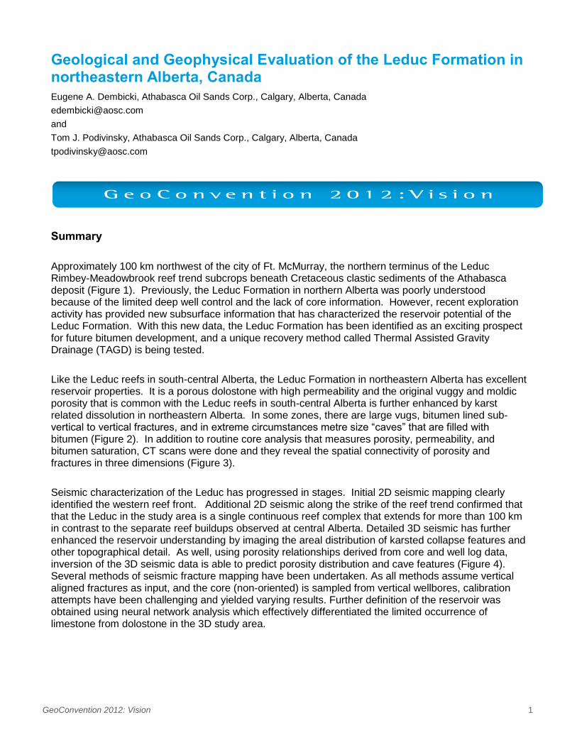
Approximately 100 km northwest of the city of Ft. McMurray, the northern terminus of the Leduc Rimbey-Meadowbrook reef trend subcrops beneath Cretaceous clastic sediments of the Athabasca deposit (Figure 1). Previously, the Leduc Formation in northern Alberta was poorly understood because of the limited deep well control and the lack of core information. However, recent exploration activity has provided new subsurface information that has characterized the reservoir potential of the Leduc Formation. With this new data, the Leduc Formation has been identified as an exciting prospect for future bitumen development, and a unique recovery method called Thermal Assisted Gravity Drainage (TAGD) is being tested.
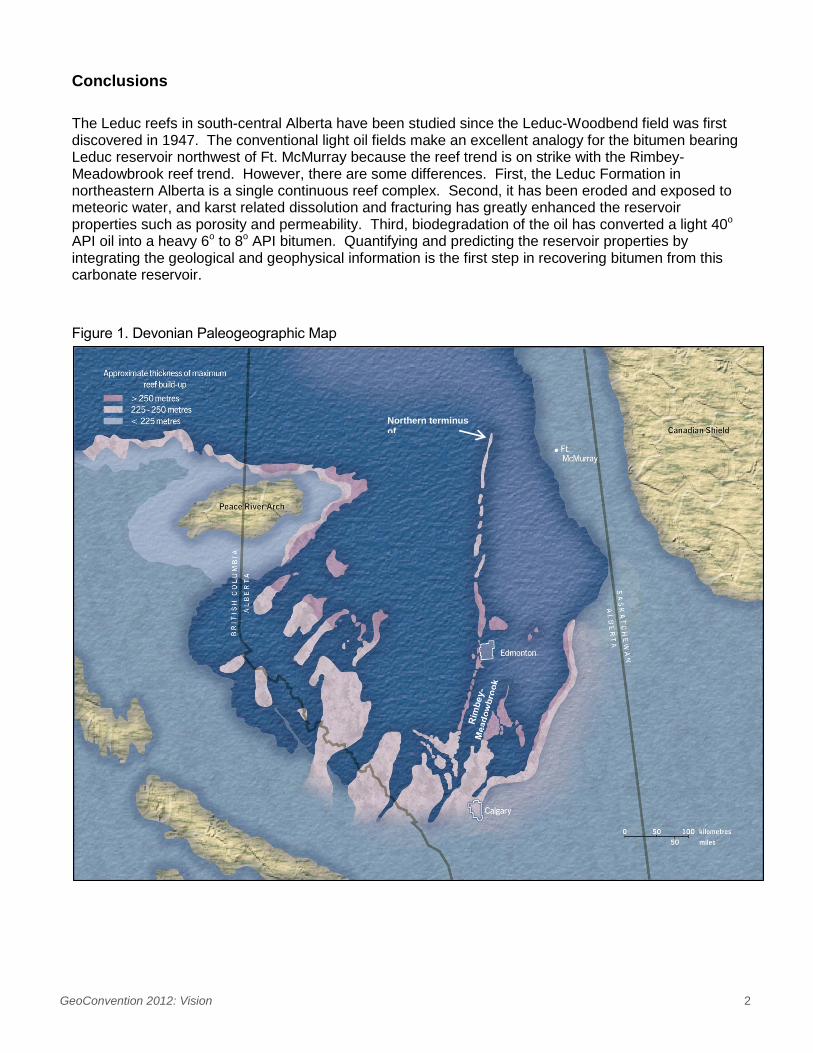
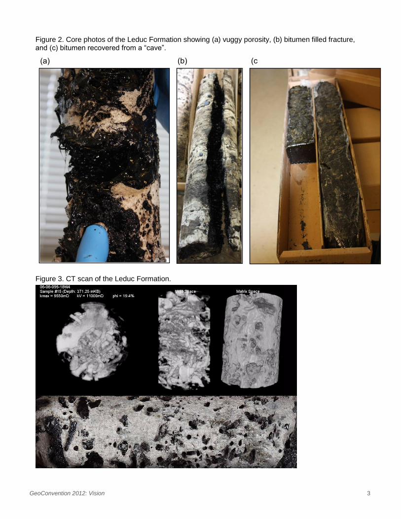
Like the Leduc reefs in south-central Alberta, the Leduc Formation in northeastern Alberta has excellent reservoir properties. It is a porous dolostone with high permeability and the original vuggy and moldic porosity that is common with the Leduc reefs in south-central Alberta is further enhanced by karst related dissolution in northeastern Alberta. In some zones, there are large vugs, bitumen lined sub-vertical to vertical fractures, and in extreme circumstances metre size “caves” that are filled with bitumen (Figure 2). In addition to routine core analysis that measures porosity, permeability, and bitumen saturation, CT scans were done and they reveal the spatial connectivity of porosity and fractures in three dimensions (Figure 3).
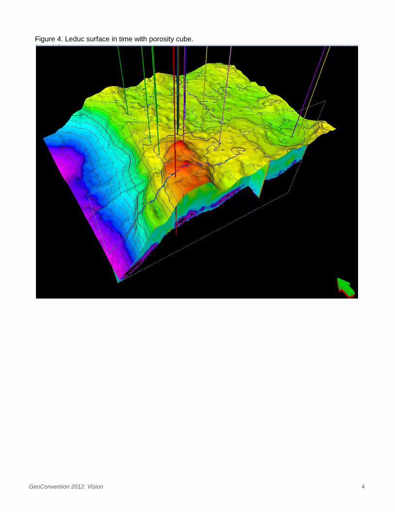
Seismic characterization of the Leduc has progressed in stages. Initial 2D seismic mapping clearly identified the western reef front. Additional 2D seismic along the strike of the reef trend confirmed that that the Leduc in the study area is a single continuous reef complex that extends for more than 100 km in contrast to the separate reef buildups observed at central Alberta. Detailed 3D seismic has further enhanced the reservoir understanding by imaging the areal distribution of karsted collapse features and other topographical detail. As well, using porosity relationships derived from core and well log data, inversion of the 3D seismic data is able to predict porosity distribution and cave features (Figure 4). Several methods of seismic fracture mapping have been undertaken. As all methods assume vertical aligned fractures as input, and the core (non-oriented) is sampled from vertical wellbores, calibration attempts have been challenging and yielded varying results. Further definition of the reservoir was obtained using neural network analysis which effectively differentiated the limited occurrence of limestone from dolostone in the 3D study area.
GeoConvention 2012: Vision 2
Conclusions
The Leduc reefs in south-central Alberta have been studied since the Leduc-Woodbend field was first discovered in 1947. The conventional light oil fields make an excellent analogy for the bitumen bearing Leduc reservoir northwest of Ft. McMurray because the reef trend is on strike with the Rimbey-Meadowbrook reef trend. However, there are some differences. First, the Leduc Formation in northeastern Alberta is a single continuous reef complex. Second, it has been eroded and exposed to meteoric water, and karst related dissolution and fracturing has greatly enhanced the reservoir properties such as porosity and permeability. Third, biodegradation of the oil has converted a light 40o API oil into a heavy 6o to 8o API bitumen. Quantifying and predicting the reservoir properties by integrating the geological and geophysical information is the first step in recovering bitumen from this carbonate reservoir.
Figure 1. Devonian Paleogeographic Map
Northern terminus of
GeoConvention 2012: Vision 3
Figure 2. Core photos of the Leduc Formation showing (a) vuggy porosity, (b) bitumen filled fracture, and (c) bitumen recovered from a “cave”.
Figure 3. CT scan of the Leduc Formation.
(a) (b) (c)
GeoConvention 2012: Vision 4
Figure 4. Leduc surface in time with porosity cube.