en visa t summer sc hool - earth.esa.int · en visa t summer sc hool ear th system monitoring &...
TRANSCRIPT

European Space
Programmes
www.esa.int

Paris
ESA mission is to provide and promote - for exclusively peaceful purposes - the exploitation of space science, research, technology and space applications.
Created in 1975 – 17 member states – 90% budget spent to industry
European Space Agency
ESOC (De)
ESRIN (It)
ESTEC (Nl)
HQ (Fr)
Meeting of delegates
Control satellite

Human space flight
(International Space Station)
Microgravity research
Earth Observation (EO)
(ERS, Envisat, MSG)
Telecommunications
(Artemis)
Satellite Navigation
(EGNOSS, Galileo)
Launcher development
ESA optional programmes
10/2003 - 51
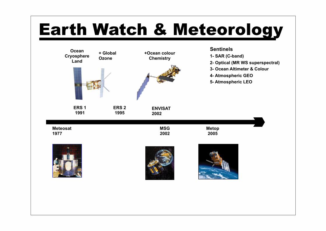
Metop2005
Meteosat1977
Earth Watch & Meteorology
ERS 11991
ERS 21995
ENVISAT2002
OceanCryosphere
Land
+ GlobalOzone
+Ocean colourChemistry
MSG2002
Sentinels
1- SAR (C-band)
2- Optical (MR WS superspectral)
3- Ocean Altimeter & Colour
4- Atmospheric GEO
5- Atmospheric LEO
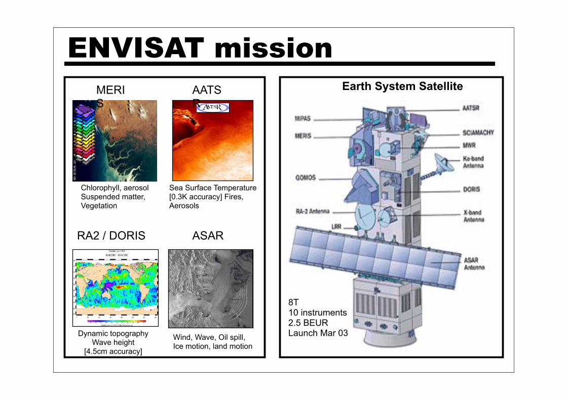
ENVISAT missionEarth System Satellite
8 T10 sensorsOrbit 800km2300 MEUR
MERIS
AATSR
RA2 / DORIS ASAR
Sea Surface Temperature[0.3K accuracy] Fires, Aerosols
Chlorophyll, aerosolSuspended matter,Vegetation
Dynamic topographyWave height
[4.5cm accuracy]
Wind, Wave, Oil spill,Ice motion, land motion
8T10 instruments2.5 BEURLaunch Mar 03
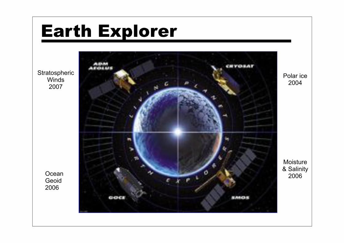
Polar ice2004
Ocean Geoid2006
StratosphericWinds2007
Moisture& Salinity
2006
Earth Explorer
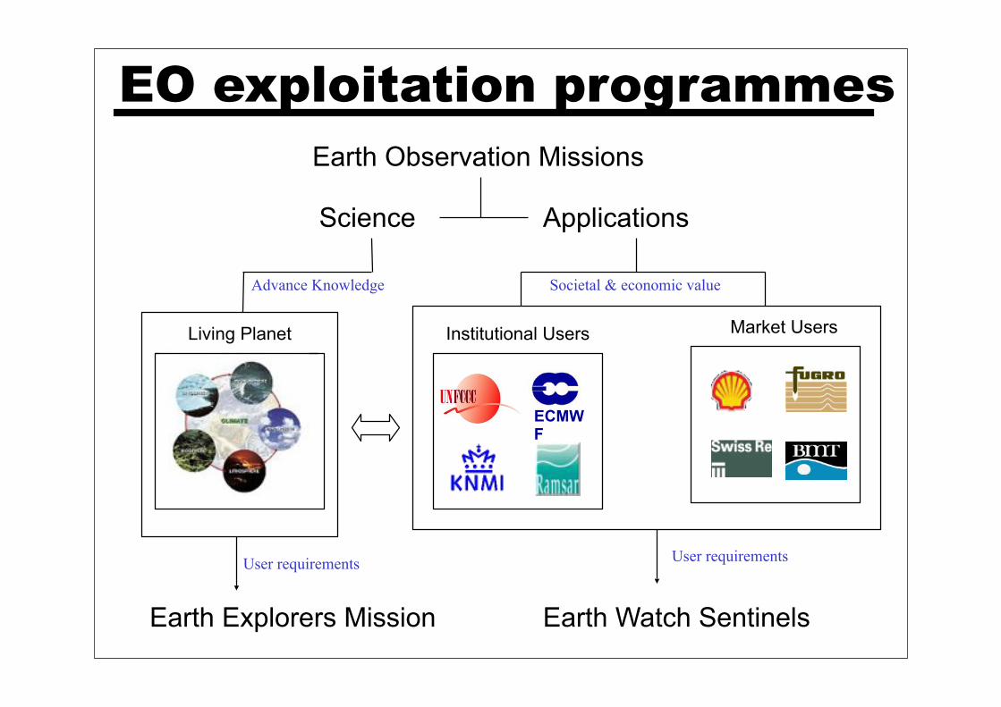
Science Applications
EO exploitation programmes
ECMWF
Institutional Users Market UsersLiving Planet
Earth Observation Missions
Earth Explorers Mission Earth Watch Sentinels
User requirementsUser requirements
Advance Knowledge Societal & economic value
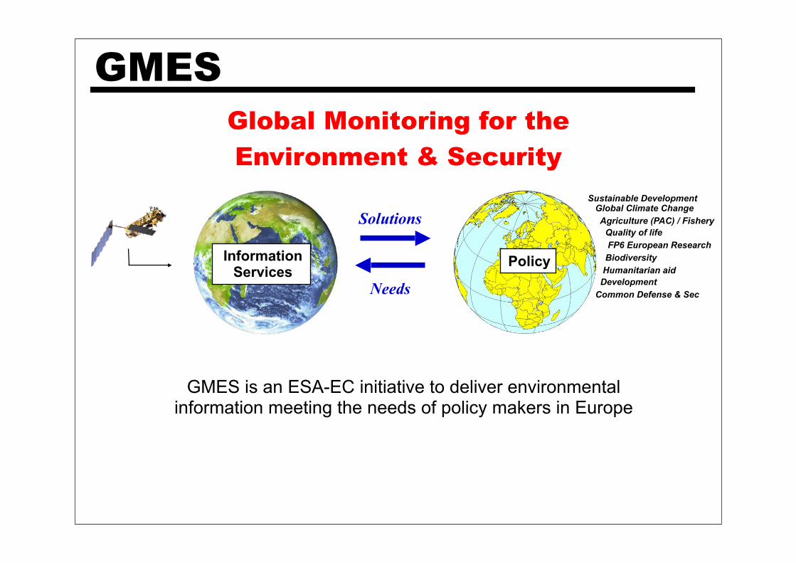
Solutions
Needs
InformationServices
Policy
Sustainable Development Global Climate Change
Agriculture (PAC) / Fishery
Quality of life
FP6 European Research
Biodiversity
Humanitarian aid
Development
Common Defense & Sec
GMES is an ESA-EC initiative to deliver environmental information meeting the needs of policy makers in Europe
GMES
Global Monitoring for the
Environment & Security

From Observation to Decision
Geophysical parameters:e.g. Water quality mapping
From Data ...
Indicators :e.g. Coastal erosion
… to Information ...
Decision-support info. :o Integrated GIS
… to Recommendations
Turning Terrabytes of raw data into useful information.
credit IWGEO

Climate Monitoring
Global Sea Level Rise
Satellites constantly monitor the state of our climate, its seasonal-to-decadal variability (e.g. El Nino Southern Oscillation) as well as its long-term changes (e.g. global temperature, sea level).
© ESA (TOPEX, ERS & ENVISAT)
El Nino seen by Envisat
11-1997

Forest monitoring1990 (Kyoto baseline) 2002 (Landsat)
Forest change statistics from EO are used to quantify LULUCF activities in the framework of the Kyoto Protocol
Satellites constantly monitor forest biomass (e.g. land cover type, carbon stock, moisture) and fire risks.
Managing forests
Forest mapping from space supports sustainable forestry practices, detection of illegal logging as well as the implementation of international environmental conventions to protect climate (UNFCCC), wetlands (Ramsar), biodiversity and combat desertification.
© ESA, GAF

Polar services
Where is Lena?
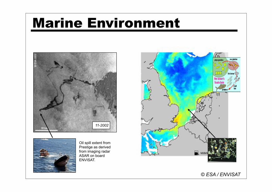
Marine Environment
Oil spill extent from Prestige as derived from imaging radar ASAR on board ENVISAT.
© ESA / ENVISAT
11-2002
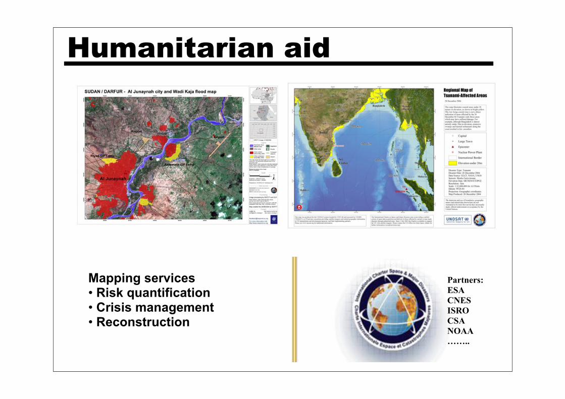
Humanitarian aid
Partners:
ESA
CNES
ISRO
CSA
NOAA
……..
Mapping services• Risk quantification • Crisis management• Reconstruction

Natural & Human Induced Disasters
Human Health & Well-Being
Energy Resources
Climate Variability &
Change
Weather Information, Forecasting &
Warning
Ecosystems
Sustainable Agriculture &
Desertification
Oceans
Space Applications
Carbon Cycle

ESA Envisat
Summer School
envisat.esa.int/envschool
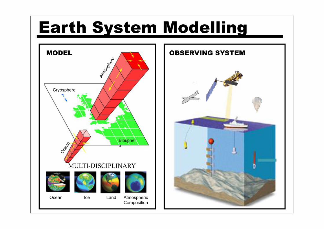
Earth System Modelling
Atm
osph
ere
Oce
an
Biosphere
Ocean Ice Land AtmosphericComposition
Cryosphere
MODEL OBSERVING SYSTEM
MULTI-DISCIPLINARY
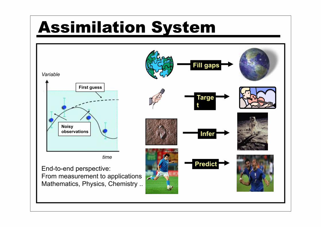
Fill gaps
Predict
Target
Infer
Assimilation System
Noisy observations
First guess
time
Variable
End-to-end perspective:From measurement to applicationsMathematics, Physics, Chemistry ..
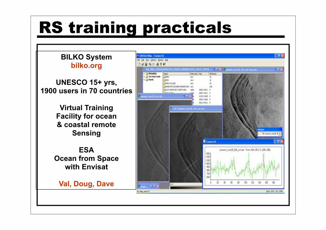
RS training practicals
BILKO System
bilko.org
UNESCO 15+ yrs, 1900 users in 70 countries
Virtual TrainingFacility for ocean& coastal remote
Sensing
ESAOcean from Space
with Envisat
Val, Doug, Dave

DA training practicals
DARC simple models
Test different DA schemes (merits/drawbacks)
+ sensitivity of dynamical systems
Amos & Stefano

Information• Material: ESA background, papers, some talks, feedback form + all talks on web after school.
• Poster: 70cm width, number in abstract book, display at lunch time 13:30 in B14, session 17:30 (2mins/person), EMS prize
• Logistics:• Lunch @ Mensa at 13:00 (buffet + main courses)• Bus @ 18:00 in front of B14 .. • COCKTAIL tonight, welcome by Dr. Liebig. • Visit castelli romani Saturday• ?help?: call Cathy Morris 80 595
Carmen Comparetto 80 912 Pierre-Philippe Mathieu 80 568

Thank you
Special thanks to:
… Cathy Morris, Ulla Vayrynen, Carmen Comparetto & Villa Tuscolana, Paula Landart, Christine Violetti, Simone Leoni & IT team, Site helpdesk team, sponsors Matlab & IDL …..
…. All speakers & assistants …