water flow in porous media - western washington …kula.geol.wwu.edu/rjmitch/hyd_cond_372b.pdf ·...
TRANSCRIPT
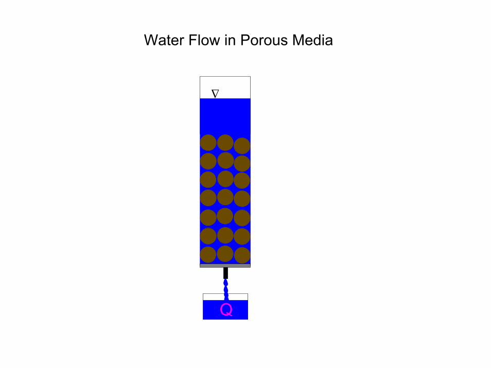
∆
Q
Water Flow in Porous Media

∆Q
water flows due to a combination of water pressure and gravity
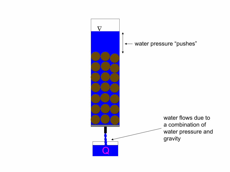
∆Q
water flows due to a combination of water pressure and gravity
water pressure “pushes”
∆Q
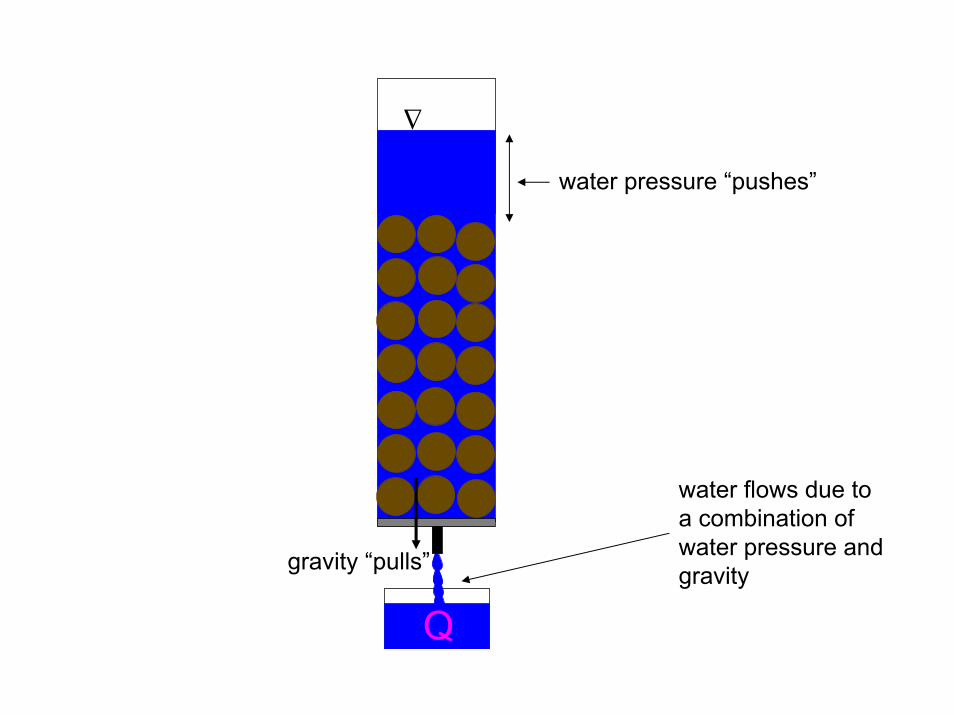
water flows due to a combination of water pressure and gravity
water pressure “pushes”
gravity “pulls”

Water pressure “pushes” and gravity “pulls”
The combination of these two quantities is called the hydraulic head
Water moves due to a difference in hydraulic head between two locations.
The change in hydraulic head over some distance is called thehydraulic gradient.

∆
Q
A water molecule at the surface of the sand senses a water pressure due to the height of the water above the sand. It is called the pressure head or hp
A water molecule at the surface wants to “fall” to the bottom of the sand due to gravity. This is called elevation head or hz
The total head at the surface of the sand
hp
hz
The total head at the surface of the sand is
h = hp + hz

∆
Q
A water molecule at the bottom of the sand senses no water pressure because the valve opening is exposed to the atmosphere, therefore hp = 0
A water molecule at the bottom doesn’t fall any distance because it is already at the bottom! Therefore, hz = 0
The total head at the bottom of the sand
The total head at the bottom of the sand is
h = 0

∆
Q
The change in total head (∆h)
∆h = head at the top “minus” the head at the bottom
∆h = h – 0 = hp + hz
hp
hz
∆
Q
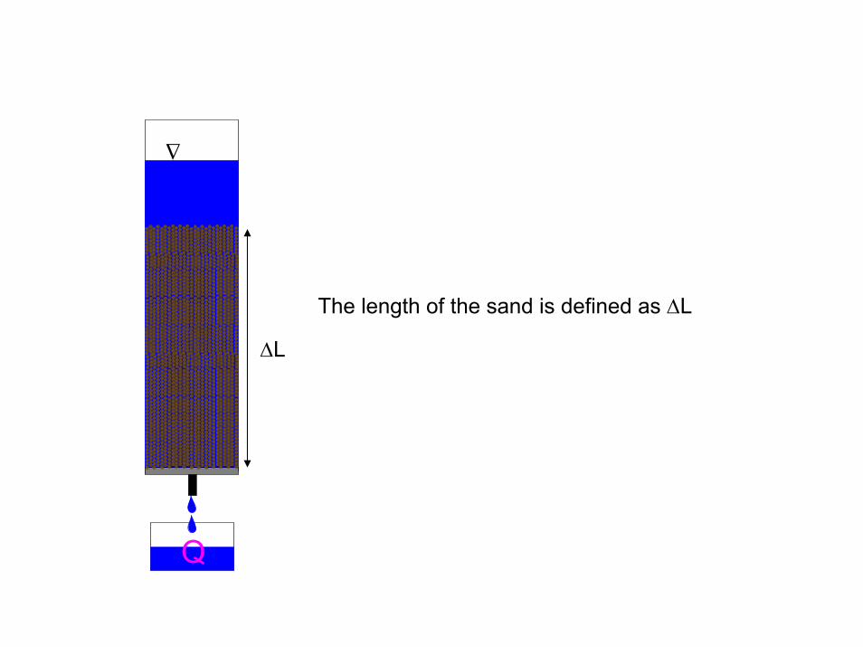
The length of the sand is defined as ∆L
∆L

∆
Q
The hydraulic gradient
hp
hz
The hydraulic gradient is ∆h/∆L
∆L

∆Q
friction along the grain surfaces will resist water flow
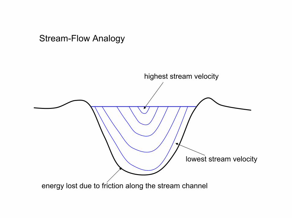
Stream-Flow Analogy
highest stream velocity
lowest stream velocity
energy lost due to friction along the stream channel
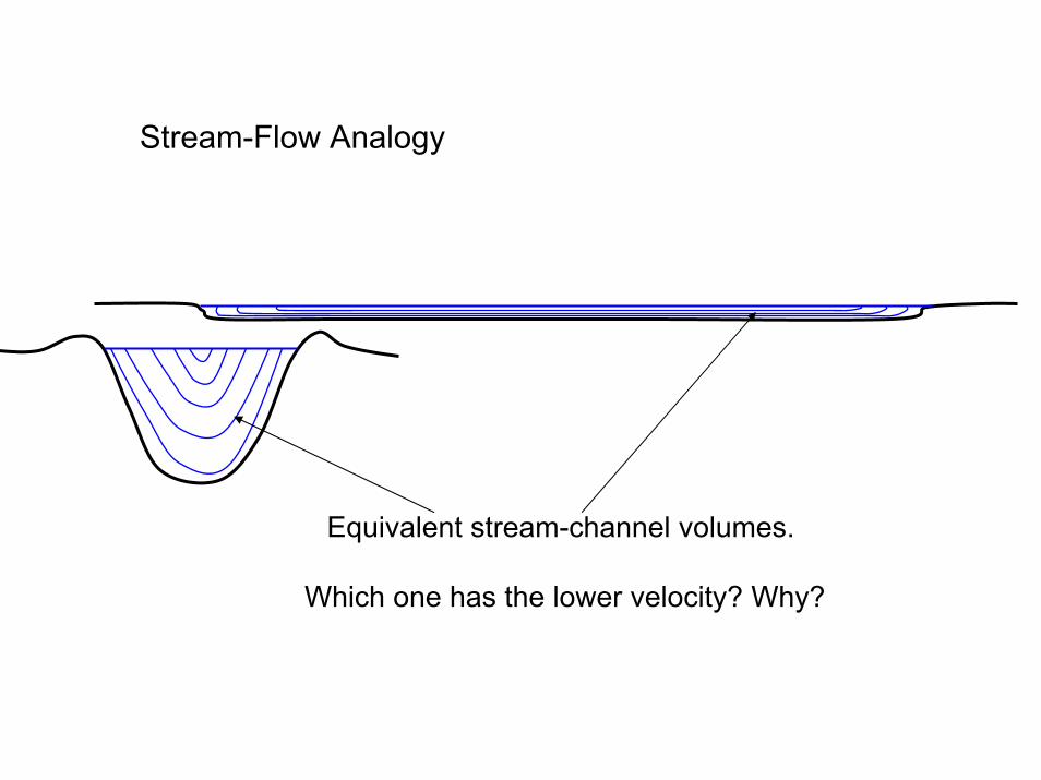
Stream-Flow Analogy
Equivalent stream-channel volumes.
Which one has the lower velocity? Why?
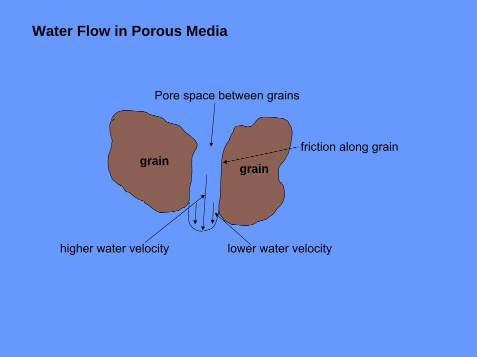
graingrainfriction along grain
higher water velocity lower water velocity
Pore space between grains
Water Flow in Porous Media
The amount of friction along grain boundaries depends on the surface area of the sediment
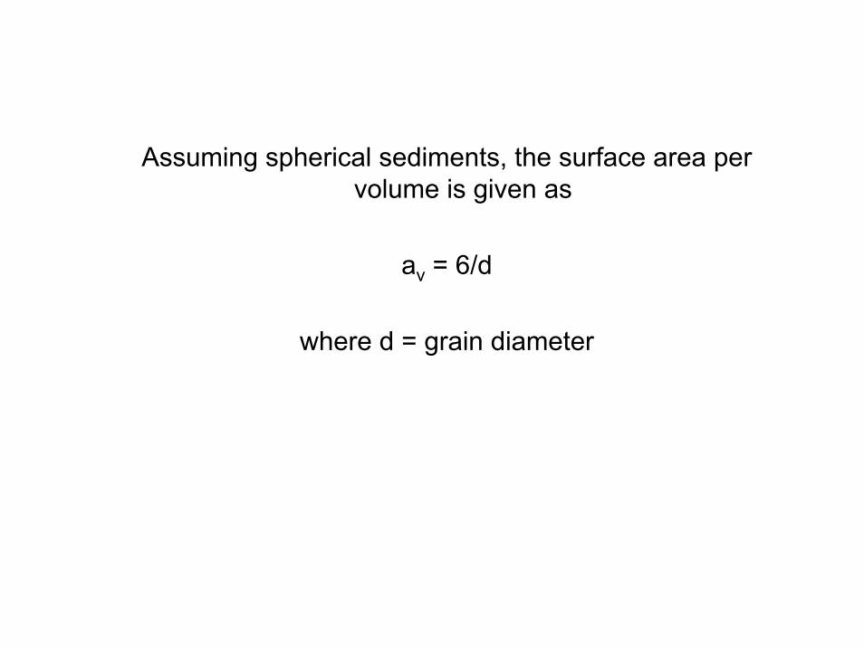
Assuming spherical sediments, the surface area per volume is given as
av = 6/d
where d = grain diameter

∆Q
gravel having grain diameters of 4.0 mm
Surface area, av = 15 cm2 per cm3
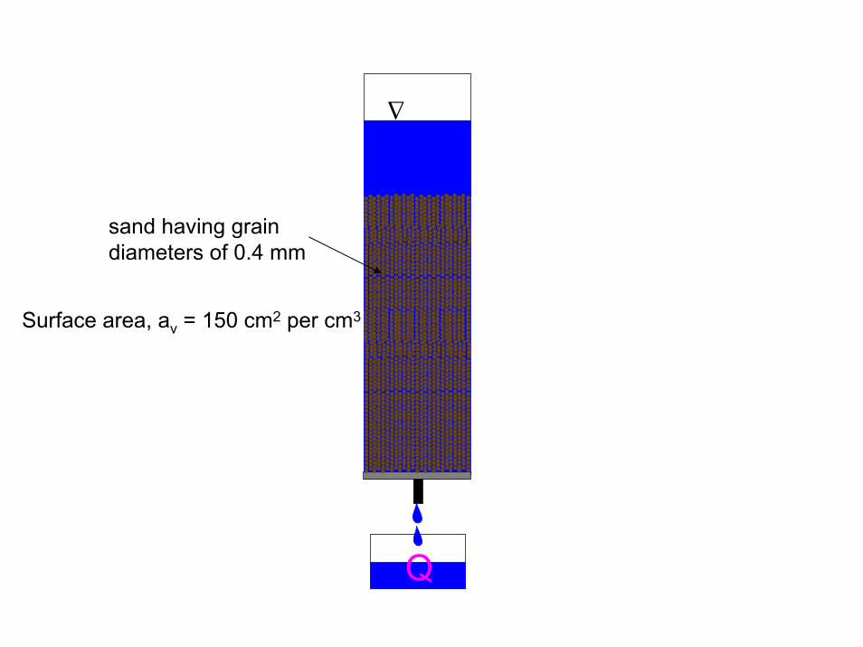
∆Q
sand having grain diameters of 0.4 mm
Surface area, av = 150 cm2 per cm3
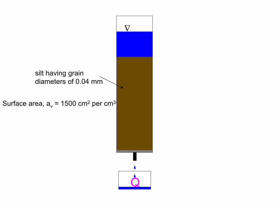
∆Q
silt having grain diameters of 0.04 mm
Surface area, av = 1500 cm2 per cm3
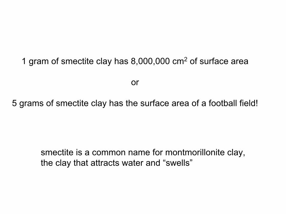
1 gram of smectite clay has 8,000,000 cm2 of surface area
or
5 grams of smectite clay has the surface area of a football field!
smectite is a common name for montmorillonite clay,the clay that attracts water and “swells”
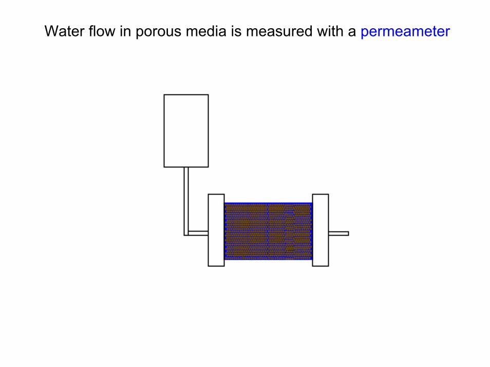
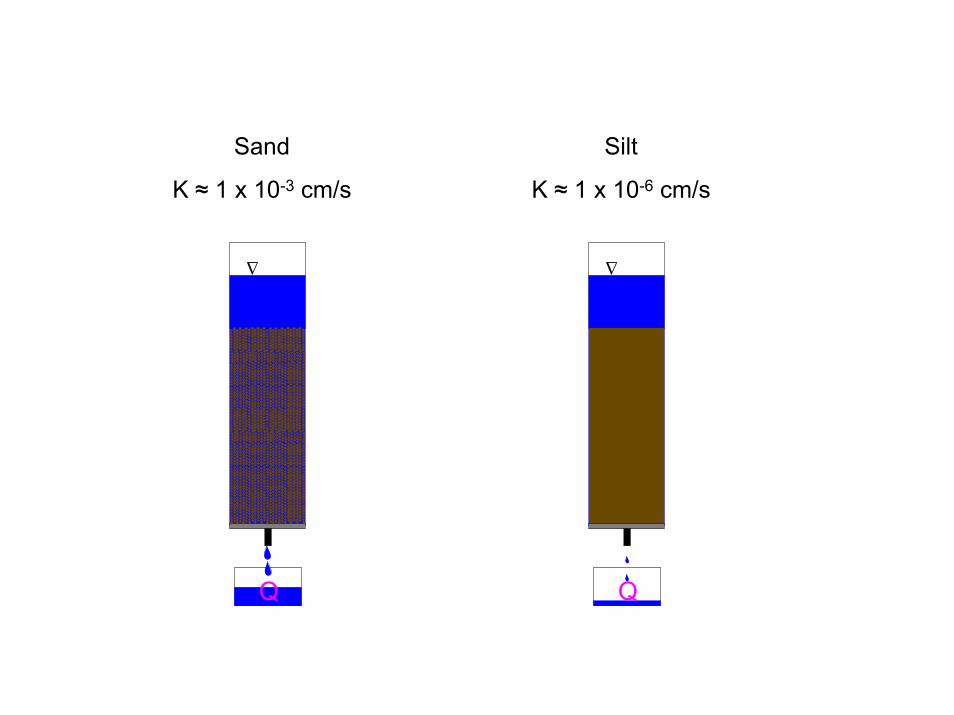
Water flow in porous media is measured with a permeameter
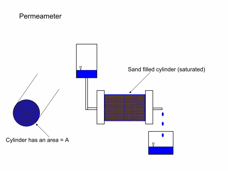
Permeameter
Sand filled cylinder (saturated)
Cylinder has an area = A

Permeameter
water pressure in the vessel “pushes” water into the sand
water flows through the sand and out the valve
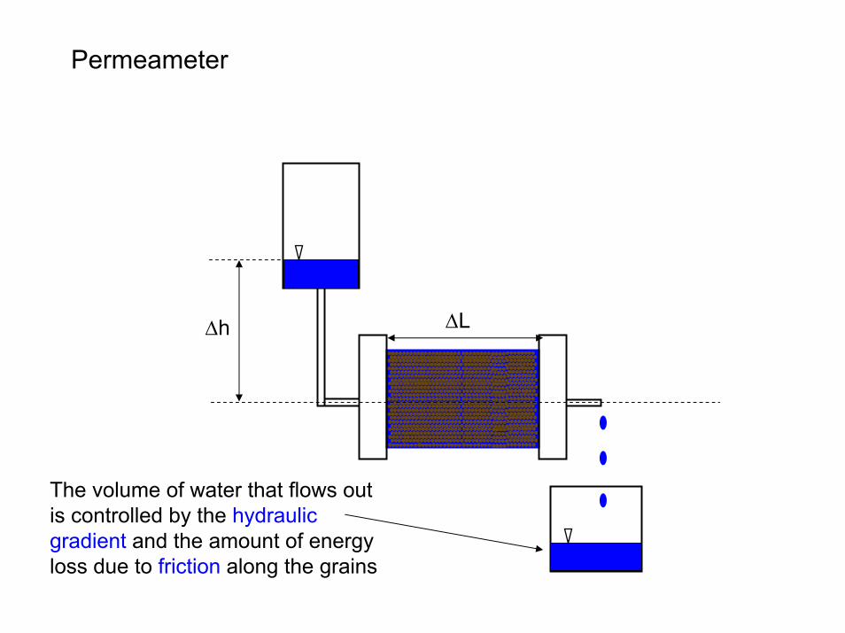
Permeameter
The volume of water that flows out is controlled by the hydraulic gradient and the amount of energy loss due to friction along the grains
∆h ∆L

First Experiment
The volume of water that flows out in some length of time is the discharge = Q
∆h ∆L
the water height in the vessel remains constant
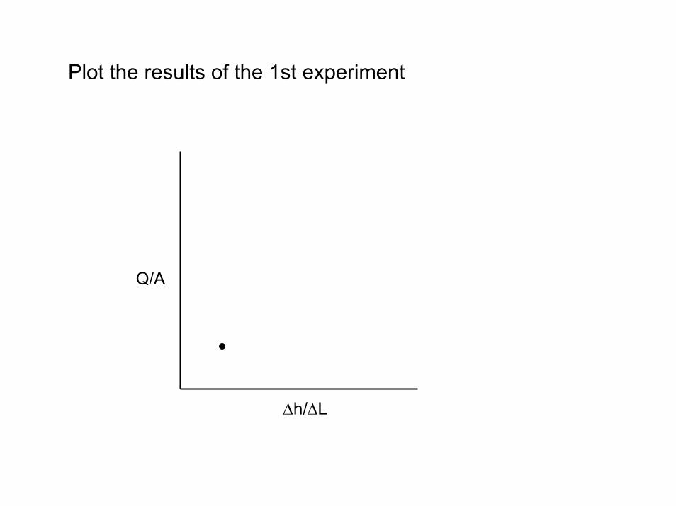
Plot the results of the 1st experiment
Q/A
∆h/∆L
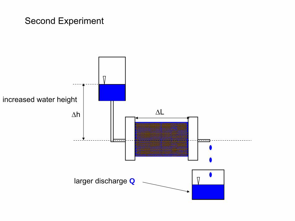
Second Experiment
larger discharge Q
∆h ∆L
increased water height

Plot the results of the 2nd experiment
Q/A
∆h/∆L
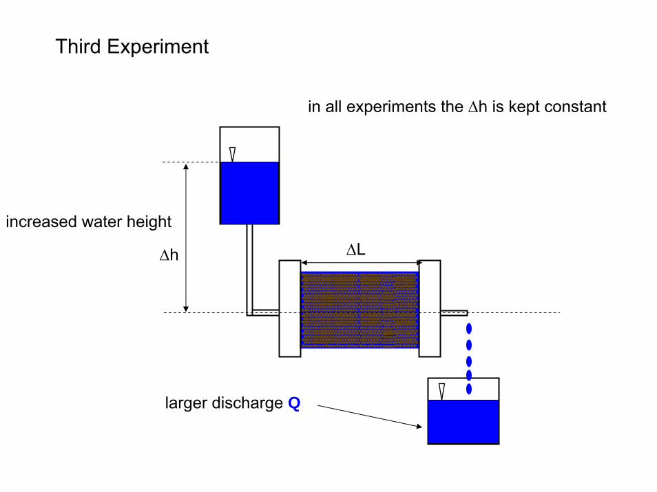
Third Experiment
larger discharge Q
∆h ∆L
increased water height
in all experiments the ∆h is kept constant

Plot the results of the 3rd experiment
Q/A
∆h/∆L
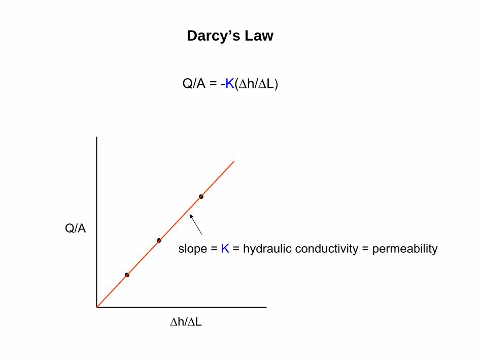
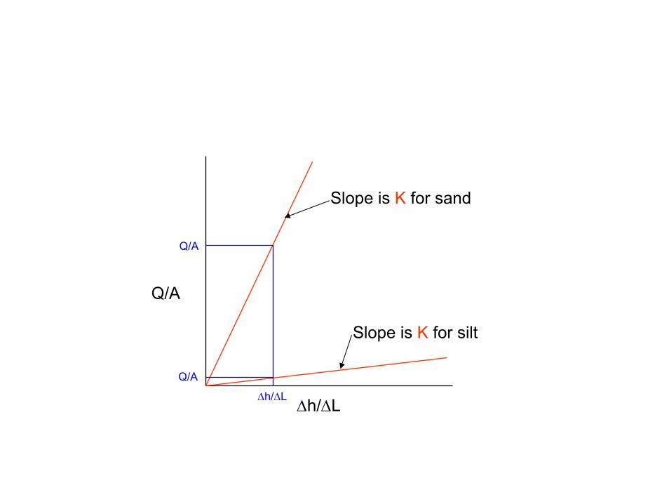
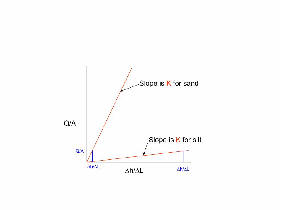
Darcy’s Law
Q/A = -K(∆h/∆L)
Q/A
∆h/∆L
slope = K = hydraulic conductivity = permeability
The hydraulic conductivity is a measure of the sediments ability to transmit fluid.
It’s magnitude is controlled by the grain size (or pore size) which determines the amount of frictional resistance
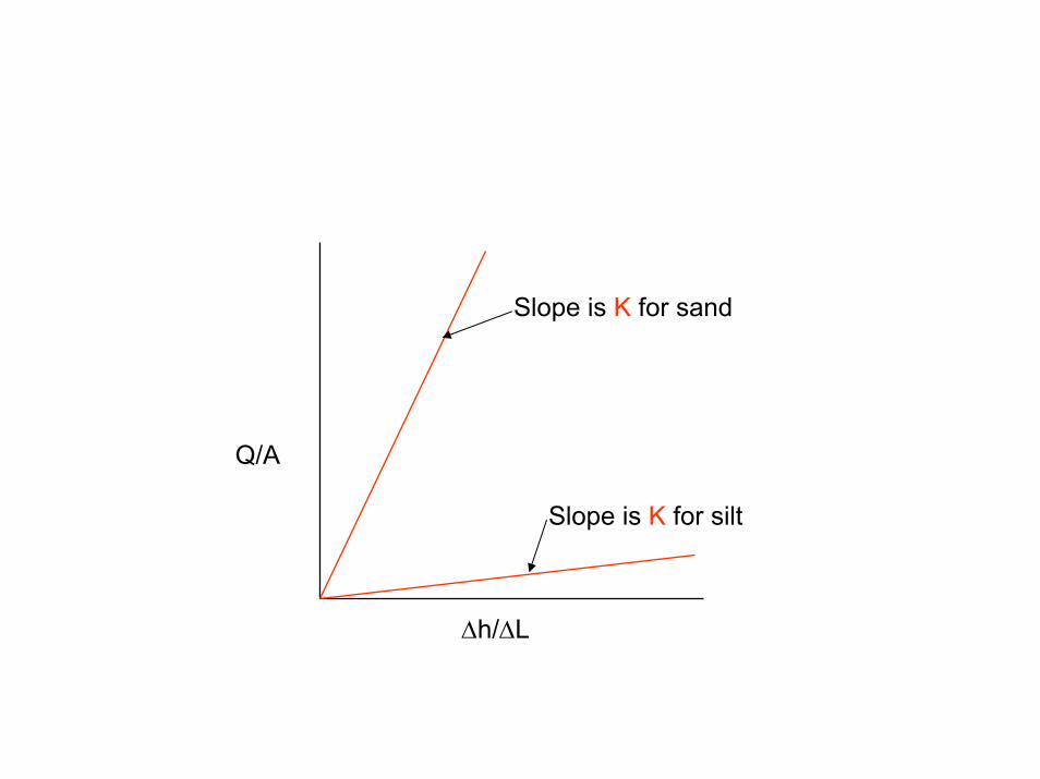
Slope is K for sand
Slope is K for silt
Q/A
∆h/∆L
Slope is K for sand
Slope is K for silt
Q/A
Q/A
Q/A
∆h/∆L∆h/∆L
Q/A
∆h/∆L
Slope is K for sand
Slope is K for siltQ/A
∆h/∆L∆h/∆L
∆
Q
∆
Q
Silt
K ≈ 1 x 10⁻⁶ cm/s
Sand
K ≈ 1 x 10⁻³ cm/s
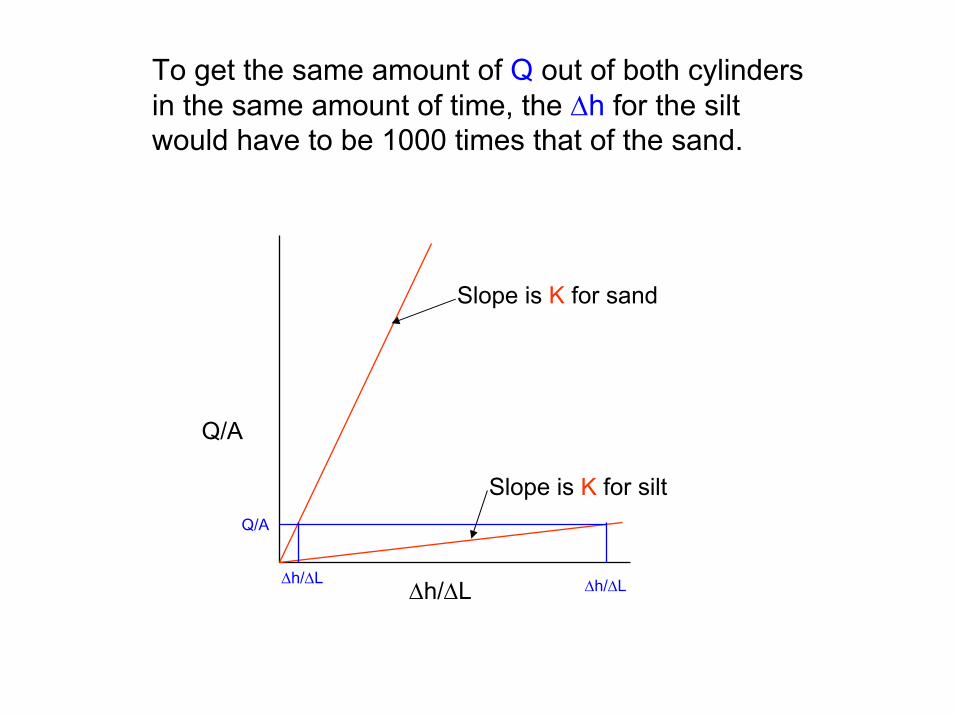
To get the same amount of Q out of both cylinders in the same amount of time, the ∆h for the silt would have to be 1000 times that of the sand.
Q/A
∆h/∆L
Slope is K for sand
Slope is K for siltQ/A
∆h/∆L∆h/∆L

Saturated Flow in Porous Media
water moves fastest in the center of the pore
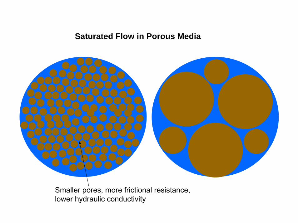
Saturated Flow in Porous Media
Smaller pores, more frictional resistance, lower hydraulic conductivity
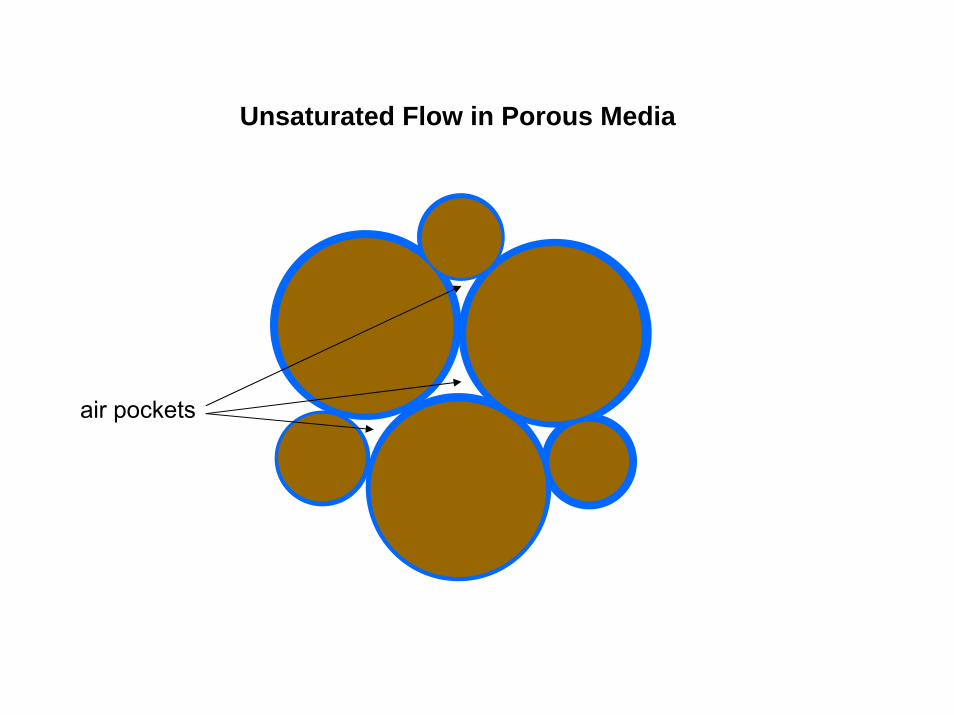
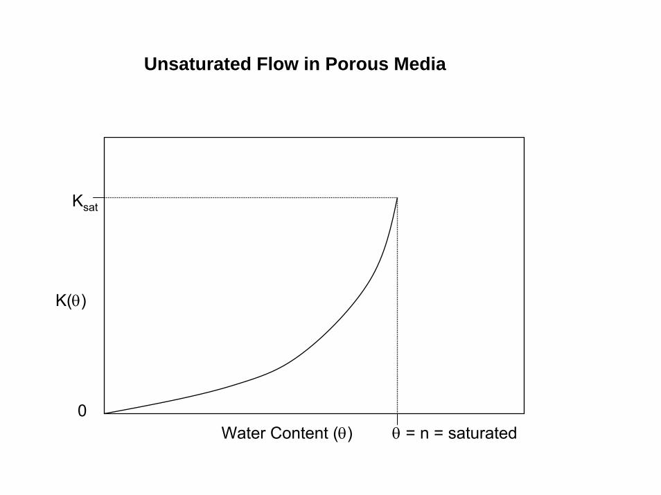
Unsaturated Flow in Porous Media
air pockets

Unsaturated Flow in Porous Media
water is a wetting fluid, i.e., it likes to adhere to the grains surfaces
air pockets
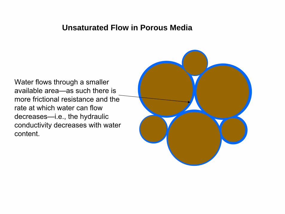
Unsaturated Flow in Porous Media
Water flows through a smaller available area—as such there is more frictional resistance and the rate at which water can flow decreases—i.e., the hydraulic conductivity decreases with water content.
Unsaturated Flow in Porous Media
K(θ)
0Water Content (θ) θ = n = saturated
Ksat
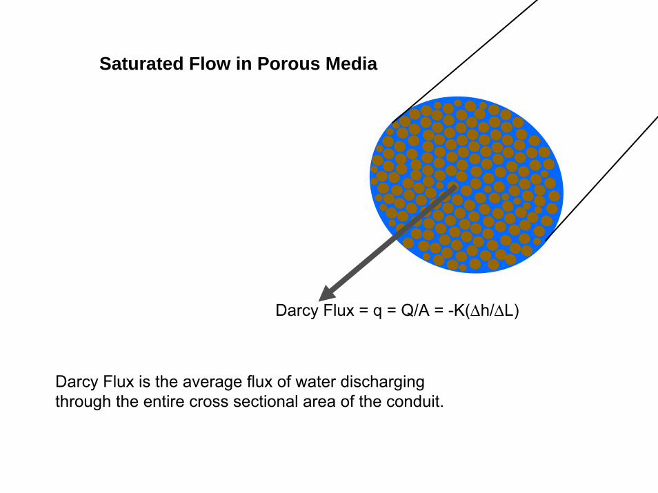
Saturated Flow in Porous Media
Darcy Flux = q = Q/A = -K(∆h/∆L)
Darcy Flux is the average flux of water discharging through the entire cross sectional area of the conduit.
Saturated Flow in Porous Media
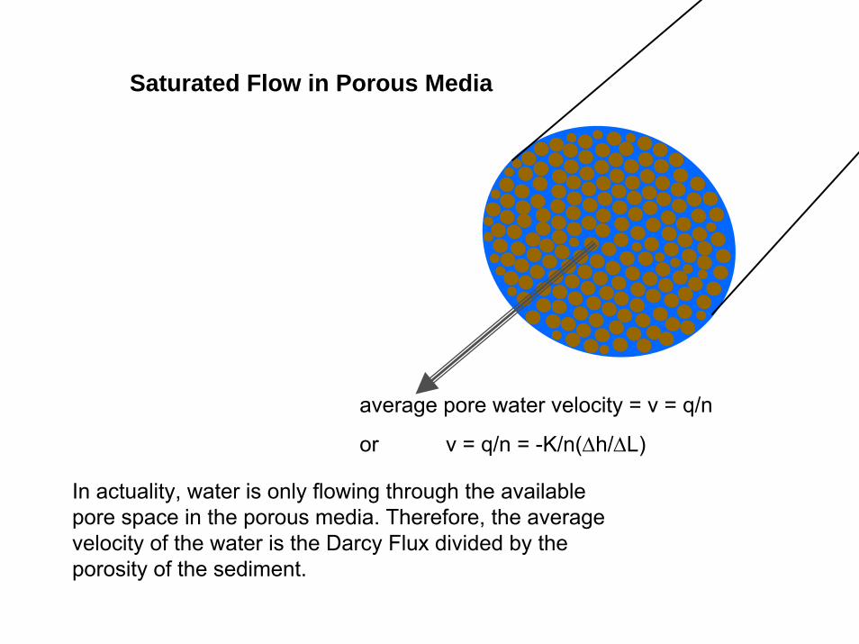
average pore water velocity = v = q/n
or v = q/n = -K/n(∆h/∆L)
In actuality, water is only flowing through the available pore space in the porous media. Therefore, the average velocity of the water is the Darcy Flux divided by the porosity of the sediment.
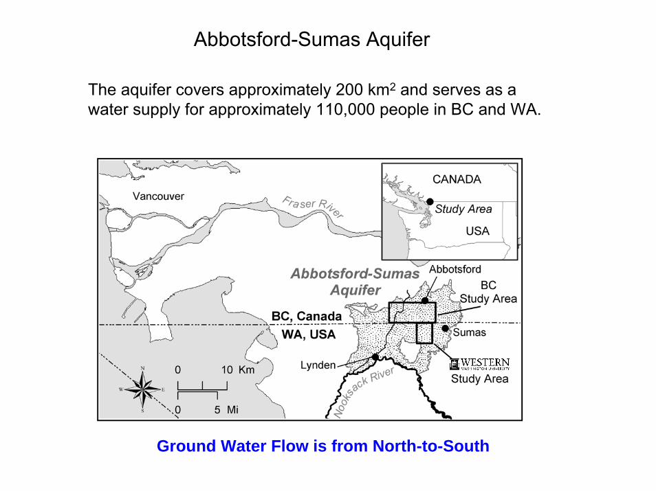
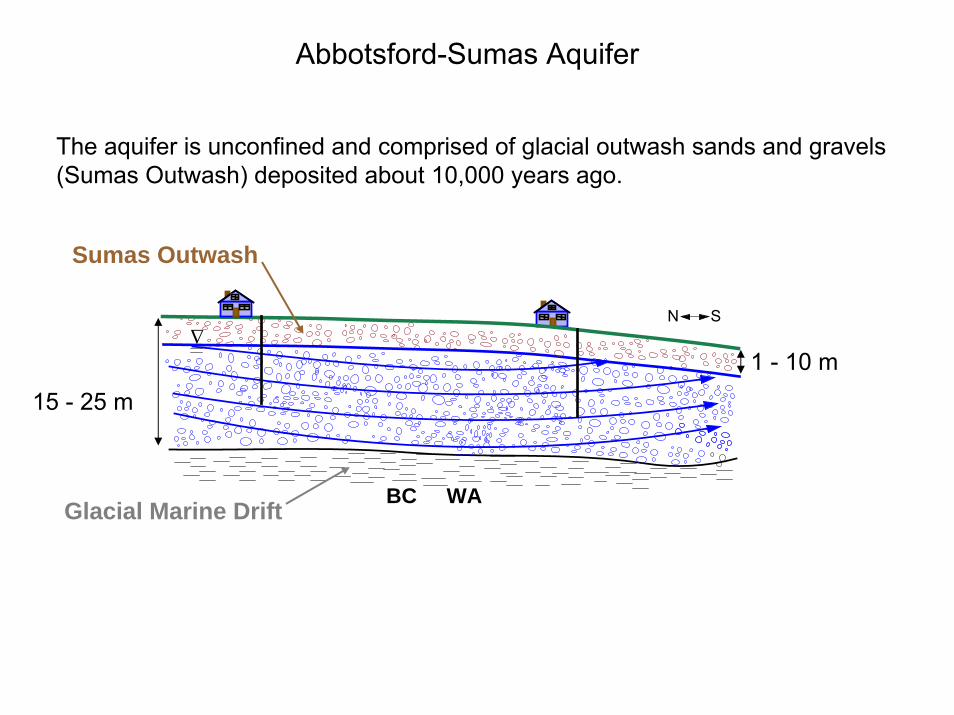
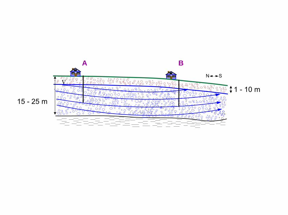
Abbotsford-Sumas Aquifer
The aquifer covers approximately 200 km2 and serves as a water supply for approximately 110,000 people in BC and WA.
Ground Water Flow is from North-to-South
∆ N S
BC WA
15 - 25 m
1 - 10 m
Sumas Outwash
Glacial Marine Drift
Abbotsford-Sumas Aquifer
The aquifer is unconfined and comprised of glacial outwash sands and gravels (Sumas Outwash) deposited about 10,000 years ago.

Sumas Outwash
∆ N S
PANGBORN RD
HALVERSTICK RD
VAN
BU
REN
RD
HALVERSTICK RD
Judson Lake
Pangborn Lake
V9
T1
P3
V6V5
V4
V1
H8H6H5H2
H1
V10
K1
V8
V7
V3
V2T2
P2
H7H4H3
V12
BC3BC6
BC5BC4
0 0.5 1 1.50.25Miles
0 0.7 1.4 2.10.35Kilometers
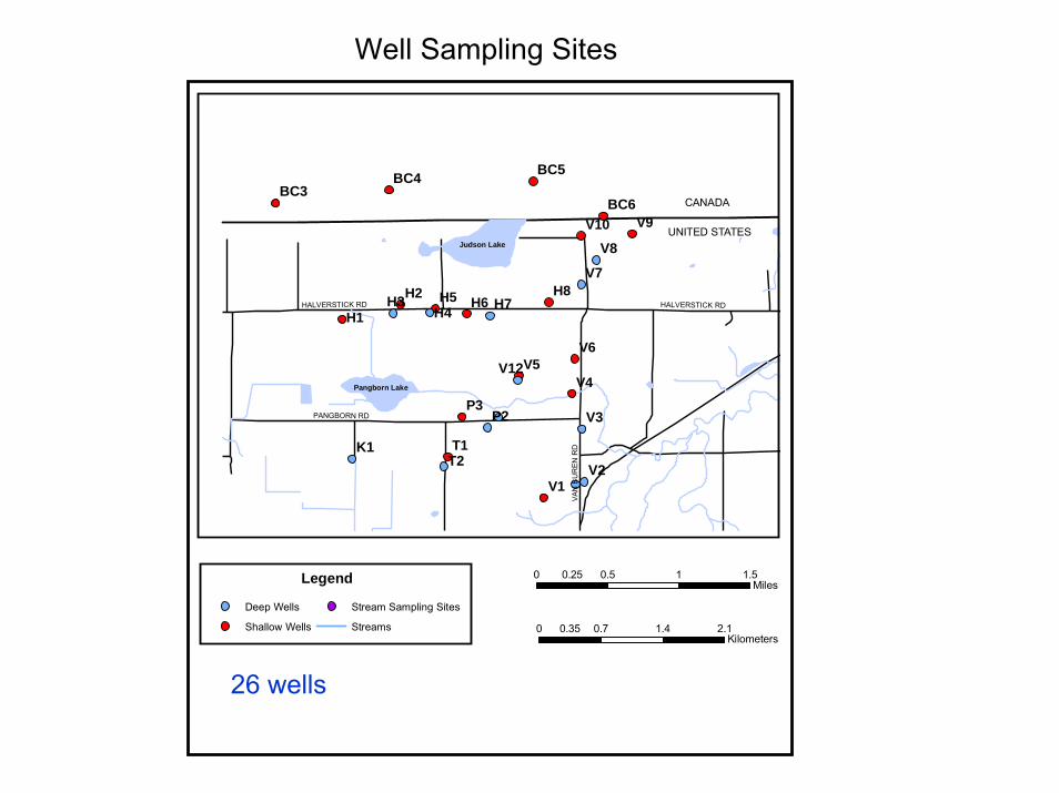
Legend
Deep Wells
Shallow Wells
Stream Sampling Sites
Streams
CANADA
UNITED STATES
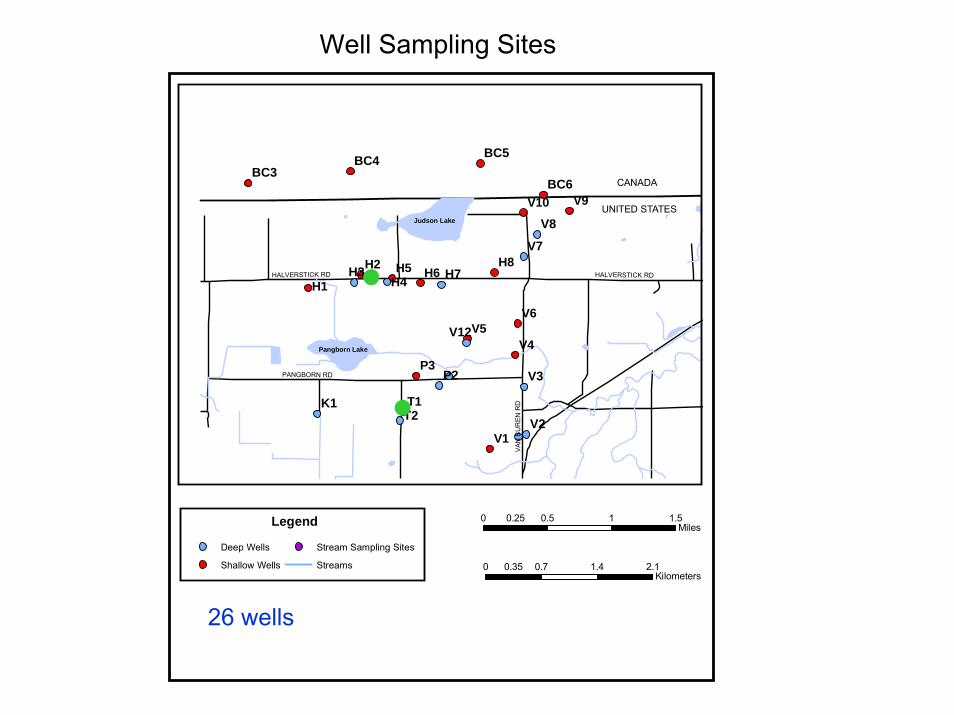
Well Sampling Sites
26 wells

Water-level measurements and sampling

Depth to Water Table
H2
H3
H4
H5
H6 P1
P3 T1 T2 V1
V11
V12 V2
V4
V5
V6
V7
V8
V9
20
40
60
Dep
th to
Wat
er (f
t)
shallow wellsdeep wells
PANGBORN RD
HALVERSTICK RD
VAN
BU
REN
RD
HALVERSTICK RD
Judson Lake
Pangborn Lake
V9
T1
P3
V6V5
V4
V1
H8H6H5H2
H1
V10
K1
V8
V7
V3
V2T2
P2
H7H4H3
V12
BC3BC6
BC5BC4
0 0.5 1 1.50.25Miles
0 0.7 1.4 2.10.35Kilometers
Legend
Deep Wells
Shallow Wells
Stream Sampling Sites
Streams
CANADA
UNITED STATES
Well Sampling Sites
26 wells
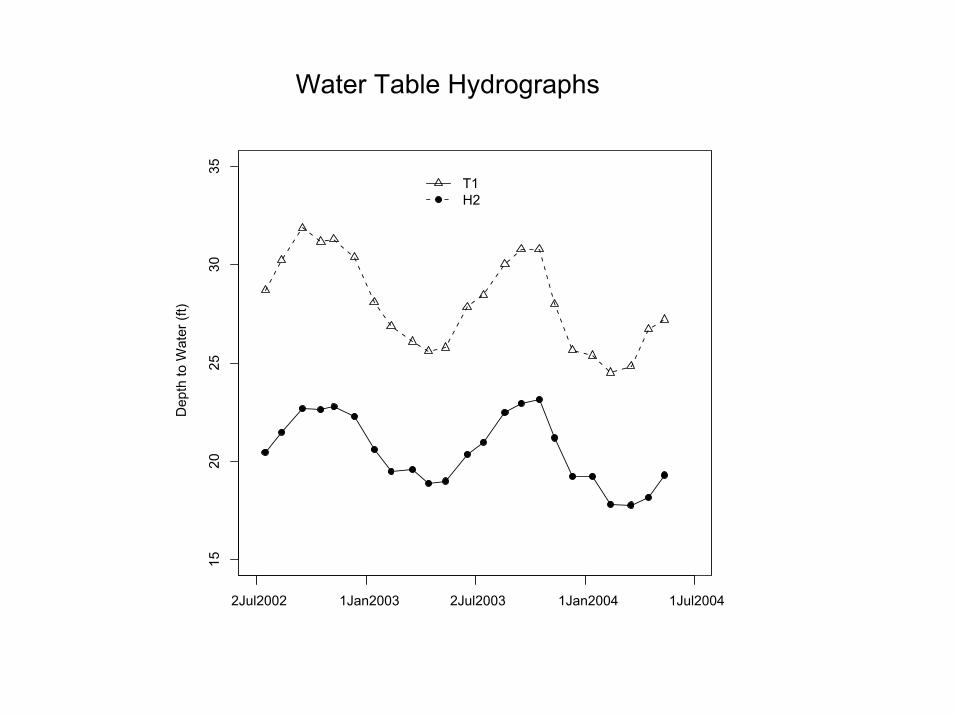
Water Table Hydrographs
1520
2530
35
Dep
th to
Wat
er (f
t)
2Jul2002 1Jan2003 2Jul2003 1Jan2004 1Jul2004
T1H2
∆ N S
15 - 25 m
1 - 10 m
A B
∆ N S
15 - 25 m
1 - 10 m
A B
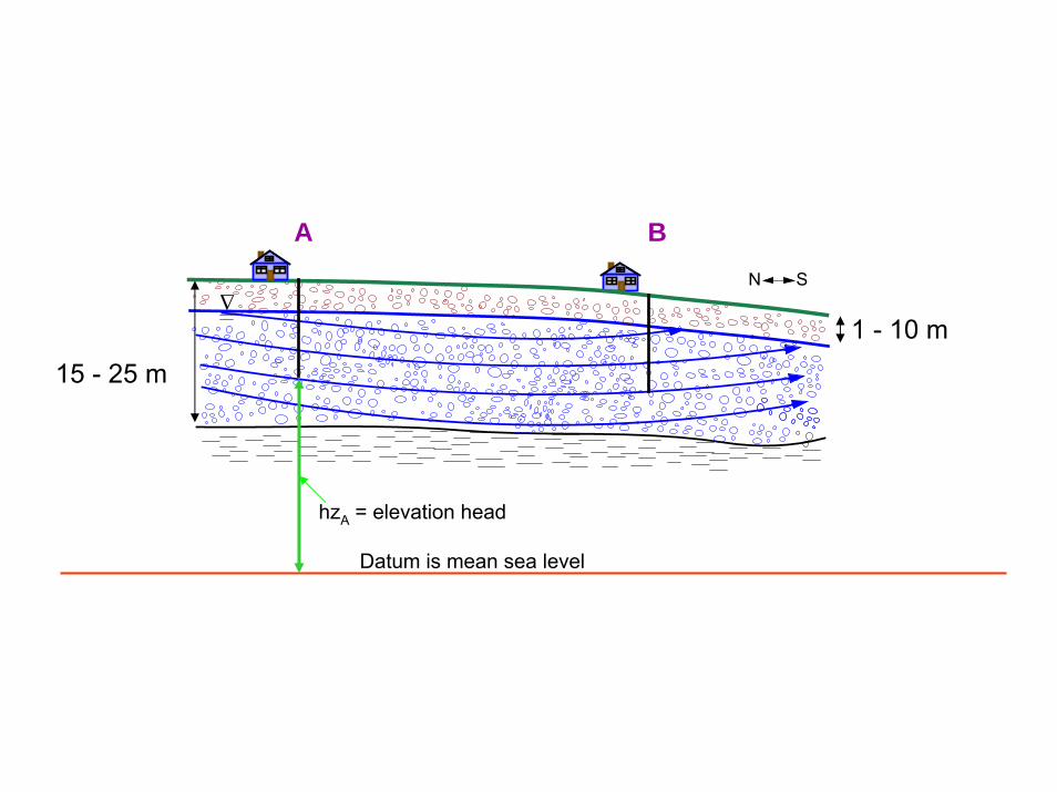
Datum is mean sea level
hzA = elevation head

∆ N S
15 - 25 m
1 - 10 m
A B
Datum is mean sea level
hzA = elevation head
hpA = pressure head

∆ N S
15 - 25 m
1 - 10 m
A B
Datum is mean sea level
hzA = elevation head
hA = total head = pressure head + elevation head
hpA = pressure head

∆ N S
15 - 25 m
1 - 10 m
A B
Datum is mean sea level
hzB = elevation head
hpB = pressure head
hB = total head = pressure head + elevation head

∆ N S
15 - 25 m
1 - 10 m
A B
Datum is mean sea level
The change in total head (∆h) between A and B is what causes water to flow.
∆h = hA - hB

∆ N S
15 - 25 m
1 - 10 m
A B
Distance between wells is ∆L
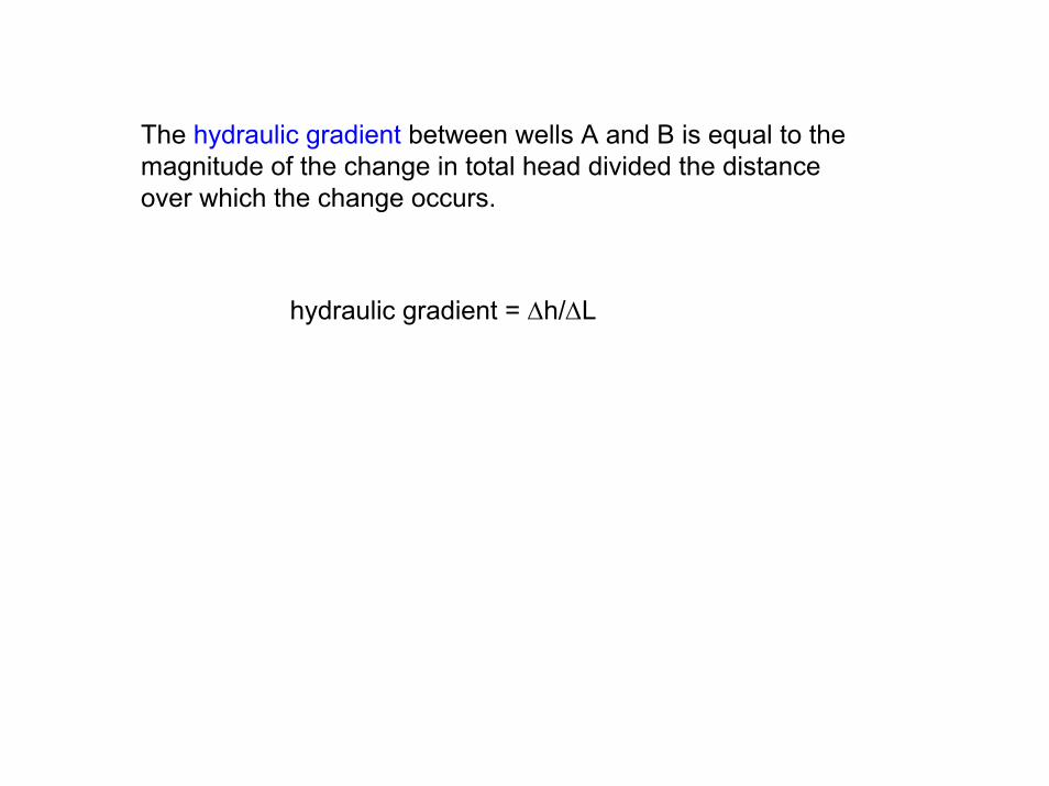
The hydraulic gradient between wells A and B is equal to the magnitude of the change in total head divided the distance over which the change occurs.
hydraulic gradient = ∆h/∆L
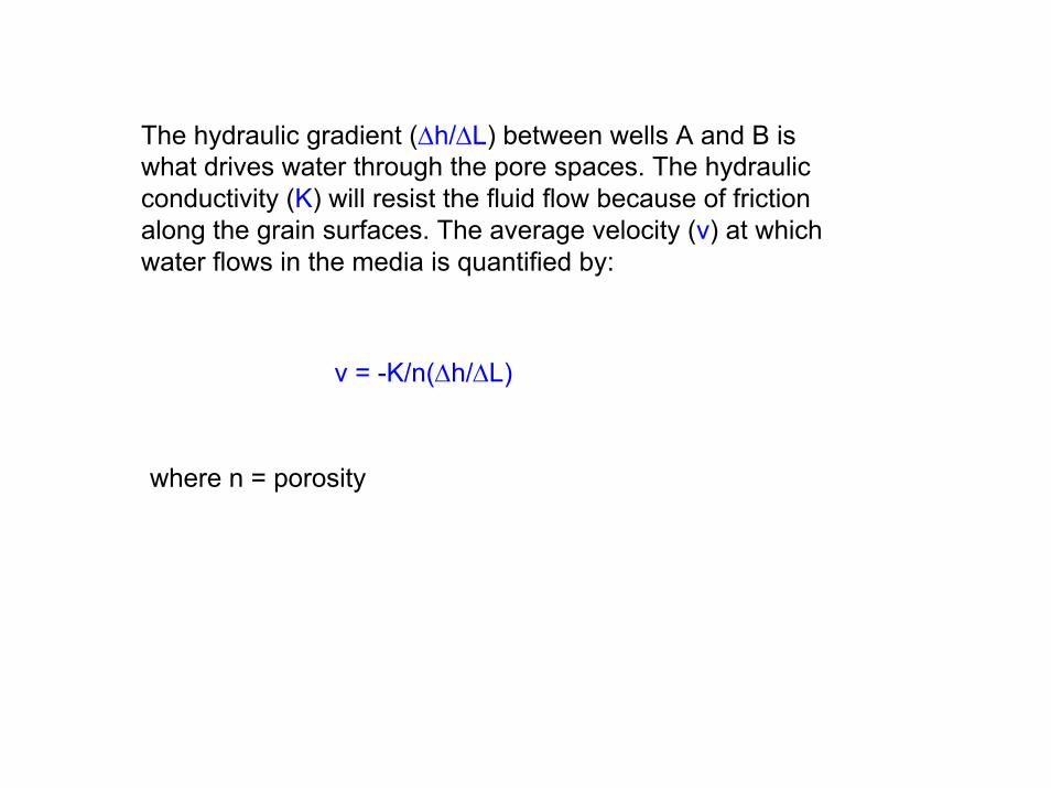
The hydraulic gradient (∆h/∆L) between wells A and B is what drives water through the pore spaces. The hydraulic conductivity (K) will resist the fluid flow because of friction along the grain surfaces. The average velocity (v) at which water flows in the media is quantified by:
v = -K/n(∆h/∆L)
where n = porosity
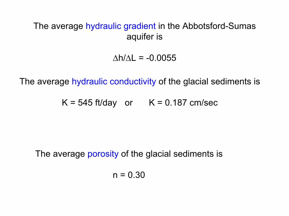
The average hydraulic gradient in the Abbotsford-Sumas aquifer is
∆h/∆L = -0.0055
The average hydraulic conductivity of the glacial sediments is
K = 545 ft/day or K = 0.187 cm/sec
The average porosity of the glacial sediments is
n = 0.30

The average pore-water velocity can be determined using Darcy’s Law
velocity = v = -K/n (∆h/∆L)
Using the aquifer parameters in the equation above yields
velocity = v = -545/0.30(-0.0055) = 10 ft/day
which is very fast for groundwater
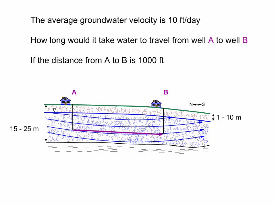
∆ N S
The average groundwater velocity is 10 ft/day
How long would it take water to travel from well A to well B
If the distance from A to B is 1000 ft
15 - 25 m
1 - 10 m
A B
∆ N S
15 - 25 m
1 - 10 m
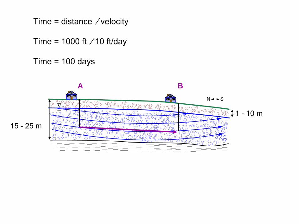
Time = distance ⁄ velocity
Time = 1000 ft ⁄ 10 ft/day
Time = 100 days
A B

∆ N S
15 - 25 m
If the aquifer were a fine sand with a hydraulic conductivity of5.45 ft/day……then the
Velocity = 0.10 ft/day
Time = 1000 ft ⁄ 0.10 ft/day
Time = 10,000 days or 27 years!!
1 - 10 m
A B

Why is this important?
∆ N S
15 - 25 m
1 - 10 m
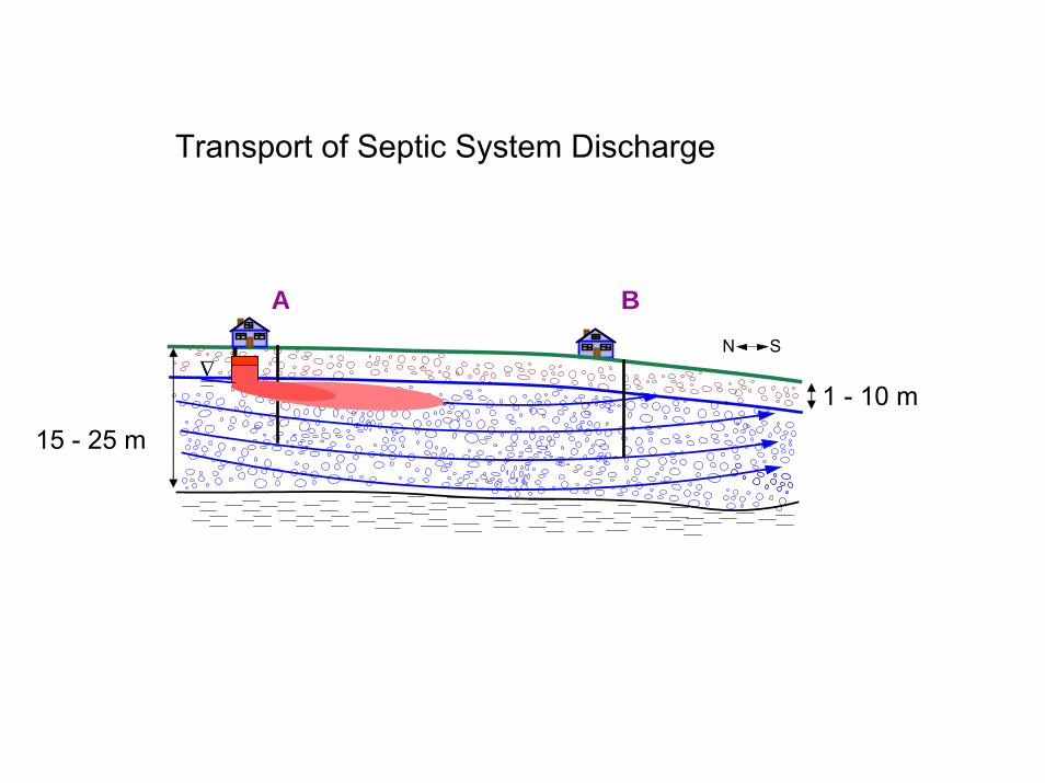
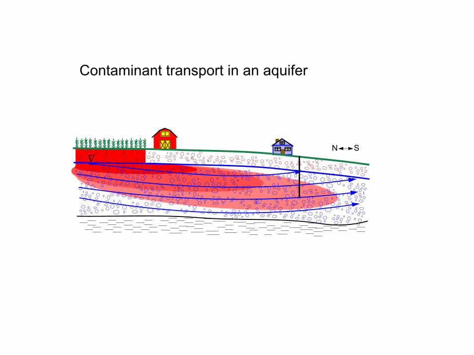
Transport of Septic System Discharge
A B
N S∆
Contaminant transport in an aquifer
∆
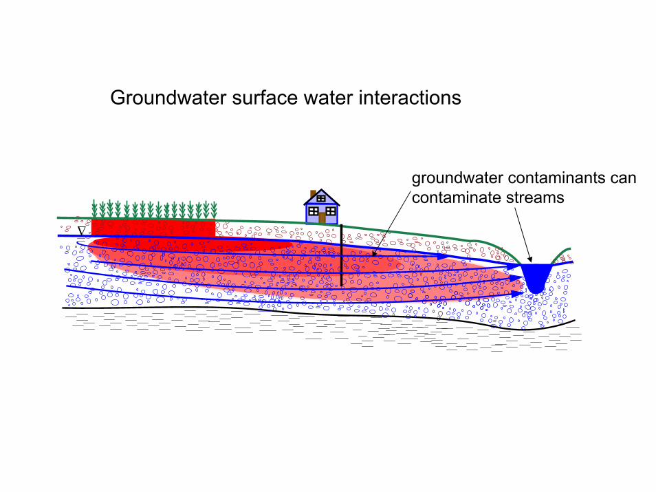
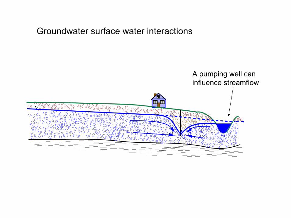
Groundwater surface water interactions
groundwater contaminants can contaminate streams
∆
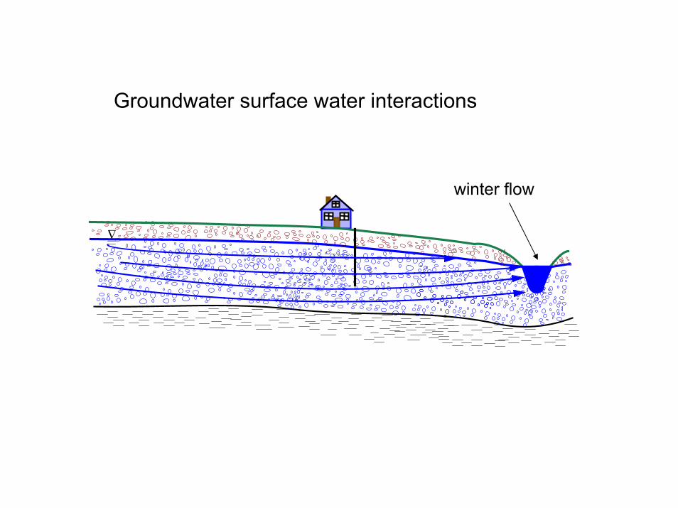
Groundwater surface water interactions
winter flow
∆
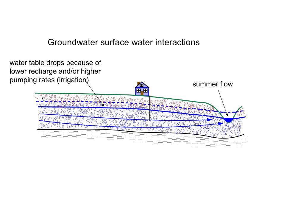
Groundwater surface water interactions
summer flow
water table drops because of lower recharge and/or higher pumping rates (irrigation)
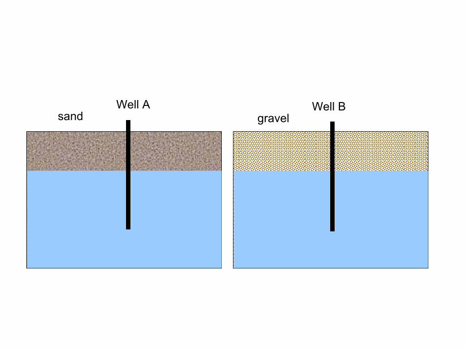
Well A Well Bsand gravel
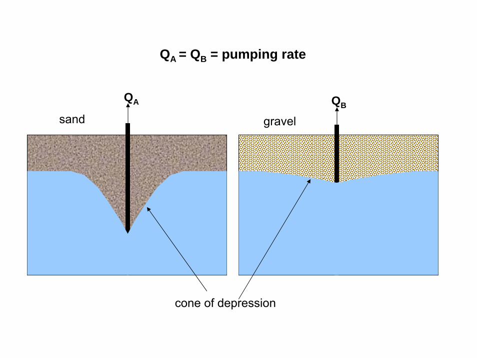
QA = QB = pumping rate
gravel
QA QB
cone of depression
sand
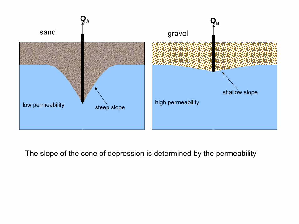
gravel
QBQA
steep slope
sand
low permeability high permeability
shallow slope
The slope of the cone of depression is determined by the permeability
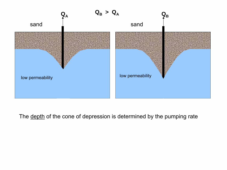
QB > QA
The depth of the cone of depression is determined by the pumping rate
sand
QA
low permeability
QB
sand
low permeability low permeability
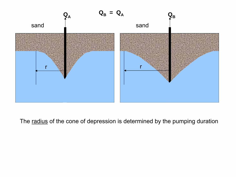
QB = QAQA
The radius of the cone of depression is determined by the pumping duration
sand sand
QB
low permeability
rr
∆
Groundwater surface water interactions
A pumping well can influence streamflow