phase i environmental assessment report - the … · phase i environmental assessment report...
TRANSCRIPT
Phase I Environmental Assessment Report Subject Property Located at 845 South Figueroa Street Los Angeles, California 90017
September 26, 2012 Project: 12-188 Prepared for: The State Bar of California 180 Howard Street
San Francisco, CA 94105 Prepared by: Proprietary Notice:
The report and its contents are PRIVILEGED AND CONFIDENTIAL INFORMATION. This document should not be duplicated or copied under any circumstances without the express permission of Waterstone Environmental, Inc. The purpose of the report is to allow the client listed above to evaluate the potential environmental liabilities at the Subject Property. Any unauthorized reuse of Waterstone Environmental Inc. reports or data will be at the unauthorized user’s sole risk and liability.
Waterstone Environmental, Inc. 2936 East Coronado Street Anaheim, California 92806 (714) 414-1122; Fax (714) 414-1166

Phase I Environmental Assessment Report Subject Property Located at 845 South Figueroa Street Los Angeles, California 90017
September 26, 2012 Project: 12-188 Prepared by:
Brianne Archer, P.E., REA Eric Smith, P.G., C.H.G. Senior Engineer Principal Hydrogeologist
Jeffrey Dagdigian, Ph.D. Managing Partner
Waterstone Environmental, Inc. 2936 East Coronado Street Anaheim, California 92806 (714) 414-1122; Fax (714) 414-1166

Table of Contents Section Pages
845 South Figueroa Street Phase I EA Waterstone Environmental, Inc. Los Angeles, CA i Project: 12-188
1.0 Introduction ........................................................................................................................1 1.1 Purpose .....................................................................................................................1 1.2 Scope of Work .........................................................................................................1 1.3 Limitations and Exceptions .....................................................................................2 1.4 Reliance ...................................................................................................................3 1.5 Proprietary Notice ....................................................................................................3
2.0 User Provided Information ...............................................................................................4 2.1 Reason for Performing the Phase I ESA ..................................................................4 2.2 Title Records, Liens, and Property Use Limitations ................................................4 2.3 Specialized Knowledge, Commonly Known & Degree of Obviousness ................4 2.4 Value Reduction for Environmental Issues .............................................................5
3.0 General Subject Property Characteristics ......................................................................6 3.1 Subject Property General Description .....................................................................6 3.2 Adjacent Properties ..................................................................................................6
4.0 Environmental Setting .......................................................................................................8 4.1 Regional Setting .......................................................................................................8 4.2 General Geologic Conditions ...................................................................................8 4.3 Groundwater Conditions ..........................................................................................8
5.0 Government Database Review ........................................................................................10 5.1 Government Databases Searched ...........................................................................10 5.2 Subject Property Summary ....................................................................................15 5.3 Surrounding Properties Summary ..........................................................................15
6.0 Historical Document Review ...........................................................................................20 6.1 Proprietary Document Review ...............................................................................20 6.2 Local Agency Records Review ..............................................................................24
6.2.1 Local Agencies ................................................................................................................. 24 6.3 Review of Previous Environmental Documents ....................................................25 6.4 Summary of Subject Property and Vicinity History/Land Use .............................26
7.0 Subject Property Inspection Observations ....................................................................28 7.1 Personnel Interviews ..............................................................................................28 7.2 Subject Property Inspection Observations .............................................................28
7.2.1 Historical Materials of Concern ........................................................................................ 29 7.2.2 Utilities ............................................................................................................................. 30 7.2.3 Oil and Gas Wells and Pipelines ....................................................................................... 31 7.2.4 Public Water Wells ........................................................................................................... 31 7.2.5 Sensitive Environmental Receptors .................................................................................. 31 7.2.6 Radon ................................................................................................................................ 31 7.2.7 Mold.................................................................................................................................. 32

Table of Contents Section Pages
845 South Figueroa Street Phase I EA Waterstone Environmental, Inc. Los Angeles, CA ii Project: 12-188
7.2.8 Engineering Controls ........................................................................................................ 32 7.3 Neighboring Property Inspection Observations .....................................................32
8.0 Summary and Conclusions .............................................................................................33 8.1 Summary ................................................................................................................33 8.2 Findings and Conclusions ......................................................................................35
8.2.1 Potential Subject Property Issues ...................................................................................... 35 8.2.2 Potential Off-Site Property Issues ..................................................................................... 35
8.3 Recommendations ..................................................................................................35
9.0 References .........................................................................................................................36 Figures
1 Subject Property Location Map 2 Subject Property Vicinity Map
Appendices
A Lien Report B Radius Map Report C Sanborn Map Report D Aerial Photographs E Topographic Map Report F City Directory G Agency Documentation H Property Documentation I Subject Property Photographs

845 South Figueroa Street Phase I EA Waterstone Environmental, Inc. Los Angeles, CA 1 Project: 12-188
Section 1.0 Introduction
1.1 Purpose Waterstone Environmental, Inc. (“Waterstone”) has been retained by Jarrett Fugh, Esq. of Duane Morris LLP to prepare a Phase I Environmental Site Assessment (“Phase I”) for the property located at 845 South Figueroa Street in the City of Los Angeles, California (“Subject Property,” see Figure 1), on behalf of the State Bar of California. The Subject Property is currently occupied by a five-story commercial building with a subterranean parking level. The purpose of this environmental assessment is to identify Recognized Environmental Conditions (“REC”) for the Subject Property. This assessment was conducted utilizing generally accepted Phase I industry standards in accordance with the American Society of Testing and Materials (“ASTM”) Standard E 1527-05 – Phase I Environmental Site Assessment Process and All Appropriate Inquiry (“AAI”). For the purpose of this report, and as defined by the ASTM, a REC is “the presence or likely presence of any hazardous substance or petroleum products on a property under conditions that indicate an existing release, a past release, or a material threat of a release of any hazardous substance or petroleum products into the structure, on the property, or into the ground, groundwater, or surface water of the property.” The work was conducted pursuant to authorization to proceed with the project by Mr. Jarrett Fugh, Esq. of Duane Morris LLP. 1.2 Scope of Work The following scope of work was performed to accomplish the Phase I objectives:
Visual Inspection - A visual evaluation of the Subject Property was conducted in readily accessible areas to identify RECs. Additionally, visual observations of adjoining properties were made from the vantage point of the Subject Property as well as from public right-of-ways to determine the potential impact of these sites on the Subject Property.
Subject Property Interview - Interviews were requested of individuals knowledgeable and familiar with the Subject Property.
Records Review - Available environmental reports, agency records, building department permits, Sanborn Maps and historical aerial photographs of the Subject Property and surrounding areas were reviewed.
Agency Document Review - Appropriate regulatory agencies were contacted for information regarding hazardous materials use, storage, and/or releases at the Subject Property.

Section 1.0 Introduction
845 South Figueroa Street Phase I EA Waterstone Environmental, Inc. Los Angeles, CA 2 Project: 12-188
Published Database Review - Published governmental agency databases were reviewed to identify properties within ASTM-specified radii of the Subject Property with a reported environmental concern or incident. Waterstone subcontracts the government agency database search to Environmental Data Resources, Inc. (“EDR”).
Additional Regulatory Review - Appropriate regulatory agencies were contacted and available records for properties that may negatively impact the Subject Property were reviewed.
Report Preparation - A summary report was prepared of the environmental assessment findings and conclusions.
Environmental Professional – All Subject Property inquiry was conducted by an environmental professional or under the supervision of an environmental professional.
Required Purchaser Activities – It is the responsibility of the purchaser to assess the purchase price compared to fair market value, conduct a search for environmental cleanup liens, inquire about commonly known or ascertainable information that may affect the environmental conditions of the Subject Property, and provide any specialized knowledge or experience as the landowner or grantee.
1.3 Limitations and Exceptions If topics are not explicitly discussed within this document, the reader should not assume those topics have been investigated. For example, physical testing, other than that specifically detailed in this document, was not performed. The work performed in conjunction with this study and data developed are intended as a description of available information on the dates and at the locations described. This report does not warrant against future operations or conditions, nor does it warrant against:
Operations which are not in evidence from visual observations or search of published agency records, or facts that were concealed, withheld, or not fully disclosed at the time the inspection was conducted.
Conditions that could only be determined by physical sampling or intrusive testing.
Conditions on locations other than the User-provided Subject Property address and/or legal parcel description.
This report is not intended to address, assess, or otherwise determine whether soil or groundwater contamination, waste emplacement, existing or threatened mold/fungus growth, asbestos containing building materials, and/or lead-based paint actually exists at the Subject Property. Such determination would require comprehensive subsurface exploration and/or other sampling activities, which were beyond the scope of service for this assessment. Additionally, this report does not serve as a comprehensive wetlands, mining, oil, pipeline, and/or gas well survey. This report summarizes an environmental investigation conducted for the Subject Property. Although conditions at neighboring properties may impact the Subject Property and, to the

Section 1.0 Introduction
845 South Figueroa Street Phase I EA Waterstone Environmental, Inc. Los Angeles, CA 3 Project: 12-188
extent they were identified, were included in the Subject Property evaluation, this report does not serve as an assessment of sites other than the Subject Property. 1.4 Reliance The Phase I Environmental Assessment was performed in accordance with a request by Jarrett Fugh, Esq. of Duane Morris LLP on behalf of the State Bar of California. The work was performed in accordance with the terms and conditions of the existing contract for the environmental evaluation of the Subject Property for the exclusive use of Duane Morris LLP and the State Bar of California, the “User.” These parties intends to rely upon this report as an assessment of the existing physical condition of the Subject Property for the purpose of deciding whether, and under what conditions, to proceed with a property refinance or acquisition. The aforementioned party may use and rely on this report provided that the parties agree to be bound by the same contractual terms and conditions imposed by aforementioned contract of engagement. Waterstone recommends that any authorized party intending to rely upon the report independently determine whether the scope of services meets their expectations for an acquisition transaction. Waterstone’s professional services were performed using that degree of care and skill ordinarily exercised, under similar circumstances, by reputable due-diligence professionals practicing in the Phase I Environmental Assessment due-diligence consulting field in this or similar localities at this time. No other warranty, expressed or implied, is made as to the professional opinions described in this report. Waterstone is not responsible or liable for any claims that are associated with the interpretation of the available information. Additionally, Waterstone is not responsible for any claims from third parties not associated with the User, unless this report is assigned in its entirety to a party acceptable to Waterstone. Note: Waterstone exercised the usual and customary professional care in its efforts to assess property environmental law/code/regulation compliance. However, it is beyond the scope of a Phase I Environmental Assessment to provide definitive and thorough opinions regarding environmental legal compliance. Due to the existence of literally thousands of laws, codes, and regulations pertaining to the environment, Waterstone does not represent that any observations in this Phase I Environmental Assessment are a complete and definitive opinion regarding regulatory compliance. Waterstone has based its assessment on prior Subject Property histories, interviews, a review of available records, and observations of activities during a physical site inspection. Some or all of this information has been reported to Waterstone from several sources. Waterstone has relied on this reported information and data without further verification or validation of its accuracy. 1.5 Proprietary Notice This document is confidential information and should not be duplicated or copied without the express permission of Waterstone Environmental, Inc. Any unauthorized reuse of Waterstone reports or data will be at the unauthorized user’s sole risk and liability.

845 South Figueroa Street Phase I EA Waterstone Environmental, Inc. Los Angeles, CA 4 Project: 12-188
Section 2.0 User Provided Information
Waterstone has performed this Phase I ESA for the State Bar of California under the request of Duane Morris LLP. As such, the State Bar of California is considered the “User” of the report, as defined under ASTM Standard Practice E 1527-05. In order to satisfy the requirements of AAI and to qualify for one of the Landowner Liability Protections (“LLPs”) offered by the Small Business Liability Relief and Brownfields Revitalization Act of 2001 (the “Brownfields Amendments”), the User must provide certain information regarding the history of the property, its use, and its purchase price. As part of this Phase I ESA, Waterstone requested certain information from the User. The information requested and associated responses are outlined in the remainder of this section of the report. 2.1 Reason for Performing the Phase I ESA Waterstone understands that this assessment was performed for the User to evaluate potential refinancing or purchase of the Subject Property. As such, this Phase I ESA was conducted in accordance with AAI in an effort to qualify for the innocent landowner, contiguous property owner, and bona fide prospective purchaser defense to CERCLA liability and performed as an appropriate risk management and due diligence standard for real estate transactions in accordance with general industry standards which include ASTM Standard E 1527-05. 2.2 Title Records, Liens, and Property Use Limitations A lien search was performed by Environmental Data Resources (EDR) and is included as Appendix A. No environmental liens or Activity Use Limitations (AULs) were reported in the lien search. Waterstone interviewed Mr. Steve Mazer of the State Bar of California regarding Subject Property usage. Mr. Mazer was not aware of any liens or property use limitations. Waterstone also requested the completion of a User Questionnaire. A copy of the User Questionnaire completed by Mr. Mazer is included as Appendix B. With reference to AULs that are in place on the Subject Property or that have been filed or recorded in a registry (40 CFR 312.26), the User has no knowledge of any AULs, such as engineering controls, land use restrictions or institutional controls that are in place at the Subject Property and/or have been filed or recorded in a registry under federal, tribal, state or local law. 2.3 Specialized Knowledge, Commonly Known & Degree of Obviousness With reference to specialized knowledge or experience of the person seeking to qualify for LLPs (40 CFR 312.28), Waterstone interviewed the User who stated he had no specialized knowledge
Section 2.0 User Provided Information
845 South Figueroa Street Phase I EA Waterstone Environmental, Inc. Los Angeles, CA 5 Project: 12-188
or experience related to the Subject Property or nearby properties other than the information Waterstone has provided in this Phase I report which Waterstone previously discussed with the User. With reference to commonly known or reasonably ascertainable information about the Subject Property (40 CFR 312.30), the User was not aware (other than the information Waterstone has provided in this Phase I report which Waterstone previously discussed with the User) of commonly known or reasonably ascertainable information about the Subject Property that would help the environmental professional to identify conditions indicative of releases or threatened releases, such as the historical past uses of the Subject Property:
1. Specific chemicals that are present or once were present at the Subject Property; 2. Spills or other chemical releases that have taken place at the Subject Property; and 3. Environmental cleanups that have taken place at the Subject Property.
With reference to the degree of obviousness of the presence or likely presence of contamination at the Subject Property, and the ability to detect the contamination by appropriate investigation (40 CFR 312.31), the User, based on knowledge and experience related to the Subject Property, was not aware of any obvious indicators that point to the presence or likely presence of contamination at the Subject Property other than the information Waterstone has provided in this Phase I report which Waterstone previously discussed with the User. Waterstone requested from the User any other specialized knowledge regarding the environmental conditions associated with the Subject Property. The User did not have any specialized knowledge of RECs or other conditions of environmental concern at the Subject Property other than the information Waterstone has provided in this Phase I report which Waterstone previously discussed with the User. 2.4 Value Reduction for Environmental Issues Waterstone interviewed the User regarding the relationship of the prospective purchase price to the fair market value of the Subject Property if it were not contaminated (40 CFR 312.29). The User indicated that, to his knowledge, the prospective purchase price for the Subject Property reasonably reflects its fair market value and has not been reduced due to contamination known or believed to be present.
845 South Figueroa Street Phase I EA Waterstone Environmental, Inc. Los Angeles, CA 6 Project: 12-188
Section 3.0 General Subject Property Characteristics
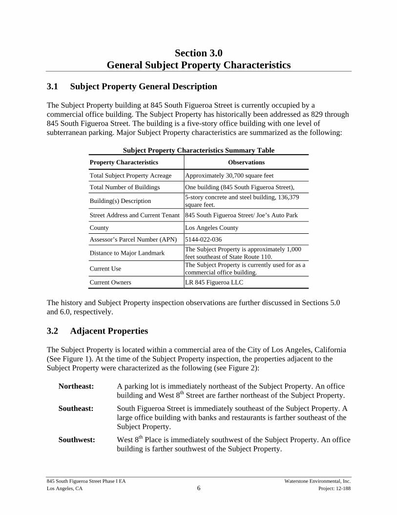
3.1 Subject Property General Description The Subject Property building at 845 South Figueroa Street is currently occupied by a commercial office building. The Subject Property has historically been addressed as 829 through 845 South Figueroa Street. The building is a five-story office building with one level of subterranean parking. Major Subject Property characteristics are summarized as the following:
Subject Property Characteristics Summary Table
Property Characteristics Observations
Total Subject Property Acreage Approximately 30,700 square feet
Total Number of Buildings One building (845 South Figueroa Street),
Building(s) Description 5-story concrete and steel building, 136,379 square feet.
Street Address and Current Tenant 845 South Figueroa Street/ Joe’s Auto Park
County Los Angeles County
Assessor’s Parcel Number (APN) 5144-022-036
Distance to Major Landmark The Subject Property is approximately 1,000 feet southeast of State Route 110.
Current Use The Subject Property is currently used for as a commercial office building.
Current Owners LR 845 Figueroa LLC
The history and Subject Property inspection observations are further discussed in Sections 5.0 and 6.0, respectively. 3.2 Adjacent Properties The Subject Property is located within a commercial area of the City of Los Angeles, California (See Figure 1). At the time of the Subject Property inspection, the properties adjacent to the Subject Property were characterized as the following (see Figure 2):
Northeast: A parking lot is immediately northeast of the Subject Property. An office building and West 8th Street are farther northeast of the Subject Property.
Southeast: South Figueroa Street is immediately southeast of the Subject Property. A large office building with banks and restaurants is farther southeast of the Subject Property.
Southwest: West 8th Place is immediately southwest of the Subject Property. An office building is farther southwest of the Subject Property.

Section 3.0 General Subject Property Characteristics
845 South Figueroa Street Phase I EA Waterstone Environmental, Inc. Los Angeles, CA 7 Project: 12-188
Northwest: A parking structure is immediately northwest of the Subject Property. Francisco Street is farther northwest of the Subject Property.
Figure 1 provides a Subject Property location map. Figure 2 provides a map of the Subject Property and vicinity.

845 South Figueroa Street Phase I EA Waterstone Environmental, Inc. Los Angeles, CA 8 Project: 12-188
Section 4.0 Environmental Setting
The following summarizes the general environmental setting of the Subject Property. 4.1 Regional Setting The Subject Property is situated near latitude 34.047100 (north) and longitude 118.262300 (west) at an approximate elevation of 256 feet above mean sea level. The topography of the Subject Property and vicinity is generally flat, but slopes gently to the south, as shown in the Los Angeles, California USGS Topographic Map. A topographic map is provided in the Physical Source Settings Summary section of the EDR Radius Map report. The Subject Property is not located within a 100-year or 500-year flood zone. 4.2 General Geologic Conditions The Subject Property is located in Los Angeles County, within the northwestern portion of the Peninsular Ranges geomorphic physiographic province of California. According to the California Department of Conservation, this area is described as follows:
The Peninsular Ranges is a series of ranges separated by northwest trending valleys, sub-parallel to faults branching from the San Andreas Fault. The trend of topography is similar to the Coast Ranges, but the geology is more like the Sierra Nevada, with granitic rock intruding the older metamorphic rocks. The Peninsular Ranges extend into lower California and are bound on the east by the Colorado Desert. The Los Angeles Basin and the island groups (Santa Catalina, Santa Barbara, and the distinctly terraced San Clemente and San Nicolas islands), together with the surrounding continental shelf (cut by deep submarine fault troughs), are included in this province.
No fault zones are identified on the Subject Property or within one-mile of the Subject Property in the EDR Report Physical Settings Source Summary. 4.3 Groundwater Conditions The Subject Property is located in Los Angeles County, within the Central Subbasin (4-11.04) of the Coastal Plain of Los Angeles Groundwater Basin. According to the California Department of Water Resources, this area is classified as:
The Central Subbasin occupies a large portion of the southeastern part of the Coastal Plain of Los Angeles Groundwater Basin. This subbasin is commonly referred to as the “Central Basin” and is bounded on the north by a surface divide called the La Brea High, and on the northeast and east by emergent less permeable Tertiary rocks of the Elysian, Repetto, Merced, and Puente Hills. The southeast boundary between the Central Basin and the Orange County Groundwater Basin roughly follows Coyote Creek, which is a regional drainage province boundary. The southwest boundary is formed by the Newport

Section 4.0 Environmental Setting
845 South Figueroa Street Phase I EA Waterstone Environmental, Inc. Los Angeles, CA 9 Project: 12-188
Inglewood fault system and the associated folded rocks of the Newport Inglewood uplift. The Los Angeles and San Gabriel Rivers drain inland basins and pass across the surface of the Central Basin on their way to the Pacific Ocean. Except for semi-perched aquifers, the aquifers in the Central Basin Pressure Area are confined and generally separated by fine grained aquicludes. These aquicludes are of varying lateral extent and composition and are absent in some areas where aquifers merge. Eight aquifers have been identified in this area including: the semi-perched and Gaspur Aquifers (Recent alluvium); Exposition / Artesia and Gage Aquifers (Lakewood formation); and Hollydale, Lynwood, Silverado, and Sunnyside Aquifers (San Pedro formation).
According to the EDR Report Physical Settings Source Summary, groundwater in the vicinity of the Subject Property is expected to flow to the south. Based on available groundwater reports for properties in the vicinity of the Subject Property, groundwater is approximately 35 to 40 feet below ground surface (bgs).

845 South Figueroa Street Phase I EA Waterstone Environmental, Inc. Los Angeles, CA 10 Project: 12-188
Section 5.0 Government Database Review
5.1 Government Databases Searched An investigation of the government environmental databases related to the Subject Property and the nearby area was conducted to identify potential RECs that may be recorded in government database systems or files. Properties that have or may have the potential for existing or future Subject Property contamination, environmental liabilities, or the potential for contamination migration to surrounding areas are listed in this report. The information pertaining to the sites on the regulatory databases was obtained from the EDR Radius Map with GeoCheck (See Appendix B) provided by EDR. The databases searched are detailed below. The results of the Subject Property and Surrounding Property listings are summarized in Sections 5.2 and 5.3, respectively. Federal Database Review National Priorities List The National Priorities List (NPL) is the Environmental Protection Agency’s database of uncontrolled or abandoned hazardous waste sites identified for priority remedial actions under the Superfund program. A site, to be included on the NPL, must either meet or surpass a predetermined hazard ranking system score, or be chosen as a state’s top-priority site, or meet all three of the following criteria: 1) the US Department of Health and Human Services issues a health advisory recommending that people be removed from the site to avoid exposure; 2) EPA determines that the site represents a significant threat, and 3) EPA determines that the remedial action is more cost-effective than removal action. The ASTM-defined search radius for NPL sites is one mile from the Subject Property. Comprehensive Environmental Response Compensation Liability Information System The Comprehensive Environmental Response, Compensation, and Liability Information System (CERCLIS) list includes a list of properties/facilities, which are suspected or confirmed to have adversely impacted the environment. The list is comprehensive in that it includes all properties for which an allegation has been made regarding environmental contamination. The ASTM radius for CERCLIS is one mile from the Subject Property. CORRACTS The EPA maintains a database of RCRA facilities, which are undergoing corrective action. A corrective action order is issued pursuant to RCRA Section (h) when there has been a release of hazardous waste or constituents into the environment from a RCRA facility. The ASTM-defined radius for CORRACTS is one mile from the Subject Property.
Section 5.0 Government Database Review
845 South Figueroa Street Phase I EA Waterstone Environmental, Inc. Los Angeles, CA 11 Project: 12-188
Resource Conservation and Recovery Act The EPA’s Resource Conservation and Recovery Act (RCRA) program identifies and tracks hazardous waste from the point of generation to the point of disposal. The RCRA Facilities database is an EPA compilation of reporting facilities that generate, store, transport, treat or dispose of hazardous waste. However, the listing of a site as a hazardous waste generator does not necessarily indicate that a hazardous waste release has occurred or that contamination exists at that address. RCRA- Permitted Treatment, Storage, and Disposal (TSD) RCRA-TSD facilities are those that treat, store, and/or dispose of hazardous waste. The ASTM-defined search radius for this database is one-half mile from the Subject Property. RCRA- Large and Small Quantity Generators A RCRA small quantity generator (SQG) site generates at least 100 kilograms per month but less than 1,000 kilograms per month of non-acutely hazardous waste. A RCRA large quantity generator (LQG) generates at least 1,000 kilograms per month of non-acutely hazardous waste or one kilogram per month of acutely hazardous waste. The ASTM-defined search radius for this database is one-quarter mile from the Subject Property. Emergency Response Notification System The Emergency Response Notification System (ERNS) is a national database of information or reported releases of oil or hazardous substances. The database contains information from spill reports made to the federal authorities including the U.S. EPA, U.S. Coast Guard, and the U.S. Department of Transportation. The ASTM-defined search radius for this database is limited to the Subject Property. CONSENT Addresses listed in major legal settlements that establish responsibility and standards for cleanup at NPL (Superfund) sites are released periodically by United States District Courts after settlement by the parties to the litigation matters. The ASTM-defined search radius for this database is one mile from the Subject Property. RODs Records of Decision (RODs) documents mandate a permanent remedy at an NPL (Superfund) site containing technical and health information to aid the cleanup. The ASTM-defined search radius for this database is one mile from the Subject Property.

Section 5.0 Government Database Review
845 South Figueroa Street Phase I EA Waterstone Environmental, Inc. Los Angeles, CA 12 Project: 12-188
MINES The MINES database is a record of mine locations maintained by the United States Department of Labor, Mine Safety and Health Administration. The ASTM-defined search radius for this database is one-half mile from the Subject Property. Toxic Substances Control Act (TSCA) The TSCA database identifies manufacturers and importers of chemical substances included on the TSCA Chemical Substance Inventory list maintained by the Environmental Protection Agency. The ASTM-defined search radius for this database is limited to the Subject Property. State Database Review Annual Work-plan (AWP) The Annual Work-plan Database (AWP) includes sites on the state priority list (also referred to as the SPL). The ASTM-defined search radius for this database is one mile from the Subject Property. CAL-Sites (Formerly ASPIS) The Cal-Site database, formerly known as ASPIS, contains both known and potential hazardous substance sites identified by the California Department of Toxic Substances Control (DTSC). The ASTM-defined search radius for this database is one mile from the Subject Property. CHMIRS The California Hazardous Material Incident Report System (CHMIRS) contains information on reported hazardous incidents (i.e., accidental releases or spills) provided by the California office of Emergency Services. The ASTM-defined search radius for this database is limited to the Subject Property. CORTESE The Office of Environmental Protection, Office of Hazardous Materials publishes a listing of confirmed hazardous waste sites based on input from several databases, including: 1) CALSITES - Department of Toxic Substances Control, Abandoned Sites Program Information Systems, 2) SARA Title III Section III Toxic Chemicals Release Inventory, 3) FINDS, 4) HWIS - Department of Toxic Substances Control, Hazardous Waste Information System, 5) State Water Resources Control Board, 6) Integrated Waste Management Control Board, 7) Air Resources Board, 8) RWQCB - Leaking Underground Storage Tanks, 9) RWQCB - Underground Storage Tanks, 10) Update Rule (Chemical Manufacturers), 11) Waste Board, 12) Waste Discharge System, and 13) Department of Toxic Substances Control Docket. The ASTM-defined search radius for this database is one mile from the Subject Property.

Section 5.0 Government Database Review
845 South Figueroa Street Phase I EA Waterstone Environmental, Inc. Los Angeles, CA 13 Project: 12-188
Notify 65 Notify 65 records, assembled from the State Water Resources Control Board’s Proposition 65 database, contain facility notifications about any release that could impact drinking water and thereby expose the public to potential health risk. The ASTM-defined search radius for this database is one mile from the Subject Property. Toxic Pits The Toxic Pits Database identifies sites suspected of containing hazardous substances where cleanup has not yet been completed. The ASTM-defined search radius for this database is one mile from the Subject Property. State Landfill (SWF/LF) Solid Waste Information System records typically contain an inventory of solid waste disposal facilities or landfills (SWF/LF) that may be active or inactive facilities or open dumps that failed to meet RCRA Section 4004 criteria for solid waste landfills or disposal sites. The ASTM-defined search radius for this database is one-half mile from the Subject Property. WMUDS/SWAT The Waste Management Unit Database System (WMUDS) is used for program tracking and inventory of waste management units and is provided by the State Water Resources Control Board. The ASTM-defined search radius for this database is one-half mile from the Subject Property. Bond Expenditure Plan (BEP) The site-specific Bond Expenditure Plan (BEP) listing was compiled by the Department of Health Services as the basis for an appropriation of Hazardous Substance Cleanup Bond Act Funds and is not updated. The ASTM-defined search radius for this database is one mile from the Subject Property. Registered Underground Storage Tanks Underground storage tanks are regulated under Subtitle 1 of the Resource Conservation and Recovery Act (RCRA). The risk commonly associated with UST sites is based on a possible release of a hazardous substance/waste from underground storage tanks or containers. The primary concerns related to USTs are the potential migration of contamination that could impact the Subject Property soil, groundwater, and/or potable water supply. The ASTM-defined search radius for this database is one-quarter mile from the Subject Property.

Section 5.0 Government Database Review
845 South Figueroa Street Phase I EA Waterstone Environmental, Inc. Los Angeles, CA 14 Project: 12-188
Leaking Underground Storage Tank Incident Report Leaking underground storage tank records contain an inventory of reported leaking underground storage tank incidents. The ASTM-defined search radius for this database is one-half mile from the Subject Property. California SLIC Database This database is derived from the California Regional Water Quality Control Board’s list of spills, leaks, investigations and/or cleanup (SLIC) sites. The ASTM-defined search radius for this database is one-half mile from the Subject Property. Voluntary Cleanup Program (VCP) The Voluntary Cleanup Program (VCP) database includes low threat level properties with either confirmed or unconfirmed releases where the project proponents have requested that the DTSC oversee investigation and/or cleanup activities and have agreed to provide funding for DTSC activities. The ASTM-defined search radius for this database is one-half mile from the Subject Property. Emissions Inventory Data (EMI) The Emissions Inventory Data (EMI) database contains toxics and criteria pollutant emissions data collected by the Air Resources Board and local air pollution agencies. The ASTM-defined search radius for this database is limited to the Subject Property. ENVIROSTOR The Department of Toxic Substances Control’s (DTSC’s) Site Mitigation and Brownfields Reuse Program’s (SMBRP’s) EnviroStor database identifies sites that have known contamination or sites for which there may be reasons to investigate further. The ASTM-defined search radius for this database is one mile from the Subject Property. Surrounding Property Unique Local, Supplemental, and/or Proprietary Databases DRYCLEANERS The Drycleaners database contains a listing of dry cleaning-related facilities with EPA identification numbers and includes power laundries, garment pressing, dry cleaning plants, upholstery cleaning, and similar service locations. The ASTM-defined search radius for this database is one-quarter mile from the Subject Property.
Section 5.0 Government Database Review
845 South Figueroa Street Phase I EA Waterstone Environmental, Inc. Los Angeles, CA 15 Project: 12-188
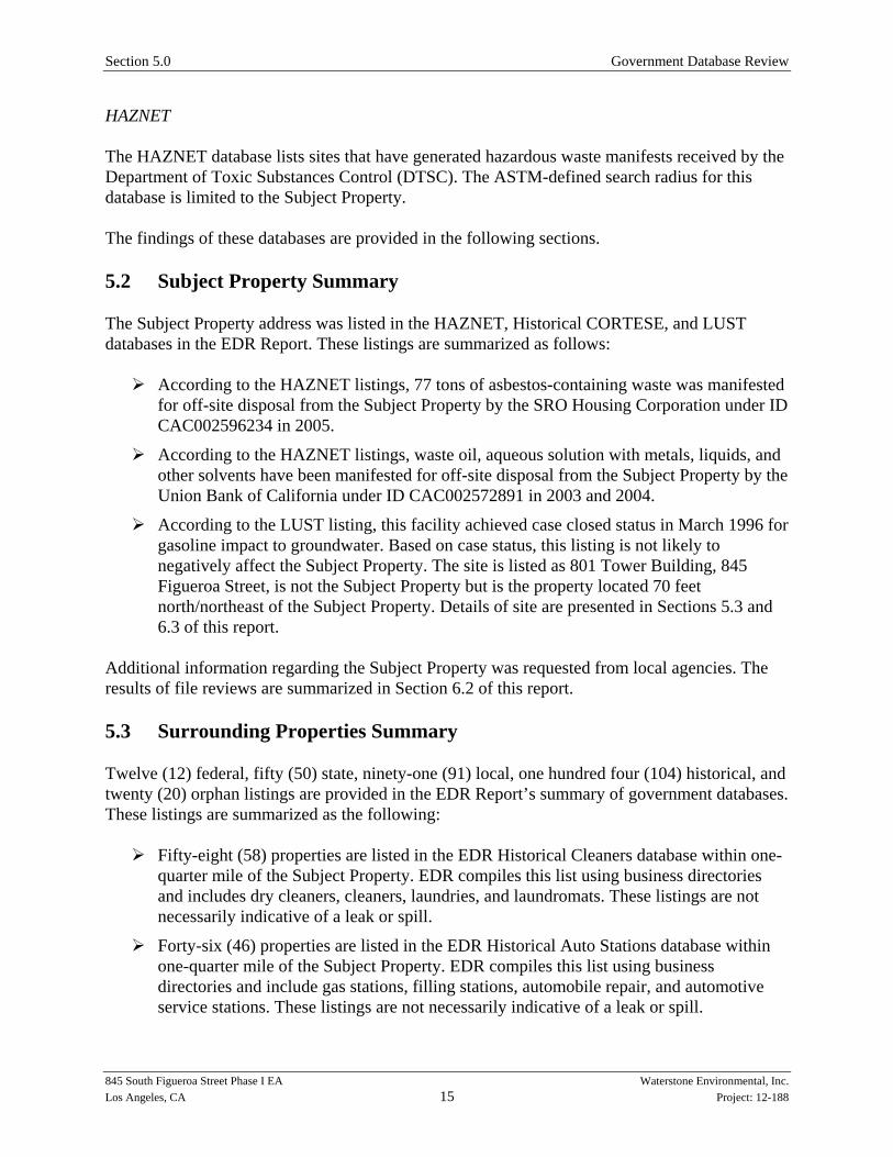
HAZNET The HAZNET database lists sites that have generated hazardous waste manifests received by the Department of Toxic Substances Control (DTSC). The ASTM-defined search radius for this database is limited to the Subject Property. The findings of these databases are provided in the following sections. 5.2 Subject Property Summary The Subject Property address was listed in the HAZNET, Historical CORTESE, and LUST databases in the EDR Report. These listings are summarized as follows:
According to the HAZNET listings, 77 tons of asbestos-containing waste was manifested for off-site disposal from the Subject Property by the SRO Housing Corporation under ID CAC002596234 in 2005.
According to the HAZNET listings, waste oil, aqueous solution with metals, liquids, and other solvents have been manifested for off-site disposal from the Subject Property by the Union Bank of California under ID CAC002572891 in 2003 and 2004.
According to the LUST listing, this facility achieved case closed status in March 1996 for gasoline impact to groundwater. Based on case status, this listing is not likely to negatively affect the Subject Property. The site is listed as 801 Tower Building, 845 Figueroa Street, is not the Subject Property but is the property located 70 feet north/northeast of the Subject Property. Details of site are presented in Sections 5.3 and 6.3 of this report.
Additional information regarding the Subject Property was requested from local agencies. The results of file reviews are summarized in Section 6.2 of this report. 5.3 Surrounding Properties Summary Twelve (12) federal, fifty (50) state, ninety-one (91) local, one hundred four (104) historical, and twenty (20) orphan listings are provided in the EDR Report’s summary of government databases. These listings are summarized as the following:
Fifty-eight (58) properties are listed in the EDR Historical Cleaners database within one-quarter mile of the Subject Property. EDR compiles this list using business directories and includes dry cleaners, cleaners, laundries, and laundromats. These listings are not necessarily indicative of a leak or spill.
Forty-six (46) properties are listed in the EDR Historical Auto Stations database within one-quarter mile of the Subject Property. EDR compiles this list using business directories and include gas stations, filling stations, automobile repair, and automotive service stations. These listings are not necessarily indicative of a leak or spill.
Section 5.0 Government Database Review
845 South Figueroa Street Phase I EA Waterstone Environmental, Inc. Los Angeles, CA 16 Project: 12-188
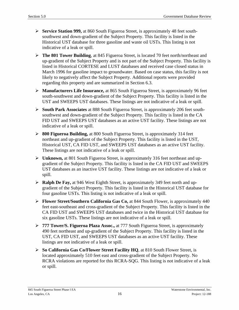
Service Station 999, at 860 South Figueroa Street, is approximately 48 feet south-southwest and down-gradient of the Subject Property. This facility is listed in the Historical UST database for three gasoline and waste oil USTs. This listing is not indicative of a leak or spill.
The 801 Tower Building, at 845 Figueroa Street, is located 70 feet north/northeast and up-gradient of the Subject Property and is not part of the Subject Property. This facility is listed in Historical CORTESE and LUST databases and received case closed status in March 1996 for gasoline impact to groundwater. Based on case status, this facility is not likely to negatively affect the Subject Property. Additional reports were provided regarding this property and are summarized in Section 6.3.
Manufacturers Life Insurance, at 865 South Figueroa Street, is approximately 96 feet south-southwest and down-gradient of the Subject Property. This facility is listed in the UST and SWEEPS UST databases. These listings are not indicative of a leak or spill.
South Park Associates at 888 South Figueroa Street, is approximately 206 feet south-southwest and down-gradient of the Subject Property. This facility is listed in the CA FID UST and SWEEPS UST databases as an active UST facility. These listings are not indicative of a leak or spill.
800 Figueroa Building, at 800 South Figueroa Street, is approximately 314 feet northeast and up-gradient of the Subject Property. This facility is listed in the UST, Historical UST, CA FID UST, and SWEEPS UST databases as an active UST facility. These listings are not indicative of a leak or spill.
Unknown, at 801 South Figueroa Street, is approximately 316 feet northeast and up-gradient of the Subject Property. This facility is listed in the CA FID UST and SWEEPS UST databases as an inactive UST facility. These listings are not indicative of a leak or spill.
Ralph De Fay, at 946 West Eighth Street, is approximately 349 feet north and up-gradient of the Subject Property. This facility is listed in the Historical UST database for four gasoline USTs. This listing is not indicative of a leak or spill.
Flower Street/Southern California Gas Co, at 844 South Flower, is approximately 440 feet east-southeast and cross-gradient of the Subject Property. This facility is listed in the CA FID UST and SWEEPS UST databases and twice in the Historical UST database for six gasoline USTs. These listings are not indicative of a leak or spill.
777 Tower/S. Figueroa Plaza Assoc., at 777 South Figueroa Street, is approximately 490 feet northeast and up-gradient of the Subject Property. This facility is listed in the UST, CA FID UST, and SWEEPS UST databases as an active UST facility. These listings are not indicative of a leak or spill.
So California Gas Co/Flower Street Facility HQ, at 810 South Flower Street, is located approximately 510 feet east and cross-gradient of the Subject Property. No RCRA violations are reported for this RCRA-SQG. This listing is not indicative of a leak or spill.

Section 5.0 Government Database Review
845 South Figueroa Street Phase I EA Waterstone Environmental, Inc. Los Angeles, CA 17 Project: 12-188
Downtown One Hour Photo, at 951 South Figueroa, is located approximately 576 feet southwest and down-gradient of the Subject Property. No RCRA violations are reported for this RCRA-SQG. This listing is not indicative of a leak or spill.
The Salvation Army, at 900 West 9th Street, is approximately 773 feet west and cross-gradient of the Subject Property. This facility is listed in the CA FID UST and SWEEPS UST databases as an inactive UST facility. These listings are not indicative of a leak or spill.
Eight (8) facilities located between one-eighth and one-quarter mile are listed in the RCRA-SQG database. No RCRA violations are reported for these facilities. These listings are not indicative of leaks or spills.
Thirty (30) facilities located between one-eighth and one-quarter mile are listed in AST or UST databases. These facilities are not listed in any leak or spill databases.
Fifteen (15) facilities are located between one-eighth and one-half mile down or cross--gradient of the Subject Property and listed in the SLIC, LUST, or Historical CORTESE databases, indicating a leak or a spill. Based on distance, case status, and/or groundwater flow direction, these facilities are not likely to negatively affect the Subject Property.
Seven (7) facilities are listed in the Envirostor database as Tiered Permit facilities and are located between one-quarter mile and one mile down or cross-gradient of the Subject Property. Based on distance and groundwater flow direction, these facilities are not likely to negatively affect the Subject Property.
Eight (8) facilities are located between one-quarter mile and one mile from the Subject Property and are listed in the Envirostor database as a school investigation or clean-up site. Based on case status and distance, these facilities are not likely to negatively affect the Subject Property.
Democratic National Convention – Staples Center, at 1111 South Figueroa Street, is located approximately 0.29 miles southwest and down-gradient of the Subject Property. This facility is listed in the CERCLIS database as a removal only site with no site assessment work needed to track counter-terrorism actions for the Democratic National Convention. Based on case status and groundwater flow direction, this facility is not likely to negatively affect the Subject Property.
Hertz Rent-a-Car (Former), at 1055 West 7th Street, is approximately 0.31 miles northeast and up-gradient of the Subject Property. This facility is listed in the LUST database and received case closed status in June 1997 for gasoline impact to groundwater. Based on case status, this facility is not likely to negatively affect the Subject Property.
Nakano International Corp., at 1111 West Wilshire Boulevard, is approximately 0.36 miles north and up-gradient of the Subject Property. According to the EDR Report, this facility is listed in the Historical CORTESE and LUST databases. According to the LUST listing, this facility is listed in the LUST database and received case closed status in May 1998 for gasoline impact to groundwater. Based on case status, this facility is not likely to negatively affect the Subject Property.

Section 5.0 Government Database Review
845 South Figueroa Street Phase I EA Waterstone Environmental, Inc. Los Angeles, CA 18 Project: 12-188
Good Samaritan Hospital, at 1102 6th Street, is approximately 0.40 miles north and up-gradient of the Subject Property. According to the EDR Report, this facility is listed in the Historical CORTESE and LUST databases. According to the LUST listing, this facility is undergoing verification monitoring for solvent impact to groundwater. Additional information was requested from local agencies from this facility and the results of file reviews are discussed in Section 6.2.
Office Building, at 1136 West 6th Street, is approximately 0.40 miles north and up-gradient of the Subject Property. This facility is listed in the LUST database and received case closed status in September 2011 for heating oil impact to soil. Based on case status, distance, and the limited media impacted, this facility is not likely to negatively affect the Subject Property.
Platt Corporation (Former), at 1000 West 6th Street, is located approximately 0.40 miles north-northeast and up-gradient of the Subject Property. According to the LUST listing, this facility was granted case closed status in 1997 by the local agency for gasoline impact to groundwater. Based on case status and distance, this facility is not likely to negatively affect the Subject Property.
Good Samaritan Hospital, at 637 Lucas Avenue, is located approximately 0.41 miles north-northwest and up-gradient of the Subject Property. According to the LUST listing, this facility is undergoing site assessment for solvent impact to groundwater. Based on distance, this facility is not likely to negatively affect the Subject Property.
Unocal (Evangeline Site), at 1005 6th Street, is located approximately 0.42 miles north-northeast and up-gradient of the Subject Property. According to the EDR Report, this facility is listed in the Historical CORTESE and LUST databases. According to the LUST listing, this facility was granted case closed status in 1998 by the local agency for gasoline impact to the local aquifer. Based on case status and distance, this facility is not likely to negatively affect the Subject Property.
Kirk-Rich Dials, at 404 West 7th Street, is located approximately 0.43 miles east-southeast and cross-gradient of the Subject Property. According to the EDR Report, this facility is listed in the CERCLIS database as a potential radium contamination site and was cleaned up and removed in 2005. Based on case status and distance, this facility is not likely to negatively affect the Subject Property.
Hospital of the Good Samaritan, at 1245 Wilshire Boulevard, is located approximately 0.44 miles north-northwest and up-gradient of the Subject Property. According to the EDR Report, this facility is listed in the Historical CORTESE and LUST databases. According to the LUST listing, this facility received case closed status in September 1996 for gasoline impact to groundwater. Based on case status, this facility is not likely to negatively affect the Subject Property.
Unique Premium Metals, Inc., at 640 South Hill Street, is located approximately 0.48 miles east and cross-gradient of the Subject Property. This facility is listed in the HWP database as a precious metal recycler. Based on distance and groundwater flow direction, this facility is not likely to negatively affect the Subject Property.

Section 5.0 Government Database Review
845 South Figueroa Street Phase I EA Waterstone Environmental, Inc. Los Angeles, CA 19 Project: 12-188
Jeffries Banknote Company, at 1330 West Pico Boulevard, is located approximately 0.66 miles west-southwest and cross-gradient of the Subject Property. This facility is listed in the ENVIROSTOR database as a past hazardous waste disposal inventory site. Based on distance and groundwater flow direction, this facility is not likely to negatively affect the Subject Property.
Johnson Bronze Company, at 1818 South Grand Avenue, is located approximately 0.94 miles south-southwest and down-gradient of the Subject Property. This facility is listed in the ENVIROSTOR database for a site characterization and assessment grant. Based on distance and groundwater flow direction, this facility is not likely to negatively affect the Subject Property.
Unmapped Sites (Orphan Properties)
o Due to poor or inadequate address information, twenty (20) sites were not detailed in the EDR Radius Map. Based on the address information provided and additional information determined by on-line sources, none of the orphan sites are located within one mile of the Subject Property.
Section 6.0 provides further discussion regarding the Subject Property and surrounding site use.

845 South Figueroa Street Phase I EA Waterstone Environmental, Inc. Los Angeles, CA 20 Project: 12-188
Section 6.0 Historical Document Review
To determine whether RECs exist for the Subject Property based on historical activities and/or operations at the Subject Property and/or a neighboring property, Waterstone conducted a review of historical documents, available local agency or departmental records, and available previous investigation reports. The following sections summarize the findings of these document reviews. 6.1 Proprietary Document Review Waterstone subcontracted the historical document search to EDR. The information searched and documents available are summarized as the following:
A search of the EDR Historic Map Collection was conducted for the Subject Property. The EDR Historic Map Collection is the largest and most extensive private collection of prior-use maps in the United States, with coverage ranging from 1867 through 1994. Sanborn Fire Insurance Maps from 1888, 1890, 1894, 1906, 1950, 1953, 1955, 1958, 1960, 1962, 1963, 1967, 1968, and 1970 were available for review. The Historical Maps Report is provided as Appendix C.
Historical aerial photographs of the Subject Property and surrounding area were obtained from EDR. Photographs from 1928, 1938, 1947, 1956, 1965, 1976, 1989, 1994, and 2005 were provided to and reviewed by Waterstone (See Appendix D). A review of the aerial photographs is provided in the table below.
Historical Topographic Maps of the Subject Property and surrounding area were obtained from EDR. Maps from 1900, 1901, 1902, 1928, 1966, 1972, 1981, and 1994 were provided to and reviewed by Waterstone (See Appendix E). A review of the Topographic Maps is provided in the table below.
City Directories have been published for many cities and towns across the United States since the 18th century. For each address within an area, City Directories list the name of each resident or, if a business operates from that address, the name and type of business. While the geographic coverage of City Directories is comprehensive for most major cities, many rural areas and small towns may not be included, and many towns and cities have discontinued the practice of issuing City Directories (See Appendix F). City Directory coverage was available for the area and is reviewed in the table below.

Section 6.0 Historical Document Review
845 South Figueroa Street Phase I EA Waterstone Environmental, Inc. Los Angeles, CA 21 Project: 12-188
Historical Sources Summary Table Date Observations Source
1888/ 1890/ 1894
Subject Property: Multiple parcels one of which is occupied by a residential dwelling are depicted within the Subject Property boundary. Surrounding Properties: Dwellings and vacant parcels are immediately northeast of the Subject Property. West 8th Street is farther northeast of the Subject Property. Pearl Street (currently Figueroa Street) is immediately southeast of the Subject Property. Dwellings are farther southeast of the Subject Property. Lincoln Street (currently 8th Place) is immediately southwest of the Subject Property. Dwellings are farther southwest of the Subject Property. Dwellings and vacant parcels are immediately northwest of the Subject Property. Moore Street (currently Francisco Street) is farther northwest of the Subject Property.
Sanborn Maps
1900/ 1901/ 1902
Due to map scale, specific details in this topographic map are difficult to discern. Subject Property: The Subject Property is located in a developed portion of downtown Los Angeles and individual structures are not depicted. Surrounding Properties: Surrounding properties are located in the densely developed downtown area of the City of Los Angeles.
Topographic Map
1906
Subject Property: Multiple parcels primarily occupied by residential dwellings are depicted within the Subject Property boundary. The southernmost parcel is occupied by the Fraternal Brotherhood Hall. Surrounding Properties: Surrounding properties appear generally similar to the previous Sanborn Maps. S. Pearl Street to the southeast of the Subject Property is now renamed Figueroa Street and Moore Street to the northwest of the Subject Property is now renamed Francisco Street. Lodgings and commercial businesses are located northeast of the Subject Property. A structure labeled as an undertaker is located southeast of the Subject Property. A structure labeled as “Bresee Bros. Undertakers” as well as a boarding house is located southwest of the Subject Property. Additional flats and an alley named Corydon Drive is located northwest of the Subject Property.
Sanborn Maps
1920-1929
Subject Property: The Fraternal Brotherhood Building and a church pastor are listed at 845 South Figueroa Street. Surrounding Properties: Residences and commercial businesses are listed in the vicinity of the Subject Property during this time period.
City Directories
1928
Subject Property: The Subject Property is depicted similarly to the previous topographic map. Surrounding Properties: Surrounding properties are depicted similarly to the previous topographic map.
Topographic Map
1928
Subject Property: One large building (likely the Fraternal Brotherhood Hall) is visible in the southwestern portion of the Subject Property. Several smaller buildings (likely dwellings) are visible in the northeastern portion of the Subject Property. Surrounding Properties: The vicinity of the Subject Property is densely developed with various structures during this time period. South Figueroa Street is southeast of the Subject Property. Eighth Place is southwest of the Subject Property. Several small buildings and Francisco Street are northwest of the Subject Property. Several large structures and West 8th Street are northeast of the Subject Property.
Aerial Photograph
1930-1939
Subject Property: Various businesses, social halls, and a church are listed at 845 South Figueroa Street. Surrounding Properties: Residences and commercial businesses are listed in the vicinity of the Subject Property during this time period.
City Directories
1938
Subject Property: The Subject Property appears generally similar to the previous aerial photograph. The northeastern portion of the Subject Property appears to be a parking lot. Surrounding Properties: Surrounding properties appear generally similar to the previous aerial photograph. The property northwest of the Subject Property appears to be vacant.
Aerial Photograph

Section 6.0 Historical Document Review
845 South Figueroa Street Phase I EA Waterstone Environmental, Inc. Los Angeles, CA 22 Project: 12-188
Historical Sources Summary Table Date Observations Source
1940-1949
Subject Property: The Berean Assembly Church, California College of Mortuary Services, and Homesteaders Life Assn. are listed at 845 South Figueroa Street. Surrounding Properties: Residences and commercial businesses are listed in the vicinity of the Subject Property during this time period.
City Directories
1947
Subject Property: The Subject Property appears generally similar to the previous aerial photograph. Surrounding Properties: Surrounding properties appear generally similar to the previous aerial photograph.
Aerial Photograph
1950-1959
Subject Property: No listings are available for the Subject Property. Surrounding Properties: Surrounding properties are listed similarly to the previous decade of listings.
City Directories
1950/ 1953/ 1955/ 1958/
Subject Property: The northwest portion of the Subject Property is occupied by an Auto Sales business. The southeast portion of the Subject Property is occupied by a structure identified as the LA Conservatory of Music and Arts. Surrounding Properties: Various commercial businesses including auto sales, auto storage, apartments, a garage, a post office, and parking with oil and gas storage are located north and northeast of the Subject Property. Various commercial businesses including auto sales, furniture and restaurants are located across Figueroa Street southeast of the Subject Property. Various commercial businesses including hotels, storage, apartments, restaurants, and a Catholic Youth Organization/Welfare Bureau are located across 8th Place (formerly Lincoln Street) southwest of the Subject Property. A parking lot is immediately northwest of the Subject Property.
Sanborn Maps
1956
Subject Property: The Subject Property appears generally similar to the previous aerial photograph. Surrounding Properties: Surrounding properties appear generally similar to the previous aerial photograph. A parking lot is immediately northwest of the Subject Property. The 110-Freeway is now visible northwest of the Subject Property.
Aerial Photograph
1960-1969
Subject Property: No listings are available for the Subject Property. Surrounding Properties: Surrounding properties are listed similarly to the previous decade of listings.
City Directories
1960/ 1962/ 1963/ 1967/ 1968
Subject Property: The Subject Property appears generally similar to the previous Sanborn Map. Surrounding Properties: Surrounding properties appear generally similar to the previous Sanborn Map. The Catholic Welfare Bureau to the southwest of the Subject Property was replaced by a parking lot on the 1962 map. A Pacific Telephone Mobile Service Center and furniture storage business are immediately north of the Subject Property where auto storage previously existed starting on the 1960 map. In 1967, commercial businesses to the northeast of the Subject Property include City National Bank, garages, parking, and apartments.
Sanborn Maps
1965 Subject Property: The Subject Property appears to be entirely occupied by a parking lot. Surrounding Properties: Surrounding properties appear generally similar to the previous aerial photograph.
Aerial Photograph
1966
Subject Property: The Subject Property is depicted similarly to the previous topographic map. Surrounding Properties: Surrounding properties appear generally similar to the previous topographic map. A post office is located northeast of the Subject Property.
Topographic Map
1971-1979
Subject Property: Commercial offices, including banking, mortgage, shipping, electronic equipment, and architectural offices are listed at 845 South Figueroa Street. Surrounding Properties: Surrounding properties are listed similarly to the previous decade of listings.
City Directories
Section 6.0 Historical Document Review
845 South Figueroa Street Phase I EA Waterstone Environmental, Inc. Los Angeles, CA 23 Project: 12-188
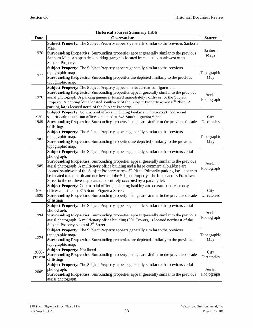
Historical Sources Summary Table Date Observations Source
1970
Subject Property: The Subject Property appears generally similar to the previous Sanborn Map. Surrounding Properties: Surrounding properties appear generally similar to the previous Sanborn Map. An open deck parking garage is located immediately northwest of the Subject Property.
Sanborn Maps
1972
Subject Property: The Subject Property appears generally similar to the previous topographic map. Surrounding Properties: Surrounding properties are depicted similarly to the previous topographic map.
Topographic Map
1976
Subject Property: The Subject Property appears in its current configuration. Surrounding Properties: Surrounding properties appear generally similar to the previous aerial photograph. A parking garage is located immediately northwest of the Subject Property. A parking lot is located southwest of the Subject Property across 8th Place. A parking lot is located north of the Subject Property.
Aerial Photograph
1980-1989
Subject Property: Commercial offices, including banking, management, and social security administration offices are listed at 845 South Figueroa Street. Surrounding Properties: Surrounding property listings are similar to the previous decade of listings.
City Directories
1981
Subject Property: The Subject Property appears generally similar to the previous topographic map. Surrounding Properties: Surrounding properties are depicted similarly to the previous topographic map.
Topographic Map
1989
Subject Property: The Subject Property appears generally similar to the previous aerial photograph. Surrounding Properties: Surrounding properties appear generally similar to the previous aerial photograph. A multi-story office building and a large commercial building are located southwest of the Subject Property across 8th Place. Primarily parking lots appear to be located to the north and northwest of the Subject Property. The block across Francisco Street to the northwest appears to be entirely occupied by a parking lot.
Aerial Photograph
1990-1999
Subject Property: Commercial offices, including banking and construction company offices are listed at 845 South Figueroa Street. Surrounding Properties: Surrounding property listings are similar to the previous decade of listings.
City Directories
1994
Subject Property: The Subject Property appears generally similar to the previous aerial photograph. Surrounding Properties: Surrounding properties appear generally similar to the previous aerial photograph. A multi-story office building (801 Towers) is located northeast of the Subject Property south of 8th Street.
Aerial Photograph
1994
Subject Property: The Subject Property appears generally similar to the previous topographic map. Surrounding Properties: Surrounding properties are depicted similarly to the previous topographic map.
Topographic Map
2000-present
Subject Property: Not listed Surrounding Properties: Surrounding property listings are similar to the previous decade of listings.
City Directories
2005
Subject Property: The Subject Property appears generally similar to the previous aerial photograph. Surrounding Properties: Surrounding properties appear generally similar to the previous aerial photograph.
Aerial Photograph

Section 6.0 Historical Document Review
845 South Figueroa Street Phase I EA Waterstone Environmental, Inc. Los Angeles, CA 24 Project: 12-188
6.2 Local Agency Records Review Based on the listings provided in the EDR report review of government databases, Waterstone submitted requests for file review at local agencies (See Appendix G). The agencies contacted and the results of file reviews are discussed in the following sections. 6.2.1 Local Agencies Based on the listings provided in the EDR report review of government databases, Waterstone submitted requests for information for the Subject Property at local agencies. According to files made available at state and local agencies, available records used to prepare this Phase I EA are listed on Table 1.
Local Agency Records Review Agency Subject Property Records Surrounding Property Records
City of Los Angeles Fire Department
The LAFD Underground Storage Tank has not yet responded to Waterstone’s request for information. The LAFD Hazardous Materials Division has no records for the Subject Property.
No records were requested for surrounding properties.
City of Los Angeles Building Department
Building permits for the Subject Property confirm the current office building was constructed in 1970. Certificates of Occupancy for a parking lot at 839 South Figueroa Street were issued in 1961. A Certificate of Occupancy was issued for a three-story music school at the Subject Property in 1949.
A four-story parking structure was constructed in 1970 and addressed as 845 South Figueroa Street; however, this is likely the parking structure immediately northwest of the Subject Property at 824 Francisco Street.
Los Angeles Industrial Waste Management Division
A permit was issued in 1976 for the discharge of recirculated water from air conditioning. The permit has been updated for change of ownership in 1980 and 1988. The permit was terminated in 1994.
Not reviewed.
Los Angeles Regional Water Quality Control Board (RWQCB), Los Angeles, California
The LARWQCB has not yet responded to Waterstone’s request for information.
A Review of RWQCB files was completed using the online Geotracker database. (http://geotracker.waterboards.ca.gov/). The results of these file reviews are summarized below.
California Department of Toxic Substances Control (DTSC), Glendale and Chatsworth Offices
The DTSC has no records for the Subject Property.
No records were requested for surrounding properties.
Pacific Bell, 1102 West 6th Street (approximately 0.40 miles north and up-gradient of the Subject Property)

Section 6.0 Historical Document Review
845 South Figueroa Street Phase I EA Waterstone Environmental, Inc. Los Angeles, CA 25 Project: 12-188
According to the 2011 Second Semi-Annual Groundwater Monitoring Report (prepared by Hydrologue, Inc. and dated November 29, 2011), soil and groundwater sampling has been conducted at this former hospital facility. Groundwater monitoring is being conducted at this facility. According to this report, groundwater contamination is delineated and exists completely within the Good Samaritan Hospital facility approximately 0.4 miles north of the Subject Property.
Based on distance, this facility is not likely to negatively affect the Subject Property. 6.3 Review of Previous Environmental Documents
Waterstone prepared a Phase I Environmental Assessment for the Subject Property for the current property owner in January 2012. At that time, Waterstone identified no Recognized Environmental Conditions for the Subject Property. As part of the January 2012 report, Waterstone reviewed three prior Phase I reports for the Subject Property and a Statement of Completion for Asbestos Abatement. A summary of these reports is provided below: ACT Inc., July 3, 2007, Statement of Completion for Asbestos Removal The site contact provided Waterstone with a copy of a Statement of Completion for Asbestos Removal prepared for the Subject Property by ACT Inc. and dated July 3, 2007. A copy of the asbestos abatement certification, which is for all asbestos removal except the roof materials, is provided as Appendix H Smith-Emery GeoServices, March 29, 2006, Phase I Environmental Site Assessment The site contact provided Waterstone with a copy of a Phase I ESA prepared for the Subject Property by Smith-Emergy GeoServices (SEG) and dated March 29, 2006. The results of the Phase I ESA are summarized as follows:
No Recognized Environmental Conditions were identified on the Subject Property.
Based on the age of the structure at the Subject Property, SEG recommended that an asbestos and lead survey be conducted prior to any renovation or demolition activities.
According to the SEG report, the 801 Towers Building, located northwest of the Subject Property, and the Subject Property are listed in the regulatory database as a site with a leaking gasoline UST. The Subject Property’s former tenant, Union Bank, was reported as a responsible party. No records of any USTs or hazardous materials storage were on file for the Subject Property at the City of Los Angeles Fire Department. According to SEG, the leak site likely originated from an adjacent site to the north (801 South Figueroa Street) which was formerly a gas station and garage. Two UST removal events occurred at the 801 South Figueroa Street property, one in 1990 and one in 1992. This report documents the removal, remedial actions (excavation) and post excavation confirmation sampling conducted associated with these USTs. During the 1990 removal a soil sample collected at the UST invert of the 500-gal UST at the time of removal indicated non-detect levels of total petroleum hydrocarbons (TPH) and for
Section 6.0 Historical Document Review
845 South Figueroa Street Phase I EA Waterstone Environmental, Inc. Los Angeles, CA 26 Project: 12-188
benzene, toluene, ethylbenzene and xylene (BTEX) compounds. At the 280-gal UST the soil sample collected at the UST invert contained a TPH concentration of 830 mg/kg (parts per million, ppm). Six borings conducted around the perimeter of the tank excavation indicated non-detect levels of TPH and BTEX in soil indicating the extent of impacted soil from the UST was limited. Eleven tons of soil was removed from the UST excavation to a depth of 15 feet. Confirmation sidewall and bottom samples were non-detect for TPH, TPH-gasoline range and BTEX compounds. The leak was reported in 1993 and closure was granted in 1996 by the RWQCB to the Subject Property and the adjacent property to the north, 801 South Figueroa Street. Based on the closure letter from the RWQCB, SEG did not considered this an item of concern. Based on the UST removal records discovered by SEG, Waterstone agrees with the opinion that leak site indicated in the LUST listing for the Subject Property likely originated from 801 South Figueroa Street and not the Subject Property. The Subject Property is listed in the regulatory database for handling of waste solvents by former tenant Union Bank. SEG states that no evidence of storage/use of hazardous chemicals, or conduits to the subsurface, was observed during site reconnaissance. Waterstone Environmental, Inc., May 7, 2004, Phase I Environmental Assessment Report Waterstone also prepared a Phase I ESA for Subject Property located at 845 Figueroa Street, Los Angeles. The results of the Phase I ESA indicated No Recognized Environmental Conditions were identified on the Subject Property. Applied Geosciences (Applied), February 6, 1991, Phase I Environmental Site Assessment A Phase I ESA was prepared by Applied Geosciences (Applied) dated February 6, 1991. Applied reported that LAFD records indicated a 420-gal UST containing fuel oil was installed November 1950 under the sidewalk on the north side of 8th Place, approximately 100 ft west of Figueroa Street. The UST was reported to have been used in connection with a hot water heating system owned by the Los Angeles Conservatory of Music and Arts. There were no records of tank removal/abandonment. Applied concluded that the previous building was demolished and the UST may have been removed during the construction of the current building in 1969. A geophysical survey was conducted by Subsurface Surveys in September 2004 to determine if the suspect UST was still present under the southern property boundary. The results indicated no presence of a suspect UST in the location indicated from former LAFD records as reported by Applied. 6.4 Summary of Subject Property and Vicinity History/Land Use Based on information provided by aerial photographs, Sanborn Maps, City Directories, and local building department records, the following historical uses and operations of the Site should be noted:
Section 6.0 Historical Document Review
845 South Figueroa Street Phase I EA Waterstone Environmental, Inc. Los Angeles, CA 27 Project: 12-188
The Site was developed on previously vacant or agricultural land prior to 1888. Two dwellings were present at the Subject Property in 1890. The Fraternal Brotherhood Hall and additional dwellings were constructed at the Subject Property between 1890 and 1906.
Various social halls, churches and a mortuary college occupied the property from 1906 through the 1940s. The LA Conservatory of Music and Arts occupied the southwestern portion of the Subject Property and an auto sales business occupied the northeastern portion of the Subject Property in 1949 through at least 1955. By 1958, the entire Subject Property was occupied by an auto sales business.
The current commercial office building was constructed at the Subject Property in 1970. Based on information provided by aerial photographs, Sanborn Maps, City Directories, an Environmental Data Resources, Inc. (EDR) Governmental Database Report, and local agency records, the following historical uses and operations of properties in the vicinity of the Site should be noted:
Dense residential development was completed in the vicinity of the Subject Property prior to 1888.
By the 1950s, the majority of the properties in the vicinity of the Site were occupied by commercial businesses, including hotels, offices, garages, and parking lots.
A closure letter for minor scattered hydrocarbon contamination at 801 South Figueroa Street and 845 South Figueroa Street from a leaking UST was issued by the RWQCB on March 4, 1996. The Subject Property tenant, US Bank, was identified as the responsible party for the event which was reported in 1993. No records of USTs were located for the Subject Property; however, there is record of two UST removal events which took place on the property at 801 South Figueroa Street. It is likely that the contamination originated from the property at 801 South Figueroa Street, which historically was occupied by a garage facility and oil and gas storage.

845 South Figueroa Street Phase I EA Waterstone Environmental, Inc. Los Angeles, CA 28 Project: 12-188
Section 7.0 Subject Property Inspection Observations
7.1 Personnel Interviews At the time of the Subject Property inspection, Waterstone interviewed the foreman of the current construction at the Subject Property and also spoke with Mr. Suhr and Mr. Mazer. Their responses are included throughout this report. 7.2 Subject Property Inspection Observations On September 19, 2012, Waterstone performed an inspection of the Subject Property and vicinity. Photographs are provided as Appendix I. At the time of the Subject Property inspection, the following was observed at the Subject Property:
Subject Property Feature Summary Table Feature / Characteristic Y/N Comments
Underground Storage Tanks (USTs) N
The Subject Property address is listed in the LUST database; however, based on documentation available for the LUST listing, no USTs were installed at the Subject Property.
Aboveground Storage Tanks (ASTs) N None observed.
Hazardous Chemicals (including petroleum and pesticides) N None observed.
Other or Unidentified Drums and Containers N None observed.
Septic Tanks N None observed.
Drainage Systems Y Grates were observed in the subterranean parking level at the Subject Property.
Sumps Y A sump pump is presumed to be present at the Subject Property due to the subterranean parking level.
Clarifiers N None observed. Hoists or Lifts N None observed. Dumping or Filling Activities N None observed. Vapor Intrusion N No evidence observed. Floor Drains N None observed. Materials Spills N None observed. Monitor/Supply/ Disposal Wells N None observed.
Odors N None noted. Air Emissions N No potential sources noted. Unusually Stained Pavement Or Flooring N None observed.
Pits, Ponds, Lagoons N None observed. Pools Of Liquid N None observed. Roads And Trails With No Apparent Purpose N None observed.
Stained Or Disturbed Soil N None observed.
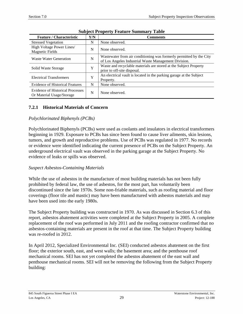
Section 7.0 Subject Property Inspection Observations
845 South Figueroa Street Phase I EA Waterstone Environmental, Inc. Los Angeles, CA 29 Project: 12-188
Subject Property Feature Summary Table Feature / Characteristic Y/N Comments
Stressed Vegetation N None observed. High Voltage Power Lines/ Magnetic Fields N None observed.
Waste Water Generation N Wastewater from air conditioning was formerly permitted by the City of Los Angeles Industrial Waste Management Division.
Solid Waste Storage Y Waste and recyclable materials are stored at the Subject Property prior to off-site disposal.
Electrical Transformers Y An electrical vault is located in the parking garage at the Subject Property.
Evidence of Historical Features N None observed. Evidence of Historical Processes Or Material Usage/Storage N None observed.
7.2.1 Historical Materials of Concern Polychlorinated Biphenyls (PCBs) Polychlorinated Biphenyls (PCBs) were used as coolants and insulators in electrical transformers beginning in 1929. Exposure to PCBs has since been found to cause liver ailments, skin lesions, tumors, and growth and reproductive problems. Use of PCBs was regulated in 1977. No records or evidence were identified indicating the current presence of PCBs on the Subject Property. An underground electrical vault was observed in the parking garage at the Subject Property. No evidence of leaks or spills was observed. Suspect Asbestos-Containing Materials While the use of asbestos in the manufacture of most building materials has not been fully prohibited by federal law, the use of asbestos, for the most part, has voluntarily been discontinued since the late 1970s. Some non-friable materials, such as roofing material and floor coverings (floor tile and mastic) may have been manufactured with asbestos materials and may have been used into the early 1980s. The Subject Property building was constructed in 1970. As was discussed in Section 6.3 of this report, asbestos abatement activities were completed at the Subject Property in 2005. A complete replacement of the roof was performed in July 2011 and the roofing contractor confirmed that no asbestos-containing materials are present in the roof at that time. The Subject Property building was re-roofed in 2012. In April 2012, Specialized Environmental Inc. (SEI) conducted asbestos abatement on the first floor; the exterior south, east, and west walls; the basement area; and the penthouse roof mechanical rooms. SEI has not yet completed the asbestos abatement of the east wall and penthouse mechanical rooms. SEI will not be removing the following from the Subject Property building:

Section 7.0 Subject Property Inspection Observations
845 South Figueroa Street Phase I EA Waterstone Environmental, Inc. Los Angeles, CA 30 Project: 12-188
Drywall in the penthouse mechanical rooms and fire proofing on structural beams and overspray. All areas will be stabilized and the materials will remain in good condition.
Asbestos-containing material on the western wall where no construction will take place during this project. All areas on the West wall where paint was removed has been stabilized and encapsulated.
Under the original concrete there are two 18” transite exhaust pipes buried under the parking areas in the basement. The pipes that were left in place are in good conditions and all sections that were cut out have been cut, capped and buried.
Lead-based Paint Lead was a major ingredient in paint pigment prior to and through the 1940s. While other pigments were used in the 1950s, the use of lead in paint continued until the mid 1970s. In 1978, the Consumer Products Safety Commission banned paint and other surface coating materials, which are lead-containing. The Subject Property building was constructed in 1970; therefore, it’s possible that lead-based paint was used during its construction and/or maintenance. Lead-based paint sampling was conducted prior to the 2012 renovation but lead was not detected at elevated concentrations. Lead in Drinking Water The USEPA sets drinking water standards and has determined that lead is a health concern at certain exposure levels. Materials that contain lead have frequently been used in the construction of water supply distribution systems, and plumbing systems in private home and other buildings. The most commonly found materials include service lines, pipes, brass and bronze fixtures, and solders and fluxes. Lead in these materials can contaminate drinking water as a result of the corrosion that takes place when water comes into contact with those materials. EPA’s national primary drinking water regulations requires all public water systems to optimize corrosion control to minimize lead contamination results from the corrosion of plumbing materials. EPA has established an action level of 15 parts per billion (ppb) for lead in drinking water. Any water system that continues to exceed the action level after installation of corrosion control and/or source water treatment must eventually replace all lead service lines contributing in excess of 15 ppb of lead to drinking water. Any water system that exceeds the action level must also undertake a public education program to inform users of ways they can reduce their exposure to potentially high levels of lead in drinking water. According to the City of Los Angeles Department of Water and Power, the water provided to their customers meets the Federal and state primary and secondary drinking water standards. No testing of drinking water at the Subject property was conducted for this report. 7.2.2 Utilities According to the user, the following utilities service the area:

Section 7.0 Subject Property Inspection Observations
845 South Figueroa Street Phase I EA Waterstone Environmental, Inc. Los Angeles, CA 31 Project: 12-188
Water – City of Los Angeles Department of Water and Power
Gas – Southern California Gas Company
Electric – City of Los Angeles Department of Water and Power
Sewer – City of Los Angeles 7.2.3 Oil and Gas Wells and Pipelines Wells can act as potential conduits for the migration of contamination, unless they have been properly abandoned (i.e., filled and plugged) in such a manner as to prevent the transport of hazardous material into the groundwater aquifers. Oil or gas wells or pipelines were not identified on the Subject Property during the Subject Property inspection, were not depicted on the Munger Maps published by the California Department of Oil, Gas, and Geothermal Resources (DOGGR), and were not listed in the EDR Physical Setting Source Map for this area of the City of Los Angeles. According to the EDR, one oil or gas well is located between one-eighth and one-quarter mile of the Subject Property. Two oil or gas wells are located between one-quarter and one-half mile of the Subject Property. Thirty-six (36) oil or gas wells are located between one-half mile and one-mile of the Subject Property. 7.2.4 Public Water Wells No public water wells were observed on the Subject Property during the Subject Property inspection nor were they listed in the EDR Radius Map Report. One Federal Public Water Supply Well is located within one-eighth mile of the Subject Property. 7.2.5 Sensitive Environmental Receptors Primary concerns associated with sensitive receptors and wetlands are:
Federal and state environmental regulations often limit an owner’s ability to modify the Property when sensitive receptors or wetlands are potentially impacted; and
The potential of a release or discharge from a facility impacting a sensitive receptor or wetland.
Sensitive environmental receptors, such as wetlands, historical landmarks, or endangered species were not identified at or within the Subject Property or in the EDR Report. 7.2.6 Radon Radon is a gas that can seep into structures constructed in areas with soils containing uranium. Radon travels through soil and enters the structure through cracks and holes in basement walls or floor drains, or other openings. Based on the location of the Subject Property and according to information provided by the USEPA, radon levels in Los Angeles County, California are below the USEPA action level of 4.0 picocuries per liter (Zone 2).

Section 7.0 Subject Property Inspection Observations
845 South Figueroa Street Phase I EA Waterstone Environmental, Inc. Los Angeles, CA 32 Project: 12-188
7.2.7 Mold Mold and/or fungi growth generally occurs on cellulose-based material, such as wood or drywall paper, that has been inundated with excess moisture. The presence of mold and/or fungi growth is normally an indication of a plumbing, roofing, other leak, and/or water source that results in the abnormal presence of moisture. It is possible that significant fungal spore growth inside walls, insulation, attic spaces, or other areas can exist and not be visible on the finished surfaces of a building’s interior spaces. Waterstone did not (i) perform a mold/fungi inspection, (ii) perform any building material surface mold sampling, or (iii) perform air sampling for mold spores at the Subject Property as part of this Phase I. Waterstone did not identify any obvious signs of mold growth at the Subject Property in the areas inspected. 7.2.8 Engineering Controls No engineering controls were observed at the Subject Property. 7.3 Neighboring Property Inspection Observations Visual observations of adjoining properties were made from the vantage point of the Subject Property as well as from public right-of-ways to determine the potential impact of these sites on the Subject Property. The following table summarizes neighboring property observations:
Neighboring Property Summary Table Property Characteristics Observations Surrounding Property General Description
The Subject Property is located in a commercial area of the City of Los Angeles, California.
Neighboring Properties Listed In EDR Radius Report
None of the properties in the EDR Report are adjacent to the Subject Property.
Groundwater Monitoring Wells Groundwater monitoring wells were not observed on adjacent properties; however, Waterstone did not enter adjacent properties to perform a thorough inspection.
Underground Features No evidence of underground features was observed in the vicinity of the Subject Property but Waterstone did not enter adjacent properties to perform a thorough inspection.
Evidence of Subsurface Investigation
No evidence of subsurface investigations was observed in the vicinity of the Subject Property but Waterstone did not enter adjacent properties to perform a thorough inspection.

845 South Figueroa Street Phase I EA Waterstone Environmental, Inc. Los Angeles, CA 33 Project: 12-188
Section 8.0 Summary and Conclusions
8.1 Summary The Subject Property building at 845 South Figueroa Street is currently occupied by a commercial office building. The building is a five-story office building with one level of subterranean parking. At the time of the Subject Property inspection, the properties adjacent to the Subject Property were:
Northeast: A parking lot is immediately northeast of the Subject Property. An office building and West 8th Street are farther northeast of the Subject Property.
Southeast: South Figueroa Street is immediately southeast of the Subject Property. A large office building with banks and restaurants is farther southeast of the Subject Property.
Southwest: West 8th Place is immediately southwest of the Subject Property. An office building is farther southwest of the Subject Property.
Northwest: A parking structure is immediately northwest of the Subject Property. Francisco Street is farther northwest of the Subject Property.
Based on information provided by aerial photographs, Sanborn Maps, City Directories, and local building department records, the following historical uses and operations of the Site should be noted:
The Site was developed on previously vacant or agricultural land prior to 1888. Two dwellings were present at the Subject Property in 1890. The Fraternal Brotherhood Hall and additional dwellings were constructed at the Subject Property between 1890 and 1906.
Various social halls, churches and a mortuary college occupied the property from 1906 through the 1940s. The LA Conservatory of Music and Arts occupied the southwestern portion of the Subject Property and an auto sales business occupied the northeastern portion of the Subject Property in 1949 through at least 1955. By 1958, the entire Subject Property was occupied by an auto sales business.
The current commercial office building was constructed at the Subject Property in 1970. Based on information provided by aerial photographs, Sanborn Maps, City Directories, an Environmental Data Resources, Inc. (EDR) Governmental Database Report, and local agency records, the following historical uses and operations of properties in the vicinity of the Site should be noted:

Section 8.0 Conclusions
845 South Figueroa Street Phase I EA Waterstone Environmental, Inc. Los Angeles, CA 34 Project: 12-188
Dense residential development was completed in the vicinity of the Subject Property prior to 1888.
By the 1950s, the majority of the properties in the vicinity of the Site were occupied by commercial businesses, including hotels, offices, garages, and parking lots.
A closure letter for minor scattered hydrocarbon contamination at 801 South Figueroa Street and 845 South Figueroa Street from a leaking UST was issued by the RWQCB on March 4, 1996. The Subject Property tenant, US Bank, was identified as the responsible party for the event which was reported in 1993. No records of USTs were located for the Subject Property; however, there is record of two UST removal events which took place on the property at 801 South Figueroa Street. It is likely that the contamination originated from the property at 801 South Figueroa Street, which historically was occupied by a garage facility and oil and gas storage.
Waterstone conducted a site inspection of the property at 845 South Figueroa Street in the City of Los Angeles, California on September 29, 2011. No evidence of hazardous material or hazardous waste storage was noted at the time of the site inspection. The Subject Property building was constructed in 1970; therefore, it is possible that asbestos and lead-containing paint was used during its construction and maintenance. The site contact provided Waterstone with a copy of a Statement of Completion for Asbestos Removal prepared for the Subject Property by ACT Inc. and dated July 3, 2007. The asbestos removal for all noted asbestos containing materials, other than roofing materials, was conducted in 2005. A complete replacement of the roof was performed in July 2011 and the roofing contractor confirmed that no asbestos-containing materials were present in the roof at that time. A re-roof was also performed in 2012. In April 2012, SEI conducted asbestos abatement on the first floor; the exterior south, east, and west walls; the basement area; and the penthouse roof mechanical rooms. SEI has not yet completed the asbestos abatement of the east wall and penthouse mechanical rooms. SEI will not be removing the following from the Subject Property building:
Drywall in the penthouse mechanical rooms and fire proofing on structural beams and overspray. All areas will be stabilized and the materials will remain in good condition.
Asbestos-containing material on the western wall where no construction will take place during this project. All areas on the West wall where paint was removed has been stabilized and encapsulated.
Under the original concrete there are two 18” transite exhaust pipes buried under the parking areas in the basement. The pipes that were left in place are in good conditions and all sections that were cut out have been cut, capped and buried.
Lead-based paint sampling was conducted prior to the 2012 renovation but lead was not detected at elevated concentrations.
Section 8.0 Conclusions
845 South Figueroa Street Phase I EA Waterstone Environmental, Inc. Los Angeles, CA 35 Project: 12-188
8.2 Findings and Conclusions Waterstone has performed a Phase I Environmental Site Assessment in general conformance with the scope and limitations of ASTM Practice E 1527-05 of the Subject Property. Potential on- and off-Subject Property issues identified during this investigation are summarized as the following: 8.2.1 Potential Subject Property Issues Recognized Environmental Conditions (RECs) were not identified for the Subject Property; however, the following should be noted:
The Subject Property building was constructed in 1970. It is likely that lead-based paint was used during its construction and maintenance.
8.2.2 Potential Off-Site Property Issues Recognized Environmental Conditions (RECs) were not identified in connection with off-Subject Property properties; however, a Historical REC was identified for the adjacent property at 801 S. Figueroa Street. A soil sample collected at the time of the removal of a 280-gal UST contained 830 ppm TPH. Subsequent remediation was conducted at the UST location and 11 tons of soil was removed. Confirmation soil samples from the UST excavation revealed non-detect levels for TPH, TPH-gasoline range, and for BTEX compounds. Case closure was granted in March 1996.
8.3 Recommendations Based on the foregoing, as well as representations made by individuals interviewed for this report, no additional assessment is recommended by Waterstone.
845 South Figueroa Street Phase I EA Waterstone Environmental, Inc. Los Angeles, CA 36 Project: 12-188
Section 9.0 References
Published References Environmental Data Resources, Inc., September 12, 2012, Radius Map with GeoCheck Environmental Data Resources, Inc., December 12, 2011, Certified Sanborn Map Report Environmental Data Resources, Inc., December 9, 2011, Historical Topographic Map Report Environmental Data Resources, Inc., December 9, 2011, City Directory Report Environmental Data Resources, Inc., December 13, 2011, Aerial Photographs Environmental Data Resources, Inc., September 13, 2012, LienSearch Report Applied Geosciences (Applied), February 6, 1991, Phase I Environmental Site Assessment Waterstone Environmental, Inc., May 7, 2004, Phase I Environmental Assessment Report Smith-Emery GeoServices, March 29, 2006, Phase I Environmental Site Assessment Waterstone Environmental, Inc., January 6, 2012, Phase I Environmental Assessment Report Other Resources Regional Water Quality Control Board, Los Angeles Region California Department of Toxic Substances Control (DTSC), Cypress and Chatsworth Offices City of Los Angeles Building Department City of Los Angeles Fire Department California Department of Conservation, Department of Oil, Gas, and Geothermal Resources United Stated Environmental Protection Agency – Radon Research Program California Geological Survey