gis: conceptual reminder franck theeten – bart meganck
TRANSCRIPT

GIS: conceptual reminder
Franck Theeten – Bart Meganck

Earth’s Grid System
• Coordinates are usually noted in a Cartesian reference system (with 2 axes, bi-dimensional)
01 2 3 4 5 6-1
-1
1
4
3
X
Y

Earth’s Grid System• Note: the unit for measurements doesn’t
depend from the axes, but from the reference system (it can be degrees, but also meter,
01 2 3 4 5 6-1
-1
1
4
3
X
Y

Earth’s Grid System• Note: the unit for measurements doesn’t
depend from the axes, but from the reference system :– Reference system is combination of
– geoid (real earth surface)– Ellipsoid (mathematical approximation of earth volume)– Shape and position of projection plane– Origin of the 2 axes– Unit of measurement (can be degrees or meter)

Latitude and longitudelongitude
(meridians)
latitude (parallels)

the easy part : latitude
• Determine the angle between a position and the earth axis (plane of the equator)
• Not affected by earth rotation• Can be measured by comparing angles
between the soil and the light coming from the Sun

the hard part : longitude
• Value affected by earth rotation• Dependent of time (initially calculated by
clocks aligned on local noon)• Definition of a reference meridian is not
physical but arbitrary– Often linked to political reason and colonial history
• Currently (since the 19th century: Greenwich, UK)• Before, 15th century: Meridian of Tordesillas (separation
between Portuguese and Spanish colonies)
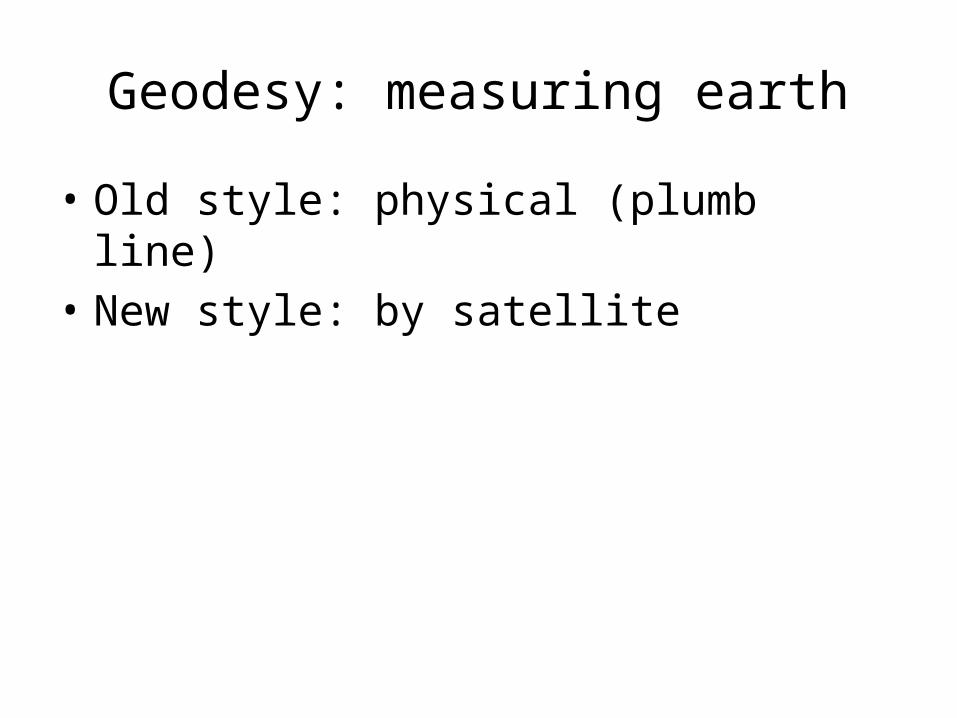
Geodesy: measuring earth
• Old style: physical (plumb line)• New style: by satellite

Geodesy: measuring earth
• Old style: physical (plumb line)• New style: by satellite
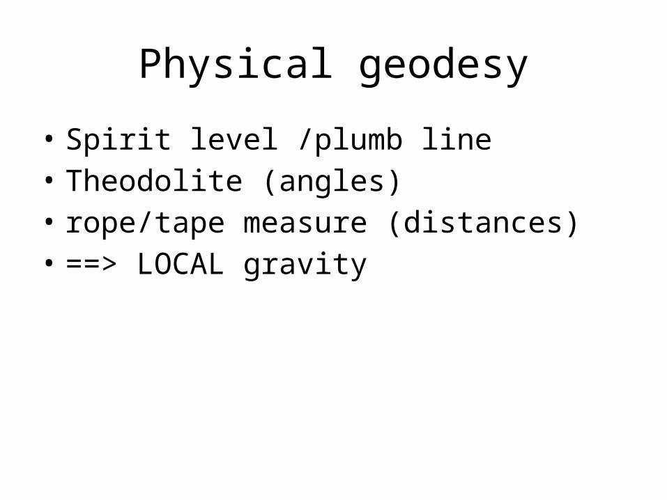
Physical geodesy
• Spirit level /plumb line• Theodolite (angles)• rope/tape measure (distances)• ==> LOCAL gravity

Physical geodesy
• The GEOID : sum object of all local gravity fields (plumb line)

The Geoid
• Sum of local gravities, VERY complex• Not related to altitude

Satellite geodesy
• Geoid is not used• Gravity center of Earth is only point that
sattellites can “feel”, they know nothing about Earth's surface
• Mathematical model for Earth surface : ELLIPSOID

The ELLIPSOID
• Mathematical model for Earth surface• Approximation, never exact !• Not a perfect sphere (1/300 flattening)

Geodetic DATUM
• A geodetic datum is a physical realization of a coordinate system used for describing point locations
• Contain ALL parameters for your reference system

•Mention the DATUM ! ! !

ALWAYS mention the DATUM
• Coordinates without datum are UTTERLY USELESS !!!
• Coordinates without datum are UTTERLY MEANINGLESS !!!
• Coordinates without datum are COMPLETE NONSENSE !!!

Well Known Text notation (WKT)
• A) coordinates
B) Projection
Type « POINT(X Y) »
Ex : -POINT(0 0)
-LINESTRING(0 0, 1 1, 1 2)
-POLYGON (0 0, 1 1, 1 2, 0 0)
- …
PROJCS["NAD83 / UTM Zone 10N", GEOGCS["NAD83", DATUM["North_American_Datum_1983", SPHEROID["GRS 1980",6378137,298.257222101] ], PRIMEM["Greenwich",0], UNIT["degree",0.0174532925199433] ], PROJECTION["Transverse_Mercator"], PARAMETER["latitude_of_origin",0], PARAMETER["central_meridian",-123], PARAMETER["scale_factor",0.9996], PARAMETER["false_easting",500000], PARAMETER["false_northing",0], UNIT["metre",1] ]
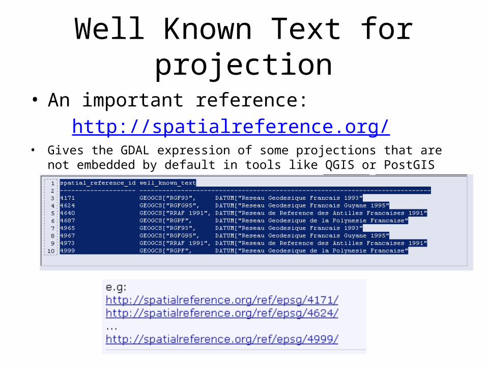
Well Known Text for projection
• An important reference:http://spatialreference.org/
• Gives the GDAL expression of some projections that are not embedded by default in tools like QGIS or PostGIS

QGIS: changing the projection settings
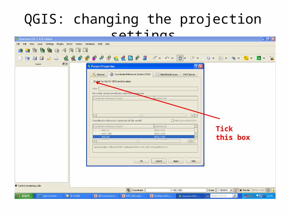
QGIS: changing the projection settings
Tick this box

QGIS: changing the projection settings
Select the projection by categories
Select the projection by name

Quantum GIS: define custom projection

Projections
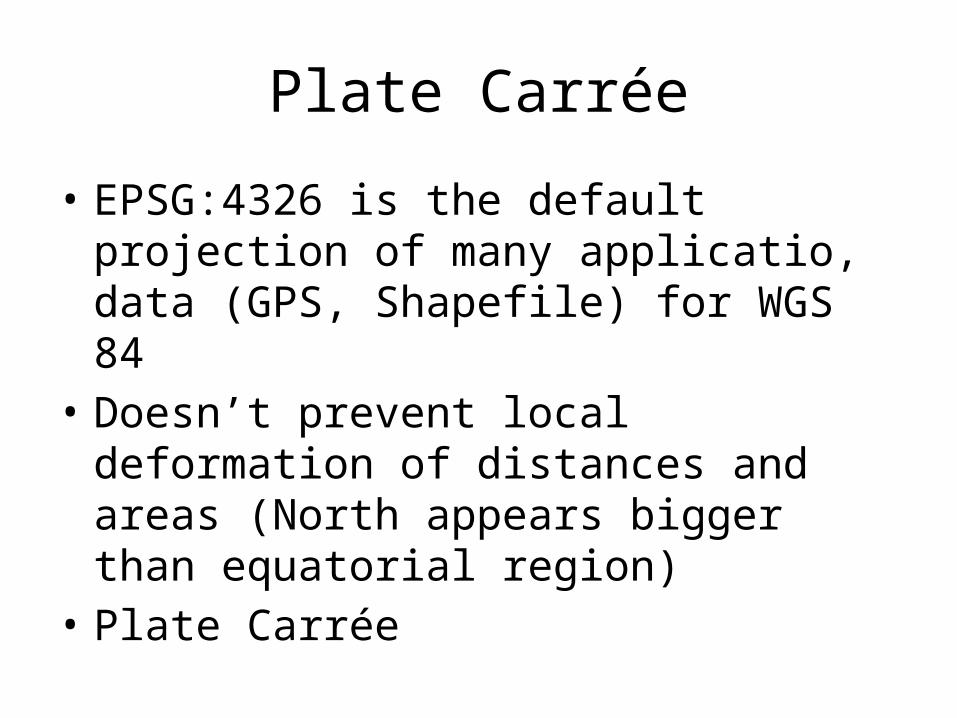
Plate Carrée
• EPSG:4326 is the default projection of many applicatio, data (GPS, Shapefile) for WGS 84
• Doesn’t prevent local deformation of distances and areas (North appears bigger than equatorial region)
• Plate Carrée

Simple Mercator
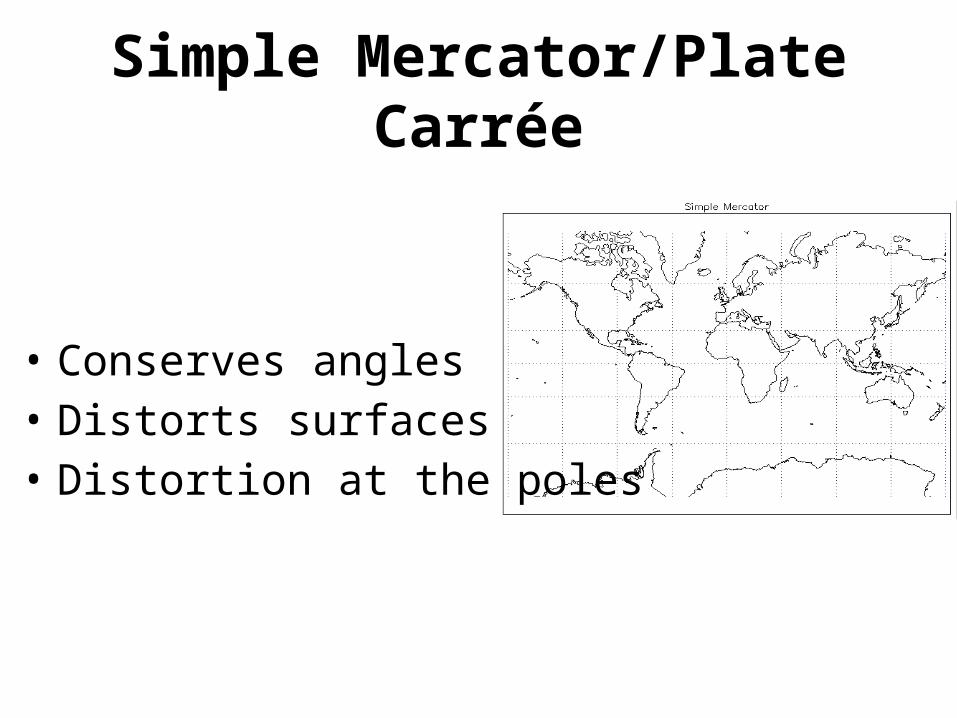
Simple Mercator/Plate Carrée
• Conserves angles• Distorts surfaces• Distortion at the poles

Simple Mercator/Plate Carrée
• Conserves angles• Distorts surfaces• Distortion at the poles

Gall-Peeters map type

Gall-Peeters map type
• Conserves surfaces• Distorts angles

Universal Transverse Mercator
• Network of projection arranged by longitude• Cylindrical

Universal Transverse Mercator
• Looks a “disco ball” (select small rectangular areas to limit deformation of areas, distances and angles to minimal)

UTM Zones

UTM Zones
• Interest: unit is meter (distance are easy to express)
• But each zone has its own local origin (not bound to the equator)
• Most of time cannot be applied on world scale layers
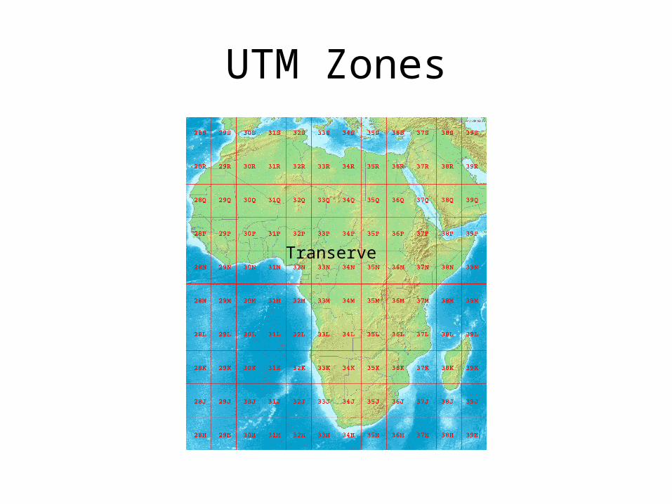
UTM Zones
Transerve

UTM Data
• Pretty much use for Raster data – elevation data (SRTM)
– http://srtm.csi.cgiar.org/ – http://www.cgiar-csi.org/data/srtm-90m-digital-elevation-dat
abase-v4-1
– Climatic data– Processed satellite images (LANDSAT)
– https://zulu.ssc.nasa.gov/mrsid

Type of data
Types of data for GIS
• Vector data• Raster data

Vector data
• Vector layer:– Mathematical expression of a geographical shape
• points, • lines, • surfaces
– Easy to reproject (parameter of equation)– Already georeferenced– ESRI Shapefile most common data standard for
shapefiles

Vector data (shapefile)
• A shapefile:– Elaborated by ESRI but widely used
• at least 3 (or event better 4) files with the same name but different extensions that must be out in the same folder

Vector data (shapefile)
• ***.shp => the shape (drawn form)• ***.dbf => attribute table (editable in
spreadsheet)• ***.shx=>intermediate index• ***.prj=> Metadata of the projection (WKT format)

Raster data
• Image file or grid used to display matricial data• Need georefencing project• Hard to reproject QGIS can reproject them• Most common standard for
• Images• Altitude data (DEM: Digital Elemevation model:
http://www.cgiar-csi.org/data/elevation/item/45-srtm-90m-digital-elevation-database-v41 )• Climatic data http://www.worldclim.org/download

Types of GIS application

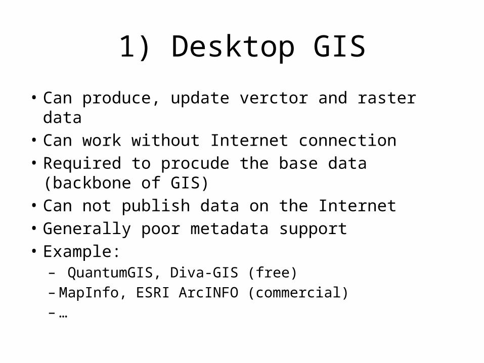
1) Desktop GIS
• Can produce, update verctor and raster data• Can work without Internet connection• Required to procude the base data (backbone
of GIS)• Example:
– QuantumGIS, Diva-GIS (free)– MapInfo, ESRI ArcINFO (commercial)– …
1) Desktop GIS
• Can produce, update verctor and raster data• Can work without Internet connection• Required to procude the base data (backbone of GIS)• Can not publish data on the Internet• Generally poor metadata support• Example:
– QuantumGIS, Diva-GIS (free)– MapInfo, ESRI ArcINFO (commercial)– …

2) GIS database
• Relational databases with plugins to handle geographical data
• No Graphical interface (but Desktop GIS can connect them and display content)
• Originally worked on vectors, but soince recently can handle rasters and 3-D data
• Powerful to store and modify big vector datasets
• Useful to store maps displayed on the Internet

2) GIS database
• Example:– PostGIS (GIS plug-in of the OpenSource
PostgreSQL database)
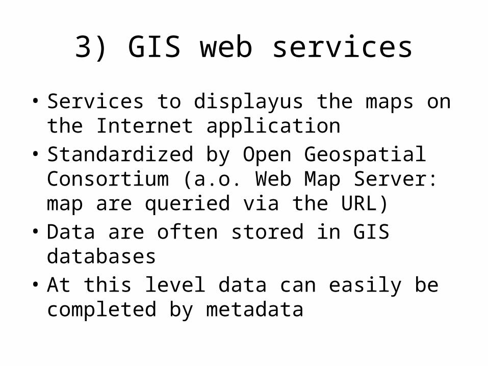
3) GIS web services
• Services to displayus the maps on the Internet application
• Standardized by Open Geospatial Consortium (a.o. Web Map Server: map are queried via the URL)
• Data are often stored in GIS databases• At this level data can easily be completed by
metadata

3) GIS web services
• Example:– GeoServer (Open source): map server
• http://geoserver.org
– GeoNetwork (OpenSpource, created by FAO): metadata server
• http://geonetwork-opensource.org/

3) GIS web services
• Example:– GeoServer (Open source): map server
• http://geoserver.org
– GeoNetwork (OpenSpource, created by FAO): metadata server
• http://geonetwork-opensource.org/
– OpenLayers: Javascript library to integrate maps in web pages
• http://www.openlayers.org/
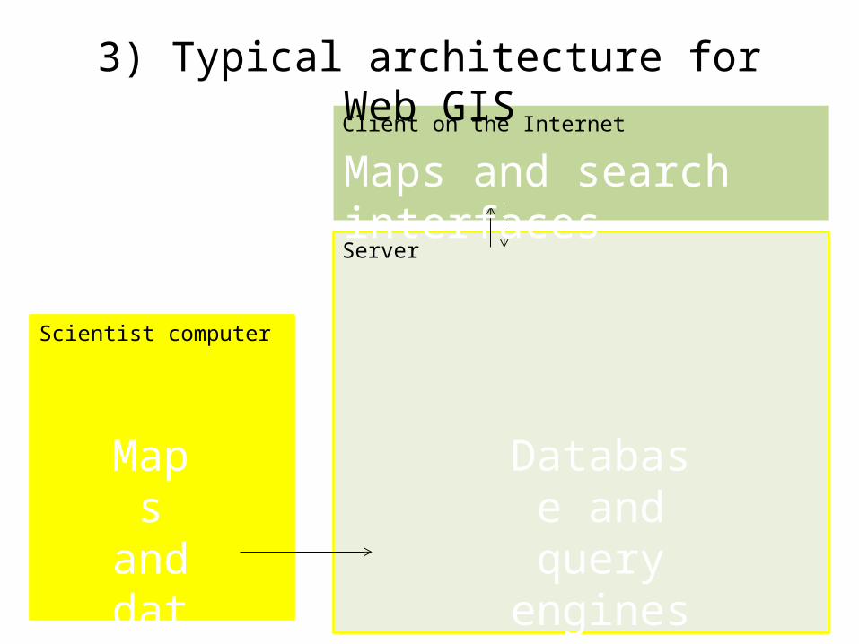
Client on the Internet
Server
Scientist computer
3) Typical architecture for Web GIS
Maps and data
Database and query
engines
Maps and search interfaces

Client on the Internet
Server
Scientist computer
3) Typical architecture for Web GIS
Shapefile or rasters
HTTP server (often Tomcat for Java)
Map server (GeoServer)
Metadata server
(Geonetwork)
Web page with Javascript client (OpenLayers)
GIS database(PostGIS)Imported
(QGIS, OGR, GDAL)