teacher's guide to structuring an 8th grade global studies course while integrating...
TRANSCRIPT
Teacher's Guide to Structuring an
8th Grade Global Studies Course
while Integrating the Minnesota State Standards
(rev. 2)
Developed by Middle School Team Members: Jan Hertel (Coordinator)
1
Teacher's Guide to an 8th grade Global Studies course
The 2011 Minnesota Standards in Social Studies require that 8th gradewill be a Global Studies course, including 29 Geography, 12 History, 4Economics, and 3 Government and Citizenship benchmarks.The
purpose of this document is to provide effective ways for teachers to teach an 8th grade Global Studies course with MAGE recommended
units. There are 2 proposed pacing guides for the year which have beendeveloped by a committee of teachers from across the state, all
members of the Minnesota Alliance for Geographic Education. In eachproposal, the year starts with an overview, followed by 8 regional units.Benchmarks have been placed in each unit, many with suggested
activities and resources. "Skills" benchmarks are listed on a separate page (gray background), but some skills should be included in each unit.Local needs may require that benchmarks be moved to other units.This
is a working document that will continue to be updated.
2
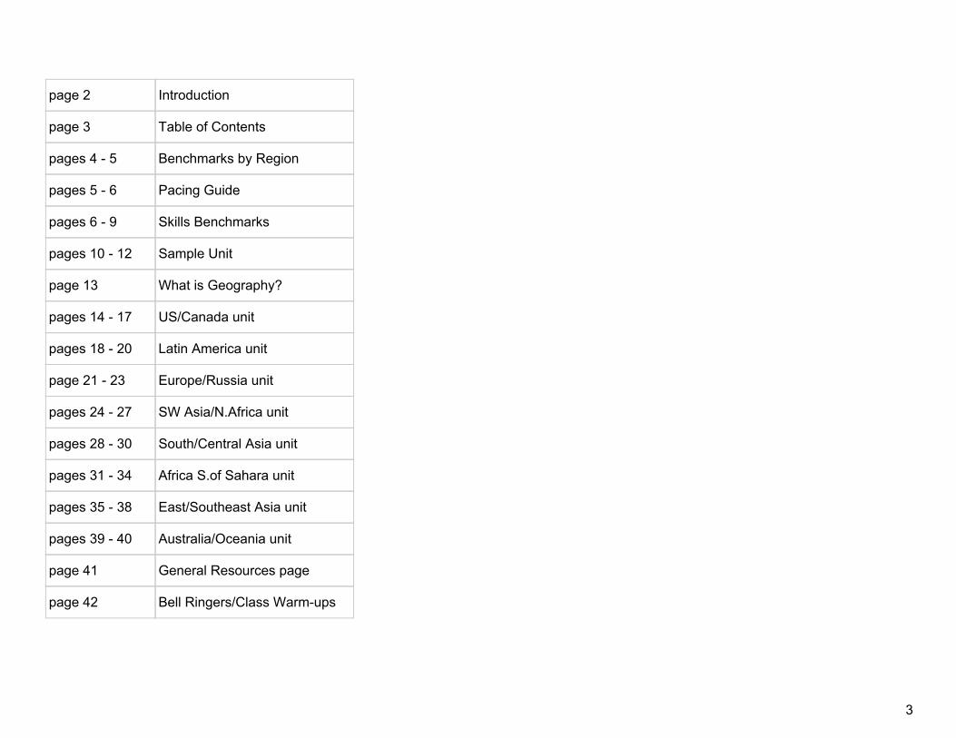
page 2 Introduction
page 3 Table of Contents
pages 4 5 Benchmarks by Region
pages 5 6 Pacing Guide
pages 6 9 Skills Benchmarks
pages 10 12 Sample Unit
page 13 What is Geography?
pages 14 17 US/Canada unit
pages 18 20 Latin America unit
page 21 23 Europe/Russia unit
pages 24 27 SW Asia/N.Africa unit
pages 28 30 South/Central Asia unit
pages 31 34 Africa S.of Sahara unit
pages 35 38 East/Southeast Asia unit
pages 39 40 Australia/Oceania unit
page 41 General Resources page
page 42 Bell Ringers/Class Warmups
3

Benchmarks by Region
US/Canada Latin America Europe/Russia SW Asia/N. Africa
SubSahara Africa
South/Central Asia
East/Southeast Asia
Australia/Oceania
8.3.3.5.1 8.3.3.5.2 8.3.3.5.3 8.3.3.5.4 8.3.3.5.7 8.3.3.5.6 8.2.5.12.1 8.3.3.5.8
8.3.3.6.1 8.3.3.6.2 8.3.3.6.3 8.3.3.6.4 8.3.3.6.7 8.3.3.6.6 8.3.3.5.5 8.3.2.6.8
8.3.3.10.1 relates to 8.1.5.12.1
8.3.3.10.3 8.3.3.10.4 8.3.3.8.1 8.3.3.7.1 (see also: SW Asia/NAfr)
8.3.3.10.7 8.3.3.6.5 8.3.1.1.1
8.3.3.10.2 8.4.3.14.8 8.4.3.13.2 8.3.3.10.5 8.4.3.14.8 (alternate: Latin America)
8.4.3.14.2 (alternate:Latin
America)
8.3.3.10.6 8.1.1.1.1
8.1.5.12.1 (alternate:
Europe/Russia)
8.4.3.14.1 8.4.3.13.3 8.1.1.1.1 8.2.3.4.1 (alternate: Overview, Eur/Russia)
8.2.5.12.1 (alternate: S &
SE Asia)
8.2.3.4.2
8.3.2.3.1 8.4.3.13.1 8.1.5.12.1 (alternate:
U.S./Canada)
8.4.3.14.7 8.3.1.1.1 8.4.3.14.3 (alternate:
SWAsia/NAfr, E & SE Asia)
8.2.1.1.1
8.1.1.1.1 8.3.2.3.1 8.2.3.4.1 (alternate: overview,
subSah Afr.
8.1.5.13.1 8.4.3.14.5 (alternate: Cen. & S. Asia, E and SE Asia, SW and
N. Afr
8.4.3.14.5 (alternate:
subSah Afr, E & Se Asia, SW Asia & N. Afr)
8.4.3.14.3 (alternate: Cen. &
S Asia, SWAsia/NAfr)
8.3.1.1.1 8.3.2.3.1 8.4.3.14.6 8.1.1.1.1 8.3.1.1.1 8.3.1.1.1
8.2.1.1.1 8.1.1.1.1 8.4.3.14.3 (alternate: S &
Cen. Asia, MiddleEast, E & SE
Asia)
8.3.2.3.1 8.4.3.14.5 (alternate:
subSah Afr, SW & N Afr., S & Cen
Asia)
4

8.3.1.1.1 8.1.1.1.1 8.1.1.1.1
8.4.1.2.1 8.1.1.1.1 8.4.3.13.1 (alternate:
subSah Afr, Lat Am
8.4.3.14.5 (alternate: Cen & S Asia, E & SE Asia, SubSah
Afr
8.4.3.13.1 (see also: subSah Afr. & Latin America)
8.1.1.1.1 8.4.3.14.4
8.4.1.2.1
Pacing Guide
Proposal A days Proposal B days
Overview 10 Overview 10
Australia/Oceania 5 10 US/Canada 10 15
East & SE Asia 20 25 Latin America 10 15
South & Central Asia 10 15 Europe/Russia 15 20
SW Asia/N. Africa 20 25 SW Asia/N. Africa 20 25
SubSahara Africa 20 SubSahara Africa 20
Europe/Russia 15 20 South & Central Asia 10 15
Latin America 10 15 East & SE Asia 20 25
US/Canada 10 15 Australia/Oceania 5 10
Research/theme unit 1518 Research/theme unit 15 18
TOTAL 135 160 TOTAL 135 160
**remaining days local discretion**
**remaining days local discretion**
5

Note: Above are 2 proposed plans for an 8th grade Global Studies course. The number of days per unit was determined largely by the number of benchmarks included in the unit. Proposal A would start with an overview of the world, merged with a unit on Australia/Oceania. The rationale is that this is a high interest area for students to start the year. Subsequent units work north and west, ending with the US and Canada. The "research/theme" unit is well suited to several skills standards and could be positioned within any unit. Proposal B is a more traditional approach to Global Studies. In both proposals the number of days is variable to suit local needs.
6

Skills Benchmarks
The following benchmarks are from all disciplines of Social Studies. It is recommended that teachers check this list frequently when planning lessons. Skills are best learned when repeated and applied in several content lessons.This overview is meant to provide students a mental framework and skills base for their study of the world. A variety of worldmaps and data will be examined to give a global perspective. Students will explore how the world is categorized into various regions based on human and physical characteristics. There are 8 basic spatial questions that will be addressedthroughout the overview and each region of the world. 1. Where? 2. What is there? 3. Why is it there? 4. What difference does it make? 5. How are other places similar or different? 6. How are places linked? 7. What spatial patternscan you see on a map? 8. How do spatial patterns change over space and time?
Benchmarks Possible Topics: Resources:
8.2.3.4.1 Identify factors which affect economic growth (percentage changes in Gross Domestic Product –GDP) and lead to a different standard of living. I can identify factors which affect economic growth in different countries.
w www.gapminder.org ;
w http://www.thedailybeast.com/newsweek/2010/08/15/interactiveinfographicoftheworldsbestcountries.html
8.3.2.3.1 Use appropriate geographic tools to analyze and explain the distribution of physical and human characteristics of places. I can use geographic tools to explain the distribution of physical and human characteristics of places.
w Scale of the Universe interactive graphic
http://apod.nasa.gov/apod/ap120312.html
8.1.1.1.1 Exhibit civic skills including participating in civic discussion on issues in the contemporary world, demonstrating respect for the opinions of people or groups who have different perspectives, and reaching consensus. I can participate in a Civic discussion. I can demonstrate respect for opinions of people or groups who have different perspectives. I can apply inquiry and analysis skills to be a well informed citizen and participate in my country’s democratic government.
8.2.1.1.1 Apply reasoned decisionmaking techniques in
7

making choices; explain why different governments faced with the same alternatives might make different choices. I can explain why individuals and governments make different economic choices.
w paced chart http://fffl.councilforeconed.org/documents/9781561836949visuallesson02.pdf
8.3.1.1.1 Obtain and analyze geographic information from a variety of print and electronic sources to investigate places or answer specific geographic questions; provide rationale for its use. I can gather and analyze geographic information from print and electronic sources.I can use geospatial technology to analyze geographic information.
w UN maps of human development
http://hdr.undp.org/en/data/map/
8.3.1.1.2 Create and use various kinds of maps, including overlaying thematic maps, of places in the world; incorporate the “TODALSS” map basics, as well as points, lines and colored areas to display spatial information. I can apply the 7 elements (title, orientation, date, author, legend/key, source, scale) of a map to display spatial information on a variety of maps.
/ w www.Worldmapper.com spatial maps for use
with spatial questions
w www.geteach.com allows you to manipulate and compare data side by side using 2 world maps
w http://www.progonos.com/furuti/MapProj/Normal/TOC/cartTOC.html
w Map projections explained, Add lines, text, symbols to base map http://www.mygreatmaps.com
8.3.1.2.1 Formulate questions about topics in geography; pose possible answers; use geospatial technology to analyze problems and make decisions within a spatial context. I can ask geographic questions. I can gather, organize, and analyze informationto answer questions.
v The Geospatial Revolution Project from Penn State
http://www.youtube.com/watch?v=poMGRbfgp38
w Geothentic http://lt.umn.edu/geothentic/ real world problems for students to solve
8

8.4.1.2.1 Pose questions about a topic in world history; gather and organize a variety of primary and secondary sources related to the questions; analyze sources for credibility and bias; suggest possible answers and write a thesis statement; use sources to draw conclusions and support the thesis; and present supported findings and cite sources. I can research a topic and create a thesis statement using contemporary world history . I can use both primary and secondary sources to site my findings.
w http://chnm.gmu.edu/worldhistorysources/index.htm
l
9
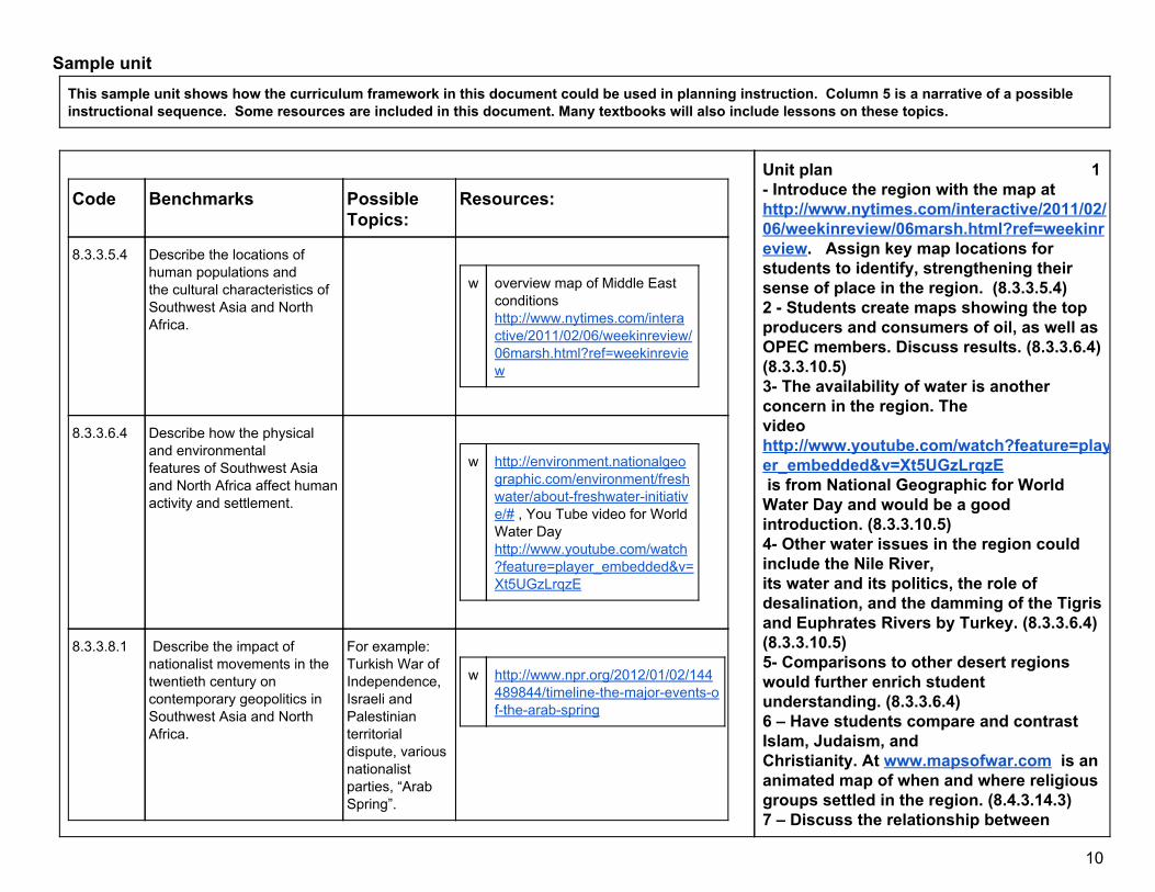
Sample unit This sample unit shows how the curriculum framework in this document could be used in planning instruction. Column 5 is a narrative of a possible instructional sequence. Some resources are included in this document. Many textbooks will also include lessons on these topics.
Code Benchmarks Possible Topics:
Resources:
8.3.3.5.4 Describe the locations of human populations and the cultural characteristics of Southwest Asia and North Africa.
w overview map of Middle East
conditions http://www.nytimes.com/interactive/2011/02/06/weekinreview/06marsh.html?ref=weekinreview
8.3.3.6.4 Describe how the physical and environmental features of Southwest Asia and North Africa affect human activity and settlement.
w http://environment.nationalgeo
graphic.com/environment/freshwater/aboutfreshwaterinitiative/# , You Tube video for World Water Day http://www.youtube.com/watch?feature=player_embedded&v=Xt5UGzLrqzE
8.3.3.8.1 Describe the impact of nationalist movements in the twentieth century on contemporary geopolitics in Southwest Asia and North Africa.
For example: Turkish War of Independence, Israeli and Palestinian territorial dispute, various nationalist parties, “Arab Spring”.
w http://www.npr.org/2012/01/02/144
489844/timelinethemajoreventsofthearabspring
Unit plan 1 Introduce the region with the map at http://www.nytimes.com/interactive/2011/02/06/weekinreview/06marsh.html?ref=weekinreview. Assign key map locations for students to identify, strengthening their sense of place in the region. (8.3.3.5.4) 2 Students create maps showing the top producers and consumers of oil, as well as OPEC members. Discuss results. (8.3.3.6.4) (8.3.3.10.5) 3 The availability of water is another concern in the region. The video http://www.youtube.com/watch?feature=player_embedded&v=Xt5UGzLrqzE is from National Geographic for World Water Day and would be a good introduction. (8.3.3.10.5) 4 Other water issues in the region could include the Nile River, its water and its politics, the role of desalination, and the damming of the Tigris and Euphrates Rivers by Turkey. (8.3.3.6.4) (8.3.3.10.5) 5 Comparisons to other desert regions would further enrich student understanding. (8.3.3.6.4) 6 – Have students compare and contrast Islam, Judaism, and Christianity. At www.mapsofwar.com is an animated map of when and where religious groups settled in the region. (8.4.3.14.3) 7 – Discuss the relationship between
10

8.3.3.10.5 Describe how the distribution and development of oil and water resources influence the economy and societies of Southwest Asia and North Africa.
8.4.3.14.7 Assess the influence of television, the Internet and other media on cultural identity and social and political movements. (The New Global Era: 1989 to Present)
8.1.5.13.1 Explain how different types of governments reflect historically and culturally specific understandings of the relationships between the individual, government and society.
w US military forces abroad
http://news.nationalpost.com/2011/10/28/graphicmappingasuperpowersizedmilitary/
8.4.3.14.5 (see also: Cen & S Asia, E & SE Asia, SubSah Afr
Assess the state of human rights around the world as described in the 1948 Universal Declaration of Human Rights. (The New Global Era: 1989 to Present)
In Google Earth under the Global Awareness Layerchoose The Elders: Every Human has Rights.This allows you to view issues around the world.
8.4.3.14.3 (see also: E & SE Asia, Cen. & S Asia)
Describe varieties of religious beliefs and practices in the contemporary world including Shamanism/Animism, Hinduism, Buddhism, Judaism, Christianity and Islam. (The New Global Era: 1989 to Present)
w http://www.mapsofwar.com
history of religion animated map.
8.4.3.14.6 Describe how movements and social conditions have
religious traditions and social conditions, such as life for women in Saudi Arabia. (8.4.3.14.6) 8 Discuss the differences between the terms “Arab” and “Muslim.” 9. Examine events of the Arab Spring. NPR published a timeline with brief explanations at http://www.npr.org/2012/01/02/144489844/timelinethemajoreventsofthearabspring . (8.4.3.14.7) 10. Examining the IsraeliPalestinian relationship and conflict may include history of conflict, the current state of affairs, and predictions for the future. Students can practice taking the perspective of multiple stakeholders and debate the key positions. (8.4.3.14.6)
11

affected the lives of women in different parts of the world. (The New Global Era: 1989 to Present)
8.1.1.1.1 Exhibit civic skills including participating in civic discussion on issues in the contemporary world, demonstrating respect for the opinions of people or groups who have different perspectives, and reaching consensus.
w http://debategraph.org/ ,
w http://www.procon.org/
12

Beginning of the year What is Geography?
AP Human Geog. https://www.youtube.com/watch?v=rkoUBtfrykw
NGSWhat is GeoLiteracy? https://www.youtube.com/watch?v=Pb8yenSogzE
NGS Why is GeoLiteracy Important? https://www.youtube.com/watch?v=sTUG13RCz9A
Geography Matters https://www.youtube.com/watch?v=JyhSHDGgcw
Geobee what is geography? http://www.youtube.com/watch?v=ri0_ijyFni4
Ode to EarthBaba Yetu (Human Planet trailer)
http://www.youtube.com/watch?v=r6qi393Z7L8
We are all connected (cool side by side comparison) from WWF
http://www.youtube.com/watch?v=JsViKFU63i4
National Geographic real world geographers http://education.nationalgeographic.com/education/topics/realworldgeography/?ar_a=1
13
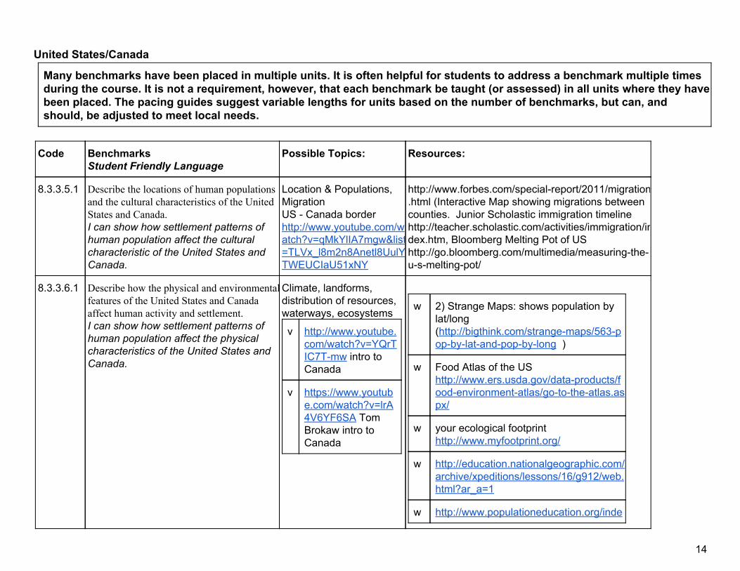
United States/Canada
Many benchmarks have been placed in multiple units. It is often helpful for students to address a benchmark multiple times during the course. It is not a requirement, however, that each benchmark be taught (or assessed) in all units where they have been placed. The pacing guides suggest variable lengths for units based on the number of benchmarks, but can, and should, be adjusted to meet local needs.
Code Benchmarks Student Friendly Language
Possible Topics: Resources:
8.3.3.5.1 Describe the locations of human populations and the cultural characteristics of the United States and Canada. I can show how settlement patterns of human population affect the cultural characteristic of the United States and Canada.
Location & Populations, Migration US Canada border http://www.youtube.com/watch?v=qMkYlIA7mgw&list=TLVx_l8m2n8Anetl8UulYTWEUCIaU51xNY
http://www.forbes.com/specialreport/2011/migration.html (Interactive Map showing migrations between counties. Junior Scholastic immigration timeline http://teacher.scholastic.com/activities/immigration/index.htm, Bloomberg Melting Pot of US http://go.bloomberg.com/multimedia/measuringtheusmeltingpot/
8.3.3.6.1 Describe how the physical and environmentalfeatures of the United States and Canada affect human activity and settlement. I can show how settlement patterns of human population affect the physical characteristics of the United States and Canada.
Climate, landforms, distribution of resources, waterways, ecosystems
v http://www.youtube.com/watch?v=YQrTIC7Tmw intro to Canada
v https://www.youtube.com/watch?v=lrA4V6YF6SA Tom Brokaw intro to Canada
w 2) Strange Maps: shows population by lat/long (http://bigthink.com/strangemaps/563popbylatandpopbylong )
w Food Atlas of the US http://www.ers.usda.gov/dataproducts/foodenvironmentatlas/gototheatlas.aspx/
w your ecological footprint http://www.myfootprint.org/
w http://education.nationalgeographic.com/archive/xpeditions/lessons/16/g912/web.html?ar_a=1
w http://www.populationeducation.org/inde
14
x.php?option=com_content&task=view&id=26&Itemid=4
w carbon footprint lesson http://learning.blogs.nytimes.com/2008/0 1/22/onefoottofootredfootgreenfoot/#more4801
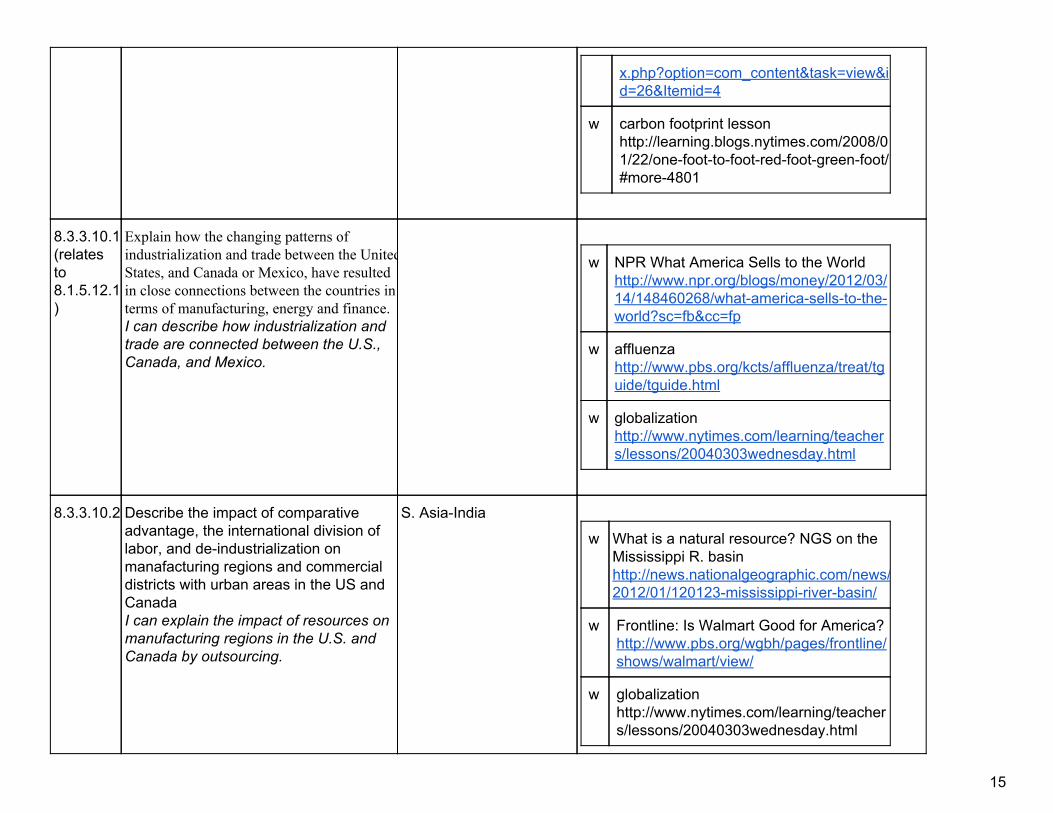
8.3.3.10.1(relates to 8.1.5.12.1)
Explain how the changing patterns of industrialization and trade between the UnitedStates, and Canada or Mexico, have resulted in close connections between the countries in terms of manufacturing, energy and finance. I can describe how industrialization and trade are connected between the U.S., Canada, and Mexico.
w NPR What America Sells to the World http://www.npr.org/blogs/money/2012/03/14/148460268/whatamericasellstotheworld?sc=fb&cc=fp
w affluenza http://www.pbs.org/kcts/affluenza/treat/tguide/tguide.html
w globalization http://www.nytimes.com/learning/teachers/lessons/20040303wednesday.html
8.3.3.10.2 Describe the impact of comparative advantage, the international division of labor, and deindustrialization on manafacturing regions and commercial districts with urban areas in the US and Canada I can explain the impact of resources on manufacturing regions in the U.S. and Canada by outsourcing.
S. AsiaIndia
w What is a natural resource? NGS on the Mississippi R. basin http://news.nationalgeographic.com/news/2012/01/120123mississippiriverbasin/
w Frontline: Is Walmart Good for America? http://www.pbs.org/wgbh/pages/frontline/shows/walmart/view/
w globalization http://www.nytimes.com/learning/teachers/lessons/20040303wednesday.html
15

outsourcing tutoring http://www.nytimes.com/learning/teachers/lessons/20050908thursday.html
8.1.5.12.1(see also: Europe/Russia)
Explain why governments belong to differenttypes of economic alliances and international and regional organizations. I can explain why governments belong to different types of economic alliances & international & regional organizations.I can explain the purpose of international political and economic institutions.I can explain how different governments are influenced by history and culture.
United Nations, World Trade Organization, Arab League, African Union, European Union, North Atlantic Treaty Organization, Organization of American States, Asia Pacific
w http://www.icivics.org/teachers/lessonplans/internationalorganizations
8.4.1.2.1 Pose questions about a topic in world history; gather and organize a variety of primary and secondary sources related tothe questions; analyze sources for credibility and bias; suggest possible answers and write a thesis statement; use sources to draw conclusions and support the thesis; and present supportedfindings and cite sources. I can research a topic and create a thesisstatement using contemporary world history . I can use both primary and secondary sources to site my findings.
Geothentic is a Univ. of Minnesota project where students solve real world problems in locating a hospital, avian flu, climate change, and more. http://lt.umn.edu/geothentic/
8.3.2.3.1 Use appropriate geographic tools to analyze and explain the distribution of physical and human characteristics of places. I can use geographic tools to explain the distribution of physical and human characteristics of places.
w Map shows phone and SMS connections within the US http://senseable.mit.edu/csa/interact.html
16

8.1.1.1.1 Exhibit civic skills including participating incivic discussion on issues in the contemporary world, demonstrating respect for the opinions of people or groups who have different perspectives, and reaching consensus. I can participate in a Civic discussion. I can demonstrate respect for opinions of people or groups who have different perspectives. I can apply inquiry and analysis skills to be a well informed citizen and participate in my country’s democratic government.
Election 2012
w www.uselectionatlas.org ,
w www.livingroomcandidate.org, e
w http://debategraph.org/, pr o and con on many issues
w http://www.globalissues.org/
w http://wwcsd.net/~widrigr/PersuasiveWriting.htm
w http://www.procon.org/,
17
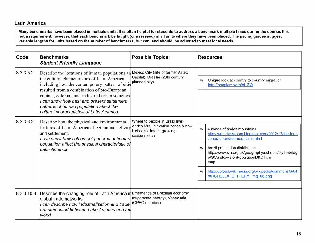
Latin America Many benchmarks have been placed in multiple units. It is often helpful for students to address a benchmark multiple times during the course. It is not a requirement, however, that each benchmark be taught (or assessed) in all units where they have been placed. The pacing guides suggest variable lengths for units based on the number of benchmarks, but can, and should, be adjusted to meet local needs.
Code Benchmarks Student Friendly Language
Possible Topics: Resources:
8.3.3.5.2 Describe the locations of human populations andthe cultural characteristics of Latin America, including how the contemporary pattern of citiesresulted from a combination of preEuropean contact, colonial, and industrial urban societies.I can show how past and present settlement patterns of human population affect the cultural characteristics of Latin America.
Mexico City (site of former Aztec Capital), Brasilia (20th century planned city)
w Unique look at country to country migration
http://peoplemov.in/#f_ZW
8.3.3.6.2 Describe how the physical and environmental features of Latin America affect human activityand settlement. I can show how settlement patterns of human population affect the physical characteristic of Latin America.
Where to people in Brazil live?, Andes Mts, (elevation zones & how it effects climate, growing seasons,etc.)
w 4 zones of andes mountains
http://wahlclassroom.blogspot.com/2012/12/thefourzonesofandesmountains.html
w brazil population distribution http://www.sln.org.uk/geography/schools/blythebridge/GCSERevisionPopulationD&D.htm map
w http://upload.wikimedia.org/wikipedia/commons/6/64/ARCHELLA_E_THERY_Img_06.png
8.3.3.10.3 Describe the changing role of Latin America inglobal trade networks. I can describe how industrialization and trade are connected between Latin America and theworld.
Emergence of Brazilian economy (sugarcaneenergy), Venezuala (OPEC member)
18
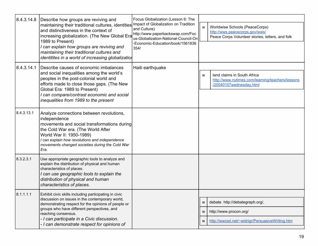
8.4.3.14.8 Describe how groups are reviving and maintaining their traditional cultures, identities and distinctiveness in the context of increasing globalization. (The New Global Era:1989 to Present) I can explain how groups are reviving and maintaining their traditional cultures and identitites in a world of increasing globalization.
Focus Globalization (Lesson 6: The Impact of Globalization on Tradition and Culture) http://www.paperbackswap.com/FocusGlobalizationNationalCouncilOnEconomicEducation/book/1561836354/
w Worldwise Schools (PeaceCorps)
http://wws.peacecorps.gov/wws/ Peace Corps Volunteer stories, letters, and folk
8.4.3.14.1 Describe causes of economic imbalances and social inequalities among the world’s peoples in the postcolonial world and efforts made to close those gaps. (The New Global Era: 1989 to Present) I can compare/contrast economic and social inequalities from 1989 to the present
Haiti earthquake w land claims in South Africa
http://www.nytimes.com/learning/teachers/lessons/20040107wednesday.html
8.4.3.13.1 Analyze connections between revolutions, independence movements and social transformations during the Cold War era. (The World After World War II: 19501989) I can explain how revolutions and independence movements changed societies during the Cold War Era.
8.3.2.3.1 Use appropriate geographic tools to analyze and explain the distribution of physical and human characteristics of places. I can use geographic tools to explain the distribution of physical and human characteristics of places.
8.1.1.1.1 Exhibit civic skills including participating in civic discussion on issues in the contemporary world, demonstrating respect for the opinions of people or groups who have different perspectives, and reaching consensus. I can participate in a Civic discussion. I can demonstrate respect for opinions of
w debate http://debategraph.org/,
w http://www.procon.org/
w http://wwcsd.net/~widrigr/PersuasiveWriting.htm
19
people or groups who have different perspectives. I can apply inquiry and analysis skills to be awell informed citizen and participate in my country’s democratic government.
8.3.1.1.1 Obtain and analyze geographic information from a variety of print and electronic sources to investigate places or answer specific geographic questions; provide rationale for its use. I can gather and analyze geographic information from print and electronic sources.I can use geospatial technology to analyze geographic information.
w UN maps of human development
http://hdr.undp.org/en/data/map/
20
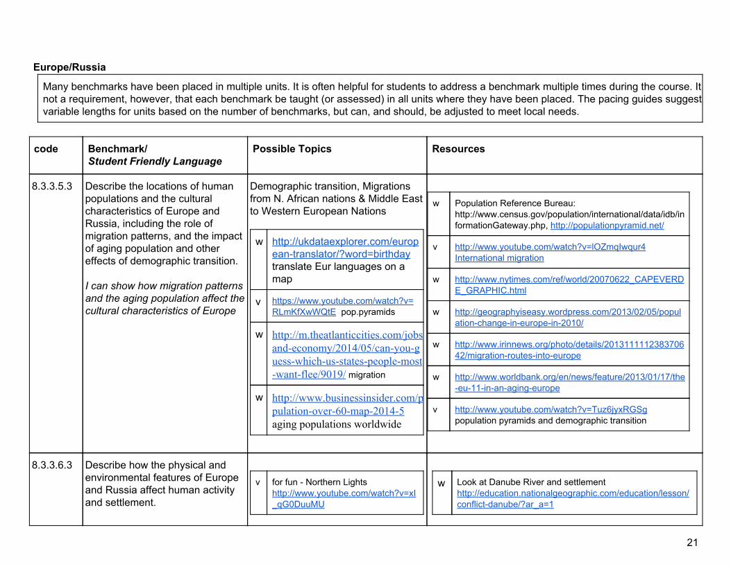
Europe/Russia
Many benchmarks have been placed in multiple units. It is often helpful for students to address a benchmark multiple times during the course. It isnot a requirement, however, that each benchmark be taught (or assessed) in all units where they have been placed. The pacing guides suggest variable lengths for units based on the number of benchmarks, but can, and should, be adjusted to meet local needs.
code Benchmark/ Student Friendly Language
Possible Topics Resources
8.3.3.5.3 Describe the locations of human populations and the cultural characteristics of Europe and Russia, including the role of migration patterns, and the impact of aging population and other effects of demographic transition. I can show how migration patterns and the aging population affect the cultural characteristics of Europe
Demographic transition, Migrations from N. African nations & Middle East to Western European Nations
w http://ukdataexplorer.com/europeantranslator/?word=birthday translate Eur languages on a map
v https://www.youtube.com/watch?v=RLmKfXwWQtE pop.pyramids
w http://m.theatlanticcities.com/jobsandeconomy/2014/05/canyouguesswhichusstatespeoplemostwantflee/9019/ migration
w http://www.businessinsider.com/populationover60map20145 aging populations worldwide
w Population Reference Bureau:
http://www.census.gov/population/international/data/idb/informationGateway.php, http://populationpyramid.net/
v http://www.youtube.com/watch?v=lOZmqIwqur4 International migration
w http://www.nytimes.com/ref/world/20070622_CAPEVERDE_GRAPHIC.html
w http://geographyiseasy.wordpress.com/2013/02/05/populationchangeineuropein2010/
w http://www.irinnews.org/photo/details/201311111238370642/migrationroutesintoeurope
w http://www.worldbank.org/en/news/feature/2013/01/17/theeu11inanagingeurope
v http://www.youtube.com/watch?v=Tuz6jyxRGSg population pyramids and demographic transition
8.3.3.6.3 Describe how the physical and environmental features of Europe and Russia affect human activity and settlement.
v for fun Northern Lights
http://www.youtube.com/watch?v=xI_qG0DuuMU
w Look at Danube River and settlement http://education.nationalgeographic.com/education/lesson/conflictdanube/?ar_a=1
21
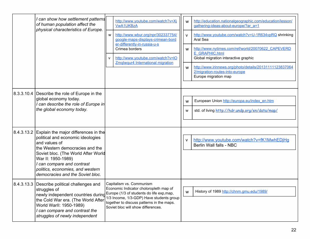
I can show how settlement patternsof human population affect the physical characteristics of Europe.
http://www.youtube.com/watch?v=XjVwA1UKBzA
w http://www.wbur.org/npr/302337754/googlemapsdisplayscrimeanborderdifferentlyinrussiaus Crimea borders
v http://www.youtube.com/watch?v=lOZmqIwqur4 International migration
w http://education.nationalgeographic.com/education/lesson/gatheringideasabouteurope/?ar_a=1
v http://www.youtube.com/watch?v=U1R634vpRQ shrinking Aral Sea
w http://www.nytimes.com/ref/world/20070622_CAPEVERDE_GRAPHIC.html Global migration interactive graphic
w http://www.irinnews.org/photo/details/201311111238370642/migrationroutesintoeurope Europe migration map
8.3.3.10.4 Describe the role of Europe in the global economy today. I can describe the role of Europe in the global economy today.
w European Union http://europa.eu/index_en.htm
w std. of living http://hdr.undp.org/en/data/map/
8.4.3.13.2 Explain the major differences in thepolitical and economic ideologies and values of the Western democracies and the Soviet bloc. (The World After WorldWar II: 19501989) I can compare and contrast politics, economies, and western democracies and the Soviet bloc.
v http://www.youtube.com/watch?v=fK1MwhEDjHg Berlin Wall falls NBC
8.4.3.13.3 Describe political challenges and struggles of newly independent countries duringthe Cold War era. (The World After World WarII: 19501989) I can compare and contrast the struggles of newly independent
Capitalism vs. Communism Economic Indicator choloropleth map of Europe (1/3 of students do life exp,map, 1/3 Income, 1/3GDP) Have students group together to discuss patterns in the maps. Soviet bloc will show differences.
w History of 1989 http://chnm.gmu.edu/1989/
22

countries during the Cold War Era.
8.1.5.12.1 (see also: U.S./Canada)
Explain why governments belong to different types of economic alliances and international and regional organizations. I can explain why governments belong to different types of economic alliances & international & regional organizations. I can explain the purpose of international political and economic institutions
United Nations, World Trade Organization, Arab League, African Union, European Union, North Atlantic Treaty Organization, Organization of American States, Asia Pacific
8.2.3.4.1 (see also: overview, subSah Afr.
Identify factors which affect economic growth (percentage changes in Gross Domestic Product – GDP) and lead to a different standard of living. I can identify factors which affect economic growth in different countries.
8.4.3.13.1 (see also: subSah Afr, Lat Am)
Analyze connections between revolutions, independence movements and social transformations during the Cold War era. (The World After World War II: 19501989) I can explain how revolutions and independence movements changed societies during the Cold War Era.
23

SW Asia/N. Africa
Many benchmarks have been placed in multiple units. It is often helpful for students to address a benchmark multiple times during the course. It is not a requirement, however, that each benchmark be taught (or assessed) in all units where they have been placed. The pacing guides suggest variable lengths for units based on the number of benchmarks, but can, and should, be adjusted to meet local needs.
Code Benchmarks Student Friendly Language
Possible Topics: Resources:
8.3.3.5.4 Describe the locations of human populations and the cultural characteristics of Southwest Asia and North Africa. I can show how settlement patterns of human population affect the cultural characteristic of North Africa and Southwest Asia.
w overview map of Middle East conditions
http://www.nytimes.com/interactive/2011/02/06/weekinreview/06marsh.html?ref=weekinreview
8.3.3.6.4 Describe how the physical and environmental features of Southwest Asia and North Africa affect human activity and settlement. I can show how settlement patterns of human population affect the physical characteristics and environmental features of North Africa and Southwest Asia.
v http://www.youtube.com/wat
ch?v=2pXuAw1bSQo Our Thirsty World
v http://www.youtube.com/watch?v=4PTtcDdgaqE It Starts With One Drop
v http://www.youtube.com/watch?v=eDzxN1CclyM Water Changes Everything
v http://www.youtube.com/watch?v=Xt5UGzLrqzE Refresh
w Freshwater initiative from NGS
http://environment.nationalgeographic.com/environment/freshwater/aboutfreshwaterinitiative/#
v World Water Day rqzE http://www.youtube.com/watch?feature=player_embedded&v=Xt5UGzL
v http://www.youtube.com/watch?v=4PTtcDdgaqE water crisis
8.3.3.8.1 Describe the impact of nationalist movements in the twentieth century on contemporary geopolitics in Southwest Asia and North Africa.
For example: Turkish War of Independence, Israeli and Palestinian territorial dispute, various nationalist parties, “Arab Spring”.
w us recognition of israel
http://www.archives.gov/education/lessons/usisrael/
24
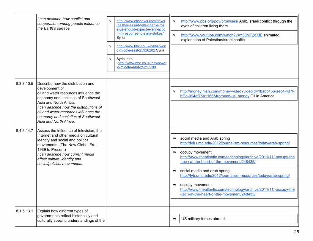
I can describe how conflict and cooperation among people influence the Earth’s surface.
v http://www.cbsnews.com/news/basharassadtellscharlieroseusshouldexpecteveryactioninresponsetosyriastrikes/ Syria
v http://www.bbc.co.uk/news/worldmiddleeast25926282 Syria
v Syria intro http://www.bbc.co.uk/news/worldmiddleeast25217799
v http://www.pbs.org/pov/promises/ Arab/Israeli conflict through the eyes of children living there
v http://www.youtube.com/watch?v=Y58njT2oXfE animated explanation of Palestine/Israel conflict
8.3.3.10.5 Describe how the distribution and development of oil and water resources influence the economy and societies of Southwest Asia and North Africa. I can describe how the distributions of oil and water resources influence the economy and societies of Southwest Asia and North Africa.
v http://money.msn.com/moneyvideo?videoid=1babc456aec44d7f
bf8c094ef75a1166&from=enus_money Oil in America
8.4.3.14.7 Assess the influence of television, the Internet and other media on cultural identity and social and political movements. (The New Global Era: 1989 to Present) I can describe how current media affect cultural identity and social/political movements.
w social media and Arab spring
http://fyb.umd.edu/2012/journalismresources/today/arabspring/
w occupy movement http://www.theatlantic.com/technology/archive/2011/11/occupythetechattheheartofthemovement/248435/
w social media and arab spring http://fyb.umd.edu/2012/journalismresources/today/arabspring/
w occupy movement http://www.theatlantic.com/technology/archive/2011/11/occupythetechattheheartofthemovement/248435/
8.1.5.13.1 Explain how different types of governments reflect historically and culturally specific understandings of the
w US military forces abroad
25

relationships between the individual, government and society. I can explain how different governments are influenced by history and culture.
http://news.nationalpost.com/2011/10/28/graphicmappingasuperpowersizedmilitary/
w http://www.icivics.org/teachers/lessonplans/whorules
8.4.3.14.5 (see also: Cen & S Asia, E & SE Asia, SubSah Afr
Assess the state of human rights around the world as described in the 1948 Universal Declaration of Human Rights. (The New Global Era: 1989 to Present) I can evaluate the state of human rights around the world.
w Human Rights Watch
http://www.hrw.org/
w UofM Center for Human Rights http://www1.umn.edu/humanrts/center/default.html (including “This is My Home” curriculum)
w United Nations Population Fund http://www.unfpa.org/issues/
w Asian Human Rights Commission http://www.humanrights.asia/
w Breaking the Silence http://www.breakingthesilence.org.il/
w Education program on children’s rights http://worldschildrensprize.org/page.html#&panel12
w India Together www.indiatogether.org/humanrights
w In Google Earth under the Global Awareness Layerchoose The
Elders: Every Human has Rights.This allows you to view issues around the world.
w unicef children’s rights http://teachunicef.org/sites/default/files/units/Child_rights_Unit_68.pd
w children with disabilities http://teachunicef.org/sites/default/files/documents/children_with_disabilities_68_0.pdf
w Amnesty International http://amnesty.org/ case studies, research, news; searchable by country
w Citizens for Global Solutions http://globalsolutions.org/humanrights
v http://globalsolutions.org/multimedia
w http://www.ohchr.org/en/pages/welcomepage.aspx
w Free the Children http://www.freethechildren.com/
w International Gay and Lesbian Human Rights Commission www.iglhrc.org/cgibin/iowa/home/index.html
w Know Child Labor http://www.knowchildlabor.org/
8.4.3.14.3 (see also: E & SE
Describe varieties of religious beliefs and practices in the contemporary world
w http://www.mapsofwar.com on this site there is a history of
26

Asia, Cen. & S Asia)
including Shamanism/Animism, Hinduism, Buddhism, Judaism, Christianity and Islam. (The New Global Era: 1989 to Present) I can describe different religions around the world.
religion animated map.
w summaries of world religions http://www.schoolatoz.nsw.edu.au/homeworkandstudy/othersubjectsandprojects/peopleculturesandgovernment/worldreligions
w UK RE resources for ages 1114 http://www.bbc.co.uk/schools/websites/11_16/site/re.shtml
8.4.3.14.6 Describe how movements and social conditions have affected the lives of women in different parts of the world. (The New Global Era: 1989 to Present) I can explain how women’s rights have changed around the world in the present era.
w http://www.pewresearch.org/f
acttank/2014/01/08/whatisappropriateattireforwomeninmuslimcountries/ women’s attire
w women’s rights
http://www.globalissues.org/article/166/womensrights
w umoja kenya http://www.nytimes.com/learning/teachers/lessons/20041208wednesday.html
v http://www.imdb.com/title/tt2258858/ Wadjda trailer Saudi girl and bike
8.1.1.1.1 Exhibit civic skills including participating in civic discussion on issues in the contemporary world, demonstrating respect for the opinions of people or groups who have different perspectives, and reaching consensus. I can participate in a civic discussion. I can demonstrate respect for opinions of people or groups who have different perspectives. I can apply inquiry and analysis skills to be a well informed citizen and participate in my country’s democratic government.
w debate http://debategraph.org/,
w http://www.procon.org/
w http://wwcsd.net/~widrigr/PersuasiveWriting.htm
27

South/Central Asia
Many benchmarks have been placed in multiple units. It is often helpful for students to address a benchmark multiple times during the course. It is not a requirement, however, that each benchmark be taught (or assessed) in all units where they have been placed. The pacing guides suggest variable lengths for units based on the number of benchmarks, but can, and should, be adjusted to meet local needs.
Code Benchmarks Student Friendly Language
Possible Topics: Resources:
8.3.3.5.6 Describe the locations of human populations and the cultural characteristics of South Asia and Central Asia, including causes for the differences in population density in the region, and implications of population growth in South Asia on the future world population. can show the reasons for different settlement patterns and how they affect future population growth of South Asia and Central Asia.
8.3.3.6.6 Describe how the physical and environmental features of South Asia and Central Asia affect human activity and settlement. I can show how the human population affect the physical characteristics and environmental features of South Asia and Central Asia.
v http://www.youtube.com/watch?v=U1R634vpRQ&featur
e=related, Aral Sea
v http://www.youtube.com/watch?v=EAUyddi_5j8&safe=active Aral Sea
8.3.3.10.7 Analyze the role of comparative advantage in the rise of the Indian market economy in the global economic system. I can analyze how comparative advantage has impacted the rise in the Indian market economy on the global economic system
v India Rising from ABC News
http://www.youtube.com/watch?v=FQ1O9NlnugE
w http://www.pbs.org/now/shows/425/ (india rising)
8.4.3.14.2 (see also Latin
Compare and contrast the development of diasporic communities throughout the world due to regional conflicts, changing international labor
28
America) demands and environmental factors. (The New Global Era: 1989 to Present) I can define diasporic communities.I can compare and contrast diasporic communities from 1989 to the present.
l
w list of diasporas http://en.wikipedia.org/wiki/List_of_diasporas
w letters from the diaspora http://www.nytimes.com/learning/teachers/lessons/20070905wednesday_print.htm
w garifuna diaspora (banana corporations caused) http://www.stanford.edu/group/arts/honduras/teacher/migrationteacher.html
w http://learning.blogs.nytimes.com/2007/09/05/lettersfromthediaspora/refugees
w http://www.redcross.org.uk/Whatwedo/Teachingresources/Lessonplans/Refugeessecondary
w http://movingpeoplechangingplaces.org/locations.html
8.2.5.12.1 (see also: S & SE Asia)
Explain why trade is mutually beneficial to countries; define and apply absolute and comparative advantage with respect to international trade. I can use international trade information to show how countries around the world benefit from trade.
w International trade game advanced level
http://www.imf.org/external/np/exr/center/students/trade/traders.aspx?u=DD60F25B
w globalization http://www.nytimes.com/learning/teachers/lessons/20040303wednesday.html
8.4.3.14.3 (see also: S & Cen. Asia, Middle East, E & SE Asia)
Describe varieties of religious beliefs and practices in the contemporary world including Shamanism/Animism, Hinduism, Buddhism, Judaism, Christianity and Islam. (The New Global Era: 1989 to Present) I can describe different religions around the world
w Dalit caste girls in India
http://www.theglobeandmail.com/news/world/breakingcaste/
w world religions http://www.schoolatoz.nsw.edu.au/homeworkandstudy/othersubjectsandprojects/peopleculturesandgovernment/worldreligions
w http://www.bbc.co.uk/schools/websites/11_16/site/re.shtml
29

8.4.3.14.5 (see also: subSah Afr, E & Se Asia, SW Asia & N. Afr)
Assess the state of human rights around the world as described in the 1948 Universal Declaration of Human Rights. (The New Global Era: 1989 to Present) I can evaluate the state of human rights around the world.
See resources under Africa South of the Sahara or SW Asia/N. Africa units
8.3.1.1.1 Obtain and analyze geographic information from a variety of print and electronic sources to investigate places or answer specific geographic questions; provide rationale for its use. I can gather and analyze geographic information from print and electronic sources.I can use geospatial technology to analyze geographic information.
w UN maps of human development
http://hdr.undp.org/en/data/map/
30

Africa South of the Sahara
Many benchmarks have been placed in multiple units. It is often helpful for students to address a benchmark multiple times during the course. It is not a requirement, however, that each benchmark be taught (or assessed) in all units where they have been placed. The pacing guides suggest variable lengths for units based on the number of benchmarks, but can, and should, be adjusted to meet local needs.
Code Benchmark Student Friendly Language
Possible Topics: Resources:
8.3.3.5.7 Describe the locations of human populations and the cultural characteristics of Africa South of the Sahara, including the causes and effects of the demographic transition since 1945. I can show settlement patterns of human population affect the cultural characteristics of Africa south of the Sahara since 1945.
v http://ngm.nationalgeographic.com/video/player?titleID=1437286183#/?titleID=africasahel&catID=1 Nat. Geo. on the Sahel
w PBS on race including activity on sorting people
http://www.pbs.org/race/002_SortingPeople/002_00home.htm
w Day in the Life of Africa project http://www.olympusglobal.com/en/event/DITLA/
w http://www.washingtonpost.com/wpsrv/photo/world/africa/index.htm
w http://www.inourvillage.org/index.html
v https://www.youtube.com/watch?v=BPjQGYaBDtg Africa overview teacher podcast
8.3.3.6.7 Describe how the physical and environmental features of Africa South of the Sahara affect human activity and settlement. I can show how the human population affect the physical characteristics and environmental features of Africa south of the Sahara
article about Africa's economic growth , Freshwater initiative from NGS , You Tube video for World Water Day
w http://www.foreignpolicy.com/articles/2012/06/11/afric
a_takes_off_by_g_paschal_zachary?page=0,0
w http://environment.nationalgeographic.com/environment/freshwater/aboutfreshwaterinitiative/#
v http://www.youtube.com/watch?feature=player_embedded&v=Xt5UGzLrqzE
w life without taps simulation game http://www.bridgesglobal.org.uk/documents/LWTOnline.pdf
31
v http://www.youtube.com/watch?v=2pXuAw1bSQo
8.3.3.7.1 (see also: SW Asia/NAfr)
Describe independence and nationalist movements in SubSaharan Africa and Asia, including India's independence movement. I can describe the independence and nationalist movements of SubSaharan Africa, Asia, and India.
v https://www.youtube.com/watch?feature=player_embedded&v=kPS_WXOyomY S.Sudancrisis documentary 8 min.
w Lost Boys of Sudan several short videos
http://education.nationalgeographic.com/education/topics/lostboys/?ar_a=1
w after Darfur resettlement in Midwest http://www.nytimes.com/learning/teachers/lessons/20070404wednesday.html
8.4.3.14.8 (See also Latin America)
Describe how groups are reviving and maintaining their traditional cultures, identities and distinctiveness in the context of increasing globalization. (The New Global Era: 1989 to Present) I can explain how groups are reviving and maintaining their traditional cultures and identitites in a world of increasing globalization.
w NGS Sudan: Country in Crisis videos
http://news.nationalgeographic.com/news/2006/12/061215sudanvideo1.html
v https://www.youtube.com/watch?v=pRpeEdMmmQ0 Shakira WakaWaka World Cup Soccer 2010
v World Cup Soccer Wavig Flag https://www.youtube.com/watch?v=y4a8ueEMz7YWavin
8.2.3.4.1 (see also: Overview, Eur/Russia)
Identify factors which affect economic growth (percentage changes in Gross Domestic Product—GDP) and lead to a different standard of living in different countries. I can identify factors which affect economic growth in different countries.
;
v https://www.youtube.com/watch?v=UFcYo3JCZo CNN Africa growth
v http://www.youtube.com/watch?v=bpSNM625LFU&safe=active#t=36 About MicroFinance Kiva
w http://www.gapminder.org
w Jr. Schol. Foreign aid by country: http://www.foreignassistance.gov/CountryIntro.aspx
w China’s economy http://www.pbs.org/newshour/extra/teachers/lessonplans/world/china.html
32
8.3.1.1.1 Obtain and analyze geographic information from a variety of print and electronic sources to investigate places or answer specific geographic questions; provide rationale for its use. I can gather and analyze geographic information from print and electronic sources.I can use geospatial technology to analyze geographic information.
8.4.3.14.5 (see also: Cen. & S. Asia, E and SE Asia, SW and N. Afr
Assess the state of human rights around the world as described in the 1948 Universal Declaration of Human Rights. (The New Global Era: 1989 to Present) I can evaluate the state of human rights around the world.
w Human Rights Watch
http://www.hrw.org/
w UofM Center for Human Rights http://www1.umn.edu/humanrts/center/default.html (including “This is My Home” curriculum)
w United Nations Population Fund http://www.unfpa.org/issues/
w Asian Human Rights Commission http://www.humanrights.asia/
w Breaking the Silence http://www.breakingthesilence.org.il/
w Education program on children’s rights http://worldschildrensprize.org/page.html#&panel12
w India Together www.indiatogether.org/humanrights
v https://www.youtube.com/watch?v=K2z8BoRyuSw Free Nelson Mandela song
v http://www.history.com/topics/nelsonmandela/videos/nelsonmandelac
w In Google Earth under the Global Awareness
Layerchoose The Elders: Every Human has Rights.This allows you to view issues around the world.
w UNICEFchildren’s rights http://teachunicef.org/sites/default/files/units/Child_rights_Unit_68.pd
w children with disabilities http://teachunicef.org/sites/default/files/documents/children_with_disabilities_68_0.pdf
w Amnesty International http://amnesty.org/ case studies, research, news; searchable by country
w Citizens for Global Solutions http://globalsolutions.org/humanrights
v http://globalsolutions.org/multimedia
w http://www.ohchr.org/en/pages/welcomepage.aspx
w Free the Children http://www.freethechildren.com/
w International Gay and Lesbian Human Rights Commission www.iglhrc.org/cgibin/iowa/home/index.html
w Know Child Labor http://www.knowchildlabor.org/
33
hampionoffreedom?m=528e394da93ae&s=undefined&f=1&free=false Nelson Mandela life
8.4.3.13.1 (see also Latin America)
Analyze connections between revolutions, independence movements and social transformations during the Cold War era. (The World After World War II: 19501989) I can explain how revolutions and independence movements changed societies during the Cold War Era.
v Mandelahttp://www.youtube.com/watch?v=yjYm78K6aNI BBC
v Mandela http://www.youtube.com/watch?v=hmmaazQQKA Long Walk to Freedom trailer
v Mandela Invictus trailer http://www.youtube.com/watch?v=AqKjVo9qso
8.3.2.3.1 Use appropriate geographic tools to analyze and explain the distribution of physical and human characteristics of places. I can use geographic tools to explain the distribution of physical and human characteristics of places.
w teacher info on wide variety of topics dealing with
Africa http://www.africa.upenn.edu/About_African/ww_dev.html
34

East/Southeast Asia unit
Many benchmarks have been placed in multiple units. It is often helpful for students to address a benchmark multiple times during the course. It is not a requirement, however, that each benchmark be taught (or assessed) in all units where they have been placed. The pacing guides suggest variable lengths for units based on the number of benchmarks, but can, and should, be adjusted to meet local needs.
Code Benchmarks Student Friendly Language
Possible Topics: Resources:
8.2.5.12.1 Explain why trade is mutually beneficial to countries; define and apply absolute and comparative advantage with respect to international trade. I can use international trade information to show how countries around the world benefit from trade.
w http://www.forbes.com/2010/04/20/oilenergyminerals
businessglobal200010chinainvestmenttracker.html
w http://www.nytimes.com/learning/teachers/lessons/20040303wednesday.html
8.3.3.5.5 Describe the locations of human populations and the cultural characteristics of East Asia and Southeast Asia, including how the demographic transition has influenced the region’s population, economy and culture. I can show how settlement patterns of human population affect the cultural characteristics of East Asia and Southeast Asia.
;
w http://lt.umn.edu/earthducation/expedition6/2014/05/06/community/ Earthducation #6 Nepal
v NGS world reaches 7 billion
http://www.youtube.com/watch?v=sc4HxPxNrZ0&feature=player_embedded
v NGS Are you Typical? http://www.youtube.com/watch?v=4B2xOvKFFz4&feature=relmfu
w http://ngm.nationalgeographic.com/7billion
v http://www.youtube.com/watch?v=VcSX4ytEfcE excellent re: population growth
v http://ed.ted.com/lessons/howpandemicsspread
8.3.3.6.5 Describe how the physical and environmental features of East Asia and Southeast Asia affect human activity and settlement. I can show how the settlement patterns of human population affect the physical characteristics and
v ABC video quake and tsunami 2011
http://www.abc.net.au/news/specials/japanquake2011/
35

environmental features of East Asia and Southeast Asia.
v http://freevideocoding.com/flvplayer.swf?file=http://flash.vx.roo.com/streamingVX/63056/1458/20110311_japan_wave_successions_sky_1000k.mp4&autostart=true
8.3.3.10.6 Identify the characteristics of a market economy that exist in contemporary China; describe how China's changing economy has impacted the United States and the global economic system since 1970. I can identify the characteristics of China’s market economy and the impact it has on the United States.
w China’s economy
http://www.pbs.org/newshour/extra/teachers/lessonplans/world/china.html
8.2.3.4.2 Identify characteristics of command, mixed, and marketbased (capitalist) economies; classify the economic systems of countries in a given region. I can explain the different characteristics of economic systems around the world
w comparative economic systems
http://www.econedlink.org/lessons/index.php?lid=322&type=educator
w who what for whom http://www.councilforeconed.org/lessonresources/lessons/samplelessons/Master_Curriculum_Guides_56_Sample_Lesson.pdf
w candy activity for different systems http://www.fraserinstitute.org/uploadedFiles/fraserca/Content/educationprograms/teachers/classroomresources/LessonPlanEconomicSystems.pdf
8.2.1.1.1 Apply reasoned decisionmaking techniques in making choices; explain why different governments faced with the same alternatives might make different choices. I can explain why individuals and governments make different economic choices.
w paced chart
http://fffl.councilforeconed.org/documents/9781561836949visuallesson02.pdf
w benefits and drawbacks of globalization http://www.nytimes.com/learning/teachers/lessons/20040303wednesday.html
w khmer rouge search for justice
36

http://www.nytimes.com/learning/teachers/lessons/20071114wednesday.html
8.4.3.14.3 (see also: Cen. & S Asia, SWasia/NAfr)
Describe varieties of religious beliefs and practices in the contemporary world including Shamanism/Animism, Hinduism, Buddhism, Judaism, Christianity and Islam. (The New Global Era: 1989 to Present) I can describe different religions around the world.
w summaries of world religions
http://www.schoolatoz.nsw.edu.au/homeworkandstudy/othersubjectsandprojects/peopleculturesandgovernment/worldreligions
w UK RE resources for ages 1114 http://www.bbc.co.uk/schools/websites/11_16/site/re.shtml
w Burma Buddhism government oppression of monks http://www.nytimes.com/learning/teachers/lessons/20071003wednesday.html
8.4.3.14.4 Analyze how Pacific Rim countries have achieved economic growth in recent decades. (The New Global Era: 1989 to Present) I can analyze how the Pacfic Rim countries have grown economically from 1989 to the present.
w how East Asia became an economic power
lessonhttp://www.indiana.edu/~easc/outreach/documents/teamsvol2/how_east_asia_became_an_economic_power.pdf
8.3.1.1.1 Obtain and analyze geographic information from a variety of print and electronic sources to investigate places or answer specific geographic questions; provide rationale for its use. I can gather and analyze geographic information from print and electronic sources. I can use geospatial technology to analyze geographic information.
w UN maps of human development
http://hdr.undp.org/en/data/map/
8.4.3.14.5 (see also: subSah Afr, SW & N Afr.,
Assess the state of human rights around the world as described in the 1948 Universal Declaration of Human Rights. (The New Global Era: 1989 to Present)
See resources under SW Asia/N. Africa or subSahara Africa units
37

S & Cen Asia) I can evaluate the state of human rights around the world.
8.4.1.2.1 Pose questions about a topic in world history; gather and organize a variety of primary and secondary sources related to the questions; analyze sources for credibility and bias; suggest possible answers and write a thesis statement; use sources to draw conclusions and support the thesis; and present supported findings and cite sources. I can research a topic and create a thesis statement using contemporary world history . I can use both primary and secondary sources to site my findings.
Geothentic is a Univ. of Minnesota project where students solve real world problems in locating a hospital, avian flu, climate change, and more.
38

Australia/Oceania
Many benchmarks have been placed in multiple units. It is often helpful for students to address a benchmark multiple times during the course. It is not a requirement, however, that each benchmark be taught (or assessed) in all units where they have been placed. The pacing guides suggest variable lengths for units based on the number of benchmarks, but can, and should, be adjusted to meet local needs.
Code Benchmarks Student Friendly Language Possible Topics: Resources:
8.3.3.5.8 Describe the locations of human populations and the cultural characteristics of Australia/Oceania.I can show how settlement patterns of human population affect the cultural characteristics of Australia/Oceania.
v Time lapse video of New Zealand http://vimeo.com/43799611
w Korean population in NZ lesson http://www.asianz.org.nz/ourwork/educatingasia/asiacurriculum/units/korea
w population possibilities activity http://www.stats.govt.nz/tools_and_services/services/schools_corner/Activities/Secondary/activityibmeducationresource.aspx
w (use with interactive boundary map http://apps.nowwhere.com.au/StatsNZ/Maps/default.aspx)
w Aboriginal Australia http://www.schoolatoz.nsw.edu.au/homeworkandstudy/othersubjectsandprojects/history/aboriginalaustralia
w Many Nations One People (Australia) http://www.abc.net.au/schoolstv/nations/
8.3.2.6.8 Describe how the physical and environmental features of Australia/ Oceania affect human activity and settlement, including how the human populations have adapted to and changed the
w www.go4thesummit.com ; sustainability
http://www.reefcheckaustralia.org/files/documents/83/teacher_facilitation_and_information_guide.pdf
w Gold (focus on Australian Gold Rush)
39

landscape differently over time. I can show how human population affects the physical characteristics and environmental features of Australia/Oceania.
http://www.schoolatoz.nsw.edu.au/homeworkandstudy/othersubjectsandprojects/history/gold
v http://www.youtube.com/watch?v=tdMCAV6Yd0Y NZ haka video
8.3.1.1.1 Obtain and analyze geographic information from a variety of print and electronic sources to investigate places or answer specific geographic questions; provide rationale for its use. I can gather and analyze geographic information from print and electronic sources. I can use geospatial technology to analyze geographic information.
http://www.youtube.com/watch?v=XCbPFHu3OOc
http://www.youtube.com/watch?v=qHIDGESGh5c
40

General Resources
Resources: Description
http://www.educationalsimulations.com/index.php Real Lives is a unique, interactive life simulation game that enables you to live one of billions of lives in any country in the world.
http://wws.peacecorps.gov/wws/educators/ Lessons (culture)
http://www.econedlink.org/ K12 Econ Lesson Materials (470 Lessons)
http://www.econdata.net/ 400 links to socioeconomic data sources and a topten list of sites.
http://www.geteach.com/ Allows dual screen Google Earth displaying any info from the CIA Factbook and Google Earth
www.overlapmaps.com Overlay countries and physical features for size comparison
http://hdr.undp.org/en/data/map/ UN Human Development in maps
http://www.scoop.it/t/geographyeducation Frequent updates on topics of interest in Geography
http://education.nationalgeographic.com/education/?ar_a=1 Numerous teacher resources from National Geographic
http://www.peacecorps.gov/wws/educators/enrichment/globalissuesfocus/index.cfm
Peace Corps lessons and other ideas
http://www.newseum.org/todaysfrontpages/flash/ Front pages of newspapers from around the world
http://www.kmlfactbook.org/ All the info in the CIA Factbook put on Google Earth in file that can be saved
http://www.archives.gov/federalregister/electoralcollege/links.html Office of the Federal Register
http://www.newspapermap.com Google map with clickable links to newspapers around the world
http://wwwpersonal.umich.edu/~mejn/cartograms/ World Cartograms
http://www.weexplore.com/ Online adventure learning environment where students pose their own questions, answer them, and share safely online.
http://mapfrappe.com/ Overlay any place onto another for true size comparison
41