pre feasibility report - welcome to...
TRANSCRIPT

1
PRE – FEASIBILITY
REPORT

2
TABLE OF CONTENT
Sr.
No.
Content Page
No.
1.0 Executive Summary 3
2.0 Introduction of Project and Background Information 5
3.0 Project Description 8
4.0 Site Analysis 14
5.0 Planning Brief 20
6.0 Proposed Infrastructure 25
7.0 Rehabilitation & Resettlement 26
8.0 Project Schedule 26
9.0 Analysis of Proposal 27

3
1. EXECUTIVE SUMMARY
Particulars Details
Location Sinla Limestone Mining Lease Area
Near village Sinla (Nimbol),
Tehsil –Jaitaran, Distt –Pali, Rajasthan
Latitude 26°18'36.05"N to 26°19'40.61"N
Longitude 73°49'4.96"E to 73°49'59.71"E
Toposheet No. 45F/15
Total lease Lease area 100.7528ha.
Mineable Reserves 17.77 million tones
After detailed exploration, mineral reserves and
mine life may increased.
Capacity Proposed production – 2.0Million Tonnes Per annum
(MTPA) (ROM)
Life of Mine 10 years
After detailed exploration mineral reserves and mine
life may increased.
Ultimate Pit Limit 261 mRL
Estimated project cost Rs13.17crores
EMP Cost Rs 1.0 crores
DG Set 1 No.
Highest and Lowest Elevation
S. No. Particulars Elevation (m AMSL)
1. Highest 308.27

4
2. Lowest 288.88
Land use 1) Govt. Waste land (19.2955 Ha.) & Private Land
81.4573 Ha)
Nearest Habitation/ Town Sinla, approximate 1.00 km from applied area in N
direction
Nearest Airport Jodhpur,89 km
Nearest Highway NH-112 at 21 km
Nearest Railway Station Bilara Railway Station 25 km
Power Supply Sinla
Nearest Dispensary and Govt.
Hospital
Jaitaran at 21 km.
Educational Facility Jaitaran at 21 km.
Nearest Telephone Facility Jaitaran at 21 km.
Water Demand and Supply 16 KLD, Source: Tube well
Nearest Tourist Places None within the study area
Defense Installations None within the study area
Archeological Features None within the study area
Ecological Sensitive Zones None within the study area
Nearest Streams/ Rivers/
Water Bodies (from mine
boundary)
Luni(Seasonal River) 2 km in south
Seismic Zone Seismic zone – II.
5
2. INTRODUCTION OF PROJECT /BACKGROUND INFORMATION
Mining project for Limestone (Cement Grade)with.M.L. No 155/2012. The project is
located near village – Sinla (Nimbol) Tehsil – Jaitaran and District – Pali, Raj. Applied
area – 126.075 hect.
LOI granted over the area : 100.7528 ha.
Proposed production – 2.0millionTPA (ROM).
2.1 Identification of the project and project proponent
Name of the Project Sinla Limestone Mining Lease Area
Name of the Lessee Nirma Limited
Location of the project Near Village – Sinla (Nimbol)
Tehsil –Jaitaran, Distt – Pali (Raj.)
Proposed Production 2.0Million TPA (ROM) Cement Grade
Lease Area 100.7528ha. (Govt. & Private Land)
Mob. No. +91 9825320090
Status of the Firm Limited Company
2.2 Brief description of the nature of the project:
An area of limestone (cement grade), admeasuring 126.075 ha near Village Sinla
(Nimbol), Tehsil Jaitaran of District Pali, Rajasthan was granted under Prospecting
License (PL) in favour of company by Govt. of Rajasthan vide order no.
DMG/SOJAT/CC,12/P.1(2) 6/2009/412 dated 25.08.2010 under rule 9(1) of MCR,
1960.
After getting the Prospecting License Deed executed on 09.09.2010, company had
submitted the scheme of prospecting as required under rule 4 of MCDR, 1988 to the
Controller General, IBM, Govt. of India, Nagpur and carried out detailed geological
prospecting as per Scheme of Prospecting with view to prove the availability of
cement grade limestone for its Cement Plant (capacity 2.28 Million TPA) located at
VillageNimbol, Tehsil Jaitaran, District Pali, Rajasthan State.

6
The company has submitted an application for grant of Mining Lease vide letter no.
SVCPL/GGK/ML/7065A/107/2012-13 dated 06.09.2012 for winning limestone
(cement grade) for captive use for cement manufacturing.
The ML application has been disposed off by the Govt. of Rajasthan and issued
Letter of Intent (LOI) vide letter no. P.3 (20)KHAN/GR.-2/2014 dated 05.12.2014 for
grant of mining lease over an area of 126.075ha excluding of gaucher land
18.2637ha (Annexure 1).In turn, ME, DMG, Sojat City has demarcated the area jointly with
surveyor, PatwariDigrana&Nimbol after excluding gaucher land and adjoining area and prepared
demarcation report for an area admeasuring 100.7528 ha excluding gaucher land and adjoining area
and accordingly State Govt has issued the revised LOI vide order no. P.3(20)KHAN/GR.-2/2014
dated 21.07.2015 for over an area of 100.7528 ha.
In pursuant to the order of Honorable High Court of Gujarat, M/s Siddhi Vinayak
Cement Pvt.Ltd. (SVCPL) has been amalgamated with M/S NIRMA Limited (NL)
with an appointment date of 1st April 2014. In pursuance to the order with effect
from 10th June 2015 being the date on which scheme coming into effect. All the
assets and liabilities including entire businesses of Siddhi Vinayak Cement Pvt.Ltd.
(SVCPL) without any further act or deed, stood transferred to and vested into the
Nirma Ltd.
Consequent upon the amalgamation, Siddhi Vinayak Pvt.Ltd. would now be
knownas “NIRMA LIMITED”.
The certified copy of the order issued on 3rd June 2015 passed by the Hon’ble High
Court of Gujarat is enclosed herewith as Annexure -__. Copy of resolution passed
by the Board of Directors of the Company taking into the record the amalgamation
of Siddhi Vinayak Cement Pvt.Ltd. with the Nirma Ltd. in the light of the said
order is enclosed herewith as Annexure No. ............
Nature of the Project:
Mining of Limestone (Cement Grade) is proposed in the area of 100.7528ha. (Govt.
& Private Land), near village– Sinla (Nimbol), Tehsil – Jaitaran, District – Pali,
Rajasthan. Mining will be carried out by Opencast Mechanized method. Proposed
production is 2.0Million TPA (ROM).

7
2.3 Need for the project and its importance to the country and or region:
The basic objective of the project is to make effective utilization of material in the
country or region. The entire limestone generated from this mine will be taken from
captive use at Company’s Cement plant for Cement manufacturing. Extracted
limestone will not be sold to any other party.Limestone mining will help in the
economic growth of the country or region and provides direct and indirect
employment to nearby labourers.
2.4 Demands-supply gap:
The entire limestone generated from this mine will be taken from captive use at
Company’s Cement plant for Cement manufacturing. Extracted limestone will not
be sold to any other party.
2.5 Imports vs. Indigenous Production
There will be no import for the project. There will be indigenous inputs in the entire
mining activity.
2.6 Export Possibility
The entire production of limestone will be used by cement plant of the Company
located at Village –Nimbol, Tehsil Jaitaran, Dist. Pali, Rajasthan. No part of the
product is proposed to be exported.
2.7 Domestic/Export Markets
The proposed mining activity is for obtaining limestone for indigenous consumption for
cement manufacturing.
2.8 Employment Generation (Direct or Indirect)
The mining project will generate direct & indirect employment. About 106
people will get employment. About 60-70 % employment shall be from local
villages.
S No. Category Nos.
1 Highly Skilled 23

8
2 Skilled 70
3 Semi- Skilled 08
4 Un-Skilled 05
Total 106
3.0 PROJECT DESCRIPTION
3.1 Type of project including interlinked and interdependent projects:
The proposed project is mining unit of Limestone in the area of 100.7528ha.
situated near village Sinla (Nimbol) Tehsil – Jaitaran& District – Pali, Rajasthan.
Proposed Production is 2.0MillionTPA (ROM).
No Interlinked or Interdependent project.
3.2 Location
Near Village : Sinla(Nimbol)
Tehsil : Jaitaran
District : Pali
State : Rajasthan
Google Image of the applied area –
9
TOPOSHEET NO. WITH LATITUDE AND LONGITUDE
The applied area forms a part of Survey of India toposheet no.45F/15.The appliedis
located at following latitude and longitudes:
Latitude: 26°18'36.05"N to 26°19'40.61"N
Longitude: 73°49'4.96"E to 73°49'59.71"E
The highest elevation of the area is 308.27 m AMSL and lowest being 288.88m
AMSL.
3.3 Details of Alternate Site Considered and the Basis of Selecting the Proposed Site,
Particularly the Environmental Considerations Gone Into Should Be Highlighted:
Mining is site specific project hence no alternate site is considered.
3.4 Size/Magnitude of Operation
It is proposed to produce 2.0Million TPA (ROM) of Limestone (Cement Grade)from
the area of 100.7528hectares by Open cast Mechanized method of mining.
3.5 Project description with process details:
It is a mining project of Limestone(Cement Grade) from the applied area
100.7528ha, situated at near village –Sinla (Nimbol), Tehsil – Jaitaran, District –
Pali, Rajasthan. Proposed production is 2.0million TPA (ROM).The material
generated from this mine will be for captive use in Company’s own Cement plant
located at village Nimbol.
Proposed Mining Method
The Limestone Mine shall be developed by Mechanized open cast mining by
developing systematic benches.
The bench Parameter shall be for mineral
1. Bench Height 8 m
2. Working Bench Width 10-15 m

10
3. Working Face Slope 85o
Diesel engine operated fully hydraulic heavy duty dozers shall be deployed for making haul
roads, their maintenance, dozing, collection and removal of loose material, cleaning of haul
road and faces, making heaps of blasted material for efficient loading etc.
Alluvium/ soil is to be removed first by means of dozer and loaded and transported to a
place where it is to be stacked temporarily.
Diesel engine operated crawler mounted hydraulic excavators with 3.5 cum capacity
bucket shall be used to load alluvium and usable limestone into 25tonne capacity
diesel engine operated Rear Dumpers. The alluvium shall be taken to place where
plantation/ greenbelt are to be carried out and ROM limestone from various benches
shall be transported and fed directly to the crusher situated in cement plant
periphery.
100 mm- 115 mm dia drilling are proposed with hole depth of 8.8m with sub-grade
drilling.The explosive charge per hole shall, therefore, be 30 kgs. with about 25%
(20% to 30%) of the charge being booster charge and the balance 75% (80% to 70%)
consisting of column charge (ANFO is proposed).The pattern of initiation adopted
affects the standard of fragmentation, muck profile after blast, ground vibrations
caused, noise generated, fly rock, air blast etc. At this applied area, square/
rectangular/ staggered grid, multi row pattern or extended V pattern shall be
adopted to start with and later on based on experience gained the pattern to be
adopted in future shall be standardized.
Long/ short (ms) delays shall be used. This will help in reduction of ground
vibrations, back break, fly-rock, air blast etc.
Ground Water Table
Proposed working will not intersect Ground water.
11
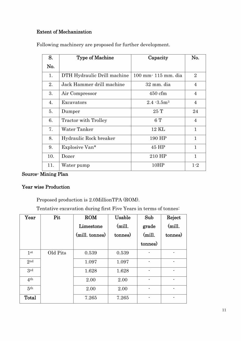
Extent of Mechanization
Following machinery are proposed for further development.
S.
No.
Type of Machine Capacity No.
1. DTH Hydraulic Drill machine 100 mm- 115 mm. dia 2
2. Jack Hammer drill machine 32 mm. dia 4
3. Air Compressor 450 cfm 4
4. Excavators 2.4 -3.5m3 4
5. Dumper 25 T 24
6. Tractor with Trolley 6 T 4
7. Water Tanker 12 KL 1
8. Hydraulic Rock breaker 190 HP 1
9. Explosive Van* 45 HP 1
10. Dozer 210 HP 1
11. Water pump 10HP 1-2
Source- Mining Plan
Year wise Production
Proposed production is 2.0MillionTPA (ROM).
Tentative excavation during first Five Years in terms of tonnes:
Year Pit ROM
Limestone
(mill. tonnes)
Usable
(mill.
tonnes)
Sub
grade
(mill.
tonnes)
Reject
(mill.
tonnes)
1st Old Pits 0.539 0.539 - -
2nd 1.097 1.097 - -
3rd 1.628 1.628 - -
4th 2.00 2.00 - -
5th 2.00 2.00 - -
Total 7.265 7.265 - -
12
Source-Mining Plan
3.6 Raw material required along with estimated quantity, likely source, marketing area
of final products, mode of transport of raw material and finished product:
Raw material i.e.Limestone will be produced by opencast Mechanized method of
mining, proposed production is 2.0MillionTPA; it will be transported to Plant by
using tippers/dumpers.
3.7 Resource optimization/ recycling and reuse envisaged in the project, if any, should
be briefly outlined.
Not applicable.
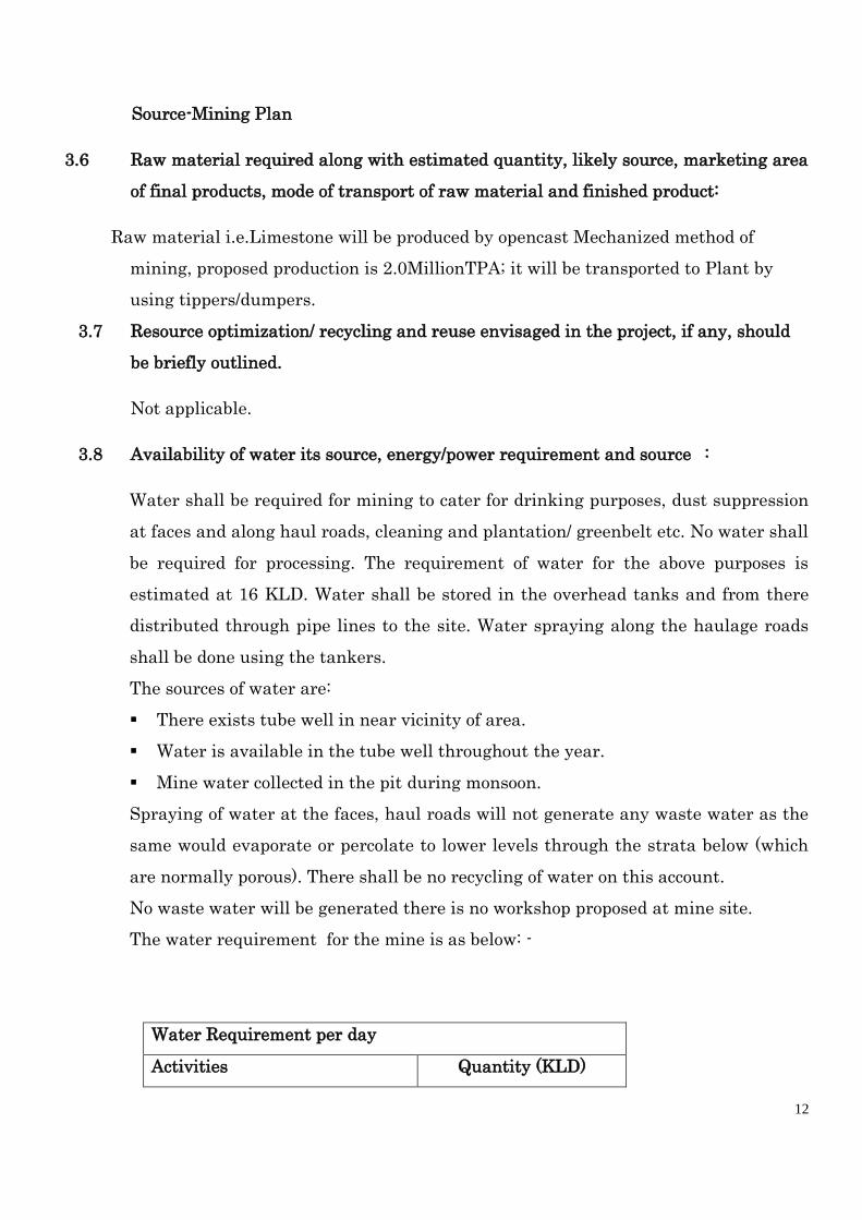
3.8 Availability of water its source, energy/power requirement and source :
Water shall be required for mining to cater for drinking purposes, dust suppression
at faces and along haul roads, cleaning and plantation/ greenbelt etc. No water shall
be required for processing. The requirement of water for the above purposes is
estimated at 16 KLD. Water shall be stored in the overhead tanks and from there
distributed through pipe lines to the site. Water spraying along the haulage roads
shall be done using the tankers.
The sources of water are:
There exists tube well in near vicinity of area.
Water is available in the tube well throughout the year.
Mine water collected in the pit during monsoon.
Spraying of water at the faces, haul roads will not generate any waste water as the
same would evaporate or percolate to lower levels through the strata below (which
are normally porous). There shall be no recycling of water on this account.
No waste water will be generated there is no workshop proposed at mine site.
The water requirement for the mine is as below: -
Water Requirement per day
Activities Quantity (KLD)
13
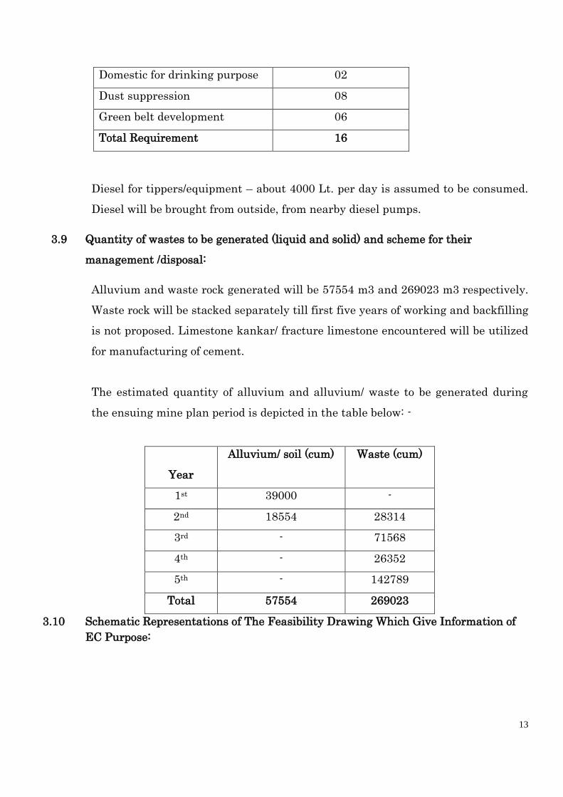
Domestic for drinking purpose 02
Dust suppression 08
Green belt development 06
Total Requirement 16
Diesel for tippers/equipment – about 4000 Lt. per day is assumed to be consumed.
Diesel will be brought from outside, from nearby diesel pumps.
3.9 Quantity of wastes to be generated (liquid and solid) and scheme for their
management /disposal:
Alluvium and waste rock generated will be 57554 m3 and 269023 m3 respectively.
Waste rock will be stacked separately till first five years of working and backfilling
is not proposed. Limestone kankar/ fracture limestone encountered will be utilized
for manufacturing of cement.
The estimated quantity of alluvium and alluvium/ waste to be generated during
the ensuing mine plan period is depicted in the table below: -
Year
Alluvium/ soil (cum) Waste (cum)
1st 39000 -
2nd 18554 28314
3rd - 71568
4th - 26352
5th - 142789
Total 57554 269023
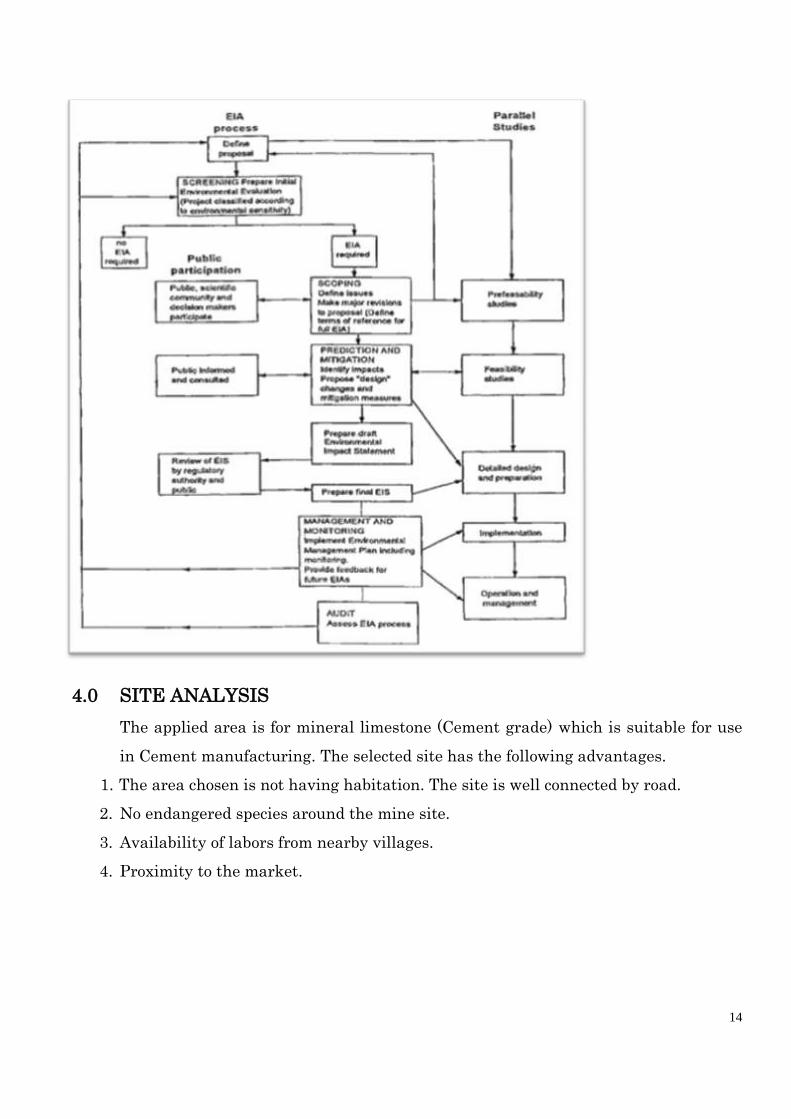
3.10 Schematic Representations of The Feasibility Drawing Which Give Information of
EC Purpose:
14
4.0 SITE ANALYSIS
The applied area is for mineral limestone (Cement grade) which is suitable for use
in Cement manufacturing. The selected site has the following advantages.
1. The area chosen is not having habitation. The site is well connected by road.
2. No endangered species around the mine site.
3. Availability of labors from nearby villages.
4. Proximity to the market.
15
4.1 Connectivity
Connectivity Details from Project Site:
4.2 Land form, land use and land ownership
The applied area is undulating terrain marked by alluvial land with low raised
stony waste hills trending north-south.The highest elevation of the area is 308.27 m
AMSL and lowest elevation is 288.88 mAMSL.
Sr.
No. Particulars Details
1. Road
Connectivity
The area is about 21 km away from the Jaitaran town which is on
National Highway No. 112. The area is presently not well connected
directly with the National and State highways. Few buses are plying on
the road leading to village Sinla (Nimbol).
Facilities available around the applied area:
1. Police Station at Jaitaran – 21.0 km
2. NH-112 at Jaitaran – 21.0 km
3. Railway Station at Merta City &Bilara – 55 km & 25 km respectively
4. Hospital at Jaitaran – 21 km
5. Airport at Jodhpur – 89 km.
2. Nearest
Highway
NH-112 (21 km)
3.
Nearest
Railway
Station
The nearest railhead is at Bilara a distance of 25 km.
4. Nearest
Airport
The nearest civilian airport for regular commercial flights is at
Jodhpur, the road distance from the applied area is around 89
km.
Type of Land Area in Hectares
Govt. Waste Land 19.2955

16
4.3 Topography
The applied area forms a part of undulating terrain marked by alluviul land with
low raised stony waste hills trending north-south. The general elevation ranged
from 288.88m to 308.27 m amsl. The area is marked by few shallow mining pits
scattered all over the limestone ridge having mostly the capping of dolomitic
limestone. Slight slope can be seen from north to south.
The area for mining lease forms part of the semi-arid zone. No specific drainage
pattern is developed within the area. The rainwater flows as per natural slopes in
the nearby fields. No perennial nallas or river is found in the applied area as well as
within 10 km radius area. Luniriver flows at around 2.0 km radially in south which
is a seasonal river.
4.4 Existing Land use Pattern
The applied area is Govt. Waste & Private Land (100.7528 hect.). Existing land use
pattern is given as below:
Particulars Forest
Land
Ag/
Private
Land
Grazing
Land
Waste
Land
Othe
rs
Total
a) Pits &
Quarries
- 1.17 - 1.40 - 2.57
b) Dumps of ore
Waste & O.B.
Soil stack
- Nil
Nil
Nil
- Nil
Nil
Nil
- Nil
Nil
Nil
c)
Infrastructure
including of
office, Roads
- 0.50 - 0.50 - 1.00
d) Township - Nil - Nil - Nil
e) Others
(i) Barren land
-
-
-
17.3955
-
-
Private Land 81.4573
Total: 100.7528
17
(ii) Crop land - 79.7873 - - - 79.7873
Total occupied
Area
- 81.4573 - 19.2955 - 81.4573
4.5 Existing Infrastructure:
Road transport, post and telegraph, communication, banking, education and health
care are the basic amenities, which are required in any township. Nirma Limited
management shall take all the necessary steps for upliftment of the basic amenities
in the area by providing drinking water, pucca road, education, health care
etc.Regular medical checkups of the mine employees will be carried out as per the
provisions of Mines Rules 1955.
4.6 Soil classification:
The area of limestone and its surroundings present a simple structural setup. No
major structural feature and disturbed structure is observed in the area.
The limestone is highly jointed and the prominent set of joint seen in the area. At
places voids/ cavities have been observed within the limestone surface exposures.
The limestone contains a high percentage of calcium carbonate and variable
percentage of magnesium carbonate, silica, alumina and iron oxides. The nature of
occurrence of high-grade limestone is highly erratic on the surface and it has been
found to change laterally to the dolomitic and silicified variety within very short
distance
The following succession of rock unit observed in the applied ML area: -
Alluvium 1.0m to 6.0m
Dol. Limestone 5.0m to 20.0m (1 to 3 beds)
High Gr. Limestone Upto 4.0m at places (1 bed)
Cement Gr. Limestone 5.0m to 13.0m (1 to 2 beds)
Low Gr. Limestone 8.0m to 19.0m (1 bed)
Regional geology & local geology:
a) Regional geology:-

18
The Bilara limestone extends from Mandla in Sojat Tehsil, district Pali to
RolQuazian in tehsil and district Nagaur via Atbara, Bilara, Borunda, Gotan,
Mundwa, Khinvsar. The length of Bilara Limestone has been observed over 150 km
with width ranging from a km to over 10 km.
The Regional Stratigraphy of the applied area is as follows:
Group Formation Rock Type Nagaur
Group Tunklian
Sandstone
Sandstone, gritty sandstone & pebbly
sandstone Nagaur
Sandstone
Brick red sandstone, siltstone, shale
Pondlo
Dolomite
Dolomite, dolomitic limestone, cherty
dolomite, Stromatolitic limestone,
dolomite etc.
Bilara
Group Gotan
Limestone
Limestone with bands of
chert and dolomite.
Dhanappa
Dolomite
Stromatolitic limestone, dolomite,
dolomite limestone, chert and cherty
dolomite Gribhakar
Sandstone
Bricked siltstone, shale & sand stone
Sonia
Sandstone
Maroon silt stone, shale & sand stone
-------------Unconformity -----------
Jodhpur
Group Pokhran
Boulder Bed
Bed comprising pebbles, cobbles, boulders
and erratic of Malani Granite and rhyolite
in sandy/ silty/ clay matrix
Local Geology
Sinla limestone deposit falls in the Bilara Limestone belt. The surface elevation of
limestone deposit in the lease area ranges from 288.88m AMSL to 308.27 m AMSL.
The applied area has stony wasteland appearance with major part of the area
except small few patches/ parts as agricultural land.
The high grade limestone from Borunda and Gotan area is known for its low silica
less than 1.5%, CaO more than 52%, MgO less than 1% and TC over 97%. Such
deposits are being mined near villages BasniSejan and Pundloo and are located in
nearby applied area of limestone.
19
Limestone in the area strikes North-South to North East-South West and is gently
dipping on either side, at low angles, less than 150. The area is not structurally
much disturbed and almost free from faults. Parts of the applied area have stony
wasteland appearance with isolated alluvial areas which have been developed as
cultivable land.
4.7 Climatic details
The climatic conditions in this region remain arid to semi arid throughout the year,
with extremes of temperature and unreliable scanty rainfall. The rainfall is very
unreliable, as there have been fluctuations during various periods. The rainfall in
the area is scanty about average 400 mm per annum. About 80% of the rainfall is
during the months of July to September. The variation of annual rainfall from year
to year is very large. On an average, there are about 30 rainy days in a year. During
the southwest monsoon season relative humidity is generally 60% and during the
rest of the year is 30%. During summer season sometimes, humidity drops as low as
15%.
Variation is very high in maximum and minimum temperature ranges, which are
the characteristics of tropical climate. The temperature starts rising from March to
maximum in the month of May/ June. Hottest months are April, May & June with
scorching sun always over the sky. In summer extremely hot when day temperature
shoots up to 47oC. The lowest temperature in winter season has been recorded 3oC.
The air is generally dry except during the short period of rainy season.
4.8 Social Infrastructure
The social infrastructure like educational facilities (Primary and Higher Secondary School),
Drinking water supply, Post and Telegraph, Public transportation and Primary
Health Centre are available in the study area.

20
5. PLANNING BRIEF
5.1 Planning concept
It ispropose to produce 2.0Million TPA (ROM) of Limestone(cement grade)from the
applied area. It is situated in Pali District of Rajasthan.
5.2 Population projection
The mining project will generate direct & indirect employment. About 106
people will get employment. About 60-70 % employment shall be from local
villages.
S No. Category Nos.
1 Highly Skilled 23
2 Skilled 70
3 Semi- Skilled 08
4 Un-Skilled 05
Total 106
5.3 Land use Planning:
Land use pattern (Hects.)
Sr.
No.
Particulars Pre-
Operational
Operational Post-
Operational
A) Mining
Activity
1 Pits 2.57 19.5000 27.77
2 Dumps 0.0000 4.000 0.0000
3 Road &
Building
1.0000 1.6000 1.0000
4 Top Soil
Storage
- - 0.00
5 Plantation - 2.50 6.50
6 Plantation
on Backfilled
- - 2.23
B) Remaining
Virgin. Govt.
17.3955
3.7655
0.0055

21
Waste Land
C) Agriculture
Private Land
79.7873 69.3873 63.2473
Total area 100.7528 100.7528 100.7528
5.4 Assessment of infrastructure demand (physical and social).
Road transport, post and telegraph, communication, banking, education and health
care are the basic amenities, which are required in any township. Nirma Limited
management shall take all the necessary steps for upliftment of the basic amenities
in the area by providing drinking water, pucca road, education, health care
etc.Regular medical checkups of the mine employees will be carried out as per the
provisions of Mines Rules 1955.
5.5 Facilities provided:
5.5.1 Infrastructure
Additional facilities will be made as per the requirement.Arrangements for safe and
healthy working conditions.Provision of Drinking water from nearby tube well or
through tankers in dry period as per the Mines Rules.Toilets, First aid facility will
be provided as per Mines rules.
5.5.2 Landscaping and green belt development
During the first five years plantation is proposed to be covered an area of 2.5 ha along
boundary. Plantation shall be done at the rate of 1000 saplings/ha. This includes 6.5 ha
along periphery and 2.23 ha on backfilled area.
Stage wise Cumulative Plantation
Year Peripheral Unworked /
Backfilled Area
Total
Area
(Ha.)
No. of
trees
Area
(Ha.)
No. of trees Area
(Ha.)
No. of
trees
1st 0.50 500 - - 0.50 500
2nd 0.50 500 - - 0.50 500
3rd 0.50 500 - - 0.50 500
4th 0.50 500 - - 0.50 500
22
5th 0.50 500 - - 0.50 500
6th year
onwards
till mine
life
4.00 4000 2.23 2500 6.23 6500
Total 6.50 6500 2.23 2500 8.73 9000
The following species to be planted: -
S. No. Local Name Botanical Name
1. Anwala Emblicaofficinalis
2. Khejri Prosopis cineraria
3. Khair Acacia catechu
4. Neem Azadirachtaindica
5. Shisham Dalbergiasissoo
Protection of Plants:
Survival rate assumed: 75%. For improving the survival rate of the plant following
measures to be taken care of:
A self generation bio-fertilizer will also be established.
Tree guard/ fencing shall be provided to protect the saplings.
5.5.3 Health and safety System
During the opencast working, and allied activities, all the precautionary measures
shall be taken into account as per MMR 1961 and MCDR 1988 for safety and
security.
Following Safety & security measures will be enforced:
Moving front of the quarry shall have temporary fencing.
Permanent fencing will be provided where quarry has reached the ultimate
pit limit.
Mine entrance will have a permanent check post and record shall be
maintained of all persons / vehicles entering the mine area.

23
Round the clock security arrangement shall be provided to prevent
inadvertent entry of persons.
5.5.4 Disaster Management and Risk Assessment
Risk Assessment
The limestone deposit is unstable structurally and geological evidences in the area
support to this fact.
Due to the structural weaknesses and high rainfall characteristics the area is prone
to loosening of rocks, swift currents carrying heavy sediment load, uprooting of trees
involving the following risks: -
(a) Land slides
(b) Damage of life and property
(c) Disruption of road & telecommunication facilities
(d) Lightening
(e) Fire hazard in HEMM
Disaster Management:
The complete mining operation will be carried under the management and
control of experienced and qualified Mines Manager having Certificate of
Competency to manage the mines, granted by DGMS. Standing orders and
circulars issued by DGMS shall be followed by the mine management in case of
disaster, if any.
To avoid any fire hazard all heavy earth moving equipment shall be provided
with fire fighting equipment. All fuel storage stations shall be provided with
adequate fire fighting arrangements. Personal shall be given proper training in
fire fighting and mock rehearsals conducted.
However to meet any emergency a Disaster Management Plan shall be prepared
widely circulated and training through rehearsals and mock drills shall be done.
The objective of the Disaster Management Plan is to make use of the combined
resources of the mines and outside services to achieve the following:-
Effect the rescue and medical treatment of casualties
Safeguard other people
24
Minimize damage to property and the environment
Initially contain and ultimately bring the incidence under control
Identify any dead
Provide authoritative information to the news media
Secure the safe rehabilitation of affected area
The applied mine is a captive limestone mine located close to the cement plant.
The following facilities are provided at the plant and same shall be available for
mine as well.
1. Fire fighting station with fire fighting trucks and staff
2. Well equipped hospital
3. Ambulance
The applicant with own facilities will be capable of handling any emergency
however, in case of any need, help of District Administration, Govt. Hospital and
Police from district town can be taken.
A senior most executive will be heading the emergency organization. He will
work as site controller. Mine Manager will work as incident controller to
organize the team for controlling the incident with the person under his control.
Preventive Measures:
Dumps will be designed for a maximum height of 0m in two stages. The slope
stability of waste rock dumps will be maintained with overall angle of 27o& the
side slopes will be 45o from horizontal.
All provisions of MMR 1961, conditions imposed in permission for Deep hole
drilling and blasting and use of HEMM, and conditions of explosive license will
be followed.
Fire fighting equipment in the machinery/ office will be maintained. Persons will
be trained in the use of fire fighting equipment and mock rehearsal will be
conducted.
Training of security personnel.
Procedures as laid down in Disaster Management Plan to be followed.
Training:
25
Persons will be trained in the following:
Knowledge of Explosive Chemicals and use of protective equipment.
Procedures for reporting emergencies
Location and use of fire fighting equipment
Knowledge of alarm system and siren
Evacuation procedures
Training in first aid as per Mines Rules 1955
Emergency Equipment & Facilities:
Mobiles
Fire fightingequipments
Emergency medical supplies
Other protective equipments i.e. goggles, helmet, face shield, hand gloves, safety belts,
barricade tape. First Aid station as per the provisions of Mines Rules 1955.
6. PROPOSED INFRASTRUCTURE
S. No. Details
1 Lease Area 100.7528hectares.
2 Residential Area The nearest human settlement in buffer zone is in village
Sinla which is also at far of safety zone.
3 Connectivity The area is about 21 km away from the Jaitaran town
which is on National Highway No. 112. The area is
presently not well connected directly with the National and
State highways. Few buses are plying on the road leading
to village Sinla.
Facilities available around the applied area:
Police Station at Jaitaran – 21.0 km
NH-112 at Jaitaran – 21.0 km
Railway Station at Merta City &Bilara – 55 km & 25 km
respectively

26
Hospital at Jaitaran – 21 km
Airport at Jodhpur – 89 km.
4 Green Belt Total 8.73hect. area will be used as plantation at statutory
barrier & backfilled area during Post-Operational stage.
5 Social Infrastructure Road transport, post and telegraph, communication,
banking, education and health care are the basic amenities,
which are required in any township. Nirma Limited
management shall take all the necessary steps for
upliftment of the basic amenities in the area by providing
drinking water, pucca road, education, health care etc.
6 Water Management 16 KLD, Source: tube well.
7 Sewerage System Domestic Effluent treated in soak pits and overflow used
for gardening
8 Industrial Waste
Management
N.A.
9 Solid Waste
Management
No waste will be generated.
10 Power requirement N.A.
7. REHABILITATION & RESETTLEMENT PLAN
There is no human settlement within the applied area. No human settlement will
be disturbed due to the mining activity. So, no Rehabilitation and Resettlement is
proposed.
8. PROJECT SCHEDULE
8.1 Proposed schedule and approval for implementation
The proposed project shall be established after getting the Environmental
Clearance from MoEF&CC, New, Delhi.
8.2 Project cost estimation

27
.
(A) Capital investment:
Estimated Project Cost for the proposed project is Rs. 13.17crores. This project
cost includes EMP cost of Rs. 1 Crores
(B) Operational cost
The mineral will be mined from the applied area and the cost of per ton of mining
will be approx. Rs. 180/- per ton.
8.3 ECONOMIC VIABILITY
The anticipated cost of mining is Rs. 180/- per ton cost. Average sale value is
assumed at Rs. 250-280/- ton of Limestone. Hence the project will be viable. As our
mine will be captive mine and limestone will be supplied to company’s own cement
plant.
9. ANALYSIS OF PROPOSAL
Project will create direct & indirect employment opportunities within the
surrounding region. Unit will use good faith efforts to employ local people from the
nearby villages depending upon the availability of skilled & un-skilled man-
power surrounding the project site.
In the proposed project would require significant workforce of non-technical and
technical persons. Migration of highly education and skilled experience will result
in increase of literacy in the surrounding villages.
In addition, the proposed project shall enhance the prospects of employment.
Assessment of the potential socioeconomic benefits during mining
focused primarily on work force requirements, acquisition of supplies, and the
temporary increased demand for services related to the mining project like food,
housing, communications, law enforcement, medical care, local transportation etc.
Due to these, additional revenue to local suppliers for required products and
services related to the construction and operation phases of the project will generate.
Thus, mining activities will provide numerous new, although temporary, work

28
opportunities for both skilled and unskilled labor, as well as contribute
significantly to the local economy.
Additional government revenue expected from royalty, taxes, duties and other fees.
An added benefit to the proposed project will result in considerable growth of
stimulating the industrial and commercial activities in the state. Small and
medium scale industries may be further developed as a consequence.