light detection and ranging lidar and the faa - c.ymcdn.com · light detection and ranging lidar...
TRANSCRIPT
Light Detection and Ranging
LiDAR and the FAA FAA Review and
Reclassification of LiDAR systems February 2014
In an economy where you are counting every dollar, it is good to know you can count on MAPPS!
What is MAPPS? + The national professional association of private sector geospatial firms in the United States.
+ MAPPS has been recognized by FAA as the voice of the aerial survey profession (Air Traffic Bulletin #2006-1, February 2006).
+ Many MAPPS member firm principals and senior technologists are licensed professional engineers
(P.E.) or surveyors (P.S.), and LIDAR is increasingly being defined by the states as part of the practice of surveying, requiring professional licensure.
+ The U.S. Department of Labor has identified the geospatial field as one of 14 high-growth, high-demand, and economically vital sectors of the American economy.
+ The geospatial field is a $73 billion market that drives more than $1 trillion in economic activity.
+ More than 500,000 American jobs are related to the collection, storage and dissemination of imagery and geospatial data, and another 5.3 million workers utilize such data.
+ The U.S. Government estimates as much as 90 percent of government information has a
geospatial information component.
In an economy where you are counting every dollar, it is good to know you can count on MAPPS!
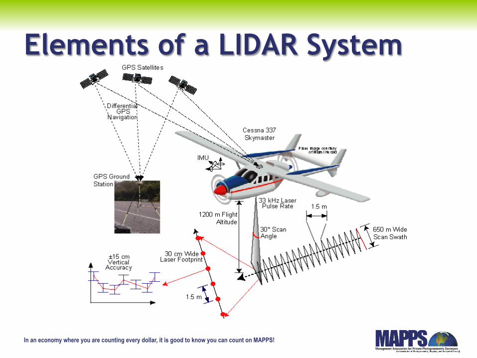
Elements of a LIDAR System
In an economy where you are counting every dollar, it is good to know you can count on MAPPS!
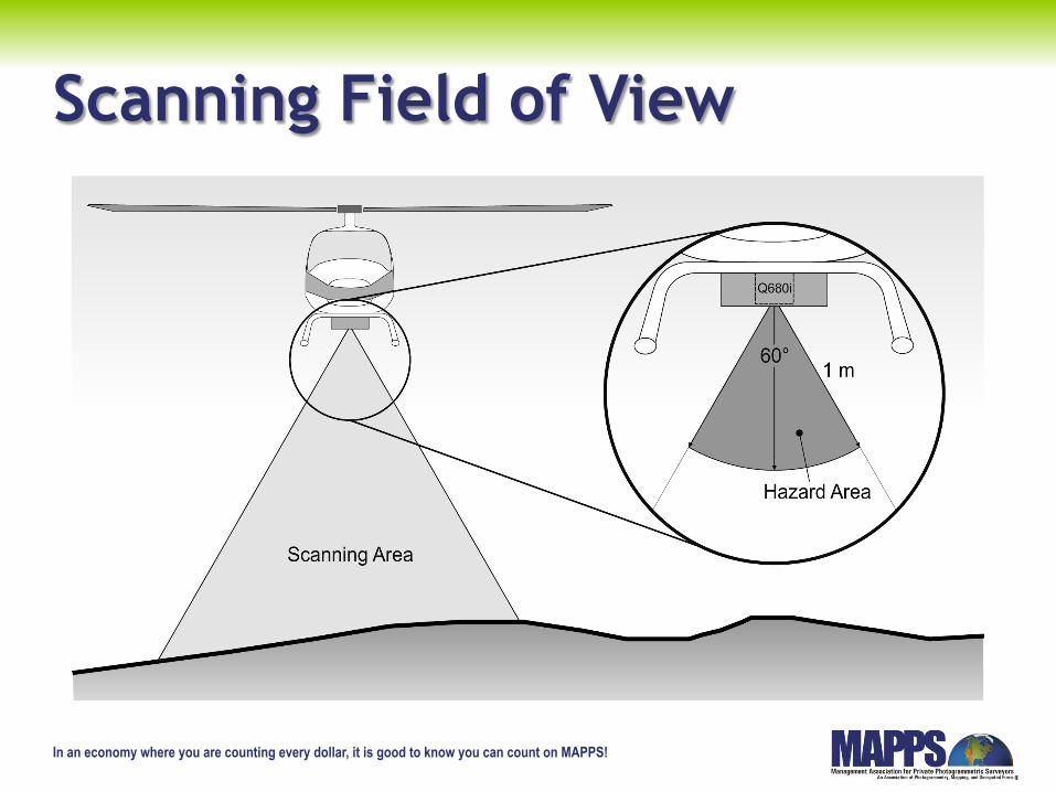
Scanning Field of View
In an economy where you are counting every dollar, it is good to know you can count on MAPPS!
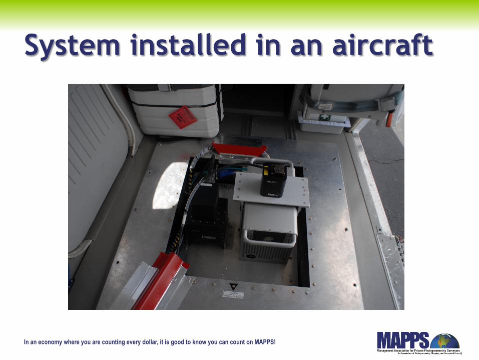
System installed in an aircraft
In an economy where you are counting every dollar, it is good to know you can count on MAPPS!
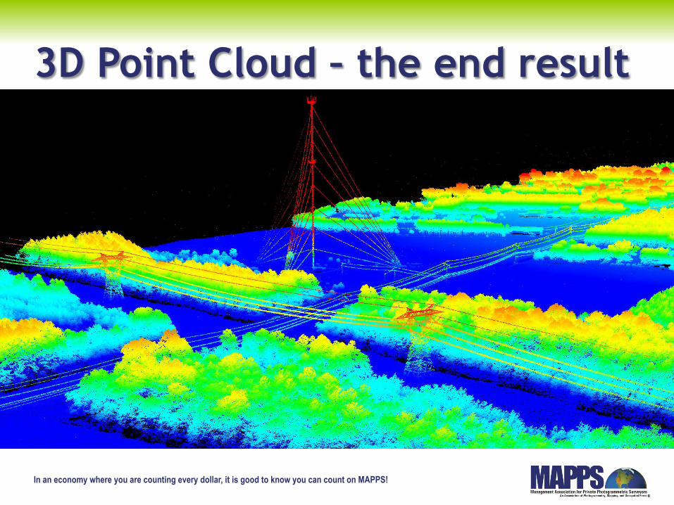
3D Point Cloud – the end result
In an economy where you are counting every dollar, it is good to know you can count on MAPPS!
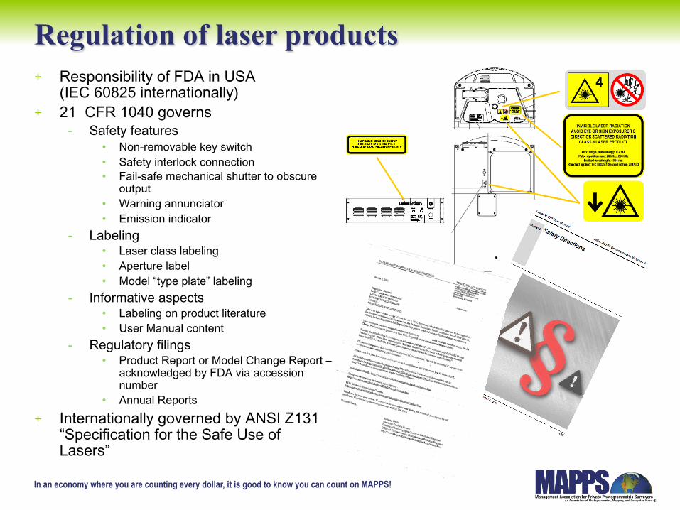
Regulation of laser products + Responsibility of FDA in USA
(IEC 60825 internationally) + 21 CFR 1040 governs
- Safety features • Non-removable key switch • Safety interlock connection • Fail-safe mechanical shutter to obscure
output • Warning annunciator • Emission indicator
- Labeling • Laser class labeling • Aperture label • Model “type plate” labeling
- Informative aspects • Labeling on product literature • User Manual content
- Regulatory filings • Product Report or Model Change Report –
acknowledged by FDA via accession number
• Annual Reports + Internationally governed by ANSI Z131
“Specification for the Safe Use of Lasers”
In an economy where you are counting every dollar, it is good to know you can count on MAPPS!
Laser Safety Background
+ ANSI Z136 Standards + 21CFR 1040 Guidelines + IEC and EN Laser Safety Standards + Wikipedia Laser Safety + Laser Safety by Henderson and Schulmeister

In an economy where you are counting every dollar, it is good to know you can count on MAPPS!
Understanding Laser Safety + Characteristics of laser light + Is LiDAR laser radiation is hazardous? + Laser Operating Modes, Laser Power + Characteristics of laser beams + What effect, if any, does LiDAR laser radiation have on eyes and skin? + What is Reflection Hazard and what are its effects, if any? + Maximum Permissible Exposure + What are LiDAR Laser hazard areas – safety distances? + Laser Scanner - Stationary mode and Scan mode + Laser classes + Laser classification + Time base + Classification of repetitively pulsed lasers + Classification of LIDAR scanners, NOHD and ENOHD + Design methods regarding the laser class + Examples of laser classification of instruments + Protective eyewear + Laser safety officer
In an economy where you are counting every dollar, it is good to know you can count on MAPPS!
Technical Discussion of NOHD Building on the classification of the laser source as provided by the FDA regulations, the use of the Nominal Ocular Hazard Distance (NOHD) provides a means to ensure the safe operation of airborne Lidar survey systems taking into account their operational environment. The NOHD is the distance from the source at which the intensity or the energy per unit area becomes lower than the Maximum Permissible Exposure (MPE) on the cornea or the skin. The MPE’s are below known hazardous levels. Thus, at distances greater than the NOHD the intensity from the laser beam is not hazardous for unaided viewing or exposure. If one is using an optical device, such as a telescope or binoculars, to view the beam, then allowance must be made for the possible higher intensity entering the eye as a result of the larger collecting aperture of the optical device. This results in an increase in the distance at which the intensity becomes lower than the MPE, and is referred to as extended or expanded Nominal Ocular Hazard Distance (eNOHD). Thus, as long as the viewer is at a distance greater than the NOHD or, if using an optical device, the eNOHD, there is no hazard.
In an economy where you are counting every dollar, it is good to know you can count on MAPPS!
Thus, from an operational viewpoint taking into account the likelihood of optical devices being in use by a person on the ground, as long as the airborne Lidar system is only permitted to operate from an altitude greater than the NOHD or eNOHD then there is no hazard to viewers on the ground. Engineering controls are implemented into the lidar survey systems to ensure that (1) if the altitude becomes too low or an object intercepts the beam at a distance less than the NOHD or eNOHD or (2) if the scanner fails or locks in position, the laser is shut off in a time interval short enough to prevent any hazard to a potential viewer.
In an economy where you are counting every dollar, it is good to know you can count on MAPPS!
Laser Safety
+ Laser Safety requires the design and use of lasers to minimize the risk of accidents.
+ This is accomplished by calculating the MPE(maximum permissible exposure) of the system to biologic tissue such as eyes.
+ The calculation then defines the class of laser safety. i.e. Class 1, Class 2, etc.
In an economy where you are counting every dollar, it is good to know you can count on MAPPS!
+ When submitting a report to the FDA,the producer must provide an information set for the scientists and Laser Safety Officers to calculate the Class of Laser.
+ The distance used to calculate the Laser
Classification is 100 millimeters or roughly 4 inches from the laser source.
In an economy where you are counting every dollar, it is good to know you can count on MAPPS!
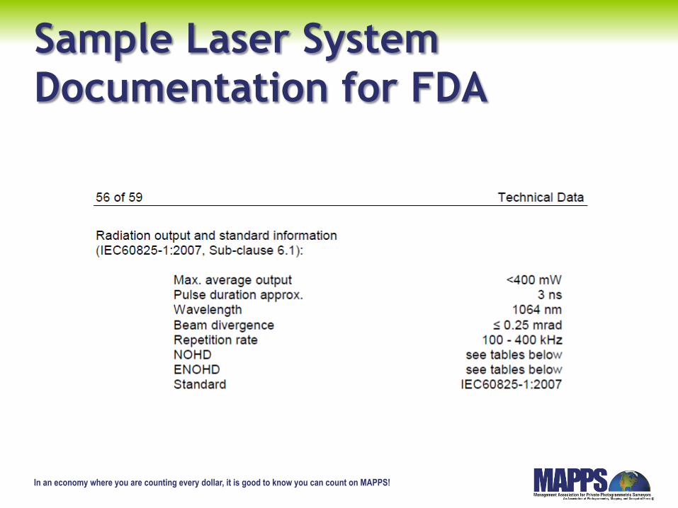
Sample Laser System Documentation for FDA
In an economy where you are counting every dollar, it is good to know you can count on MAPPS!
Time or Dwell Time of Lasers
+ This is the amount of time the laser system must dwell or be focused on the retina of the eye for damage to occur.
+ Each system is calculated independently but some systems are .25 m,10,100 or 30000 seconds depending on parameters.
+ This is important as an aircraft is constantly moving.
In an economy where you are counting every dollar, it is good to know you can count on MAPPS!
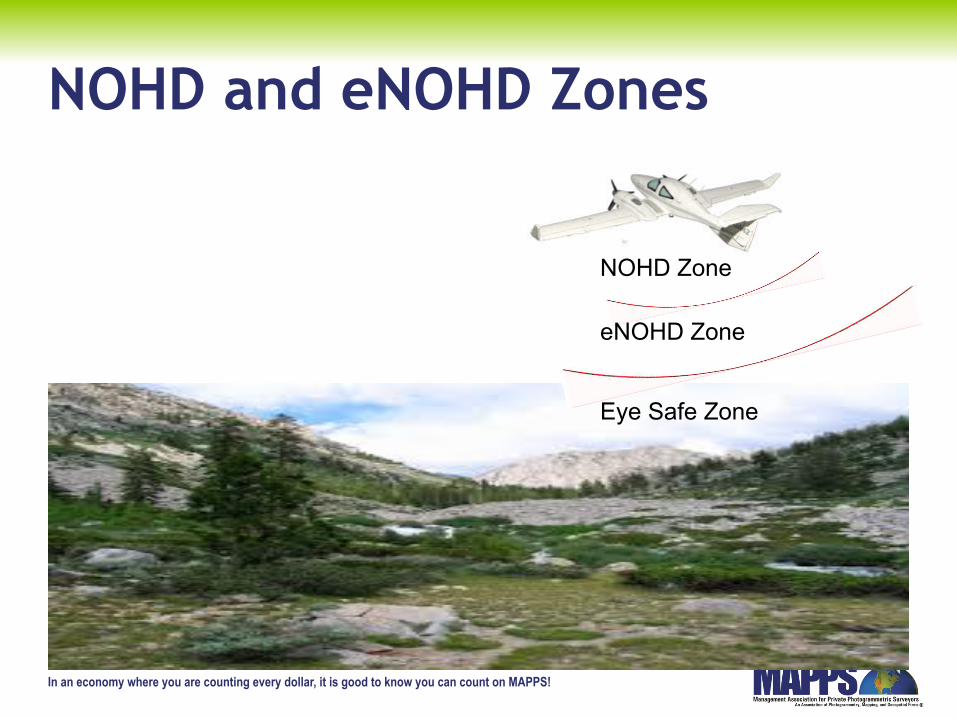
NOHD and eNOHD Zones
NOHD Zone
eNOHD Zone
Eye Safe Zone
In an economy where you are counting every dollar, it is good to know you can count on MAPPS!
How NOHD and eNOHD assist in analyzing the real hazard + Laser Class describes potential hazard of a laser
system. + Emission to be measured in the near range, typically
100 mm or 4 inches + Real Laser Hazard is determined by NOHD and
eNOHD + NOHD/eNOHD is based on maximum permissible
exposure (MPE) at the location of an observer
In an economy where you are counting every dollar, it is good to know you can count on MAPPS!
Why NOHD and eNOHD? + Laser Class does not take into account the
operational parameters (all parameters set for maximum emission – 4 inches away).
+ NOHD/eNOHD depends strongly on LIDAR parameter settings AND flight/mission parameters.
+ LIDAR parameters are laser power settings, pulse repetition rate, scan speed, beam divergence, etc.
+ Flight/mission parameters are altitude, speed over ground, etc..
In an economy where you are counting every dollar, it is good to know you can count on MAPPS!
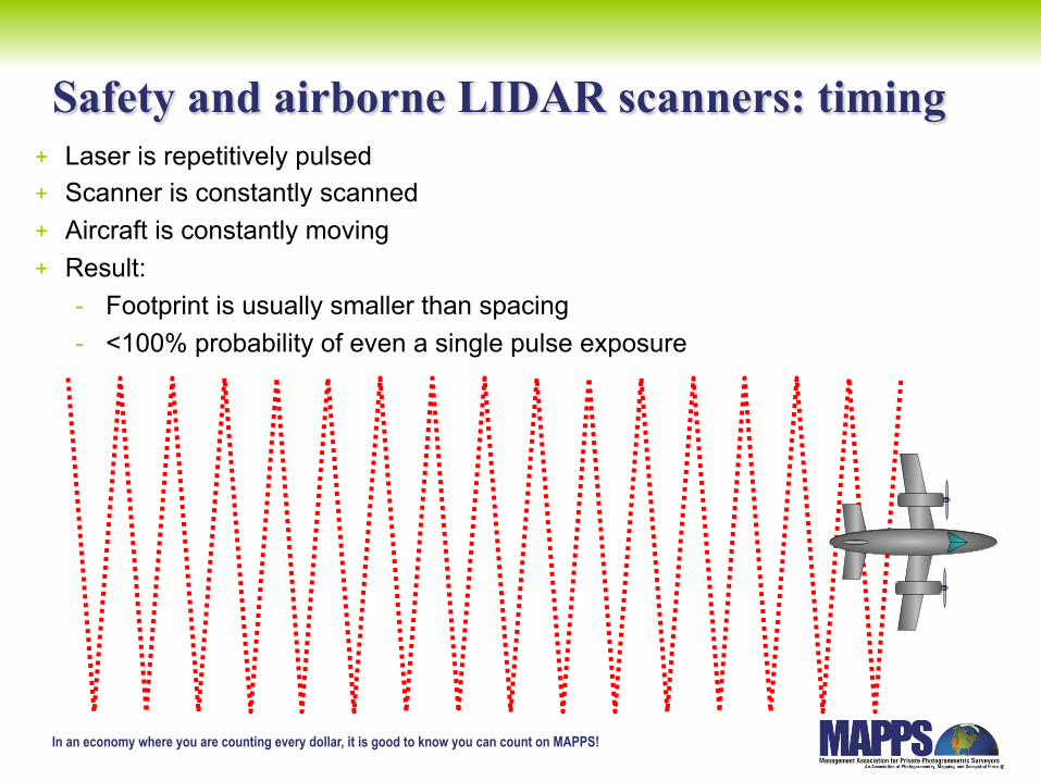
Safety and airborne LIDAR scanners: timing + Laser is repetitively pulsed + Scanner is constantly scanned + Aircraft is constantly moving + Result:
- Footprint is usually smaller than spacing - <100% probability of even a single pulse exposure
In an economy where you are counting every dollar, it is good to know you can count on MAPPS!
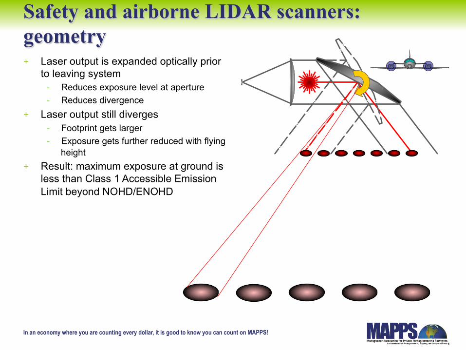
Safety and airborne LIDAR scanners: geometry + Laser output is expanded optically prior
to leaving system - Reduces exposure level at aperture - Reduces divergence
+ Laser output still diverges - Footprint gets larger - Exposure gets further reduced with flying
height + Result: maximum exposure at ground is
less than Class 1 Accessible Emission Limit beyond NOHD/ENOHD
In an economy where you are counting every dollar, it is good to know you can count on MAPPS!
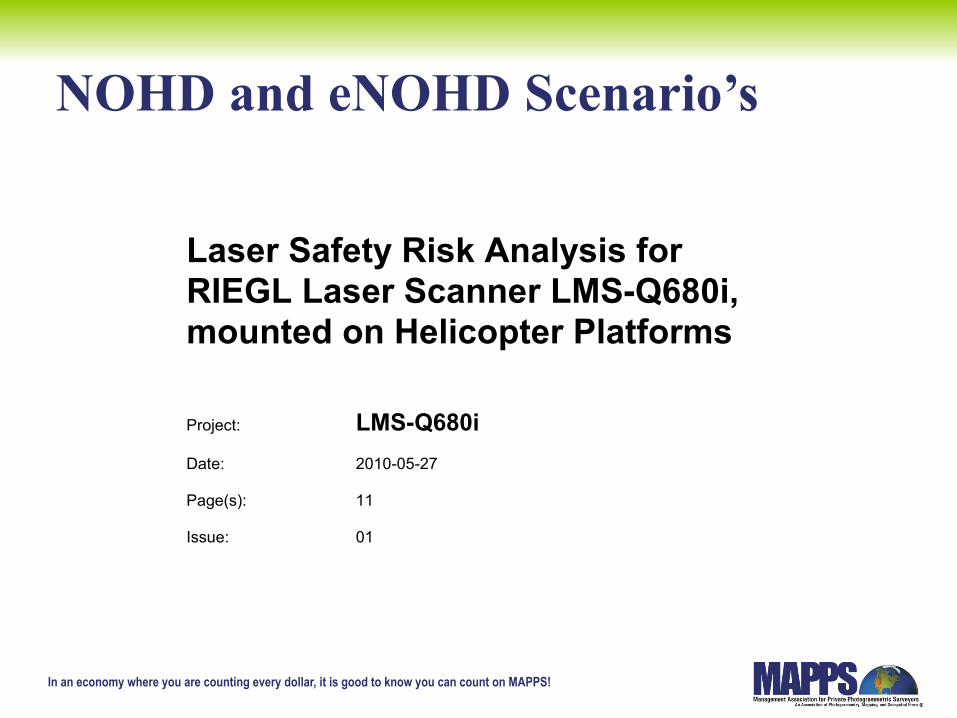
NOHD and eNOHD Scenario’s
Laser Safety Risk Analysis for RIEGL Laser Scanner LMS-Q680i, mounted on Helicopter Platforms
Project: LMS-Q680i Date: 2010-05-27 Page(s): 11 Issue: 01
In an economy where you are counting every dollar, it is good to know you can count on MAPPS!
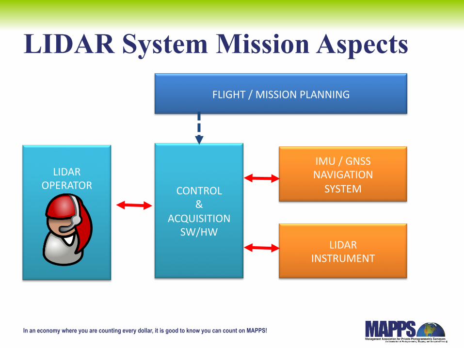
LIDAR System Mission Aspects
LTM OPERATOR
FLIGHT / MISSION PLANNING
ALTM OPERATOR
LIDAR OPERATOR
CONTROL &
ACQUISITION SW/HW
IMU / GNSS NAVIGATION SYSTEM
LIDAR INSTRUMENT
In an economy where you are counting every dollar, it is good to know you can count on MAPPS!
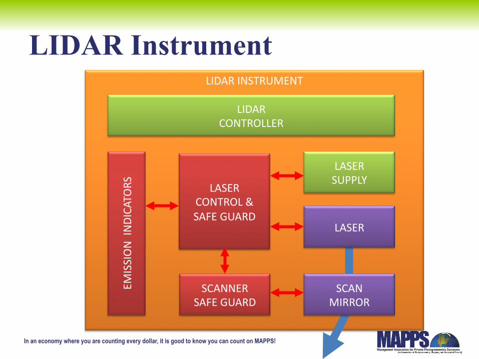
LIDAR INSTRUMENT
LIDAR Instrument
LASER
SCAN MIRROR
LASER SUPPLY
LASER CONTROL & SAFE GUARD
SCANNER SAFE GUARD
LIDAR CONTROLLER
EMISSION INDICATORS
In an economy where you are counting every dollar, it is good to know you can count on MAPPS!
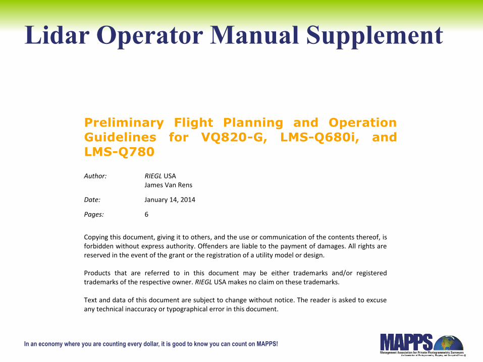
Lidar Operator Manual Supplement
Preliminary Flight Planning and Operation Guidelines for VQ820-G, LMS-Q680i, and LMS-Q780
Author: RIEGL USA James Van Rens
Date: January 14, 2014
Pages: 6
Copying this document, giving it to others, and the use or communication of the contents thereof, is forbidden without express authority. Offenders are liable to the payment of damages. All rights are reserved in the event of the grant or the registration of a utility model or design. Products that are referred to in this document may be either trademarks and/or registered trademarks of the respective owner. RIEGL USA makes no claim on these trademarks. Text and data of this document are subject to change without notice. The reader is asked to excuse any technical inaccuracy or typographical error in this document.
In an economy where you are counting every dollar, it is good to know you can count on MAPPS!
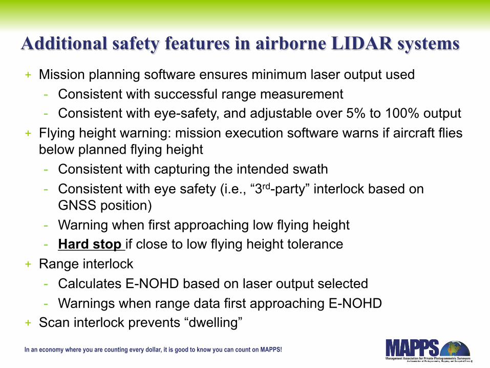
Additional safety features in airborne LIDAR systems + Mission planning software ensures minimum laser output used
- Consistent with successful range measurement - Consistent with eye-safety, and adjustable over 5% to 100% output
+ Flying height warning: mission execution software warns if aircraft flies below planned flying height - Consistent with capturing the intended swath - Consistent with eye safety (i.e., “3rd-party” interlock based on
GNSS position) - Warning when first approaching low flying height - Hard stop if close to low flying height tolerance
+ Range interlock - Calculates E-NOHD based on laser output selected - Warnings when range data first approaching E-NOHD
+ Scan interlock prevents “dwelling”
In an economy where you are counting every dollar, it is good to know you can count on MAPPS!
Key Elements of the System
+ Mounted but portable electronic mapping system. Moved between aircraft.
+ Normal and safe operation of the aircraft with or without the system in place.
+ Pilot, system operator and internal protocols control the operation.
In an economy where you are counting every dollar, it is good to know you can count on MAPPS!
Reclassification Supported + LIDAR SYSTEM design has fail-safe modes for
mirror/scanner failure. + LIDAR design and manufacturing meets all
applicable standards. + General system design assures safety. + Aircraft integration and operation no different
than a conventional camera – electrical and structural Field Approval.
+ User Training Methods in place. + NOHD and eNOHD more realistic measure.
In an economy where you are counting every dollar, it is good to know you can count on MAPPS!
Conclusions
+ Systems are designed for airworthiness. + NOHD and eNOHD determinations are more
effective assessments of hazard . + Operational Safety Aspects protect the flight
crews, passengers and civilians. + Field Approval is based upon traditional
electrical and structural elements. + Installations are on a “no hazard” basis.
In an economy where you are counting every dollar, it is good to know you can count on MAPPS!
Final Conclusion
+ LiDAR does not have an appreciable effect on an aircraft’s weight, balance, structural strength, reliability, operational characteristics, or other characteristics affecting airworthiness. Therefore, no STC is required.