atmospheric lidar based remote sensing...
TRANSCRIPT
Atmospheric Lidar Based Remote Sensing Techniques
Longlong Wang Mentor: Prof. Samo Stanič
Contents
Atmospheric properties
Atmospheric detection principle using lidar
Versatility of lidar application platforms
Interpretation of lidar data
My future work

Atmospheric Layers
Various layers in the atmosphere accessible to lidar researchers
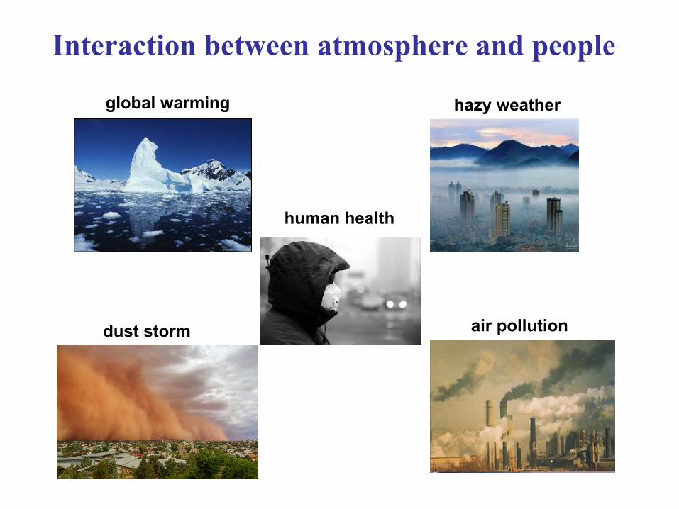
Interaction between atmosphere and people
dust storm
hazy weatherglobal warming
air pollution
human health
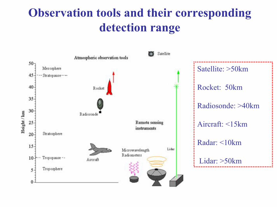
Observation tools and their corresponding detection range
Satellite: >50km
Rocket: 50km
Radiosonde: >40km
Aircraft: <15km
Radar: <10km
Lidar: >50km
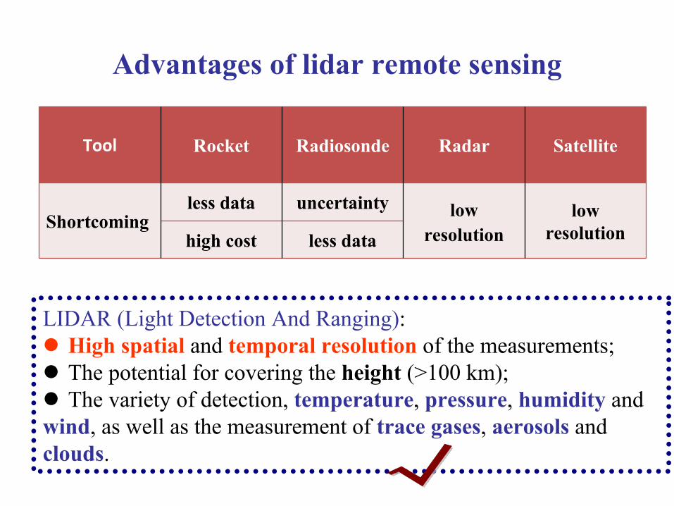
Advantages of lidar remote sensing
LIDAR (Light Detection And Ranging): High spatial and temporal resolution of the measurements; The potential for covering the height (>100 km); The variety of detection, temperature, pressure, humidity and wind, as well as the measurement of trace gases, aerosols and clouds.
Tool Rocket Radiosonde Radar Satellite
Shortcomingless data uncertainty low
resolutionlow
resolutionhigh cost less data
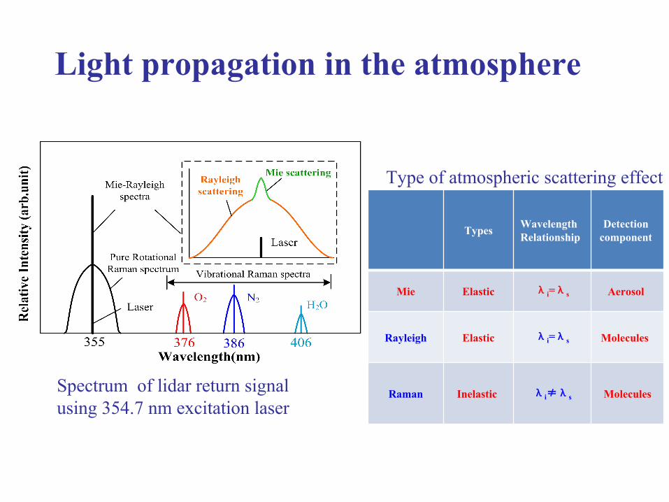
Light propagation in the atmosphere
Types Wavelength Relationship
Detection component
Mie Elastic λi=λs Aerosol
Rayleigh Elastic λi=λs Molecules
Raman Inelastic λi≠λs Molecules
Type of atmospheric scattering effect
Spectrum of lidar return signal using 354.7 nm excitation laser

Elastic scattering
• Aerosols: diameter of about 100μm, suspended in the atmosphere, liquid or solid particles;
• Include: ground dust, dust storms, forest, fire shot, pollen, and other gaseous pollutants;
• Influence: climate change, cloud formation, visibility changes and human health.
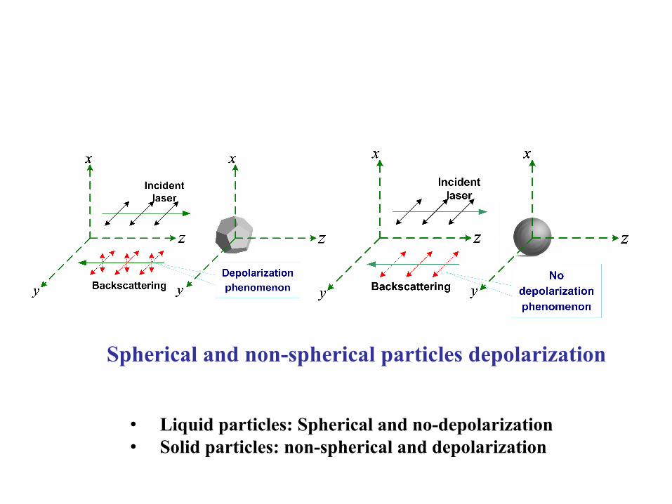
Spherical and non-spherical particles depolarization
• Liquid particles: Spherical and no-depolarization• Solid particles: non-spherical and depolarization
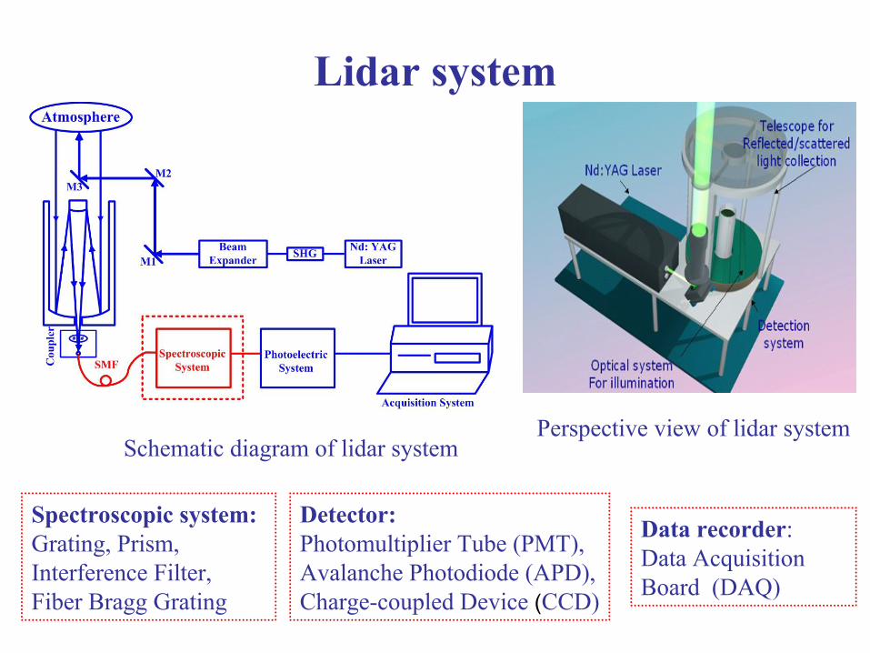
Lidar system
Schematic diagram of lidar system Perspective view of lidar system
Spectroscopic system: Grating, Prism, Interference Filter, Fiber Bragg Grating
Detector: Photomultiplier Tube (PMT), Avalanche Photodiode (APD),Charge-coupled Device (CCD)
Data recorder: Data Acquisition Board (DAQ)
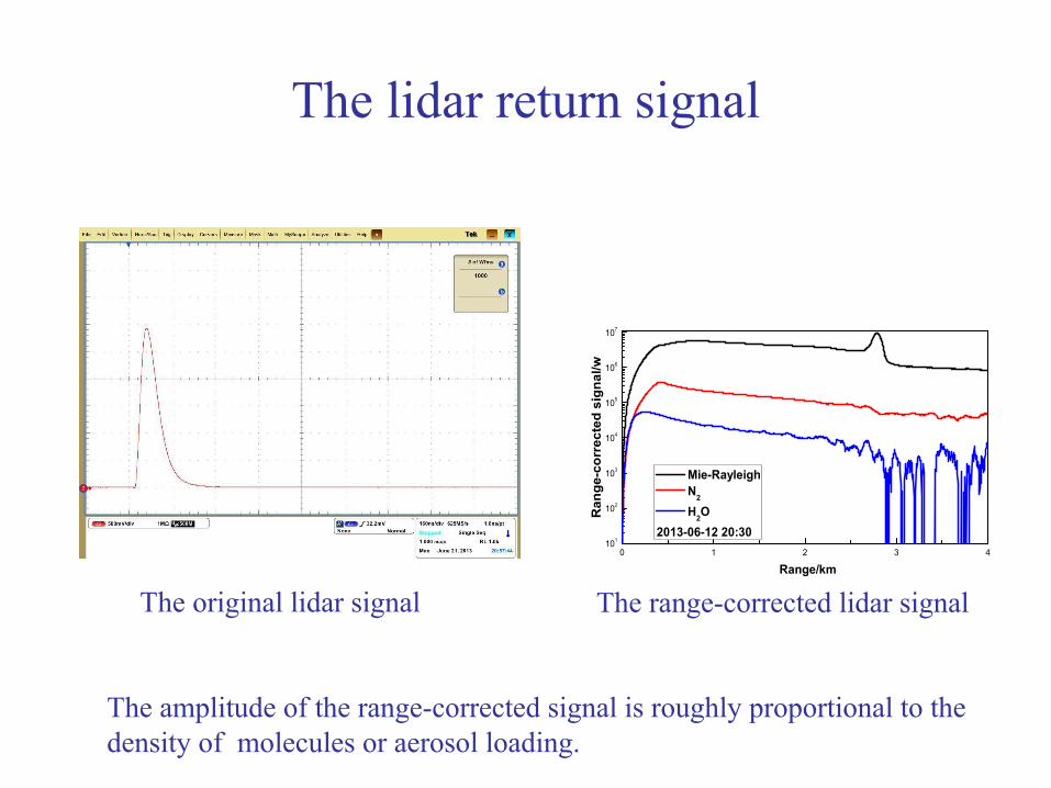
The lidar return signal
0 1 2 3 4101
102
103
104
105
106
107
Ran
ge-c
orre
cted
sig
nal/w
Range/km
Mie-Rayleigh N2
H2O2013-06-12 20:30
The range-corrected lidar signal
The amplitude of the range-corrected signal is roughly proportional to the density of molecules or aerosol loading.
The original lidar signal
State of the art
In the furture studies of lidar: Optical properties of aerosol, Field of wind, temperature and humidity.
Global fixed-point observation network: The European Aerosol Research Lidar Network (EARLINET); Micro Pulse Lidar Network (MPLNET) by NASA 2010; AD-net in East of Asia, based sandstorm observation.
Furthermore, focus on the purpose for the needs of different applications, developing into multi-platform support (ground, vehicle, airborne , spaceborne and so on). United States, Europe and China etc. developed their spaceborne lidar system.
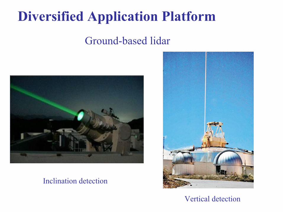
Ground-based lidar
Vertical detection
Inclination detection
Diversified Application Platform
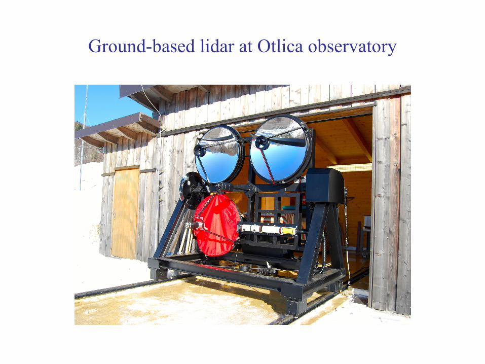
Ground-based lidar at Otlica observatory
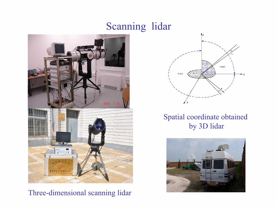
Scanning lidar
Three-dimensional scanning lidar
Spatial coordinate obtained by 3D lidar

Airborne application of lidar
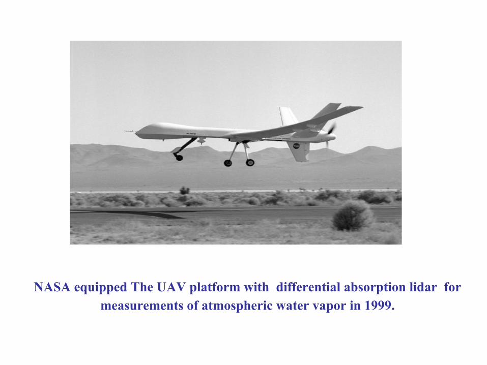
NASA equipped The UAV platform with differential absorption lidar for measurements of atmospheric water vapor in 1999.
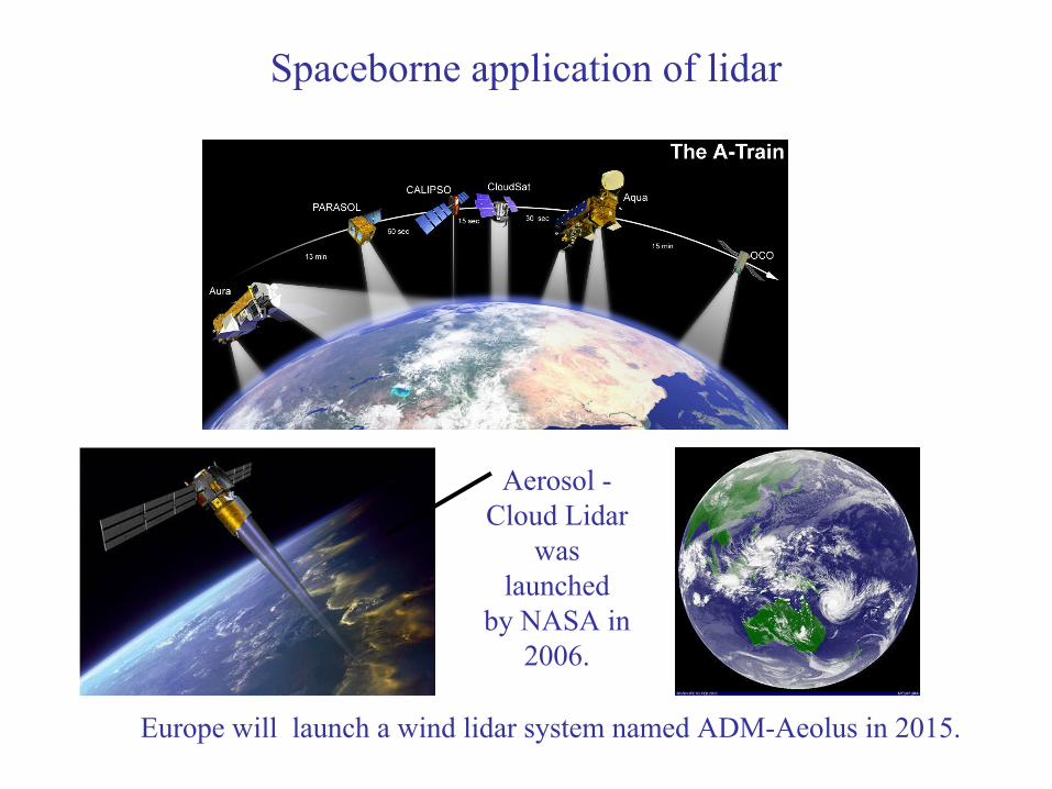
Spaceborne application of lidar
Europe will launch a wind lidar system named ADM-Aeolus in 2015.
Aerosol -Cloud Lidar
waslaunched
by NASA in 2006.
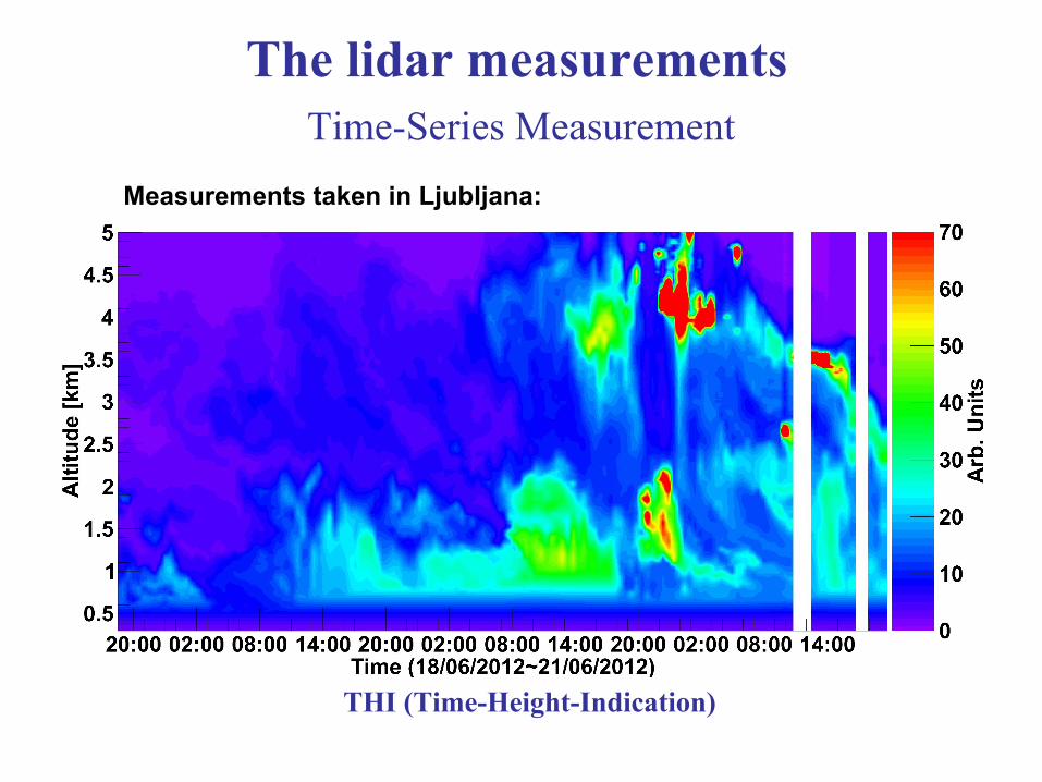
Time-Series Measurement
THI (Time-Height-Indication)
The lidar measurements
Measurements taken in Ljubljana:
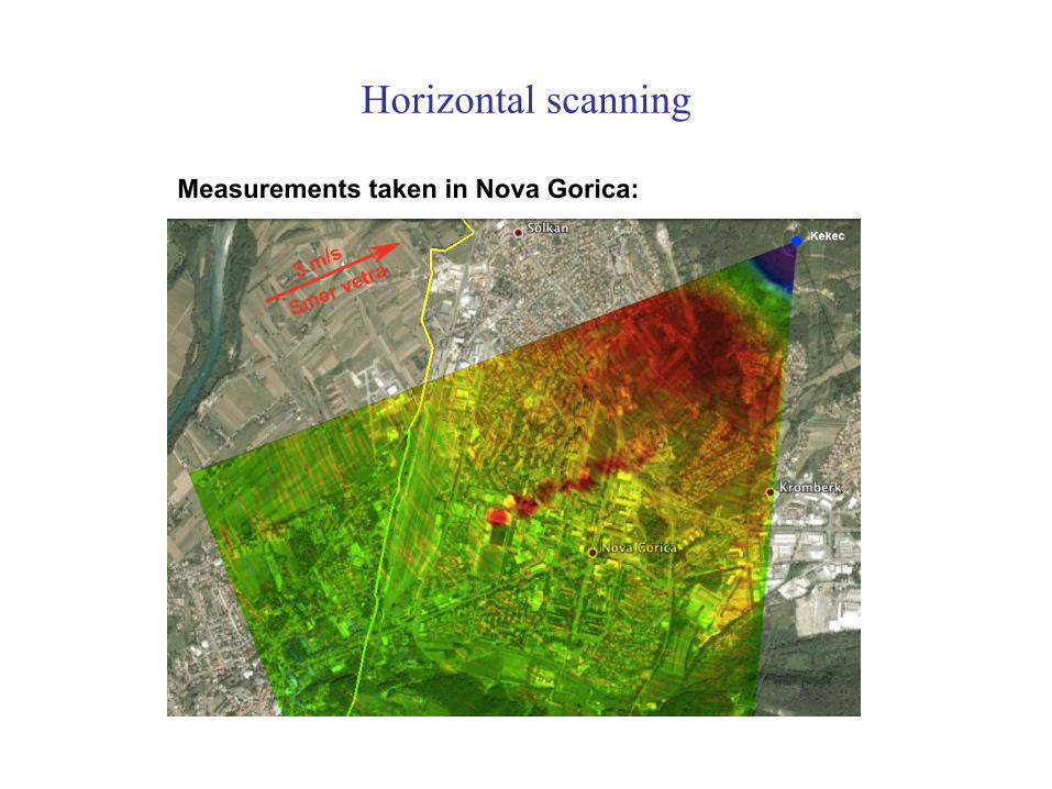
Horizontal scanning
Measurements taken in Nova Gorica:
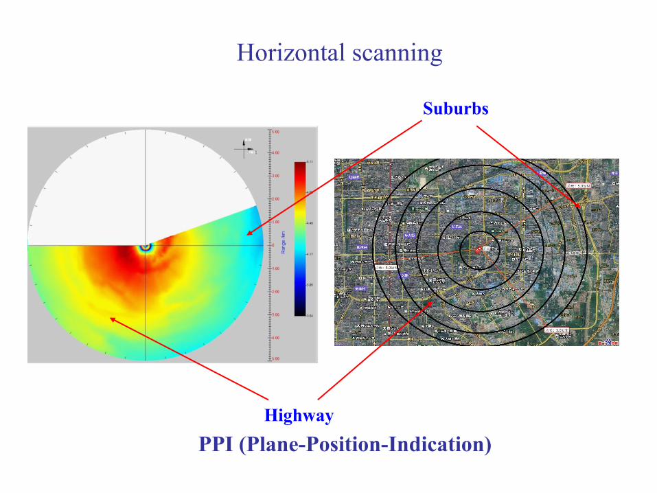
PPI (Plane-Position-Indication)
Horizontal scanning
Suburbs
Highway
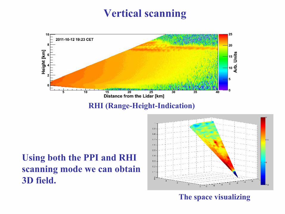
RHI (Range-Height-Indication)
Vertical scanning
The space visualizing
Using both the PPI and RHI scanning mode we can obtain 3D field.
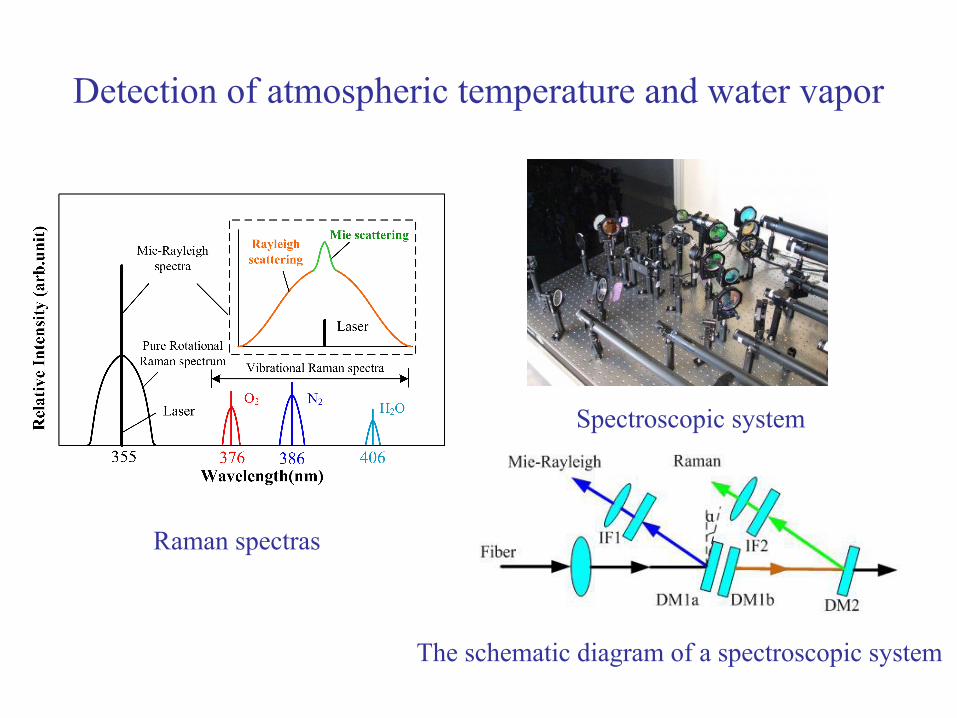
Detection of atmospheric temperature and water vapor
Raman spectras
Spectroscopic system
The schematic diagram of a spectroscopic system
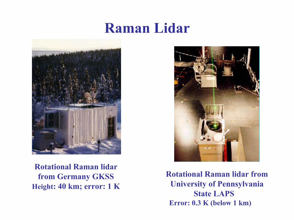
Raman Lidar
Rotational Raman lidar from Germany GKSS
Height: 40 km; error: 1 K
Rotational Raman lidar fromUniversity of Pennsylvania
State LAPS Error: 0.3 K (below 1 km)
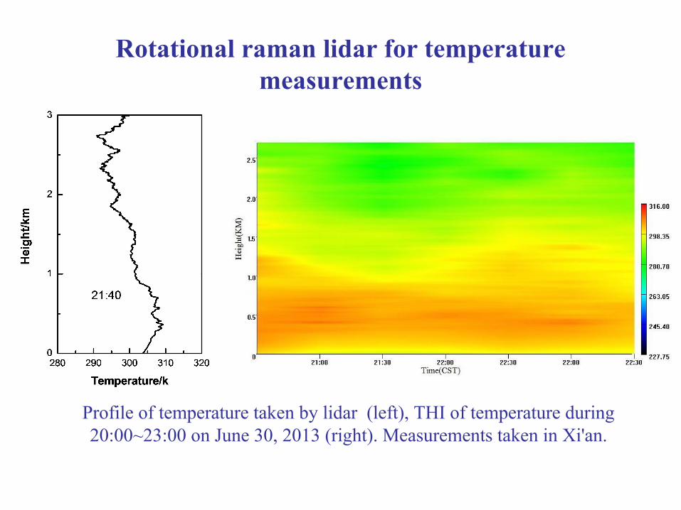
Rotational raman lidar for temperaturemeasurements
Profile of temperature taken by lidar (left), THI of temperature during 20:00~23:00 on June 30, 2013 (right). Measurements taken in Xi'an.
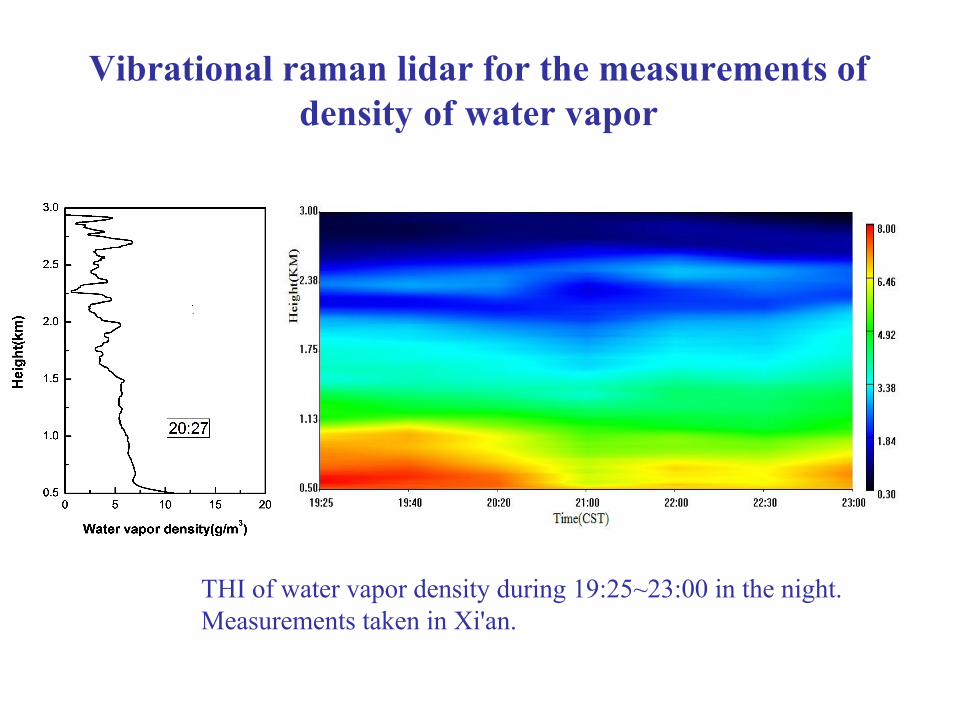
Vibrational raman lidar for the measurements of density of water vapor
THI of water vapor density during 19:25~23:00 in the night.Measurements taken in Xi'an.
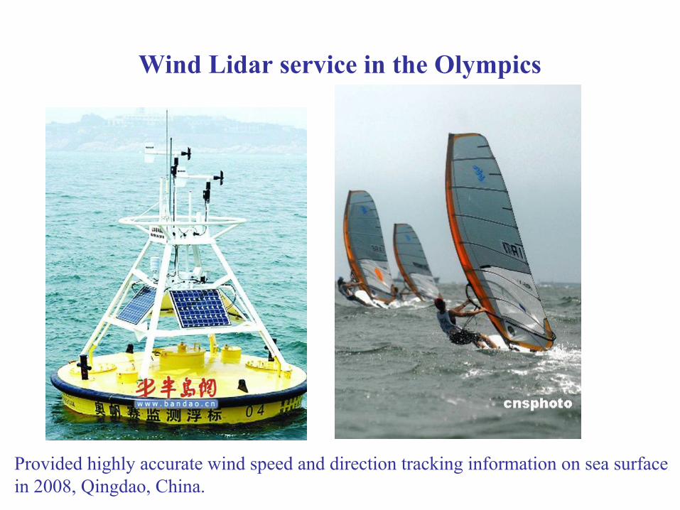
Wind Lidar service in the Olympics
Provided highly accurate wind speed and direction tracking information on sea surfacein 2008, Qingdao, China.
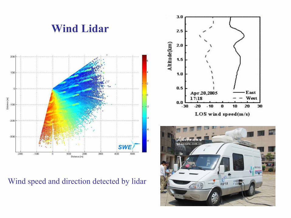
Wind Lidar
Wind speed and direction detected by lidar
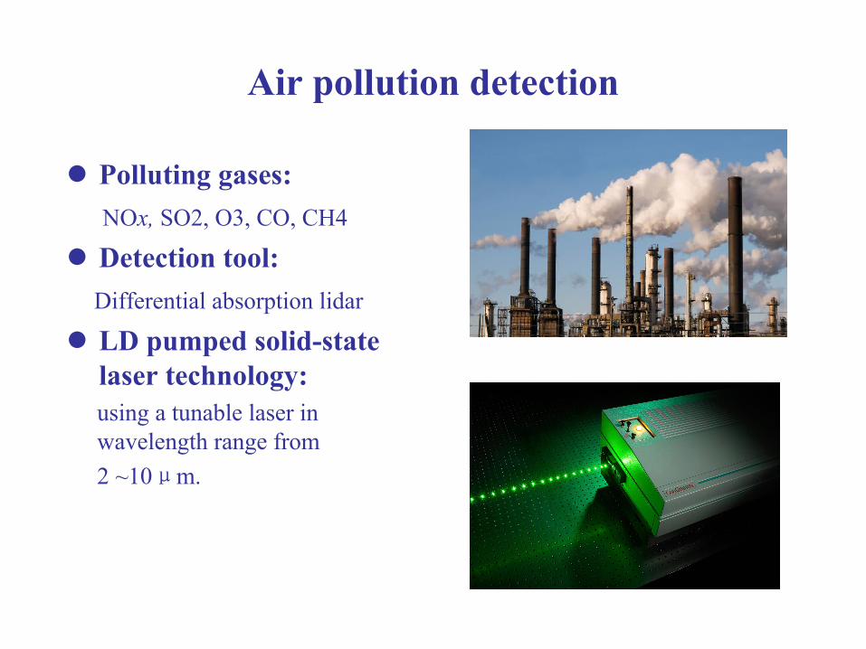
Air pollution detection
Polluting gases: NOx, SO2, O3, CO, CH4
Detection tool: Differential absorption lidar
LD pumped solid-state laser technology: using a tunable laser in wavelength range from 2 ~10μm.
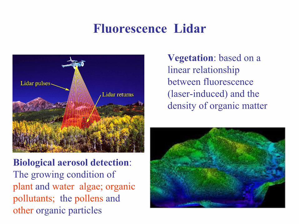
Fluorescence Lidar
Vegetation: based on a linear relationship between fluorescence (laser-induced) and the density of organic matter
Biological aerosol detection: The growing condition of plant and water algae; organic pollutants; the pollens and other organic particles
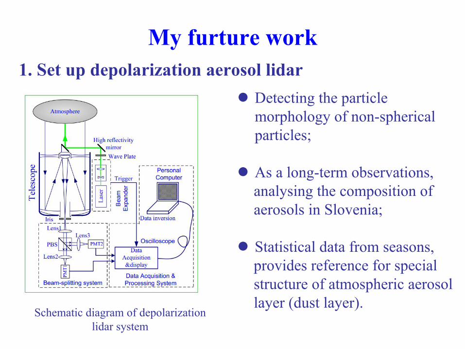
My furture work1. Set up depolarization aerosol lidar
Detecting the particle morphology of non-spherical particles;
As a long-term observations, analysing the composition of aerosols in Slovenia;
Statistical data from seasons,provides reference for special structure of atmospheric aerosol layer (dust layer).
Schematic diagram of depolarizationlidar system
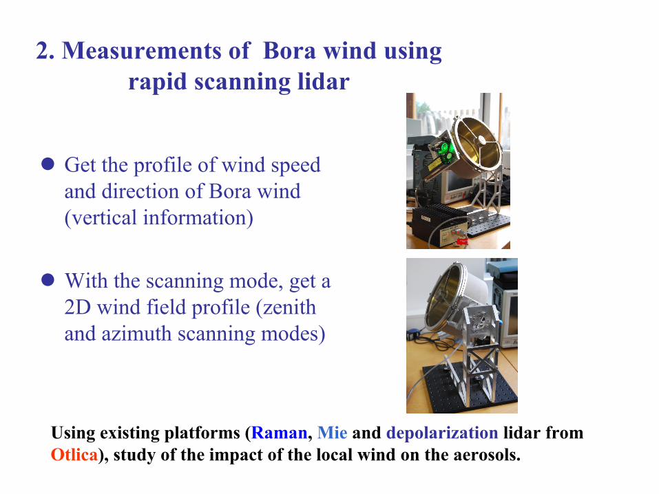
Get the profile of wind speed and direction of Bora wind (vertical information)
With the scanning mode, get a 2D wind field profile (zenith and azimuth scanning modes)
2. Measurements of Bora wind using rapid scanning lidar
Using existing platforms (Raman, Mie and depolarization lidar from Otlica), study of the impact of the local wind on the aerosols.
References[1] R. Measures. Laser Remote Sensing: Fundamentals and Applications. Malabar: Krieger Publishing Company (1992).
[2] V. Kovalev, W. Eichinger. Elastic Lidar: Theory, Practice, and Analysis Methods. Wiley-Interscience (2004).
[3] F Gao. Study of processes in atmospheric boundary layer over land-sea transition interface using scanning Lidar. PHD thesis, University of Nova Gorica (2012).
[4] T-Y He. Study of atmospheric aerosol transport processes on local and regional scales. PHD thesis, University of Nova Gorica (2013).
[5] F. Gao, et al. Observations of the Atmospheric Boundary Layer Acrossthe Land-Sea Transition Zone Using a Scanning Mie Lidar, Journal of QuantitativeSpectroscopy & Radiative Transfer, 112 (2), 182–188 (2011).
[6] D-X. Hua , X-Q. Song, Advances in lidar remote sensing techniques, Journal of Infrared and Laser Engineering, 37 (2) (2008).

Thank you for your attention