jakarta flood early warning system (j … is not model ... jakarta flood early warning system. radar...
TRANSCRIPT
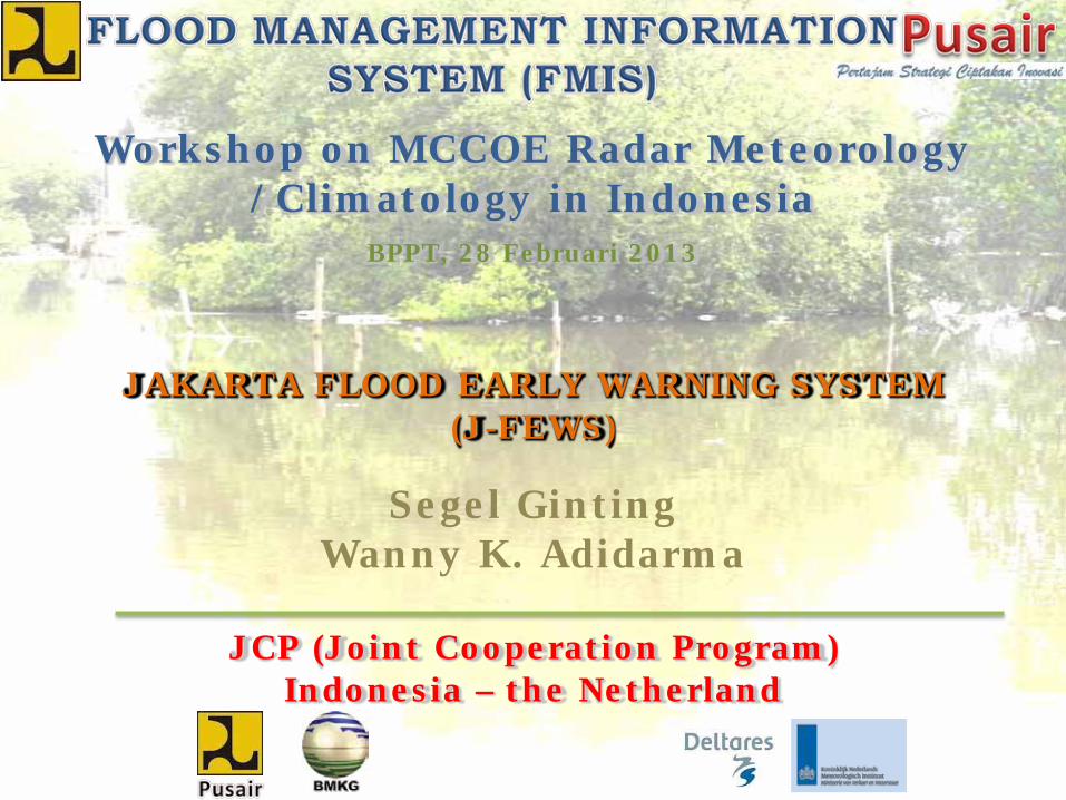
JAKARTA FLOOD EARLY WARNING SYSTEM (J-FEWS)
JCP (Joint Cooperation Program) Indonesia – the Netherland
Segel GintingWanny K. Adidarma
Workshop on MCCOE Radar Meteorology /Climatology in Indonesia
BPPT, 28 Februari 2013
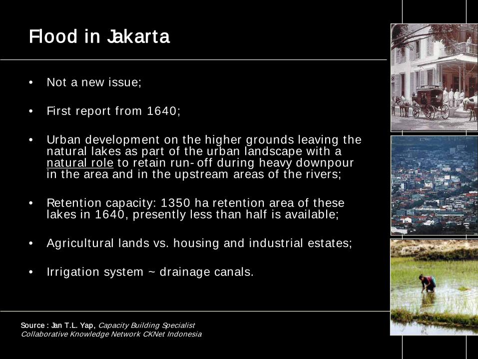
Flood in Jakarta
• Not a new issue;
• First report from 1640;
• Urban development on the higher grounds leaving the natural lakes as part of the urban landscape with a natural role to retain run-off during heavy downpour in the area and in the upstream areas of the rivers;
• Retention capacity: 1350 ha retention area of these lakes in 1640, presently less than half is available;
• Agricultural lands vs. housing and industrial estates;
• Irrigation system ~ drainage canals.
Source : Jan T.L. Yap, Capacity Building SpecialistCollaborative Knowledge Network CKNet Indonesia
The Flood Disaster Strategy
• The Department of Regional Development and Environmental of the Organisation of American States argues that
“The most effective approach to reducing the long-term impact of natural hazards is to incorporate natural hazard assessment and mitigation activities into the process of integrated development planning and investment project formulation and implementation.”
• Combinations of structural and non-structural flood mitigation measures have been shown to alleviate the effects of floods in a cost-effective way.
Source : Jan T.L. Yap, Capacity Building SpecialistCollaborative Knowledge Network CKNet Indonesia
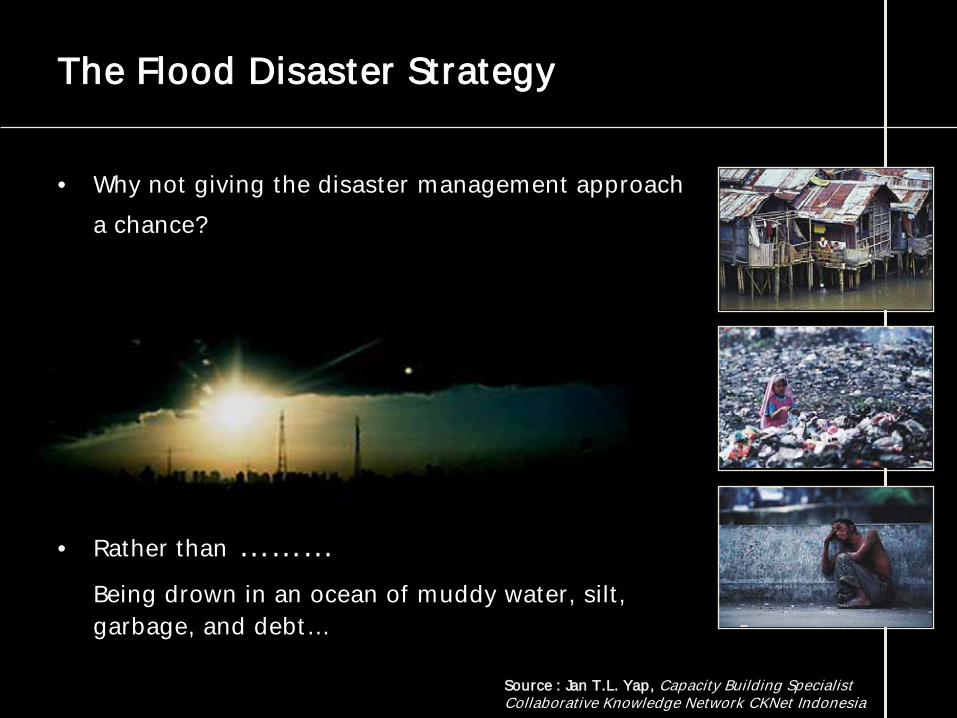
The Flood Disaster Strategy
• Why not giving the disaster management approach a chance?
• Rather than ………Being drown in an ocean of muddy water, silt, garbage, and debt…
Source : Jan T.L. Yap, Capacity Building SpecialistCollaborative Knowledge Network CKNet Indonesia
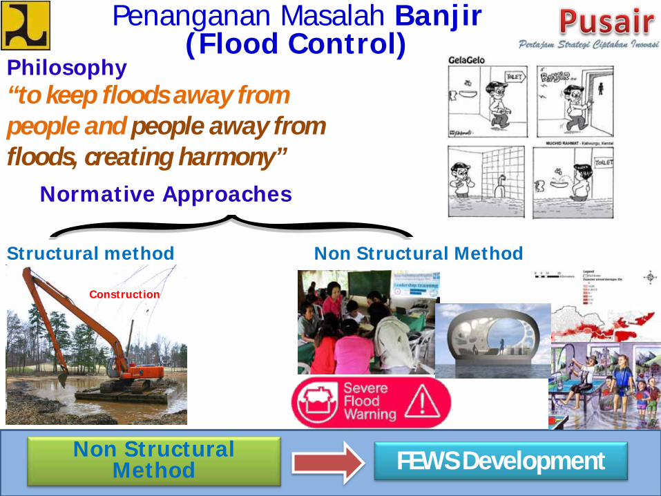
Penanganan Masalah Banjir(Flood Control)
Philosophy“to keep floods away from people and people away from floods, creating harmony”
Normative Approaches
Non Structural MethodStructural method
Construction
Non Structural Method FEWS Development
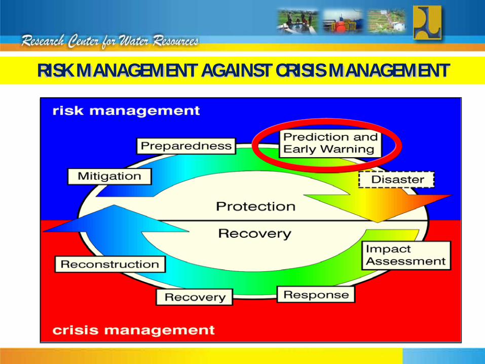
RISK MANAGEMENT AGAINST CRISIS MANAGEMENT
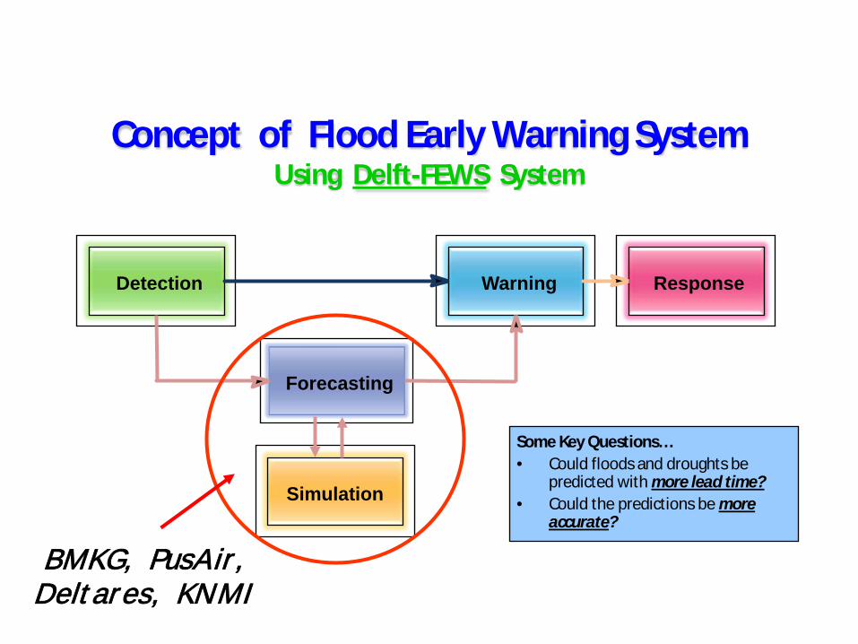
Concept of Flood Early Warning System Using Delft-FEWS System
Detection Warning Response
Forecasting
Simulation
BMKG, PusAir, Deltares, KNMI
Some Key Questions…• Could floods and droughts be
predicted with more lead time?• Could the predictions be more
accurate?
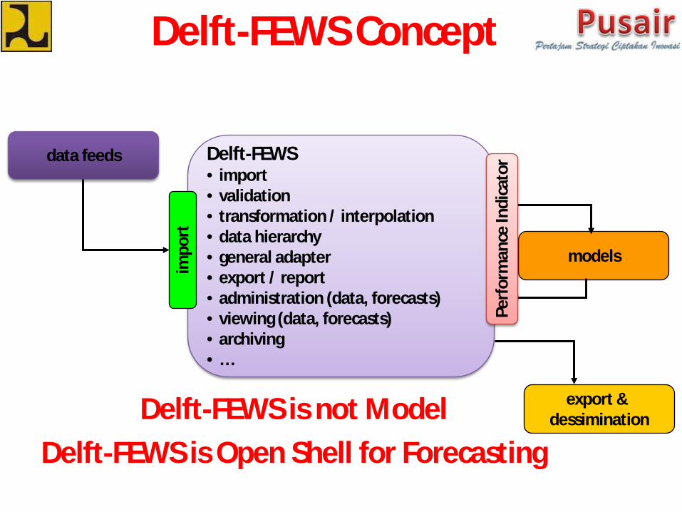
Delft-FEWS Concept
Delft-FEWS• import• validation• transformation / interpolation• data hierarchy• general adapter• export / report• administration (data, forecasts)• viewing (data, forecasts)• archiving• …
data feeds
models
export & dessimination
Perf
orm
ance
Indi
cato
r
impo
rt
Delft-FEWS is not ModelDelft-FEWS is Open Shell for Forecasting
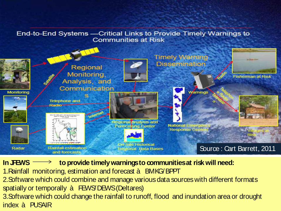
Source : Cart Barrett, 2011
In JFEWS to provide timely warnings to communities at risk will need:1.Rainfall monitoring, estimation and forecast à BMKG/BPPT2.Software which could combine and manage various data sources with different formats spatially or temporally à FEWS/DEWS (Deltares)3.Software which could change the rainfall to runoff, flood and inundation area or drought index à PUSAIR
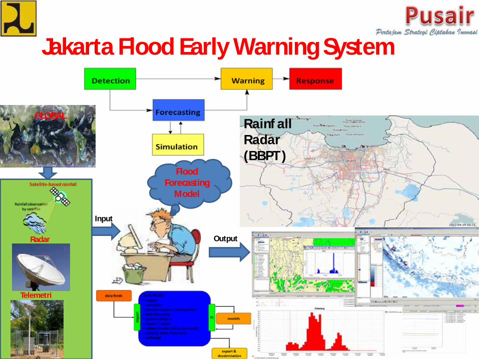
Jakarta Flood Early Warning System
Radar
Telemetri
GLOBAL
Flood Forecasting
Model
Input
Output
Rainfall Radar (BBPT)
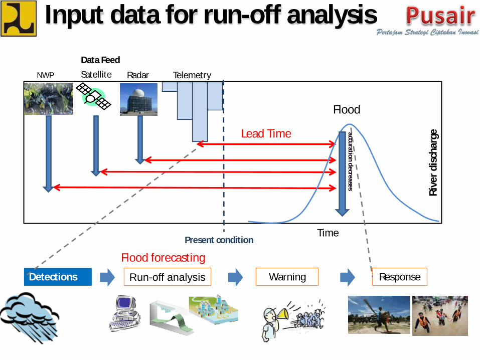
Input data for run-off analysisData Feed
Telemetry
Flood
Time
Rive
r dis
char
ge
accuration decreasesLead Time
Detections Run-off analysis Warning Response
Flood forecastingPresent condition
NWP Satellite Radar
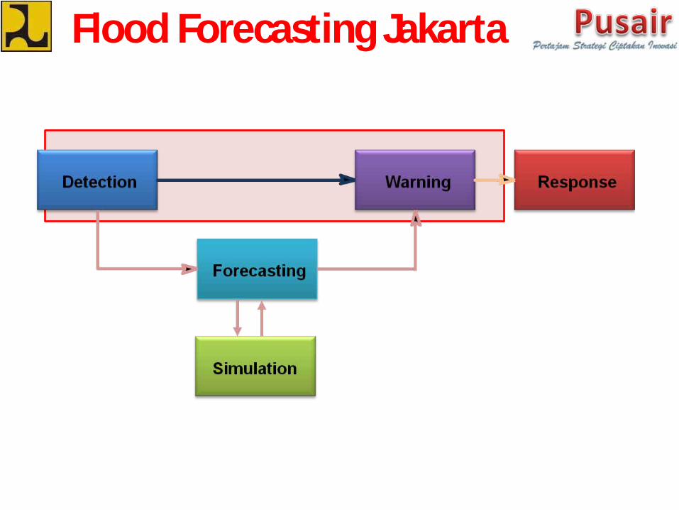
Flood Forecasting Jakarta
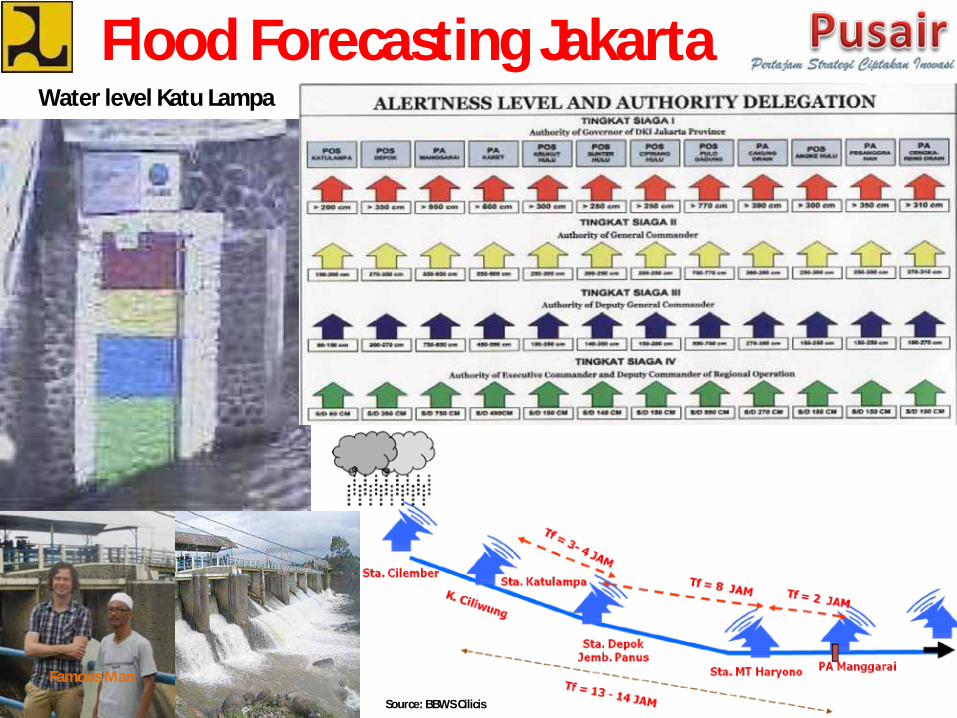
Flood Forecasting JakartaWater level Katu Lampa
Famous Man
Source: BBWS Cilicis
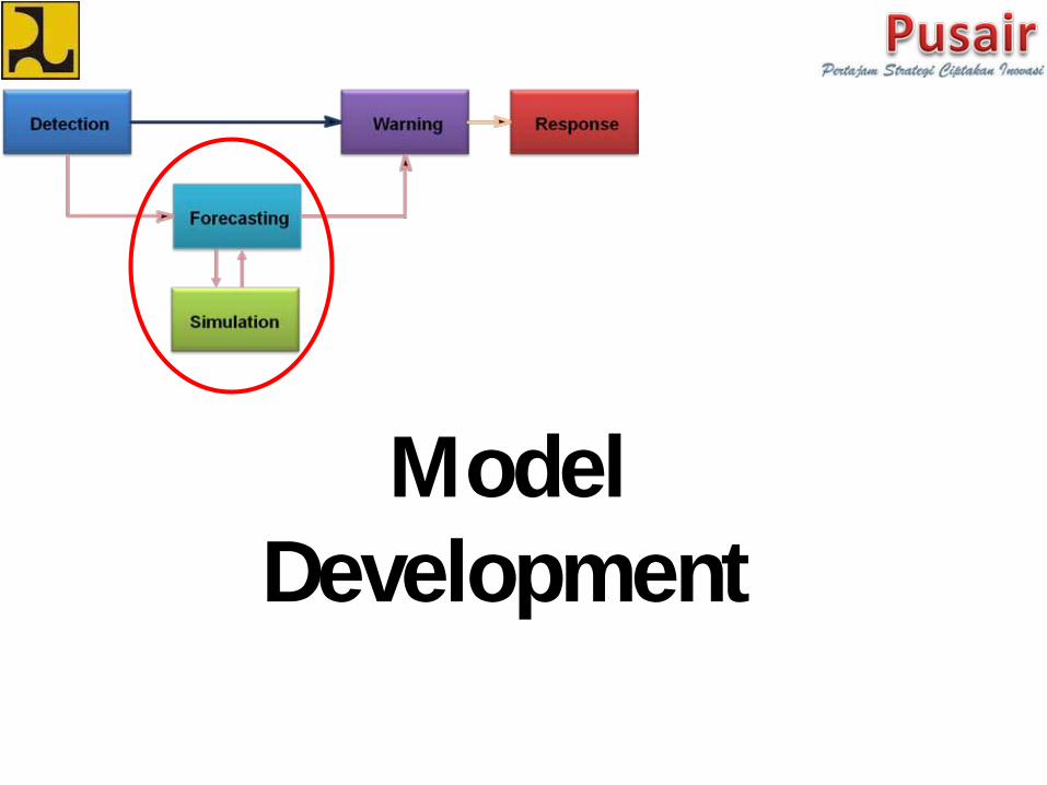
Model Development
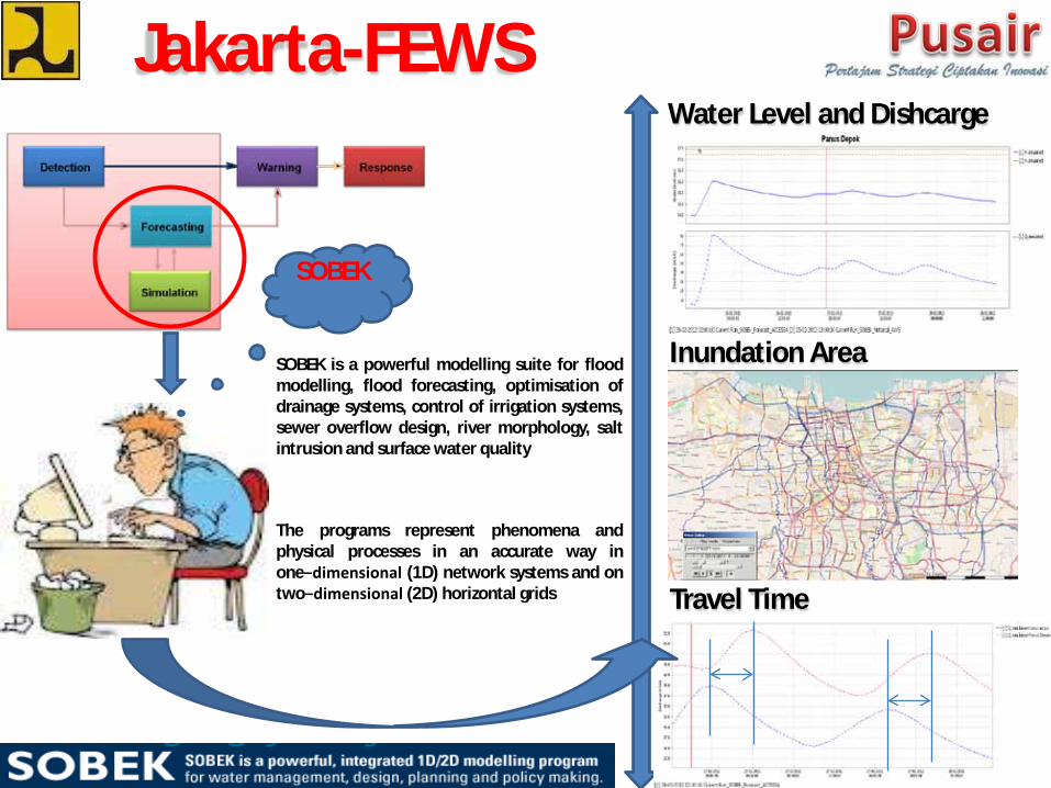
Jakarta-FEWSWater Level and Dishcarge
Inundation Area
Travel Time
SOBEK
SOBEK is a powerful modelling suite for floodmodelling, flood forecasting, optimisation ofdrainage systems, control of irrigation systems,sewer overflow design, river morphology, saltintrusion and surface water quality
The programs represent phenomena andphysical processes in an accurate way inone−dimensional (1D) network systems and ontwo−dimensional (2D) horizontal grids
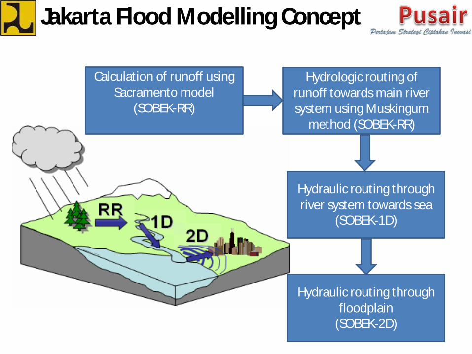
Calculation of runoff usingSacramento model
(SOBEK-RR)
Hydrologic routing ofrunoff towards main riversystem using Muskingum
method (SOBEK-RR)
Hydraulic routing throughriver system towards sea
(SOBEK-1D)
Hydraulic routing throughfloodplain
(SOBEK-2D)
Jakarta Flood Modelling Concept

Pumps
Tidal gates
Operation
Field condition
Flood extent
scenario
Jakarta Flood Modelling
Rain and Tide Flood Simulation Output
SOBEK
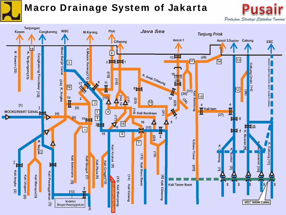
Macro Drainage System of Jakarta
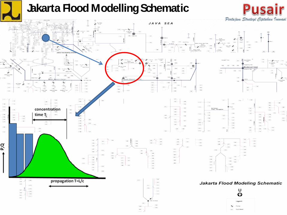
Jakarta Flood Modelling Schematic
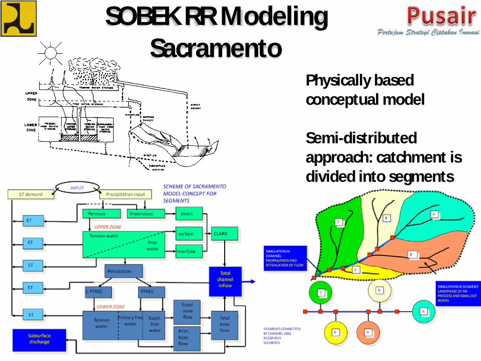
SOBEK RR ModelingSacramento
Physically based conceptual model
Semi-distributed approach: catchment is divided into segments
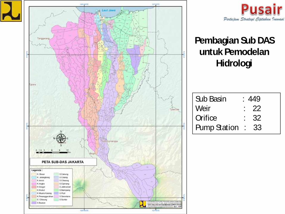
Pembagian Sub DAS untuk Pemodelan
Hidrologi
Sub Basin : 449Weir : 22Orifice : 32Pump Station : 33
Calibration and ValidationModeling
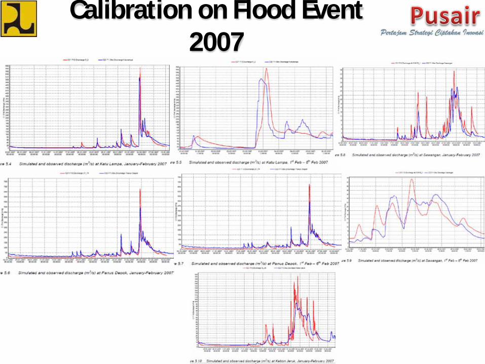
Calibration on Flood Event 2007
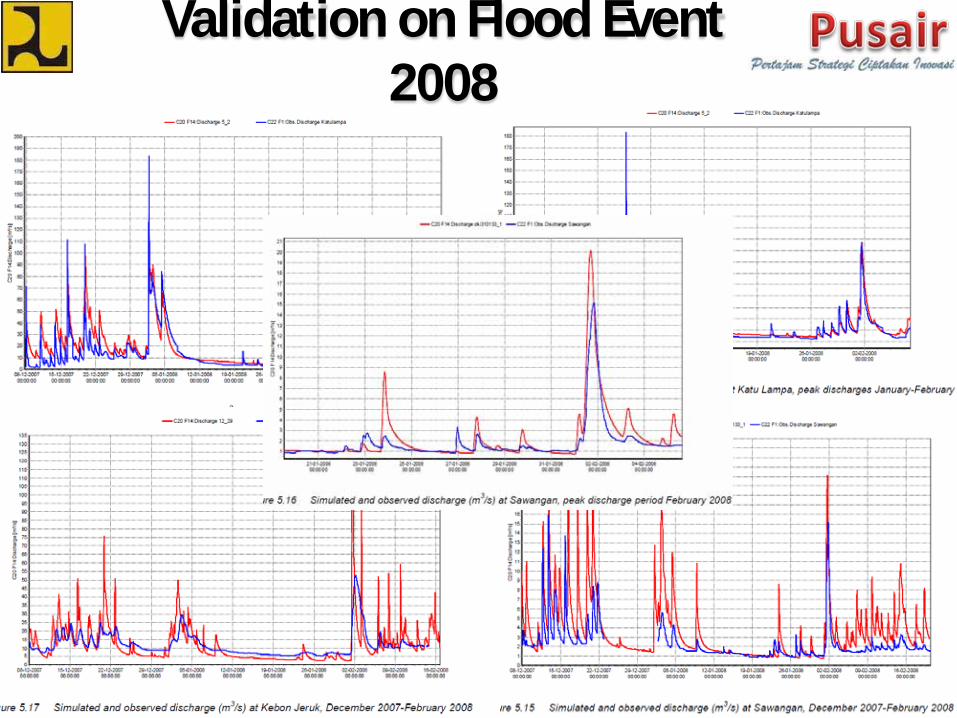
Validation on Flood Event 2008
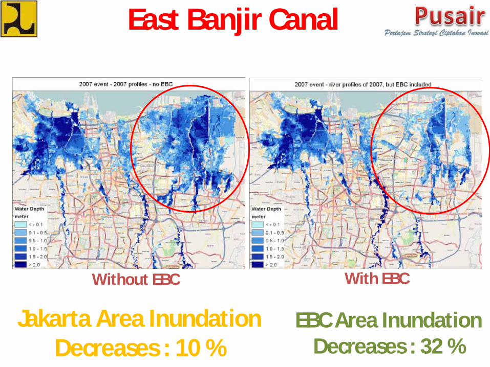
Jakarta Area Inundation Decreases : 10 %
EBC Area Inundation Decreases : 32 %
Without EBC With EBC
East Banjir Canal
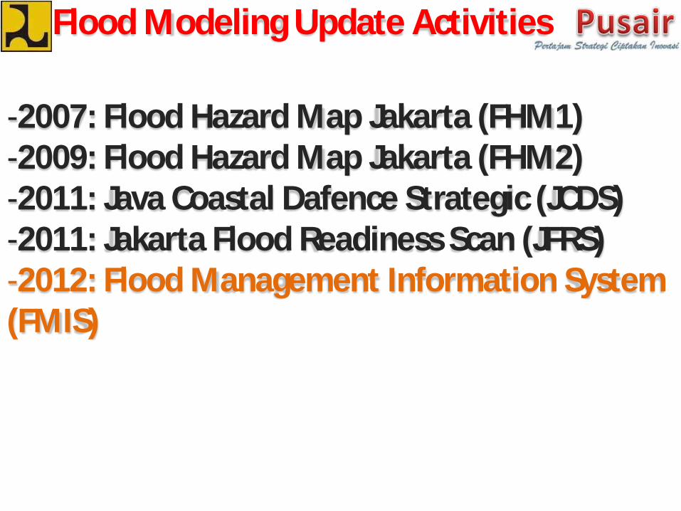
Flood Modeling Update Activities
-2007: Flood Hazard Map Jakarta (FHM1)-2009: Flood Hazard Map Jakarta (FHM2)-2011: Java Coastal Dafence Strategic (JCDS)-2011: Jakarta Flood Readiness Scan (JFRS)-2012: Flood Management Information System (FMIS)
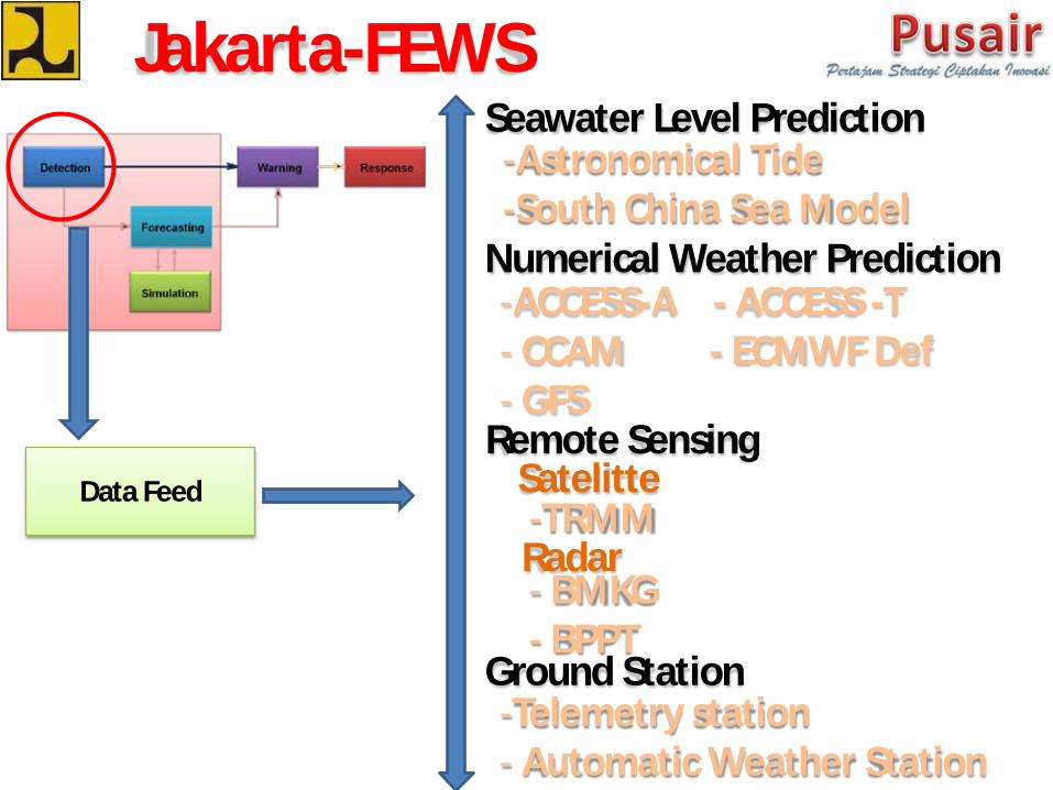
Jakarta-FEWS
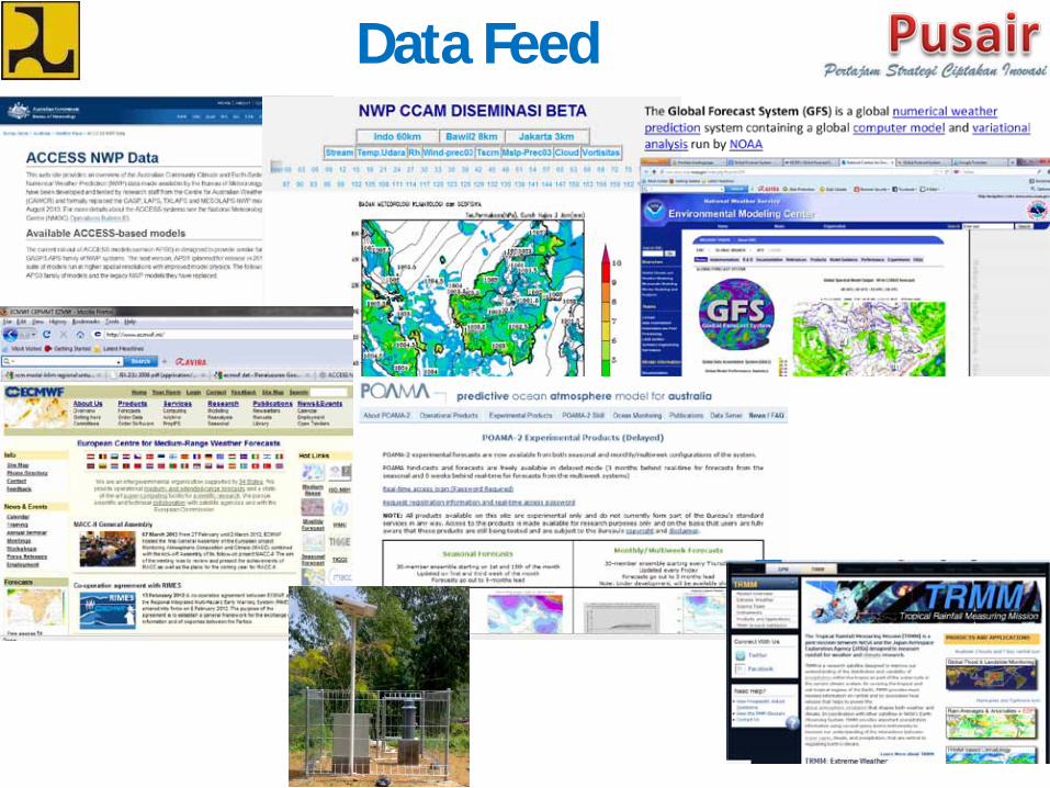
Data Feed
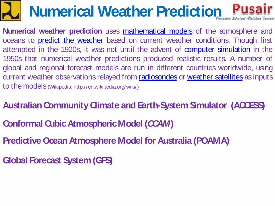
Numerical Weather Prediction-ACCESS-A - ACCESS -T- CCAM - ECMWF Def- GFS
Satelitte-TRMMRadar
Ground Station-Telemetry station- Automatic Weather Station
- BMKG- BPPT
Seawater Level Prediction-Astronomical Tide-South China Sea Model
Remote Sensing
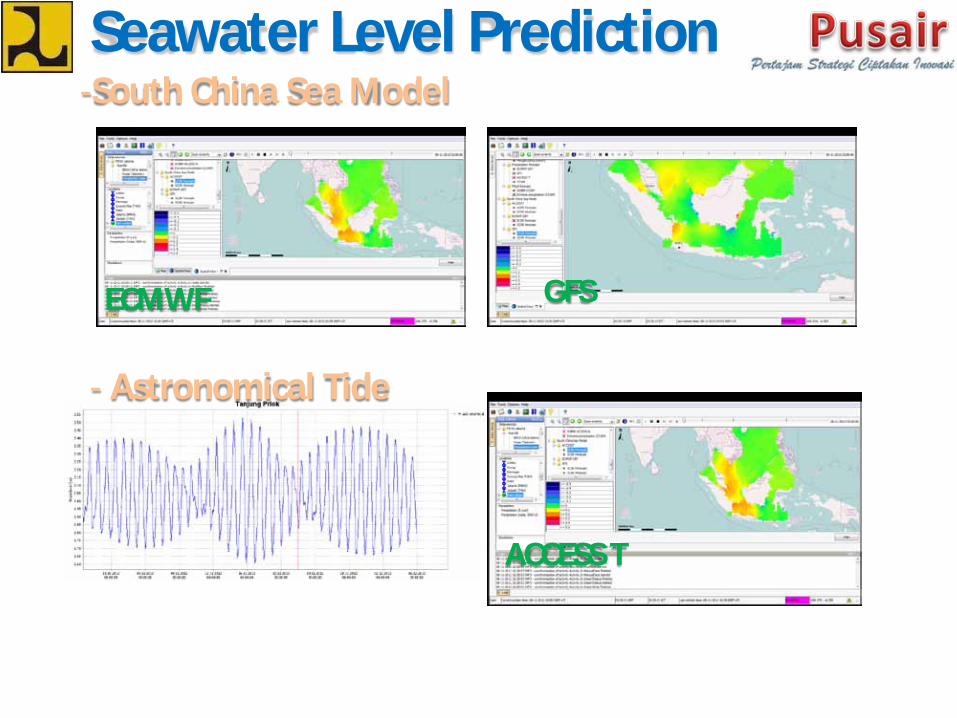
Seawater Level Prediction-South China Sea Model
GFS
ACCESS T
- Astronomical Tide
ECMWF
Numerical Weather Prediction
Conformal Cubic Atmospheric Model (CCAM)
Predictive Ocean Atmosphere Model for Australia (POAMA)
Australian Community Climate and Earth-System Simulator (ACCESS)
Numerical weather prediction uses mathematical models of the atmosphere andoceans to predict the weather based on current weather conditions. Though firstattempted in the 1920s, it was not until the advent of computer simulation in the1950s that numerical weather predictions produced realistic results. A number ofglobal and regional forecast models are run in different countries worldwide, usingcurrent weather observations relayed from radiosondes or weather satellites as inputsto the models (Wikipedia, http://en.wikipedia.org/wiki/)
Global Forecast System (GFS)

Data Feed
Output JFEWSFlood Information
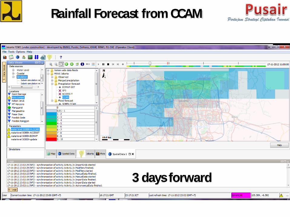
Rainfall Forecast from CCAM
3 days forward
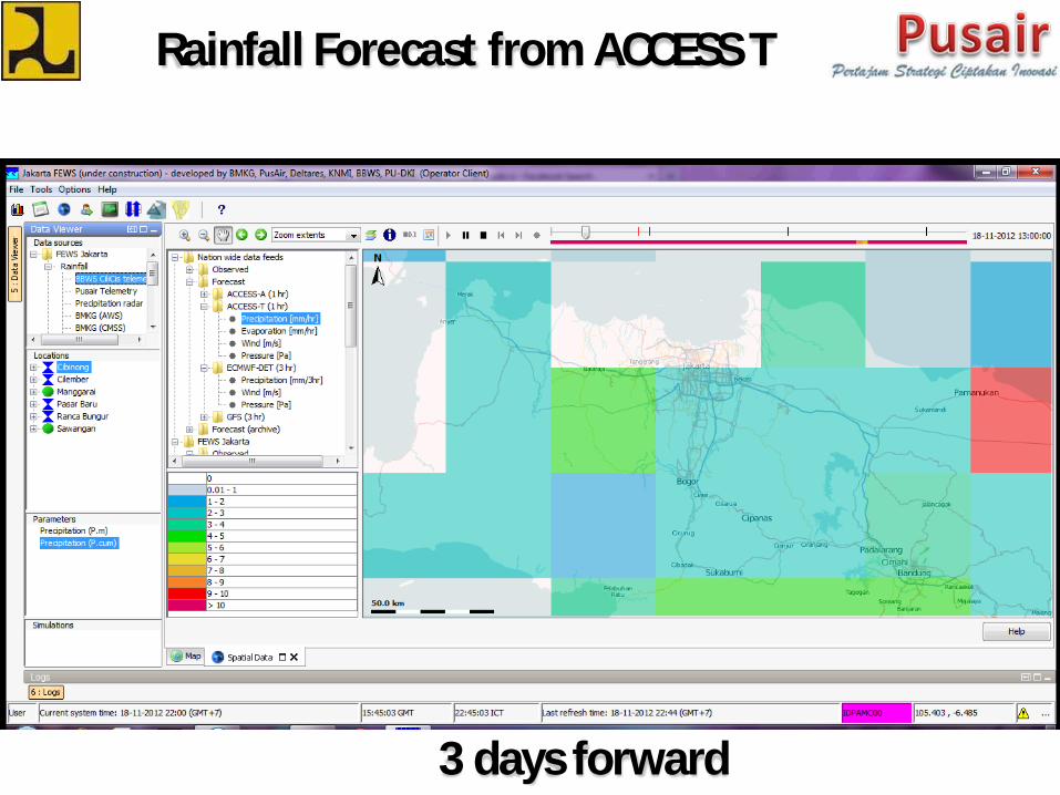
Rainfall Forecast from ACCESS T
3 days forward
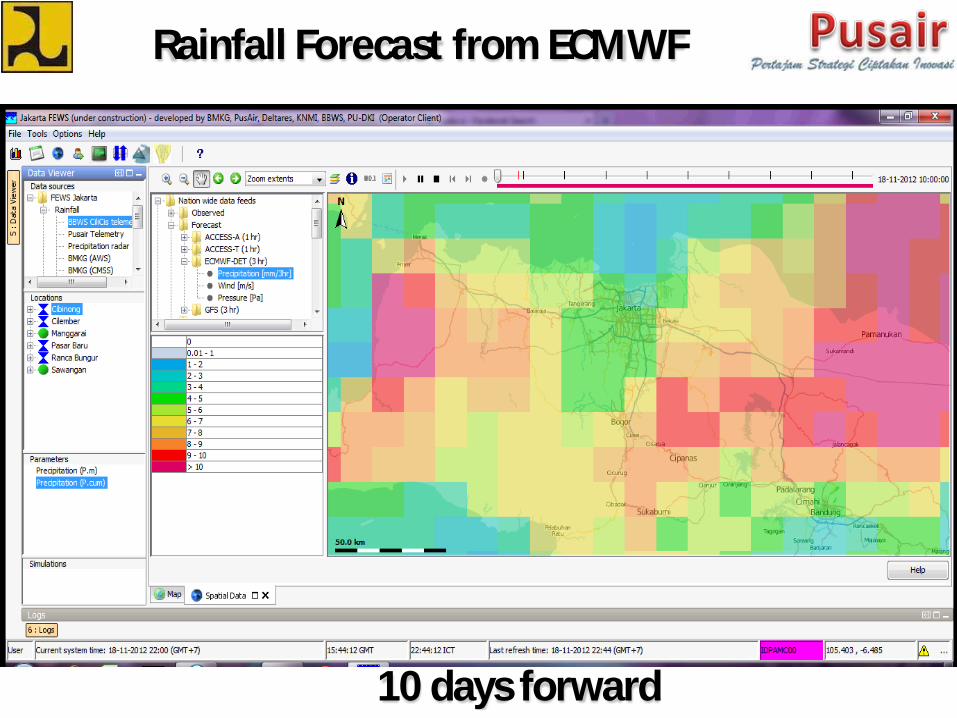
Rainfall Forecast from ECMWF
10 days forward
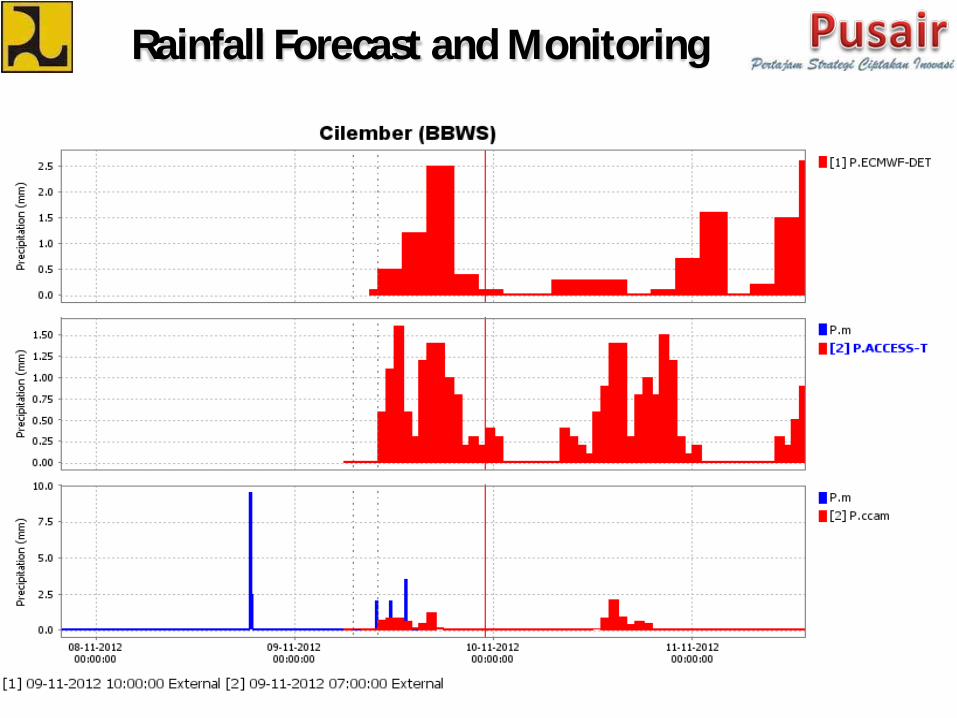
Rainfall Forecast and Monitoring
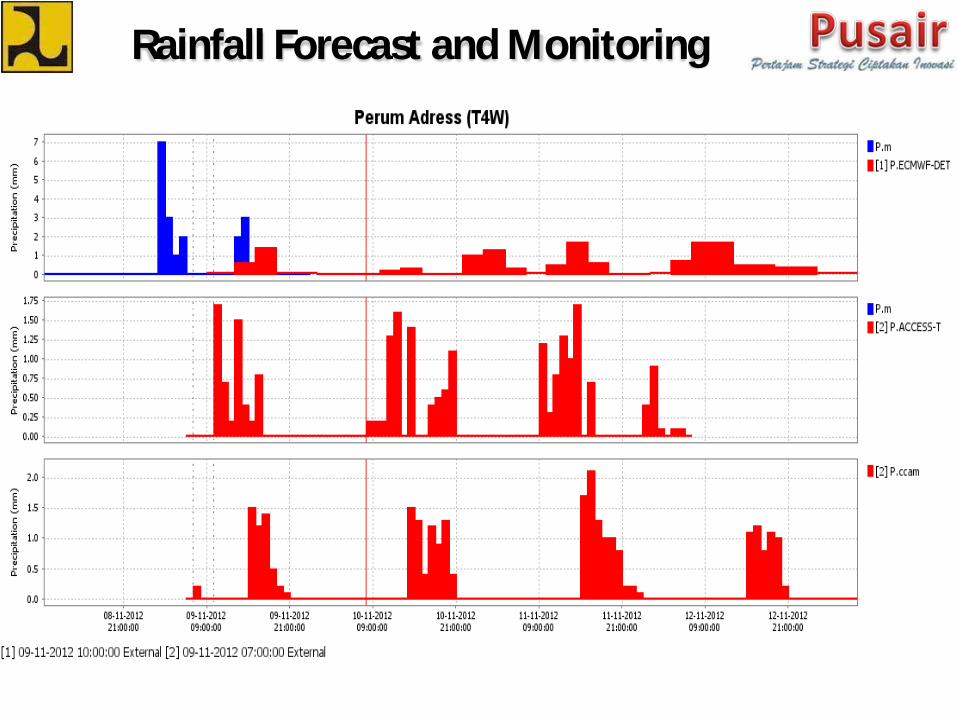
Rainfall Forecast and Monitoring
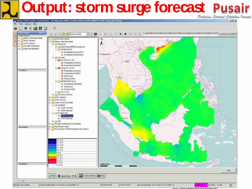
http://bedrockasia.files.wordpress.com
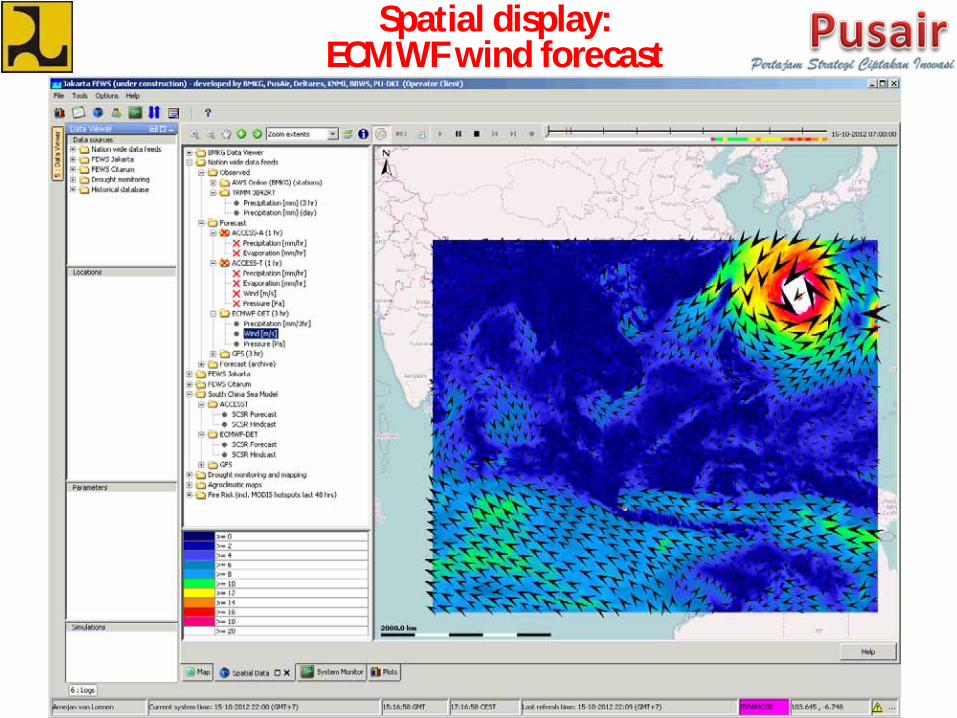
Spatial display: ECMWF wind forecast
http://bedrockasia.files.wordpress.com
Output: storm surge forecast
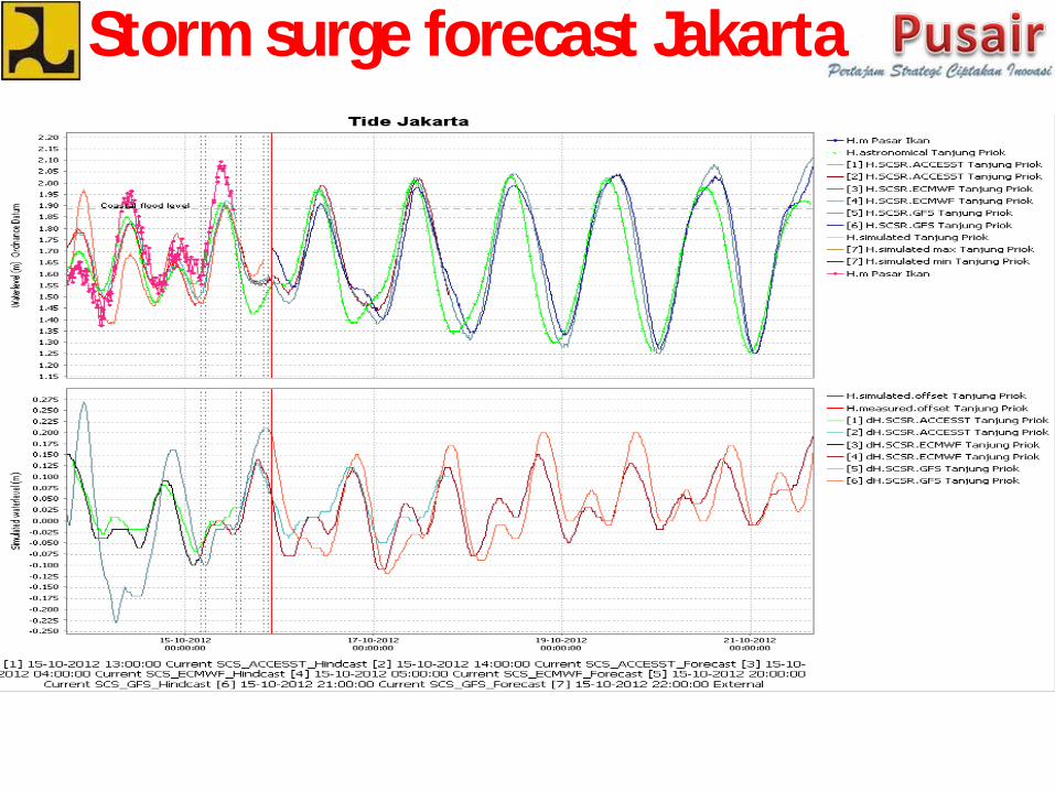
Storm surge forecast Jakarta
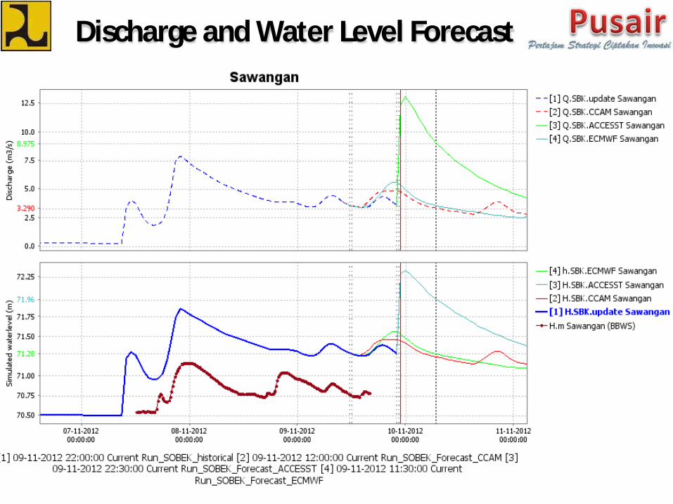
Discharge and Water Level Forecast
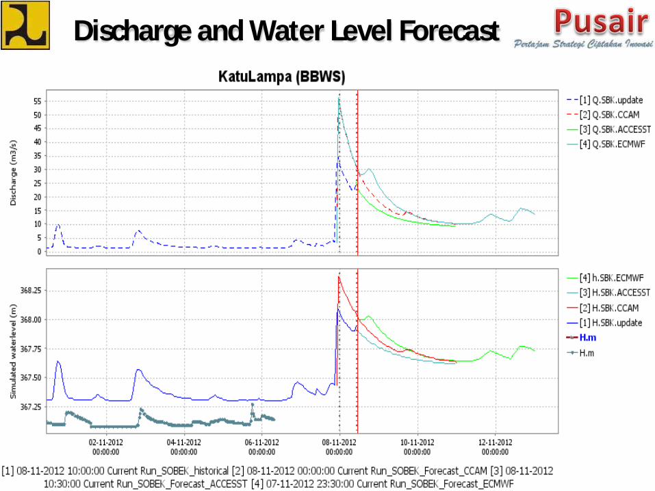
Discharge and Water Level Forecast
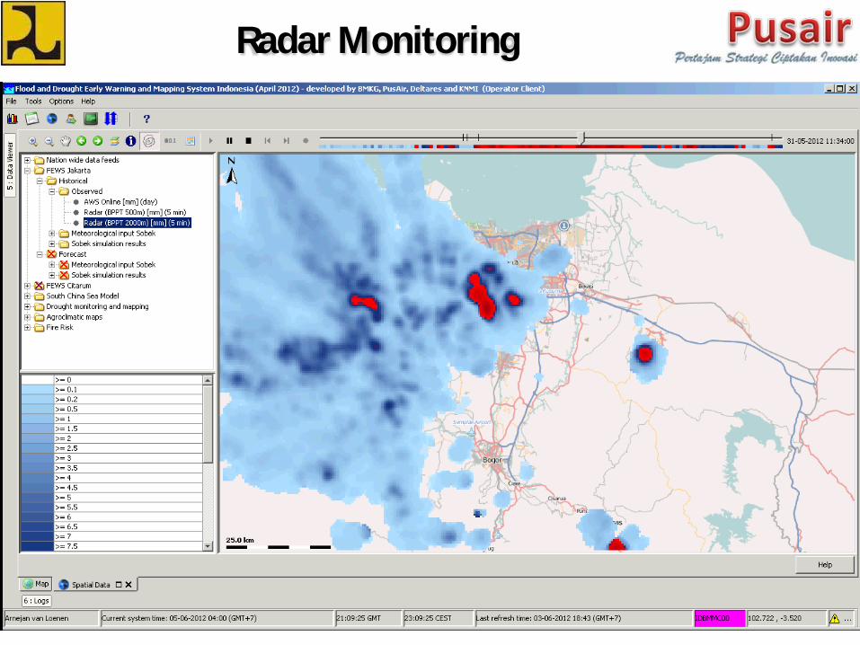
Radar Monitoring
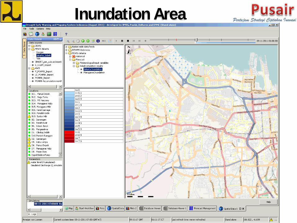
Inundation Area

Thank you for your kind
attention
http://ijef-share.blogspot.com