geo-referencing of cadastral general boundaries for the improvement of land governance in kenya a...
TRANSCRIPT
GEO-REFERENCING OF CADASTRAL GENERAL BOUNDARIES FOR THE IMPROVEMENT OF
LAND GOVERNANCE IN KENYAA Paper Prepared for presentation at the
“2015 WORLD BANK CONFERENCE ON LAND AND POVERTY”
The World Bank – Washington DC, March 23 – 27, 2015
Presenter: Silas Kinoti Muriithi, DS – Commissioner, National Land Commission, Kenya
1
Using Geospatial Data in Innovative Ways to Monitor Land Governance

KENYA ON THE WORLD MAPEquator divides the country into two nearly equal parts
2

Kenya’s Production Systems
3
Population: Over 40 millionArea: 582,646 Sq. KmLand mass: 97.8%Water Surface: 2.2%High Potential: 20%ASAL: 80%Pop. Density: 2 – 2,000/Sq. Km67% of land is unregisteredGDP per Capita: USD 1,245Kenya has one govt of national
unity and 47 county govts
A BRIEF COUNTRY PROFILE

WHAT IS A GENERAL BOUNDARY?
An approximate boundary of which the precise line is undetermined in relation to the physical features which demarcate it.
4
River Fence
Ridge Hedge
Dry Hedge Undefined Feature

GENESIS AND PROGRESSION OF GENERAL BOUNDARIES IN KENYA
1. Pre-Colonial Era2. Colonial Era3. The Swynnerton Plan of 19544. Land Consolidation Process5. Post Independent Kenya Accelerated Land Adjudication
5

LAND CONSOLIDATION & LAND ADJUDICATION
Unique Problem of Land ConsolidationFinding space for consolidated fragments to land
6
(There are some areas in Kenya where land consolidation was started in the 1970s and to date (2015), there are still “parcels of land in the air” yet to find space to land)
LAND CONSOLIDATION & LAND ADJUDICATION
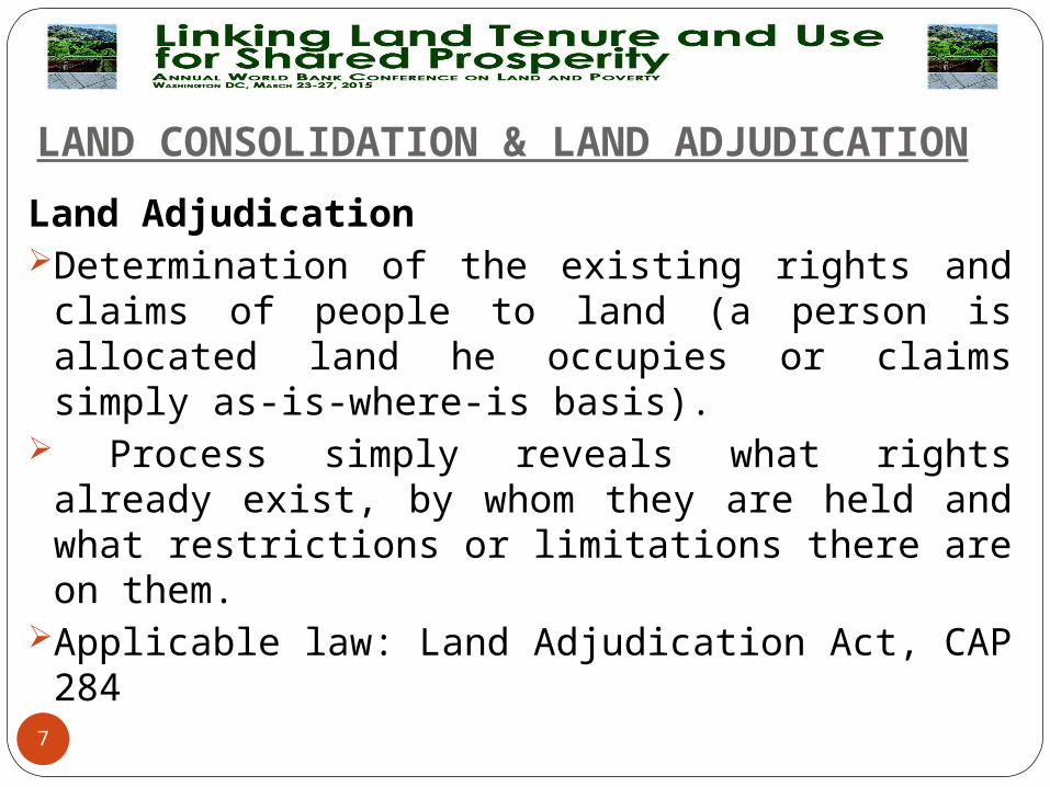
Land AdjudicationDetermination of the existing rights and claims of
people to land (a person is allocated land he occupies or claims simply as-is-where-is basis).
Process simply reveals what rights already exist, by whom they are held and what restrictions or limitations there are on them.
Applicable law: Land Adjudication Act, CAP 284
7
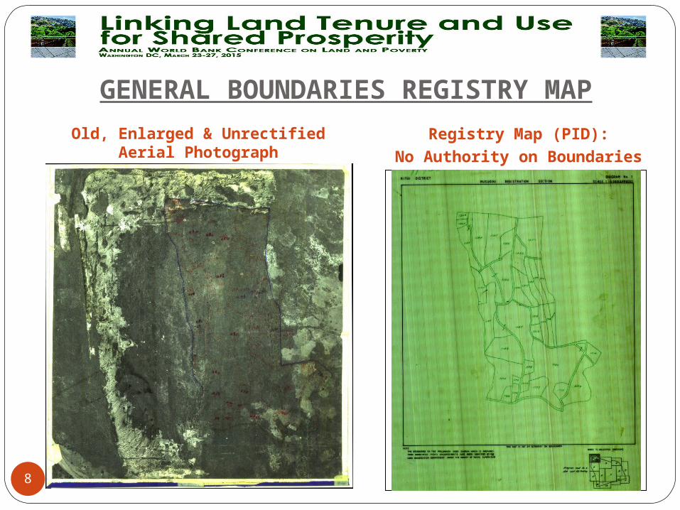
GENERAL BOUNDARIES REGISTRY MAPOld, Enlarged & Unrectified
Aerial PhotographRegistry Map (PID):
No Authority on Boundaries
8
GENERAL BOUNDARIES REGISTRY MAP
9
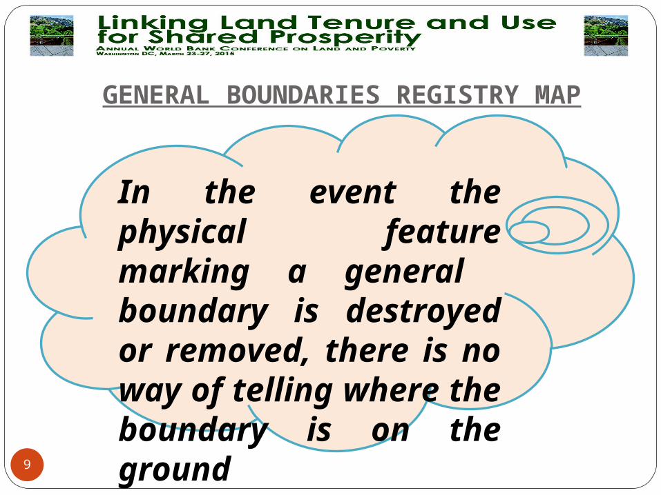
In the event the physical feature marking a general boundary is destroyed or removed, there is no way of telling where the boundary is on the ground
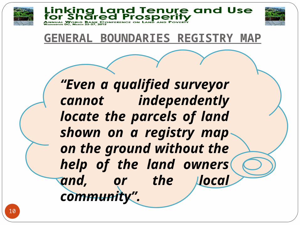
GENERAL BOUNDARIES REGISTRY MAP
10
“Even a qualified surveyor cannot independently locate the parcels of land shown on a registry map on the ground without the help of the land owners and, or the local community”.

GENERAL BOUNDARIES AND LAND DISPUTES
Common Land Related Disputes Boundary Disputes Ownership Disputes Herders and Farmers Disputes Common Pool Resources (CPR) Disputes
Common grazing fieldsWatering pointsForests and WoodlandsIrrigation watersSand harvesting etc.11

GENERAL BOUNDARIES AND LAND DISPUTES
12
(The smaller the land size or land
resource, the greater the dispute)
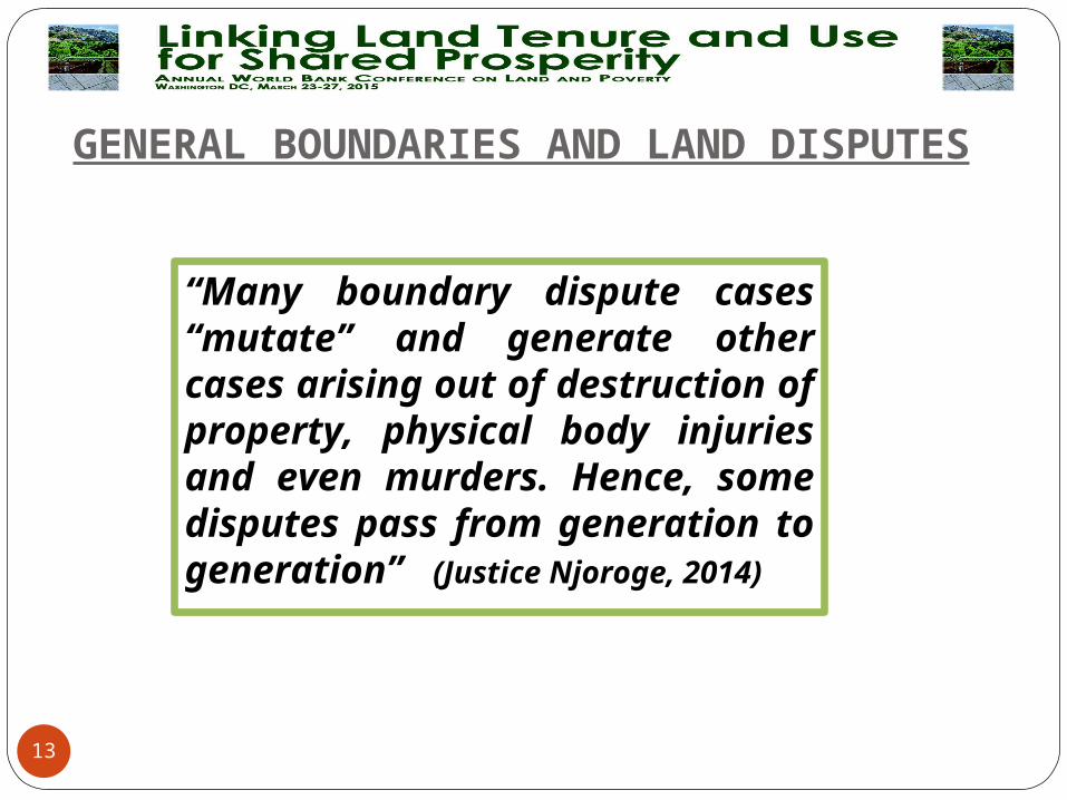
GENERAL BOUNDARIES AND LAND DISPUTES
13
“Many boundary dispute cases “mutate” and generate other cases arising out of destruction of property, physical body injuries and even murders. Hence, some disputes pass from generation to generation” (Justice Njoroge, 2014)
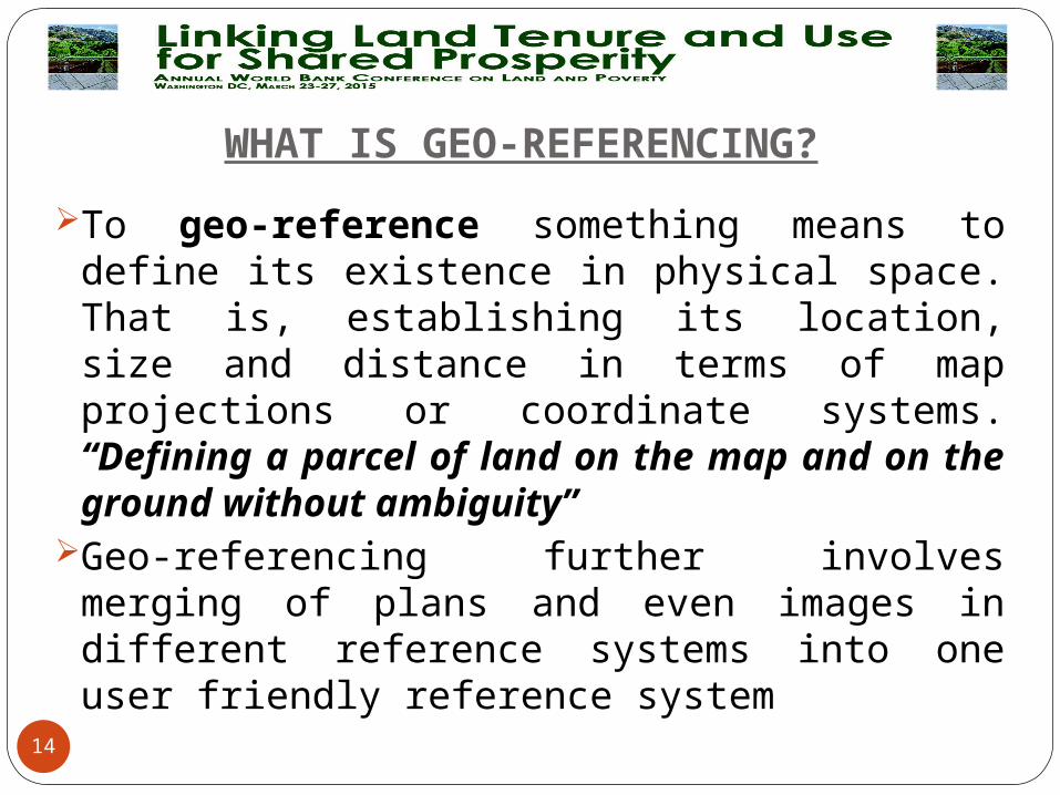
WHAT IS GEO-REFERENCING?
To geo-reference something means to define its existence in physical space. That is, establishing its location, size and distance in terms of map projections or coordinate systems. “Defining a parcel of land on the map and on the ground without ambiguity”
Geo-referencing further involves merging of plans and even images in different reference systems into one user friendly reference system
14

Surveying is a method of Geo-referencing
15
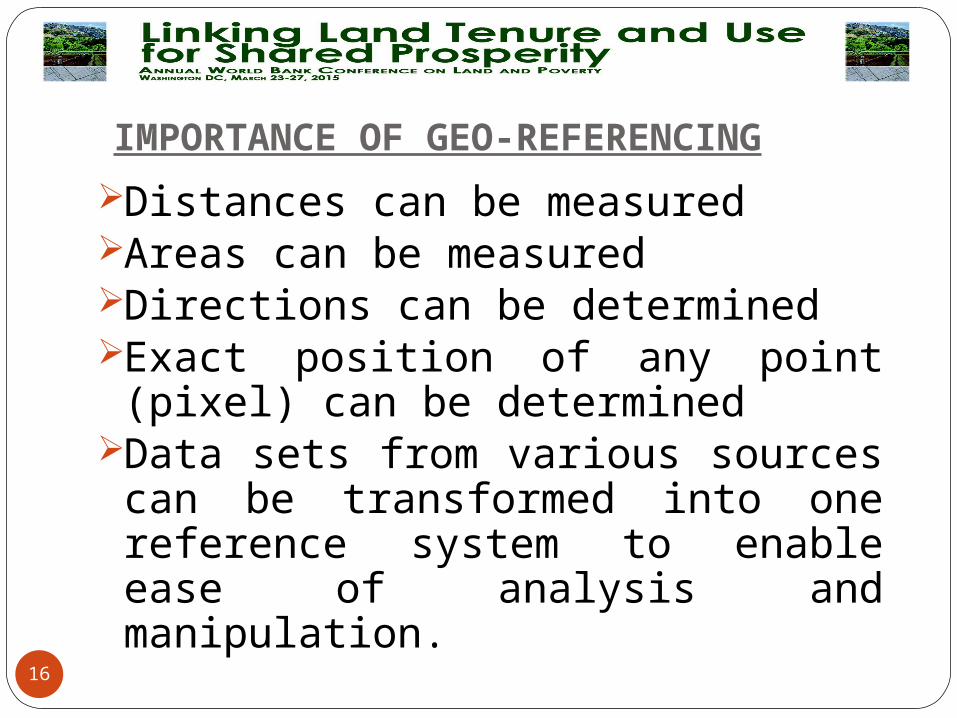
IMPORTANCE OF GEO-REFERENCING
Distances can be measuredAreas can be measuredDirections can be determinedExact position of any point (pixel) can be determined
Data sets from various sources can be transformed into one reference system to enable ease of analysis and manipulation.
16

IMPORTANCE OF GEO-REFERENCING
Boundaries of parcels of land can be determined on the ground with certainty
Boundary disputes can be solved easilyFurther surveys can be done easilyRegistry maps can become authorities
on boundaries
17
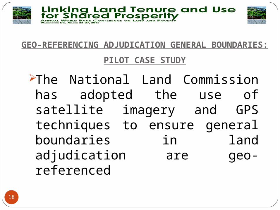
GEO-REFERENCING ADJUDICATION GENERAL BOUNDARIES:
PILOT CASE STUDY
The National Land Commission has adopted the use of satellite imagery and GPS techniques to ensure general boundaries in land adjudication are geo-referenced
18
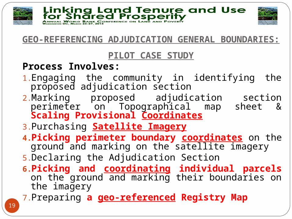
GEO-REFERENCING ADJUDICATION GENERAL BOUNDARIES:
PILOT CASE STUDYProcess Involves:1. Engaging the community in identifying the proposed
adjudication section2. Marking proposed adjudication section perimeter on
Topographical map sheet & Scaling Provisional Coordinates3. Purchasing Satellite Imagery4. Picking perimeter boundary coordinates on the ground and
marking on the satellite imagery5. Declaring the Adjudication Section6. Picking and coordinating individual parcels on the ground
and marking their boundaries on the imagery7. Preparing a geo-referenced Registry Map
19

PILOT CASE STUDY:
1. Engaging the Community in Identification and Declaration of the Adjudication Section
20

PILOT CASE STUDY:
2. Marking proposed adjudication section perimeter on Topographical Mapsheet & Scaling Provisional Coordinates
21
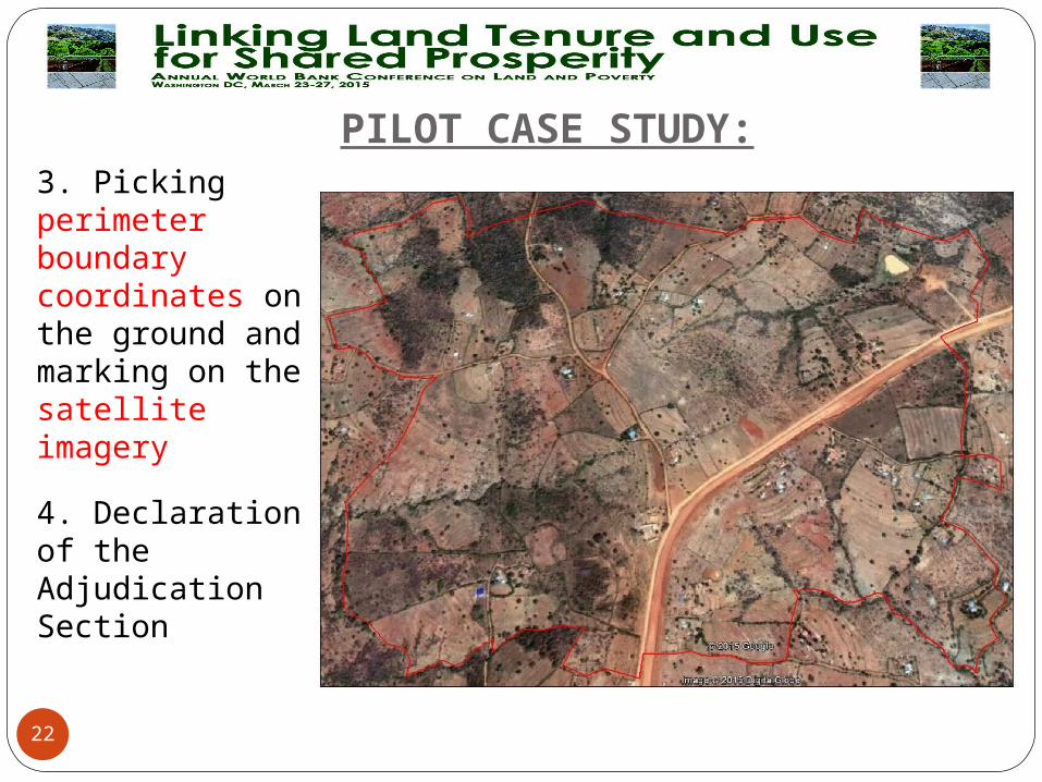
PILOT CASE STUDY:
3. Picking perimeter boundary coordinates on the ground and marking on the satellite imagery
4. Declaration of the Adjudication Section
22

PILOT CASE STUDY:
5. Picking and coordinating individual parcels on the ground and marking on the image
23
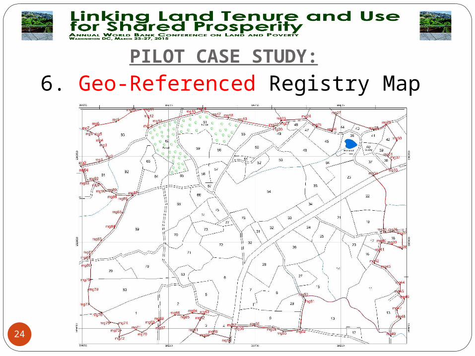
PILOT CASE STUDY:
6. Geo-Referenced Registry Map
24
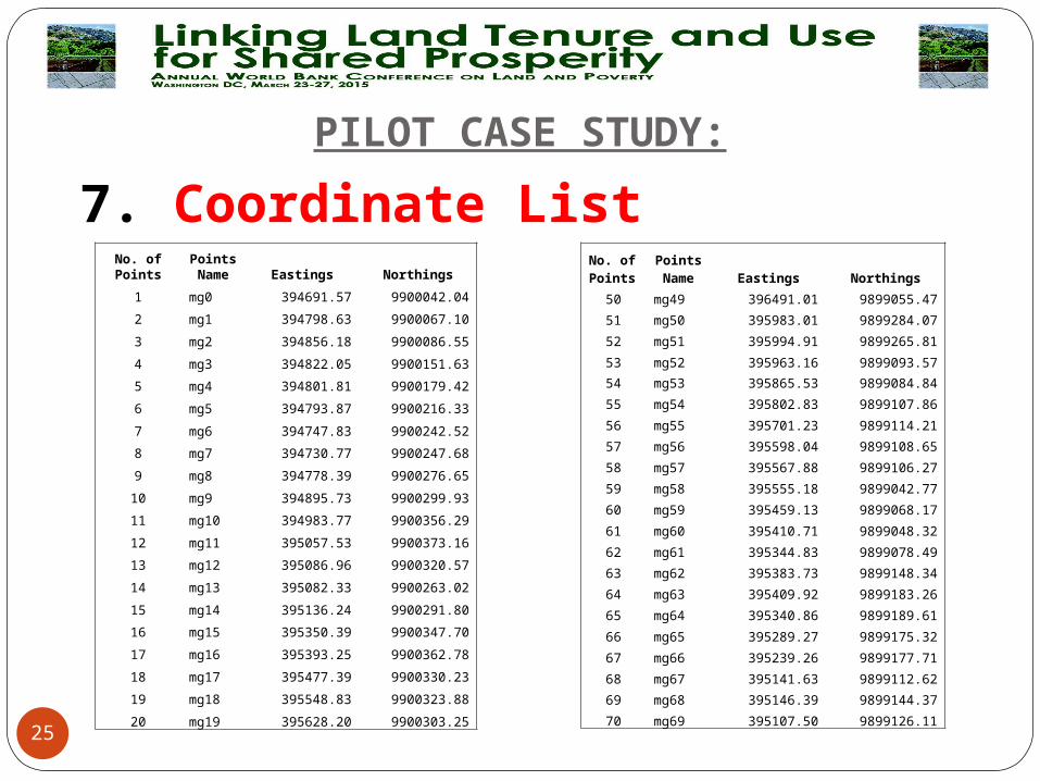
PILOT CASE STUDY:
7. Coordinate List
25
No. of PointsPoints Name Eastings Northings
1 mg0 394691.57 9900042.04
2 mg1 394798.63 9900067.10
3 mg2 394856.18 9900086.55
4 mg3 394822.05 9900151.63
5 mg4 394801.81 9900179.42
6 mg5 394793.87 9900216.33
7 mg6 394747.83 9900242.52
8 mg7 394730.77 9900247.68
9 mg8 394778.39 9900276.65
10 mg9 394895.73 9900299.93
11 mg10 394983.77 9900356.29
12 mg11 395057.53 9900373.16
13 mg12 395086.96 9900320.57
14 mg13 395082.33 9900263.02
15 mg14 395136.24 9900291.80
16 mg15 395350.39 9900347.70
17 mg16 395393.25 9900362.78
18 mg17 395477.39 9900330.23
19 mg18 395548.83 9900323.88
20 mg19 395628.20 9900303.25
No. of Points
Points Name Eastings Northings
50 mg49 396491.01 9899055.47
51 mg50 395983.01 9899284.07
52 mg51 395994.91 9899265.81
53 mg52 395963.16 9899093.57
54 mg53 395865.53 9899084.84
55 mg54 395802.83 9899107.86
56 mg55 395701.23 9899114.21
57 mg56 395598.04 9899108.65
58 mg57 395567.88 9899106.27
59 mg58 395555.18 9899042.77
60 mg59 395459.13 9899068.17
61 mg60 395410.71 9899048.32
62 mg61 395344.83 9899078.49
63 mg62 395383.73 9899148.34
64 mg63 395409.92 9899183.26
65 mg64 395340.86 9899189.61
66 mg65 395289.27 9899175.32
67 mg66 395239.26 9899177.71
68 mg67 395141.63 9899112.62
69 mg68 395146.39 9899144.37
70 mg69 395107.50 9899126.11

MAIN CHALLENGE
26
In moving from “Informality to Formality”, how do we ensure it is not
a burden to the poor populace?
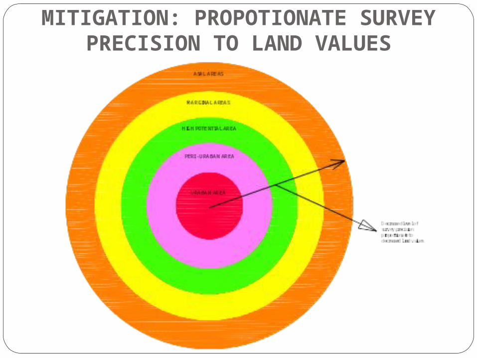
MITIGATION: PROPOTIONATE SURVEY PRECISION TO LAND VALUES