envi training - goozmo, boulder colorado company · 1 envi training itt visual information...
TRANSCRIPT
1
ENVI Training
ITT Visual Information Solutions
Topographic Production Capability
2
ENVI
• ENVI 4.8 with ENVI Zoom– 3‐window “classic” interface.
– One‐window "Zoom" interface with pan and zoom functionality.
– Can launc Zoom or classic from the other interface in a linked session.
– 4.8 introduces Viewshed Workflow, LiDAR viewer, and ENVI tools for ArcGIS®
Topographic Production Capability
3
Notes on Organization
• We’ll be taking one long break for lunch and a couple of short breaks throughout the day.
• Training will be organized to go through guided workflows, followed up by challenge exercises.
• A comprehensive set of ENVI capabilities will be organized into scenario‐based training.
• A few standalone module sections at the end will cover Orthorectification, DEM Extraction, SPEAR, and THOR tools.
Topographic Production Capability
4
Disaster Mitigation ScenarioUsing change detection to guide
reconstruction efforts post‐Tsunami.
Topographic Production Capability
5
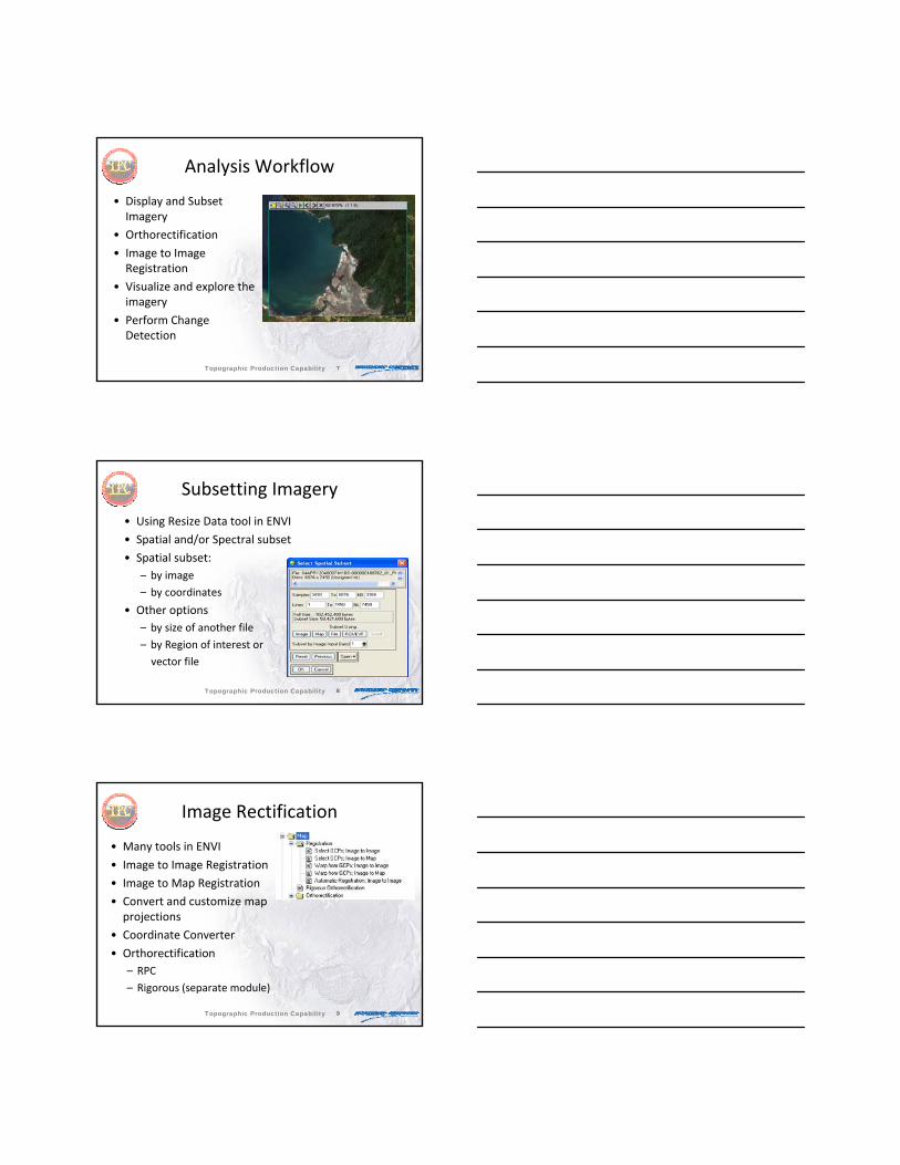
Indian Ocean Tsunami Analysis
In the immediate aftermath of the 2004 Indian Ocean Tsunami, image analysis played a key role in assessing damage caused by windstorm, flood and storm surge.
Topographic Production Capability
6
The extracted coastal damage assessment information was then available to GIS users and rescue personnel in their applications to quantify and classify the extent of the damage.
Indian Ocean Tsunami Analysis
Topographic Production Capability
7
Analysis Workflow
• Display and Subset Imagery
• Orthorectification
• Image to Image Registration
• Visualize and explore the imagery
• Perform Change Detection
Topographic Production Capability
8
Subsetting Imagery
• Using Resize Data tool in ENVI
• Spatial and/or Spectral subset
• Spatial subset:– by image
– by coordinates
• Other options– by size of another file
– by Region of interest or
vector file
Topographic Production Capability
9
Image Rectification
• Many tools in ENVI
• Image to Image Registration
• Image to Map Registration
• Convert and customize map projections
• Coordinate Converter
• Orthorectification– RPC
– Rigorous (separate module)
Topographic Production Capability
10
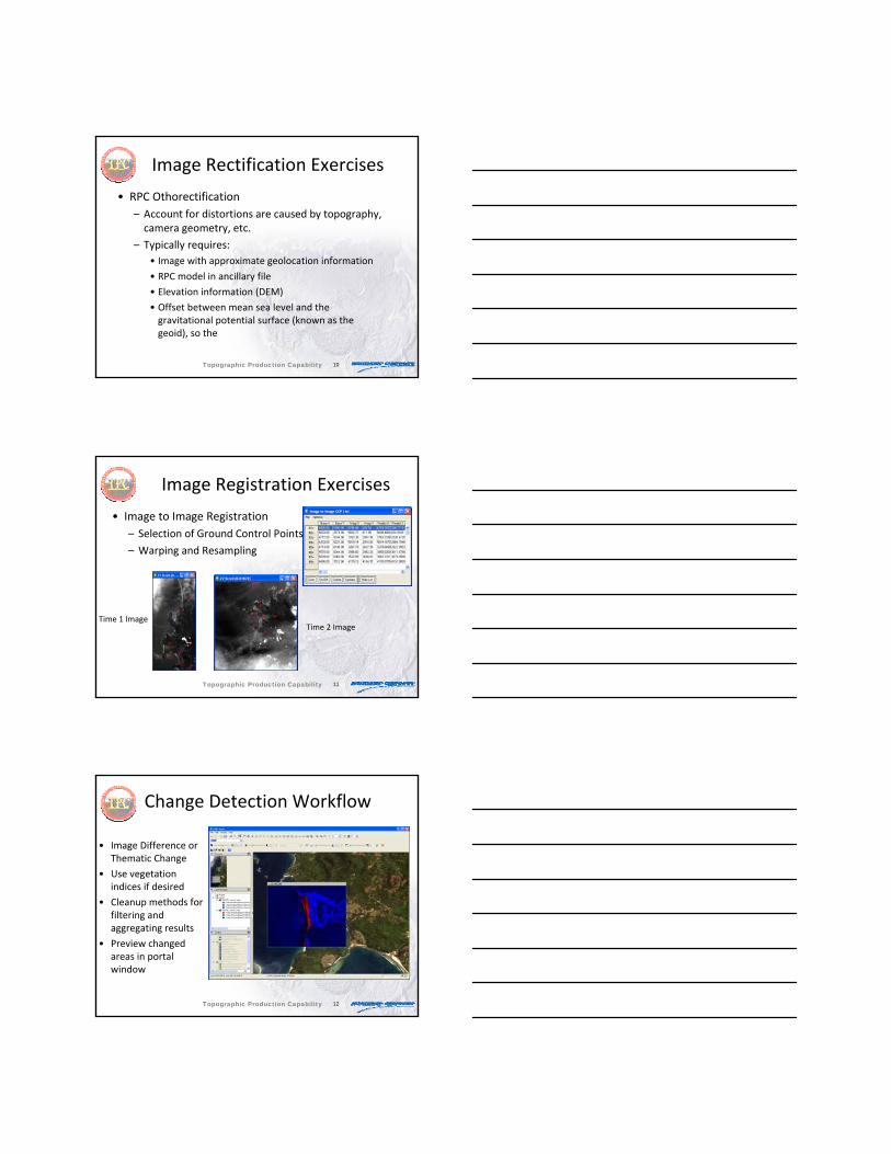
Image Rectification Exercises
• RPC Othorectification– Account for distortions are caused by topography, camera geometry, etc.
– Typically requires:• Image with approximate geolocation information
• RPC model in ancillary file
• Elevation information (DEM)
• Offset between mean sea level and the gravitational potential surface (known as the geoid), so the
Topographic Production Capability
11
Image Registration Exercises
• Image to Image Registration– Selection of Ground Control Points
– Warping and Resampling
Time 1 ImageTime 2 Image
Topographic Production Capability
12
• Image Difference or Thematic Change
• Use vegetation indices if desired
• Cleanup methods for filtering and aggregating results
• Preview changed areas in portal window
Change Detection Workflow
Topographic Production Capability
13
Change Detection• Two change detection algorithms in
ENVI Zoom– Thematic Change – takes two classification images and identifies differences between them. The resulting classification image shows class transitions, for example, from vegetation class to urban class.
– Image Difference ‐ compares two images taken at different times, and it identifies differences between them. The difference can be computed on a specified input band or on a feature index (e.g., veg), with optional thresholding
Topographic Production Capability
14
Change Detection
• Thresholding– Automatic methods
– Manual sliders
• Cleanup step – Smoothing
– Aggregation
Topographic Production Capability
15
Change Detection
• Export– Classification image
– Vectors (shapefiles) HLZ.pptx
Topographic Production Capability
16
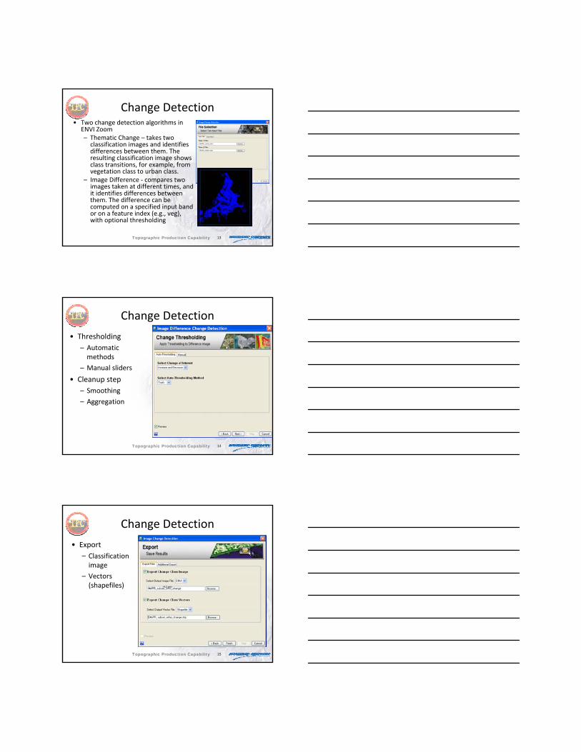
Ship Landing ScenarioUsing ENVI to select suitable regionsfor shore approach.
Topographic Production Capability
17
Ship Landing Scenario
• Commercial data import– Combine individual bands into one file and reorder
• Image Mosaicking • SPEAR Relative Water Depth
– Masking• Density Slice• Export to ArcGIS
Topographic Production Capability
18
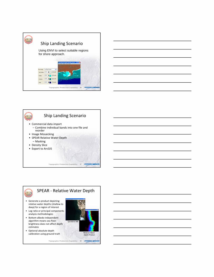
Relative Water Depth Product
SPEAR ‐ Relative Water Depth
• Generate a product depicting relative water depths (shallow to deep) for a region of interest
• Log ratio or principal components analysis methodologies
• Bottom albedo independent algorithm means sea floor brightness does not affect depth estimates
• Optional absolute depth calibration using ground truth
Quickbird MSI
Topographic Production Capability
19
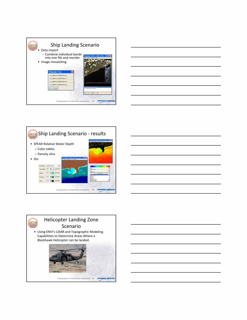
Ship Landing Scenario• Data import
– Combine individual bands into one file and reorder
• Image mosaicking
Topographic Production Capability
20
Ship Landing Scenario ‐ results
• SPEAR Relative Water Depth
– Color tables
– Density slice
• Density Slice
Topographic Production Capability
21
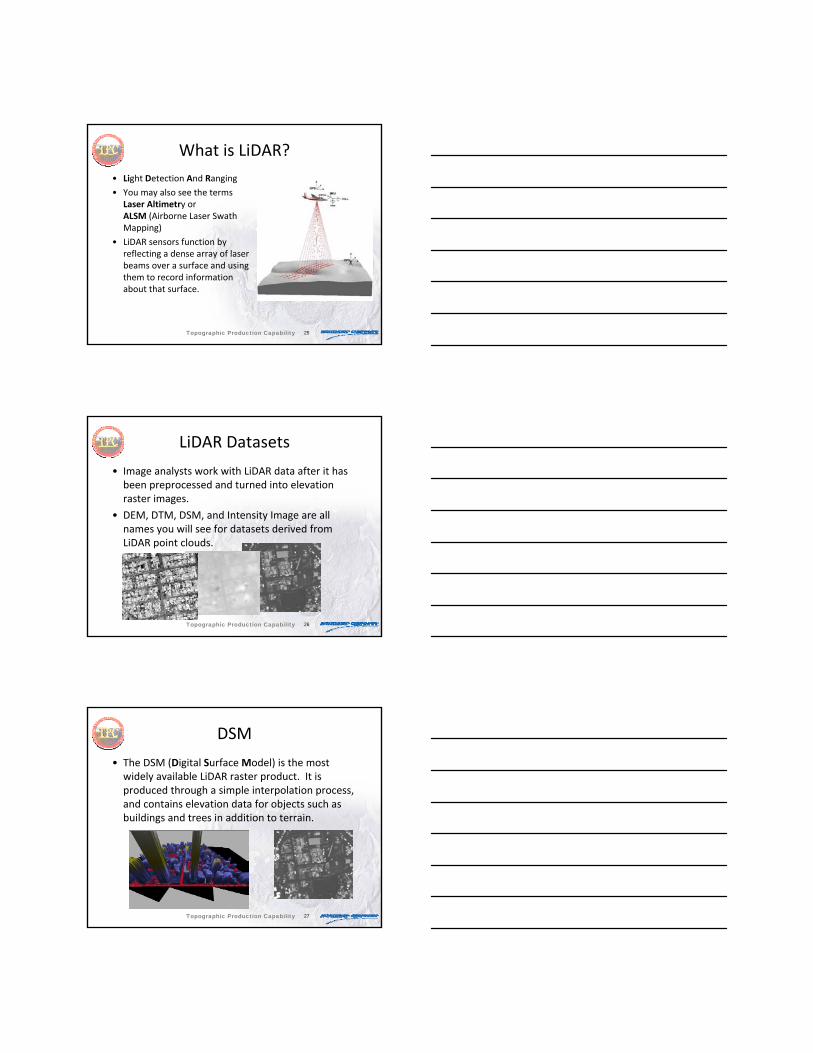
Helicopter Landing Zone Scenario
• Using ENVI’s LiDAR and Topographic Modeling Capabilities to Determine Areas Where a Blackhawk Helicopter can be landed.
Topographic Production Capability

22
HLZ Requirements
• Exclude areas near Vertical Obstructions
• Exclude Water cover.
• Exclude areas of excessive slope or with otherwise unsuitable topography.
• Combine all exclusions into a single rule image.
• Select areas of appropriate morphology for the helicopter in question (area, shape, etc.)
Topographic Production Capability
23
ENVI Capabilities
• Use the LiDAR Viewer to gain actionable intelligence.
• Construct a vertical obstructions layer using Band Math.
• Mask out water by digitizing vectors aided with region growing.
• Create buffer zones around water and vertical obstructions.
Topographic Production Capability
24
ENVI Capabilities
• Perform topographic modeling.
• Threshold out unsuitable data ranges to an ROI.
• Use convolutions and morphology to locate appropriately sized areas for the landing zone.
Topographic Production Capability
25
What is LiDAR?• Light Detection And Ranging
• You may also see the terms Laser Altimetry or ALSM (Airborne Laser Swath Mapping)
• LiDAR sensors function by reflecting a dense array of laser beams over a surface and using them to record information about that surface.
Topographic Production Capability
26
LiDAR Datasets
• Image analysts work with LiDAR data after it has been preprocessed and turned into elevation raster images.
• DEM, DTM, DSM, and Intensity Image are all names you will see for datasets derived from LiDAR point clouds.
Topographic Production Capability
27
DSM
• The DSM (Digital Surface Model) is the most widely available LiDAR raster product. It is produced through a simple interpolation process, and contains elevation data for objects such as buildings and trees in addition to terrain.
Topographic Production Capability
28
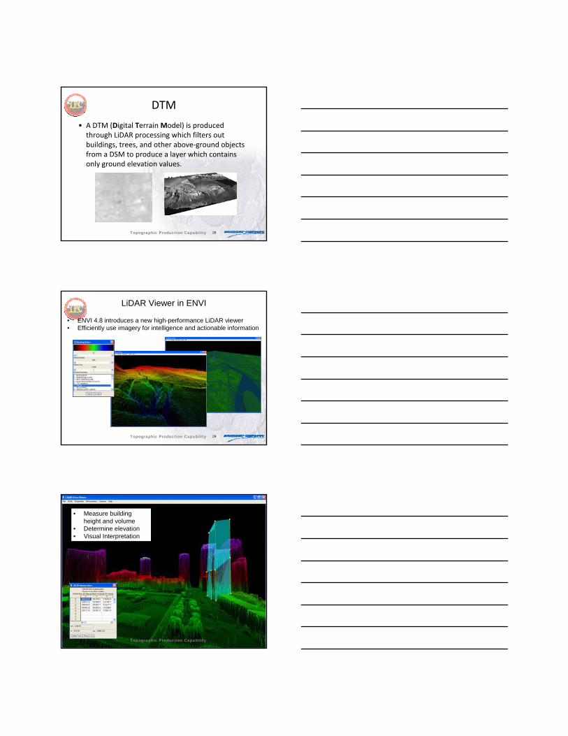
DTM
• A DTM (Digital Terrain Model) is produced through LiDAR processing which filters out buildings, trees, and other above‐ground objects from a DSM to produce a layer which contains only ground elevation values.
Topographic Production Capability
29
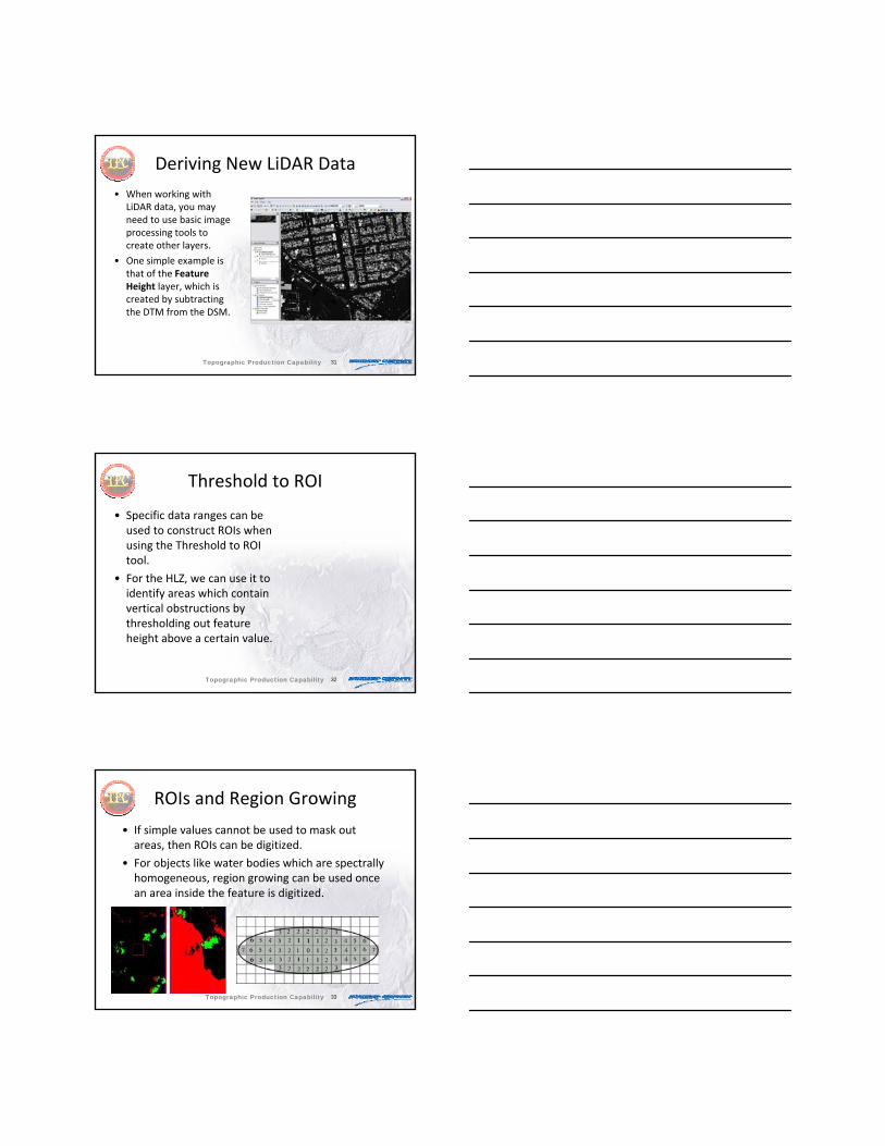
LiDAR Viewer in ENVI
• ENVI 4.8 introduces a new high-performance LiDAR viewer• Efficiently use imagery for intelligence and actionable information
Topographic Production Capability
30
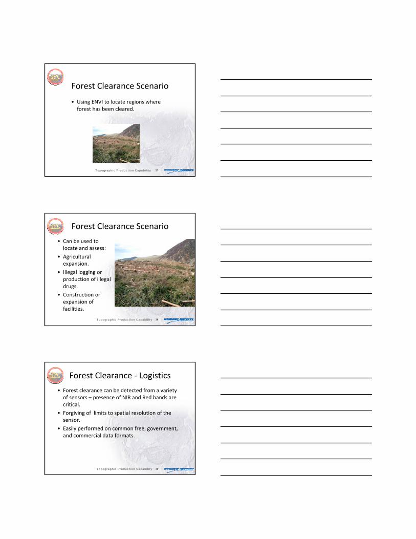
• Measure building height and volume
• Determine elevation• Visual Interpretation
Topographic Production Capability
31
Deriving New LiDAR Data• When working with
LiDAR data, you may need to use basic image processing tools to create other layers.
• One simple example is that of the Feature Height layer, which is created by subtracting the DTM from the DSM.
Topographic Production Capability
32
Threshold to ROI
• Specific data ranges can be used to construct ROIs when using the Threshold to ROI tool.
• For the HLZ, we can use it to identify areas which contain vertical obstructions by thresholding out feature height above a certain value.
Topographic Production Capability
33
ROIs and Region Growing
• If simple values cannot be used to mask out areas, then ROIs can be digitized.
• For objects like water bodies which are spectrally homogeneous, region growing can be used once an area inside the feature is digitized.
Topographic Production Capability

34
Topographic Modeling
• Slope, Aspect, and other topographic measures can be extraction from a DEM in ENVI.
• Use Threshold to ROI with these tools to mask out desirable or undesirable values.
Topographic Production Capability
35
Band Math in ENVI
• Band Math is a multi purpose tool which can be used to combine datasets, extract information from various datasets, or compare datasets.
• Don’t overestimate the difficulty of using the band math tool. Most operations use only basic arithmetic.
Topographic Production Capability
36
ENVI Morphology Filters
• Can use Erode to shrink or reduce islands of smaller pixels, or Dilate to fill, expand, or fill holes in an image.
• Morphology filters provide the capability to automatically filter out areas of potential helicopter landing zones that are too small to accept helicopters of a certain size.
Topographic Production Capability
37
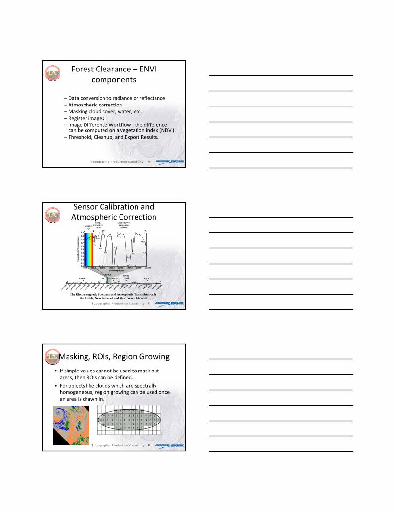
Forest Clearance Scenario
• Using ENVI to locate regions where forest has been cleared.
Topographic Production Capability
38
Forest Clearance Scenario
• Can be used to locate and assess:
• Agricultural expansion.
• Illegal logging or production of illegal drugs.
• Construction or expansion of facilities.
Topographic Production Capability
39
Forest Clearance ‐ Logistics
• Forest clearance can be detected from a variety of sensors – presence of NIR and Red bands are critical.
• Forgiving of limits to spatial resolution of the sensor.
• Easily performed on common free, government, and commercial data formats.
Topographic Production Capability
40
Forest Clearance – ENVI components
– Data conversion to radiance or reflectance– Atmospheric correction – Masking cloud cover, water, etc.– Register images– Image Difference Workflow : the difference can be computed on a vegetation index (NDVI).
– Threshold, Cleanup, and Export Results.
Topographic Production Capability
41
Sensor Calibration and Atmospheric Correction
Topographic Production Capability
10-6 nm
10-5 nm
10-4 nm
10-3 nm
10-2 nm
10-1 nm1 n
m10
nm10
0 nm
1 μm
10 μm
100 μ
m1 m
m1 c
m10
cm 1 m 10 m
100 m 1 k
m10
km10
0 km
400.0 700.0 1000.0 1300.0 1600.0 1900.0 2200.0 2500.0Wavelength (nm)
Atm
osph
eric
Tra
nsm
ittan
ce
0.00.10.20.30.40.50.60.70.80.91.0
O3 O2H2O
O2
H2O
H2O
H2O
H2O
H2O
O2 CO2
CO2
CH4
H2O
RADIOMICRO-WAVEINFRAREDUVGAMMA
VISIBLE(VIS)
NEAR-INFRARED
(NIR)
SHORT WAVE INFRARED
(SWIR)
VISIBLE
The Electromagnetic Spectrum and Atmospheric Transmittance in the Visible, Near Infrared and Short Wave Infrared
42
Masking, ROIs, Region Growing
• If simple values cannot be used to mask out areas, then ROIs can be defined.
• For objects like clouds which are spectrally homogeneous, region growing can be used once an area is drawn in.
Topographic Production Capability
43
NDVI
• Use vegetation’s spectral properties to assess health and vegetation types.
• Relies on peak in NIR and valley in Red.
Topographic Production Capability
44
Image Rectification
• Many tools in ENVI
• Image to Image Registration
• Image to Map Registration
• Convert and customize map projections
• Coordinate Converter
• Orthorectification– RPC
– Rigorous (separate module)
Topographic Production Capability
45
Image Rectification –Nearest Neighbor Resampling
• Original scene and the newly rectified scene
2. Output image with GCPs
3. Source image laid over output image with GCPs aligned
4. Pixel values from the input are assigned to pixels in output byresampling
1. Source image with GCPs
GCP
GCP
Topographic Production Capability

46
Image Rectification – ResamplingImage Rectification – ResamplingGrid Nearest Neighbor
Bilinear Cubic Convolution
Original imageWarped image
Topographic Production Capability
47
Forest Clearance: Change Detection
• Guided workflow in ENVI Zoom.
• Compute Feature Index Difference.
• Threshold Difference Image.
• Cleanup classification image.
• Export to vectors.
Topographic Production Capability
48
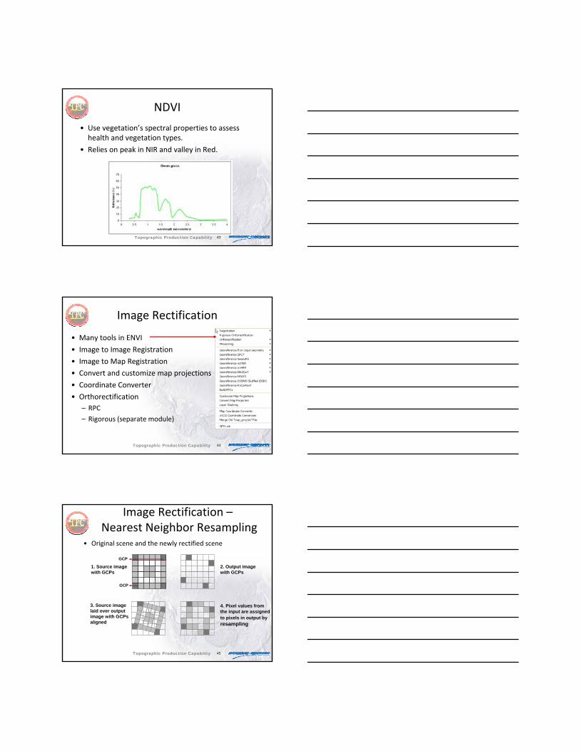
ENVI Tools: further integration with ArcGIS®
• Image analysis tools can now be accessed directly from ArcGIS
• ENVI tools work in both Server and desktop environments
• Support for ArcGIS 9.3 and 10
ENVI Tools
Can be accessed from the ArcGIS Desktop
Also from the ArcGIS Server®
Platform
Topographic Production Capability
49
D
Tools include:• Detecting Change• Extracting Features• Classifying land cover
• Create custom ENVI Tools
• Upon installation of ENVI, image processing tools will appear in ArcGIS
ENVI 4.8: Streamlined workflow and further integration with ArcGIS®
Topographic Production Capability
50
– Rosse Ice Shelf, Antarctica– Change detection from 2005-2008
51
• Blue areas = new, positive, change• Red areas = removed, negative
change
52
Orthorectification
• A process that accurately registers image pixels to ground coordinates and removes geometric distortions induced during image capture– Causes of geometric distortions
• Variable scene topography• Off-nadir sensor acquisition geometry• Platform instability or inaccurate knowledge of pointing
geometry
• Result: An image product with properties of a map– Projected to map coordinate system (e.g., UTM)– Constant scale
Topographic Production Capability
53
Applications of Orthoimagery
• Orthoimagery is essential for:– Accurate point coordinate determination– Object measurement (size, shape)– Precise collection of feature data for mapping applications
• Orthoimagery is often used as an image base in Geographic Information Systems (GIS)– Positional accuracy required for registration with map layers– Imagery often provides the most up-to-date information to map
users
Topographic Production Capability
54
ENVI Orthorectification Methods
• RPC-based Method (Rational Polynomial Coefficients)– Uses an approximate sensor model to construct the
geometry relating an image pixel (sample, line) to a map coordinate (X, Y, Z)
• Rigorous Sensor Model Method– Uses the exact sensor model defined by detailed
interior and exterior orientation parameters– Combines several analytical sub-models that:
• Construct a look vector for each image pixel • Intersect the vector with the earth ellipsoid• Project the intersection to a map coordinate system
– Multiple imagesTopographic Production Capability
55
ENVI RPC OrthorectificationRequired Inputs:
– Image– RPC data– Elevation– Geoid offset for
correct elevationOptional Inputs:
– Digital Elevation Model (DEM)
– Ground Control Points (GCPs)
Topographic Production Capability
56
Features and functionality:• Rigorous Sensor Models
• Wizard‐Based GUI Workflow
• Block Bundle Adjustment
• GCPs for Model Adjustment
• Reorder Images & Define Cutlines
• Automatic Tie‐Point Generation (requires RPCs)
Supported sensors:• ASTER Level 1B• LANDSAT 5 (TM) and 7 (ETM+)• IKONOS & OrbView-3• GeoEye-1• QuickBird• SPOT DIMAP• WorldView-1• RADARSAT-1• EROS-A, ERS, CARTOSAT-1,
FORMOSAT-2, KOMPSAT-2• Vexcel UltraCam & Applanix DSS• RPC Support• Generic Frame Camera• Customizable
ENVI – Rigorous Orthorectification Module
Topographic Production Capability
57
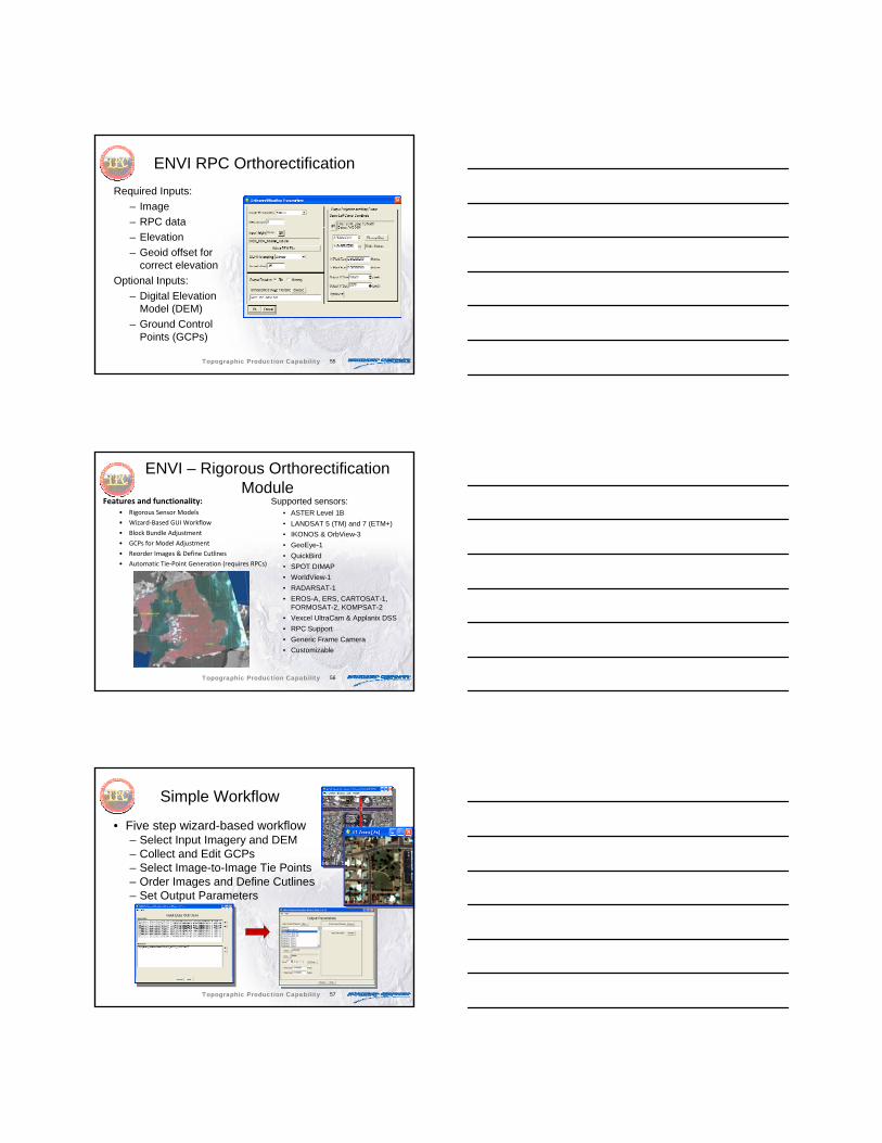
Simple Workflow
• Five step wizard-based workflow– Select Input Imagery and DEM– Collect and Edit GCPs– Select Image-to-Image Tie Points– Order Images and Define Cutlines– Set Output Parameters
Topographic Production Capability
58
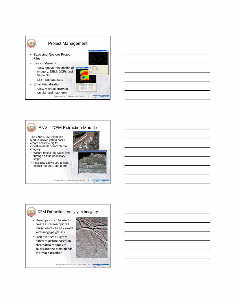
Project Management
• Save and Restore Project Files
• Layout Manager– View spatial relationship of
imagery, DEM, GCPs and tie points
– List input data sets• Error Visualization
– View residual errors in tabular and map form
Topographic Production Capability
59
ENVI - DEM Extraction Module
The ENVI DEM Extraction Module allows you to easily create accurate digital elevation models from stereo imagery• Wizard-based tool walks you
through all the necessary steps
• Flexibility allows you to edit, extract features, and more
Topographic Production Capability
60
DEM Extraction: Anaglyph Imagery
• Stereo pairs can be used to create a stereoscopic 3D image which can be viewed with anaglyph glasses.
• Each eye sees a slightly different picture based on chromatically opposite colors and the brain blends the image together.
Topographic Production Capability
61
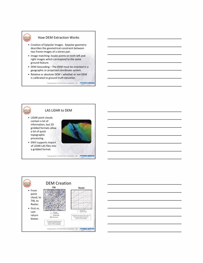
How DEM Extraction Works
• Creation of Epipolar Images. Epipolar geometry describes the geometrical constraint between two frame images of a stereo pair.
• Image matching: locate points on both left and right images which correspond to the same ground feature.
• DEM Geocoding – The DEM must be oriented in a geographic or projected coordinate system.
• Relative or absolute DEM – whether or not DEM is calibrated to ground truth elevation.
Topographic Production Capability
62
LAS LiDAR to DEM
• LiDAR point clouds contain a lot of information, but 2D gridded formats allow a lot of quick topographic processing.
• ENVI supports import of LiDAR LAS files into a gridded format.
Topographic Production Capability
63
DEM Creation
• From point cloud, to TIN, to Raster.
• First vs. Last return biases.
Topographic Production Capability

64
• LiDAR results contain above surface features.
• End product can be used for topographic modeling, Orthorectification, etc.
Topographic Production Capability
65
Image to Map Registration
ITT Visual Information Solutions
Topographic Production Capability
66
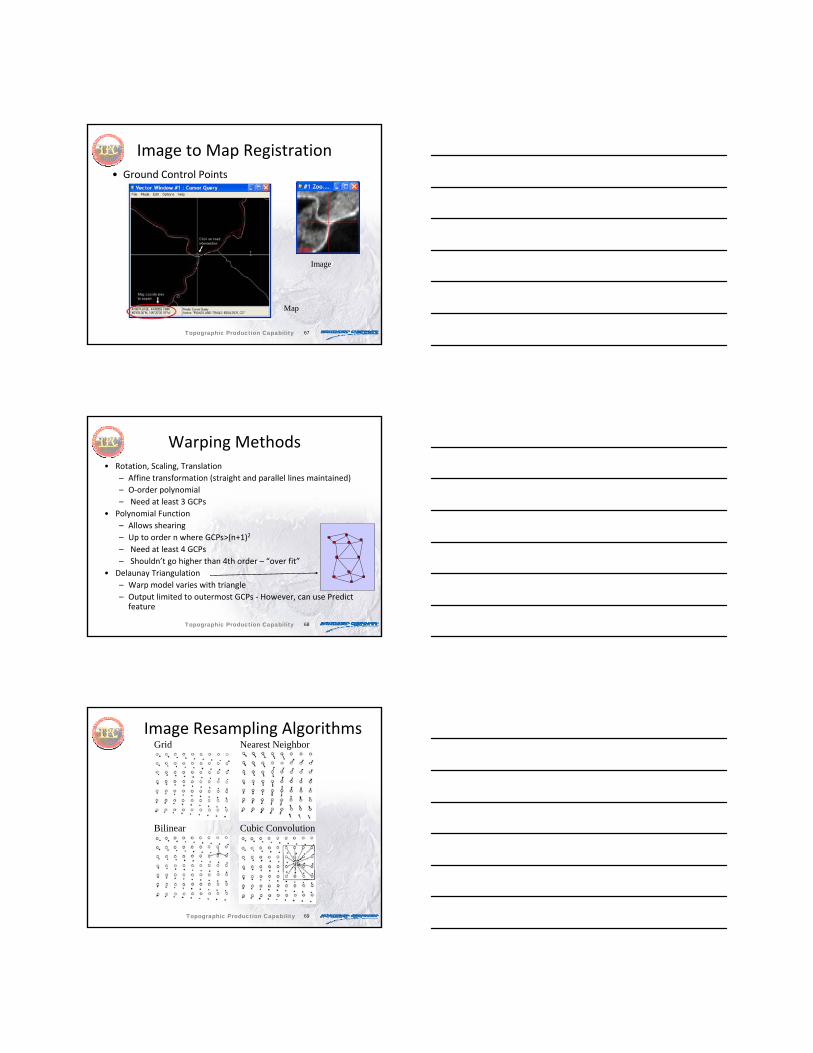
Image to Map Registration
• Picking Ground Control Points– Fractional pixel possible with zoom window
• Warping
• Resampling
• RMS error – based on GCPs so not a direct measure of accuracy
Topographic Production Capability
67
Image to Map Registration• Ground Control Points
Image
Map
Topographic Production Capability
68
Warping Methods• Rotation, Scaling, Translation
– Affine transformation (straight and parallel lines maintained)– O‐order polynomial– Need at least 3 GCPs
• Polynomial Function– Allows shearing– Up to order n where GCPs>(n+1)2
– Need at least 4 GCPs– Shouldn’t go higher than 4th order – “over fit”
• Delaunay Triangulation– Warp model varies with triangle– Output limited to outermost GCPs ‐ However, can use Predict
feature
Topographic Production Capability
69
Image Resampling AlgorithmsImage Resampling AlgorithmsGrid Nearest Neighbor
Bilinear Cubic Convolution
Topographic Production Capability

70
Resampling
• Nearest Neighbor– Preserves radiometry
– Pixilated output
• Bilinear Interpolation– Smoother lines
• Cubic Convolution– Smoother lines
– More computationally intensive
Topographic Production Capability
71
SPEAR Tools
ITT Visual Information Solutions
Topographic Production Capability
72
SPEAR Workflows• Change Detection (3 types) • Lines of Communication (water and roads)• Pan Sharpening• Relative Water Depth• Spectral Analogues• Terrain Categorization (TERCAT)• Vegetation Delineation• Watercraft Finder• Anomaly Detection • Google Earth Bridge• Terrain‐based Orthorectification• Image‐to‐Map Registration• Metadata Browser • Independent Component Analysis• Image Segment Mosaicking• Vertical Stripe Removal
Topographic Production Capability
73
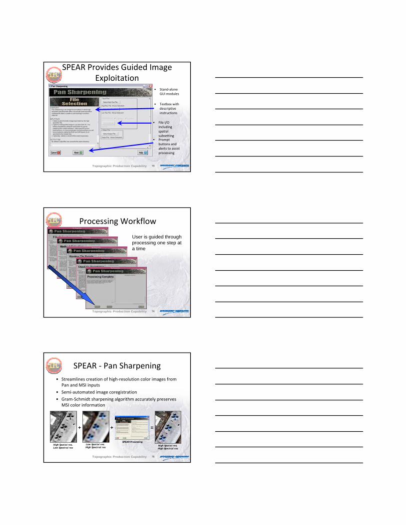
SPEAR Provides Guided Image Exploitation
• Stand‐alone GUI modules
• Textbox with descriptive instructions
• File I/O including spatial subsetting
• Prompt buttons and alerts to assist processing
Topographic Production Capability
74
Processing Workflow
User is guided through processing one step at a time
Topographic Production Capability
75
SPEAR ‐ Pan Sharpening• Streamlines creation of high‐resolution color images from
Pan and MSI inputs
• Semi‐automated image coregistration
• Gram‐Schmidt sharpening algorithm accurately preserves MSI color information
+ + =
High Spatial res.Low Spectral res
Low Spatial res.High Spectral res
High Spatial res.High Spectral res
SPEAR Processing
Topographic Production Capability
76
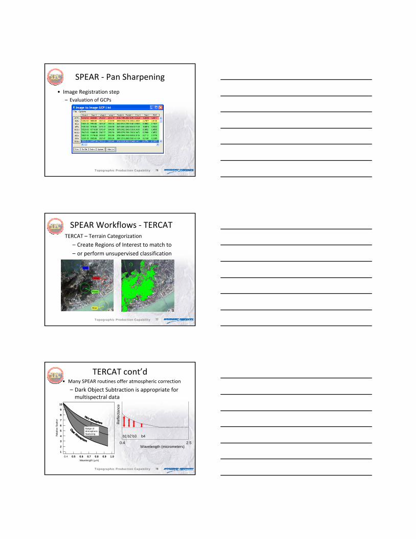
SPEAR ‐ Pan Sharpening
• Image Registration step– Evaluation of GCPs
Topographic Production Capability
77
SPEAR Workflows ‐ TERCATTERCAT – Terrain Categorization
– Create Regions of Interest to match to
– or perform unsupervised classification
Topographic Production Capability
78
TERCAT cont’d• Many SPEAR routines offer atmospheric correction
– Dark Object Subtraction is appropriate for multispectral data
Range of Atmospheric Scattering
Wavelength (μm)0.4 0.5 0.6 0.7 0.8 0.9 1.0
1
2
3
4
5
6
7
8
9
10
Rel
ativ
e Sc
atte
r
Range of Atmospheric Scattering
Wavelength (μm)0.4 0.5 0.6 0.7 0.8 0.9 1.0
1
2
3
4
5
6
7
8
9
10
Rel
ativ
e Sc
atte
r
b4
Wavelength (micrometers)0.4 2.5
Ref
lect
ance
b1 b2 b3
Topographic Production Capability
79
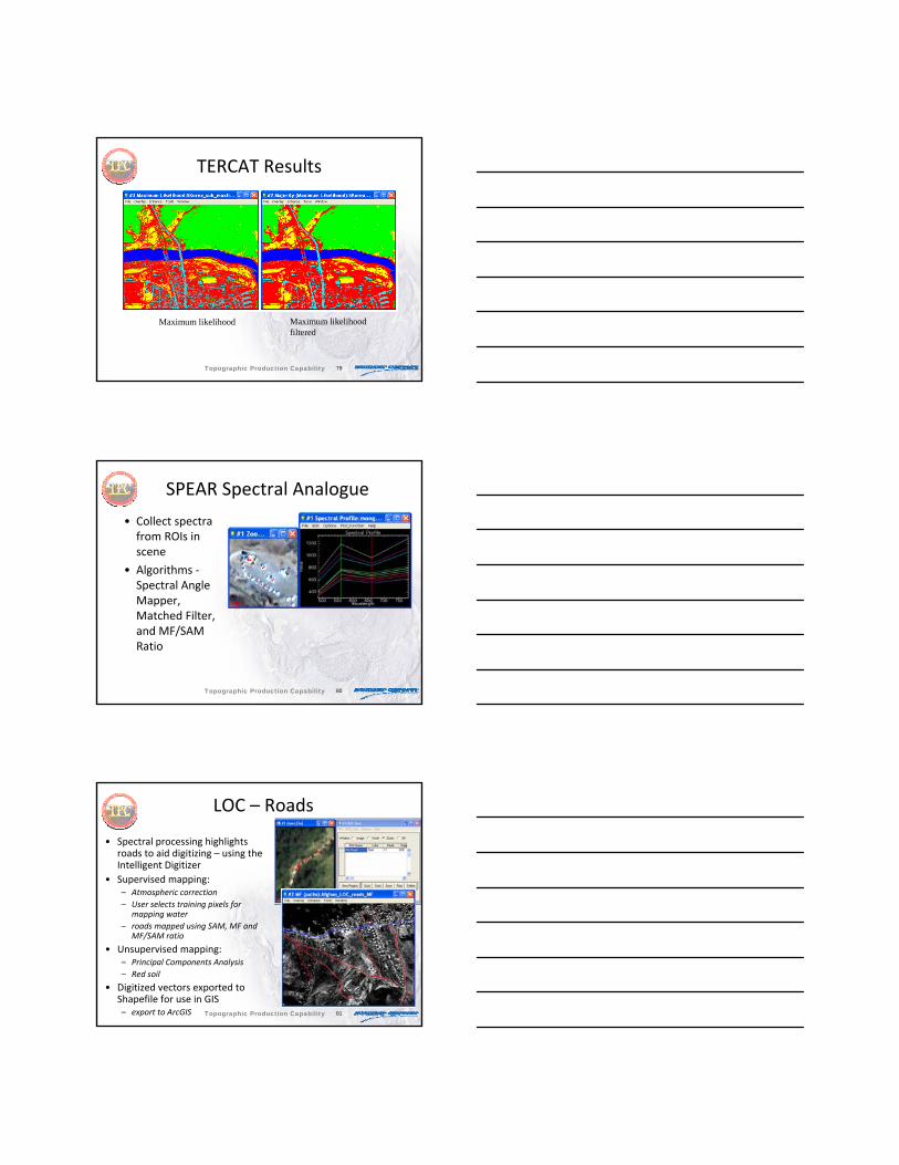
TERCAT Results
Maximum likelihood Maximum likelihoodfiltered
Topographic Production Capability
80
SPEAR Spectral Analogue
• Collect spectra from ROIs in scene
• Algorithms ‐Spectral Angle Mapper, Matched Filter, and MF/SAM Ratio
Topographic Production Capability
81
LOC – Roads
• Spectral processing highlights roads to aid digitizing – using the Intelligent Digitizer
• Supervised mapping:– Atmospheric correction– User selects training pixels for
mapping water– roads mapped using SAM, MF and
MF/SAM ratio
• Unsupervised mapping:– Principal Components Analysis– Red soil
• Digitized vectors exported to Shapefile for use in GIS– export to ArcGIS
SPEAR derived LOC
Topographic Production Capability

82
THOR Workflows
ITT Visual Information Solutions
Topographic Production Capability
83
THOR Tools
• Enable novice analysts to effectively exploit hyperspectral data
• “SPEAR‐like” workflows for hyperspectral data processing
Topographic Production Capability
84
THOR
• Will work with any reflectance hyperspectral data that ENVI will read– Automatically extracts metadata from ARTEMIS NITF data
– Fully supports all data written in NGA’s HSI NITF standard
• Place existing tools within ENVI into user‐friendly workflows
• Add new twists to old tools
Topographic Production Capability
85
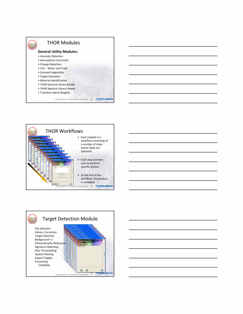
THOR Modules
General Utility Modules:• Anomaly Detection• Atmospheric Correction• Change Detection• LOC – Water and Trails• Stressed Vegetation• Target Detection• Material Identification• THOR Spectral Library Builder• THOR Spectral Library Viewer• Transform Band Weights
Topographic Production Capability
86
THOR Workflows• Each module is a
workflow consisting of a number of steps (some steps are optional)
• Each step prompts user to perform specific actions
• At the end of the workflow, the product is complete
Topographic Production Capability
87
Target Detection Module
File SelectionAtmos. CorrectionTarget SelectionBackground +/‐Dimensionality ReductionSignature MatchingRule ThresholdingSpatial FilteringExport TargetsProcessing
Complete
Topographic Production Capability
88
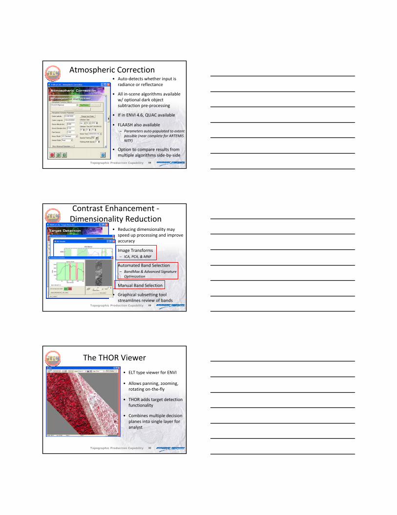
Atmospheric Correction• Auto‐detects whether input is
radiance or reflectance
• All in‐scene algorithms available w/ optional dark object subtraction pre‐processing
• If in ENVI 4.6, QUAC available
• FLAASH also available– Parameters auto‐populated to extent
possible (near complete for ARTEMIS NITF)
• Option to compare results from multiple algorithms side‐by‐side
Topographic Production Capability
89
Contrast Enhancement ‐Dimensionality Reduction
• Reducing dimensionality may speed up processing and improve accuracy
• Image Transforms– ICA, PCA, & MNF
• Automated Band Selection– BandMax & Advanced Signature
Optimization
• Manual Band Selection
• Graphical subsetting tool streamlines review of bands
Topographic Production Capability
90
The THOR Viewer
• ELT type viewer for ENVI
• Allows panning, zooming, rotating on‐the‐fly
• THOR adds target detection functionality
• Combines multiple decision planes into single layer for analyst
Topographic Production Capability

91
Rule Thresholding
• One target overlay is generated per target
• Each overlay is generated by combining a user‐specified set of rule images
Topographic Production Capability
92
Combining Rule Images
Topographic Production Capability
93
• Pop‐up bubbles provide additional context for selected targets– Image chip shows corresponding area on ancillary image
– Spectral plot shows reference target signature and mean spectrum for selected target
– Additional info includes target name, area, and confidence rating for detection
Rule Pop‐Up Windows
Topographic Production Capability
94
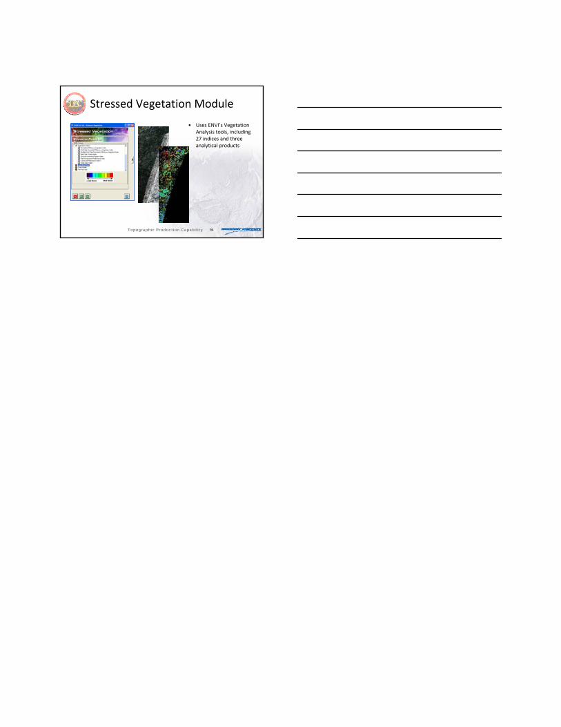
Stressed Vegetation Module
• Uses ENVI’s Vegetation Analysis tools, including 27 indices and three analytical products
Topographic Production Capability