development and management of transboundary …biiss.org/seminar...
TRANSCRIPT
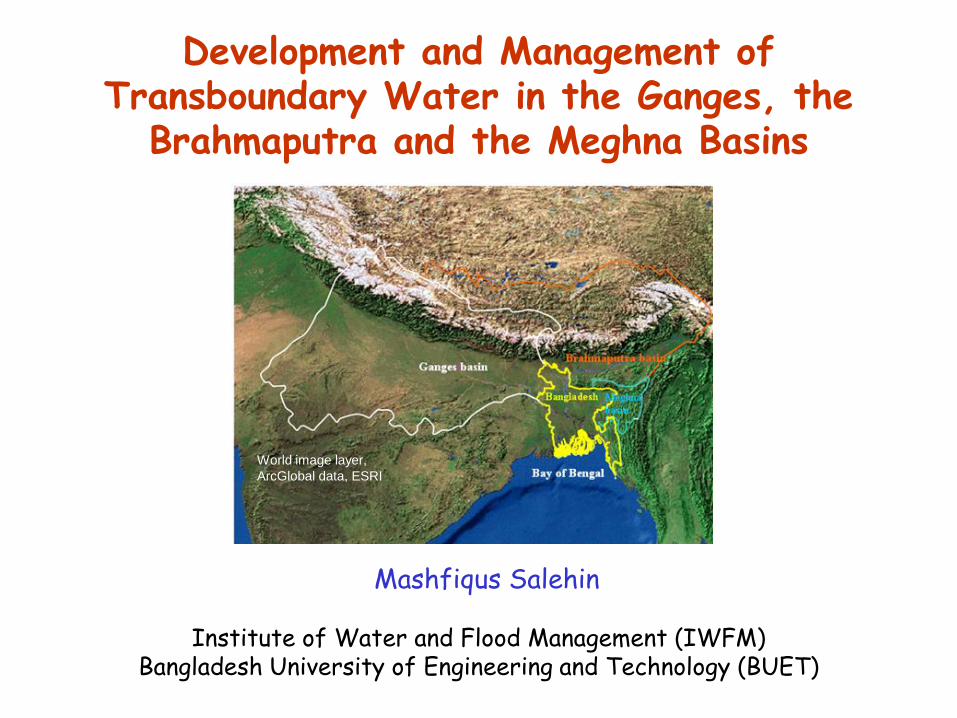
Development and Management of Transboundary Water in the Ganges, the
Brahmaputra and the Meghna Basins
World image layer,
ArcGlobal data, ESRI
Mashfiqus Salehin
Institute of Water and Flood Management (IWFM)Bangladesh University of Engineering and Technology (BUET)
OUTLINE
✍ Introduction of GBM Basins
✍ Water resources management issues
✍ Water management policies and plans
✍ History of regional cooperation
✍ Water Management Interventions and Regional Implications
✍ Regional Cooperation – The WAY FORWARD(Water resources development opportunities, lessons learnt)

3
The GBM Basins
The three basins are distinctly different:They originate and travel through different physiographic unitsThey have geographically distinct catchment zones with dissimilar valleys and drainage networks.

4
The GBM Basins
WHY THE PROBLEMS?
Catchment areas of the GBM basins
Average annual flow – 1350 BCM (G: 500; B: 700; and M: 150 BCM)Replenishable GW storage – 230 BCM
5
Water Resources Management Issues
Rajshahi
0
10
20
30
J F M A M J J A S O N D
Sylhet
0
10
20
30
F M A M J J A S O N D
Dhaka
0
10
20
30
J F M A M J J A S O N D
Comilla
0
10
20
30
J F M A M J J A S O N D
Khulna
0
10
20
30
J F M A M J J A S O N D
Barisal
0
10
20
30
J F M A M J J A S O N D
Chittagong
0
10
20
30
J F M A M J J A S O N D
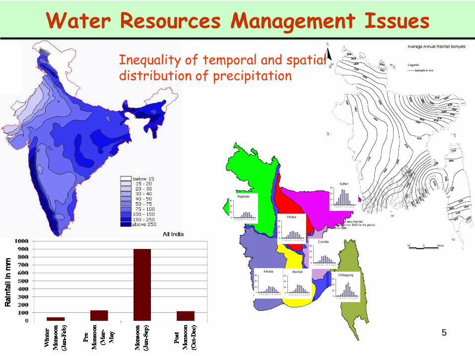
Inequality of temporal and spatial distribution of precipitation

Water Resources Management IssuesInequality of temporal and spatial distribution of flow

7
Water Resources Management Issues
Huge populationanticipated growthprevailing poverty
About 10% of the worlds’ population lives in this region, representing only 1.2% of the world’s land mass.
8
Water Resources Management Issues
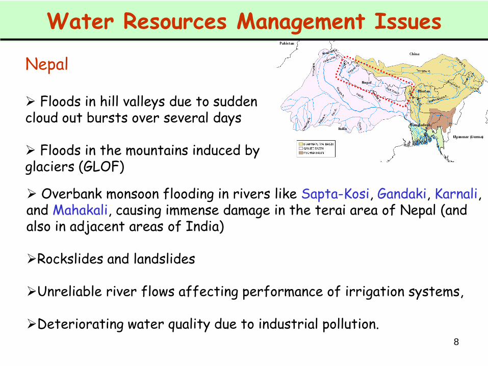
Nepal
Floods in hill valleys due to sudden cloud out bursts over several days
Floods in the mountains induced by glaciers (GLOF)
Overbank monsoon flooding in rivers like Sapta-Kosi, Gandaki, Karnali, and Mahakali, causing immense damage in the terai area of Nepal (and also in adjacent areas of India)
Rockslides and landslides
Unreliable river flows affecting performance of irrigation systems,
Deteriorating water quality due to industrial pollution.
9
Water Resources Management Issues
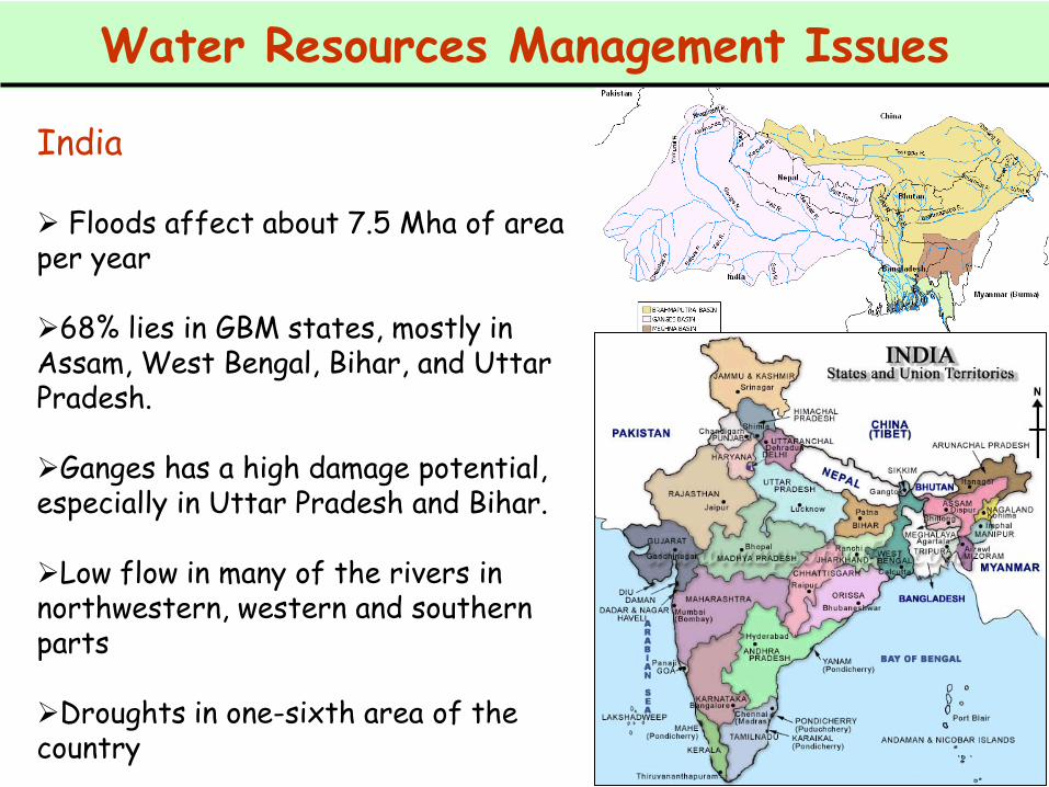
India
Floods affect about 7.5 Mha of area per year
68% lies in GBM states, mostly in Assam, West Bengal, Bihar, and Uttar Pradesh.
Ganges has a high damage potential, especially in Uttar Pradesh and Bihar.
Low flow in many of the rivers in northwestern, western and southern parts
Droughts in one-sixth area of the country
10
Water Resources Management Issues
India
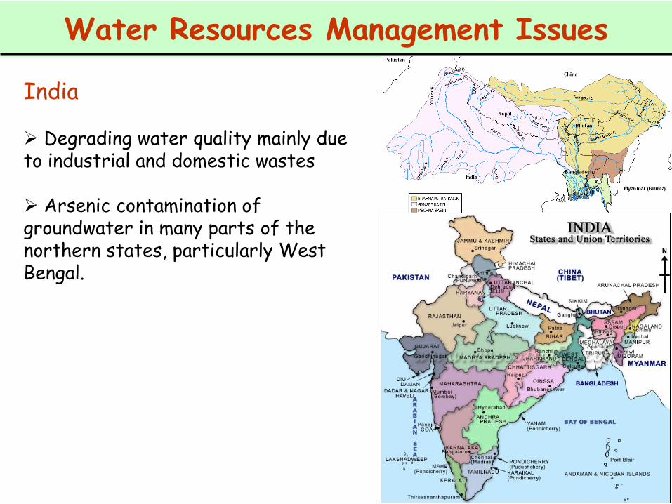
Degrading water quality mainly due to industrial and domestic wastes
Arsenic contamination of groundwater in many parts of the northern states, particularly West Bengal.

11
Water Resources Management Issues
5
4
3
2
1
6
7
8
91011
13
12
14
15
16
17
20
21
18
19
22
23
24
25
2627 28 29 30 31
32 33
38
37
3634 35
39
40
45
56
53
42
50
49
44
4743
46
48
52
54
51
55
57
Bra
hm
ap
utr
aR
ive
r
Ganges River
Meghna
Riv
er
Dhaka
Low
er M
eghna
Riv
er
Padma
River
NW
NC
SW
EH
NE
SESC
RE
Hydrological regions
NW: North-West
NC: North-Central
NE: North-East
SW: South-West
SC: South-Central
SE: South-East
EH: Eastern Hills
RE: Rivers and Estuary
57 Cross-boundary rivers
LEGEND
5
4
3
2
1
6
7
8
91011
13
12
14
15
16
17
20
21
18
19
22
23
24
25
2627 28 29 30 31
32 33
38
37
3634 35
39
40
45
56
53
42
50
49
44
4743
46
48
52
54
51
55
57
5
4
3
2
1
6
7
8
91011
13
12
14
15
16
17
20
21
18
19
22
23
24
25
2627 28 29 30 31
32 33
38
37
3634 35
39
40
45
56
53
42
50
49
44
4743
46
48
52
54
51
55
57
Bra
hm
ap
utr
aR
ive
r
Ganges River
Meghna
Riv
er
Dhaka
Low
er M
eghna
Riv
er
Padma
River
NW
NC
SW
EH
NE
SESC
RE
Hydrological regions
NW: North-West
NC: North-Central
NE: North-East
SW: South-West
SC: South-Central
SE: South-East
EH: Eastern Hills
RE: Rivers and Estuary
57 Cross-boundary rivers
LEGEND
Bangladesh

12
Water Resources Management Issues
Cyclone.shpHigh RiskRiskWind RiskNO DATA
Bangladesh
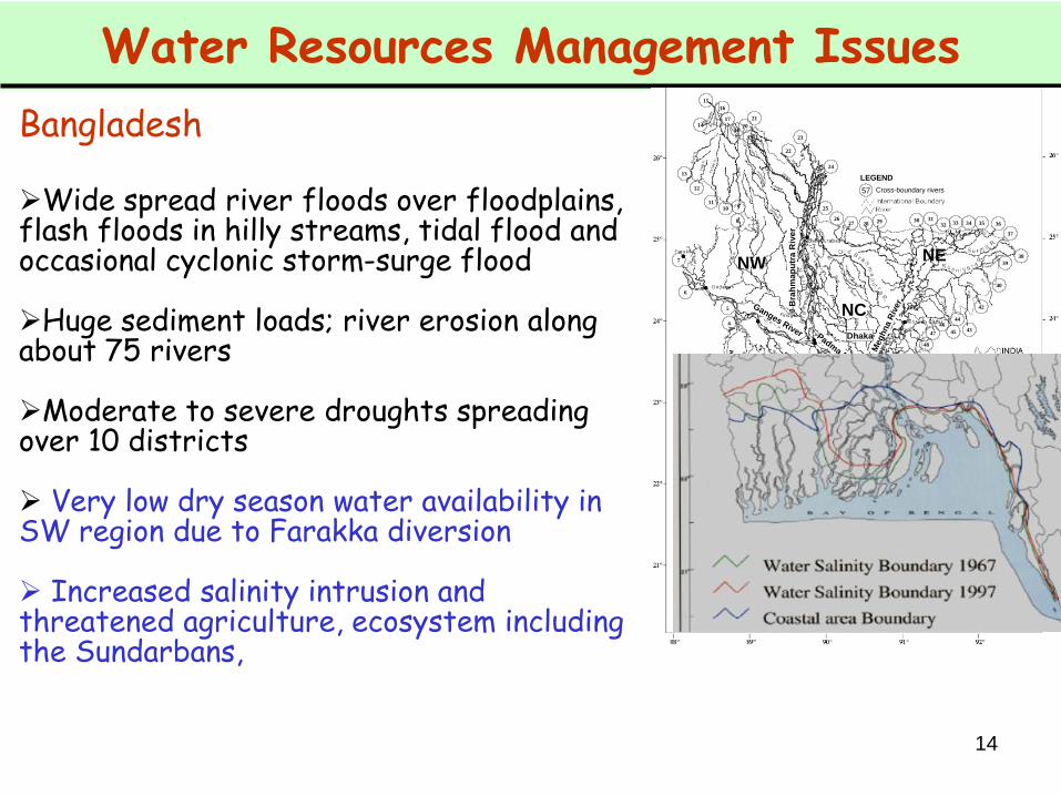
Wide spread river floods over floodplains, flash floods in hilly streams, tidal flood and occasional cyclonic storm-surge flood
Huge sediment loads; river erosion along about 75 rivers

13
Water Resources Management Issues
Bangladesh
Wide spread river floods over floodplains, flash floods in hilly streams, tidal flood and occasional cyclonic storm-surge flood
Huge sediment loads; river erosion along about 75 rivers
Moderate to severe droughts spreading over 10 districts
14
Water Resources Management Issues
Bangladesh
Wide spread river floods over floodplains, flash floods in hilly streams, tidal flood and occasional cyclonic storm-surge flood
Huge sediment loads; river erosion along about 75 rivers
Moderate to severe droughts spreading over 10 districts
Very low dry season water availability in SW region due to Farakka diversion
Increased salinity intrusion and threatened agriculture, ecosystem including the Sundarbans,
5
4
3
2
1
6
7
8
91011
13
12
14
15
16
17
20
21
18
19
22
23
24
25
2627 28 29 30 31
32 33
38
37
3634 35
39
40
45
56
53
42
50
49
44
4743
46
48
52
54
51
55
57
Bra
hm
ap
utr
aR
ive
r
Ganges River
Meghna
Riv
er
Dhaka
Low
er M
eghna
Riv
er
Padma
River
NW
NC
SW
EH
NE
SESC
RE
Hydrological regions
NW: North-West
NC: North-Central
NE: North-East
SW: South-West
SC: South-Central
SE: South-East
EH: Eastern Hills
RE: Rivers and Estuary
57 Cross-boundary rivers
LEGEND
5
4
3
2
1
6
7
8
91011
13
12
14
15
16
17
20
21
18
19
22
23
24
25
2627 28 29 30 31
32 33
38
37
3634 35
39
40
45
56
53
42
50
49
44
4743
46
48
52
54
51
55
57
5
4
3
2
1
6
7
8
91011
13
12
14
15
16
17
20
21
18
19
22
23
24
25
2627 28 29 30 31
32 33
38
37
3634 35
39
40
45
56
53
42
50
49
44
4743
46
48
52
54
51
55
57
Bra
hm
ap
utr
aR
ive
r
Ganges River
Meghna
Riv
er
Dhaka
Low
er M
eghna
Riv
er
Padma
River
NW
NC
SW
EH
NE
SESC
RE
Hydrological regions
NW: North-West
NC: North-Central
NE: North-East
SW: South-West
SC: South-Central
SE: South-East
EH: Eastern Hills
RE: Rivers and Estuary
57 Cross-boundary rivers
LEGEND
15
Water Resources Management Issues
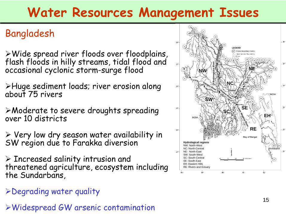
Bangladesh
Wide spread river floods over floodplains, flash floods in hilly streams, tidal flood and occasional cyclonic storm-surge flood
Huge sediment loads; river erosion along about 75 rivers
Moderate to severe droughts spreading over 10 districts
Very low dry season water availability in SW region due to Farakka diversion
Increased salinity intrusion and threatened agriculture, ecosystem including the Sundarbans,
Degrading water quality
Widespread GW arsenic contamination
5
4
3
2
1
6
7
8
91011
13
12
14
15
16
17
20
21
18
19
22
23
24
25
2627 28 29 30 31
32 33
38
37
3634 35
39
40
45
56
53
42
50
49
44
4743
46
48
52
54
51
55
57
Bra
hm
ap
utr
aR
ive
r
Ganges River
Meghna
Riv
er
Dhaka
Low
er M
eghna
Riv
er
Padma
River
NW
NC
SW
EH
NE
SESC
RE
Hydrological regions
NW: North-West
NC: North-Central
NE: North-East
SW: South-West
SC: South-Central
SE: South-East
EH: Eastern Hills
RE: Rivers and Estuary
57 Cross-boundary rivers
LEGEND
5
4
3
2
1
6
7
8
91011
13
12
14
15
16
17
20
21
18
19
22
23
24
25
2627 28 29 30 31
32 33
38
37
3634 35
39
40
45
56
53
42
50
49
44
4743
46
48
52
54
51
55
57
5
4
3
2
1
6
7
8
91011
13
12
14
15
16
17
20
21
18
19
22
23
24
25
2627 28 29 30 31
32 33
38
37
3634 35
39
40
45
56
53
42
50
49
44
4743
46
48
52
54
51
55
57
Bra
hm
ap
utr
aR
ive
r
Ganges River
Meghna
Riv
er
Dhaka
Low
er M
eghna
Riv
er
Padma
River
NW
NC
SW
EH
NE
SESC
RE
Hydrological regions
NW: North-West
NC: North-Central
NE: North-East
SW: South-West
SC: South-Central
SE: South-East
EH: Eastern Hills
RE: Rivers and Estuary
57 Cross-boundary rivers
LEGEND

16
Water Resources Management Issues
Bhutan
Mounting pressure on the water resources due to competing demands from different users
Seasonal and local imbalances of flows
Localized and seasonal water shortages for drinking and agricultural purposes,
Rising fluctuation between lean season and monsoon season flows, leading to sub-optimal utilization of generating capacity of hydropower plants
Glacial lake outburst floods (GLOF)
Increasing sediment loads in rivers
17
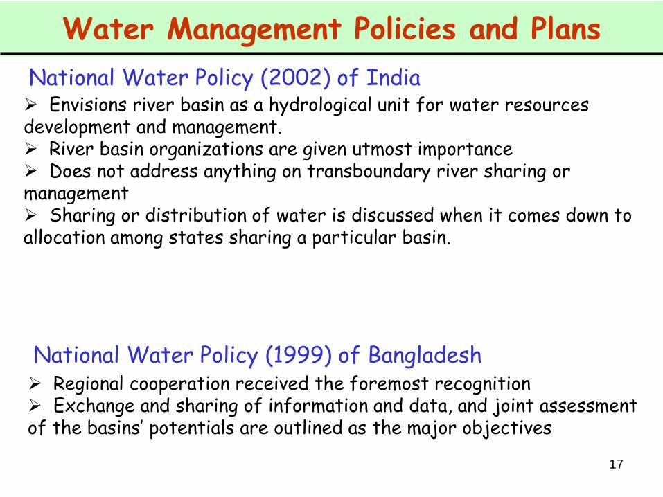
Water Management Policies and Plans
Envisions river basin as a hydrological unit for water resources development and management. River basin organizations are given utmost importance Does not address anything on transboundary river sharing or management Sharing or distribution of water is discussed when it comes down to allocation among states sharing a particular basin.
National Water Policy (2002) of India
National Water Policy (1999) of Bangladesh Regional cooperation received the foremost recognition Exchange and sharing of information and data, and joint assessment of the basins’ potentials are outlined as the major objectives

18
Water Management Policies and Plans
Recognizes the potential for sharing the water resources ‘benefits’ on equitable terms Seeks to enhance regional cooperation in sharing and exchange of data, and improve disaster forecasting and warning systems.
National Water Plan (2005) of Nepal
National Water Policy (2003) of Bhutan
Expresses similar pledges with regards to regional cooperation.

19
History of Regional Cooperation
The water sharing disputes between Nepal and India date back to early twentieth century
Sarda Barrage Agreement in 1920 Kosi river agreement in 1954 Gandak agreement in 1959
India – Nepal Cooperation
‘Sell-out’ to many Nepalese people(Uprety 2006; Salman and Uprety 2002; Biswas 2008)
More recently, Mahakhali Treaty in 1996: Sarada Barrage, Tanakpur Barrage, and Pancheshwar Project.
- regarded by many as a creation of a climate of goodwill and mutual confidence, although the reaction has been mixed to many Nepalese people.
Sapta-Kosi High Dam Project and Sun Kosi Storage cum Diversion Scheme
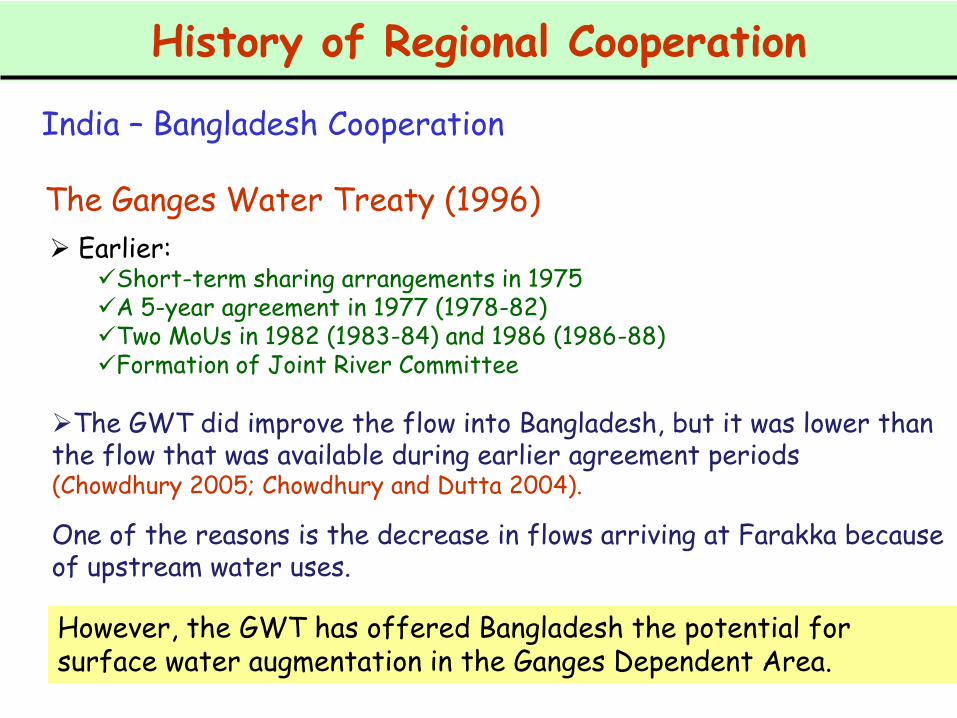
History of Regional Cooperation
India – Bangladesh Cooperation
Earlier: Short-term sharing arrangements in 1975A 5-year agreement in 1977 (1978-82)Two MoUs in 1982 (1983-84) and 1986 (1986-88)Formation of Joint River Committee
The Ganges Water Treaty (1996)
However, the GWT has offered Bangladesh the potential for surface water augmentation in the Ganges Dependent Area.
The GWT did improve the flow into Bangladesh, but it was lower than the flow that was available during earlier agreement periods (Chowdhury 2005; Chowdhury and Dutta 2004).
One of the reasons is the decrease in flows arriving at Farakka because of upstream water uses.
21
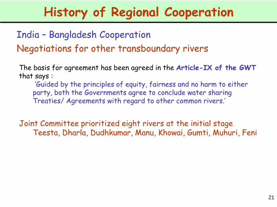
History of Regional Cooperation
India – Bangladesh Cooperation
Joint Committee prioritized eight rivers at the initial stageTeesta, Dharla, Dudhkumar, Manu, Khowai, Gumti, Muhuri, Feni
The basis for agreement has been agreed in the Article-IX of the GWT that says :
‘Guided by the principles of equity, fairness and no harm to either party, both the Governments agree to conclude water sharing Treaties/ Agreements with regard to other common rivers.’
Negotiations for other transboundary rivers

22
History of Regional Cooperation
Rather very smooth because of the close and friendly ties.
A win-win situation for both countries in the hydropower sector, with India providing both technical and financial assistance to develop the numerous hydropower projects in Bhutan.
India benefits from Bhutan’s renewable hydroelectric energy resource to meet a part of its huge power demand while Bhutan benefits from the revenues earned from the export of power.
Jaldhaka agreement in 1961. 336 MW Chukhahydel project commissioned in 1986–88. The Tala hydroelectric project of 1020 MW
India – Bhutan Cooperation
23
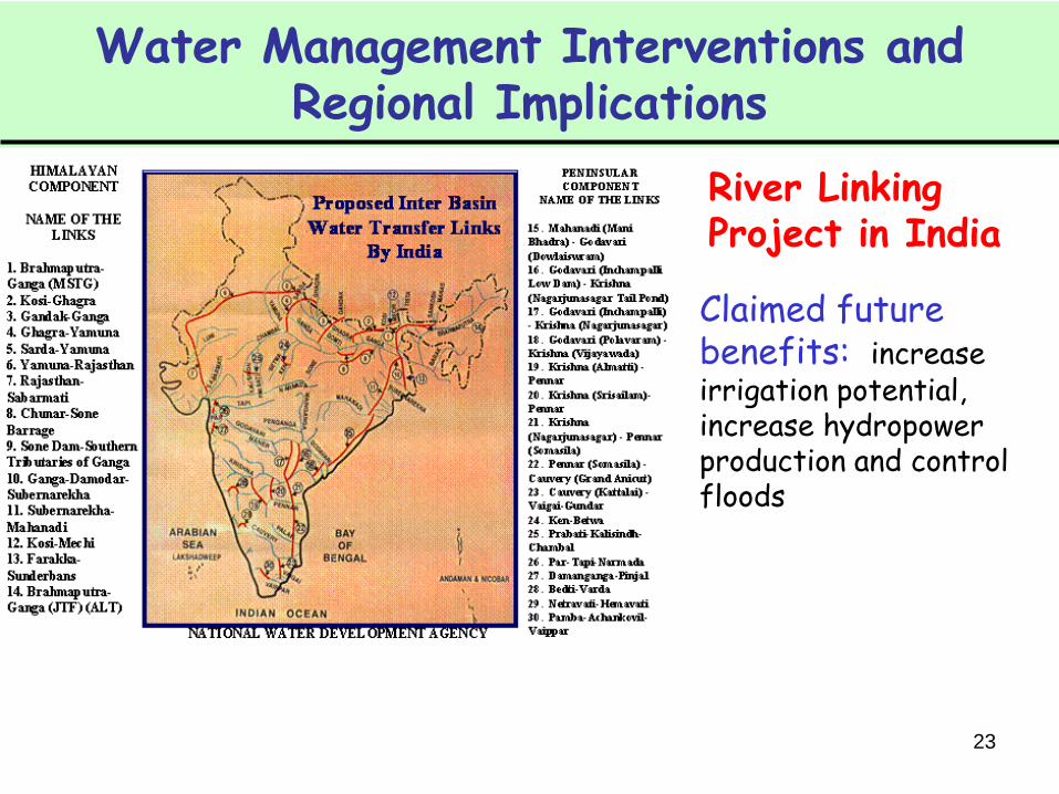
Water Management Interventions and Regional Implications
Claimed future benefits: increase irrigation potential, increase hydropower production and control floods
River Linking Project in India
24
Criticism in India Major sources of criticisms, however, came from prominent
water professionals all across India (Iyer 2003; Bandyopadhyay and Perveen 2002; and Singh 2003) . A letter and a memorandum signed by 58 eminent professionals were sent to the prime minister to reconsider the project.
Surplus-deficit paradox: not found recognition by many.
The primary answer to reduce the water scarcity in rain scarce areas (western & southern parts) has to be local, through water harvesting and conservation (traditional rainwater harvesting, tank-rehabilitation, etc), and increasing water use efficiency.
Socio-economic and environmental consequences
Water Management Interventions and Regional Implications
River Linking Project in India
25
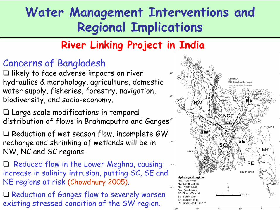
Concerns of Bangladesh likely to face adverse impacts on river hydraulics & morphology, agriculture, domestic water supply, fisheries, forestry, navigation, biodiversity, and socio-economy.
Large scale modifications in temporal distribution of flows in Brahmaputra and Ganges.
Reduction of wet season flow, incomplete GW recharge and shrinking of wetlands will be in NW, NC and SC regions.
Reduced flow in the Lower Meghna, causing increase in salinity intrusion, putting SC, SE and NE regions at risk (Chowdhury 2005).
Reduction of Ganges flow to severely worsen existing stressed condition of the SW region.
5
4
3
2
1
6
7
8
91011
13
12
14
15
16
17
20
21
18
19
22
23
24
25
2627 28 29 30 31
32 33
38
37
3634 35
39
40
45
56
53
42
50
49
44
4743
46
48
52
54
51
55
57
Bra
hm
ap
utr
aR
ive
r
Ganges River
Meghna
Riv
er
Dhaka
Low
er M
eghna
Riv
er
Padma
River
NW
NC
SW
EH
NE
SESC
RE
Hydrological regions
NW: North-West
NC: North-Central
NE: North-East
SW: South-West
SC: South-Central
SE: South-East
EH: Eastern Hills
RE: Rivers and Estuary
57 Cross-boundary rivers
LEGEND
5
4
3
2
1
6
7
8
91011
13
12
14
15
16
17
20
21
18
19
22
23
24
25
2627 28 29 30 31
32 33
38
37
3634 35
39
40
45
56
53
42
50
49
44
4743
46
48
52
54
51
55
57
5
4
3
2
1
6
7
8
91011
13
12
14
15
16
17
20
21
18
19
22
23
24
25
2627 28 29 30 31
32 33
38
37
3634 35
39
40
45
56
53
42
50
49
44
4743
46
48
52
54
51
55
57
Bra
hm
ap
utr
aR
ive
r
Ganges River
Meghna
Riv
er
Dhaka
Low
er M
eghna
Riv
er
Padma
River
NW
NC
SW
EH
NE
SESC
RE
Hydrological regions
NW: North-West
NC: North-Central
NE: North-East
SW: South-West
SC: South-Central
SE: South-East
EH: Eastern Hills
RE: Rivers and Estuary
57 Cross-boundary rivers
LEGEND
Water Management Interventions and Regional Implications
River Linking Project in India

Proposed Interventions
Tipaimukh Dam Across the Barak river in Manipur state in India is planned to be constructed primarily for flood control and power generation, envisaging secondary benefits including irrigation.
Concerns both inside and outside India
Big concerns in Bangladesh
Regional Cooperation – The WAY FORWARD
Huge potentials of regional cooperation in the GBM basins
However, lack of mutual trust and confidence among the co-riparian countries has played a major role in the long-standing disputes or conflicts surrounding trans-boundary rivers.
Water Resources Development Opportunities
The GBM countries have much to learn from the experiences ofinternational treaties and river basin organizations, which underscore the importance of
common or shared interests of nationsperception of huge mutual benefitsusefulness of sharing of benefits, andimportance of basin-level management

Development options through cooperative measuresStructural: dams or reservoirs at ‘suitable’ locationsNon-structural: sharing or exchange of data and information
Structural:Dams or reservoirs need to be of multipurpose nature – irrigation, flood control, navigation, hydropower generation, enhanced economic condition
Regional Cooperation – The WAY FORWARD
Water Resources Development Opportunities
Need cooperative approach:Geographical and hydrological characteristics make Nepal the most suitable site for construction of multi-purpose reservoirs.
Hydropower generation Flood mitigation in d/s reaches of the Ganges Stored monsoon water augmenting dry season flow Possibility of river navigation.
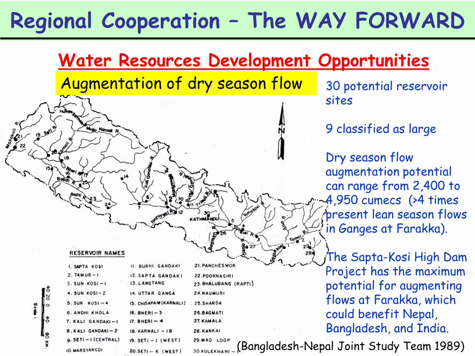
30 potential reservoir sites
9 classified as large
Dry season flow augmentation potential can range from 2,400 to 4,950 cumecs (>4 times present lean season flows in Ganges at Farakka).
The Sapta-Kosi High Dam Project has the maximum potential for augmenting flows at Farakka, which could benefit Nepal, Bangladesh, and India.
Regional Cooperation – The WAY FORWARD
Water Resources Development OpportunitiesAugmentation of dry season flow
(Bangladesh-Nepal Joint Study Team 1989)
30
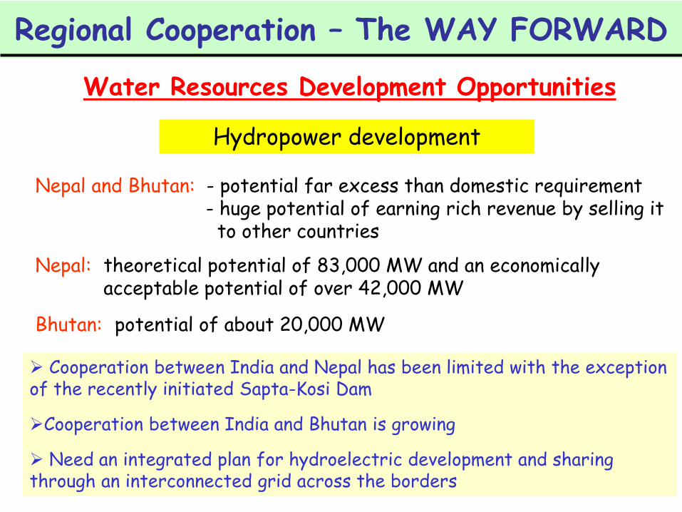
Hydropower development
Cooperation between India and Nepal has been limited with the exception of the recently initiated Sapta-Kosi Dam
Cooperation between India and Bhutan is growing
Need an integrated plan for hydroelectric development and sharing through an interconnected grid across the borders
Nepal and Bhutan: - potential far excess than domestic requirement- huge potential of earning rich revenue by selling it
to other countries
Regional Cooperation – The WAY FORWARD
Water Resources Development Opportunities
Nepal: theoretical potential of 83,000 MW and an economically acceptable potential of over 42,000 MW
Bhutan: potential of about 20,000 MW
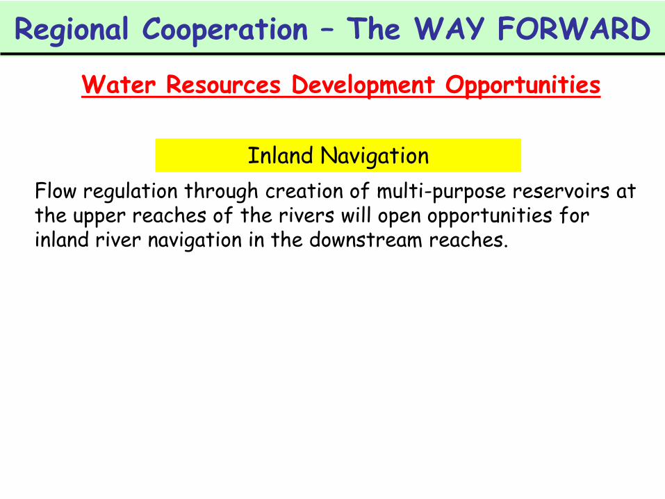
Inland Navigation
Flow regulation through creation of multi-purpose reservoirs at the upper reaches of the rivers will open opportunities for inland river navigation in the downstream reaches.
Regional Cooperation – The WAY FORWARD
Water Resources Development Opportunities
32
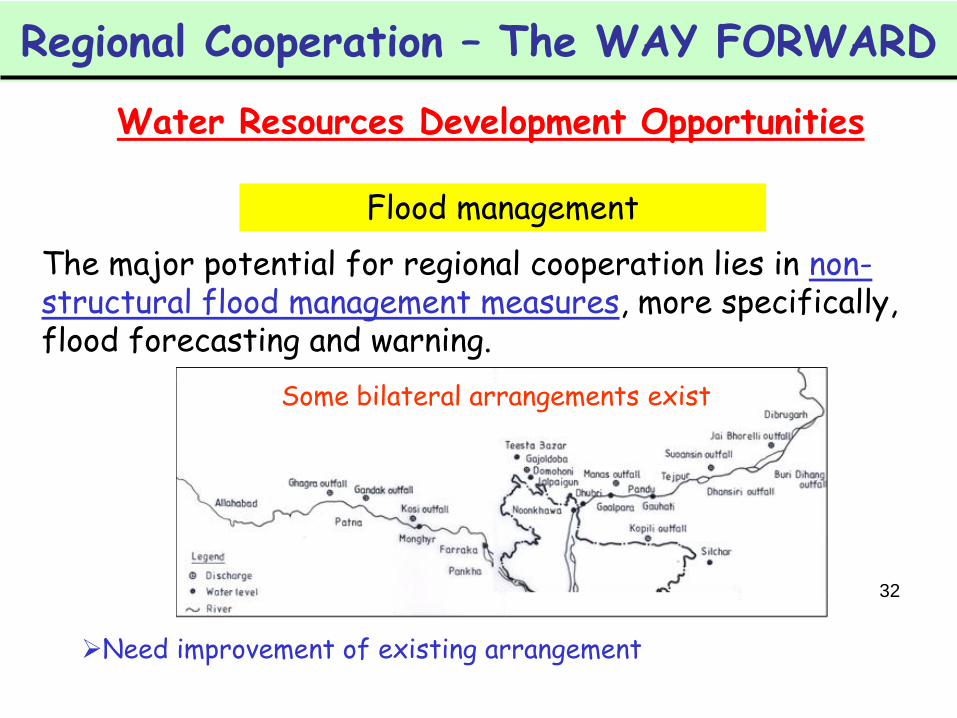
Flood management
The major potential for regional cooperation lies in non-structural flood management measures, more specifically, flood forecasting and warning.
Some bilateral arrangements exist
Need improvement of existing arrangement
Regional Cooperation – The WAY FORWARD
Water Resources Development Opportunities

Regional Cooperation – The WAY FORWARD
SHARED VISION
Development and maintaining of ‘common’ or ‘shared’ vision or interests
Will help stimulate a mutual trust and confidence among the basin countries.
Agreements between economically and politically disparate countries were possible in the cases of the Indus Treaty, Mekong River Agreement, and Nile Basin Initiative.
Nile Basin InitiativeBurundi, Democratic Republic of Congo, Egypt, Eritrea, Ethiopia, Kenya, Rwanda, Sudan, Uganda and the United Republic of Tanzania
Launched in 1999 basin-wide framework Joint-problem solving guided by a ‘shared vision’ equitable ‘benefit’ sharing
Mekong River Commission Lao PDR, Thailand, Cambodia and VietNam (China and Myanmar –dialogue partners since 1996)
Mekong Committee established in 1957
Mekong River Commission established in 1995
agreement based on principles of international law joint-basin wide planning process (Basin Development Plan)

Regional Cooperation – The WAY FORWARD
SHARING OF BENEFITS
Equitable distribution/ sharing of benefits is at the root of some of the world’s most successful institutions.
Instead of traditional – a zero-sum, rights-based approach, benefits derived from water equitably allocated, – a win-win, integrative approach.
Sharing of benefits from water use - whether from hydropower, agriculture, flood control, navigation, trade, tourism and the preservation of healthy aquatic ecosystems - not the distribution of water itself.
Regional Cooperation – The WAY FORWARD
SHARING OF BENEFITS
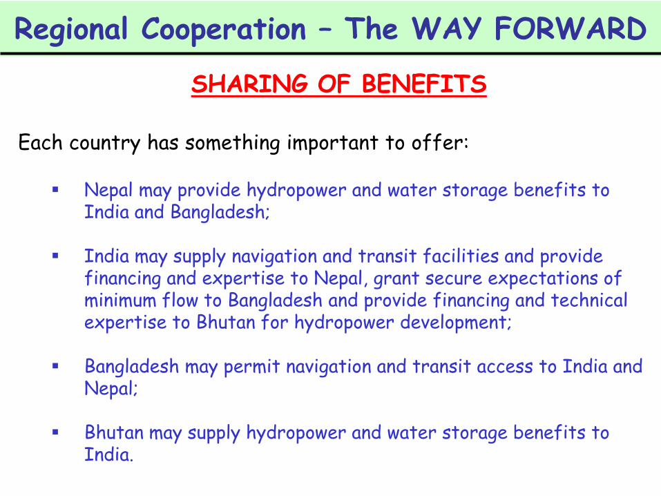
Each country has something important to offer:
Nepal may provide hydropower and water storage benefits to India and Bangladesh;
India may supply navigation and transit facilities and provide financing and expertise to Nepal, grant secure expectations of minimum flow to Bangladesh and provide financing and technical expertise to Bhutan for hydropower development;
Bangladesh may permit navigation and transit access to India and Nepal;
Bhutan may supply hydropower and water storage benefits to India.
Regional Cooperation – The WAY FORWARD
MULTI-LATERAL COOPERATION
Bilateral negotiations are likely to exclude the positive and negative externalities.
Multilateral resolution will help materialize the huge potentials of ‘sharing of benefits’ in a sustainable way.greater levels of participation and tendency for more permanent and effective agreements.
Construction of multi-purpose storage reservoirs - concerns the interests of more than two countries, and hence need multilateral dialogues and cooperation.

Regional Cooperation – The WAY FORWARD
BASIN-WIDE APPROACH
Shared vision on equitable sharing of benefits can best be achieved through basin-wide management of water resources.
Lessons may be drawn from the prevailing basin-wide management of trans-boundary rivers, for example, Rhine, Mekong, Danube, and Nile.
Regional Cooperation – The WAY FORWARD
RESILIENT INSTITUTIONS
Despite the potential for dispute in trans-boundary basins, the record of cooperation historically overwhelms the record of acute conflict over international water resources.
UNESCO (2003): ‘some of the most vociferous enemies around the world’ have been able to negotiate and maintain wateragreements because of resilient institutions that stood firm over time and during periods of otherwise strained relations.
The Mekong Committee has functioned since 1957, and exchanged data throughout the Viet Nam War.The Indus River Commission survived through two wars between India and Pakistan.All ten Nile riparian states are currently involved in negotiations over cooperative basin development the Nile Basin Initiative (NBI).

Regional Cooperation – The WAY FORWARD
PARTICIPATORY FACT FINDING
Experiences from Mekong and Nile highlights the need to stimulate a participatory process (stakeholder involvement in WRM process)
Initial strategic joint fact-finding projects among co-riparians will serve as an important catalytic tool for eliminating ‘MISTRUST’ and achieving a SHARED VISION & COMMITMENT among riparian nations.
Will help Crisis Prevention rather than post-crisis conflict resolution
All relevant stakeholders (national governments, civil society organizations, academia, research institutions, NGOs and donors) need to work together in joint research to address the challenges ahead.

40
Lessons for GBM Countries
Multi-track DiplomacyTrack I - have been made for a long time through the JRC
Track II - have also been pursued to enhance the effectiveness of the Track I efforts, an outcome of which is the signing of the Ganges Water Treaty.
Need multi-track diplomacy Complexities of water sharing issues are growing Discussions between co-riparian nations are highly politicized In Track III, dialogue and advocacy efforts will be led by the civil society organizations, with the aim to stimulate progress at more formal levels (Track I and Track II).

41
Thank You