city of kalispell growth policy plan-it 2035
TRANSCRIPT

1 | P a g e
CITY OF KALISPELL
GROWTH POLICY
PLAN-IT 2035
Prepared by:
Kalispell City Planning Board
201 1st Avenue East
Kalispell, MT 59901
(406) 758-7940
Adopted by Kalispell City Council
Resolution #5821A
July 3, 2017
This document can be viewed, printed, or downloaded at http://www.kalispell.com/planning

2 | P a g e
VISION
KALISPELL IS:
The commercial and governmental center of the Flathead Valley with
a diverse economy, robust employment, and vibrant neighborhoods
offering a variety of housing options; where community history and
culture are celebrated, parks are abundant and well-maintained,
greenways and trails connect the community, and public services
provide for the needs of residents and visitors alike, while looking
forward to future growth.
Kalispell, Montana is moving towards the future. When the first settlers came upon the
forested landscape north of Flathead Lake, with majestic mountains draped with lush
timberlands on three sides, few could have imagined how this remote wilderness would change
over the coming century.
Founded in 1891, as a division point for the Great Northern Railroad on its route through the
Rocky Mountains, Kalispell’s founders positioned it as the financial, governmental and cultural
center of the Flathead Valley. The railroad, in 1904, chose another route and served Kalispell
with a branch line, but their vision held true and Kalispell has flourished in the intervening
years.
As of 2016, Kalispell’s population stands at just over 21,500 residents with a local and regional
economy that belies its modest size. Kalispell is the heart of the Flathead Valley and serves as
the economic, cultural, and governmental center of a region that includes the world class
recreational amenities of Flathead Lake, Glacier National Park, Whitefish Mountain Ski Area and
thousands of square miles of National Forests.
Kalispell is prepared to grow. “Kalispell Growth Policy PLAN-IT 2035” lays out a framework to
guide growth in and around the City for the next 20 years. It was developed through a
comprehensive outreach effort with scores of community groups with a stake in Kalispell,
followed by an in-depth review by the Kalispell Planning Board and Kalispell City Council.
Following the adoption of the Growth Policy by the City Council, the next step is to begin
development of significant and relevant deliverables described in its recommendations. There

3 | P a g e
are five key projects that will have a tangible, positive impact on the citizens of Kalispell. They
include:
1. The “Core Area Plan” that was adopted by the City Council in 2012. Its key components
are the establishment of a rail-served industrial park on Kalispell’s eastern border, the
relocation of the rail-dependent uses out of the Core Area, the creation of a linear park
and pedestrian & bike trail across town, and the infusion of both private and public
resources back into the neighborhood.
2. “The Downtown Plan” that takes a careful and considerate look at Kalispell’s historic
downtown and courthouse corridor and identifies the area’s key strengths, weaknesses,
opportunities and threats; and then prioritizes and addresses the issues to energize and
reinforce the historic downtown’s role as the heart of Kalispell.
3. The “South Kalispell Urban Renewal Plan” will explore and evaluate future scenarios
facing the residential and commercial areas surrounding the Kalispell City Airport and
along the U.S. Highway 93 South Corridor, with the goal of establishing a land use vision
that can be fostered and built upon in the coming years.
4. The “Kalispell Pedestrian and Bicycle Master Plan” will use the completed sidewalk and
trail inventory to create a conceptual pedestrian and bicycle network, identify and
prioritize key missing links in the system, and establish strategies for improving and
increasing the community’s non-motorized mobility throughout the City.
5. The “Kalispell Transportation Plan Update” will ensure Kalispell’s road network keeps
pace with growth and continues to serve the needs of its residents, businesses, and
visitors. Kalispell’s Transportation Plan was last updated in 2008. At that time, the
Highway 93 Alternate Route, connecting Highway 93 South with Highway 93 North, was
still in the conceptual design phase, and was not certain enough to be included in the
transportation models for the community. Now completed, this project, and many
other factors, will be incorporated into traffic demand models and future capital
improvement plans.
Throughout its history, the development of the City of Kalispell has been a cooperative effort
between its citizens, its businesses, and various government entities; and so has it been with
the creation of “Kalispell Growth Policy PLAN-IT 2035.” A vision for the future of Kalispell is
spelled out in the following pages, but that vision can only be realized through the actions of
many people and organizations working for a variety of interests. “PLAN-IT 2035” serves to

4 | P a g e
weave these actions into a cohesive fabric that will ensure Kalispell is a unique and vibrant
place for people to live, work, and play – now and into the future.
City of Kalispell Council Members
Mayor – Mark Johnson
Ward 1 – Kari Gabriel and Sandy Carlson
Ward 2 – Wayne Saverud and Chad Graham
Ward 3 – Jim Atkinson and Rod Kuntz
Ward 4 – Tim Kluesner and Phil Guiffrida
City of Kalispell Planning Board Members
Chad Graham, City Council Member – President
Charles Pesola, City Member – Vice President
Doug Kauffman, City Member
Steve Lorch, City Member
Christopher Yerkes, City Member
Ronalee Skees, City Member
Rory Young, County Member

5 | P a g e
CITY OF KALISPELL GROWTH POLICY
Contents Introduction: PLAN-IT 2035………………………………………………………………………………………………………………..7
Chapter 1: The Economy……………………………………………………………………………………………………………….11
Chapter 2: Growth Policy Administration………………………………………………………………………………………14
Chapter 3: Community Growth & Design………………………………………………………………………………………17
Chapter 4: Land Use ........................................................................................................................... 21
A. Housing: ............................................................................................................................ 21
B. Business and Industry: ...................................................................................................... 26
C. Healthcare: ........................................................................................................................ 30
D. Sand and Gravel Resources ............................................................................................... 32
Chapter 5: Natural Environment……………………………………………………………………………………………………34
Chapter 6: Historic Downtown and Core Area ................................................................................... 39
Chapter 7: Parks and Recreation ........................................................................................................ 43
Chapter 8: Transportation .................................................................................................................. 46
Chapter 9: Public Infrastructure & Services........................................................................................ 52
Chapter 10: Implementation Strategies ............................................................................................... 65
Appendix A - Neighborhood and Area Plans & Growth Policy Amendments:
Highway 93 North Area Plan (adopted August 7, 2006) ............................................................................. 83
Highway 93 South Corridor Area Plan (adopted December 1, 2008) ......................................................... 87
Kalispell West Neighborhood Plan (adopted May 4, 2009) ........................................................................ 96
Core Area Plan (adopted December 17, 2012……………………………………………………………………………………….99
The Downtown Plan .................................................................................................................................. 100
Annexation Policy………………………………………………………………………………………………………………………………..101
Resources & Analysis…………………………………………………………………………………………………………………………..107

6 | P a g e
Figures:
1. Kalispell Growth Policy Planning Area Map (Introduction chapter)
2. Residential Subdivision Map (Housing chapter)
3. Environmentally Sensitive Resources Map (Natural Environment chapter)
4. Downtown & Core Area Map (Downtown and Core Area chapter)
5. Historic Districts & Properties Map (Historic & Cusltural Conservation chapter)
6. Parks & Recreation Facilities Map (Parks & Recreation chapter)
7. Transporation System Map (Transporation chapter)
8. Public Infrastructure Map (Public Infrastructure & Services chapter)
a. Water Mains
b. Groundwater Wells & Lift Stations
c. Sewer Mains & Lift Stations
d. Waste Water Treament Plan
e. Fire Stations
f. Police Stations
g. Kalsipell Regional Medical Center
9. Urban Renewal Tax Increment Finance (TIF) Districts Map (Implementation Strategies
chapter)
10. Highway 93 North Area Map
11. Highway 93 South Corridor Map
12. Kalsipell West Neighborhood Map
13. Core Area Plan Boundary
14. Downtown Plan
15. Annexation Policy Map

7 | P a g e
Introduction: PLAN-IT 2035
The Kalispell Growth Policy is an official public document created and adopted by the City of
Kalispell as a vision for future growth in and around the City. The Growth Policy is not a law or
regulation, but rather a community guide for making land use decisions. The term “Growth
Policy” is synonymous with “master plan,” “comprehensive plan” or “community plan.”
Montana statutes require that a Growth Policy be adopted and that the City Council give
consideration to the policies and pattern of development set out in the Growth Policy. The
Growth Policy is implemented through different methods, including the adoption of zoning and
subdivision regulations and the making of public resource investments. When considering
zoning, subdivisions, and other development issues; the Growth Policy should be consulted to
ensure future development is in substantial compliance with its goals and policies. The plan is
intended to reflect the economic, social, and environmental visions of the City of Kalispell, its
residents and various stakeholders. It is, at its most fundamental level, a blueprint for the
physical development of the community.
The Growth Policy area boundaries shown in Figure 1, “Kalispell Growth Policy Future Land Use
Map”, illustrates three distinct planning areas covered by the Kalispell Growth Policy.
The first is the Kalispell City limits, covering approximately 11.91 square miles. This is
the only area the City can implement the Growth Policy and enforce its separately
adopted rules and regulations.
The second is the annexation boundary and includes land beyond the City limits where
City services area generally available or could be reasonably extended if the property
were to be annexed into the City in the next ten years. The future land use designations
in this area provide guidance for the City when it considers initial zoning for properties
proposed for annexation. The future land use designations also serve as a guide to the
County when it considers rezoning land around the City.
The third is the Growth Policy Planning Area, which generally extends out three miles
from the City limits. It is primarily taken from the transportation system and Public
Works facilities plans, adopted by the City Council between 2006 and 2008. This is the
area anticipated to be served by City of Kalispell water and/or sewer over the next 30 to
50 years. It has been used in this document to provide a vision for the future.

8 | P a g e
The essential characteristics of the Growth Policy are that it is comprehensive, general, and
long range. Comprehensive means that the document applies geographically to the entire
community in order to coordinate its overall pattern of growth. Comprehensive also means
that consideration is given to all of the basic functions that make a community work such as
housing, the economy, land use, the environment, transportation, public facilities, and public
services.
General means that the policy is broad in scope, focusing more on general principles and
philosophy than detailed standards. Accordingly, the format of the document is an outline of
issues, goals, policies, and recommendations, rather than legally described locations,
engineered solutions, or detailed regulations on specific property.
Long range means that the Growth Policy looks beyond the present to anticipate future issues
and opportunities. The period addressed by this policy is through the year 2035, with a
scheduled annual review by the Planning Board. The Growth Policy should be updated every
five years or sooner as needed. The update may result in a partial or full revision of the
document as deemed necessary by the Kalispell City Council.
Legal foundations of the Growth Policy are found in Montana's Local Planning and Enabling Act
(Sections 76-1-101 through 76-1-606, MCA) which outlines the contents and process for the
preparation and use of the Growth Policy. These provisions state that the Planning Board shall
prepare and propose a Growth Policy for review and approval by the governing body, in this
case the Kalispell City Council.
The state statute prescribes the following specific elements be included in the Growth Policy
document:
A. Community goals and objectives;
B. Maps and text describing the jurisdictional area;
C. Projected trends for the duration of the Growth Policy;
D. Policies, regulations, and other measures to be implemented in order to achieve the
goals and objectives established above;
E. Development, maintenance, and replacement strategies for public infrastructure;
F. An implementation strategy that includes:
a. a timetable for implementing the Growth Policy;
b. a list of conditions that will lead to a revision of the Growth Policy; and
c. a timetable for reviewing the Growth Policy at least once every 5 years and revising
the policy if necessary;

9 | P a g e
G. A statement of how the governing bodies will coordinate and cooperate with other
jurisdictions and the county in which the city or town is located on matters related to
the Growth Policy;
H. A statement explaining how the governing bodies will define, evaluate and make
decisions regarding subdivisions and their impacts;
I. An explanation of how public hearings regarding subdivisions will be conducted;
J. An evaluation of the potential for fire and wildland fire in the jurisdictional area,
including whether or not there is a need to delineate the wildland-urban interface.
Kalispell Growth Policy – Plan-It 2035
The City of Kalispell adopted its first master plan in 1962. In 1974, the Kalispell City-County
Planning Board updated the plan to reflect the changing conditions in the community. In 2012,
an outreach effort consisting of community presentations and workshops with various school
boards, fire districts, community interest groups, and individuals was conducted. The feedback
gathered during this effort was incorporated into the current draft.
The Growth Policy document is composed of the Growth Policy text and the future land use
map, while the resource and analysis section provides support data dealing with social,
environmental, and economic factors.
The policy document includes the following chapters:
1) The Economy
2) Growth Policy Administration
3) Community Growth & Design
4) Land Use
a. Housing
b. Business and Industry
c. Healthcare
d. Sand and Gravel Resources
5) Natural Environment 6) Historic Downtown and Core Area 7) Parks and Recreation 8) Transportation 9) Public Infrastructure & Services 10) Implementation Strategies
Each chapter is organized into a format of interrelated issues, goals, policies, and
recommendations. The "issues" are statements of important trends, challenges, opportunities,
and community values. The "goals" are basic statements of the community's aims and

10 | P a g e
priorities. The "policies" are the principles of action that guide the City in making decisions.
The "recommendations" are specific actions to be considered by the City as part of an overall
implementation strategy.
The future land use map, Figure 1, is a geographic illustration of the plan's goals and policies
applied to the Growth Policy area. The map indicates the types of land uses recommended in
various locations, representing the recommendation of an orderly growth pattern. The text
includes explanations of these map designations within related chapters. Like the text, the
color map designation is part of the Growth Policy and it is intended to indicate generalized
rather than exact locations for anticipated future land uses.
Figure 1: Kalispell Growth Policy Planning Area Map

11 | P a g e
Chapter 1: The Economy
The Kalispell area has a diverse economy with healthcare, retail trade, tourism, manufacturing,
and construction being the largest contributors to the local economy, followed closely by
professional and administrative services and wholesale trade. Farming and forestry are still
important in the overall economic picture in the Flathead Valley, although there has been a
decline in these sectors over the past several decades. In recent years, the largest gains in the
local economy have been in the healthcare and financial services fields. Flathead County
healthcare and social assistance jobs are growing at three times the state rate, creating
economic development benefits for Kalispell and the region.
Issues:
1. Although Kalispell functions as the commercial, retail, healthcare, educational and
government center of Flathead County, it comprises only 22% of the area’s population.
2. In 2012, the population in Kalispell over 16 years of age was estimated at 15,271 people
with an estimated 10,213 (67%) of those people in the labor force. By comparison,
Flathead County has 72,254 people over 16 years of age, with 46,661 (65%) in the labor
force.
3. The traditional economic base of the Kalispell area are industries including wood
products manufacturing, metal refining, railroad, and agriculture which have been
replaced by healthcare and tourism based jobs. Healthcare jobs tend to be high-wage;
whereas, tourism jobs tend to be service oriented and low-wage, comparatively.
4. It can be difficult for businesses to fill positions with qualified individuals.
5. Healthcare, retail, government and accommodations/food service sectors of the
economy provide the employment base for Kalispell and are responsible for creating
most of the new jobs in the area.
6. Joint planning policy between the City and County for the area around Kalispell presents
challenges in providing sound infrastructure, growth management, and environmental
protection, but also offers an opportunity to strengthen the local economy when joint
policy can be agreed upon.

12 | P a g e
GOALS:
1. ENCOURAGE AN ADEQUATE SUPPLY OF JOBS, HIGHER MEDIAN INCOME FOR THOSE
JOBS, AND A STABLE, DIVERSIFIED ECONOMY.
2. MONITOR THE GROWTH TRENDS WITHIN THE VALLEY IN ORDER TO BE IN TUNE WITH
THE CHANGING ECONOMY.
3. STRENGTHEN KALISPELL AS A REGIONAL HEALTHCARE CENTER THAT PROVIDES A
BROAD SPECTRUM OF HEALTHCARE RELATED SERVICES.
4. STRENGTHEN KALISPELL AS A REGIONAL RETAIL CENTER THAT STRIVES TO CAPTURE
MORE LOCAL AND OUT OF COUNTY DOLLARS.
Policies:
1. The Growth Policy is a key element in guiding economic development efforts.
2. Provide adequate space for growth that carefully considers the type, location, and
design of industrial sites, shopping areas, and tourist facilities.
3. Work with business and industrial associations to promote and coordinate business and
industry in accordance with the Growth Policy.
4. Work with economic development organizations to further Growth Policy goals and
policies and to encourage countywide coordination of their efforts.
5. Support the Kalispell area’s position as a regional commercial center and a location of
major healthcare, government, industrial facilities and retail services.
6. Support amenities and activities that promote the Kalispell area as a retirement,
tourism, convention, and arts destination.
Recommendations:
1. Support public/private partnerships to strengthen commercial districts within the City.

13 | P a g e
2. Coordinate with employment and educational services to improve long term
employment outcomes for job seekers and business.
3. Pursue grants to help with economic development and locating businesses within the
City.
4. Develop incentives for business and industry that offer higher paying wages to
encourage them to locate within the City.

14 | P a g e
Chapter 2: Growth Policy Administration
Administration of the Growth Policy and its implementation is the responsibility of the City of
Kalispell. Kalispell has a council / manager form of government with an eight-member council
and a mayor who votes on all matters. A full-time City manager administers the day-to-day
business of the City. There are a number of boards and commissions that advise the council on
a range of issues.
The Growth Policy will be reviewed a minimum of once every five years by the Planning Board
for relevancy and a report given to the Kalispell City Council who may initiate an update as
needed. Amendments can also be made through the general Growth Policy amendment
process to address specific development projects that have not been anticipated, or with a
neighborhood plan to address specific areas within the community that have special needs or
issues.
Issues:
1. Cooperation between the City and other public service providers is critical to reinforcing
an orderly development pattern in the Growth Policy area, coordinating the extension
of public facilities and services, and addressing the numerous issues that cross over City-
County boundaries.
2. There is a need for joint planning between the City and the County.
3. Development standards for the City and County at the urban / rural interface are not
consistent.
GOALS:
1. FOSTER CITY-COUNTY COOPERATION, PARTICULARLY IN MANAGING GROWTH AND
COORDINATING PROVISION OF PUBLIC FACILITIES AND SERVICES.
2. PROMOTE COOPERATION BETWEEN THE CITY OF KALISPELL, UTILITY SERVICE
PROVIDERS, AND FLATHEAD BUSINESSES.
3. COORDINATION BETWEEN THE CITY AND COUNTY PLANNING BOARDS TO CONSIDER
THE ADOPTION OF ZONING CONSISTENT WITH LAND USE GOALS, POLICIES AND LAND
USE MAP TO PROMOTE ORDELRY EXPANSION OF THE CITY.

15 | P a g e
4. ENSURE DECISIONS ARE FAIR, OPEN AND BASED ON GOOD INFORMATION THAT IS
AVAILABLE TO THE PUBLIC AND DECISION MAKERS.
5. CONTINUE TO FIND WAYS TO SHARE EQUIPMENT AND OTHER RESOURCES TO INCREASE
THE EFFICIENCY OF LOCAL GOVERNMENT OPERATIONS.
6. SEEK WAYS TO PROVIDE FOR GREATER PUBLIC PARTICIPATION IN THE DEVELOPMENT
REVIEW PROCESS.
Policies:
1. Use this document as a guide for development and growth when making decisions
related to development within the Growth Policy planning area.
2. Zoning and subdivision regulations should conform and be used to implement the
provisions of this document.
3. Initiate City-County agreements or programs that would cooperatively influence the
amount and type of growth within the Growth Policy area.
4. Updates of the Growth Policy should be considered when there is a major change in
circumstances such as a significant increase or decrease in population, changes in
economic or environmental conditions, or significant changes in public infrastructure
and services.
5. Public involvement and outreach to inform the public regarding development projects in
a timely manner and to encourage public participation will be provided to ensure the
integrity of the public review process.
Recommendations:
1. Develop a cooperative relationship between the elected officials, government agencies,
and utility service providers that results in consistent development standards, efficient
use of public infrastructure and resources, and quality development.

16 | P a g e
2. Find ways to provide greater exposure for the public to the planning process, such as
the local media, social media, and public hearing notification signs to encourage
improved public involvement and interest.
3. Schedule meetings between the City and County Planning Boards to discuss goals and
policies in areas of mutual interest and coordinate the Growth Policy to reflect a shared
vision of the future.
4. Use the general Growth Policy amendment process to address large scale and / or
complex projects that have not been anticipated in the Growth Policy.
5. Create a memorandum of understanding to be signed between the City and County that
would form an understanding between the parties to promote:
Urban and rural development standards.
Zone changes, Growth Policy amendments, and conditional use permits.
Subdivision review processes.
Transfer of County roads to the City.
Extension of services including sewer and water.
Public safety, emergency services, and related facilities.

17 | P a g e
Chapter 3: Community Growth & Design
During the early part of the 1990's there was a relatively high level of growth that stabilized
during the last half of the 1990's. At the beginning of the 2000’s the City experienced a rapid
expansion of its boundaries due to both residential and commercial growth. This outward
growth continued until 2009 when development of new homes and commercial businesses
slowed dramatically due to the recession. Beginning in 2012, the pace of development began
to show signs of recovery, and 2015 has seen this trend continue as past developments that
had stalled due to the recession are beginning to move forward.
A new urban planning and development paradigm has emerged in recent years. This paradigm
signals a return to the development pattern that characterized Kalispell from its founding until
the 1950’s. There is an emphasis on redevelopment of the existing urban core. The urban core
allows for balanced transportation options including walking, biking, transit, or driving.
Neighborhoods can once again be the center of social activity and interaction. Other aspects of
the paradigm include mixed-use projects, higher residential densities and pedestrian friendly
site development. Along with this new development and redevelopment, the community still
considers the quality of life for its residents significant, and should be considered when
reviewing growth of the City.
Issues:
1. Growth rates have fluctuated between moderate and high levels making land use and
planning difficult.
2. Growth has both positive and negative effects on quality of life.
3. The City and County regulations are not always consistent leading to conflicts in
development standards and haphazard development patterns.
4. Low-density development in outlying areas has created difficulties in the City’s natural
expansion of its infrastructure (streets, parks, water, and sewer lines).
5. Strip commercial development land use patterns further diminish the existing
commercial areas of the City, which adds to the deteriorating functionality of the federal
highways system outside of the City limits.

18 | P a g e
GOALS:
1. RESIDENTIAL AND COMMERCIAL DEVELOPMENT SHOULD COMPLEMENT THE
COMMUNITY VALUES OF:
a. Creating walkable and bikeable neighborhoods.
b. Design that integrates the new development into the surrounding neighborhood.
c. De-emphasizing large parking lots adjacent to the street or highway and making the
building the prominent feature from the street or highway.
2. IMPLEMENT A COMPREHENSIVE, EFFECTIVE GROWTH MANAGEMENT PROGRAM THAT
RECOGNIZES AND UPHOLDS THE GENERAL WELFARE OF THE COMMUNITY AS WELL AS
INDIVIDUAL RIGHTS.
3. ENCOURAGE HOUSING TYPES THAT PROVIDE HOUSING FOR ALL SECTORS AND INCOME
LEVELS WITHIN THE COMMUNITY.
4. COMMERCIAL AND RESIDENTIAL DEVELOPMENT SHOULD BE DESIGNED TO TAKE
ADVANTAGE OF AND ENHANCE ADJACENT STREETS, PARKS, AND NATURAL FEATURES.
5. IMPLEMENT DESIGN STANDARDS AT THE HIGHWAY ENTRANCES TO THE CITY.
6. REINFORCE THE MAJOR STRENGHTS OF DOWNTOWN WHICH ARE ITS CENTRAL
LOCATION; ITS DENISTY AND INTRICATE MIX OF LAND USES, ITS HISTORIC DISTRICTS
AND APPEALING PEDESTRIAN ENVIRONMENT, ITS CIVIC FUNCTIONS AS THE SEAT OF
THE CITY AND COUNTY GOVERNMENT, AND ITS SYMBOLIC IMPORTANCE AS THE
CENTER OF THE COMMUNITY.
Policies:
1. Encourage resolution of disputes involving land use policy by broad participation,
education, compromise, and consideration of private property rights with that of the
neighborhood. Maintain mechanisms to provide for open, well-publicized public
processes.
2. Encourage consistent government policies for development and infrastructure within
urban areas.

19 | P a g e
3. Provide for land use changes which are complimentary to well-established residential
areas that have significant neighborhood and cultural integrity, such as Kalispell’s
historic districts.
4. Design and locate development to protect public health and safety; ensure adequate
provision of services; and complement the character of its surroundings.
5. Development by the public sector should comply with the same standards and rules as
that of private sector development. Encourage, where feasible, development by the
private, rather than public sector.
6. Partnering between public and private sector should be considered when greater
efficiency of resources can be realized by both parties.
7. Encourage the design of urban public spaces such as local streets and public squares to
be central areas framed by buildings, creating a visual quality of partial enclosure.
8. Encourage the design of urban streets to provide for convenient circulation, safe
pedestrian access, and avoid excess road width that encourages speeding and makes
pedestrian crossing difficult.
9. Encourage deployment of cutting edge information technology infrastructure to support
and attract residents and businesses, while ensuring the preservation of the historic and
cultural heritage and natural environment of the community.
10. The highway entrances into the City should be developed as attractive gateways with
broad setbacks, landscaping, and multi-use trails that tie in with the pedestrian and
bicycle system.
Recommendations:
1. Maintain a municipal annexation program in conjunction with the City of Kalispell
Water, Sewer and Storm Drainage Systems Facility Plan to address service to fringe
developments.
2. Use the Kalispell potential utility service area plan as indicated in this document and
taken from the Kalispell Facility Plan as a guide when deciding the future use and
densities in a particular area.

20 | P a g e
3. Continually monitor, update, and streamline development codes to keep abreast of
changing trends and technologies, to better coordinate the development review
process, and to avoid unnecessary, costly delays in processing applications.
4. Encourage infill housing where public services are available by allowing guest cottages,
garage apartments and accessory dwellings when feasible.
5. When large-scale development may have significant impacts on the community, studies
should be provided to assist in assessing impacts including analysis related to traffic,
infrastructure and the cost of providing services.
6. All zoning district designations should be reviewed for conformance with this Growth
Policy. The City or neighborhoods may initiate zone changes in order to bring zoning into
compliance.
7. Adequate considerations should be given to parcel boundaries to avoid splitting lots into
different zoning districts when reasonable.
8. Develop and adopt design standards for the highway entrances into City.
9. Encourage design standards for commercial projects that contribute to community
character.
10. Continue to monitor sign standards and policies so non-conforming signs are removed
and replaced with conforming, attractive signage.

21 | P a g e
Chapter 4: Land Use
The land use chapter establishes the general distribution, location, and extent of future land
uses and provides standards for intensity and density of the built environment. It establishes
policies to guide land use, development and redevelopment within the various land use
categories which includes; housing, business and industry, healthcare and sand and gravel
resources. The various land use categories are also shown on the Growth Policy Future Land
Use map. The map works in coordination with the policy statements and acts as a guiding tool
for future development. The various land uses are described in further detail below:
A. Housing:
If the City of Kalispell is to prosper, it is essential to address residential housing. Business and
Industry that consider locating within the City of Kalispell will evaluate the availability of
housing for their employees of all salary levels. It is important that current and future residents
of the community, who come from varying backgrounds, have adequate and quality housing
available to them. The quality and availability of housing for all economic groups reflects an
entire community and its image.
Issues:
1. Kalispell’s population is expected to grow by up to 38% over the next two decades,
increasing the demand for additional housing by as many as 3,000 housing units by
2035.
2. Housing ownership for traditional detached single-family houses has become
increasingly more difficult for low and moderate income wage earners.
3. Kalispell has a high proportion of seniors. While most local housing consists of single-
family detached houses, demand is growing for a mix of housing types, such as more
one-person households, assisted living housing for seniors, townhouses, apartment
buildings, accessory apartments, and second homes.
4. Rental vacancy rate is below 2% leaving few rental options and increased rental prices.
5. Residential development in Kalispell has often occurred in a piecemeal manner,
resulting in disjointed service delivery and a lack of community cohesiveness and
interconnectivity.

22 | P a g e
GOALS:
1. PROVIDE AN ADEQUATE SUPPLY AND MIX OF HOUSING THAT MEETS THE NEEDS OF
PRESENT AND FUTURE RESIDENTS IN TERMS OF COST, TYPE, DESIGN AND LOCATION.
2. PRESERVE KALISPELL’S NATIONAL REGISTER HISTORIC DISTRICT THAT INCLUDES MORE
THAN 1,000 HOUSES, MAIN STREET AND COURTHOUSE CIRCLE, ALL CONSTRUCTED
DURING THE EARLY YEARS.
Policies:
1. All residents should have the opportunity to live in neighborhoods that provide safe
housing.
2. City regulations should maintain incentives to provide for varied affordable housing
types.
3. Encourage the development of urban residential neighborhoods as the primary
residential land use pattern in the Growth Policy area. These developments should
incorporate design features that are either consistent with or anticipate the changing
character of the area.
4. Give special consideration to functional design to accommodate seniors and disabled
residents who have various special needs regarding housing, transportation,
handicapped access, and services.
5. High-density housing developments and senior housing should be located in close
proximity to other necessary services and incorporate bus stops and shelters in their
design.
6. Allow home occupations that would not create any disturbances that would not be in
excess of that which would normally be anticipated in a residential area.
7. Maintain the integrity of existing residential districts so they are bicycle-safe and
pedestrian-friendly.

23 | P a g e
8. New residential subdivisions and multi-family developments should design in
accordance with the Kalispell Standards for Design and Construction. When possible,
neighborhoods should connect to and complement the community’s trail system.
9. On larger tracts of land, creative design and a mix of housing types is encouraged within
the overall density requirements to create more dynamic neighborhoods, to provide
more open space, and to protect sensitive resource areas.
10. Low-density residential (suburban) neighborhoods should be developed at a density
that does not exceed 4 dwelling units per acre on an overall site basis. An integrated
development plan within a suburban neighborhood could include:
a. Single-family homes on lots down to 5,000 square feet,
b. Zero lot line and patio homes, when accompanied by generous open spaces and
common areas, and
c. Townhomes.
11. Medium-density residential (urban) neighborhoods should be developed at densities
between four and twelve dwelling units per acre on an overall site basis. An integrated
development plan within an urban neighborhood could include:
a. Single-family homes on lots down to 2,500 square feet,
b. Zero lot line and patio homes, when accompanied by ample open spaces and
common areas,
c. Duplexes and triplexes,
d. Townhomes; and
e. Limited mixed uses.
12. High-density residential neighborhoods should be developed at densities up to 20 units
per acre, with some as high as 40 units per acre. An integrated development plan within
a high-density neighborhood could include:
a. Zero lot line and patio homes, with open spaces and common areas,
b. Triplexes and Four-plexes,
c. Multi-family, and
d. Mixed uses.
13. Residential neighborhoods should have convenient access to the transportation
network, business districts, parks, and schools via streets sidewalks and multi-use paths.

24 | P a g e
14. A variety of housing types and compatible land uses are encouraged in residential areas
and should be designed to fit scale and character of the neighborhood. Where
necessary, developers should utilize the Planned Unit Development (PUD) process to
craft development proposals that are both innovative and creative, while maintaining
the integrity and values of the community.
15. Encourage and promote the use of second floor residential units in the historic
downtown and in the redevelopment of the core area.
16. Invest in the creation of neighborhood plans that seek to revitalize and energize
deteriorated or blighted areas.
Recommendations:
1. Develop and implement an affordable housing strategy to effectively provide for the
needs of low and moderate-income residents.
2. Investigate alternative funding mechanisms to reduce impact fees.
3. Develop programs for rehabilitation of deteriorating and historically significant housing
and infrastructure.
4. Periodically review the zoning text and map to remain current with changing
technologies and policies.
5. Develop a comprehensive pedestrian and bicycle network in the community that
includes the installation of new sidewalks and trails and the replacement of dilapidated
sidewalks and trails to better serve and connect neighborhoods, schools, parks, and
commercial areas.
6. Support the ongoing efforts of the Kalispell Community Development Department to
encourage the creation of affordable housing options and programs.
7. Maintain the integrity of the historical east and west side districts by recognizing the
existing streets as local streets rather than as collectors or minor arterials, specifically 3rd
Avenue East and 4th Avenue East.
25 | P a g e
8. Foster the creation of neighborhood groups that are concerned with protecting and
promoting the character of their neighborhoods and can serve as a resource for
revitalization efforts.
9. Encourage mixed uses to include residential units within the core area as it redevelops.
10. Identify older neighborhoods and areas of deteriorated or blighted housing stock and
develop programs to assist in their stabilization and repair.
11. Encourage regular, open communication between the City Council, the Impact Fee
Committee, and other boards and commissions as it relates to affordable housing.
Figure 2: Subdivision Map

26 | P a g e
B. Business and Industry:
Kalispell is the retail, commercial, and government center for the Flathead Valley. In addition,
Kalispell has increasingly emerged as the regional trade center for Northwest Montana where
nonresident spending is $668 million dollars, the highest in Montana. The viability of the local
economy depends on some degree on both commercial and economic growth, especially in the
areas of basic industries which bring money into the community. In order to meet the demand,
numerous districts have developed in the City for business and industry development,
including; 1) The Downtown area including the Core Area; 2) South Kalispell along U.S. 93 up to
the courthouse; 3) Westside of U.S. 2 near Meridian; 4) North commercial district along U.S. 93;
5) Old School Station industrial tech park; and 6) the Glacier Rail Park. All of the districts
mentioned above have developed on, or within close proximity to the U.S. 93 or U.S. 2 highway
corridors. The business and industry districts (“B” and “I" Zones) provide for the necessary area
for existing and future business development. Additionally, the larger PUD’s have a business
and industry component, which provides for additional business opportunities as developments
progress.
Issues:
1. The cost of developing in the City is greater than in the County leading to more
commercial and industrial development in the County.
2. Land with commercial zoning is available in the community but is sometimes located in
undesirable areas where infrastructure is either lacking or in need of upgrades.
3. As technology and the economy have evolved the demand for traditional
industrial/manufacturing sites with rail access have declined, and the need for areas
with full urban services in high-tech industrial park settings have increased.
4. Development of DNRC Section 36 land is difficult for small business due to lack of
infrastructure improvements despite high demand.
5. State liquor license laws make licenses expensive and the transfer process prohibitive.
This makes it harder to attract the type of dining establishments in demand to Kalispell.
6. There is a need for light industrial property as part of the future growth of Kalispell, but
no quantifiable information is available that assesses market conditions, absorption
potential and vacancy rates.

27 | P a g e
7. Strict legal interpretation and application of standards for design & construction are a
hindrance to business.
8. The Kalispell Downtown planning area has significant capacity for future business and
industry. Knowing this capacity can help in planning for downtown revitalization and in
economic development efforts.
GOALS:
1. ENCOURAGE THE DEVELOPMENT AND GROWTH OF PROSPEROUS COMMERCIAL AND
INDUSTRIAL DISTRICTS, EACH WITH A VIABLE MIX OF BUSINESSES, SUITABLE
INFRASTRUCTURE, AND A COORDINATED DEVELOPMENT PATTERN THAT REDUCES
BUSINESS COSTS AND INCREASES BUSINESS OPPORTUNITIES.
2. ENSURE KALISPELL IS EQUIPPED WITH THE TECHNOLOGY INFRASTRUCTURE NEEDED TO
CONNECT WITH GLOBAL MARKETS.
3. PROVIDE ADEQUATE AREAS WITHIN THE COMMUNITY FOR COMMERCIAL AND
INDUSTRIAL DEVELOPMENT THAT MEETS THE NEEDS OF PRESENT AND FUTURE
BUSINESSES IN TERMS OF COST, TYPE, DESIGN AND LOCATION.
4. BECOME MORE COMPETITIVE WITH THE COUNTY IN ORDER TO ENCOURAGE MORE
BUSINESS DEVELOPMENT WITHIN CITY LIMITS.
5. MAINTAIN THE INTEGRITY OF WELL-ESTABLISHED RESIDENTIAL AREAS BY AVOIDING THE
ENCROACHMENT OF INCOMPATIBLE USES AND PROVIDING SIGNIFICANT BUFFER AREAS
BETWEEN INCOMPATIBLE USES.
6. DEVELOP A BETTER UNDERSTANDING OF FUTURE COMMERCIAL AND INDUSTRIAL
NEEDS IN ORDER TO BE RESPONSIVE TO POTENTIAL GROWTH.
Policies:
1. Neighborhood Commercial Areas:
a. Establish neighborhood commercial areas designed to provide convenient goods and
services that address the daily needs of the immediate neighborhood.

28 | P a g e
b. Neighborhood commercial areas should generally be three to five acres in size and
be spaced one-half to one mile apart. Sites should be configured to enable
clustering of neighborhood commercial businesses, emphasizing bike and pedestrian
access.
c. Uses should be architecturally designed, landscaped and buffered to fit the
surrounding neighborhood.
2. General Commercial
a. Established commercial districts along major arterials are anticipated to provide
areas for commercial uses that require space for outdoor display of merchandise,
storage of materials and / or equipment and outdoor sales areas as well as general
retail.
b. The expansion of additional commercial districts along major arterials is anticipated
to occur at such time as the development or redevelopment of existing commercial
districts have significantly developed to avoid the creation of new commercial
district and leapfrog development.
c. Expansion of commercial areas should be contingent upon the provision of public
services and adequate infrastructure with consideration given to anticipated impacts
on the neighborhoods, streets and the natural environment.
d. Accommodate traffic circulation and access in ways that are safe for both motorized
and non-motorized users, and that complement the street environment, rather than
detract.
3. Highway Community Entrance:
a. Emphasize the objective of pleasing corridors that encourage highway landscaping.
b. In designated mixed use areas, allow for a compatible mix of office, commercial,
light industrial, residential, and public facilities.
c. Encourage the use of innovative land use regulations to achieve a pleasing
community entrance.
d. Encourage highway commercial development to adhere to the following design
guidelines:
i. Encourage access by a secondary street or use of shared driveways and
interconnected parking lots where secondary street access is not feasible.
ii. Increase building and parking lot setbacks.
iii. Incorporate pedestrian and bicycle facilities into landscaped frontages.
iv. Landscape highway frontage and parking lots to enhance development sites and
reduce visual impacts of development.

29 | P a g e
v. Keep signs simple to reduce clutter and allow rapid comprehension by highway
motorists without undue distraction. Encourage variety and creativity in sign
design.
vi. Outdoor storage, machinery, utilities, trash dumpsters, service bays, antennas,
rooftop equipment, and similar accessory facilities should be hidden or screened
from public view to protect aesthetic qualities.
vii. Outdoor lighting should be low intensity, directed downward and shielded to
prevent glare.
viii. Allow for storm water facilities in landscaped areas when consistent and
complementary with the overall design.
4. Urban Mixed-Use Areas:
a. Encourage the development of compact, centrally located service and employment
areas that provide easy connections between existing commercial and residential
neighborhoods.
b. A complete system of pedestrian and bike paths is important in mixed-use areas.
c. Expand the depth of urban highway commercial areas as mixed-use corridors, in
order to provide an alternative to linear commercial development, concentrate
more intensive uses along traffic arterials, improve business district circulation and
transportation efficiency areas, by secondary street access, provide flexibility for
larger development sites, and expand small business opportunities.
d. Within these corridor areas, provide for higher-intensity, mixed-use areas roughly
two blocks on both sides of urban highways. As distance from the highway
increases, create a gradual transition into the residential neighborhoods by
encouraging multi-family, offices and other compatible uses as a transition tool with
sensitivity to compatible design.
e. Avoid encroachment into established, intact residential areas.
f. Allow a compatible mix of higher-intensity uses including office as well as some
commercial and light industrial; medium and high-density residential and public
facilities.
6. Industrial Districts:
a. Designate adequate and suitable areas for industrial uses. b. Encourage non-rail served industrial business to locate in the appropriately-zoned
areas along the Highway 93 South corridor. c. Should have adequate access to transportation infrastructure and be sufficient in
size to allow for future expansion. d. Continue to work with the Flathead County Economic Development Authority on the
development of the Glacier Rail Park into a rail served industrial park.

30 | P a g e
e. Avoid encroachment into established, intact residential areas.
Recommendations:
1. Fund a market study for business and industry development within the City and recruit
accordingly.
2. Be more proactive as a City at the state level to address issues that are impacting local
business and industry.
3. Explore alternative funding mechanisms for infrastructure to eliminate reliance on
impact fees.
4. Explore ways the City of Kalispell can create financial and other incentives to encourage
improvements that lead to the redevelopment of underutilized business and industry
properties.
C. Healthcare:
Healthcare has been a prominent industry in Kalispell since 1910, when the Sisters of Mercy
first opened the Kalispell Hospital in Downtown Kalispell. Searching for additional space to
address the increasing demand for healthcare, Kalispell Regional Hospital moved to its present
day location on Buffalo Hill in 1976. Since that time, medical services associated with Kalispell
Regional Hospital have continued to grow. A host of additional medical providers have sprung
up adjacent to the hospital creating a regional medical community serving a significant area of
Northwest United States and reaching into Canada. Services added include: A.L.E.R.T., the first
rural rotor wing air ambulance program, Neurology, an Intensive Care Unit, Radiation Oncology,
the New Addition Birthing Center, the first MRI in the State of Montana and Home Health,
Dialysis and Heart Catheterization Services, Inpatient Rehabilitation, Pathways, a psychiatric
and substance abuse treatment center, cardiac surgery and Neonatology. Remodel and cutting
edge ideology has long been the norm at Kalispell Regional Hospital, with new patient care
areas and diagnostic space being added as technology has changed. Flathead County healthcare
and social assistance jobs are growing at three times the state rate, creating economic
development benefits for Kalispell and the region. Because of the growing medical specialties,
broad service area, unified medical system, high quality doctor pool, and proximity to Canada,
Kalispell has the potential to further grow its destination medical center services.

31 | P a g e
Issues:
1. KRMC and the surrounding healthcare neighborhood continues to grow and expand placing increased demands on the local transportation systems and infrastructure.
2. As the hospital has grown they have been required to continue to add surface parking. This is becoming problematic because space is limited, surface parking competes with future building sites and adequate parking adjacent to the specific facilities is difficult to coordinate.
3. The zoning code does not provide for alternative parking solutions often associated with large hospital developments.
4. Pedestrian access to the hospital and the surrounding healthcare neighborhood currently has challenges as new facilities are added in an area that originally had limited pedestrian facilities available.
5. The hospital and the surrounding healthcare neighborhood has seen significant growth and lacks a unified wayfinding signage plan. Currently, the zoning code does not provide for a solution that is needed in a campus type development.
6. The hospital, the surrounding healthcare related offices, visitors, and surrounding residents are inhibited by a lack of through streets to conveniently carry traffic through the healthcare neighborhood.
GOALS:
1. ENCOURAGE THE DEVELOPMENT AND GROWTH OF THE HEALTHCARE INDUSTRY.
2. PROVIDE FOR A SATELLITE AREA WITHIN THE CITY WHERE HEALTHCARE RELATED DEVELOPMENT CAN OCCUR.
3. STRENGTHEN KALISPELL AS A REGIONAL HEALTHCARE CENTER THAT PROVIDES A BROAD SPECTRUM OF HEALTHCARE RELATED SERVICES.
Policies:
1. Designate adequate and suitable areas for healthcare related uses.
2. Provide for adequate infrastructure and public services to support the healthcare district.
3. Consider the impacts of healthcare development on the surrounding residential neighborhoods.

32 | P a g e
Recommendations:
1. Coordinate with the hospital in order to develop a unified PUD for the healthcare
district in order to better coordinate land use needs of the expanding medical
community with the land use regulatory structure.
2. Provide for short-term and long-term housing options within the healthcare district.
3. Work with major interests in the healthcare district to develop a unified way-finding
signage program to help the public and emergency service providers locate services and
facilities.
4. Continue to evaluate traffic flows and needs as growth continues on the campus.
D. Sand and Gravel Resources
Sand and gravel are important natural resources found throughout Flathead County. While
large amounts of gravel are located throughout the Flathead valley, sand is a resource that is
more limited. Sand and gravel provide the foundation upon which our infrastructure is built.
While there is currently no active gravel extraction in the City limits of Kalispell, there are
several active gravel resources on the outskirts of the City limits. With a continued high level of
construction activity, the pressure to provide nearby sources of sand and gravel will only
intensify.
Issues:
1. Sand and gravel extraction operations within the planning area generally conflict with
residential land uses.
2. Sand and gravel resources are essential for infrastructure development and having them
conveniently located is financially beneficial for the community.
GOALS:
1. SAND AND GRAVEL RESOURCES WITHIN THE GROWTH POLICY PLANNING AREA ARE
MANAGED TO ENSURE THEY ARE AVAILABLE FOR INFRASTRUCTURE DEVELOPMENT
AND REDEVELOPMENT AND IMPACTS ARE MITIGATED.

33 | P a g e
Policies:
1. Sand and gravel resources should be granted generous buffers while the resource is
being actively managed.
2. Reclamation of expended resource extraction areas should be encouraged so that the
land can be converted to a beneficial second use.
3. Create performance standards for the existing and future gravel extraction operations
that mitigate impacts from incompatible land uses. Standards should include, but not
be limited to road maintenance, dust abatement, noise control, and vegetative buffers.
4. Designate areas on Kalispell’s Future Land Use Map where mineral resource extraction
is most appropriate and will have the least impact on other resources and land uses.
Recommendations:
1. Encourage and cooperate with sand and gravel extraction operators to develop plans for
operation, eventual decommissioning, and reclamation of extraction sites.

34 | P a g e
Chapter 5: Natural Environment
Important natural resource and environmental factors in the Growth Policy area include
hydrology, floodplains, air quality, steep slopes, soil limitations, wildfire hazards, trees, forest
cover, wildlife habitat, and agricultural lands. The topography and geography of the Kalispell
Growth Policy area presents certain development constraints due to wetlands, steep slopes,
floodplains, and hydric soils. Most of the Growth Policy area consists of nearly level alluvial lands,
bottom lands, and low terraces. The Flathead, Whitefish, and Stillwater Rivers in the eastern half
of the Growth Policy area are part of a large riparian complex which creates a large floodplain
area. Steep slopes in the southwest portion of the Growth Policy area pose limitations to
development. The steep slopes in combination with timberlands create wildfire hazards.
Productive farmlands in the southern and northern part of the Growth Policy area contribute to
the cultural, economic, and historic character of the Growth Policy area.
Issues:
1. The natural environment is an important part of what makes the area an appealing
place to live which may be jeopardized as unplanned growth occurs.
2. Various key sectors of the area’s economy depend upon and impact the natural
environment.
3. Development of the farming, ranching and woodland areas reduce open space that
functions in a practical and productive manner.
4. The 100-year floodplain is prevalent in many areas and poses significant development
limitations due to federal permitting requirements, fill limitations, and subdivision
restrictions.
5. Development of agricultural lands that provide a source of food and wood products,
export income, scenic open space, wildlife habitat are at risk because of economic and
development pressures.
6. High land costs are a major impediment to maintaining and expanding the farming
business.
7. Soil stability and erosion pose limitations on development on or near sloping sites,
particularly along the high banks of the Whitefish and Stillwater Rivers.

35 | P a g e
8. Water quality continues to be an important issue to the community and ways to avoid
nutrient loading and other forms of water contamination to the Flathead River Basin are
critical.
9. Wildlife and wildlife habitat is being displaced by residential development resulting in
the loss of important habitat.
10. Areas disturbed during development of subdivision roads, building sites and other
construction activity can contribute to erosion and the spread of noxious weeds if not
properly restored and maintained.
GOALS:
1. ENCOURAGE DEVELOPMENT THAT IS COMPATIBLE WITH OR ENHANCES NATURAL
RESOURCE VALUES INCLUDING AIR, WATER, SOIL, AND VEGETATION.
2. DEVELOPMENT NEAR ENVIRONMENTALLY SENSITIVE AREAS, AS SHOWN IN FIGURE 3
ENVIRONMENTALLY SENSITIVE RESOURCES MAP, SHOULD BE ACCOMPLISHED SO THAT
THESE FEATURES ARE LEFT IN A RELATIVELY UNDISTURBED STATE.
3. HIGH LEVELS OF AIR QUALITY AND WATER QUALITY SHOULD BE ENCOURAGED
THROUGH DESIGN STANDARDS.
4. DEVELOPMENT SHOULD BE COMPATIBLE WITH IMPORTANT WILDLIFE HABITAT
CORRIDORS.
5. PROTECT THE HEALTH AND INTEGRITY OF THE NATURAL ENVIRONMENT BECAUSE OF
ITS IMPORTANCE IN MAINTAINING A COMPETITIVE ADVANTAGE WITH OTHER REGIONS.
6. PROTECT WETLAND AND RIPARIAN AREAS SINCE THEY ARE IMPORTANT IN FLOOD
PROTECTION, MAINTAINING WATER QUALITY, AND PROVIDING HABITAT.
7. ENCOURAGE HIGHER DENSITY MIXED USE DEVELOPMENTS ON LANDS WITHIN AND
CLOSE TO THE CITY LIMITS.
8. DISCOURAGE LARGE LOT DEVELOPMENTS WITHOUT PUBLIC INFRASTRUCTURE.

36 | P a g e
9. WORK CLOSELY WITH THE COUNTY ON PRESERVING AGRICULTURAL LANDS WITHIN THE
GROWTH POLICY PLANNING AREA.
10. MAINTAIN A DIVERSE URBAN FORESTRY PROGRAM SO THAT FUTURE TREE DISEASE
DOES NOT HAVE AS LARGE OF AN IMPACT ON THE COMMUNITY.
Policies:
1. Encourage infill, clustering, and other compact development patterns to lessen impacts
on sensitive lands.
2. Implement measures to assist in maintaining high water quality and load reduction for
the Flathead Basin.
3. Development in areas that have known high groundwater in close proximity to public
utilities should be discouraged until such time as public sewer is available.
4. Encourage and create incentives to conserve agricultural lands.
5. Encourage urban growth only on agricultural lands entirely within the City’s annexation
policy boundary.
6. Encourage the use of conservation easements to protect productive agricultural lands
outside of the City’s annexation policy boundary.
7. Noxious weed controls should be implemented through revegetation of disturbed areas
immediately after development along with adequate controls after development.
8. Support right to farm language in developments adjacent to or in close proximity of
farmland.
9. Protection of wildlife and wildlife habitat should be encouraged through conscientious
actions.
10. Wildlife travel corridors should be conserved and maintained possibly through
easements or other voluntary restrictions.

37 | P a g e
11. To prevent compromises to the built and natural environment, utilities shall be placed
underground in new developments, signage should be simple and unobtrusive, and
lighting shall be dark-sky compliant.
12. Development should be designed to avoid and minimize impacts to the environmentally
sensitive areas including:
a. The 100-year floodplain
b. Wetlands, riparian areas and shallow aquifers
c. Streams and rivers
d. Steep slopes
e. High bank areas adjacent to the Whitefish and Stillwater Rivers and their
tributaries.
13. A healthy, sustainable urban forest along City streets, in parks and open space lands,
and on private property is vital to the quality of life in the community, the value of
property, and mitigating other environmental impacts.
Recommendations:
1. The City should coordinate with the County in developing a community-wide drainage
plan encompassing the City and surrounding suburbs, to reduce water pollution and
flooding.
2. Coordinate regulatory programs involving floodplains, wetlands, and riparian areas,
including unstable river banks, steep slopes, wildlife habitat, and water quality.
3. Limit and mitigate impacts related to outdoor lighting by enforcing dark sky compliant
lighting regulations.
4. Protect the shallow aquifers as sensitive water quality zones and establish performance
standards.
5. Develop and implement a non-point source pollution abatement plan for the Growth
Policy area.
6. Coordinate with the Flathead Land Trust for the conservation of land whenever feasible.
7. Develop an Urban Forestry Management Plan for the City that describes the tree
inventory of the City, identifies short and long-range management prescriptions, lays

38 | P a g e
out the resources needed to manage the resource, and proposes strategies for
maintaining and managing the City’s tree and forest cover.
8. Work with developers early in the process to maintain and protect existing trees when
development is proposed and consider providing parkland credits when significant trees
or stands of trees are protected in long-term conservation easements.
Figure 3: Environmentally Sensitive Areas Map

39 | P a g e
Chapter 6: Historic Downtown and Core Area
Kalispell’s downtown and Core Area both were developed in the late 1800's and early 1900's,
and have played a prominent role in the City’s history and development. The downtown and
core area serve as important economic contributors in the City as a tourism destination and as
a home to a number of local businesses, banks and local government offices. In addition to the
economic benefits of the downtown and Core Area, they serve as the epicenter of arts, culture
and historic conservation. The downtown and Core Area are the historic and cultural identity of
the community with the Central School Museum, Hockaday Museum of Art, Imagine If Library
and numerous historic buildings. These buildings play an important role in defining the rich
historical and cultural character of the community.
Issues:
1. Excessive through vehicular and truck traffic in the downtown and core area detracts
from the preservation and maintenance of the historical and cultural character and
undermines pedestrian and bicycle safety and access.
2. While the downtown hosts a variety of healthy cultural institutions including the Central
School Museum, Imagine IF Library and the Hockaday Museum of Art that draw
residents and visitors, there could be a stronger cultural presence in the district, i.e. –
new larger library, performing arts center, etc.
3. Water mains are absent on the west side of Main Street making it challenging to install
fire suppression systems to meet current fire safety codes.
4. Retrofitting existing buildings in the downtown to meet City building code requirements
can be cost prohibitive.
5. Parking within the downtown and Core Area is perceived as inconvenient.
6. Development and other changes in the downtown can be incompatible with the scale,
patterns, landmarks, and architecture of its surroundings.
7. MDT is relying on a 1994 EIS that designs the courthouse couplet as four-lane. The EIS
only evaluates traffic flow and does not appropriately evaluate other factors such as,
economic, historical impacts, social, visual and pedestrians.

40 | P a g e
GOALS:
1. DIVERT HEAVY TRUCK THROUGH TRAFFIC FROM THE DOWNTOWN AND SURROUNDING
NEIGHBORHOODS.
2. ENCOURAGE DEVELOPMENT AND REDEVELOPMENT IN THE DOWNTOWN AND
IMPLEMENTATION OF THE CORE AREA NEIGHBORHOOD PLAN.
3. NEW DEVELOPMENT SHOULD CONTRIBUTE TO THE COMMUNITY QUALITY OF LIFE AND
ITS ATTRACTIVENESS AS A RETIREMENT AND TOURISM DESTINATION.
4. STRENGTHEN THE DOWNTOWN AS A HISTORICAL AND CULTURAL CENTER OF THE
COMMUNITY AND A VIABLE COMMERCIAL CENTER FOR RESIDENTS AND TOURISTS.
5. PROVIDE YEAR AROUND CULTURAL OPPORTUNITIES BY MAINTAINING OUTDOOR
VENUES AND GOOD ACCESS TO EVENTS AT THE LIBRARY, MUSEUMS AND OTHER CIVIC
SPACES.
6. PRESERVE AND ENHANCE KALISPELL TRADITIONAL TOWNSCAPE OF MAIN STREET AND
NEIGHBORHOOD STREETS DESIGNED FOR SLOWER VEHICLE TRAFFIC, WALKING,
BICYCLING AND HISTORIC TOWN ATMOSPHERE.
7. FOSTER PUBLIC/PRIVATE RELATIONSHIPS AND COMMUNICATE OPPORTUNITIES FOR
GRANTS, LOANS, ETC.
8. DOCUMENT AND CONSERVE OUR HISTORICAL AND CULTURAL HERITAGE FOR THE
BENEFIT OF PRESENT AND FUTURE GENERATIONS.
Policies:
1. Work to create and support a prosperous core of retailers, restaurants and
entertainment uses that keeps the downtown and Core Area active and vibrant.
2. Reinforce and take advantage of downtown’s strengths including its higher
concentration of people, investment in buildings and infrastructure, intricate mix of land
uses, historic and architectural character, pedestrian orientation, and visitor attraction.

41 | P a g e
3. Recognize that there are special parking considerations downtown which differ from
other areas. Encourage innovative parking management, effective regulation of on-
street parking, shared parking provisions, parking standards that encourage reuse of
upper floors, and provision of public parking lots and structures.
4. Encourage rehabilitation and reuse of existing downtown buildings.
5. Redevelopment in the downtown should consider the downtown’s historic character
and be compatible with the existing built environment.
6. Discourage the demolition of historically or culturally significant structures and sites.
7. Support redevelopment by improving infrastructure to assist the development
community.
8. Encourage development and redevelopment by creating incentives for developers to
off-set infrastructure and other site costs.
9. Redevelopment is encouraged to integrate a variety of residential housing types to
accommodate people of different age groups and income levels.
10. Support and encourage the concentration of community events, civic functions, and
activities in the downtown.
11. Promote a mix of uses in downtown buildings emphasizing retail uses on the main floor
and offices or residential uses on upper floors.
12. Encourage the design of urban streets to provide for convenient circulation, safe
pedestrian and bicycle access and avoid excess road width that encourages speeding
and makes roadway crossings difficult.
13. Support the preservation, expansion and creation of cultural institutions.
Recommendations:
1. Continue to implement the Core Area Plan, including its goals, strategies and policies.

42 | P a g e
2. Undertake a study and develop a Downtown Plan that identifies concerns associated
with parking, utilities, traffic flow, pedestrian access, building reuse and economic
vitality.
3. Establish a local heritage commission to identify local landmarks, review alterations of
these landmarks, expand public outreach and education and further historical and
cultural conservation goals.
4. Review and update as necessary the City of Kalispell Architectural Design Standards to
reflect the best management practices for historic and cultural preservation.
Figure 4: Downtown and Core Area Map
Figure 5: Historic Districts and Properties Map

43 | P a g e
Chapter 7: Parks and Recreation
The Kalispell park system consists of both active and passive recreational areas, including a
variety of park types, pathways, and facilities. The City of Kalispell manages approximately 406
acres of parkland, including 138 acres under permanent easement from the State of Montana
for the Kalispell Youth Athletic Complex (Kidsports). The parkland inventory includes 321 acres
of active parkland and 73 acres of natural open space. Kalispell also owns 12 acres of
undeveloped land.
In 2006, the City of Kalispell published the “Parks and Recreation Comprehensive Master Plan”
in response to the rapid growth occurring in Kalispell and the Flathead Valley in the first five
years of the new millennium. The Master Plan addresses the Kalispell’s anticipated parks and
recreation needs until the year 2020. Much of the content for the Growth Policy was taken
from the master plan.
Issues:
1. Park system renovations have been historically under-funded and the deferred
maintenance is leading to an overall decline in recreation assets.
2. Trails consistently rank high in community surveys, yet the City lacks a comprehensive
network of trails, sidewalks and bike lanes.
3. Although wetlands, creeks and, river corridors create barriers to development, they can
provide ideal locations for regional greenways and trail systems.
4. The City lacks public indoor recreation spaces, a performing arts center, and public
meeting spaces.
5. As of 2013, more than 15 percent of the City’s population is over the age of 65, and this
age group has increased by over 70 percent since 1980. This trend is expected to
continue.
6. Based on National Recreation and Parks Association standards, the City is currently
under-serving the needs of its citizens relative to parklands and recreation facilities. The
deficit becomes more pronounced as the City boundary and population expand.

44 | P a g e
GOALS:
1. COMPLETE PARK RENOVATIONS IN A TIMELY MANNER.
2. ENSURE THE PARK SYSTEM IS SAFE, USABLE, AND ATTRACTIVE IN ALL SEASONS.
3. CREATE A PARK VOLUNTEER PROGRAM THAT LEVERAGES DEPARTMENT RESOURCES
AND ACCOMPLISHES NEEDED PARK IMPROVEMENTS ACROSS THE SYSTEM.
4. DESIGN AND CONSTRUCT A MULTI-FUNCTION COMMUNITY RECREATION CENTER
EITHER THROUGH PUBLIC OR PRIVATE INVESTMENT.
5. PLAN FOR AND INVEST IN THE CONNECTIVITY OF PEDESTRIAN AND BICYCLE ROUTES.
6. ESTABLISH A PARK AND RECREATION DISTRICT THAT CREATES A STABLE AND
SUSTAINABLE FUNDING MECHANISM FOR PARK MAINTENANCE AND FUTURE
ACQUISITION AND DEVELOPMENT.
7. PROVIDE CONVENIENT AND SAFE OPPORTUNITIES FOR PHYSICAL ACTIVITY FOR
RESIDENTS OF ALL AGES AND INCOME LEVELS.
8. IMPROVE AMERICANS WITH DISABILITY ACT (ADA) ACCESS AT PARK SITES AND
FACILITIES, AS WELL AS THROUGH RECREATION PROGRAMS.
Policies:
1. Enhance and develop public/private partnerships with non-profits, private organization
and other governmental agencies to provide necessary park and recreation services to
the community.
2. Demographic and economic information should inform and support the development of
current and future park facility plans.
3. Commercial and residential developments should provide parks and recreation
amenities as a condition of approval. Planned unit developments (PUDs) should provide
both land and park improvements to mitigate the impacts of increased density. Cash in-
lieu is an acceptable substitute for direct improvements when a neighborhood’s park
needs are already met.

45 | P a g e
4. Greenways and trails should be supported for their social, economic, environmental,
and public health benefits.
5. Parks, recreation, and dedicated open spaces are essential to the quality of life in
Kalispell and should be professionally administered and managed.
6. The City should keep pace with industry trends in Parks and Recreation programs;
exploring and adapting to the changing culture of active adults, using social media, and
other technical opportunities to enhance our community.
Recommendations:
1. Establish a park renovation fund that ensures park renovations are conducted so as to
prevent major deterioration of park assets that would necessitate complete
replacement.
2. Enhance and develop a park and recreation volunteer program that leverages
community assets and improves residents’ understanding and appreciation for the park
system and its programs.
3. Plan for and invest in the current and future park needs in the community.
4. Review the Parks & Recreation Comprehensive Master Plan every five years and update
when necessary.
Figure 6: Parks and Recreation Facilities Map

46 | P a g e
Chapter 8: Transportation
This chapter is based on the findings and recommendations contained within the 2006 Kalispell
Area Transportation Plan, updated in 2008. The Kalispell Area Transportation Plan was a major
update to the City’s 1993 Transportation Plan. The Plan was written in direct response to the
rapid growth Kalispell experienced in the years from 2000 to 2006, and includes the US
Highway 93 Bypass in the modeling of future traffic impacts for the Growth Policy area. The
Plan contains a comprehensive inventory of the transportation system, along with a discussion
of travel demand, traffic calming, system management, and recommended street network
improvements. The issues, goals, policies, and recommendations below are summarized from
the Kalispell Area Transportation Plan.
Issues:
1. Overall traffic volumes in Kalispell have grown considerably over the last 10 years and
are forecasted to continue to increase over the next 20 years.
2. A number of local, collector, and, arterial streets lack pedestrian and bicycle facilities
and pose significant safety problems.
3. Some areas both inside and outside of the City lack a gridded, interconnected street
system, which limits route options for local residents and business, and concentrates
traffic onto one or two access roads.
4. A significant amount of traffic, including truck traffic and seasonal tourist traffic, passes
through the City on US Hwy 93 without making a stop and contributes to traffic
congestion in key areas.
5. At times, traffic volumes overwhelm the capacity of the transportation system and
associated traffic control devices to adequately maintain system performance.
6. The local climate and snow and ice removal operations cause lane markings to rapidly
degrade.
7. Pedestrian safety issues are especially problematic the further one travels from the core
of the community, especially in the older and middle-aged neighborhoods, due to the
almost total lack of sidewalks, bike lanes and multi-use trails.

47 | P a g e
8. The community lacks an overall pedestrian and bicycle travel plan connecting schools,
parks, shopping areas, and community facilities with neighborhoods.
9. The narrow two-lane segment of Whitefish Stage Road between Oregon Street and
West Reserve Drive is substandard with volumes of traffic expected to nearly double in
the next 15 years.
10. There is no east / west connection between Highway 93 and Whitefish Stage Road north
of Oregon Street and south of West Reserve Drive, which inhibits free flowing access
between Kidsports, Flathead Valley Community College, the Highway 93 North retail
area, and Fire Station #62 with the Edgerton School neighborhood and Evergreen.
11. No funding program is in place to upgrade substandard existing or newly annexed
streets to urban standards.
12. Excess traffic along Third Avenue East and Fourth Avenue East degrades the residential
character of the East Side Neighborhood.
13. Congestion from commuter traffic and on-street parking in and around the Flathead
High School degrades the residential character of the West Side Neighborhood.
14. Public transportation is limited.
15. Woodland Avenue and Seventh Avenue East do not connect.
16. Funding and construction of roadway improvement projects is time-consuming,
expensive, and subject to delays.
17. The railroad tracks running east-west through the core area significantly restricts north-
south vehicle, pedestrian, bicycle, and emergency responder access.
18. There are approximately 120 miles of roadway within the City. Of the 120 miles
approximately 6.7 miles is rated poor based on the City’s Pavement Surface Evaluation
and Rating (PASER) System.
48 | P a g e
GOALS:
1. PROVIDE A SAFE, EFFICIENT, ACCESSIBLE, AND COST EFFECTIVE TRANSPORTATION
SYSTEM THAT OFFERS VIABLE CHOICES FOR MOVING PEOPLE AND GOODS
THROUGHOUT THE COMMUNITY.
2. ADOPT A COMPLETE STREET APPROACH TO RIGHT-OF-WAY DEVELOPMENT THAT
BALANCES VEHICLE USAGE WITH TRANSIT AND NON-MOTORIZED MODES OF
TRANSPORTATION, SO THEY MAY BE SEEN AS VIABLE ALTERNATIVES TO AUTOMOBILE
TRAVEL IN AND AROUND THE COMMUNITY.
3. PROVIDE AN OPEN PUBLIC INVOLVEMENT PROCESS IN THE DEVELOPMENT OF THE
TRANSPORTATION SYSTEM AND IN THE IMPLEMENTATION OF TRANSPORTATION
IMPROVEMENTS WHERE COMMUNITY STANDARDS AND VALUES, SUCH AS AESTHETICS
AND NEIGHBORHOOD PROTECTION, ARE INCORPORATED.
4. PROVIDE A FINANCIALLY SUSTAINABLE TRANSPORTATION PLAN THAT IS ACTIVELY USED
TO GUIDE TRANSPORTATION DECISION-MAKING THROUGHOUT THE COURSE OF THE
NEXT 20 YEARS.
5. IDENTIFY AND PROTECT FUTURE ROAD CORRIDORS THAT WILL SERVE FUTURE
DEVELOPMENTS AND PUBLIC LANDS.
6. PROVIDE AN ALTERNATE TRANSPORTATION CONNECTION BETWEEN KIDSPORTS AND
WHITEFISH STAGE ROAD.
Policies:
1. Use a complete street approach to the planning and development of capital
improvements in the public right-of-way and in the review of development proposals
that include dedication of transportation improvements.
2. Coordinate land use and transportation so higher-intensity development is located in
well-established areas near arterial and collector streets.
3. Discourage routing heavy traffic and through-traffic in residential areas by creating a
more thorough grid system when possible.

49 | P a g e
4. Utilize and reserve principal and minor arterials for through-traffic.
5. Provide access to individual lots by way of local streets to the maximum extent feasible
and avoid granting individual access onto collectors and arterials.
6. Reserve adequate right-of-way for designated arterial and collector roads on lands
proposed for new development.
7. Support the expansion of public transit services to meet the mobility needs of seniors,
disabled persons, and the general public.
8. Develop a pedestrian-bicycle system to supplement the auto-oriented street system and
to meet local transportation and recreation needs.
9. Recognize the need to maintain and protect the residential and pedestrian character
and integrity of the Woodland Avenue area by avoiding the construction of a roadway
connection to 7th Ave East and developing a bike and pedestrian trail instead.
10. Support the development of either a motorized or non-motorized bridge over the
Stillwater River to connect the Flathead Valley Community College to the neighborhood
surrounding Edgerton School.
11. Coordinate major capital improvement projects on the transportation system and other
public infrastructure to minimize “throw-away” costs and make the most efficient use of
public resources.
12. Support the acquisition of grants to study and improve traffic system performance.
13. The 2006 Kalispell Area Transportation Plan identifies a major street network
classification system. Each functional classification is defined below. The classifications
are listed in a hierarchy intended to describe the function and traffic-carrying capacities
of each road, relative to other roads in the system.
a. Principal Arterials: The purpose of principle arterials is to serve the major
activity centers, the highest traffic volume corridors, and the longest trip
distances in an urbanized area. Significant intra-area travel, such as between
central business districts and outlying residential areas. Principal arterials
generally connect to other principal arterials, minor arterials and some collector

50 | P a g e
streets. Speeds can vary between 25 and 65 miles per hour (MPH), depending
on the setting. Traffic volumes would carry between 10,000 and 35,000 vehicles
per day (VPD). Principal arterials in the planning area include:
i. US Highway 2 (including Idaho Street and LaSalle Road)
ii. US Highway 93 (including Main Street and Sunset Boulevard)
iii. Alternate US Highway 93 (new bypass road west of City)
iv. MT Highway 35
v. Reserve Drive, from US 93 to LaSalle Road (US 2)
b. Minor Arterials: Minor arterials interconnect with and augment the principal
arterials. They accommodate moderate length trips and distribute traffic to
smaller geographic areas. Speeds typically range from 25 to 55 MPH. Traffic
volumes carry between 5,000 to 15,000 VPD.
c. Collector streets: Collectors serve a joint purpose of traffic movement and
access to residential, commercial and industrial areas. These roads may traverse
residential neighborhoods and distribute trips from arterials to ultimate
destinations or local streets. Traffic is slower, with speeds of 25 to 45 MPH.
Collector streets typically serve a defined neighborhood and carry 2,000 to
10,000 VPD.
d. Local: The local street system includes all other roadways not included in the
higher levels. They provide direct access to abutting lots and buildings and
higher level roads. Speeds are usually 25 MPH. Volumes are expected to be less
than 2,000 VPD.
Recommendations:
1. Review and update the Kalispell Area Transportation Plan in 2017 with an emphasis on
identifying and updating important components, rather than a comprehensive update.
2. Study and consider alternatives to using Third Avenue East and Fourth Avenue East as
minor arterials north of 14th Street East to Second Street East in order to protect the
integrity of the residential areas.
3. Explore alternative funding sources and methods for developing alternative modes of
transportation.

51 | P a g e
4. Develop alternative funding sources and expanded programs for transportation
upgrades.
5. Develop a comprehensive pedestrian / bike plan for the community.
6. Develop and support a comprehensive pavement management system that ensures
roadway conditions are inventoried periodically, and repairs and maintenance of the
pavement surface and lane markings are performed in a timely manner to avoid costly
replacement projects.
7. Connect Woodland Avenue and Seventh Avenue East with a bike and pedestrian trail.
8. Develop a capital improvement program that provides a plan for implementing the
Transportation System Management and Major Street Network improvements
presented in the 2006 Kalispell Area Transportation Plan with 2008 update.
9. Apply for and obtain grants to study and improve the traffic control system
performance.
Figure 7: Transportation System Map

52 | P a g e
Chapter 9: Public Infrastructure & Services
One of the main benefits of living in or operating a business within the City of Kalispell is access
to public infrastructure, such as water, sewer, and storm drainage, and the municipal services
of police and fire protection, along with solid waste management. The provision and reliability
of these public services is of paramount concern for current residents and for the orderly
growth of the City’s population and boundary.
Individual facility plans for each of the components of public infrastructure were developed in
2008, as an update to a 2002 combined Water, Sewer and Storm Water Management Plan.
Water and sewer facility plans were updated for South Kalispell in 2016. This chapter
reinforces the findings and recommendations in those updated plans and provides the basis for
their implementation and periodic update. The first three sections of this chapter address each
public infrastructure component listed above.
This chapter’s last three sections address the municipal services of police protection, fire and
ambulance services, and solid waste management.
WATER: Clean, safe drinking water is arguably the most precious resource the City offers its
residents. It is also one of the most vital services it provides. The City of Kalispell and the
Evergreen Water District are the primary providers of drinking water in the Growth Policy
planning area, but there are a number of private, community water systems owned and
operated by homeowner’s associations within residential subdivisions. The demand on the
current and future water system is based on land use, population density, the magnitude and
type of commercial and industrial activity in the area, visiting population and employment
impact, the condition of the existing system, and regulatory requirements.
Issues:
1. Historic population growth has been cyclic with alternating periods of rapid expansion
and years of slower growth, making forecasting difficult and inexact.
2. Aging water mains and fittings, many installed over 75 years ago, have outlived their
design life, leading to an increase in water main breaks and needed pipe replacements.
3. The City of Kalispell possesses significant water rights with respect to growth, priority
dates, volumes, and flow rates for both groundwater and surface water sources.

53 | P a g e
4. The threat of bioterrorism and associated federal mandates requires system
vulnerabilities be identified and mitigated.
5. Based on population forecasts and the demand on existing system facilities, the overall
water system supply is anticipated to reach capacity in the near future.
6. The timing and need for water main extensions or expansions, wells, and tanks to serve
growth is dependent on how fast and where growth occurs. The City water system has
two separately managed pressure zones. The growth in a particular pressure zone
dictates the types of expansion for the zone. Proactive expansion of infrastructure can
facilitate growth in certain areas.
7. Limited fire flow capacity in some areas of the City hinders redevelopment and
reinvestment.
8. There are areas adjacent to the City of Kalispell on private water systems that would not
be easily upgraded to meet fire flow requirements and are currently without hydrants.
9. Some areas outside of the City limits use water lines for their domestic water supply
which do not meet minimum City standards.
10. Some areas have water mains which are not looped, limiting fire protection potential
and water service redundancy.
11. There are a number of individual wells within the City that are unregulated and pose a
long-term threat to the aquifer due to infiltration.
GOALS:
1. UPDATE THE WATER FACILITY PLAN IN 2020 TO REFLECT THE CURRENT POPULATION
TRENDS AND ANY TECHNOLOGICAL ADVANCEMENTS IN WATER FACILITIES OR
PROVISION.
2. CONTINUE TO IDENTIFY AND PRIORITIZE LOCATIONS WITH MAINS THAT ARE AT THE
HIGHEST RISK OF FAILURE.
3. MAINTAIN AND UPDATE WATER RIGHTS TO ENSURE CURRENT AND FUTURE WATER
NEEDS ARE ACCOUNTED FOR.

54 | P a g e
4. IMPLEMENT WATER CONSERVATION PROGRAMS AIMED AT EDUCATING THE PUBLIC
AND PROLONGING THE USEFUL LIFE OF THE EXISTING INFRASTRUCTURE.
5. WORK TO INCORPORATE ALL USERS OF CITY WATER SERVICES INTO THE CITY.
6. LOOP ALL WATER LINES TO PROVIDE ADEQUATE FIRE FLOWS FOR HYDRANTS.
7. CONTINUE TO PROVIDE SAFE, POTABLE WATER TO MEET THE NEEDS OF ALL USERS.
8. CONSIDER FUTURE NEEDS WITH THE REPLACEMENT OR INSTALLATION OF MAINS.
9. PROVIDE ADEQUATE PRESSURE AND FLOWS TO MEET FIRE FIGHTING AND FIRE
SPRINKLER NEEDS.
Policies:
1. Water lines and utility easements should be extended to the farthest extent of new
developments to facilitate orderly growth to adjacent lands in the future.
2. Dead-end lines should be avoided.
3. Water mains should be looped when practical and feasible.
4. Annexation to the City of Kalispell should be required when water is extended to
provide service to an unincorporated area.
5. New water mains should be sized to accommodate current and potential future users in
the area.
6. The use of individual wells within the City is discouraged.
7. When individual wells are abandoned, they shall be properly decommissioned in order
to protect groundwater resources from contamination.
Recommendations:
1. Update and adopt a capital improvements plan addressing City water system demands.
55 | P a g e
2. Construct a new well and storage tank to serve north Kalispell.
3. Areas within the unincorporated area of Kalispell receiving water services should be
annexed to the City as part of a comprehensive annexation plan.
4. Update the Kalispell extension of services plan every five years, at a minimum.
SEWER: The City’s sanitary sewer system includes over 100 miles of sanitary sewer main, 41
sanitary sewer lift stations, and an advanced wastewater treatment facility. All infrastructure is
managed and maintained for overall system health. Much of the original infrastructure installed
in the original townsite is still in place and functioning today. The newest infrastructure in the
system is primarily in the growth areas on the north and south sides of the City.
Issues:
1. High groundwater infiltration and storm water runoff inflow are having a significant
negative impact on the City’s waste water treatment plant.
2. New development may require upgrades to the existing collection systems including
possible upsize, upgrade or replacement of existing sewage pumping facilities.
3. Current deviations for the Grandview lift station and trunk line require the construction
of a West Side Interceptor to provide capacity for growth in west and north Kalispell.
4. Throughout Kalispell some neighborhoods still use on-site sewage treatment for sewage
disposal.
5. Outside the City limits, Kalispell is surrounded by areas of residential and commercial
development using on-site sewage treatment systems.
6. By contract, the City of Kalispell is required to allocate a portion of wastewater
treatment capacity to the Evergreen Sewer District.
7. Suburban residential subdivisions developed using on-site sewage treatment systems
are difficult to convert to public sewer.

56 | P a g e
8. The Montana Department of Environmental Quality (MDEQ) is expected to tighten Total
Maximum Daily Limits (TMDLs) for Ashley Creek and Flathead Lake. These changes are
expected to include nutrient and temperature limits unreachable by current
technologies. Any new MDEQ requirements may require costly upgrades to the
treatment plant.
GOALS:
1. CONNECT AREAS OF THE CITY CURRENTLY USING ON-SITE SEWAGE TREATMENT
SYSTEMS TO PUBLIC CITY SEWER WHENEVER POSSIBLE.
2. MAKE PUBLIC SEWER AVAILABLE TO AREAS THAT ARE IN CLOSE PROXIMITY TO SERVICES
AS DIRECTED BY THE EXTENSION OF SERVICES PLAN.
3. WORK TO INCORPORATE ALL INDIVIDUAL USERS OF CITY SEWER INTO THE CITY.
4. ELIMINATE INFILTRATION OF HIGH GROUND WATER INTO THE CITY’S SEWER
COLLECTION SYSTEM.
5. ENSURE THE WASTE WATER TREATMENT PLANT AND THE SEWER COLLECTION SYSTEM
HAS ADEQUEATE CAPACITY TO ACCOMMODATE FUTURE DEVELOPMENT.
Policies:
1. New sewer mains should be designed and constructed to accommodate the future
extension and expansion of the sewer system.
2. Annexation to the City of Kalispell should be required when sewer is extended to
provide services to an unincorporated area.
3. Impacts from new development requiring upgrades to the sewer collection system, such
as the upsizing of mains and lift stations should primarily be the responsibility of the
developer or builder rather than existing users.
4. Sewer service to new developments should follow the Extension of Services Plan.

57 | P a g e
Recommendations:
1. Continue the study and analysis of the wastewater treatment and collection facilities.
2. Design and construct the West Side Interceptor.
3. Update the Sanitary Sewer Capital Facilities Plan in 2017.
4. Identify and correct instances of groundwater and storm water inflow and infiltration.
5. Continue to update the capital improvements plan.
6. Update the Kalispell extension of services plan every five years, at a minimum.
7. Unincorporated areas of Kalispell receiving either sewer services should be annexed to
the City as part of a comprehensive annexation plan for the area.
STORMWATER MANAGEMENT: Storm water is rainwater and melted snow that runs off
streets, lawns, and other sites. When storm water is absorbed into the ground, it is filtered and
ultimately replenishes aquifers or flows into streams and rivers. In developed areas, however,
impervious surfaces such as pavement and roofs prevent precipitation from naturally soaking
into the ground. The runoff from these impervious surfaces is often contaminated with various
pollutants, which can negatively affect receiving waters, and the concentrated flows can cause
downstream flooding, stream bank erosion, habitat degradation and numerous other problems.
There are several storm water systems in the City of Kalispell, but few in the unincorporated
urban areas of the community.
Issues:
1. There are no public storm drainage systems in most of the planning jurisdiction.
2. Storm water management and treatment can be problematic for new development
where no public facilities exist.
3. Some areas of the community are especially prone to flooding and ponding because of
inadequate storm water management facilities.

58 | P a g e
4. The City has a regulated small municipal separate storm sewer system (MS4) and is
required to meet the storm water MPDES permit requirements.
GOALS:
1. ENSURE ADEQUATE STORMWATER MANAGEMENT FACILITES FOR ALL INCORPORATED
URBAN AREAS.
2. IMPROVE THE DRAINAGE AND STORMWATER INFRASTRUCTURE IN PROBLEM AREAS OF
THE COMMUNITY.
3. REQUIRE ALL NEW DEVELOPMENT AND REDEVELOPMENT TO HAVE ADEQUATE STORM-
WATER MANAGEMENT FACILITIES FOR STORM EVENT ATTENUATION AND WATER
QUALITY TREATMENT.
4. ENSURE MAINTENANCE AND MANAGEMENT OF EXISTING AND NEW STORM WATER
MANAGEMENT FACILITIES ARE BEING PERFORMED ON BOTH PUBLIC AND PRIVATE
PROPERTIES TO MAXIMIZE THEIR USE.
5. MEET ALL REQUIREMENTS OF THE MS4 PERMIT INCLUDING EFFLUENT LIMITS, STORM
WATER MANAGEMENT PROGRAM AND SPECIAL CONDITIONS FOR IMPAIRED WATERS
AND MONITORING, RECORDING, AND REPORTING REQUIREMENTS.
Policies:
1. As new City streets are constructed, and as existing streets are improved, storm
drainage infrastructure will be installed or improved.
2. The rate of runoff from a developed piece of property should not exceed that which
would occur had the property remained undeveloped.
3. Best management practices should be implemented on new development and
redevelopment to reduce the discharge of pollutants.
4. Encourage the use of low impact development techniques as part of an overall storm
water management plan for new development rather than the use of traditional,
engineered storm water management practices.

59 | P a g e
Recommendations:
1. As the City’s street reconstruction program continues, storm drainage should be
improved.
2. Develop a storm water management system for areas identified in the storm water
facility and capital improvement plans.
3. Explore the expansion of existing storm water management facilities to accommodate
new development.
4. Seek greater cooperation between public entities such as the City, County, and State to
recognize and address storm water management issues in the community.
POLICE PROTECTION: Within City limits, police protection is provided by the Kalispell Police
Department; outside of City limits, the Flathead County Sheriff’s Office has jurisdiction. The
City and County provide mutual aid upon request.
Issues:
1. The Flathead County Jail located in Kalispell serves both the City and County and is
continually overcrowded. When the jail was opened in 1987 it was built to house up to 64
beds, and it currently has 85 beds. It is anticipated that up to 125 – 130 beds will be
needed within the next five years.
2. Illegal drugs in the community pose a threat to residents and public at large.
3. Limited space with the police department office creates problems with attempting to bring
on additional staff.
GOALS:
1. ENSURE THAT WE HAVE SAFE AND HEALTHY NEIGHBORHOODS.
2. FOSTER PARTNERSHIPS FOR JAIL EXPANSIONS.

60 | P a g e
3. ELIMINATE THE ABILITY OF MANUFACTURERS AND USERS OF ILLEGAL DRUGS TO EXIST OR
OPERATE IN THE COMMUNITY.
4. BUILD ON ESTABLISHED RELATIONSHIPS BETWEEN LAW ENFORCEMENT AGENGIES TO
ENHANCE THE EFFECTIVENESS OF THE DRUG TASK FORCE.
5. ENSURE THE HIGHEST LEVEL OF PUBLIC SAFETY WHILE PROTECTING THE RIGHTS AND
DIGNITY OF THE CITIZENS OF THE COMMUNITY.
6. INCREASE COMMUNITY AWARENESS REGARDING THE PRODUCTION AND USE OF
DRUGS.
7. STRIVE TO CONTINUALLY IMPROVE THE SKILLS, EQUIPMENT AND RESOURCES OF THE
LAW ENFORCEMENT COMMUNITY.
8. COLLABORATE WITH THE PUBLIC TO IDENTIFY CAUSES OF CRIME AND TO REDUCE CRIME.
9. CONTINUE TO IMPROVE THE COMMUNITY POLICING MODES AND INCREASE THE
NUMBER OF COMMUNITY PARTNERSHIPS.
Policies:
1. Adequately staff law enforcement agencies.
2. Officers and staff conduct themselves with honesty, integrity, professional competence,
compassion and respect for the public.
3. Apply unbiased enforcement of the laws.
Recommendations:
1. Coordinate between law enforcement agencies to provide a seamless service of law
enforcement in the community.
2. Continue to pursue grants to provide funds for staffing and equipment.
3. As the community grows, ensure that the law enforcement agencies have adequate
staffing and resources.

61 | P a g e
FIRE AND AMBULANCE SERVICE: The Kalispell Fire Department with automatic aid from
surrounding fire districts provides fire response to the community. The City of Kalispell
operates an Advanced Life Support (ALS) transport ambulance service that is staffed by cross-
trained firefighter/paramedics and responds for emergency medical calls for service to the City
of Kalispell and portions of the county EMS districts upon request. Other duties provided for
the community are confined space rescue, hazardous materials technician level response team,
community fire safety education, residential fire safety inspections and fire code compliancy in
the commercial occupancy setting.
Issues:
1. Fire protection provided by the Kalispell Fire Department is currently limited to the area
of the City limits of Kalispell. Geographical, population, protection class types and other
variables continue to challenge the department in providing an effective and timely
response to incidents located on the outer perimeter of the City limits of Kalispell.
2. Continued Development on the northern, southern and western boundaries of the City
limits of Kalispell add to the constraints of effective fire protection and EMS response.
3. Call demand, frequency, and call type quickly exceed current fire department
capabilities, relying on outside agencies other than Kalispell Fire to provide response
and care.
4. To achieve full Insurance Services Office (ISO) rating points the department needs a
training facility that has live fire capabilities with a smoke room, drill tower at-least 3
stories in height, and a training area of at least 2 acres in size.
GOALS:
1. ADEQUATELY STAFF AND OPERATE FIRE COMPANIES TO BE ABLE TO HANDLE CALL
DEMAND AND PROVIDE EFFECTIVE FIRE AND EMS RESPONSE AND MITIGATION.
2. MAINTAIN THE CITY’S ISO RATING AT A CLASS 3.
3. MAINTAIN MUTUAL AID AGREEMENTS WITH SURROUNDING FIRE DISTRICTS AND
RESPONDING AGENCIES.

62 | P a g e
4. ASSIST THE COMMUNITY IN REDUCING AND PREVENTING EMERGENCIES THROUGH
PUBLIC EDUCATION, FIRE CODE AND SAFETY ENFORCEMENT, AND COMPLYING WITH
CURRENT ENGINEERING STANDARDS BY ADOPTING CURRENT FIRE, BUILDING, AND
ELECTRICAL CODES.
Policies:
1. All new construction, occupancy remodeling and/or change of documented occupancy
use shall be required to comply with adopted fire, electrical and building codes.
2. All fire department actions will be implemented to provide the greatest need for the
greatest number to the community.
3. The fire department will attempt to provide the safest working environment available
for fire department staff and assisting agencies.
4. The Kalispell Fire Department will protect our community with the highest level of
professionalism.
5. Provide adequate training and resources to all fire department personnel.
Recommendations:
1. The City of Kalispell should strive to achieve an appropriate response model to facilitate
the needs of ISO. According to ISO deployment analysis “The built-upon area of the fire
protection area should have a first-due engine company within 1.5 road miles and a
ladder-service company within 2.5 miles. As an alternative to determining the number
of needed engine and ladder/service companies through the road-mile analysis, a fire
protection area may use the results of a systematic performance evaluation. This type
of evaluation analyzes computer-aided dispatch (CAD) history to demonstrate that, with
its current deployment of companies the fire department meets the time constraints for
initial arriving engine and initial full-alarm assignment in accordance with the general
criteria in NFPA 1710, standard for the Organization and Deployment of Fire suppression
Operations, Emergency Medical Operations, and Special Operations to the public by
career fire departments.”
2. Continue providing appropriate training needed to fire department personnel and
maintain training records as needed per National Fire Protection Agency (NFPA) and ISO.

63 | P a g e
3. Continue necessary multi-company, multi-jurisdictional involvement in training and
response.
4. Continue fostering better working relationships with other responding agencies and
provide the necessary means to support mutual and automatic aid.
SOLID WASTE MANAGEMENT: The City of Kalispell provides residential and commercial solid
waste transport service. All of the solid waste in the area is taken to the Flathead County
Landfill. All recycling is done through the private sector.
Issues:
1. There are limited opportunities for recycling for the general public through community-
wide recycling programs.
2. Out of City residents often bring their garbage to be placed in City dumpsters
overburdening their capacity.
3. Residents place large pieces of furniture, construction materials and other debris for
solid waste pick-up rather than taking them directly to the landfill.
GOALS:
1. EXPAND RECYCLING EFFORTS IN A COST EFFECTIVE WAY TO REDUCE TONNAGE AT THE
LANDFILL.
2. KEEP THE CITY STREETS AND ALLEYS CLEAN AND FREE OF DEBRIS.
3. MAINTAIN HIGH LEVELS OF SERVICE FOR SOLID WASTE PICK-UP.
4. REDUCE WASTE AT THE LANDFILL BY SEPARATING COMPOSTABLE MATERIALS FROM
HOUSEHOLD GARBAGE.
5. MAINTAIN REASONABLE AND COMPETITIVE RATES FOR SOLID WASTE REMOVAL.

64 | P a g e
Policies:
1. Encourage citizens to recycle items that can be taken by the local recycling facilities.
2. Encourage citizens to remove large objects such as furniture and construction material
from the alleys rather than pick-up and disposal by the City.
3. Encourage and work with the County landfill to develop a composting program.
Recommendations:
1. Expand residential and commercial services to new areas in the City.
2. Continue the City’s spring cleanup program of large debris and consider expanding
program into the fall if dumping of material in the alleyways persist.
Figure 8: Public Infrastructure & Services Map

65 | P a g e
Chapter 10: Implementation Strategies
Implementation of this Growth Policy is primarily the City of Kalispell’s responsibility, but to be
completely effective a significant amount of coordination with other public agencies, the
business community, and Kalispell’s citizens will be required.
There are three primary tools used to implement the Growth Policy. They include: the
adoption and enforcement of appropriate land use zoning classifications, subdivision
regulations, and the adoption and application of development standards. Along with, and in
support of, these three primary tools there are a number of additional, secondary tools and
programs the City should use as needed in order to realize the vision, goals, and policies
contained in the Growth Policy. The following sections describe these tools and programs and
provide a framework for their implementation.
1. Zoning Regulations:
The Growth Policy serves as a basis for assigning appropriate zoning when land uses change or
development occurs. The policy document anticipates future development patterns, i.e.
residential, commercial, and industrial. However, this is a policy document, not a regulatory
document. The zoning ordinance functions as an important tool in implementing the Growth
Policy and is generally used to develop the long range development goals. Appropriate zoning
is generally based upon the Growth Policy recommendations and policies. Zoning is intended
to regulate the types of uses that may occur on a particular piece of property by establishing
different types of zoning districts. In addition to the types of uses, zoning also regulates
building height to avoid shadowing or blocking views. Zoning also sets standards regarding the
density or minimum lot size requirements as well as where a structure is located on a piece of
property by establishing setbacks and lot coverage limits.
Montana’s Planning Statutes, Title 76, outlines the requirements for establishing zoning, zone
amendments, and public hearing requirements.
The City of Kalispell has zoning authority over land within the City through the Kalispell Zoning
Ordinance. Flathead County, has adopted the Flathead County Zoning Regulations that are applied
in all areas outside the City limits and enforced by the County. All of the property inside the
Growth Policy area has been zoned, either by the City or the County.

66 | P a g e
Zoning Regulations Implementation Strategy:
a. Development of the suburban and rural lands in the Growth Policy area should be
coordinated with Flathead County and the appropriate assignment of zoning. The zoning
should be substantially in compliance with the land use designations of the Growth Policy.
b. There should be coordination and consistency between the Kalispell and County zoning
regulations in areas just outside the City limits.
c. Enforce the City’s subdivision design standards and standards for design and
construction development to address impacts related to conditionally permitted uses
and incorporate them into the Kalispell Zoning Ordinance.
d. Use the Planned Unit Development zoning overlay process for mixed-use development
and other large or complex land projects where appropriate.
e. Inside the City of Kalispell, zoning should be based upon the land use designation of the
Growth Policy map.
f. Develop highway entrance corridor development standards to address development in the
entryways to the community.
2. Subdivision Regulations:
The Montana Subdivision and Platting Act was adopted in 1973 and authorizes local governments
to adopt subdivision regulations and outlines the public hearing and review process. Cities and
counties must adopt subdivision regulations in accordance with state statutes. The City of Kalispell
administers subdivision regulations for lands within the City limits and for all lands proposed to be
annexed. Flathead County has jurisdiction for lands outside the City limits. The subdivision
regulations govern the division of land into lots that can be individually conveyed. Standards are
outlined in the subdivision regulations for road design, access, water and sewer extensions, storm
water management, parkland dedications, fire access, and more.
The state statutes governing subdivision review also outline a notification and public hearing
process for major subdivisions, subdivisions with six or more lots. Minor subdivisions, or
subdivisions with five or fewer lots, fall under an expedited review process or a “summary review”
process that does not require notification of property owners or a public hearing.

67 | P a g e
The City of Kalispell subdivision regulations include a section devoted to design standards, that
when followed should result in an overall development pattern that is consistent with the goals
and policies of the Growth Policy. In situations where there may be ambiguity or a need for
interpretation of the standards, the Growth Policy should be consulted to help guide staff and the
public.
Subdivision Implementation Strategy:
a. Enforce design standards for roads, water, sewer and other infrastructure for new
development.
b. Encourage public interest and participation in the review process when major subdivisions
are scheduled for public hearing by notifying property owners within 150 feet from the
property, excluding any public right-of-way or waterways, to be subdivided via certified
mail at least 14 days prior to the meeting.
c. When subdivisions are anticipated to have high impacts to an area, a traffic analysis may
be required to identify mitigation.
d. Property that is anticipating receiving City services should be annexed prior to or
concurrent with preliminary plat review.
e. Subdivision road designs should be based primarily on a gridded and/or interconnected
street system with a provision for anticipated future roadway extension that should be
indicated as a future roadway on the final plat.
f. Subdivision design should maintain the quality and integrity of the natural environment
particularly in environmentally sensitive areas such as wetlands, riparian corridors, and
floodplain which should be integrated rather than eliminated.
g. Subdivision regulations should provide greater encouragement for locating new parks
within reasonable distances of each other particularly areas with higher density
development.
h. Major subdivisions shall be reviewed in accordance with the public interest criteria
outlined in the statutes and will be required to have an environmental assessment and
public hearing before the Planning Board.

68 | P a g e
i. Minor subdivisions shall be eligible for summary review provided they meet the criteria
outlined in the Kalispell Subdivision Regulations and state statutes.
j. Some minor subdivisions may be eligible for an exemption from review provided they
meet the criteria outlined in the Kalispell Subdivision Regulations and state statutes.
3. Growth Policy Update Amendment:
Kalispell’s Growth Policy should be periodically examined for relevance under the current
economic, social, cultural, and market conditions of the community. The state statutes require
that a Growth Policy be reviewed every five years. An update, whether it is general or based on
one or several issues, should be initiated by the Kalispell City Council and based on a
recommendation from the Kalispell City Planning Board from their annual review.
Growth Policy Update Implementation Strategy:
a. Whenever there is a major change in the socio-economic conditions of the community
such as a large increase or decrease in population, a new industry entering or exiting the
market; consideration should be given to updating the Growth Policy.
b. The Planning Board should schedule a formal work session in the fall of each year to
conduct a review of the Growth Policy and evaluate it for relevancy. The Planning Board
should prepare a report to the City Council as to whether or not it should be amended
with consideration being given to changes in the legal framework, factual errors or
contradictions, significant changes in the community or new and relevant information
that would affect specific policies and goals.
c. Based on the Planning Board’s review, the Council may conclude that an update or
amendment to the Growth Policy is warranted. A report from the Planning Board
should include a description of proposed changes and rationale, impacts of changes,
necessary revisions to Growth Policy implementation strategies, and resulting revisions
to regulations if needed.
d. Amendments should include a public hearing before the Planning Board with the level of
public involvement depending on the scope of the proposed changes or amendments.
e. Evaluation criteria should include:

69 | P a g e
1. Consistency with the goals and policies of the Growth Policy, state law, and other
established policies adopted by the City Council;
2. Demonstration of the public need and support for the change;
3. The proposed change is the most effective means of meeting the need; and
4. The public, as a whole, benefits, rather than one or a few property owners at the
expense of others.
f. Additional plans should be initiated as recommended by the Planning Board to address
specific areas or needs in the community, such as: a bike and pedestrian plan or
redevelopment plan for certain areas or neighborhoods.
4. Neighborhood and Area Plan Amendments:
Neighborhood Plans and Area Plans are tools to provide greater clarity for future development
within a specific neighborhood or area of the City. The land area for this type of plan generally
covers approximately 20 acres or more. These plans should be evaluated within the framework of
the Growth Policy and follow the same review and approval process. They should be adopted as
an addendum to the Kalispell Growth Policy in Appendix A. A neighborhood or area plan should
expand on the goals and policies of Growth Policy and provide guidance at the neighborhood or
project level. Typically a group of property owners would initiate a neighborhood plan in order
to address unique situations or specific neighborhood concerns. The state Growth Policy
statutes require that they be in compliance with the goals and policies of the municipality’s
Growth Policy.
Neighborhood Plan Amendment Implementation Strategy:
a. The governing bodies within the Growth Policy area shall coordinate public hearings
when neighborhood or area plans cross jurisdictional boundaries.
b. New and existing neighborhood plans and area plans should be consistent with the
Growth Policy document.
c. Neighborhood plans and area plans should be reviewed every three years to determine
whether they are still relevant and whether or not changes should be made or the plan
should sunset. If the plans are found to be irrelevant they would be rescinded by a
resolution passed by the City Council.

70 | P a g e
d. A neighborhood or area plan will become the policy for the geographic area it addresses
and any land use ordinances or regulations, such as zoning or subdivision review, should be
based on this plan. The plan is conceptual in nature and not an engineering or
construction document.
e. An application for a neighborhood or area plan amendment should be developed to
include required information and a public hearing process. The information should
include a plan identifying significant issues, goals, and, policies associated with the area.
f. If there is a zone change that can be anticipated or recommended as part of a
neighborhood or plan, the plan amendment shall be acted on by the City Council to
accept, revise, or reject it prior to the initiation of the zone change.
5. General Growth Policy Amendment:
An application to amend the Growth Policy can be made to provide a basis for evaluating a
development proposal including large or complex development projects or projects that have not
been anticipated under the Growth Policy. The amendment proposal should provide clear and
detailed information regarding a project for the purposes of evaluation and basis for future
development. The proposal should be evaluated within the framework of the Growth Policy and
should be adopted as an addendum to the Kalispell Growth Policy in Appendix A. The amendment
proposal should serve to expand on the goals and policies of the Growth Policy and provide
guidance at project level. The amendment proposal should be required to further the goals and
policies of the Growth Policy document as a whole and would not preclude the changing of the
anticipated uses on the future land use map.
General Growth Policy Amendment Implementation Strategy:
a. The governing bodies within the Growth Policy area shall coordinate public hearings
when amendments cross jurisdictional boundaries.
b. Amendments should be consistent with the Growth Policy document.
c. Amendment proposals involving a specific development should be reviewed every three
years to determine whether the document is still relevant and whether or not changes
should be made or the plan should sunset.

71 | P a g e
d. The amendment to the Growth Policy will become the policy for the area it addresses and
any land use ordinances or regulations, such as zoning or subdivision review, should be
based on this plan. The amendment proposal would be conceptual in nature and not an
engineering or construction document.
e. An application for an amendment should be developed to include required information
and a public hearing process. The information should include:
1. A plan identifying significant issues, goals, and policies associated with
proposed development;
2. The feasibility of the development;
3. A phasing plan, if appropriate;
4. Conformance with the Growth Policy overall;
5. A convincing showing of need;
6. Neighborhood compatibility;
7. Transportation impacts;
8. Environmental impacts;
9. Site hazards;
10. Adequate provision of local services; and
11. The appropriateness of the proposed location of the project.
f. If the amendment is associated with a specific development and the proposed project is
abandoned, the land use designation shall revert back to its prior land use designation
and the development proposal would sunset. Abandonment shall be deemed to have
occurred when no substantial improvements or substantial progress has been made on
the development for a period of three years and the Planning Board has made a
recommendation to the City Council for rescission. The plan would be rescinded by a
resolution passed by the City Council.
g. If there is a zone change that can be anticipated as part of the development proposal,
the amendment shall be acted on by the City Council to accept, revise, or reject prior to
the initiation of change in zoning.
6. Building and Fire Codes:
Building codes apply to all construction (e.g., new construction, additions, alterations,
conversions, improvements, remodels, and repairs), except that which is specifically exempted
by the code or state law. Building codes set minimum standards for plumbing, electrical, and
mechanical installations; construction techniques; and materials, etc. Building codes are not

72 | P a g e
developed at the local level. Instead, the State adopts nationally recognized codes, which are
developed and updated by national code committees. Cities and counties administer the state
adopted codes.
Kalispell’s building jurisdiction extends to the City limits. Within that building jurisdiction the
Kalispell Building Department administers the Uniform Building Code, the Code of American
Building Officials (CABO), One and Two Family Dwelling Code, the Uniform Mechanical Code
and the Uniform Plumbing Code. Beyond the City’s building jurisdiction, the Montana
Department of Commerce has responsibility.
Within its resource capabilities the State permits and inspects five-plex or larger residential
construction and all commercial construction; however, single-family through four-plex
residential construction, which is the bulk of rural construction, is exempt. All electrical wiring
requires an electrical permit from the State whether inside or outside of the Kalispell Building
Jurisdiction.
Building and Fire Code Implementation:
a. Building codes administered by the City of Kalispell and the State of Montana should
strive to be consistent.
b. Coordination and cooperation between the City, County and rural fire districts should be
sought to share resources and building on individual strengths.
c. Access and fire code requirements should be part of a preliminary development review
process.
d. Paving driveways, alleys, and parking lots should be required to be completed prior to
an occupancy permit being issued. If weather or other conditions do not permit
completion of parking or driveway paving, a temporary certificate of occupancy may be
issued by the Building Official.
e. A building code enforcement program should be coordinated between the City and the
County.

73 | P a g e
7. Extension of Services Plan:
The City of Kalispell is required by Montana annexation statutes, to maintain and keep current
its Extension of Services Plan for the extension of City services to areas of the City not currently
served and to lands to be annexed. The Extension of Services Plan addresses policies regarding
the extension and construction of new City infrastructure including streets, water, sewer, and
storm drainage. It also addresses the provision of fire, police, and other emergency services.
The plan establishes a potential utility service area beyond the City limits, which is mapped.
The plan establishes various policy requirements for extension of services within that boundary
including an important policy statement that developers shall be responsible for constructing all
infrastructure to serve proposed development in accordance with City design standards.
Extension of Services Plan Implementation Strategy:
a. Developers should be responsible for the installation and cost of utilities needed to
serve their development. Any upsizing or extra extensions should be reimbursed by
the City.
b. The City’s Extension of Services Plan should be based on information from the
various Water, Sewer, and Storm water Plans.
c. Use the Kalispell Extension of Services Plan to clearly articulate annexation policies
and the extension of new City utilities.
d. Provide adequate information to Flathead County regarding the extension of service
plan so that they can assist in facilitating policies.
e. Review the extension of services plan periodically for specific updates that might be
needed as a result of changes.
f. Explore the use of development agreements for the reimbursement of utility
extension costs to encourage the extension of utilities to areas without services.
8. Capital Improvement Plan.
A capital improvement plan prioritizes needed improvements to existing infrastructure and
identifies priorities for upgrades, new construction and location of utilities.
74 | P a g e
Capital Improvement Plan Implementation Strategy:
a. Utilize the information from the specific facility plans to identify needed
improvements to existing infrastructure.
b. Maintain a capital improvement fund to pay for replacement and extension of
utilities.
c. Maintain an equitable user rate and fee program to adequately fund and maintain
existing infrastructure.
9. Urban Renewal Districts:
The City of Kalispell has three urban renewal districts in the City limits aimed at eliminating
blight and assisting in upgrades to infrastructure in order to encourage new development and
redevelopment. Also sometimes referred to as “tax increment finance districts,” TIFs, or urban
renewal districts allow local governments to capture additional tax revenue from new
development to be reinvested into the district. The state statutes clearly outline the purposes
for which the funding may be used as well as the specific activities that must be identified in a
redevelopment plan. The City of Kalispell has several programs that have been used to assist in
development in the urban renewal districts, including: a 3%-interest commercial loan program
for renovation work on existing structures and off-site infrastructure improvements, which
benefit the majority of residents and compliment or assist new development projects.
Developers may also, in some instances, seek a low interest loan for certain on-site
infrastructure activities.
The first urban renewal district is the Westside Urban Renewal District adopted in 1997. This
district was significantly expanded in 2012 to include Kalispell’s Core Area. The “Core Area
Plan” details the specific goals and strategies for the Westside Urban Renewal District, which is
focused on the revitalization and rehabilitation of area located north of Downtown spanning
the width of the City limits. The main strategies in the Core Area Plan are the relocation of the
railroad dependent users to a “rail-industrial park” on the east side of the City, the removal of
the railroad tracks, the development of a non-motorized promenade running east-west across
the City. The Westside Tax Increment Finance District, which is a key financing tool for the
district has been extended for 25 years with a sunset date of 2037.
The second is the Airport/Athletic Complex Urban Renewal District that was established in
1996. The district generally encompasses an area surrounding Kalispell’s City Airport. It was
developed for the purpose of providing a financial mechanism to provide the necessary

75 | P a g e
infrastructure support to encourage the growth of secondary, value-adding businesses in the
City and the development of an expanded and updated airport complex. The Airport/Athletic
Complex Tax Increment Finance District is set to expire on July 1, 2020.
The third and final urban renewal district is the Old School Station District that was established
in 2005. The district is focused on high-technology and light-industry growth in an area located
at the far southern limits of the City. The industrial park has been developed and public utilities
extended to the park. The Old School Station Tax Increment Finance District is set to expire on
January 1, 2020.
Urban Renewal District Implementation Strategy:
a. Continue to support and operate the Community Development Department and the
various economic development programs it either administers or has access to.
b. Explore the creation of additional urban renewal districts in other areas of the City to
encourage redevelopment.
c. Continue to develop specific improvement plans for the districts and promote the
plans to encourage coordinated and desirable development within the districts.
10. Intergovernmental Cooperation:
A spirit of cooperation and understanding between the City of Kalispell and Flathead County
is critical to reinforcing an orderly development pattern, including coordinating public
facilities and services, and addressing the numerous issues that cross over City-County
boundaries. There has been a lack of joint planning between the City and County.
Intergovernmental Cooperation Implementation Strategy:
a. Develop a cooperative relationship between the elected officials, government
agencies, service and utility providers that results in consistent development
standards, efficient use of public infrastructure and resources, and quality
development.
b. Coordination between the City and the County is needed to create consistency in
development standards for both zoning and subdivision design standards at the
urban / rural interface.

76 | P a g e
c. Encourage the County to recognize the land use designations for property within the
potential utility service area and adopt zoning consistent with the land use
designation.
d. Coordinate a public review process that involves both the City and the County
residents when there are major projects that have impacts in both jurisdictions.
e. The Kalispell City Council and the Flathead County Commissioners should meet
periodically to discuss issues of joint concern.
f. Schedule meetings or work sessions between the City and County Planning Boards to
facilitate understanding and consistency in goals and polices.
11. Interlocal Agreement:
Interlocal agreements have been used by cities and counties and also between cities, counties,
and rural fire districts. These agreements are recognized under the Montana Planning Statutes
as a tool for the creation of joint Planning Boards, mutual aid agreements and agreements
between the sewer districts and the City of Kalispell. These agreements spell out the
responsibilities and expectations as well as limits of the parties.
Interlocal Agreement Implementation Strategy:
a. An interlocal agreement should be sought between the City of Kalispell and the rural
fire districts for an automatic aid agreement to further reinforce the commitment
between the parties to provide life and safety assistance to all citizens of the
community regardless of boundaries.
b. Explore a renegotiated interlocal agreement with the Evergreen Sewer District to
expand their service area.
c. An interlocal agreement be signed between the City and the County that agrees on a
joint planning jurisdiction and the reestablishment of a City-county Planning Board
for Kalispell.

77 | P a g e
12. Memorandum of Understanding:
A memorandum of understanding can be used as a tool to spell out specific obligations,
agreements and cooperative efforts between parties, either public or private. They have been
used between government and private entities to clearly articulate responsibilities and
expectations of the parties involved.
Memorandum of Understanding Implementation Strategy:
a. In lieu of or as an interim measure, a memorandum of understanding should be
sought between the City of Kalispell and Flathead County to recognize certain goals
and policies outlined in the Kalispell Growth Policy for land use decisions on the
urban fringes.
b. In order to better coordinate and address the fringe area impacts associated with
development, a memorandum of understanding between Kalispell and Flathead
County should be entered into that describes the relationships and responsibilities
for each party relative to development on the fringes of the City.
c. The following policies should be incorporated in such an agreement:
Urban and rural development standards.
Subdivision plat review processes.
Annexation policies including transfer of County roads to the City.
Extension of municipal services including sewer, water.
Public safety and emergency services and facilities.
Coordination of geographic information systems, building codes and health
department resources.
13. Floodplain Development Permits:
The City of Kalispell and Flathead County participate in the national flood insurance program
developed by the Federal Emergency Management Agency and administered by the local
governing bodies in accordance with federal laws. The 100-year and 500-year floodplain has
been mapped in all of the Growth Policy area which has significant floodplain. The Flathead
River to the east along with the Whitefish River and Stillwater River create a significant amount
of area that is restricted to development because it lies in the 100-year floodplain. Whenever
any type of fill is proposed in the 100-year floodplain, a floodplain development permit is

78 | P a g e
required to be obtained in accordance with the federal program. Both the City and the County
have personnel designated as the floodplain administrator for the respective jurisdictions.
Floodplain Development Permit Implementation Strategy:
a. Continue to participate in the national flood insurance program to keep flood
insurance rates low for all the residents of the community.
b. Discourage fill in the 100-year floodplain when other viable options are available for
development.
c. Do not allow the creation of new subdivision lots in the 100-year floodplain when fill
would be required to establish a building site.
14. City, Federal and State Grant Programs:
The City of Kalispell's Community Development Department currently administers and monitors
numerous state and federal grant programs as well as City program income funds. These have
been used for affordable housing activities such as rehabilitation and/or new construction and
down payment and closing cost assistance for first-time homebuyers as well as housing for
groups or individuals with special needs. Additionally, these funding sources provide low-
interest commercial loans for rehabilitation or renovation of commercial/retail structures
within our urban renewal districts as well as support economic development through business
retention and/or expansion. The City also provides funding for surveys and studies identifying
growth and planning needs.
Grant Program Implementation Strategy:
a. Continue to support the programs and staffing of the Community Development
Department to ensure the City's high rating and ranking in the grant arena is
maintained and enhanced.
b. Continue to utilize program income from previous grant funded projects as well as
urban renewal projects as matching funds as various grants require.
c. Continue to promote public/private partnerships wherever possible.

79 | P a g e
15. Public Participation and Public Hearing Process:
A process for notice and scheduling of public hearings for land development proposals such as
zone changes and subdivisions is outlined in the Montana Annexation and Planning Statutes.
The City of Kalispell is required, at a minimum, to meet those notice requirements, but has
actually adopted additional notice requirements that are part of the Kalispell Zoning Ordinance
and the Kalispell Subdivision Regulations. The extent and degree of public involvement should
depend on the scale of the project or proposed changes. A general Growth Policy amendment,
neighborhood plan amendment, or update of the Growth Policy involving a large area, major
policy changes or major changes to land use designations may include collecting opinions,
assessing community needs, an inventory of services and resources and providing the
opportunity for meaningful public involvement.
Public Participation and Public Hearing Process Implementation Strategy:
a. Notice requirements for items that are subject to public hearings before the Kalispell
Planning Board or Board of Adjustment should be consistent for all types of project
applications such as major subdivisions, conditional use permits, zone changes and
variances.
b. Adequate facilities need to be available to accommodate public seating and
participation when specific issues or projects draw a large audience.
c. Public notification requirements for annexations and initial zoning should be handled
the same as a zone change when there is substantial acreage, a significant increase in
density or significant increases in traffic anticipated.
d. When a public hearing is required for subdivision, zone changes, conditional use
permits or variances; property owners within 150 feet of the subject site will be
notified by mail 15 days prior to the scheduled hearing.
e. When there is a proposed change in land use, the property should be posted for 30
days prior to consideration of the proposed land use change.
f. Information regarding public hearings, development proposals and staff
recommendations should be available with adequate time for review and
consideration according to state law.

80 | P a g e
g. Information regarding development proposals, zone changes or other projects should
be available on the internet for easy access by the public.
h. Develop information systems that allow easier access to planning, zoning and
subdivision information.
i. Major subdivisions shall be reviewed in accordance with the public interest criteria
outlined in the statutes and will be required to have an environmental assessment
and a public hearing before the Planning Board.
j. Minor subdivisions shall be eligible for summary review provided they meet the
criteria outlined in the Kalispell Subdivision Regulations and state statutes.
k. Some minor subdivisions may be eligible for an exemption from review provided they
meet the criteria outlined in the Kalispell Subdivision Regulations and state statutes.
l. Work with homeowners associations and neighborhoods with areas that are
intended to be annexed by the City to identify issues and explain the process.
m. Meet with water and sewer boards, school districts or other agencies to facilitate a
better understanding of mutual concerns and needs.
n. Conduct public opinion surveys to solicit a better understanding of the community’s
desires and concerns.
o. Work with the media to provide accurate information for the public and to provide
additional exposure to land use issues.
16. Other Plans, Studies and Reports:
Additional plans, studies or reports can be performed to provide additional information,
guidance or support for the growth policies. These plans would typically be designed, funded
and performed by the City of Kalispell or other government entity to provide additional
guidance or information regarding a particular issue. These additional plans, studies or reports
would not typically be considered if they are in conjunction with a development project or
performed by or on behalf of a developer or special interest group. For example additional
drainage studies, bike and pedestrian plan, capital improvements plan, transportation plan
updates and urban renewal plans can all be used as an implementation tool for the Growth

81 | P a g e
Policy. Appendix B, the Resource and Analysis Section, of the Growth Policy should be updated
as new information becomes available on the economy, population, housing trends or other
information from the State, US Census Bureau or other reliable sources.
Plans Studies and Reports Implementation Strategy:
a. Rely on unbiased reports, studies and information as an additional tool in the decision
making process.
b. Plans, studies and reports used for decision-making purposes should provide unbiased,
objective, quantifiable information rather than being sponsored in connection with a
specific development project or by a special interest group or organization.
c. Update Appendix B, the Resources and Analysis Section; as additional information
becomes available.
Figure 9: Urban Renewal Tax Increment Finance (TIF) Districts Map

82 | P a g e
APPENDIX A
Neighborhood and Area Plans
&
Growth Policy Amendments

83 | P a g e
Highway 93 North Area Plan
The Highway 93 North Area Plan was adopted as an amendment to the Growth Policy on
August 7, 2006, and is in addition to the existing goals, policies, text, and maps. (Resolution
#5129B)
The area included in the Highway 93 North Growth Policy Amendment includes all lands
bounded by the Stillwater River as the western boundary, Church and Birch Grove Drives as the
northern boundary, LaSalle to Rose Crossing over to the Flathead River as the eastern
boundary, and Reserve Drive as the southern boundary, and generally includes Sections 13, 24
and 25 in Township 29 North, Range 22 West, and Sections 15, 16, 17, 18, 19, 20, 21, 27, 28, 29
and 30 in Township 29 North, Range 21 West, P.M.M., Flathead County, Montana.
GOAL - 1: Gateway entrances to Kalispell that enhance the community through improved
design.
Policies:
1. Gateway Entrance Corridors (areas of special concern) would extend up to 150 feet of
either side of the existing R/W for primary highways and up to 50 feet for secondary
highways.
2. The following roadway corridors are identified as gateway entrances to Kalispell.
a. Highway 93 North corridor north of Four Mile to the County Landfill.
b. US Highway 2 (LaSalle) from Reserve Drive to Birch Grove
c. Whitefish Stage from Reserve Drive to Birch Grove. (minor entrance way)
3. The following design standards are intended to enhance the gateway entrances to
Kalispell
a. Access control is important along the gateway entrance roads.
84 | P a g e
b. Access should be coordinated so as to allow only collector or arterial streets to
intersect. The judicious use of right-in right-out approaches, frontage roads and
good internal development street design should be the rule to reduce or eliminate
the need for direct access onto major gateway roads.
c. With the construction of the Church Drive overpass on US 93, every effort must be
taken to fully utilize this interchange and conversely limit direct access onto US 93
for at least ¾ mile along areas north and south of this facility to avoid congestion
points and the need for future traffic signals. The judicious use of right-in right-out
approaches, frontage roads and good internal development street design will
mitigate the need for direct access out.
d. Extra setbacks, buffering and landscaping along US Highway 93 North and US
Highway 2 and to a lesser degree along Whitefish Stage Road are the norm.
e. In those areas planned for general commercial development on a gateway entrance,
it should occur as an integrated development utilizing and enhancing the property
back from the gateway as opposed to occurring as a shallow linear strip. Significant
individual business highway exposure, individual access points, and pole signage
would not be the norm. Out parcels of commercial businesses would be anticipated
within the improved design of a PUD along the corridors.
f. Additional design standards should be developed to ensure that signage enhances
development, not detracts from it. Wall signage integrated into the overall building
design is preferred over free standing signage. Monument signs are preferred over
other types of free standing signage. Where development entrance signage or
monument signage is proposed, it should be done so as part of a unified planned
unit development concept.
g. Where the adjacent gateway road speed is posted at 35 mph or lower:
i. A minimum 20 foot landscape buffer should be provided abutting the
gateway road.
ii. Street trees should be incorporated into the landscape buffer.
iii. A pedestrian trail or sidewalk should be incorporated into the
landscaped buffer area.
iv. Four sided architecture would be the norm adjacent to gateway
entrances.

85 | P a g e
h. Where the adjacent gateway road speed is posted from 36 – 45 mph:
i. A minimum of 40 feet of landscaped buffer area should be provided.
ii. Street trees and berming should be incorporated into the landscaping.
iii. A pedestrian trail or sidewalk should be incorporated into the
landscaped buffer area.
iv. Four sided architecture would be the norm adjacent to gateway
entrances
i. Where the adjacent gateway road speed is posted above 45 mph:
i. A minimum 100 – 150 foot impact area should be provided for major
entrances and a 50 foot entrance for minor entrances.
ii. Within this impact area, a combination of berming, landscaping using
live materials and trees as well as grass, a pedestrian trail system,
limited parking and frontage roads should be incorporated.
iii. Primary buildings should not be located in this impact area, unless
specifically approved in a PUD.
iv. Four sided architecture should be the norm for development adjacent
to the impacted area.
v. Monument signs would be anticipated to occur in the rear portion of
the impacted area, other free standing signs would not.
vi. Whenever parking or signage is proposed in the impact area, it shall
only be done under a PUD process where the impacts of these actions
are anticipated and provided for.
j. Where smaller parcels cannot meet the setback areas, a PUD will be utilized.
4. Neighborhood commercial should be used as a means to buffer key intersections and to
meet immediate local needs, not to serve as a destination shopping area.
5. Neighborhood commercial areas would in turn be buffered from lower density and
intensity residential areas through the use of higher density residential uses and office
uses.
6. Pedestrian and trail systems should be incorporated into berming, landscaping,
greenbelts, park areas and setback standards along gateway entrances to enhance or
maintain the scenic value of the entrance corridor from public facilities, neighborhoods,
schools and commercial services.

86 | P a g e
GOAL - 2: The development of an integrated residential/commercial neighborhood
(Designated KN-1 on Growth Policy Map) between US 93-Reserve Drive and
Whitefish Stage.
Policies:
1. Development will be mixed use in nature creating an overall integrated neighborhood as
opposed to linear strip commercial development fronting the Gateway entrances.
2. Access onto the major Gateway roads would be limited.
3. Development in this 600 acre site would typically be:
a. Up to 45% general commercial,
b. Up to 25% urban mixed use area.
c. Up to 20% in various residential configurations.
d. 10% open space uses
4. Commercial activity would be generally distributed throughout the development
designed to serve both the adjacent neighborhood as well as the greater community.
5. Development within the KN-1 area will be required to be presented to the
Planning Board and the City Council in the form of a Planned Unit Development so that
the impacts of this development can be planned for and if necessary mitigated
through improved design.
GOAL – 3: Cooperate with Flathead County in the development of a transfer of development
rights (TDR) program. The emphasis should be to provide opportunities to conserve and protect
important farmlands, sensitive lands (high ground water, flood plain, wetlands, and critical
wildlife habitat) and rural open space.
Figure 10: Highway 93 North Area Map

87 | P a g e
Highway 93 South Corridor Area Plan
The Highway 93 South Corridor Area Plan was adopted as an amendment to the Growth Policy
on December 1, 2008, and is in addition to the existing goals, policies, text, and maps.
(Resolution #5329A)
The Highway 93 South Corridor is recognized as a major arterial within the larger Kalispell area
and as such its integrity in moving traffic is a primary goal. It is recognized that development
will occur along this corridor that will contribute to a local economy in commercial, industrial
and residential aspects. The area in the Highway 93 South Corridor Growth Policy Amendment
includes from Highway 93 west on Cemetery Road to Ashley Creek and following Ashley Creek
south to the point where Ashley Creek is in the vicinity of Rocky Cliff Drive. At this point the
boundary continues east on Rocky Cliff Drive to Highway 93 with the boundary line continuing
east of Highway 93 along the southern boundary of Old School Station subdivision to a point
just east of the subdivision to the 100 year floodplain line of the Flathead River. From the
floodplain line the boundary continues north along the floodplain until the floodplain intersects
with Demersville Road. The boundary then continues north along Demersville Road until its
intersection with Lower Valley Road. The boundary then continues west on Lower Valley Road
to its intersection with Highway 93. This area includes portions of sections 28, 29, 32, and 33 of
Township 28 North, Range 21 West.
Issues:
1. Development along the Highway 93 South corridor has the potential to compromise the
primary objective of the roadway to move traffic because of additional accesses
associated with new development.
2. Highway 93 and the Highway 93 Bypass serve as entrance corridors to Kalispell and the
viability and scenic nature of these corridors need to be protected and enhanced.
3. The Highway 93 corridor generates considerable traffic noise which will negatively
impact any development along the roadways.
4. Corridor development can oftentimes lack quality landscaping, parking, lighting and
architectural design.
88 | P a g e
5. Municipal water and sewer have recently been extended south from Kalispell along
Highway 93. Adequate capacity is available to serve all lands within the Highway 93
South Corridor Growth Policy Amendment area.
6. Lack of an existing grid street system contributes to the potential problems associated
with additional accesses being created along Highway 93 as new development occurs.
7. Lack of any pedestrian and bicycle facilities in the Highway 93 South neighborhood.
8. Topography and other natural features in this area such as the 100 year floodplain
adjacent to the Flathead River on the east side and Ashley Creek on the west limit where
development can occur.
9. Lineal development along highway corridors generally contributes to traffic problems
and conflicts associated with single accesses, visual clutter and a diminished quality of
life.
10. The city airport impacts properties immediately south of the future runway in the area
south of Cemetery Road. Impacts include limitation on building heights, need to plan
for appropriate uses, noise, and air traffic.
11. Proposed airport expansion plans may cause the re-alignment of Cemetery Road.
12. The proposed Highway 93 Bypass will serve as a barrier to local north-south traffic flow
for properties on the west side of Highway 93. There is a need to maintain a north-south
connection so as to provide an alternate to Highway 93.
13. There is an apparent remnant strip of former railroad right-of-way owned by MDT which
extends from the future Highway 93 Bypass south to the existing Highway 93 right-of-
way. Use/re-use of this land needs to be planned for.
14. The city’s 40 acre biosolids land application site located on the south side of Cemetery
Road is an important part of the Kalispell sewer treatment facility. It is important to
provide long term protection of this site from the intrusion of incompatible land uses.
15. There appears to be a future need for a school site serving the north end of the
Somers/Lakeside School district to accommodate new development in the area.

89 | P a g e
16. As commercial and industrial development occurs along the Highway 93 South corridor
there will be impacts with proposed future residential property immediately behind and
adjacent to this development pattern.
17. Noise impacts associated with Industrial uses, Highway 93 and the future Highway 93
Bypass on adjacent residential development negatively impact the quality of life for
theses residents.
18. Fire and EMS services to this area exceed the minimum response times the Fire
Department holds itself to because the closest fire station is located over 1 ½ miles
north of the Highway 93 South Neighborhood.
19. There are no neighborhood or regional parks to serve the immediate needs of existing
or future residents.
GOALS:
1. A CONCENTRATED COMMERCIAL CENTER BISECTED BY HIGHWAY 93 TO SERVE THE
IMMEDIATE COMMERCIAL NEEDS OF THOSE PEOPLE LIVING AND WORKING IN THE
GENERAL AREA OF THE SOUTH 93 CORRIDOR.
2. EXPANSION OF COMMERCIAL DEVELOPMENT SOUTH OF CEMETERY ROAD/LOWER
VALLEY ROAD NEEDS TO BE ADDRESSED UNDER A PLANNED UNIT DEVELOPMENT IN
ORDER TO ADEQUATELY ADDRESS VEHICULAR AND PEDESTRIAN ACCESS, SIGNAGE,
SETBACKS, AND OTHER ISSUES RELATING TO PROTECTING AND PRESERVING THE
COMMUNITY ENTRANCE WAY TO KALISPELL.
3. PRESERVING THE FUNCTIONALITY OF THE INTERSECTION OF HIGHWAY 93 AND THE
HIGHWAY 93 BYPASS SHOULD BE A PRIORITY.
4. DEVELOPMENT ALONG THE HIGHWAY 93 SOUTH CORRIDOR SHOULD OCCUR IN AREAS
WHERE PUBLIC SERVICES, UTILITIES AND FACILTIES ARE AVAILABLE OR CAN BE
PROVIDED.
5. NEW DEVELOPMENT WHETHER COMMERCIAL, INDUSTRIAL OR RESIDENTIAL SHOULD BE
OF HIGH QUALITY IN DESIGN AND ARCHITECTURAL QUALITY.

90 | P a g e
6. FREE FLOWING TRAFFIC ON HIGHWAY 93 SHOULD BE MAINTAINED AND NEW
DEVELOPMENT SHOULD INCORPORATE DESIGN AND TRAFFIC FEATURES THAT WILL
ELIMINATE THE NEED FOR PRESENT OR FUTURE TRAFFIC SIGNALS BETWEEN FOUR
CORNERS AND HIGHWAY 82.
7. A GRID STREET SYSTEM SHOULD BE ESTABLISHED AS NEW DEVELOPMENT OCCURS.
8. DEVELOPMENT SHOULD INCORPORATE DESIGN FEATURES AND LAND USES
APPROPRIATE TO ADJACENT AIRPORT TRAFFIC.
9. MDT OWNED EXCESS OR SURPLUS RAILROAD RIGHT-OF-WAY NOT NEEDED FOR THE
HIGHWAY 93 BYPASS SHOULD BE INCORPORATED INTO THE OVERALL DEVELOPMENT
PATTERN OF THE AREA.
10. THE FUTURE VIABILITY OF THE CITY OWNED BIOSOLIDS LAND APPLICATION SITE
IMMEDIATELY SOUTH OF CEMETERY ROAD NEEDS TO BE PROTECTED. APPROPRIATE
DESIGN, SETBACKS AND MITIGATION FEATURES SHOULD BE INCORPORATED INTO ANY
DEVELOPMENT PROPOSED ADJACENT TO THIS SITE.
11. WORK WITH THE SOMERS/LAKESIDE SCHOOL DISTRICT TO LOCATE A FUTURE SCHOOL
SITE IN THIS AREA.
12. THE HIGHWAY 93 BYPASS, THE INTERSECTION OF HIGHWAY 93 AND THE BYPASS AND
HIGHWAY 93 ARE GATEWAY ENTRANCES AND SCENIC CORRIDOR ENTRANCES TO OUR
COMMUNITY AND AS SUCH NEED SPECIAL TREATMENT AND PROTECTION.
13. PRESERVE THE TRANQUILITY OF RESIDENTIAL AREAS BY MINIMIZING POTENTIAL
CONFLICTS BETWEEN NOISE ASSOCIATED WITH THE HIGHWAY AND INDUSTRIAL USES.
14. BUILD A NEW FIRE STATION TO SERVE CURRENT AND FUTURE DEVELOPMENT IN THE
AREA.
15. PROVIDE FOR THE ONGOING ACQUISTION, CONSTRUCTION AND MAINTENANCE OF
PARKS, BIKE AND PEDESTRIAN TRAILS AND OTHER RECREATIONAL FACILTIES.
16. PEDESTRIAN AND BIKE TRAILS SHOULD BE INCORPORATED INTO NEIGHBORHOODS AND
CONNECT WITH OR PROVIDE FOR FUTURE CONNECTION WITH EXISTING OR FUTURE
TRAILS.

91 | P a g e
Policies:
1. Recognize the need within the community for high paying, high quality industrial based
jobs and business. Promote and encourage those businesses in this area.
2. Create incentives for development of industrial based businesses, including e-commerce
based businesses, along the Highway 93 South Corridor.
3. Avoid a pattern of one lot deep linear commercial and industrial development along the
Highway 93 South Corridor; instead encourage development patterns that extend
horizontally back from the highway creating commercial or industrial centers and parks.
4. Require high quality development as it relates to the provision of services, utilities,
facilities and amenities.
5. Additional accesses onto Highway 93 shall be limited and a grid street system shall be
developed when possible.
6. Frontage roads shall be developed as part of a grid street system to avoid additional
accesses onto Highway 93.
7. Provide alternative north/south roadways parallel to Highway 93 on both the east and
west sides of the highway.
8. Environmentally sensitive areas shall be avoided and protected when possible.
9. High quality design standards shall be applied to new development along the corridor
related to architecture, parking lot layout, lighting, landscaping, setbacks and signage.
10. All parking lots shall be paved and landscaped.
11. Recognize the need for the provision of fire and police services to the Highway 93 South
Corridor area.
12. Ensure that there is a well-informed public and property owners along the corridor
regarding the implications of the extension of public services to that area.

92 | P a g e
13. Aviation easements should be required for all new development or redevelopment in
the Highway 93 South Corridor area.
14. Whenever a property develops or changes ownership the developer/owner should be
alerted that the property is in the airport affected area.
15. Because of the presence of the municipal airport, residential uses are not deemed to be
appropriate within ¼ mile of the easterly ½ mile of Cemetery Road (the south end of the
proposed runway).
16. Height of personal, commercial or public communication towers or antennas should be
restricted to reduce conflicts with the existing and proposed Kalispell Airport expansion.
17. Development around the city’s 40 acre biosolids land application site located on the
south side of Cemetery Road should take into consideration mitigating measures such as
fencing, extra setbacks and an acknowledgement that they abut a sludge injection site.
In addition, in the event that this site becomes surplus to the city, some provision
should be made to provide for access to the site from the east, south and west to
provide access for future development at that time.
18. The following design standards are intended to enhance the gateway entrances to
Kalispell:
a. Access control should be the norm along the 93 corridors.
b. Access should be coordinated so as to allow only collector or arterial streets to
intersect Highway 93. The judicious use of right-in right-out approaches, frontage
roads and good internal development street design should be the rule to reduce or
eliminate the need for direct access onto major gateway roads.
c. Areas planned for commercial development along Highway 93 should occur as an
integrated development utilizing and enhancing the property back from the highway
as opposed to occurring as a shallow linear strip. Significant individual business
highway exposure, individual access points, and pole signage would not be the
norm.
d. Monument signs are preferred over pole signs.
93 | P a g e
e. Four sided architecture should be the norm for all properties abutting the gateway
entrances.
f. Billboards should be prohibited in the commercial and residential zones. Existing
billboards in these zones should be considered a primary use. Such existing
billboards should be phased out in these zones under the following schedule: at the
end of their current lease or when another primary use is proposed on the same
parcel or tract of land.
g. The scale of any commercial development should be sized to serve the immediate
neighborhood (i.e. Somers, South Kalispell) as opposed to regional in scale.
19. Development in the commercial areas should be mixed use in nature creating an overall
integrated neighborhood as opposed to linear strip commercial development fronting
the gateway entrances.
20. Additional setbacks along with fencing, berming and landscaping should be used to
buffer new residential and school development adjacent to existing land zoned for
industrial uses.
21. A vehicular/pedestrian connection should be provided connecting properties to the
north and south of the proposed Highway 93 Bypass to provide the following:
a. Offer a parallel route to Highway 93
b. Reduce traffic on Highway 93
c. Provide options for internal travel within developments to the north and south of
the Highway 93 Bypass
d. Reduce the need for additional access points on Highway 93
22. Advocate the design and site layout of new residential development adjacent to
industrial zoned property, Highway 93 and the future bypass to incorporate noise
reduction techniques so that the new development will not be affected by noise that
exceeds 60 dBA at the property line.

94 | P a g e
23. Encourage the use of setbacks and earth berms as noise reduction techniques in
residential development to mitigate noise impacts and discourage the use of sound
walls.
24. A future fire station site should be provided in the area. The site should include an area
no less than 2 ½ acres.
25. Park and trail locations should be located and developed in accordance with the parks
and recreation comprehensive master plan.
Recommendations:
1. New development along the Highway 93 South Corridor shall be required to connect to
public services and utilities.
2. The City of Kalispell shall explore incentives to encourage appropriate industrial
development and expansion of existing businesses in this area.
3. Architectural design standards should be adopted that require high quality design in
architecture including four sided architecture, landscaping, lighting, signage and parking
lot design.
4. Coordinate an overall access plan with the Montana Department of Transportation to
avoid the haphazard placement and approval of new access onto Highway 93 South.
5. Ensure that large scale developments adequately mitigate impacts associated with
traffic and the provision of services to the area.
6. Avoid inappropriate development of general commercial type uses along the highway
corridor south of the Four Corners commercial POD and favor the development of light
industrial and e-commerce based businesses instead.
7. Continue to coordinate land use policies with Flathead County and Lakeside Sewer
District to insure that new development along the Highway 93 South Corridor is served
by public water and sewer.
8. Plan for the future provision of fire and police services and facilities for the Highway 93
South Corridor area.

95 | P a g e
9. Continue to review, revise and update standards, policies and regulations that will
insure high quality development that meets the needs of the local and regional
economies and communities.
10. Continue working on a phased approach to the expansion of the potential utility service
area with the Lakeside/Somers inter-governmental bodies as well as the local
community.
Figure 11: Highway 93 South Corridor Map

96 | P a g e
Kalispell West Neighborhood Plan
The Kalispell West Neighborhood Plan was adopted as an amendment to the Growth Policy on
May 4, 2009, and is in addition to the existing goals, policies, text, and maps. (Resolution
#5362A)
GENERAL NEIGHBORHOOD PLANNING BOUNDARY
The Kalispell West neighborhood is described as an area generally whose south boundary is
Two Mile Drive extended westerly to West Valley Drive, then north on West Valley drive 1/2
mile to Three Mile drive, then west ¼ mile on 3 Mile Drive, then north one mile to Farm to
Market Road. At this point the boundary follows westerly and northerly along Farm to Market
Road to Church Drive, then following Church Drive easterly over to the Stillwater River, then
extending south along the Stillwater River to US 93, then south to Reserve Drive, then west on
West Reserve Drive to Stillwater Road, then on a line along Stillwater Road south to Two Mile
Road. The site is primarily in the West Valley School District.
GOAL: The orderly westward expansion of the City of Kalispell.
Policies:
1. Provide for a three-tiered system of long range planning around the City of Kalispell.
a. Provide for the immediate or short term development plans in the areas adjacent to
the city by providing reasonable uses and densities to accommodate growth for the
next 15 – 20 years. This would be graphically reflected by a future land use map
b. Provide a second tier area around the city which is beyond the immediate (15 – 20
year window) development trends or needs of the city or desire of the city to extend
services at this time. This area would be anticipated to see urban development in
the 20 – 40 year window. Because this area anticipates development so far in the
future, a development area boundary is shown as a faint line on the future land use
map but individual land uses and densities are not called out at this time.
c. Provide an overall planning boundary around the city which encompasses the initial
and secondary area as well as some lands beyond for the purpose of gathering data
such as development trends, land use changes, traffic trends and volumes, etc., to

97 | P a g e
use as a baseline to determine the rate and type of development in and adjacent to
the City of Kalispell.
2. Provide for traffic corridors (east-west and north- south) to carry traffic through the
future neighborhoods using the existing and proposed arterial system. This would
include Stillwater Road north from Reserve Drive to Church Drive.
3. Provide for the orderly expansion of future neighborhood and regional parks as
residential development expands into the West Valley area.
4. Protect the immediate Stillwater River corridor because of its unique scenic, wildlife and
environmentally sensitive characteristics. Note that the Stillwater River has been
designated as one of four “impaired streams” in the Flathead by the Montana
Department of Environmental Quality.
a. Development should be set back from the river and particularly the steep slopes
adjacent to the river due to unstable soils, deep sloughing and slumping, and the
need to provide vegetative separation for treatment for storm water runoff.
b. Attention should be given to protecting the unique wildlife habitat and floodplain
corridor.
c. Appropriate uses would include parks, linear trails and natural areas.
5. Provide for neighborhood convenience shopping centers.
a. Neighborhood commercial centers should be sized to serve the immediate
neighbors within a one mile radius.
b. Discourage any attempt to expand commercial development beyond the immediate
neighborhood service level.
c. Buffer the neighborhood shopping centers with higher density housing, offices, etc.,
to transition away from commercial to areas of lower impact such as moderate and
low density residential.
6. Provide for the suitable location of new satellite fire stations as the city grows and the
boundaries are expanded.
7. Protect the existing gravel industry sites in the West Valley and allow for their future
expansion
a. Define the existing developed gravel extraction and processing locations in the West
Valley area.
b. Provide for the future expansion and development of the existing sites.
98 | P a g e
c. Provide buffers around existing developed sites accommodating their future
expansion so as to avoid a conflict between incompatible land uses such as gravel
extraction and residential development.
d. Plan for the re-use of gravel extraction areas once the gravel resource has been
depleted.
e. Identify future gravel resource areas.
8. Anticipate that when residential development or other low intensity uses are proposed
adjacent to an active or proposed gravel site, good design techniques should be
incorporated to mitigate the associated impacts.
a. The level of mitigation should be based on the actual and anticipated impacts of the
particular property.
b. Mitigation could include fencing, berming or landscaping to limit noise or views,
strategic placement of open space or parkland, location of frontage roads or use of
alleys to move development further away from the gravel extraction site, the
employment of transitional uses such as well screened boat and recreational vehicle
storage or residential mini-storage.
Figure 12: Kalispell West Neighborhood

99 | P a g e
Core Area Plan
The Core Area Plan was adopted as an amendment to the Growth Policy on December 17,
2012, and is in addition to the existing goals, policies, text, and maps. (See Resolution # 5601A)
The “Core Area” is located along the rail corridor within the city limits bounded on the east and
west by the current city limits, on the north by Washington Street and to the south by First
Street. This 364- acre neighborhood, perched at the north end of the historic downtown, has
shown signs of blight and neglect. The plan presents a vision for revitalization of this area
through a series of actions, including:
Removal of the railroad tracks,
Development of a linear park and pedestrian/bicycle trail,
Infusion of high-density housing and a compatible mix of commercial uses,
Street and sidewalk improvements and additional north-south connections, and
Public infrastructure upgrades.
The Core Area Plan is included in the Growth Policy by reference. A complete copy can be
obtained at the City of Kalispell Planning Department’s website at:
www.kalispell.com/planning/ or in person at Kalispell City Hall.
Figure 13: Core Area Plan Boundary

100 | P a g e
The Downtown Plan
The Downtown Plan was adopted as an amendment to the Growth Policy on December 4, 2017
by Resolution #5846. The Downtown Plan addresses a number of key topics that affect the
future growth and development of Downtown Kalispell. The plan includes a vision for
Downtown Kalispell, key issues and strategies, and implementation goals to make the vision a
reality.
The Downtown Plan is included in the Growth Policy by reference. A complete copy can be
obtained at the City of Kalispell Planning Department’s website at:
http://www.kalispell.com/planning/ or in person at Kalispell City Hall.
Figure 14: The Downtown Plan Boundary
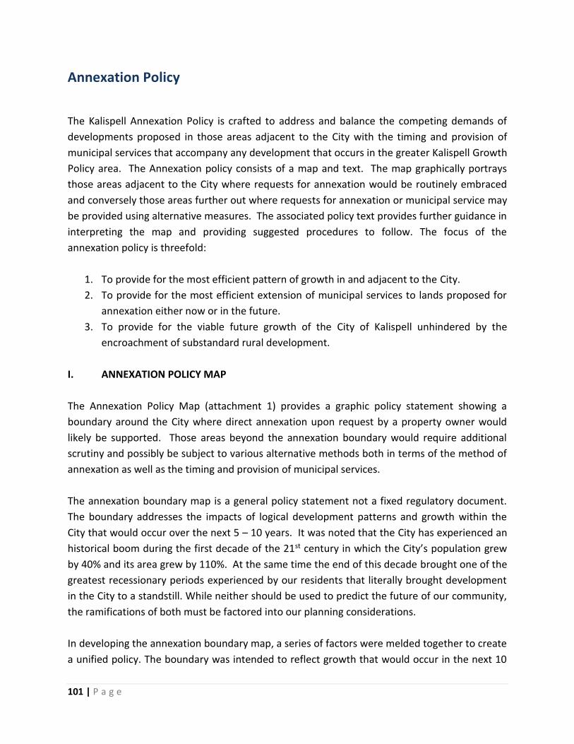
101 | P a g e
Annexation Policy
The Kalispell Annexation Policy is crafted to address and balance the competing demands of
developments proposed in those areas adjacent to the City with the timing and provision of
municipal services that accompany any development that occurs in the greater Kalispell Growth
Policy area. The Annexation policy consists of a map and text. The map graphically portrays
those areas adjacent to the City where requests for annexation would be routinely embraced
and conversely those areas further out where requests for annexation or municipal service may
be provided using alternative measures. The associated policy text provides further guidance in
interpreting the map and providing suggested procedures to follow. The focus of the
annexation policy is threefold:
1. To provide for the most efficient pattern of growth in and adjacent to the City.
2. To provide for the most efficient extension of municipal services to lands proposed for
annexation either now or in the future.
3. To provide for the viable future growth of the City of Kalispell unhindered by the
encroachment of substandard rural development.
I. ANNEXATION POLICY MAP
The Annexation Policy Map (attachment 1) provides a graphic policy statement showing a
boundary around the City where direct annexation upon request by a property owner would
likely be supported. Those areas beyond the annexation boundary would require additional
scrutiny and possibly be subject to various alternative methods both in terms of the method of
annexation as well as the timing and provision of municipal services.
The annexation boundary map is a general policy statement not a fixed regulatory document.
The boundary addresses the impacts of logical development patterns and growth within the
City that would occur over the next 5 – 10 years. It was noted that the City has experienced an
historical boom during the first decade of the 21st century in which the City’s population grew
by 40% and its area grew by 110%. At the same time the end of this decade brought one of the
greatest recessionary periods experienced by our residents that literally brought development
in the City to a standstill. While neither should be used to predict the future of our community,
the ramifications of both must be factored into our planning considerations.
In developing the annexation boundary map, a series of factors were melded together to create
a unified policy. The boundary was intended to reflect growth that would occur in the next 10

102 | P a g e
years. Many factors were considered in developing this map. First, obvious topographic
boundaries were used: Flathead and Stillwater Rivers and Ashley Creek and Lone Pine State
Park. Where geographic boundaries were not evident, a boundary that generally extended ¼
mile beyond the current City limits was incorporated to allow for efficient annexation adjacent
to the City without a hard and fast policy that new growth had to touch the City. In addition,
the availability of City services including the 5-minute fire response service area and presence
of municipal water and sewer lines were factored into the process.
The annexation policy map needs to be reviewed at least every 5 years to keep it relevant as
the City grows.
II. ANNEXATION POLICY FRAMEWORK:
The policy statements below must be used to interpret the annexation policy map. This policy
is intended to apply to all annexations of land as well as requests for municipal services for
lands outside the City. This would include both obvious annexations as shown within the
annexation policy boundary map, lands outside the annexation boundary area and wholly
surrounded lands inside the City limits proposed for annexation. This framework describes two
options for annexation, direct annexation and the use of waiver of right to protest annexation,
and when it is appropriate to consider each.
A. Annexation Options
1. Properties inside the Kalispell Annexation Boundary Area when an owner petitions for
annexation:
a. The property owner submits a written petition for annexation to the Planning
Department.
b. City would follow the “Direct Annexation” process.
2. Properties outside of the Kalispell Annexation Boundary Area when an owner petitions
for annexation:
a. The property owner submits a written petition for annexation to the Planning
Department.
b. The Planning Board would review the merits of the annexation and make one of
the following recommendations based on promoting a logical and efficient
development pattern for the City:
1) Direct annexation:
i. Available if the property meets two or more of the following criteria:

103 | P a g e
1. The property lies in the immediate path of additional annexations
which will form a logical extension of the City.
2. The property lies within the existing service area of the Fire
Department.
3. The annexation achieves one or more key goals of the Growth
Policy or provides a necessary community connection, facility or
infrastructure component.
2) Petition to Waive Right to Protest Annexation:
i. Available if the property meets a majority of the following criteria:
1. The property is outside of the City’s annexation boundary.
2. The property lies in the immediate path of additional annexations.
3. The property is in an area that may possibly be adjacent to
existing City infrastructure (sewer, water, fire service area) in the
next 10 – 20 years.
4. The property is within the service area of the Kalispell Fire
Department and is serviceable by existing or proposed extensions
to municipal water or sewer services.
5. Services within the property can be provided in the near term by
other than municipal means (private road user’s agreements,
private homeowner’s association maintenance of parks and open
space, contracting with rural fire districts, etc.) until the time that
the City actually annexes the property.
6. Development of the property achieves one or more key goals of
the Growth Policy or provides a necessary community connection,
facility, infrastructure component or community benefit.
3) Recommend not to proceed:
i. If the Planning Board determines that the property does not address an
adequate number of criteria and is not suitable for annexation or a
waiver of right to protest, the Planning Board would notify the property
owner and forward a recommendation to the City Council.
B. Annexation Processes
1. Direct Annexation Process (Property owner petitions):

104 | P a g e
a. The property owner submits a petition for annexation to the Planning
Department.
b. Staff would prepare a cost of services plan.
c. The Planning Board determines that direct annexation is appropriate.
d. The Planning Board holds a hearing for the purpose of recommending the most
appropriate zoning.
e. Planning Board recommendations on annexation and zoning are forwarded to
the City Council.
f. The City Council would act on the annexation request and if appropriate approve
the appropriate zoning.
2. Petition of Waiver of Right to Protest Annexation: (Property Owner Petitions)
a. The property owner submits a petition for annexation to the Planning
Department.
b. Staff would prepare a cost of services plan.
c. The Planning Board makes a recommendation on the most appropriate process
to follow – in this case waiver of right to protest annexation - to the City Council.
d. The City Council acts on the Planning Board recommendation. If the Council
concurs that a waiver of annexation is most appropriate the following
procedures occur:
1) The property owner enters into an inter-local agreement with the City
and the County stating that the City will provide specified services
(typically water and/or sewer) extended at the property owner’s expense
and that in exchange:
i. The property owner will agree to submit a waiver of right to
protest annexation to the City.
ii. The property owner ensures that the development will be built to
Kalispell Urban Standards and allow City inspections of the
improvements as they are installed to ensure that all future
public infrastructure is built to proper standards.
iii. Finally, the property owner agrees to require that all structures
will be built in accordance to the building codes adopted by the
City of Kalispell at the time of construction and that they will
provide for proper inspections.
iv. At such time as the property owner requests connection to the
municipal water or sewer utility, all applicable connection fees,
including impact fees, shall be paid in full to the City of Kalispell.

105 | P a g e
Upon such payment, and within a reasonable time, the necessary
taps shall be made only by authorized personnel of the City or
utility into which the tap is to be made.
2) Kalispell Site Review Committee will review the development proposal to
ensure that the development is built to Kalispell Urban Standards.
3) Kalispell Site Review Committee passes these recommendations on to the
Flathead County Planning Board to incorporate into their staff review.
4) If infrastructure is not built to Kalispell Urban Standards, the requested
municipal public services will be withheld.
5) Under this policy, the City will annex this property at its own discretion,
without protest from the property owners, after giving due notice to the
property owners of the intent to annex.
e. The City staff would then monitor the development over time and make a
recommendation to the City Council when actual annexation would appear to be
appropriate. As a justification for annexation, an updated “Cost of Services Plan”
would be prepared by staff.
3. Annexation of Wholly Surrounded Areas (City Council directed annexation)
Part 7-2-45 MCA provides a process for the City to annex wholly surrounded land. The
law provides that the City shall pass a resolution of intent, give notice to the affected
property owners and precede with annexation without a petition or request from the
affected surrounded property owners. The basis of this law is that properties, because
of their location within the boundaries of a City are in effect already receiving some
municipal services without paying their fair share in support. The residents drive City
streets, have access to City parks, have City police patrolling in and around their
neighborhoods, have access to fire protection in case of a major incident, etc. In
addition such annexations simplify the provision of emergency services creating a clear
line of agency primary responsibility when an emergency does arise.
a. The City Council directs the Planning Board to proceed with the annexation of
properties wholly surrounded per 7-2-(4501-4511) MCA.
b. The planning staff notifies the affected property owners within the wholly
surrounded area to be annexed.
c. Staff would prepare an extension of services plan showing how all municipal
services can be provided to the properties, either immediately in the case of fire,
police, road maintenance, park maintenance or where major utilities or facilities

106 | P a g e
are missing such as water mains, fire hydrants or sewer mains, financing options
that would be available to extend such facilities.
d. Informational materials are made available to the property owners explaining
the process, the type of zoning proposed and the impacts this annexation would
have on their property.
e. The Planning Board holds a public hearing for the purpose of recommending the
most appropriate zoning.
f. Planning Board recommendation is forwarded to the City Council.
g. The City Council would act on the Planning Board recommendation for
annexation and approve the appropriate zoning classification or classifications.
Figure 15: Annexation Policy Map

107 | P a g e
Resources and Analysis Section
The Resources and Analysis Section is a separate document that provides a broad range
information within the following chapters:
Chapter 1 – The Growth Policy Area
Chapter 2 – Brief History of the Kalispell Area
Chapter 3 – Population & Population Characteristics
Chapter 4 – Housing & Housing Characteristics
Chapter 5 – Education and School Enrollment
Chapter 6 – Land Use in the Growth Policy Area
Chapter 7 – Environmental Considerations
The information contained within these chapters will be regularly updated as new information
becomes available, i.e. - census, flood studies, etc. The information is primarily analytical in
nature and is a valuable tool when considering development projects and projecting future
growth within the City. Staff will often use this document when considering projects and cite
the information therein in order to accurately disclose applicable facts to the public.