an archeological survey of the proposed southwestern
TRANSCRIPT
University of South CarolinaScholar Commons
Research Manuscript Series Archaeology and Anthropology, South CarolinaInstitute of
5-1974
An Archeological Survey of the ProposedSouthwestern Beltway Extension and TwelfthStreet Extension Highway Route in the Vicinity ofCongaree CreekDavid G. Anderson
James L. Michie
Michael B. Trinkley
Robert L. Stephenson
Follow this and additional works at: https://scholarcommons.sc.edu/archanth_books
Part of the Anthropology Commons
This Book is brought to you by the Archaeology and Anthropology, South Carolina Institute of at Scholar Commons. It has been accepted for inclusionin Research Manuscript Series by an authorized administrator of Scholar Commons. For more information, please contact [email protected].
Recommended CitationAnderson, David G.; Michie, James L.; Trinkley, Michael B.; and Stephenson, Robert L., "An Archeological Survey of the ProposedSouthwestern Beltway Extension and Twelfth Street Extension Highway Route in the Vicinity of Congaree Creek" (1974). ResearchManuscript Series. 52.https://scholarcommons.sc.edu/archanth_books/52
An Archeological Survey of the Proposed Southwestern BeltwayExtension and Twelfth Street Extension Highway Route in the Vicinity ofCongaree Creek
KeywordsExcavations, Congaree Creek, South Carolina Highway Department, Southwestern Beltway ExtensionProject, Twelfth Street Extension, Lexington County, South Carolina, Archeology
DisciplinesAnthropology
PublisherThe South Carolina Institute of Archeology and Anthropology--University of South Carolina
CommentsIn USC online Library catalog at: http://www.sc.edu/library/
This book is available at Scholar Commons: https://scholarcommons.sc.edu/archanth_books/52
•
AN ARCHEOLOGICAL SURVEY OF THE PROPOSED SOU'I'HWII:tj'I'II:HNBELTWAY EXTENSION AND 'I'WELJrTH STREET EX'J'E:NH I(INHIGHWAY ROUTE IN THE VICINI1'Y OF CONGARJ i:I1: CllIi:II:I,
by
David G. Anderson, James L. Michie nll.dMichael B. Tdnkley
Research Manuscript Heries, No. flO
with
Preface and Conel.l1s1ons by
Robert I,. St ephenson
Prepared by theINSTITUTE OF ARCHEOLOGY AND ANTHRO)JOI.OI;Y
UNIVERSITY OF SOUTH CAROLINAMay, 197/1
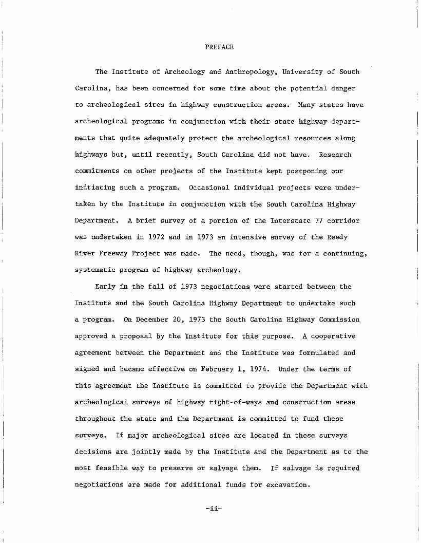
PREFACE
The Institute of Archeology and Anthropology, University of South
Carolina, has been concerned for some time about the potential danger
to archeological sites in highway construction areas. Many states have
archeological programs in conjunction with their state highway depart
ments that quite adequately protect the archeological resources along
highways but, until recently, South Carolina did not have. Research
commitments on other projects of the Institute kept postponing our
initiating such a program. Occasional individual projects were under
taken by the Institute in conjunction with the South Carolina Highway
Department. A brief survey of a portion of the Interstate 77 corridor
was undertaken in 1972 and in 1973 an intensive survey of the Reedy
River Freeway Project was made. The need, though, was for a continuing,
systematic program of highway archeology.
Early in the fall of 1973 negotiations were started between the
Institute and the South Carolina Highway Department to undertake such
a program. On December 20, 1973 the South Carolina Highway Commission
approved a proposal by the Institute for this purpose. A cooperative
agreement between the Department and the Institute was formulated and
signed and became effective on February 1, 1974. Under the terms of
this agreement the Institute is committed to provide the Department with
archeological surveys of highway right-of-ways and construction areas
throughout the state and the Department is committed to fund these
surveys. If major archeological sites are located in these surveys
decisions are jointly made by the Institute and the Department as to the
most feasible way to preserve or salvage them. If salvage is required
negotiations are made for additional funds for excavation.
-ii-
This is a highly satisfactory agreement of mutual benefit to both
parties. It insures the Department of compliance with the archeological
aspects of Environmental Impact and that the Department will either
preserve or salvage archeological values (prehistoric or historic) within
highway project areas. It also assures the Institute that archeological
values will be made known, that sites will be properly recorded and
that the resulting data will be available for scientific research. It
is a major step forward for archeology in South Carolina and another
example of productive cooperation between state agencies.
Under this agreement the Institute has already reviewed and com
mented on several A-95 statements and has done one field survey in
addition to the project that is the subject of this report.
This report describes an initial survey of a portion of the proposed
Southwestern Beltway Extension Project and includes the proposed Twelfth
Street Extension and the interchange at the junction of the two. The
area is situated between the Congaree River and Interstate 26, in Lex
ington County.
Attention was first directed to the archeological potential of this
area in 1969 when James L. Michie, an amateur archeologist in Columbia,
reported the presence of archeological sites there to the Institute.
He also suggested that the proposed Beltway Extension might endanger
them although the exact right-of-way was not then known. The Institute
sent a representative, Mr. Paul Brockington, to the area with Mr. Michie
and recorded a small Woodland Period site (38LX5) in December, 1969.
Subsequently Michie reported three other sites in this area but funds
were not available for anything more than recording these sites.
Another aspect of the area became apparent during this time when
Mr. William McDowell of the South Carolina Department of Archives and
-iii-
History reported to the Institute that the Old Congaree Fort ruins were
probably situated somewhere in this area. This early trading post had
been established in 1718 and used throughout most of that century. The
Institute sent Dr. E. Thomas Hemmings and Mr. Richard Polhemus to the
area to search for that site. A good candidate for the location of the
Congaree Fort was found and recorded as site 38LX30. A brief test pit
and surface collections, however, indicated that this site was of a
somewhat later period.
In the late fall of 1973 Mr. Michie proposed to the Institute that
the Archeological Society of South Carolina undertake research on the
sites in this area. The center line of the highway right-of-way was then
known and appeared to endanger several of the sites. Also another
potential location for the Congaree Fort had been found in a portion of
site 38LX50. Mr. Michie, Mr. David Anderson and Mr. Michael Trinkley
would undertake the direction of the S5ciety's efforts and all would be
under the general supervision of the Institute. The labor force would
be the volunteer members of the S6cie=ty. Mr. Michie had had experience
in a well-conducted excavation at the nearby Taylor Site (38LXl) and had
returned to the University to major in anthropology. Mr. Anderson, a
graduate of Case Western Reserve University in anthropology, was a
research assistant on the Institute staff. Mr. Trinkley was a graduating
senior in anthropology at the University of South Carolina. All three
were capable of the task at hand.
The Institute approved the project and it was initiated in December,
1973. Meanwhile the agreement with the South Carolina Highway Depart
ment had come into being. I asked Michie, Anderson and Trinkley to con
duct an intensive survey of the entire area including potential "borrow"
-iv-
areas, equipment parking areas, etc. This included the entire strip of
high ground from the Congaree River to Interstate 26 along both sides
of the proposed Southwestern Beltway Extension.
Meanwhile the Society began excavations in three parts of site
38LX50 and determined that it, too, was of too late a date to be the
Congaree Fort. Prehistoric occupation of this site though was found
to be very abundant and the excavations continued.
The body of this report, prepared by David Anderson, James Michie
and Michael Trinkley provides the details of this survey and summary
descriptions and definitions of the nine sites located.
INTRODUCTION
At the request of Dr. Robert L. Stephenson, State Archeologist and
Director of the Institute of Archeology and Anthropology at the Univer
sity of South Carolina, the authors undertook an extensive survey along
the route of the South Carolina Highway Departments' proposed South
western Beltway Extension between 1-26 and the Congaree River. The
purpose of the survey was to locate and briefly describe the archeologi
cal resources of the area and to determine the effect of highway con
struction upon them.
The archeological surface survey was conducted by the authors
and members of the Archeological Society of South Carolina between
December, 1973 and March, 1974. Nine sites were located during the
survey and extensive surface collections were made from each. A search
of document and map sources was made by Anderson with the assistance of
Steven Baker of the Department of History at U.S.C. The purpose of
this search was to determine the early historic occupation (if any) of
-1-
.'
. .'. ..
I ..
, .."
...
w····'...·.····." .. ; {, . '
"
"
,•
,,'
....
" ......
"
L.c..fWJ>$C-'L.: J"• ••• '
I, \. ,~ .... ; , .
I
'", .'
':t'
. .
t,
.\
....
,,
~
...\ .
\
..
.'
'. ,l "
, ,.. .. '0
" ......
\;' '.
"
".
• ••F.
-,
• I" o'.•• I
" : .. '. '..
"
)'
. , ~
. ,
.'... -. ..
.1'-, -.." '.~ ~~ '- ~'"-''' .... ,..l\' ;',
'0 f' ..... ', .. \. '-;till .......... ,," .. '- ';"', ..• - • I
..
...",'I;. I
• 1
~'
' •••'t ::. :, "', \,
"
, "
. ". . -: ',,: .,.. ," ... " .. ' " ...
the area with the goal of determining locations of possible early his
toric sites. Finally, the authors undertook a controlled testing
operation involving excavation and analysis of materials at one of the
sites (38LX50) to further clarify the archeological nature of the area.
The results of all of these operations are given below and recommenda
tions based upon them are stated in the conclusion.
A number of people helped withbhe preparation of this survey and
deserve special mention. In particular Forest Swails of Lexington,
S.c. and Tommy Charles of Columbia, S.C. are to be thanked for providing
us with data from their collections and personal surveys of the area.
Mr. Burwell Manning, the owner of much of the land in the area is to
be especially thanked for his extensive cooperation and material assis
tance in allowing us to conduct testing operations in his cultivated
areas.
The survey operation was conducted by members of the Archeological
Society of South Carolina, and to these people who gave of their time
and effort to help us we offer our sincere thanks: Forest and Sara
Swails, Steven Baker, Tommy Charles, Sammy Lee, Robert Parlor, Oleata
and Ken Beard, George Lewis, Paul Williams, Robert Durrett, Sue Ficker,
Jackie Carter, Dave Ballinger, and Sonny and Barbara Hiott. Finally,
to Leland Ferguson and Stanley South of the Institute of Archeology
special thanks are due for advice and assistance.
THE ENVIRONMENT
The area covered in the survey lies along the southern and eastern
banks of the Congaree Creek near its confluence with the Congaree River
(Figs. 1-3). The land is presently owned jointly by Mr. Burwell Manning,
-3-
the Bank of Indiana, and Hall Moore &Associates, a subsidiary of S. C.
Electric and Gass (Burwell Manning: personal communication).
The terrain consists of wide, flat, low-lying fields with occasional,
slightly elevated knolls or ridges. The land rises as it approaches the
Congaree Creek, and a long ridge overlooking the creek channel lies along
the southern and western banks. The Congaree Creek, which is immediately
to the north of most of the survey area, meanders through a small but
densely overgrown swamp. The proposed Beltway passes through fields
elevated above this swamp (five to twenty feet) while the proposed
Twelfth Street Extension passes through it (Fig. 2).
The area is presently cultivated except for forested belts along
the Congaree Creek and other small stream channels in the area. Wheat,
rye, and soy beans constitute the primary cash crops, and the area has
been under cultivation for at least fifty years and probably far longer
(Burwell Manning: personal communication). A number of abandoned early
twentieth century dwellings are located in the area and a recent power
line cut has been made, but overall the land is utilized mainly for
farming andhfiunting.
Because of the low relief of the area and the proximity of the
Congaree River, extensive flooding has taken place over most of the land
through the years. The soils of the area are characterized by water
deposited clays, silts, and fine sands resting upon a clay base, with
occasional small water-worn pebbles interspersed in the alluvium. The
low-lying fields are especially susceptible to flooding and only the
higher ground is relatively free from inundation.
The area is located just be1@w the fall line: the piedmont-~oasta1
plain boundary characterized by rocky shoals along the rivers and a
rapid drop in elevation as the crystalline rocks of the piedmont plunge
-4-
downward under the extensive sedimentary layers of rock and sediment
that cap the coastal plain geologic strata. Because ohe rivers are
relatively wide and shallow as well as rock-strewn in this area, it was
a natural fording place for earlier occupants. People traveling from
one region to the other, especially those interested in exploiting the
markedly different resources of the piedmont or the coastal plain on a
seasonal basis would be expected to frequently camp in such an area as
they traveled up and down the xiver valleys. Traffic up and down the
river would have to temporarily halt at this area, for the rocky and
shallow river passage would make travel on the water difficult; a
portage of some kind must be arranged.
With regard to the particular area under consideration, the fact
that parts of the route surveyed included knolls and ridges, many over
looking swamps, made the area seem especially attractive archeologically.
To earlier peoples this relatively high ground would provide a dry
campsite safe from most of the frequent flooding. In aedition it would
provide an ideal vantage point from which they could watch the game
filled swamps below. Finally, the recurrent flooding of the area sug
gested the possibility of finding stratified sites in the alluvial
deposits in the lower areas.
GLOSSARY OF TERMS
A number of archeological sites were located within the survey
area, and the materials recovered indicated that many of them had been
occupied over a long period of time. Because in this report a number
of general archeological terms for earlier time periods are used to
describe these sites, brief listings and identifications are given below.
-5-

Paleo-Indian refers to the time period from ten to twelve thousand
years ago when the last of the great ice-age glaciers were in retreat
in the north. The occupations of this timeLperiod are the earliest
known for this area and the New World, and represent the remains of the
nomadic big-game hunting groups that roamed the area in search of mammoths,
giant ground sloths, camels, and other large Pleistocene animals that
were in North America at this time.
The Attcnaic refers to the time period from roughly ten to three
thousand years ago, when the climate and the native animal population
were much as they are today. During this time the natives of this area
lived by hunting this smaller game and increasingly, over time, utilized
greater and greater amounts of plant material for food in a nomadic
hunting and gathering pattern of existence.
Woodland refers generally to the time period from roughly a 1000
B.C. until 1600 A.D., when colonization of this area began to increasing
ly effect the Indians' traditional way of life. During the Woodland
period agriculture, settled villages, well made pottery, and towards the
end, elaborate ceremonial complexes appear.
The Historic period generally refers to the period of white contact
and settlement in this area, and dates after A.D. 1600. The historic
sites mentioned in this report date to the eighteenth century.
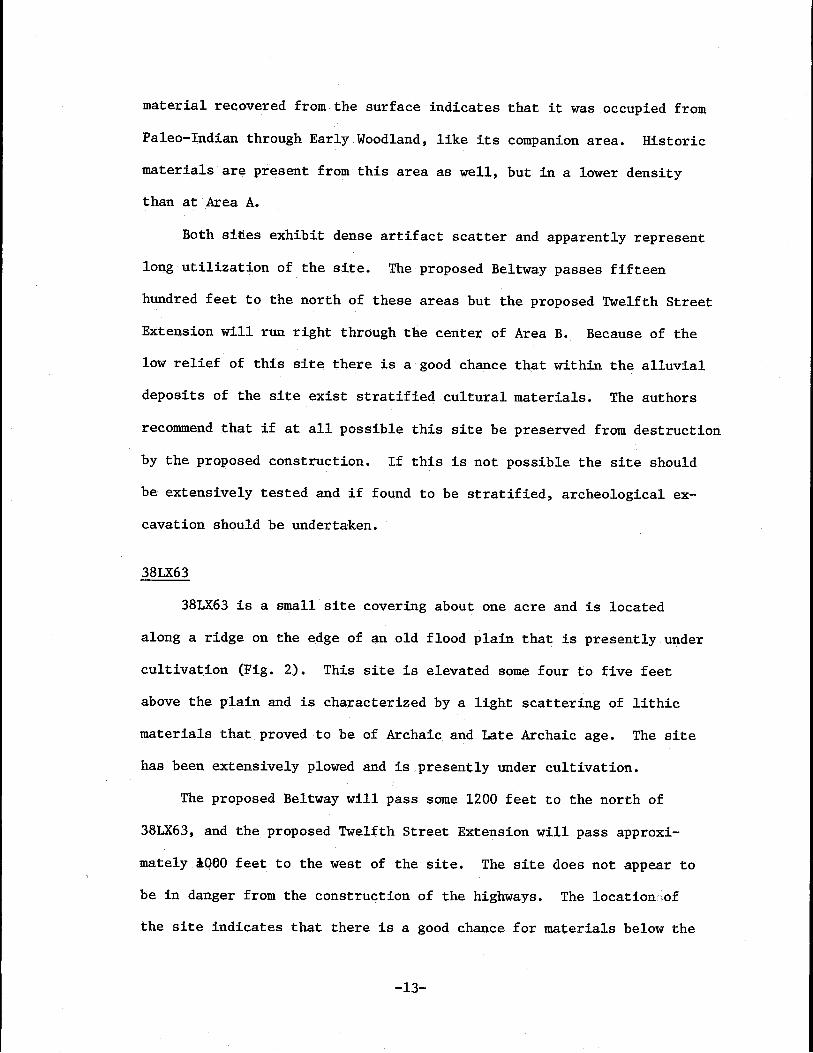
THE SITES
Four archeological sites in the area had been located and reported
to the Institute of Archeology and Anthropology by James L. Michie
prior to the period of the survey: 38LX5, 38LX19, 38LX50, and 38LX54.
A search of the site survey files and records at the Institute revealed
-6-
a fifth reported site for the area, 38LX30, located by E. Thomas
Hemmings in 1970. The survey was undertaken to see if there were other,
unreported sites in the area, and to define particular areas of arti
fact concentration within reported sites. In addition the goal of the
survey was to gather as large a sample of material as possible from
each site to give a fairly clear picture of the archeological potential.
Four additional sites were located by the survey,each with ex
tensive concentrations of artifacts appearing on the surface. Site
survey sheets on these sites have recently been placed on file with
the Institute of Archeology and are reported here as 38LX6l, 38LX62,
38LX63 , and 38LX64. These bring to a total of nine the number of
separate sites located within the survey area and reported here.
An additional section has been added to this survey to deal with
the problem of Old Fort Congaree which is believed to lie somewhere in
this area but has not been discovered. Discussion is limited to the
historical importance of the site and its probable location, with a
recommendation for salvage operations should highway construction
uncover it.
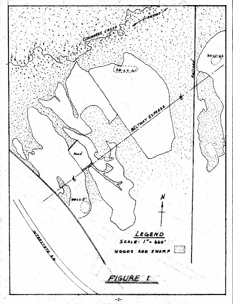
38LX5
38LX5 covers 1-2 acres and is located on the western edge of an
elevated knoll directly adjacent to Road 129 (Fig. 1). The site is
apparently Late Woodland and is characterized by an extensive scatter
of ceramic fragments and quartz and chert points, tools, and flakes.
The area has been extensively plowed and is presently under cultivation.
Woods and low-lying fields are located to the north, east, atiebsol1theast
of the site, which commands an excellent overview of the immediate area.
The site is lofated four to five hundred feet to the south of the Beltway
-7-

centerline. Construction of the Beltway should not affect this site
provided that the construction activities are confined to the right-of
way strip.
38LX61
38LX61 is a small site covering about one acre located on the
northern side of a large high hill which dominates the area (Fig. 1).
The site has been extensively plowed and is presently under cultivation.
The site is quite close to the southern bank of the Congaree Creek and
is characterized by a scattering of Woodland ceramics and lithic
materials, of which small triangular projectile points predominate.
The site appears to represent a small Woodland period occupation with
no apparent evidence for earlier or later activity. The site is well
away (over 1000 feet) from the highway and should not be affected by
construction of the Beltway provided that construction activities are
confined to the right-of-way strip.
38LX62
38LX62 is a small site covering about one acre located on a low
sandy hill overlooking the Congaree Creek swamp (Fig. 1). The site is
situated about two hundred feet to the east of the Seaboard Airline
railroad passage and is characterized by a light scatter of ceramic
fragments and lithic materials. Inspection of the surface collection
indicates that the site has a primary Woodland period occupation with
a small occurrence of earlier, Late Archaic period material. The site
has been extensively plowed and is presently under cultivation. The
southern edge of the site area is located approximately 200 feet from
the centerline of the right-of-way. The northern edge is some 600 feet
-8-
from the centerline. Construction of the Beltway may destroy approx~
imately 25% of the site. A small test excavation is recommended for
this site before construction begins.
38LX54
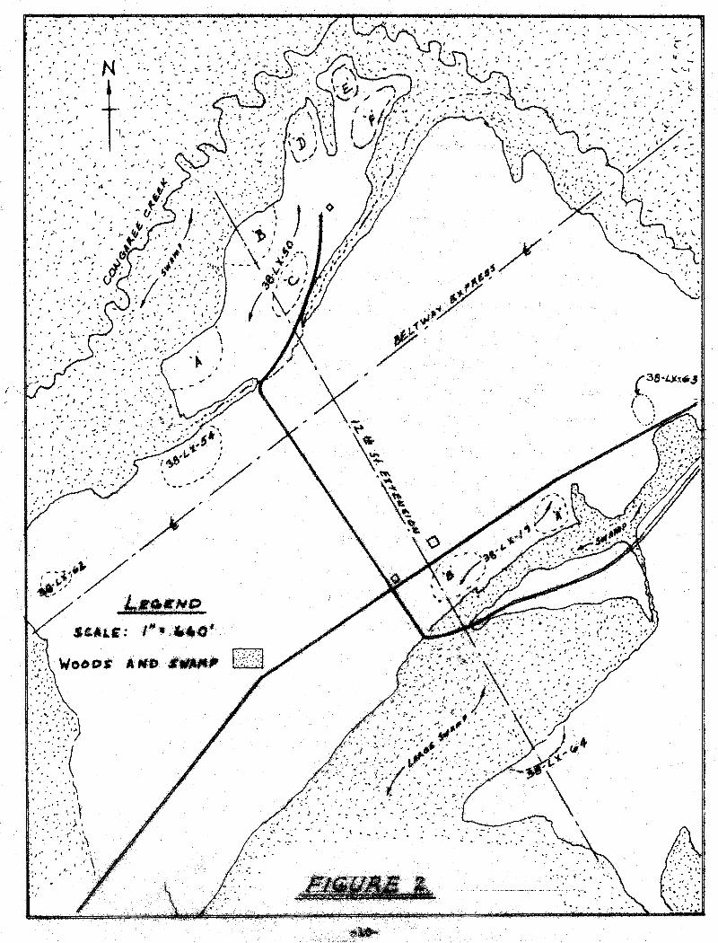
38LX54 is a large site covering about two acres that lies adjacent
to a small unnamed seasonal creek to the south of the Congaree Creek
swamp (Fig. 2). The site is located in an extensively plowed, low-lying
field elevated some four to five feet above the swamp floor which it
overlooks to the northwest.
The site is characterized by an extensive scatter of lithic and
ceramic fragments and inspection of the surface material indicates a
very dense occupation for the site throughout much of the Archaic period.
A very large quantity of surface material was collected, with the initial
analysis revealing occupation of the site all through the Archaic period
and well into the Woodland period. A small early historic occupation
is indicated by the presence of late eighteenth century ceramics, kaolin
pipe fragments, and badly worn iron fragments.
This site lies some 200 feet from the centerline of the right-of
way for the proposed Beltway; in addition the proposed clover-leaf for
the Twelfth Street Extension leading off the Beltway will probably cut
through the edge of the site. Because of the low relief of the terrain
the site may contain stratified cultural deposits in the layers of
alluvium which characterize the soils of the site. 38LX54 should be
tested to determine if such stratigraphy exists. If such proves to be
the case an extensive salvage operation is recommended.
-9-
.,.
."
•• r
,-
\.. '...... ' .... (,
r3eH.)t~.4
{ \,\
-,
.,
, ,
i ", .
, ', "
, : <! "
"; - :. -;.
,
.'• I
' .."
.:
, ,
.' ,
• 11' ,.
, .I ,
... .\
#-# ,/ .......- .'"
Ij I
,. f
.. ' I'"'
,.'
, .
I'
..... "
'., .
, .
"
..
38LX50
38LXSO is the largest, and in the opinion of the authors, the most
important of all the sites that will be ~ff.et.ctby the proposed Beltway
and Twelft Street Extension. The site encompasses an area of about
forty acres and is elevated some thirty feet above the floor of the
Congaree Creek swamp, which it overlooks ~o the north and east (Fig. 2).
The area of the site has been extensively plowed and is presently under
cultivation. An extensive survey of this particular site has determined
that six areas exhibit concentrations of aboriginal materials. These
areas are designated Areas A, B. C. D. E,and F.
All six of the areas have produced materials ranging from the
Paleo-Indian period through Early Woodland. Particularly dense occupa
tions throughout the Archam~ are indicated for all of these areas from
the quantities of materials collected during the surveys. Area B has
been tested by the authors and has been found to contain stratified
cultural deposits from the Early Archaic through the Early Woodland
with an historic occupation of the middle to late eighteenth century
over these. Area C has produced a number of Paleo-Indian artifacts
on the surface and test excavation undertaken here by the authors
indicates that the soils below the plow zone are possibly of this
period. Further testing in this area is recommended.
The areas designated are those of primary cultural concentration
on the site. Nevertheless artifact scatter occurs over the entire area
of the site$. The proposed Beltway will pass a thousand feet to the
south of this site. However, the proposed. Twelft Street Extension will
completely destroy Areas Band C which the authors feel are the most
important areas within the site. Areas A, D, E, and F appear to be out
-11-
of danger from highway construction, provided that construction activities
are confined to the right-of-way strip.
If at all possible Areas A and B of this site should be preserved
from destruction. If this is not possible an extensive archeological
salvage effort should be undertaken. Of primary consideration in
arriving at this conclusion are the indications recovered from the
survey and exploratory excavation that these areas contain significant
information regarding both the Paleo-Indian period and the early his
toric period in South Carolina.
38LX19
38LX19 is a large site covering about eight acres located on a
low-lying sand-clay ridge adjacent to a small unnamed seasonal stream
(Fig. 2). This stream meanders for several hundred yards through a
wide swamp until it enters Congaree Creek near the Old State Road.
The site is located in a plowed and cultivated field elevated some
four feet above the swamp floor.
On the suriace of the site evidence of a dense occupation is
present and is characterized by the occurrence of fire-cracked rocks,
chipped stone, and ceramics of both historic and prehistoric origin.
Within the site there are two large, distinct concentrations of debitage
that are termed Areas A and B.
Area A is in the northeastern edge of the site and lies upon a
small knoll. This rise has produced cultural material from the late
Paleo-Indian through Early Woodland periods as well as evidence of an
early historic settlement.
Area B is somewhat larger than Area A and lies on a slightly
elevated rise some two hundred f~et to the southwest. The cultural
-12-
material recovered from the surface indicates that it was occupied from
Paleo-Indian through Early Woodland, like its companion area. Historic
materials are present from this area as well, but in a lower density
than at Area A.
Both sides exhibit dense artifact scatter and apparently represent
long utilization of the site. The proposed Beltway passes fifteen
hundred feet to the north of these areas but the proposed Twelfth Street
Extension will run right through the center of Area B. Because of the
low relief of this site there is a good chance that within the alluvial
deposits of the site exist stratified cultural materials. The authors
recommend that if at all possible this site be preserved from destruction
by the proposed construction. If this is not possible the site should
be extensively tested and if found to be stratified, archeological ex
cavation should be undertaken.
38LX63
38LX63 is a small site covering about one acre and is located
along a ridge on the edge of an old flood plain that is presently under
cultivation (Fig. 2). This site is elevated some four to five feet
above the plain and is characterized by a light scattering of lithic
materials that proved to be of Archaic and Late Archaic age. The site
has been extensively plowed and is presently under cultivation.
The proposed Beltway will pass some 1200 feet to the north of
38LX63, and the proposed Twelfth Street Extension will pass approxi
matelyl060 feet to the west of the site. The site does not appear to
be in danger from the construction of the highways. The location:iof
the site indicates that there is a good chance for materials below the
-13-

,,
'/"
...'
" WtJoc!s .
..s",,~ .... to"
, ,
,/LE~saLe r'
">i/' .~. ,
: '.
..'
, .'.' • I
"
..'.
" ,"
"0 ".
", ,
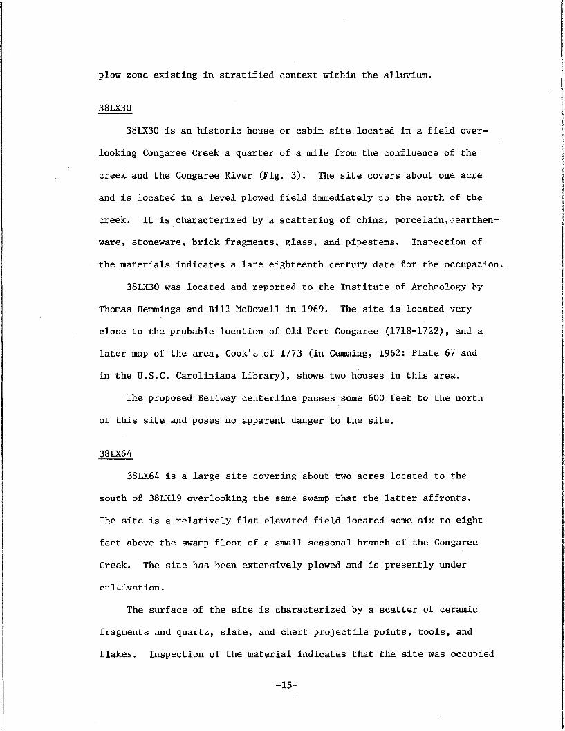
plow zone existing in stratified context within the alluvium.
38LX30
38LX30 is an historic house or cabin site located in a field over
looking Congaree Creek a quarter of a mile from the confluence of the
creek and the Congaree River (Fig. 3). The site covers about one acre
and is located in a level plowed field immediately to the north of the
creek. It is characterized by a scattering of china, porcelain,eearthen
ware, stoneware, brick fragments, glass, and pipestems. Inspection of
the materials indicates a late eighteenth century date for the occupation.
38LX30 was located and reported to the Institute of Archeology by
Thomas Hemmings and Bill McDowell in 1969. The site is located very
close to the probable location of Old Fort Congaree (1718-1722), and a
later map of the area, Cook's of 1773 (in Cumming, 1962: Plate 67 and
in the U.S.C. Caroliniana Library), shows two houses in this area.
The proposed Beltway centerline passes some 600 feet to the north
of this site and poses no apparent danger to the site.
38LX64
38LX64 is a large site covering about two acres located to the
south of 38LX19 overlooking the same swamp that the latter affronts.
The site is a relatively flat elevated field located some six to eight
feet above the swamp floor of a small seasonal branch of the Congaree
Creek. The site has been extensively plowed and is presently under
cultivation.
The surface of the site is characterized by a scatter of ceramic
fragments and quartz, slate, and chert projectile points, tools, and
flakes. Inspection of the material indicates that the site was occupied
-15-
throughout much of the Archaic and Early Woodland periods.
The proposed Beltway passes well to the north of this site (Fig. 2)
but the proposed Twelfth Street Extension cuts directly through it. If
possible this site should be preserved, if this is impossible the site
should be tested to determine its archeological potential.
THE PROBLEM OF OLD FORT CONGAREE
In 1718 the Congarees Post was constructed on the north side of
Congaree Creek near the mouth of the creek on the Congaree River. The
fort is described by McDowell (1955: 316-320) as a stockaded enclosure
designed more for the storage of trade goods than for any military
purpose. This early fort was a focal point of trade with the Cherokees
and Catawbas at this time (Brown 1966: 155). There is some evidence
(Logan 1859, cited in Brown 1966) that an earlier village of the Congaree
Indians was on the same site as the trading post. A later fort was
built upon the site of the first trading post in 1748-49 (Chambers 1968:
2), and a map of 1773 (Cook's) shows the fort and two houses in this area.
Several maps of the period (Hunter 1730 [Fig. 4a], DeBrahm 1757,
Cook 1773, Mouzon 1775, and Stuart's 1780 edition of DeBrahm [Fig. 4b])
all show the location of the fort as being just to the north of the
confluence of the Congaree Creek and Congaree River. Unfortunately the
definite location of the site has never been determined. 38LX30, reported
here, is very close to the apparent location of the fort site, and should
be tested to see if the later materials recovered in the survey give a
true picture of the site. From the records it is known that the area
about the fort was occupied on and off throughout much of the eighteenth
century.
-16-
These same early maps (particularly Cooks of 1773) place the fort
somewhere to the north of the house site 38LX30 which mayor may not
place it within the area to be affee~ed by the proposed highway construc-
tion. If the fort site is located before or during the construction of
the highway, and is endangered by that construction, then a salvage
operation should be undertaken to recover as much information as possible
from this earliest settlement in central South Carolina.
CONCLUSIONS AND RECOMMENDATIONS
This survey located nine archeological sites in the area of pro-
posed highway construction on the west bank of the Congaree River.
Five of these are endangered by the proposed construction as indicated
in Table 1.
TABLE 1
Site
38LX538LX6138LX6238LX5438LX5038LX1938LX6338Ln038LX64
Occupation
Late WoodlandWoodlandLate Archaic, WoodlandArchaic, HistoricPaleo, Archaic, Woodland, HistoricPaleo, Archaic, Woodland, HistoricArchaicWoodland, HistoricArchaic, Woodland
Importance
MinorMinorMinorModerateMajorModerateMinorMinorMinor
Danger
NoneNonePartly (25%)Partly (25%)Areas B & C (Total)Area B (25%)NoneNoneTotal
The Old Congaree Fort has not been located but may be somewhere
in the vicinity of 38LX30. Several motor patrol cuts have been made in
the plowed field to the north of this site but no evidence has been found
to suggest the site of the Congaree Fort.
-17-
It seems clear from this survey that this area has been extensively,
though sporadically, occupied from early prehistoric to recent historic
times. It is difficult to say whether this represents a heavier occupa
tion than is to be found in other similar areas nearby or not. Arche
ological investigation has not been of sufficient intensity along the
Congaree River to determine this. Suffice to say that sites of some
significance do occur along this proposed highway construction project.
It is also clear that construction of the proposed Southwestern
Beltway Extension will endanger only two sites. These are 38LX64, a
site of minor importance and 38LX52 a site of moderate importance. In
each instance only about 25% of the site is expected to be affected.
A week of test excavation by a crew of four should be sufficient to
salvage these two sites.
The proposed Twelfth Street Extension will pass through portions
of three sites. One of these, 38LX64, will be totally destroyed.
Surface indications are that this is a site of minor significance and
a week of test excavation by a crew of four should be sufficient to
salvage the remains of this site. Site 38LX19 is a site of more sub
stantial significance and the Twelfth Street Extension will destroy a
portion of one major area of this site. A week of excavation by a crew
of four should salvage these remains.
The third site, 38LX50, is the most significant of the nine sites
located and two of the most promising parts of this site, Areas B & C,
will be totally destroyed by the proposed Twelfth Street Extension.
Areas A, D, E, and F are not endangered. It is recommended that a
crew of four devote a week to each of the two Areas (A and B) to
salvage the remains expected to be found there.
-18-
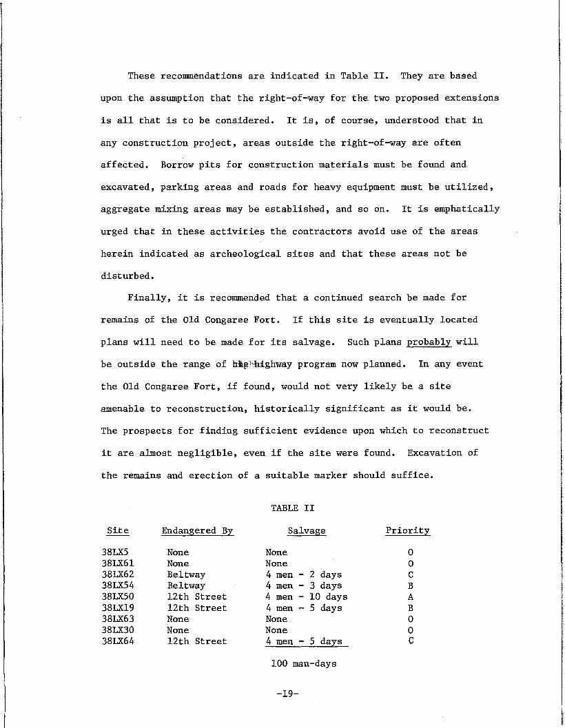
These recommendations are indicated in Table II. They are based
upon the assumption that the right-of-way for the two proposed extensions
is all that is to be considered. It is, of course, understood that in
any construction project, areas outside the right-of-way are often
affected. Borrow pits for construction materials must be found and
excavated, parking areas and roads for heavy equipment must be utilized,
aggregate mixing areas may be established, and so on. It is emphatically
urged that in these activities the contractors avoid use of the areas
herein indicated as archeological sites and that these areas not be
disturbed.
Finally, it is recommended that a continued search be made for
remains of the Old Congaree Fort. If this site is eventually located
plans will need to be made for its salvage. Such plans probably will
be outside the range of [email protected] program now planned. In any event
the Old Congaree Fort, if found, would not very likely be a site
amenable to reconstruction, historically significant as it would be.
The prospects for finding sufficient evidence upon which to reconstruct
it are almost negligible, even if the site were found. Excavation of
the remains and erection of a suitable marker should suffice.
TABLE II
Site Endangered By Salvage Priority
38LXS None None 038LX61 None None 038LX62 Beltway 4 men - 2 days C38LX54 Beltway 4 men - 3 days B38LX50 12th Street 4 men - 10 days A38LX19 12th Street 4 men - 5 days B38LX63 None None 038LX30 None None 038LX64 12th Street 4 men - 5 days C
100 man-days
-19-
REFERENCES CITED
BROWN, JANE DOUGLAS1966 The Catawba: The People of the River. The University of
South Carolina Press, Columbia.
CHAMBERS, GLADYS N.1968 A History of Cayce, South Carolina. Privately printed, copy
in archives of Caroliniana Library.
CUMMING, WILLIAM P.1962 The Southeast in Early Maps. University of North Carolina
Press, Chapel Hill, North Carolina.
20,1710 - August 29, 1718. South Carolina Department ofArchives and History, Columbia, South Carolina.
WILLIAM (ed.)Journal of the Commissioners of the Indian Trade, Sept.
McDOWELL,1955
-20-

ii'"
rI "I,:
"-,"," "
..v~
~_.
r .~.~;:,i"' ....~_r~ .
Figure 4b.
II
I
Figure 4
left; Figure 4a. Map of theCongaree River area madeby Hunter in 1730. Notestructure indicated nearmouth of Congaree Creek.Possible site of Old FortCongaree?
Balow; Figure 4b. Map of theCongaree-Saluda river regionmade in 17BO by Stuart basedon DeBbrahm's map of 1757.Note placement of Old FortCongaree as well as the factthat the area of the presentsurvey is within the Saxa GothaTownship. In particular sites38lX50 and 38lX54 are locatedwithin the township; earlyhistoric materials dating tothe 18th century have beenrecovered from the surfacesof these sites. 38lX30, alsoreported in this survey, ;slocated close to the fort s;~eand just outside the centraltownship area.