a literature search was conducted on managing...
TRANSCRIPT

APPENDIX H: Introduction
A literature search was conducted on managing watershed/reservoir sedimentation. Findings and lessons learned from the literature search were incorporated into refining sediment management strategies for this Assessment. Results of this literature search are presented in this appendix.

1
Literature Search Lower Susquehanna River Watershed
Assessment
USACE
September 2012
2
Table of Contents INTRODUCTION .......................................................................................................................... 4 DOMESTIC .................................................................................................................................... 4
1. Capitol Lake Adaptive Management Plan Final Report ...................................................... 4 2. Condition of Sixmile Creek and Watershed ........................................................................ 6 3. Dredging Slated for Russell Plant Dam ............................................................................... 8 4. Ecological-Economic Assessment of a Sediment-Producing Stream Behind Lower Granite Dam on the Lower Snake River .................................................................................................. 9 5. Grove Lake Sediment Bypass ............................................................................................ 10 6. Louisiana Coastal Restoration ........................................................................................... 11 7. Hydro-suction Sediment Removal Systems for Woodside I and Woodside II Dams, Final Report. ....................................................................................................................................... 12 8. Hydro-Suction Sediment-Removal Systems (HSRS) – Principles and Field Test ............ 14 9. Lessons Learned from a Dam Failure ................................................................................ 16 10. Nebraska Valentine Mill Pond ....................................................................................... 17 11. Potential for Increasing Storage Capacity in Los Padres Reservoir............................... 18 12. Regional Sediment Management ................................................................................... 19 13. Reservoir Conservation RESCON Volume I ................................................................. 20 14. Reservoir Conservation RESCON Volume II ................................................................ 21 15. Robles Diversion Dam HFB Study Report .................................................................... 22 16. San Clemente Dam to Come Down ............................................................................... 23 17. Savage Rapids Dam Sediment Evaluation Study ........................................................... 24 18. Sediment Build-up Causes Environmental Concerns .................................................... 25 19. Sediment Task Force Recommendations ....................................................................... 26 20. Sediment Trap Assessment, Saginaw River, Michigan ................................................. 27 21. Using Adaptive Management at Glen Canyon Dam ...................................................... 28 22. Managing Sediment in Utah’s Reservoir ....................................................................... 29 23. Reservoir Sedimentation Handbook .............................................................................. 30
OVERSEAS .................................................................................................................................. 31 1. China’s Challenge .............................................................................................................. 31 2. Going Full Circle ............................................................................................................... 33 3. Life of Maithon Reservoir, India ....................................................................................... 35 4. Measures against Reservoir Sedimentation Switzerland ................................................... 36 5. Reservoir of Fear, China .................................................................................................... 37 6. Reservoir Sedimentation and Sediment Management in Japan ......................................... 38 7. Reservoir Sedimentation Management in Asia.................................................................. 40 8. Sediment Bound Nutrient, Sudan Savanna Zone of Ghana ............................................... 41 9. Sediment Management at Naodehai Reservoir, China ...................................................... 42 10. Sediment Management Options for the Lower Ebro River and its Delta ...................... 44 11. Sediment Management Round Table Discussion .......................................................... 46 12. Sediment Management, Lavey Run-of-Rover, Switzerland .......................................... 47 13. Sedimentation and Dredging of Guanting Reservoir ..................................................... 48
LITERATURE SEARCH FINDINGS ......................................................................................... 50
4
INTRODUCTION This literature search was undertaken to review, analyze, and synthesize literature on managing watershed/reservoir sedimentation around the nation and the world. Findings and lessons learned will be incorporated into refining sediment/nutrient management strategies for the Lower Susquehanna River Watershed Assessment (LSRWA). A summary of findings, trends and conclusions are discussed herein and literature is organized into “Domestic” and “Overseas” literature. Attachment 1 to this literature search is a spreadsheet of literature evaluating whether a sediment management measure was implemented. Attachment 2 is a presentation providing an overview and findings of this literature search.
DOMESTIC
1. Capitol Lake Adaptive Management Plan Final Report Location: State of Washington, United States Waterbody/Dam: Deschutes Watershed/Deschutes River (252 miles) Parties involved: Capitol Lake Adaptive Management Plan (CLAMP) Steering Committee, City of Olympia, City of Tumwater, Washington Department of Ecology, Washington Department of Fish and Wildlife (WDFW), Washington Department of General Administration (GA), Washington Department of Natural Resources (WDNR), Squaxin Island Tribe, Thurston County, Port of Olympia Methods Used/Proposed: Dredging Citation: Capitol Lake Alternatives Analysis - Final Report. Rep. Seattle: Herrera Environmental
Consultants, 2009. Print.
Summary Capitol Lake is located in Olympia, Washington. A group called the Capitol Lake Adaptive Management Plan (CLAMP) Steering Committee is working on ways to improve the area. Sediment is carried downstream from the Deschutes River and is trapped by the dam that forms Capitol Lake. The Steering Committee finds this to be a problem for several reasons, including water quality, recreation and wildlife, and public safety because the sedimentation creates a higher risk of flooding the city. The reports suggest two possible solutions (managed lake or removing of the dam) and feasibility of each method in each issue paper. Both methods require some dredging. Any dredged material could be taken to open water dump sites or used as construction fill. The main concern is that the sediments at the inlet are known to be contaminated. Dredging needs were described in two categories: initial dredging and maintenance dredging. Disposal options considered were open-water disposal, beneficial reuse for mine reclamation, beneficial reuse for shoreline or nearshore restoration.
5
If the lake is managed, regular dredging of the entire area down to 13 feet is necessary. Sediment traps (holes) would need to be re-excavated every four to five years and the whole lake needs would need to be dredged to the 13 foot level every nine years. Removing the dam is one possible solution which would restore the estuary. Regular dredging of the inlet would still be necessary. The water would be a mix of salt and freshwater. The Steering Committee produced their final report on alternatives for the lake in July of 2009 and is awaiting a decision from the state of Washington which has the final say on the future of Capitol Lake. Costs/Funding: Infrastructure Costs-$2-$4 million Maintenance Costs-$39.8-$134.7 million Amount of Sediment: 1.7 million cubic yards has accumulated in the lake, 875,000 cubic yards needs to be removed. Annual Rate is about 35,000 cubic yards
6
2. Condition of Sixmile Creek and Watershed Location: City of Ithaca, Tompkins County, New York, United States Waterbody Size: Six Mile Creek Watershed Waterbody/Dam Size: extends about 20 miles and covers an area of approximately 46.5 square miles Parties Involved: N/A Methods Used/Proposed: Hard engineering structure, remove the dam Citation: http://www.egovlink.com/public_documents300/ithaca/published_documents/Public_Works/Water_and_Sewer/Watershed/SMC%20Management%20Overview.PDF Milone and MacBroon, Inc., 2003, Flood Mitigation Needs Assessment; Six Miles Creek,
Tomkins County, New York Sixmile Creek: A Status Report, 2007. 35p,
http://ecommons.library.cornell.edu/handle/1813/8354 Leopold, Luna, 1994, A View of the River, Harvard University Press Keller, E. A. 2001. Environmental Geology, Upper Saddle River, New Jersey, Prentice Hall Rosgen, Dave, 1996, Applied River Morphology, Wildland Hydrology, Pagosa Springs,
Colorado, http://www.communityscience.org/SixMile/SixMileCreel.html Langen, et. Al., 2006. Environmental Impacts of Winter Road Management at the Cascade Lakes
and Chapel Pond. Clarkson Center for the Environmental, Report #1.
Summary
Largest problem in Sixmile Creek (Ithica New York ) is the high load of suspended sediment as a result of erosion along the main channel and tributaries, predominantly from Brooktondale downstream to the dams. Several priorities for future research were identified. These include: 1) Quantifying the amount and source of bedload sediment moving through the watershed; 2) Describing how channel sinuosity and channel cross-sectional shape has evolved during the 20th century; 3) Quantifying the amount and source of the sediment input to Sixmile Creek from its tributaries, and 4) Determining the effects of road drainage ditches on storm-water runoff and channel erosion. Another factor with largely unknown effects on the Sixmile system is climate change. Continued incision of and slumping along these channels will follow the equilibrium trend now occurring in the main channel and will lead naturally to a reduction in sediment supply, although the time frame is uncertain. The most reasonable solution to erosional problems in these reaches is the use of hard engineering structures to control the channel location. Alternative is to remove the dam. This alternative would result in the transport of several hundred thousand cubic yards of sediment stored behind the dams downstream into the Cayuga Inlet, where efforts are underway to dredge sediment already accumulated there. If abandoned for water supply and not removed, the dams must still be maintained, although they could be allowed to fill. Once the dam is filled with sediment, the sediment load transported by Sixmile Creek will pass through the dam and ultimately be deposited into Cayuga Inlet. If the Inlet is to remain navigable, a decision will have to be made whether to remove sediment from behind the dams or from the Inlet.

7
Channel erosion control projects such as Natural Channel Design (NCD) projects, in particular those following the Rosgen protocol have been implemented (Barrile project), and are being planned for other reaches of Sixmile Creek. Cost/Funding: Not Provided Amount of Sediment: Several hundred thousand cubic yards

8
3. Dredging Slated for Russell Plant Dam Location: Russell, Massachusetts, United States Waterbody/Dam: Westfield River Watershed (78.1 miles) Parties Involved: Swift River Hydro Operations and W. Davis Hobbs Methods Used/Proposed: Dredging Citation: LaBorde, Ted. "Dredging slated for Russell plant dam." The Republican 15 Nov. 2009: n. pag.
The Republican . Web. 16 July 2012. Summary
Swift River Hydro Operations Company has plans in place to dredge the dam they own that is located on the Westfield River in Russell, Massachusetts. Dredging is set to start in 2009 by lowering the dam over 24 hours, then dredging the material. The lowering of the dam is temporary, and "There will be very little, if any, disruption of the Westfield River during the operation," according to the president of the company. Lowering will occur at the forebay (immediately upstream from the powerhouse) and tailrace (channel that carries water away from the dam) so that a silt fence can be installed before dredging. This keeps disturbance from dredging within the fenced area. The hydro plant has not been used since 1994 when it stopped supplying power to the local paper mill (Westfield River Paper Company closed at the same time), but Swift River bought the hydro plant in 2001. The company is spending $3.5 million to rehabilitate the plant. The goal after dredging is complete is to produce approximately 4.5 million kilowatts of energy but it will also include the installation of a fish ladder other wildlife protection structures. Cost/Funding: estimated $3.5 million rehabilitation project Amount of Sediment: 1,200 cubic yards
9
4. Ecological-Economic Assessment of a Sediment-Producing Stream Behind Lower Granite Dam on the Lower Snake River
Location: Pacific Northwest Region, Wyoming, Idaho, Oregon and Washington, United States Waterbody/Dam: Snake River (1,078 miles) Parties Involved: N/A Methods Used/Proposed: Dredging Citation: Brusven, Walker, Painter, Biggam, 1995, Regulated Rivers: Research and Management, Vol. 10,
373-387
Summary The Lower Snake River flows through Idaho and Washington. Lower Granite Dam is one of eight dams on the Lower Snake River and is the primary receiving pool that receives sediments that are leaving Idaho from the Colorado and Lower Snake River. The main applications of this river are fisheries, navigation, recreation, hydropower generation, and irrigation. With approximately 611,680 cubic meters (~800,050 cubic yards) of sedimentation collecting annually, it has interfered with navigation and flood control operations. Dredging has taken place intermittently in the 12 years since the report was published but the process is costly. The authors of the paper admit that dredging is inevitable, but the amount of dredging can be reduced by using several best management alternatives after finding the critical sediment producing watersheds from upstream. Cost/Funding: Not Provided Amount of Sediment: 611,680 cubic meters (~800,050 cubic yards) of sedimentation collecting annually
10
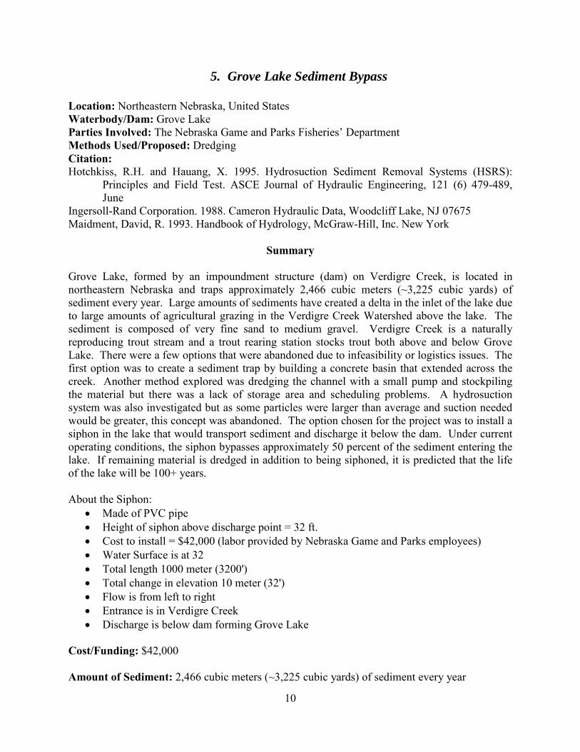
5. Grove Lake Sediment Bypass Location: Northeastern Nebraska, United States Waterbody/Dam: Grove Lake Parties Involved: The Nebraska Game and Parks Fisheries’ Department Methods Used/Proposed: Dredging Citation: Hotchkiss, R.H. and Hauang, X. 1995. Hydrosuction Sediment Removal Systems (HSRS):
Principles and Field Test. ASCE Journal of Hydraulic Engineering, 121 (6) 479-489, June
Ingersoll-Rand Corporation. 1988. Cameron Hydraulic Data, Woodcliff Lake, NJ 07675 Maidment, David, R. 1993. Handbook of Hydrology, McGraw-Hill, Inc. New York
Summary Grove Lake, formed by an impoundment structure (dam) on Verdigre Creek, is located in northeastern Nebraska and traps approximately 2,466 cubic meters (~3,225 cubic yards) of sediment every year. Large amounts of sediments have created a delta in the inlet of the lake due to large amounts of agricultural grazing in the Verdigre Creek Watershed above the lake. The sediment is composed of very fine sand to medium gravel. Verdigre Creek is a naturally reproducing trout stream and a trout rearing station stocks trout both above and below Grove Lake. There were a few options that were abandoned due to infeasibility or logistics issues. The first option was to create a sediment trap by building a concrete basin that extended across the creek. Another method explored was dredging the channel with a small pump and stockpiling the material but there was a lack of storage area and scheduling problems. A hydrosuction system was also investigated but as some particles were larger than average and suction needed would be greater, this concept was abandoned. The option chosen for the project was to install a siphon in the lake that would transport sediment and discharge it below the dam. Under current operating conditions, the siphon bypasses approximately 50 percent of the sediment entering the lake. If remaining material is dredged in addition to being siphoned, it is predicted that the life of the lake will be 100+ years. About the Siphon:
• Made of PVC pipe • Height of siphon above discharge point = 32 ft. • Cost to install = $42,000 (labor provided by Nebraska Game and Parks employees) • Water Surface is at 32 • Total length 1000 meter (3200') • Total change in elevation 10 meter (32') • Flow is from left to right • Entrance is in Verdigre Creek • Discharge is below dam forming Grove Lake
Cost/Funding: $42,000 Amount of Sediment: 2,466 cubic meters (~3,225 cubic yards) of sediment every year

11
6. Louisiana Coastal Restoration Location: Lousiana, United States Waterbody/Dam: N/A Parties Involved: U.S. Army Corps of Engineers and Research and Development Center Methods Used/Proposed: Hydraulic Transport of Sediment Citation: U.S. Army Corps of Engineers and Research and Development Center Website
Summary Application of Long Distance Conveyance (LDC) of Dredged Sediments to Louisiana Coastal Restoration. LDC projects are defined as those Louisiana coastal restoration projects that involve hydraulic transport of slurry (mixture of sediment and water) through pipelines for distances of 16 km (10 miles) or greater. Long distance transport is a mature technology that has been used efficiently for applications like coal and iron ore transport. Cost/Funding: N/A Amount of Sediment: N/A

12
7. Hydro-suction Sediment Removal Systems for Woodside I and Woodside II Dams, Final Report.
Location: Twelvemile Creek, South Carolina, United States Waterbody/Dam: N/A Parties Involved: Department of Civil and Environmental Engineering, Washington State University/South Carolina District of U.S. Geological Survey Methods Used/Proposed: Hydro-suction Sediment Removal System Citation: Appendix F: HEC-6 Sediment Transport Model. 1993. Remedial Investigation Report.
Atkinson, Edmund. 1994. Vortex-Tibe Sediment Extractors. I. Trapping Efficiency
Summary The purpose of this report is to describe Hydrosuction Sediment Removal System (HSRS) alternatives for Woodside I and Woodside II dams (WSI and WSII, Respectively). An HSRS is a pipeline system capable of transporting a water/sediment mixture past a dam using the natural energy represented by the difference in water surface elevations between the upstream and downstream sides of the dam. The bypass alternatives assume the pipeline entrance is located upstream from the dam at a point near where the reservoir begins. Thus, sediment would be intercepted before depositing in the reservoir, and would be passed downstream. Bypass pipeline systems are longer than dredge systems. A dredge system collects sediments near the face of the dam after the sediments have been deposited and moved slowly through the reservoir along the bed towards the dam. It was found to be technically feasible to employ HSRS bypassing or dredging systems to move the annual sediment load past Woodside I and Woodside II dams with no external source of energy other than a winch and pulley system in the case of HSRS dredging. Costs for pipeline and installation vary from about $160,000 for short dredging systems to about $865,000 for the longer bypassing systems. Annual losses to hydropower vary from a low of $3,500 for short dredging systems at both dams to a high value of $11,200 for the longer bypassing systems. The required pipe size for HSRS systems depends upon pipeline length, sediment load and size of grains, and available energy to drive the water/sediment mixture through the pipe. Available energy is represented by the difference between the water surface elevations above the pipe inlet and outlet. Six alternatives were analyzed for the two dams; two for WSI and four for WSII. The range for available head is 38.2-42.05 feet and total pipeline range from 850 -3700 feet. The pipe +installation cost range by the size. The ranges are between $15.90/ft+$17.75ft to $43.50/ft+$30.00/ft. This study use 24 inches and 36 inches diameter pipes. Clogged pipe entrances and pipelines represent the major maintenance issues for HSRS installations. The dredging alternative collection pipeline may also be easily back flushed using a similar pump system mounted on the dam. This research shows that HSRS is a feasible method for maintaining sediment balance both Woodside I and II.

13
The bypassing alternative requires no power sources and will likely intercept 75% of the sediment load. This will cause a decreasing the need for maintenance dredging for flushing near the dam. The dredging systems are very inexpensive and would maintain a 50 foot radius sediment free zone. Cost/Funding: N/A Amount of Sediment: N/A

14
8. Hydro-Suction Sediment-Removal Systems (HSRS) – Principles and Field Test
Location: Elkhorn River, Nebraska, United States Waterbody/Dam: Lake Atkinson, on the Elkhorn River Parties involved: City of Atkinson, the Upper Elkhorn Natural Resources District, the Nebraska Game and Parks Department, the Nebraska Department of Environmental Quality, and the U.S. Army Corps of Engineers Methods Used/Proposed: Hydro-suction Sediment Removal System Citation: Hotchkiss H., Huang X., 1995, Hydro-suction Sediment-Removal Systems (HSRS): Principles
and Field Test, Journal of Hydraulic Engineering
Summary Hydrosuction sediment-removal systems (HSRS) remove deposited or incoming sediments from reservoirs using the energy represented by the difference between water levels upstream and downstream from a dam. Field tests were carried out at Lake Atkinson, on the Elkhorn River, in Nebraska. The field study demonstrated that several different inlet shapes are capable of removing deposited sediment at the rate that it enters the reservoir on an annual basis. The relatively low-cost, low-power requirement system may be designed to either dredge or bypass sediments to downstream receiving waters. Potential benefits include partially restoring pre-dam conditions downstream and extending the life of the project. Increased turbidity levels downstream, similar to those found upstream from the reservoir, may or may not be a negative impact. There are two types of hydrosuction sediment removal. Hydrosuction dredging, in which deposited sediment is dredged and transported to either a downstream receiving stream or to a holding or treatment basin. Hydrosuction bypassing, in which incoming sediment is transported without deposition past the dam to the downstream receiving stream. Conventional methods of hydraulic dredging use a mechanical pump to supply the driving power to remove deposited sediment from a reservoir. Hydrosuction dredging removes sediment from reservoirs using the hydraulic head represented by the difference between the water levels upstream and downstream from the dam. The water-sediment mixture is transported through the pipeline until it is discharged into the relatively clear water that passes the dam through outlets or hydropower turbines. Sediments need not be stored in a spoil area. Two variations of hydrosuction dredging have been used: bottom discharge and siphon dredging. In siphon dredging, the discharge pipe is passed over the top of the dam, and in bottom dredging the pipe passes through low-level outlets at the dam. Both methods may employ a floating barge, which moves the pipeline inlet around the reservoir to access a larger area. Hydrosuction bypassing would employ the same principle to transport sediment, but would feature a permanent inlet station upstream from the reservoir deposition zone to collect the sediment into a pipe or pipelines. The sediment/water mixture is transported through the pipeline and past the dam, where it is returned to downstream receiving waters.

15
In the dredging mode, sediments can be evacuated in order to selectively introduce desirable grain size distributions downstream (assuming contaminants do not preclude introducing the sediments into the receiving waters). The releases are more continuous over longer durations to more closely match clear water release transport capacity, thus reducing the shock associated with flushing techniques. Less water is used, thus conserving reservoir water storage. In the bypassing mode. Any method that reintroduces sediment into downstream waters will increase turbidity. The objective with HSRS techniques is to return the downstream system to its more natural, predam conditions by releasing sediment in accordance with the downstream transport capacity. If the downstream habitats have adjusted to a clearer water regime, HSRS activity will change the system. Whether or not this change is desirable or acceptable must be evaluated on a case-by-case basis. Ancillary facilities for hydrosuction dredging may include a raft or barge to move the pipeline inlet in the reservoir, and externally powered water jet or cutter head at the inlet to break up consolidated sediments (if required), and instrumentation to monitor the operation. For reservoirs larger than a few acres a barge is used for efficient movement of the inlet portion of the pipeline. China to date has the most experience with hydrosuction dredging. The Chinese have used either the siphon or bottom withdrawal modes in 10 reservoirs, beginning in 1975. In all cases, the fertile sediment-laden water was passed into irrigation canals downstream and spread on cropland to replenish the topsoil and recharge the nitrogen content. Often the outlet is attached to downstream irrigation works and spread the sediment-laden water on fields to replenish topsoil and nitrogen content. Objectives can be dredging for restoration of lost storage or hydrosuction bypassing for maintaining storage. Important factors include: sediment location (reservoir sediment surveys should be conducted to determine where sediment deposits are relative to the dam; sediment size characterization: the systems are most effective for transporting fine, non-cohesive materials head and pipeline diameter depend on this, the presence of consolidated sediment and debris will require an externally powered cutter head or jet at the pipeline entrance; contaminants: contaminated sediments may be present in the reservoir, a thorough sampling program should be conducted to determine the extent and toxicity of any contaminants and a land-use history of the watershed can provide important clues as to potential contamination problems; placement of transported sediment, sediment may be passed to downstream receiving waters only if there are no objectionable levels of contaminants present, if there is sufficient clear-water flow to transport the pipeline sediment delivery without significant deposition downstream, and if all permitting activities have been successful; reservoir operation, the HSRS depends on clear-water discharge downstream, if flow only occurs during wet seasons or after heavy rain, the HSRS should be controlled to release sediment only during these times; pipeline diameter selection, pipeline will need to be at least slightly larger than one designed to pass clear-water flow; environmental impacts must be considered such as the effects of increased turbidity levels downstream, changes in water chemistry, and impacts of sediment-removal upstream; all possible regulatory Parties should be contacted early in the proposal phase to fully inform them of plans and possible impacts. Cost/Funding: N/A

16
Amount of Sediment: N/A
9. Lessons Learned from a Dam Failure Location: Village of Chagrin Falls, Ohio, United States Waterbody/Dam: Lower Lake Dam Parties involved: Federal Emergency Management Agency (FEMA), Ohio Department of Natural Resources (ODNR) Methods Used/Proposed: Rebuilding the dam Citation: Evans, James E., Scudder D. Mackey, Johan F. Gottgens, and Wilfred M. Gill. "Ohio Journal of
Science." Lessons from a Dam Failure 100 (n.d.): n. pag. Web.
Summary The IVEX Dam in northeastern Ohio failed on August 13, 1994 after a 70-year rainfall event. The dam was originally built in 1842 and has failed either partially or completely at least five times in 152 years. Before the most recent failure, the dam was 7.4 m (24.5 ft) tall, 33 m (109 ft) wide and attached to bedrock on one side and an earth filled dam on the other. Failure of the dam occurred because of a combination of the following factors: inadequate spillway design, lack of emergency spillway, large loss of capacity from a large amount of sedimentation (86% over 152 years), and poor dam maintenance. The dam failure caused rapid incision of the stream bank and this changed the course of the river westward along the bedrock. Cost/Funding: The cost of rebuilding the IVEX dam was estimated at $1-2.5 million. Amount of Sediment: Accordingly, the total mass of sediment in the reservoir was found to be 246,000 metric tons, or an annual loading of 1,770 metric tons yr1

17
10. Nebraska Valentine Mill Pond Location: Valentine, Nebraska, United States Waterbody/Dam: Valentine Mill Pond (15 acres) Parties Involved: Middle Neobrara Natural Resources District (NRD), Nebraska Department of Environmental Quality, Nebraska Public Power District, Cherry County, Nebraska Game and Parks Commission, Nebraska Environmental Trust, City of Valentine Methods Used/Proposed: Hydro-suction Sediment Removal System Citation: "Nebraska: Valentine Mill Pond." Home. N.p., n.d. Web. 12 Feb. 2014.
<http://water.epa.gov/polwaste/nps/success319/state_ne.cfm#partners>.
Summary Valentine Mill Pond was originally created to power a gristmill. Over the years the capacity of this pond has decreased from 30 acres to 15 acres. The pond has also been added to the Nebraska Department of Environmental Quality section 303(d) list for impairment for aquatic life. Some mechanical excavation of sediment was necessary, but the state needed to control the ongoing accumulation of sediments. The other method used is one designed by Rollin Hotchkiss, PhD. called the “hydrosuction sediment removal system.” The system is a pipeline that catches the sediment as it enters the pond and travels around the dam and is discharged further down the creek. The system is unique because it also does not use any external energy. As a result of sediment removal system, the pond was taken off the 303(d) list in 2003 and serves agricultural needs and supports aquatic life. Cost/Funding: Total Project Cost of $1.6 million Amount of Sediment: Minnechaduza Creek, the pond's water source, was depositing as much as 60 tons of sediment into the lake daily

18
11. Potential for Increasing Storage Capacity in Los Padres Reservoir Location: Carmel River, Monterey County, California, United States Waterbody/Dam: Carmel River (36 miles) Parties involved: The Monterey Peninsula Water Management District (MPWMD) Board of Directors Methods Used/Proposed: Dredging Citation: Bell, Andrew M. "Potential for Increasing Storage Capacity in Los Padres Reservoir." Letter to
David Gutierrez. 8 Apr. 2009. MS. California Department of Water Resources, Sacramento, California.
Summary This letter outlines possible solutions to increase dam capacity. The Los Padres Dam was built in the 1940s and its capacity has decreased from 3,030 acre-feet to 1,760 acre-feet due to sedimentation. The letter outlines 3 different concept possibilities to increase the storage capacity of the reservoir. The first concept is to dredge the sediment that has built up behind the dam. The owner of the dam has asked for a feasibility study for dredging, but the author would like input from the Division of Safety of Dams on this. The second concept is to seasonally raise the reservoir level. This would change the level of the reservoir to make sure that during seasonal periods where precipitation levels or run-off is high, then the reservoir can accommodate these fluctuations. The third option offered to increase the capacity of the dam is to add on to the existing dam or remove and build a new dam. Cost/Funding: Not Provided Amount of Sediment: Not Provided

19
12. Regional Sediment Management
Location: N/A Waterbody: N/A Size of Waterbody: N/A Parties Involved: U.S. Army Corps of Engineers, Institute for Water Resources (IWR) Methods Used/Proposed: Regional Approaches to Sediment Management Citation: USACE, IWR Regional Sediment Management 2010
Summary Implementation of the Regional Sediment Management Approach (RSM) to examine, apply and evaluate opportunities, practices, tools, benefits and impediments to applying regional approaches to sediment management. Lessons from these experiences are used to assist the field in applying the approach and to assist HQUSACE in developing policy and guidance. Progress: Maintaining the navigability of ports and water Stakeholders met to hear their range of perspectives, and identify next steps for dredged material, sediment, and watershed managers to work together more in the future. Themes were protecting the environment; Conservation and restoration of estuaries and associated resources; Protecting water quality; Maintaining reservoir capacity ; Reducing flood and coastal storm damage; Managing watersheds; Managing coasts. Cost/Funding: Not Provided Amount of Sediment: Not Provided
20
13. Reservoir Conservation RESCON Volume I Location: Algeria, China, Japan, Sudan, Switzerland, United States Waterbody/Dam: Various Reservoirs Parties Involved: N/A Methods Used/Proposed: Research study Citation: Palmieri, Alessandro, Farhed Shah, George W. Annandale, and Ariel Dinar. "The RESCON
Approach." Reservoir Conservation 1 (2003): 1-102.
Summary This book outlines the principal methods and provides references for further information on alternatives for managing reservoir sedimentation. Each reservoir site has its own constraints and not all alternatives will be suitable. This book provides some guidance as to the applicability of the various alternatives. This research develops a computer model called RESCON. The model helps to evaluate at the pre-feasibility-level the technical and economic feasibility of implementing the life cycle management approach. The results from the economic optimization routine identify the preferred sediment management technique for sustainable use of the water resource infrastructure. Before the RESCON model is used to assess the options available for a dam or a suite of dams, it is advisable to undertake a preliminary screening to include: watershed management potential; environmental and social considerations; potential for mechanical removal; and reservoir operation. There are numerous ways of managing and mitigating reservoir sedimentation problems. These include measures to: reduce sediment inflows into the reservoir; manage sediments within the reservoir; evacuate sediments from the reservoir; replace lost storage. Each measure can be further sub-divided and each has technical, environmental and economic benefits and consequences. Each has been used for managing sedimentation problems around the globe and sufficient expertise and tools are available for their technical appraisal at the feasibility level and beyond. Cost/Funding: Not Provided Amount of Sediment: Not Provided
21
14. Reservoir Conservation RESCON Volume II Location: Various countries Waterbody/Dam: Various Reservoirs Parties Involved: N/A Methods Used/Proposed: Flushing, Hydro-suction Sediment Removal System, Dredging & Trucking Citation: Shigekazu Kawashima, Tamara Butler, Farhed Shah, and George W. Annandale. "The
RESCON Approach." Reservoir Conservation 2 (2003): 1-102
Summary Volume I of the book outlines the RESCON approach to reservoir sedimentation management. Volume II details the mathematical model that has been developed as part of the RESCON research. The following sediment removal techniques can be considered: Flushing; Hydrosuction (HSRS); Traditional Dredging; Trucking; In addition, net economic benefits of the scenario involving “No sediment removal” are also computed as the benchmark case. RESCON approach is to select a sediment management strategy that is technically feasible and also maximizes net economic benefits. The solution may be 1. SUSTAINABLE, where reservoir capacity is maintained in perpetuity, or 2. NON-SUSTAINABLE, where the reservoir fills with sediments in finite time. 2a. the dam is decommissioned at an optimally determined time allowing the salvage value (=cost of decommissioning minus any benefits due to decommissioning) to be collected at this time; or 2b.the dam is maintained as a “run-of-river” project even after the reservoir is silted. Cost/Funding: Not Provided Amount of Sediment: Not Provided

22
15. Robles Diversion Dam HFB Study Report Location: Ventura, California, United States Waterbody/Dam: Ventura River (16.5 miles) Parties Involved: U.S. Department of the Interior Bureau of Reclamation Methods Used/Proposed: High Flow Bypass Citation: Mefford, Brent, Hillary Stowell, and Chuck Heinje. "Hydraulic Laboratory Report ." Robles
Diversion Dam High Flow and Sediment Bypass Structure Physical Model Study (2008): 1-72
Summary
This report presents the results of a Bureau of Reclamation hydraulic model study of the proposed high flow bypass (HFB) spillway for Robles Diversion Dam. Robles Diversion Dam is located on the Ventura River approximately 14 river miles from the ocean. A 1:20 Froude-scale model of the proposed facility was tested to determine the interaction of flows and bed load sediments near the facility following decommissioning and removal of Matilija Dam located about two river miles upstream. The HFB spillway was proposed to enhance sediment movement through the diversion pool thereby reducing the impacts of elevated bed load levels resulting from the upstream dam removal. A new auxiliary fishway and 1.5 ft dam raise associated with the HFB is also proposed to improve upstream fish passage at the diversion dam during HFB operation. Cost/Funding: Not Provided Amount of Sediment: Not Provided
23
16. San Clemente Dam to Come Down Location: Carmel River, Monterey County, California, United States Waterbody/Dam: Carmel River (36 miles) Parties Involved: Department of Water Resources Division of Dam Safety, Coastal Conservancy, Public Utilities Commission Methods Used/Proposed: Removing the dam Citation: Lopez, Daniel. "San Clemente Dam to Come down." MontereyCountyTheHerald.com. N.p., 14
Nov. 2009. Web. 16 July 2012. Summary
California American Water says it will tear down San Clemente Dam on the Carmel River. The purpose of the dam is to provide a diversion point for water withdrawal in the area. The dam is 106 feet tall concrete arch and the reservoir it creates originally held 1,425 acre-feet of water but has now been reduced to 125 acre-feet due to sedimentation. This has created a dam safety issue because the dam could now fail from a seismic episode because of pressure against the dam or flooding because of the low capacity of the reservoir. Other options included rerouting the river via a bypass to avoid the accumulated sediment and reinforcing the current dam by “buttressing” (reinforcing the dam by adding supports with rock or concrete structures) Environmentalists favor the dam removal because it is the greatest benefit to the river ecosystem. Dam removal is set to begin January 2013 and finish in three years. Cost/Funding: $84 million Amount of Sediment: Not Provided

24
17. Savage Rapids Dam Sediment Evaluation Study Location: Savage Rapids Dam, Rogue River, Oregon, United States Waterbody/Dam: Rogue River (215 miles) Parties Involved: The Bureau of Reclamation Methods Used/Proposed: Removing the dam, construction of two pumping plants Citation: Department of the Interior Bureau of Reclamation. "Josephine County Water Management
Improvement Study, Oregon." Savage Rapids Dam Sediment Evaluation Study (2001): 1-37
Summary
Savage Rapids Dam is located in southwestern Oregon, on the Rogue River, 5 miles upstream from the town of Grants Pass. The dam, owned by the Grants Pass Irrigation District (GPID), is 39 feet high and has been diverting irrigation flows since its construction in 1921. Fish ladders on the dam are old, do not meet current National Marine Fisheries Service (NMFS) fisheries criteria, and delay migrating fish. In addition, the fish screens on the north side of the dam do not comply with current NMFS fisheries criteria. Construction of two pumping plants to deliver irrigation water and removal of the dam are proposed to alleviate these fish passage problems. The pumping plants would be located immediately downstream from the fish ladders to enable GPID to deliver water to its patrons through the existing irrigation canals. The process leading to this proposal is documented in a planning report/final environmental statement (PR/FES) filed on August 30, 1995. The PR/FES focused only on salmon and steelhead passage concerns at the dam and associated diversion facilities. The Bureau of Reclamation planned to do a detailed sediment study as part of predesign activities if the Congress approved removal of the dam and provided the necessary funding. The purpose of this study was to determine the potential sediment-related impacts associated with removing the dam. Cost/Funding: Not Provided Amount of Sediment: 200,000 cubic yards
25
18. Sediment Build-up Causes Environmental Concerns Location: Jackson County, North Carolina, United States Waterbody/Dam: N/A Parties Involved: U.S. Fish and Wildlife Services Methods Used/Proposed: Dredging, removing the dam Citation: Johnson, Becky. "Sediment Build-up Causes Environmental Concern." Smoky Mountain News.
N.p., 18 July 2007. Web. 16 July 2012. Summary
Removal of the Dillsboro Dam by unleashing of sediment backed behind the dam. Estimates peg accumulated sediment behind the dam at more than 100,000 cubic yards. Duke Power initially was not going to remove the sediment before taking out the dam, but instead planned to let it wash down stream in stages as the dam came down. “The plan for Dillsboro Dam removal calls for the sediment, or sand, behind the dam to be allowed to move down river as it would have naturally,” said Fred Alexander, the Duke Power spokesperson who works out of the utility’s Franklin office. “The proposal from Duke initially was they could flush the sediment downstream, but because of our concern for the Appalachian elktoe mussel, an endangered species downstream from the dam, we think it is best to go ahead and get that sediment removed and no subject the lower part of the river to any more sedimentation,” Cantrell said. Cost/Funding: Not Provided Amount of Sediment: more than 100,000 cubic yards

26
19. Sediment Task Force Recommendations Location: United States Waterbody/Dam: Susquehanna River Dams (464 miles) Parties Involved: Susquehanna River Basin Commission Sediment Task Force Methods Used/Proposed: Stream restoration and stabilization, sediment trapping structures, sediment transport assessment, stream bank/channel stability assessment, riparian buffers, natural and reconstructed wetlands Citation: Sediment Task Force Recommendations. Rep. no. 221. Susquehanna River Basin Commission
Sediment Task Force, June 2002. Web. 16 July 2012. Summary
Riverine management recommendations are focused on stream restoration and stabilization, riparian buffers, and natural and constructed wetlands in the Susquehanna River. As is the case with the upland recommendations, emphasis is placed on the use of best management practices (BMPs) and natural systems to slow the speed of water runoff, thus limiting its erosive effects. Since energy builds as water moves downstream toward the Bay, equal attention must be paid to streambeds and floodways as is paid to flow originating from land sources. Upland recommendations address agricultural, forest, mining and urban lands, as well as transportation systems. To date, most BMPs have focused on nutrient pollution, particularly those on agricultural lands. BMPs will have to be expanded to address both nutrients and sediments, and existing practices must be evaluated to determine their effectiveness in controlling both. For urban lands, recommendations are made for promoting innovative, environmentally-sensitive site design measures, ground-water recharge, improved water quality, stream channel protection, and enhanced watershed management of stormwater and floodways. First, a feasibility study is recommended to determine if dredging the reservoirs is a viable option to maintain or reduce the volume of sediment currently trapped behind the dams. Other alternatives, including sediment bypassing, sediment fixing, and modified dam operations, were considered, but dismissed. Cost/Funding: Not Provided Amount of Sediment: As of 1990, the total amount of sediment trapped by the dams was estimated at 259 million tons.

27
20. Sediment Trap Assessment, Saginaw River, Michigan Location: Saginaw, Michigan, United States Waterbody/Dam: Saginaw River Waterbody/Dam Size: 22.4 miles Parties Involved: U.S. Army Corps of Engineers, Detroit District Methods Used/Proposed: Sediment trapping Citation: Sediment Trap Assessment Saginaw River, Michigan. Rep. Madison: W.F. Baird & Associates,
2001. W.F. Baird & Associates Ltd., Dec. 2001. Web. 16 July 2012
Summary
This report describes the assessment of sediment traps along the Saginaw River, MI, using existing numerical models and theoretical analysis. The studies indicated that most of the clay and silt from upstream passes through the federal channel and settles in Saginaw Bay, while most of sand settles in the river over the entire length of the channel. A theoretical analysis was conducted on bottom shear stress. Shear stress is usually used to describe the hydrodynamic force acting on the sediment bed. Bottom shear stress can be determined by the following formula:
Comparing the model results with the theoretical analysis, it was found that the trap efficiency estimated using the theoretical analysis (called “theoretical efficiency” below) was generally close to that estimated using the HEC-6 model (called “modeling Efficiency” below). However, the theoretical efficiency of total sediment is less than modeling efficiency. This probably results from different incoming sediment data used in the theoretical analysis and the HEC-6 modeling. The theoretical analysis was based on the total incoming sediment load at the upstream boundary of the HEC-6 model, which is significantly less than the sediment load passing through the upstream edge of the traps in the model because sediment erosion occurs in the upstream reaches of the river and more sediment is carried downstream. In summary, the proposed sediment traps capture incoming sediment with varying degrees of success depending on the trap dimensions and incoming grain sizes. These traps are located in the river segment where there is a sediment deposition environment. The developed theoretical analysis and HEC-6 modeling can be used for sediment trap design and assessment of trap efficiency. The theoretical analysis approach was verified by the HEC-6 modeling results and can be used to quickly and roughly assess trap efficiency. The HEC-6 model requires more effort to prepare the input data and process output data and can be used to assess the trap efficiency for final design. Cost/Funding: Not Provided Amount of Sediment: Not Provided

28
21. Using Adaptive Management at Glen Canyon Dam Location: Colorado River, Arizona, United States Dam: Glen Canyon Dam (1,560ft x 710ft) Waterbody: Colorado River (1,450 miles) Parties Involved: U.S Department of the Interior’s Bureau of Reclamation, U.S. Geological Survey’s Methods Used/Proposed: Pipeline to transport sediment Citation: Kubly, Dennis M. "Using Adaptive Management at Glen Canyon Dam." Renewable Energy
World.Com. N.p., 21 Oct. 2009. Web. 16 July 2012. <http://www.renewableenergyworld.com/rea/news/article/2009/10/using-adaptive-management-at-glen-canyon-dam>.
Summary
Glen Canyon Dam is located on the Colorado River and the dam’s main purpose is to store and release water to generate electricity. In 1992, Congress passed the Grand Canyon Protection Act which required operation of Glen Canyon Dam to protect natural resources while continuing to deliver water for hydroelectricity. Since the Colorado River is now controlled, sediment has now collected behind the dam and affects area beaches and wildlife both below the dam, namely, the fine sediment downstream that forms sandbars and habitat for rearing of native fish. One such fish is the endangered humpback chub whose whole population resides here and has seen a 50% decline in adult abundance in the area. Currently the scientists are testing whether high flow releases can release some of the sediments and they can be used to rebuild the beaches. If the water is released at high flow, it will create some movement of some sediment behind the dam, but it will also agitate some of the sand below the dam and replenish some of the beaches that had eroded. There is concern that the sediments that are used to replenish the beaches will erode sediment that is above the natural flow lines of the river. The Adaptive Management Program has done a feasibility assessment for a pipeline to transport fine sediments upstream of the dam that will either empty at the bottom of the dam or 16 miles downstream. There has been no action on this assessment from this point. Cost/Funding: This appraisal-level assessment indicates an initial cost range of $140 million to $430 million, plus $3.6 million to $17 million a year for operations. In addition to the large commitment to capitol funds, reclamation would have to determine where the money would come from for operations. However, this must be compared with the estimated cost increases of $15.2 million to $44.2 million as a result of changing operation of the dam to accommodate the preferred alternative in the 1995 EIS, as well as the financial cost to utilities (as a result of lost generation) of $89.1 million per year Amount of Sediment: Not Provided

29
22. Managing Sediment in Utah’s Reservoir Location: Utah Reservoirs, Utah Waterbody/Dam: Wide Hollow Reservoir, Gunlock Reservoir, Millsite Reservoir, Piute Reservoir, Otter Creek Reservoir, First Dam, Quail Creek Diversion Dam Waterbody/Dam Size: N/A Parties Involved: Utah Department of Natural Resources Methods Used/Proposed: Upstream trapping, construction, mining, logging, grazing Citation: Utah Division of Water Resources, comp. Managing Sediment in Utah's Reservoirs. Rep. Utah
Department of Natural Resources, Mar. 2010. Web. 16 July 2012. Summary
Utah has a long and continuing tradition of watershed management, which, in addition to other benefits, reduces erosion. Today’s efforts are sponsored by a cadre of federal, state and local Parties. Other than this, Utah does not have any coordinated efforts to assess or manage reservoir sedimentation. In addition to watershed management, there are methods to deal with sedimentation which are not being employed. Dam owners would benefit from implementing these methods in order to keep reservoirs sustainable. Several sediment management methods are described in this chapter. Optimal results will require some combination of methods. The chapter also discusses how to deal with sediment at diversion dams and other water infrastructure. Watershed management can significantly reduce the amount of sediment that reaches a reservoir. Such management involves protecting the ground from erosion with vegetation, land terracing, and channel stabilization. It also includes the control and scheduling of activities such as construction, mining, logging, and grazing. Cooperation among state and federal Parties that manage public lands, such as with the Utah Partners for Conservation and Development, helps fund and implement projects that limit erosion. Upstream trapping is another way to reduce the amount of sediment reaching the reservoir. This includes constructing hydraulic structures such as natural vegetation filters, check dams, detention basins and upstream reservoirs that trap sediment. Another option is to build the reservoir off of the main stream channel and selectively divert the waters that fill it. This entails directing clear water into the reservoir, primarily during non-flood conditions, while sediment-laden waters are bypassed. Constructing wetlands upstream of the reservoir also helps remove sediment from the stream. Cost/Funding: Not Provided Amount of Sediment: Not Provided

30
23. Reservoir Sedimentation Handbook
Location: N/A Waterbody: N/A Size Waterbody: N/A Parties involved: N/A Methods Used/Proposed: Sustainable sediment management Citation: Morris, Gregory L. and Fan, Jiahua. 1998. Reservoir Sedimentation Handbook, McGraw-Hill
Book Co., New York.
Summary This handbook seeks to generate an awareness of sedimentation problems, outlining practical strategies for their identification, analysis and management. Basic concepts and tools are presented which, when applied in an integrated manner, can achieve sustainable sediment management in reservoirs. Sedimentation is the single process that all reservoirs worldwide share in common, to differing degrees, and the management strategies and techniques presented are applicable to reservoirs of all ages, types, and sizes. An understanding of these principles will also aid in the effective design and management of sediment-trapping structures such as debris basins and detention ponds. Cost/Funding: Not Provided Amount of Sediment: Not Provided
31
OVERSEAS
1. China’s Challenge Location: Chang Jiang, Yangzi/Huang He Waterbody: the Yangtze River (3,915 mi)/Yellow Sea Dam: Gezhouba Dam (8,514 ft x 154 ft)
Three Gorges Dam (7,661 ft x 594 ft) Parties Involved: N/A Methods Used/Proposed: Drawdown, flushing, sluicing, turbidity currents, dredging Citation: DiFrancesco, Kara. "China's Challenge." Water Power Magazine Apr. 2001: 26-28.
Summary
Objective: to maximize hydropower production and the environmental concerns for maintaining the ecological health of the downstream fish reserve utilizing turbidity currents to passing sediment through the Jinsha dams appears to be the most viable sediment management option. Precipitation patterns result in highly variable seasonal sediment yields, sediment transported occurs during wet season between May and October. The high sediment yields pose threats to the performance of the two existing dams on the Yangtze mainstem (Gezhouba and Three Gorges Dam). Every year starting from 2003, approximately 100-150 million tons of sediment has been trapped in the Three Gorges reservoir. The four-dam cascade partially under construction in the high sediment yield portion of the Jinsha Jiang above the Three Gorges dam poses particular concern for the upper Yangtze Rare and Endemic Fish Nature Reserve. Two of the four dams China Three Gorges Corporation plans to build are already under construction (Xiluodu, XD, and Xiangjiana, XJB), while the most upstream dams are still in planning phases (Wudongde, WDD, and Baihetan, BHT). When completed, the four-dam cascade will provide 43km3 of water storage capacity, with an installed hydropower capacity of 38,500 MW, about double that of the Three Gorges Dam. Upon completion of the cascade the majority of sediment is trapped in the most upstream dam, Wudongde, with less than 4% of sediment in Xiangjiaba’s drainage basin passed downstream. The most upstream dam, Wudongde, experiences the greatest sedimentation impacts which affect the performance of the entire cascade due to the coordinated operation scheme for the dams. Management options: Implementing sediment management strategies requires assessment of the short term loses versus long term gains of sediment management, in term so both economic performance and downstream sediment impacts. The four main sedimentation control strategies utilized:
I. Drawdown and Flushing II. Storing the clear water and releasing (sluicing) the turbid water III. Releasing turbidity currents IV. Dredging
32
Utilizing turbidity currents presents an opportunity to release sediments through a dam without drawing down the reservoir, thus resulting in much less significant hydropower losses. Releasing turbidity currents by strategically opening the bottom sluice gates to pass highly concentrated flows through the reservoir presents the best possibility to release sediment downstream with minimal effect to operations and in line with the downstream environmental objectives. A potential strategy to address these issues is to use the most upstream reservoir to create optimal conditions for inducing turbidity currents in the downstream dams. Cost/Funding: Not Provided Amount of Sediment: Approximately 100-150 million tons annually

33
2. Going Full Circle Location: Pakistan, Japan, Switzerland, United States, Nepal, South Africa, Puerto Rico Waterbody/Dam: Pakistan: Tarbela Dam California: Cogswell Dam Japan: Katagiri Dam, Miwa Dam Switzeland: Gebidum Dam South Africa: Nagle Dam, First Falls Dam Puerto Rico: Fajardo Dam Nepal: Kulekhani Reservoir Parties Involved: N/A Methods Used/Proposed: Re-vegetation, warping, contour farming, check dams, bypassing, sluicing, density current venting, dredging, dry excavation, hydro-suction, drawdown flushing, pressure flushing Citation: Annandale, George . "Going Full Circle." Water Power Magazine Apr. 2001: 30-34.
Summary
Conventional Civil Engineering Design. Design life and the life cycle approaches. Overall concept: reduce the amount of sediment flowing into a reservoir; create conditions that will prevent or minimize the deposition of sediment in a reservoir. Dams need to be constructed so operators have the flexibility to regularly remove sediments from reservoirs. Practical Methods proposed to reduce sediment yield from catchments: Re-vegetation: used but not as effective Warping: technique often used in China where river water with high sediment loads is diverted onto agricultural land. The sediment deposition on the land enhances its agricultural value. However, in large rivers the amount of sediment diverted is only a small portion of the total annual sediment load so it does not necessarily significantly reduce the amount of sediment carried by a river. Contour farming: benefits agriculture but contribution to reduce sediment yield is small. Check Dams: implemented as sediment management measure upstream of dams. Require regular maintenance such as removal of deposited sediment. Check dams are generally applied in series to increase the amount of sediment they can capture. Bypassing: divert sediment carrying water around reservoirs and prevent it from entering and depositing sediment in the reservoirs. Use of bypass tunnels, modification of river channels and using off-channel storage. Implemented in Switzerland (5 bypass tunnel schemes) and Japan (4 bypass tunnel schemes).
34
Sluicing: sediment laden flows are released through a dam before the sediment particles can settle. Consists of maintaining high sediment transport carrying capacities in the water flowing through a reservoir. Density Current Venting: deposition of this sediment can be prevented by releasing the density current downstream of the dam. This is accomplished by installing low levee gates at the dam. Dredging: Dry Excavation: Removal of deposited sediment by dry excavation consists of draining the reservoir and using conventional excavation equipment to load deposited sediment into trucks for removal from the reservoir. Hydro-suction: employs dredging equipment with sufficient hydrostatic head over a dam to create suction at the upstream end of the discharge pipe. This suction is then used to remove the deposited sediment. Drawdown Flushing: complete drawdown of a reservoir to re-suspend deposited sediment and flush it downstream. Pressure Flushing: used to remove sediment directly upstream of an outlet by opening the outlet without drawing down the water surface elevation. Cost/Funding: Not Provided Amount of Sediment: Not Provided

35
3. Life of Maithon Reservoir, India Location: Damodar River, India Watebody: Barakar River (140 miles) Parties Involved: N/A Methods Used/Proposed: Rising reservoir bed levels, filling the dead storage with silt, siltation trap Citation Chaudhuri, Dipankar. "Life of Maithon Reservoir on Ground of Sedimentation: Case Study in
India." Journal of Hydraulic Engineering (2006): 875-880.
Summary Barakar is the main tributary of the Damodar River, in which two multipurpose reservoirs at Tilaiya and at Maithon have been built up in series. The Maithon Reservoir was first ponded in 1957 just after impounding the Tilaiya Reservoir in 1953. Sedimentation studies were done to determine the trap efficiency and the silt contribution. What was done: Filling of Dead Storage: To get an idea of the time required to fill the dead storage zone of the reservoir with silt, a sediment distribution study was carried out by different methods. The trigonometric method is a graphical method, in which capacities at different elevations are reduced in the ratio of depth of reservoir with reference to sediment zero elevation and that with reference to original streambed level. Rising of Reservoir Bed Levels: It is time to take care of regular flushing operations through the under sluices to create a channel in the reservoir, which will transport the silts downstream without settling at the upstream mouth of the sluices. Similarly, it is presumed that reservoir bed level at sediment zero level of 125.6 million tons will encroach the elevation of the center line of by the year 2022. It is also to note that the water supply intake of the Chitaranjan Locomotive Workshop at Chitaranjan, State West Bengal, India exists around the reservoir elevation of 134.1 feet, which may be affected beyond the year 2046 due to the deposition of sediment. Future Strategies: From the above scenario, it was determined that a siltation trap should be constructed immediately at the upstream of Maithon. Therefore it has been proposed to construct Balpahari Dam at about 50 km upstream of the Maithon Reservoir having catchments of 4,400 km2. There will definitely be an impact upon siltation at the Maithon Reservoir due to construction. This study shows that the existing sediment deposition rate at the Maithon Reservoir will be reduced to about 1.5 mm3/year due to implementation of the Balpahari project. Cost/Funding: Not Provided Amount of Sediment: Not Provided
36
4. Measures against Reservoir Sedimentation Switzerland Location: N/A Waterboday: N/A Parties Involved: N/A Methods Used/Proposed: Building new dam Citation: Jenzer Althaus , Jolanda , Giovanni De Cesare, and Anton Schleiss. "Measures Against
Reservoir Sedimentation." Energy Planet [France] 26 June 2009: n. pag. The Energy Center's Newsletter. Web. 15 May 2010.
Summary
The process of sedimentation is a severe threat to the artificial lakes serving as reservoirs for hydro-power production, drinking water supply or flood protection. A potential solution is to release the sediments out of the reservoir in a continuous way in order to assimilate the natural conditions before the dam construction. This can be done without losing water volume, by releasing sediments through the turbines. To get the sediments entrained in the turbined water, they need to be kept in suspension right in front of the water intake. Additionally there is potential to increase the reservoir capacity by the construction of new dams. Because of the ecological and operational aspects due to the increased sediments impact, an upper limit of sediment concentration needs to be defined, and the outflowing sediment concentration has to be regularly monitored and controlled. The sediment transport capacity in headrace tunnels and penstocks has to be evaluated as well. Cost/Funding: Not Provided Amount of Sediment: Not Provided
37
5. Reservoir of Fear, China Location: India Waterbody/Dam: Three Georges Dam, Yangtze River Basin (3,915 miles) Parties Involved: N/A Methods Used/Proposed: Failing dam Citation: Oster, Shai. Wall Street Journal [New York, N.Y.] 29 Aug 2007: A.1.
Summary After a year after completion of the project, the Yangtze River Basin has problems including landslides, water pollution and suggestions that the dam could contribute to the very flooding it was built to prevent. The massive weight behind the Three Gorges Dam has begun to erode the Yangtze’s steep shores at several spots along with frequent fluctuations in water levels, has triggered a series of landslides and weakened the ground under Miaohe, a village 10 miles up the reservoir. Additional dangers: as the dam blocks silt heading downstream, the Yangtze River estuary region is shrinking and sea water is coming further inland. Across the country, millions of tons of raw sewage, industrial waste and fertilizer runoff have turned lakes into algae-covered cesspools. According to official statistics, more than half of China's major waterways are so polluted that fish are dying or water is unsafe for drinking or irrigation. More than 300 million people -- almost one-quarter of the population -- lack access to clean drinking water. The changes can be seen here in Miaohe, where villagers have grown oranges from gnarled trees and farmed the area's steeply terraced rice paddies for generations. Miaohe's 100 or so residents narrowly avoided the mass relocations that accompanied the dam's construction, when some 1.3 million people moved from their homes to make way for the reservoir. After early May rains raised reservoir levels again, there were four landslides in five days not far from Miaohe village. Villagers say they heard timbers in their houses began to split. In June 2003, two weeks after the Yangtze River was impounded and the reservoir began to fill. While water levels rose, passing 300 feet and approaching 450 feet, the valley's slopes started eroding under the pressure of the water. Cost/Funding: $22 billion Amount of Sediment: The Yangtze carries some 500 million metric tons of silt into the gorges each year.
38
6. Reservoir Sedimentation and Sediment Management in Japan Location: Ibaraki-ken, Japan Waterbody: N/A Parties Involved: N/A Methods Used/Proposed: Sediment flushing, bypassing, excavating, dredging, discharging turbid water, emptying the dam Citation: Kashiwai, Josuke. Reservoir Sedimentation and Sediment Management in Japan. Tech.
Hydraulic Engineering Research Group, Incorporated Administrative Agency, Public Works Research Institute, n.d. Web. 16 July 2012.
Summary Issue in Japan: rapid loss of sediment capacity compared to original estimates; aging of reservoirs; in planning sedimentation condition and specific site conditions where the sediment inflow volume is too large to plan the sediment capacity. What has been done?
I. Mountain and foot of a mountain area, alluvial fan –steep and rapid flow a. hillside works: reducing sediment yield from hillside slope b. check dam: conserving forest area, preventing excess sediment flow to areas
downstream c. retarding basin: preventing excess sediment flow to areas downstream d. countermeasures for reservoir sedimentation: reducing reservoir sedimentation
II. Areas downstream a. foot protection works: stabilizing embankment b. groundsill: preventing scoring, stabilizing riverbed c. prohibition of sand and gravel removal: preventing riverbed degradation d. riverbed excavation: preventing riverbed aggradation, conserving water quality e. spur dike: restoration of pools
III. Coastal area Most of the activities have executed for the problems of coastal erosion from 60’s. Several reasons are considered for the erosion such as littoral transport direction change by coastal structures, sediment supply reduction by sand and gravel removal in rivers and dam construction etc. Including: wave absorbing works, jetty, offshore breakwater, artificial reef, head land , sand bypass, artificial nourishment
Methods around dam reservoirs:
I. Sediment flushing Draw down operation is executed for flushing large amount of sediments. Partially draw down operation is also executed to control released sediment volume or recover store water.
II. Sediment bypassing There are both cases. Bypassing wide range of grain size and fine sediment only.
III. Excavating and dredging
39
60% of removed sediment is effectively used. Some dams have tried to resettle in river area of dam downstream for flushing during flood.
IV. Discharging turbid water Outlet conduits, selective withdrawal facilities or special structures to release turbid bottom water are used.
V. Empty dam Gateless bottom outlets are placed near riverbed elevation if a dam is planed only flood control. Main purpose of the operation or test operation is different by each example. Results of the operation or test operation, however, have various phases such as countermeasures of sedimentation, sediment supply method to the areas downstream, influential activity on river eco-system conditions and so on. We have to find the position of the activity in the sediment transport system. That may be obtained by the concept of integrated sediment system management.
Cost/Funding: Not Provided Amount of Sediment: Total volume of resent reported annual sedimentation is about 20 million m3. Other survey shows annual removal volume from reservoirs is about 3.9 million m3
.

40
7. Reservoir Sedimentation Management in Asia Location: Japan, China, India Watebody/Dam: China: Dujiangyan, Three Gorges Dam, Tianjiawan Reservoir Japan: Asahi Dam, Dashidaira Reservoir India: Baira Reservoir, Uri Hydropower Project Parties Involved: Department of River & Coastal Engineering, Hydro-soft Technology Institute, Foundation of River & Watershed Environmental Management Methods Used/Proposed: Mechanical hydraulic dredging Citation: Jian Liu, Bingyi Liu, Jazuo Ashida, Reservoir Sedimentation Management in Asia Accessed this paper via Database on 7/16/2012. However, this is no longer available. Please contact USACE for an electronic copy of this paper.
Summary
This research was done in several Asian nations. China and India are losing 2.3% to .5% storage capacity annual because of low forest cover and erosion. About 86,000 reservoirs with a total capacity of 560 billion cubic meters were constructed by the end of 1999. The area of erosion is 3.67 million square kilometers. The soil erosion is widely distributed throughout China. Mechanical hydraulic dredging such as siphon and airlift system is employed for fine and medium sediments. The siphon system makes use of difference between water level upstream and downstream of dam to remove sediment. The dredging cost is relatively cheap. Dredging unit cost .045-.22 (RMB/cubic meters). From this research it is recommended that the sedimentation strategies should be worked out during the planning and design phases for sustainable use. For the reservoirs with very high sedimentation rates, the decommissioning of dams and dredging such as siphon dredging and mechanical dredging are likely good choices. In addition, the environmental impacts should be considered comprehensively when the sediment flushing and dredging measures are performed. Cost/Funding: Not Provided Amount of Sediment: Not Provided

41
8. Sediment Bound Nutrient, Sudan Savanna Zone of Ghana Location: Sudan savanna zone, Upper East Region of Ghana Waterbody: Dua, Doba, Zebilla, Kumpalgogo, and Bugri Reservoirs Parties Involved: Department of Crop and Soil Sciences Methods Used/Proposed: sampling Citation: Amegashie, Bright K., Charles Quansah, Wilson A. Agyare, Lulseged Tamene, and Paul L.G.
Vlek. Lakes & Reservoirs: Research and Management (2011): 61-76. Blackwell Publishing Asia Pty Ltd, 2011. Web. 16 July 2012.
Summary
Issue in Sudan, Savanna zone of Ghana: many small reservoirs were constructed to capture the water from rainfall. However, most of them may not last for half of their expected useful design lifetime because of the off-site siltation effects of erosion from their catchments. Study involved five representative small reservoirs in the Upper East Region of Ghana. Variety of sampling was taken at all five locations. Certain soil chemical and physical analysis was determined after analyzing the data collected. Differences in soil type, topography, rainfall-run-off characteristics, crop cover, organic matter content of soils and soil management practices, among other factors, can result in considerable spatial variability in the nutrient content of the various catchment soils and reservoir sediments. Sediments, organic materials and nutrients transported from watersheds to reservoirs are a primary cause of water quality degradation. These pollutants pose a potential threat to human and livestock health, cause decreased reservoir volume because of sedimentation and result in lost user benefits. Catchment area protection is needed to control erosion from the catchments and to reduce both on-site (fertility and productivity loss) and off-site (sedimentation and pollution) impacts of erosion. These measures may include adopting appropriate soil and water conservation practices, such as afforestation, improved vegetative cover with recommended cover and forage species, sustainable land management practices, and vegetative barriers (vetiver) around reservoirs. Desilted nutrient-rich sediments could be used as a soil amendment to improve the productivity of catchment soils. This possibility will require field experimentation to ascertain the benefits of these sediments in enhancing crop yields and biomass production. However, the heavy metal, pollutant and pathogen contents of the desilted sediments must be ascertained through further studies before they are used freely as soil amendments. Cost/Funding: Not Provided Amount of Sediment: Not Provided

42
9. Sediment Management at Naodehai Reservoir, China
Location: Liu River in China Waterbody: Naodehai Reservoir Parties Involved: Chaoyang Research Institute of Measurement Technology Methods Used/Proposed: Reforestation and debris dams construction, drawdown flushing Citation: World Water and Environmental Resources Congress 2003. Downloaded from ascelibrary.org by
WPC on 07/06/12
Summary China has the world’s biggest annual loss rate of reservoir storage capacity because of the low forest cover and high erosion. A lot of sediment control measures such as catchment management, routing, flushing and dredging have been developed and used to overcome the reservoir sedimentation problems. The catchment management mainly includes watershed management and water and soil conservation projects such as plantation and debris dams. The water and soil conservation is the most fundamental step to reduce the amount of sediment entering a reservoir, though it is very expensive. Routing, which generally consists of sluicing, bypassing, off-stream reservoir, sediment excluding structures and release of density current, is an effective approach for reducing sediment deposition in a reservoir. The sluicing operation mode is used for the reservoirs where large inflows and low water levels are available. This mode is generally performed by keeping the reservoir at a low water level to pass through the high sediment water during the flood season. The efficiency of sediment removal by sluicing is less than that by flushing, but it is better choice for a multipurpose project. Flushing that re-entrains deposited sediments and passes the sediment-laden flow through low level outlets in the dam is the most economical method to restore the lost storage capacity. This requires lowering water level in the reservoir and consumes significant quantities of water, but it is capable of removing even coarse sediments under certain circumstances. Dredging is very expensive and it should be seen as a last resort as the removal and disposal of existing deposits often create new social and environmental problems. Hydrosuction sediment removal system is widely used for small and medium-sized reservoirs. The hydrosuction system makes use of the difference between water levels upstream and downstream of a dam to remove sediment through a floating or submerged pipeline linked to an outlet or discharging over the dam. In order to reduce the environmental impacts of flushing and density currents on downstream river channel, the mitigating measures such as fish refuge works, bank protective works and flushing in concert with other reservoirs on the same river have been taken since 1970s. In order to reduce the sediment yield and deposition in the downstream channel, the catchment management, such as construction of debris dams, reforestation and modification of the reservoir operation mode have been studied and performed since 1971. Reforestation and debris dams are further planned and constructed to reduce the sediment yield in the basin. The 6.5-15m high debris dam generally creates a storage capacity of 0.1 to 20 mm3, and there are 2 to 5 outlets in

43
each sediment detention basin. The full drawdown flushing is the most effective approach to restore the storage capacity, and it has been proved by the practice of Naodehai reservoir. In this study, the experience of the sediment management at Naodehai reservoir was introduced. It was found that the reservoir has maintained 80% of the original capacity after 60 years of operation. This has been achieved mainly due to the unique operation modes of storing clear water in dry season and sluicing muddy water in flood season since 1971. The major environmental impact of the operation model is the sediment deposition in the downstream channels with flat gradient and large width. The countermeasures have been studied and executed to reduce the deposition in the river channel. Cost/Funding: Not Provided Amount of Sediment: Average Annual Sediment Yield is 10.47 million ton
44
10. Sediment Management Options for the Lower Ebro River and its Delta Location: Zaragoza, Spain Waterbody: Ebro River Parties Involved: N/A Methods Used/Proposed: Defense structures, restoring sediment fluxes Citation: Rovira A, Ibàñez C (2007): Sediment Management Options for the Lower Ebro River and its Delta. J Soils Sediments 7 (5) 285–295 Albert Rovira and Carles Ibàñez, Aquatic Ecosystems Unit, IRTA, Apartat de correus 200, 43540 Sant Carles de la Ràpita, Catalonia, Spain Link: http://dx.doi.org/10.1065/jss2007.08.211
Summary A sediment management plan for the lower Ebro River and delta is being developed in order to (1) restore the sediment continuity of the fluvial system by means of a new concept of reservoir management; (2) minimize the sediment imbalance within the lower Ebro River; (3) stop the coastal retreat of the river mouth area; (4) offset the elevation loss due to sea level rise and delta plain subsidence. A preliminary study focused on the technical and economical viability to transfer the sediments deposited into the Riba-Roja reservoir was conducted. In this study two different approaches have been considered in order to stop or mitigate the impacts of sediment deficit on the delta:
I. Classical engineering approach: impounding the low-lying areas by means of defense structures.
a. Very expensive b. Does not solve the present fluvial sediment deficit of the lower Ebro River and
delta caused by dams which will cause the progressive degradation of the fluvial system
II. The ecological engineering approach: restoring the sediment fluxes to the delta to stop coastal retreat and maintain land elevation in a relative sea level rise scenario.
a. The most sustainable alternative b. Implies a chance in dam management c. Restoration of the sediment flux of the lower Ebro River by means of both the
removal of the sediment trapped behind the dams, and the effective transport of the by-passed sediment to the river mouth and delta plain
i. Three major elements 1. Application of some kind of technology to remove and by-pass
sediment stored in the dams 2. The definition of a specific flow regime to transport the sediment
from the river to the delta 3. Establishment of a controlled system to deliver part of the
sediment to the delta plain

45
The restoration of the sediment continuity in the lower Ebro River depends on both the availability and the quality of sediments stored in the reservoirs and the amount of sediment removed from them. However, the possibility of evacuation and remobilization mainly depends on the exploitation licenses of the private hydropower companies which usually are managing the dams. At present, discharges released from Riba-Roja reservoir are a function of hydropower production and water demand (i.e. irrigation cycle), since economical and social values prevail over ecological and morphological needs. The different options analyzed to transfer the sediment were: the generation of flushing floods; the construction of a by-pass system (canal or pipe); and the mechanic dredging and transfer of sediment by road or boat. Study concluded that the partial restoration of sediment fluxes in the lower Ebro River and its delta is technically feasible and environmentally desirable, but further detailed studies need to be carried out before the plan can be implemented. The 'flushing flood' method has the lower costs and consists in partially or totally emptying the reservoir in order to erode the stored sediment, and evacuate them through the bottom outlets by using the water column pressure (in the first case) or by temporally restoring the water flow through the reservoir bed. Cost/Funding: in the northern Gulf of Mexico the average cost of sediment dredging for wetland restoration is about US$ 40,000/ha Amount of Sediment: Total annual suspended sediment load was estimated at approximately 20–30 million t/yr for the end of the 19th century (Varela et al. 1986, Ibáñez et al. 1996), while around 0.15–0.30 million t/yr are transported at present.
46
11. Sediment Management Round Table Discussion
Location: Central Europe, United Kingdom, Czech Republic, Germany Waterbody: Danube Delta/Elbe Basin (678 miles)/Humber River (38.5 miles) Parties Involved: European River Commissions, User Groups, Scientists, River Basin Managers Methods Used/Proposed: Flushing, dredging, relocation Citation: "Report on the SedNet Round Table Discussion ." Sediment Management-an essential element of
River Basin Management Plans (2006): 1-28.
Summary Danube River Basin, Europe: Sediment needs to be flushed from reservoirs to keep them functioning and to increase flood protection capacity. The aim of hydropower producers is to find sustainable solutions to this issue as it is realized that the flushing results in high downstream sediment loads, thus increasing turbidity which may impact on fish breeding. Material that needs to be dredged from the estuary for maintaining the nautical depth should remain in the system according to a dredging plan. While it is nowadays also used for construction purposes, it should in future be exclusively relocated in areas that are strongly eroded, e.g. in the estuary and at the coast, in order to decrease the negative annual sediment balance. The Elbe Basin, Central Europe: Besides the maintenance and repair of river-engineering works, the active management of sediments, both by dredging/ relocation and artificial bedload supply, is also part of the maintenance of the 600-km freshwater reach that serves as a Federal waterway. Relocation in the upper part of the estuary has been the main pillar of the management concept since the mid-1990s. The relocation regime and conditions were agreed upon. For instance, the relocated material has to meet certain contamination thresholds for sediments. Open water disposal is banned in the summer season. The Humber Case, United Kingdom: Sedimentation within the River Humber/Humber estuary reduces depth, affecting the safe passage of vessels. Dredging is therefore required. Cost/Funding: Not Provided Amount of Sediment: Not Provided
47
12. Sediment Management, Lavey Run-of-Rover, Switzerland
Location: Switzerland, France Waterbody: Rhone River (505 miles) at Lavey Parties Involved: N/A Methods Used/Proposed: Flushing, sluicing, hydraulic modeling Citation: Bieri, Martin , Michael Muller, Jean-Louis Boillat, and Anton Schleiss. "Modeling of Sediment
Management for the Lavey Run-of-River HPP in Switzerland." Journal of Hydraulic Engineering 1 (2012): 340-347.
Summary Reservoir sedimentation hinders the operation of the Lavey run-of-river hydropower plant (HPP) on the Rhone River in Switzerland. Deposits upstream of the gated weir and the lateral water intake reduce the flood release capacity and entrain sediments into the power tunnel. To improve sediment management an additional water intake and a training wall for improving flushing was set up. The performance of the enhancement project was tested on a physical model. Findings were that for economic reasons (i.e., water and energy losses) and ecologic reasons (i.e., effect on downstream habitat), flushing operations should be as short and infrequent as possible. A flushing scenario with maximum efficiency could be identified by physical modeling tests. Data obtained from sedimentation and flushing monitoring with prototype data validated the hydraulic model. Cost/Funding: Not Provided Amount of Sediment: Not Provided

48
13. Sedimentation and Dredging of Guanting Reservoir
Location: Yongding River, China Waterbody: Guanting Reservoir Parties Involved: N/A Methods Used/Proposed: dredging, elevating the dam Citation: Yang, Xiaoqing, Shanzheng Li, and Shiqi Zhang. "The Sedimentation and Dredging of Guanting
Reservoir." INTERNATIONAL JOURNAL OF SEDIMENT RESEARCH 18, No.2 (2003): 130-137.
Summary The main tasks of the Guanting Reservoir on the Yongding River were flood control and water supply to Beijing. Of the total original reservoir storage capacity of 2.27×10
9 m
3 (after rebuilt),
0.651×10⁹
m3
in the Yongding Zone is lost due to sedimentation and 0.252×10⁹
m3
in the Guishui Zone cannot be used due to the sand bar at the mouth of the Guishui River. Dredging is performed to deal with the sedimentation of Guanting Reservoir. A dredged channel on the mouth bar between the two parts of the reservoir ( Yongding Zone and Guishui Zone) to resume their connection and a dike to guide most sediment from upstream of the Yongding River to the Guishui Zone are suggested. To enhance the flood control capacity of the reservoir and insure the safety of Beijing, the elevation of the dam was raised from 485.0m to 492.0 m in 1986, and the reservoir storage capacity was increased from 2.27×10
9 m
3 to 4.16×10
9 m
3.
The main contributions to the reduction of the annual sediment load to the Guanting Reservoir are as follows: (1) Construction of hydraulic projects. Numerous dams and reservoirs have been built upstream and on tributaries (2) Development of irrigation system. Irrigated farm land reached 253.3×10
3
ha by 1978. About 19×106
t of sediment has been diverted onto farmland yearly, which accounts for about 34% of the reduction of the incoming sediment load to Guanting Reservoir. (3) Deposition in the river channel. The volume of sediment deposited in the upstream river channel accounts for about 24% of the reduction of the incoming sediment load to Guanting Reservoir. (4) Soil and water conservation works. Soil and water conservation works on the upstream basin area have been actively applied. The sedimentation in the reservoir induces serious problems and impacts the reservoir functions as follows: (1) The sediment deposition in the reservoir, (0.651×10
9 m
3, and equivalent to the capacity of
several tens of middle sized reservoirs) occupied some flood control capacity and decreased the flood control function. (2) The influence of the mouth bar. (3) The head of the deposition delta has advanced quickly and has reached the dam. (4) The deposition has also developed upstream. The main factors affecting the deposition and maintenance of the dredged channel are as follows: (1) Incoming flow and sediment discharge. The more incoming flow and sediment, the more deposition will result in the dredged channel.

49
(2) The width and the bottom elevation of the dredged channel. The deposition in the dredged channel with different widths from 15 to 500 m has been simulated. The results show that the wider the channel, the more volume and the more deposition there will be. (3) The location of the dredged channel and main channel shifting. (4) The operation of the reservoir. A higher water level in the reservoir would cause more sediment deposition in the upper reach, and, therefore, less sediment deposition in the dredged channel (5) To reduce the amount of sediment transported toward the dredged channel, a dike to divert most of the sediment coming from upstream directly to the Guishui Zone is being considered. (6) To deal with the deposition in the dam area and to insure operation of the dam dredging in deep water is required. Dredging has been selected to deal with reservoir sedimentation. A dredged channel through the mouth bar placed from 500 m upstream of cross section G-1002 to the left side of cross section Y-1009 to connect the two reservoir zones and a dike to guide most of the sediment from upstream to the Guishui Zone were found to be effective sediment management measures. The reservoir sedimentation has seriously impacted the water supply and flood control of Beijing. One of the main problems is the mouth bar that cuts off the flow between the Yongding and Guishui Zones. Dredging is considered as a primary measure to improve the current situation. Factors affecting the deposition and maintenance of the dredged channel: (1) Incoming flow and sediment discharge. The more incoming flow and sediment, the more deposition will result in the dredged channel. (2) The width and the bottom elevation of the dredged channel. The wider the channel, the more volume and the more deposition there will be. Intervals between dredging will vary. (3) The location of the dredged channel and main channel shifting. If the dredged channel is close to the main channel, a large amount of sediment would directly enter and deposit in the dredged channel. On the other hand, if the main channel shifts the deposition in the dredged channel would be reduced, but more sediment would be transported to the dam site and increase the deposition there. (4) The operation of the reservoir. A higher water level in the reservoir would cause more sediment deposition in the upper reach, and, therefore, less sediment deposition in the dredged channel. But this would accelerate deposition upstream. (5) To reduce the amount of sediment transported toward the dredged channel, a dike to divert most of the sediment is being considered. Different lengths, locations, and alignments of the dike have been studied in models. The results show that the dike can effectively guide most of the sediment reducing the amount of sediment deposited in the dredged channel. (6) To deal with the deposition in the dam area and to insure operation of the dam dredging in deep water is required. Cost/Funding: Not Provided Amount of Sediment: Not Provided

50
LITERATURE SEARCH FINDINGS Purpose: The Literature Search was conducted to evaluate reservoir sedimentation issues in United States and worldwide, specifically the significant decline in the its storage capacity. Through this research we found that world’s reservoirs are losing an average of 1% of their storage capacity annually. Different scientists and researchers conducted studies to identify the causes and management strategies that they believe can help restore some of the storage capacity, and prevent further decline. Developing Sediment Management Strategies/Alternatives: As sediment management strategies being developed, we must evaluate our goals and site specific information. We first need to identify the need for sediment management and its purpose. It is important to understand where the sediment comes from, its size, contaminants and deposits. Specifically, the particle size gradation, spatial distribution of reservoir sediment, the chemical composition of reservoir sediment, the rate at which the reservoir sediment would erode following dam removal, expected rate at which eroded reservoir sediment would be transported downstream and the location and magnitude of sediment deposition downstream from the dam. Once alternatives and strategies have been developed, it is vital that they are evaluated economically and environmentally. The capitol costs and future operation and maintenance requirements must be identified as well as site specific permitting requirements. We must determine if the extra cost incurred in undertaking sediment management activities worthwhile in terms of extending the productive life of a dam and whether it is economical to extend the life of a dam indefinitely. We also must determine the loss of sediment downstream from the dam and whether it results in channel and tributary degradation and causes changes in benthic and aquatic habitats to those more suited to a clearer water discharge. It is also important to take into consideration the time and effort it would take to implement the alternatives. Proposed Alternatives: There are various mechanical removal alternatives that can be used to solve the sedimentation problems. One alternative offered by many experts is removing sediment via dredging and transferring the sediment to another location. The dredged desilted nutrient-rich sediments can be used for mine reclamation, shoreline/near-shore restoration, as a soil amendment to improve the productivity of catchment soils, for habitat development uses, beach nourishment, landfill capping, recreational fill, and commercial uses. However, studies show that dredging is very expensive and should be seen as a last resort as the removal and disposal of existing deposits often create new social and environmental problems. Another alternative is installment of sediment trap (holes) which captures incoming sediment with varying degrees of success depending on the trap dimensions and incoming grain sizes. Removing the deposited sediment
51
by dry excavation is another option which consists of draining the reservoir and using conventional excavation equipment to load deposited sediment into trucks for removal from the reservoir. Other alternatives include replacing lost storage by increasing the dam height or removing the dam altogether to construct a larger dam which will increase the reservoir capacity. Temporarily lowering the dam to dredge or changing the purpose of the dam all together is another alternative. Reduction of Sediment Yield: Other findings show that reducing the sediment yield from the watershed can be done via use of soil and water conservation practices such as afforestation, improved vegetative cover and forage species, sustainable land management practices, land terracing, channel stabilization, and vegetative barriers (vetiver) around reservoirs. It also includes the control and scheduling of activities such as construction, mining, logging, and grazing. Cooperation among state and federal Parties that manage public lands, helps fund and implement projects that limit erosion. Upstream trapping is another way to reduce the amount of sediment reaching the reservoir. This includes constructing hydraulic structures such as natural vegetation filters, check dams, detention basins and upstream reservoirs that trap sediment. Check Dams are implemented as sediment management measure upstream of dams and require regular maintenance such as removal of deposited sediment. Check dams are generally applied in series to increase the amount of sediment they can capture. Minimizing Sediment Deposition An alternative to minimize sediment deposition is to build the reservoir off of the main stream channel and selectively divert the waters that fill it. Additionally, the sediment load can be decreased by drawdown flushing. Studies show that drawdown flushing involves a complete drawdown of a reservoir to re-suspend deposited sediment and flush it downstream. Draw down operation is executed for flushing large amount of sediments. Partially draw down operation is also executed to control released sediment volume or recover store water. Another method is pressure flushing which is used to remove sediment directly upstream of an outlet by opening the outlet without drawing down the water surface elevation. Researchers found that flushing that re-entrains deposited sediments and passes the sediment-laden flow through low level outlets in the dam is the most economical method to restore the lost storage capacity. This requires lowering water level in the reservoir and consumes significant quantities of water, but it is capable of removing even coarse sediments under certain circumstances. However, for economic reasons (i.e., water and energy losses) and ecologic reasons (i.e., effect on downstream habitat), flushing operations should be as short and infrequent as possible. A flushing scenario with maximum efficiency could be identified by physical modeling tests. Another alternative is density current venting where deposition of sediment is prevented by releasing the density current downstream of the dam. This is accomplished by installing low levee gates at the dam.

52
Also, utilizing turbidity currents presents an opportunity to release sediments through a dam without drawing down the reservoir, thus resulting in much less significant hydropower losses. Releasing turbidity currents by strategically opening the bottom sluice gates to pass highly concentrated flows through the reservoir presents the best possibility to release sediment downstream with minimal effect to operations and in line with the downstream environmental objectives. A potential strategy to address these issues is to use the most upstream reservoir to create optimal conditions for inducing turbidity currents in the downstream dams. Release the sediments out of the reservoir in a continuous way in order to assimilate the natural conditions before the dam construction. This can be done without losing water volume, by releasing sediments through the turbines. To get the sediments entrained in the turbined water, they need to be kept in suspension right in front of the water intake. Another alternative is sluicing which consists of sediment laden flows being released through a dam before the sediment particles can settle. This process consists of maintaining high sediment transport carrying capacities in the water flowing through a reservoir. Sluicing operation mode is used for the reservoirs where large inflows and low water levels are available. This mode is generally performed by keeping the reservoir at a low water level to pass through the high sediment water during the flood season. The efficiency of sediment removal by sluicing is less than that by flushing, but it is better choice for a multipurpose project. Another common solution found is the bypassing process during which the sediment carrying water is diverted around reservoirs to prevent it from entering and depositing sediment in the reservoirs. This is done via use of bypass tunnels, modification of river channels and using off-channel storage. Research shows that sediment can be also removed with hydro-suction dredging – a sediment removal system is widely used for small and medium-sized reservoirs. In this process, the deposited sediment is dredged and transported to either a downstream receiving stream or to a holding or treatment basin. This alternative employs dredging equipment with sufficient hydrostatic head over a dam to create suction at the upstream end of the discharge pipe. This suction is then used to remove the deposited sediment. However, upper limit of sediment concentration needs to be defined, and the outflowing sediment concentration has to be regularly monitored and controlled. From the research found, especially overseas, warping technique was found to be often used where river water with high sediment loads is diverted onto agricultural land. The sediment deposition on the land enhances its agricultural value. However, in large rivers the amount of sediment diverted is only a small portion of the total annual sediment load so it does not necessarily significantly reduce the amount of sediment carried by a river.