· created date: 5/24/2014 11:57:54 am
TRANSCRIPT

ffN ffiffiESTI G & TTS
CONSE ION FOR
Satish VermaBharat Bhusan Bindroo
JL7
RAIN WATER HARVESTING & ITS
CONSERVATION FOR MULBERRY
GARDENS
Dr. Satish Verma Scientist E (Engineer)
Dr. Bharat Bhusan Bindroo
Director
Central Sericultural Research &Training Institute (ISO 9001:2008 Certified)
Central Silk Board- Ministry of Textiles – Govt. of India Manandavadi Road, Srirampura
Mysore 570 008 India

Month & Year of Publishing: May 2014
Language: English
© All rights reserved No part of this document or parts thereof may be reproduced,
stored in retrieved system or transmitted in any form, any language
or by any means, electronic, mechanical photocopying, recording or
otherwise, without prior written permission of the publisher.
Authors Dr. Satish Verma
Dr. Bharat Bhusan Bindroo
Published by: Director Central Sericultural Research & Training Institute Central Silk Board – Ministry of Textiles – Govt. of India Manandavadi Road, Srirampura Mysore 570 08 India

PREFACEPREFACEPREFACEPREFACE Today, Sericulture is a livelihood for thousands of farmers in the states of Karnataka, Tamilnadu, and Andhra Pradesh. These three states contribute to over 85 % of mulberry silk produced in the country. Sericulture comprises primarily of mulberry cultivation and rearing of silkworms which feed on mulberry leaves. Mulberry is a high water requirement crop; annually it requires 100-120 mm of irrigation water. Most of the mulberry gardens in southern India are irrigated. The major source of irrigation water for mulberry is bore wells. The groundwater table in most of the sericulture areas of south India is depleting year by year. The water yield of the bore wells has also reduced over a period of time. The mulberry plantations in southern India are likely to be severely affected in years to come as monsoon rains are also decreasing. Owing to these changing situations, the sericulturists must make judicious use of irrigation water and put their best efforts and possible means to harvest and conserve every drop of rain water.
Rainwater harvesting has been very popular in India for centuries. Many time-proven rainwater harvesting methods for agricultural and drinking purpose are used in different states and regions of India. In this book, many such rainwater harvesting methods and practices that have been developed and were followed by our ancestors are described. Many of these can be adopted by sericulturists in days to come.
CSRTI, Mysore, a premium research and training institute of the Central Silk Board, foreseen 10 years back it self that sericulture may face scarcity of water in years to come due to climatic changes and its adverse effects on temperature and monsoon precipitations. Keeping, the water requirements for mulberry cultivation and silkworm rearing in future, CSRTI, Mysore developed many techniques and practices for harvesting rainwater and its in-situ conservation. These have been presented in this book for the benefit of the farmers. We feel that efforts of the CSRTI, Mysore will find application in field and benefit the farmers in the days and years to come.
Dr. Satish Verma Dr. Bharat Bhusan Bindroo
Dated : 16.05.2014

Index
Content Page 1. Introduction 1 2. Rain Water Harvesting and its
Importance in India 4
3. Rain Water Harvesting and Conservation Methods for Mulberry Gardens
(a) Levelling of the land before new
mulberry plantation (b) Sub-soiling and chiselling of the land for
new mulberry plantations (c) Summer ploughing of vacant lands
around mulberry gardens (d) Opening trenches in mulberry
plantations
(e) Planting mulberry across the slope (f) Impounding the rainwater in the
mulberry garden (g) Trenching and Mulching in Mulberry
Gardens (h) Sub soiling in the existing mulberry
gardens (i) Runoff collection pits (j) Farm ponds (k) Bore well recharging (l) Soil moisture conservation techniques
for mulberry gardens
21 22 26 26 28 29 31 31 33 34 36 38
4. References 41

1. Introduction1. Introduction1. Introduction1. Introduction
Today, India is the second largest producer of silk in world after China. In 2012-13, India produced 23,679 MT of raw silk. India has the distinguished advantage of producing all kinds of the commercial silks, i.e. mulberry, tasar, muga and eri. The Table 1 gives details of various kinds of silks produced in India during the year 2012-13.
Table 1 : Production of different types of silks in India during 2012-13 S.No. Type of Silk Production (MT) Percentage
1. Mulberry 18,715 79.04 2. Eri 3,116 13.16 3. Tasar 17,29 7.30 4. Muga 119 0.50
Total 23,679 100 Annual Report 2012-13, Central Silk Board
The mulberry silk, which is best among all silk varieties, is
produced in many parts of the country but the major production comes from the states of Karnataka, Andhrapradesh, West Bengal, Tamilnadu and Jammu & Kashmir. The Table 2 gives details of mulberry silk produced in India in 2012-13.
Table 2 : Production of mulberry silk by different states in India during 2012-13
S.No. State Production (MT) Percentage 1. Karnataka 8,219 43.91 2. Andhrapradesh 6,549 34.99 3. West Bengal 2,018 10.78 4. Tamilnadu 1,183 6.32 5. Jammu & Kashmir 145 0.77 6. Uttar Pradesh 124 0.66 7. Manipur 115 0.61 8. Madhya Pradesh 106 0.57 9. Maharastra 87 0.47
10. Other States 169 0.92 Total 18,715 100
Annual Report 2012-13, Central Silk Board
2
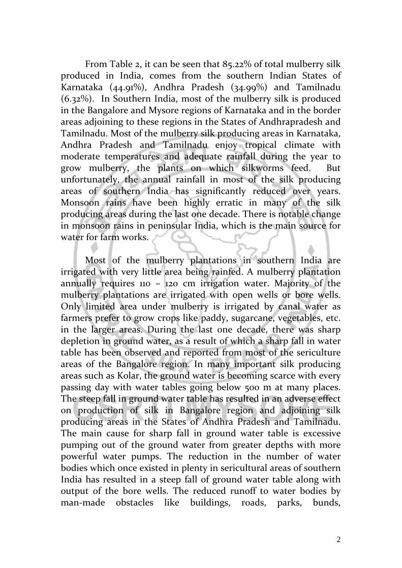
From Table 2, it can be seen that 85.22% of total mulberry silk produced in India, comes from the southern Indian States of Karnataka (44.91%), Andhra Pradesh (34.99%) and Tamilnadu (6.32%). In Southern India, most of the mulberry silk is produced in the Bangalore and Mysore regions of Karnataka and in the border areas adjoining to these regions in the States of Andhrapradesh and Tamilnadu. Most of the mulberry silk producing areas in Karnataka, Andhra Pradesh and Tamilnadu enjoy tropical climate with moderate temperatures and adequate rainfall during the year to grow mulberry, the plants on which silkworms feed. But unfortunately, the annual rainfall in most of the silk producing areas of southern India has significantly reduced over years. Monsoon rains have been highly erratic in many of the silk producing areas during the last one decade. There is notable change in monsoon rains in peninsular India, which is the main source for water for farm works.
Most of the mulberry plantations in southern India are
irrigated with very little area being rainfed. A mulberry plantation annually requires 110 – 120 cm irrigation water. Majority of the mulberry plantations are irrigated with open wells or bore wells. Only limited area under mulberry is irrigated by canal water as farmers prefer to grow crops like paddy, sugarcane, vegetables, etc. in the larger areas. During the last one decade, there was sharp depletion in ground water, as a result of which a sharp fall in water table has been observed and reported from most of the sericulture areas of the Bangalore region. In many important silk producing areas such as Kolar, the ground water is becoming scarce with every passing day with water tables going below 500 m at many places. The steep fall in ground water table has resulted in an adverse effect on production of silk in Bangalore region and adjoining silk producing areas in the States of Andhra Pradesh and Tamilnadu. The main cause for sharp fall in ground water table is excessive pumping out of the ground water from greater depths with more powerful water pumps. The reduction in the number of water bodies which once existed in plenty in sericultural areas of southern India has resulted in a steep fall of ground water table along with output of the bore wells. The reduced runoff to water bodies by man-made obstacles like buildings, roads, parks, bunds,

3
embankments, storm water drains, diversion channels, etc. has also reduced the replenishment of the ground water and recharge of the bore wells. The Figure 1 shows the effect of fall in water level in rivers and water bodies on discharge in bore wells in non-rainy period. In coastal areas, reduction in water level in water bodies, water streams & rivers cause sea water intrusion, thus making bore well water totally unusable for farming purpose.
Figure 1: Impact of over pumping of ground water and decline in water level in rivers and water bodies on bore wells In present scenario when the ground water table is going down year by year, it has become essential to take appropriate actions to harvest and conserve the rain water.
Most of the silk producing areas in southern India receive annual rainfall of 700-800 mm (70-80 cm) which is 2/3rd of annual water requirement of a mulberry garden. But unfortunately, a major portion of the rainwater flows out of the garden as runoff or evaporates. Though nature provides adequate water to farmers, they should take appropriate measures to harvest and conserve rainwater every year. This booklet provides various methods and techniques for harvesting and conserving rainwater, most of which are easy to adopt and practice.

4
2. Rain Water Harvesting and 2. Rain Water Harvesting and 2. Rain Water Harvesting and 2. Rain Water Harvesting and Its Importance in IndiaIts Importance in IndiaIts Importance in IndiaIts Importance in India
Rainwater harvesting is broadly defined as the collection and
storage of runoff for productive purposes such as crop, fodder, pasture or trees production, livestock and domestic water supply in rural areas. Rainwater harvesting is very essential for arid and semi arid regions to overcome water shortages. For agriculture purposes, it is defined as a method for inducing, collecting, storing and conserving local surface runoff.
The aim of the rainwater harvesting is to mitigate the effects of temporal shortages of rain to cover both household needs and productive use. It has been used to improve access to water and sanitation, improve agricultural production and health care thus contributing to poverty alleviation, reversal of environmental degradation through reforestation and improved agriculture practice, aid groundwater recharge, empower women in the management of water and other natural resources and address floods and droughts by storing excess water. In crop production systems, rainwater harvesting is very important, as they require high quantity of water at regular intervals.
The rainwater harvesting methods can be classified as in-situ, ex-situ and manmade systems (Figure1) The rainwater can be stored in surface soil, subsurface layers of soil and ponds, lakes, dams, etc.
Figure 1: Different rainwater harvesting and storage methods

5
Rainwater harvesting is an ancient practice and still forms an integral part of many farming systems in India. Some of the important rainwater methods still followed in India for farming (reference http://www.rainwater.org) are described below:
Paar system : Paar is a common water harvesting practice in the western Rajasthan region. It is a common place where the rainwater flows from the agar (catchment) and in the process percolates into the sandy soil. In order to access the rajani pani (percolated water) kuis or beris are dug in the agor (storage rea). Kuis or beris are normally 5 metres (m) to 12 m deep. The structure was constructed through traditional masonry technology. Normally six to ten of them are constructed in a paar. However depending on the size of the paar the numbers of kuis or beris are decided. Bhatti mentions that there are paars in Jaisalmer district where there are more than 20 kuis are in operation. This is the most predominant form of rainwater harvesting in the region. Rainwater harvested through PAAR technique is known as Patali paani.
Talab/Bandhis : Talabs are reservoirs. They may be natural, such as the ponds (pokhariyan) at Tikamgarh in the Bundelkhand region. They can be human-made, such as the lakes in Udaipur. A reservoir area of less than five bighas is called a talai; a medium sized lake is called a bandhi or talab and bigger lakes are called sagar or samand. The pokhariyan serve irrigation and drinking purposes. When the water in these reservoirs dries up just a few days after the monsoon, the pond beds are cultivated with rice.
Saza Kuva : An open well with multiple owners (saza = partner), saza kuva is the most important source of irrigation in the Aravalli hills in Mewar, eastern Rajasthan. The soil dug out to make the well pit is used to construct a huge circular foundation or an elevated
6
platform sloping away from the well. The first is built to accommodate the rehat, a traditional water-lifting device; the sloping platform is for the chada, in which buffaloes are used to lift water. Saza kuva construction is generally taken up by a group of farmers with adjacent landholdings; a harva, a man with special skills in groundwater detection, helps to fix the site.
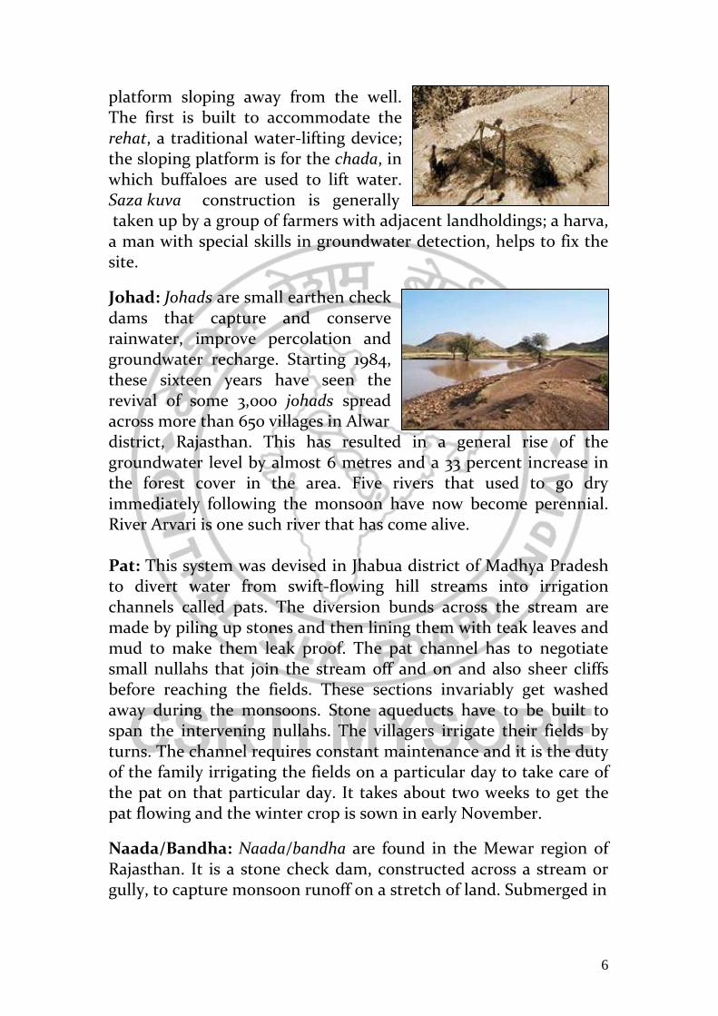
Johad: Johads are small earthen check dams that capture and conserve rainwater, improve percolation and groundwater recharge. Starting 1984, these sixteen years have seen the revival of some 3,000 johads spread across more than 650 villages in Alwar district, Rajasthan. This has resulted in a general rise of the groundwater level by almost 6 metres and a 33 percent increase in the forest cover in the area. Five rivers that used to go dry immediately following the monsoon have now become perennial. River Arvari is one such river that has come alive.
Pat: This system was devised in Jhabua district of Madhya Pradesh to divert water from swift-flowing hill streams into irrigation channels called pats. The diversion bunds across the stream are made by piling up stones and then lining them with teak leaves and mud to make them leak proof. The pat channel has to negotiate small nullahs that join the stream off and on and also sheer cliffs before reaching the fields. These sections invariably get washed away during the monsoons. Stone aqueducts have to be built to span the intervening nullahs. The villagers irrigate their fields by turns. The channel requires constant maintenance and it is the duty of the family irrigating the fields on a particular day to take care of the pat on that particular day. It takes about two weeks to get the pat flowing and the winter crop is sown in early November.
Naada/Bandha: Naada/bandha are found in the Mewar region of Rajasthan. It is a stone check dam, constructed across a stream or gully, to capture monsoon runoff on a stretch of land. Submerged in

7
water, the land becomes fertile as silt deposits on it and the soil retains substantial amounts of water.
Rapat: A rapat is a percolation tank, with a bund to impound rainwater flowing through a watershed and a waste weir to dispose of the surplus flow. If the height of the structure is small, the bund may be built of masonry, otherwise earth is used. Rajasthan rapats, being small, are all masonry structures. Rapats and percolation tanks do not directly irrigate land, but recharges well within a distance of 3-5 km downstream. Silting is a serious problem with small rapats and the estimated life of a rapat varies from 5 to 20 years. Chandela Tank: These tanks were constructed by stopping the flow of water in rivulets flowing between hills by erecting massive earthen embankments, having width of 60 m or more. These hills with long stretches of quartz reefs running underneath them acted as natural ground water barrier helping to trap water between the ridges. The earthen embankments are supported on both sides with walls of coarse stones, forming a series of stone steps. These tanks are made up of lime and mortar and this is the reason why these tanks survived even after thousand years but the only problem, which these tanks are facing, is siltation of tank beds. Chandela tanks usually had a convex curvature somewhere in the middle of the embankment.

8
Bundela Tank: These tanks are bigger in size as compared to Chandela tanks. These tanks have solid constructed steps leading to water in the tank; But these structures have chabootaras, pavillions and royal orchards, designed to show off the glory of the king who built them. But these tanks are not as cost effective and simple as Chandela tanks. These tanks were constructed to meet the growing water demands in the area. Maintenance of these tanks was done by the person employed by the king but in case of smaller tanks villagers collectively removed silt and repair embankment.
Kunds/Kundis : A kund or kundi looks like an upturned cup nestling in a saucer. These structures harvest rainwater for drinking, and dot the sandier tracts of the Thar Desert in western Rajasthan and some areas in Gujarat. Essentially a circular underground well, kunds, have a saucer-shaped catchment area that gently slopes towards the centre where the well is situated. A wire mesh across water-inlets prevents debris from falling into the well-pit. The sides of the well-pit are covered with (disinfectant) lime and ash. Most pits have a dome-shaped cover, or at least a lid, to protect the water. If need be, water can be drawn out with a bucket. The depth and diameter of kunds depend on their use (drinking, or domestic water requirements). They can be owned by only those with money to invest and land to construct it. Thus for the poor, large public kunds have to be built.
Kuis/Beris : Found in western Rajasthan, these are 10-12 m deep pits dug near tanks to collect the seepage. Kuis can also be used to harvest rainwater in areas with meagre rainfall. The mouth of the pit is usually made very narrow. This prevents the collected water from evaporating. The pit gets wider as it burrows under the ground, so that water can seep in into a large surface area. The openings of these entirely kuchcha (earthen) structures are generally covered with planks of wood, or put under lock and key. The water is used sparingly, as a last resource in crisis situations.

9
Baoris/Bers : Baoris or bers are community wells, found in Rajasthan, that are used mainly for drinking. Most of them are very old and were built by banjaras (mobile trading communities) for their drinking water needs. They can hold water for a long time because of almost negligible water evaporation.
Jhalaras: Jhalaras were human-made tanks, found in Rajasthan and Gujarat, essentially meant for community use and for religious rites. Often rectangular in design, jhalaras have steps on three or four sides. Jhalars are ground water bodies, which are built to ensure easy & regular supply of water to the surrounding areas. The jhalars are rectangular in shape with steps on three or even on all the four sides of the tank. The steps are built on a series of levels. The jhalaras collect subterranean seepage of a talab or a lake located upstream .The water from these jhalaras was not used for drinking but for only community bathing and religious rites.
Nadis: Nadis are village ponds, found near Jodhpur in Rajasthan. They are used for storing water from an adjoining natural catchment during the rainy season. The site was selected by the villagers based on an available natural catchments and its water yield potential. Water availability from nadi would range from two months to a year after the rains. They are dune areas range from 1.5 to 4.0 m and those in sandy plains vary from 3 to 12 m. The location of the nadi had a strong bearing on its storage capacity due to the related catchment and runoff characteristics. Tankas: Tankas (small tank) are underground tanks, found traditionally in most Bikaner houses. They are built in the main house or in the courtyard. They were circular holes made in the ground, lined with fine polished lime, in which rainwater was collected. ankas were often beautifully decorated with tiles, which helped to keep the water cool. The water was used only for drinking. If in any year there was less than normal rainfall and the tankas did not get filled,

10
water from nearby wells and tanks would be obtained to fill the household tankas. In this way, the people of Bikaner were able to meet their water requirements. The tanka system is also to be found in the pilgrim town of Dwarka where it has been in existence for centuries. It continues to be used in residential areas, temples, dharamshalas and hotels. Khadin: A khadin, also called a dhora, is an ingenious construction designed to harvest surface runoff water for agriculture. Its main feature is a very long (100-300 m) earthen embankment built across the lower hill slopes lying below gravelly uplands. Sluices and spillways allow excess water to drain off. The khadin system is based on the principle of harvesting rainwater on farmland and subsequent use of this water-saturated land for crop production. First designed by the Paliwal Brahmins of Jaisalmer, in western Rajasthan in the 15th century, this system has great similarity with the irrigation methods of the people of Iraq around 4500 BC and later of the Nabateans in the Middle East. A similar system is also reported to have been practised 4,000 years ago in the Negev desert, and in southwestern Colorado 500 years ago. Vav/Vavdi/Baoli/Bavadi : Traditional stepwells are called vav or vavadi in Gujarat, or baolis or bavadis in Rajasthan and northern India. Built by the nobility usually for strategic and/or philanthropical reasons, they were secular structures from which everyone could draw water. Most of them are defunct today. Stepwell locations often suggested the way in which they would be used. When a step well was located within or at the edge of a village, it was mainly
11
used for utilitarian purposes and as a cool place for social gatherings. When step wells were located outside the Village, on trade routes, they were often frequented as resting places. Many important step wells are located on the major military and trade routes from Patan in the north to the sea coast of Saurashtra. When step wells were used exclusively for irrigation, a sluice was constructed at the rim to receive the lifted water and lead it to a trough or pond, from where it ran through a drainage system and was channelled into the fields. A major reason for the breakdown of this traditional system is the pressure of centralisation and agricultural intensification.
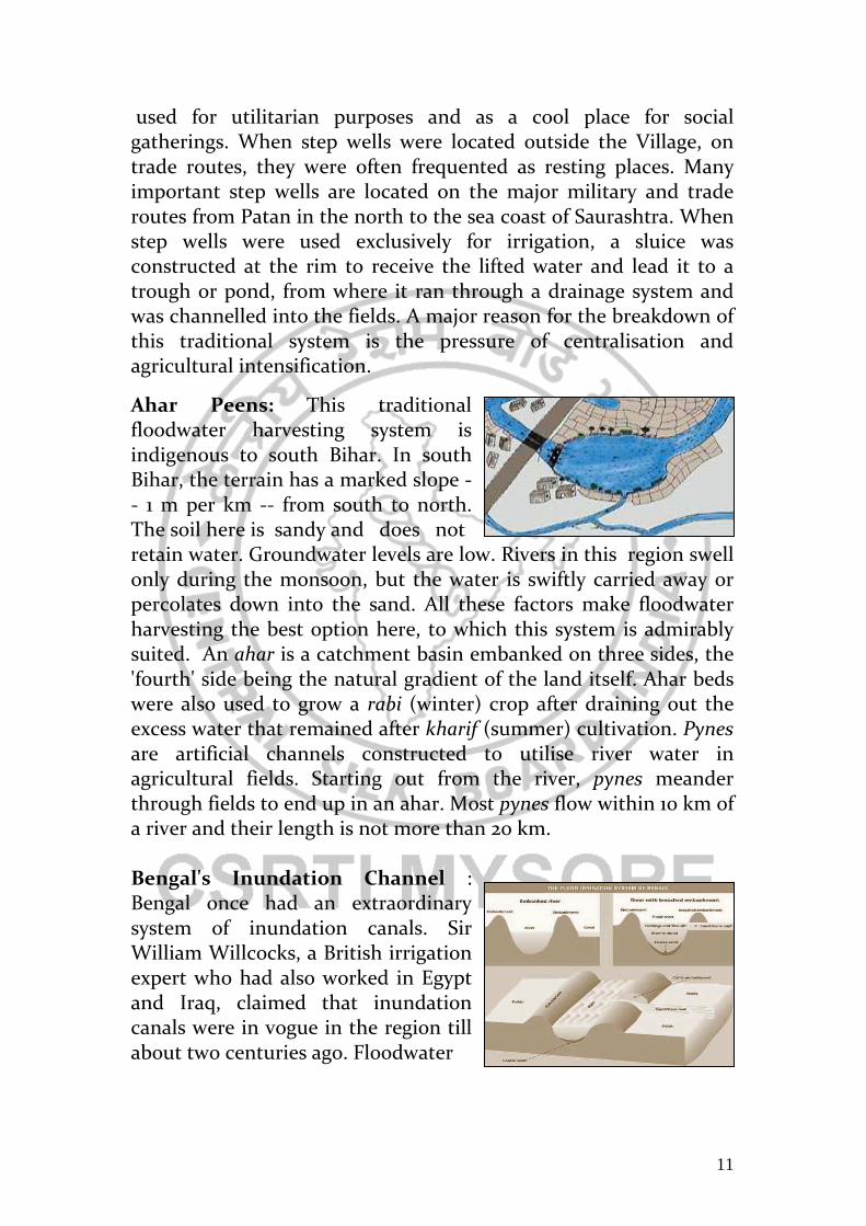
Ahar Peens: This traditional floodwater harvesting system is indigenous to south Bihar. In south Bihar, the terrain has a marked slope -- 1 m per km -- from south to north. The soil here is sandy and does not retain water. Groundwater levels are low. Rivers in this region swell only during the monsoon, but the water is swiftly carried away or percolates down into the sand. All these factors make floodwater harvesting the best option here, to which this system is admirably suited. An ahar is a catchment basin embanked on three sides, the 'fourth' side being the natural gradient of the land itself. Ahar beds were also used to grow a rabi (winter) crop after draining out the excess water that remained after kharif (summer) cultivation. Pynes are artificial channels constructed to utilise river water in agricultural fields. Starting out from the river, pynes meander through fields to end up in an ahar. Most pynes flow within 10 km of a river and their length is not more than 20 km. Bengal's Inundation Channel : Bengal once had an extraordinary system of inundation canals. Sir William Willcocks, a British irrigation expert who had also worked in Egypt and Iraq, claimed that inundation canals were in vogue in the region till about two centuries ago. Floodwater

12
entered the fields through the inundation canals, carrying not only rich silt but also fish, which swam through these canals into the lakes and tanks to feed on the larva of mosquitoes. This helped to check malaria in this region. Unfortunately, during the Afghan-Maratha war in the 18th century and the subsequent British conquest of India, this irrigation system was neglected, and was never revived.
Dungs or Campos: Dungs or Jampois are small irrigation channels linking rice fields to streams in the Jalpaiguri district of West Bengal.
Cheruvu: Cheruvu are found in Chitoor and Cuddapah districts in Andhra Pradesh. They are reservoirs to store runoff. Cheruvu embankments are fitted with thoomu (sluices), alugu or marva or kalju (flood weir) and kalava (canal).
Kohli Tanks: The Kohlis, a small group of cultivators, built some 43,381 water tanks in the district of Bhandara, Maharashtra, some 250-300 years ago. These tanks constituted the backbone of irrigation in the area until the government took them over in the 1950s. It is still crucial for sugar and rice irrigation. The tanks were of all sizes. Often with provisions to bring water literally to the doorstep of villagers. Bhanadaras: These are check dams or diversion weirs built across rivers. A traditional system found in Maharashtra, their presence raises the water level of the rivers so that it begins to flow into channels. They are also used to impound water and form a large reservoir. Where a bandhara was built across a small stream, the water supply would usually last for a few months after the rains. They are built either by villagers or by private persons who received rent-free land in return for their public act. Most Bandharas are defunct today. A very few are still in use. Phad: The community-managed phad irrigation system, prevalent in northwestern Maharashtra, probably came into existence some 300-400 years ago. The system operated on three rivers in the Tapi

13
basin - Panjhra, Mosam and Aram - in Dhule and Nasik districts (still in use in some places here). The system starts with a bandhara (check dam or diversion-weir) built across rivers. From the bandharas branch out kalvas (canals) to carry water into the fields. The length of these canals varies from 2-12 km. Each canal has a uniform discharge capacity of about 450 litres/second. Charis (distributaries) are built for feeding water from the kalva to different areas of the phad. Sarangs (field channels) carry water to individual fields. Sandams (escapes), along with kalvas and charis, drain away excess water. In this way water reaches the kayam baghayat (agricultural command area), usually divided into four phads (blocks). The size of a phad can vary from 10-200 ha, the average being 100-125 ha. Every year, the village decides which phads to use and which to leave fallow. Only one type of crop is allowed in one phad. Generally, sugarcane is grown in one or two phads; seasonal crops are grown in the others. This ensures a healthy crop rotation system that maintains soil fertility, and reduces the danger of water logging and salinity.
Kere: Tanks, called kere in Kannada, were the predominant traditional method of irrigation in the Central Karnataka Plateau, and were fed either by channels branching off from anicuts (check dams) built across streams, or by streams in valleys. The outflow of one tank supplied the next all the way down the course of the stream; the tanks were built in a series, usually situated a few kilometres apart. This ensured a) no wastage through overflow, and b) the seepage of a tank higher up in the series would be collected in the next lower one.
14
The Ramtek model: has been named after water harvesting structures in the town of Ramtek, Maharashtra. A scientific analysis revealed an intricate network of groundwater and surface water bodies, intrinsically connected through surface and underground canals. A fully evolved system, this model harvested runoff through tanks, supported by high yielding wells and structures like baories, kundis, and waterholes. This system, intelligently designed to utilise every raindrop falling in the watershed area is disintegrating due to neglect and ignorance. Constructed and maintained mostly by malguzars (landowners), these tanks form a chain, extending from the foothills to the plains, conserving about 60-70 per cent of the total runoff. Once tanks located in the upper reaches close to the hills were filled to capacity, the water flowed down to fill successive tanks, generally through interconnecting channels. This sequential arrangement generally ended in a small waterhole to store whatever water remained unstored. The presence of a Ramtek ridge in the middle, having a steep slope on both sides, results in quick runoffs and little percolation. This might have led the residents of the southern plains of the Ramtek hills to construct different types of water conservation structures (like tanks) where they could trap the maximum
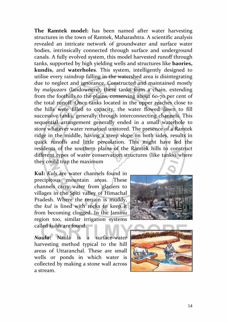
Kul: Kuls are water channels found in precipitous mountain areas. These channels carry water from glaciers to villages in the Spiti valley of Himachal Pradesh. Where the terrain is muddy, the kul is lined with rocks to keep it from becoming clogged. In the Jammu region too, similar irrigation systems called kuhls are found.
Naula: Naula is a surface-water harvesting method typical to the hill areas of Uttaranchal. These are small wells or ponds in which water is collected by making a stone wall across a stream.

15
Khatri: Khatris are structures, about 10x12 feet in size and six feet deep carved out in the hard rock mountain. These traditional water harvesting structures are found in Hamirpur, Kangra and Mandi districts of Himachal Pradesh. There are two types of khatris: one for animals and washing purposes in which rain water is collected from the roof through pipes, and other used for human consumption in which rainwater is collected by seepage through rocks. Interestingly, the khatris are owned by individual as well as by a community. There are government khatris as well, which are maintained by the panchayat.
Kuhl: Kuhls are a traditional irrigation system in Himachal Pradesh- surface channels diverting water from natural flowing streams (khuds). A typical community kuhl services six to 30 farmers, irrigating an area of about 20 ha. The system consists of a temporary headwall (constructed usually with river boulders) across a khud (ravine) for storage and diversion of the flow through a canal to the fields. By modern standards, building kuhls was simple, with boulders and labour forming the major input. The kuhl was provided with moghas (kuchcha outlets) to draw out water and irrigate nearby terraced fields. The water would flow from field to field and surplus water, if and, would drain back to the khud. The kuhls were constructed and maintained by the village community. At the beginning of the irrigation season, the kohli (the water tender) would organise the irrigators to construct the headwall, repair the kuhl and make the system operational. The kohli played the role of a local engineer. Any person refusing to participate in construction and repair activities without valid reason, would be denied water for that season. Since denial of water was a religious punishment, it ensured community participation and solidarity. A person was also free to participate by providing a substitute for his labour. The kohli also distributed and managed the water.

16
Zabo: The zabo (the word means 'impounding run-off') system is practiced in Nagaland in north-eastern India. Also known as the ruza system, it combines water conservation with forestry, agriculture and animal care.Villages such as Kikruma, where zabos are found even today, are located on a high ridge. Though drinking water is a major problem, the area receives high rainfall. The rain falls on a patch of protected forest on the hilltop; as the water runs off along the slope, it passes through various terraces. The water is collected in pond-like structures in the middle terraces; below are cattle yards, and towards the foot of the hill are paddy fields, where the run-off ultimately meanders into. Cheo-ozihi: The river Mezii flows along the Angami village of Kwigema in Nagaland. The river water is brought down by a long channel. From this channel, many branch channels are taken off, and water is often diverted to the terraces through bamboo pipes. One of the channels is named Cheo-oziihi - oziihi means water and Cheo was the person responsible for the laying of this 8-10 km-long channel with its numerous branches. This channel irrigates a large number of terraces in Kwigwema, and some terraces in the neighbouring village. There are three khels and the village water budget is divided among them.
Eri : Approximately one-third of the irrigated area of Tamil Nadu is watered by eris (tanks). Eris have played several important roles in maintaining ecological harmony such as flood-control systems, preventing soil erosion and wastage of runoff during periods of heavy rainfall, and recharging the groundwater in the surrounding areas. The presence of eris provided an appropriate micro-climate for the local areas. Without eris, paddy cultivation would have been impossible. Till the British arrived, local

17
communities maintained eris. Historical data from Chengalpattu district, for instance, indicates that in the 18th century about 4-5 per cent of the gross produce of each village was allocated to maintain eris and other irrigation structures. Assignments of revenue-free lands, called manyams, were made to support village functionaries who undertook to maintain and manage eris. These allocations ensured eri upkeep through regular desilting and maintenance of sluices, inlets and irrigation channels. The early British rule saw disastrous experiments with the land tenure system in quest for larger land revenues. The enormous expropriation of village resources by the state led to the disintegration of the traditional society, its economy and polity. Allocations for maintenance of eris could no longer be supported by the village communities, and these extraordinary water harvesting systems began to decline. Ooranis: The tanks, in south Travancore, though numerous, were in most cases oornis containing just enough water to cultivate the few acres of land dependent on them. The irregular topography of the region and the absence of large open spaces facilitated the construction of only small tanks unlike large ones seen in the flat districts of the then Madras Presidency, now Tamil Nadu.
Dongs: Dongs are ponds constructed by the Bodo tribes of Assam to harvest water for irrigation. These ponds are individually owned with no community involvement.
Bamboo Drip Irrigation: Meghalaya has an ingenious system of tapping of stream and spring water by using bamboo pipes to irrigate plantations. About 18-20 litres of water entering the bamboo pipe system per minute gets transported over several hundred metres and finally gets reduced to 20-80 drops per minute at the site of the plant. The tribal farmers of Khasi and Jaintia hills to drip-irrigate their black pepper cultivation use this 200-year-old system. Bamboo pipes are used to divert perennial springs on the hilltops to the lower reaches by gravity. The channel sections, made of bamboo, divert and convey water to the plot site where it is distributed without leakage into branches, again made and laid out with different forms of bamboo pipes. Manipulating the intake pipe positions also controls the flow of water into the lateral pipes. Reduced channel sections and diversion units are used at the last
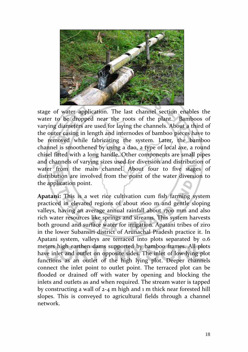
18
stage of water application. The last channel section enables the water to be dropped near the roots of the plant. Bamboos of varying diameters are used for laying the channels. About a third of the outer casing in length and internodes of bamboo pieces have to be removed while fabricating the system. Later, the bamboo channel is smoothened by using a dao, a type of local axe, a round chisel fitted with a long handle. Other components are small pipes and channels of varying sizes used for diversion and distribution of water from the main channel. About four to five stages of distribution are involved from the point of the water diversion to the application point.
Apatani: This is a wet rice cultivation cum fish farming system practiced in elevated regions of about 1600 m and gentle sloping valleys, having an average annual rainfall about 1700 mm and also rich water resources like springs and streams. This system harvests both ground and surface water for irrigation. Apatani tribes of ziro in the lower Subansiri district of Arunachal Pradesh practice it. In Apatani system, valleys are terraced into plots separated by 0.6 meters high earthen dams supported by bamboo frames. All plots have inlet and outlet on opposite sides. The inlet of low-lying plot functions as an outlet of the high lying plot. Deeper channels connect the inlet point to outlet point. The terraced plot can be flooded or drained off with water by opening and blocking the inlets and outlets as and when required. The stream water is tapped by constructing a wall of 2-4 m high and 1 m thick near forested hill slopes. This is conveyed to agricultural fields through a channel network.

19
Virdas: Virdas are shallow wells dug in low depressions called jheels (tanks). They are found all over the Banni grasslands, a part of the Great Rann of Kutch in Gujarat. They are systems built by the nomadic Maldharis, who used to roam these grasslands. Now settled, they persist in using virdas. These structures harvest rainwater. The topography of the area is undulating, with depressions on the ground. By studying the flow of water during the monsoon, the Maldharis identify these depressions and make their virdas there. Essentially, the structures use a technology that helps the Maldharis separate potable freshwater from impotable salt water. After rainwater infiltrates the soil, it gets stored at a level above the salty groundwater because of the difference in their density. A structure is built to reach down (about 1 m) to this upper layer of accumulated rainwater. Between these two layers of sweet and saline water, there exists a zone of brackish water. As freshwater is removed, the brackish water moves upwards, and accumulates towards the bottom of the virda.
Katas Mundas/Bandhas: The katas, mundas and bandhas were the main irrigation sources in the ancient tribal kingdom of the Gonds (now in Orissa and Madhya Pradesh). The village headmen known as gountias, who in turn, received the land from the Gond kings, built most of these katas. Land here is classified into four groups on the basis of its topography: aat, (highland); mal (sloped land); berna (medium land); and bahal (low land).A kata is constructed north to south, or east to west, of a village. A strong earthen embankment, curved at either end, is built across a drainage line to hold up an irregularly shaped sheet of water. The undulations of the country usually determine its shape as that of a long isosceles triangle, of which the dam forms the base. It commands a valley, the bottom of which is the bahal land and the sides are the mal terrace. As a rule, there is a cut high up on the slope near one end of the embankment from where water is led either by a small channel or tal, or from field to field along terraces, going lower down to the fields. In years of normal rainfall, irrigation was not needed because of moisture from percolation and, in that case, the surplus flow was passed into a nullah.
20
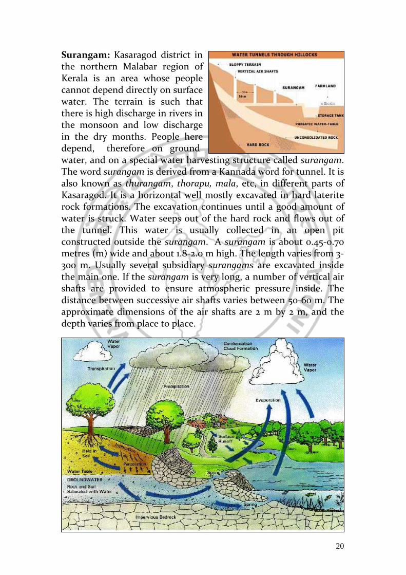
Surangam: Kasaragod district in the northern Malabar region of Kerala is an area whose people cannot depend directly on surface water. The terrain is such that there is high discharge in rivers in the monsoon and low discharge in the dry months. People here depend, therefore on ground water, and on a special water harvesting structure called surangam. The word surangam is derived from a Kannada word for tunnel. It is also known as thurangam, thorapu, mala, etc, in different parts of Kasaragod. It is a horizontal well mostly excavated in hard laterite rock formations. The excavation continues until a good amount of water is struck. Water seeps out of the hard rock and flows out of the tunnel. This water is usually collected in an open pit constructed outside the surangam. A surangam is about 0.45-0.70 metres (m) wide and about 1.8-2.0 m high. The length varies from 3-300 m. Usually several subsidiary surangams are excavated inside the main one. If the surangam is very long, a number of vertical air shafts are provided to ensure atmospheric pressure inside. The distance between successive air shafts varies between 50-60 m. The approximate dimensions of the air shafts are 2 m by 2 m, and the depth varies from place to place.
21
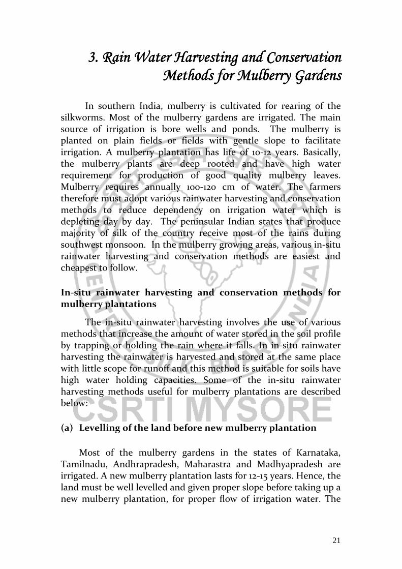
3. Rain Water Harvesting and Conservation 3. Rain Water Harvesting and Conservation 3. Rain Water Harvesting and Conservation 3. Rain Water Harvesting and Conservation Methods for Mulberry GardensMethods for Mulberry GardensMethods for Mulberry GardensMethods for Mulberry Gardens
In southern India, mulberry is cultivated for rearing of the silkworms. Most of the mulberry gardens are irrigated. The main source of irrigation is bore wells and ponds. The mulberry is planted on plain fields or fields with gentle slope to facilitate irrigation. A mulberry plantation has life of 10-12 years. Basically, the mulberry plants are deep rooted and have high water requirement for production of good quality mulberry leaves. Mulberry requires annually 100-120 cm of water. The farmers therefore must adopt various rainwater harvesting and conservation methods to reduce dependency on irrigation water which is depleting day by day. The peninsular Indian states that produce majority of silk of the country receive most of the rains during southwest monsoon. In the mulberry growing areas, various in-situ rainwater harvesting and conservation methods are easiest and cheapest to follow.
In-situ rainwater harvesting and conservation methods for mulberry plantations
The in-situ rainwater harvesting involves the use of various methods that increase the amount of water stored in the soil profile by trapping or holding the rain where it falls. In in-situ rainwater harvesting the rainwater is harvested and stored at the same place with little scope for runoff and this method is suitable for soils have high water holding capacities. Some of the in-situ rainwater harvesting methods useful for mulberry plantations are described below:
(a) Levelling of the land before new mulberry plantation
Most of the mulberry gardens in the states of Karnataka, Tamilnadu, Andhrapradesh, Maharastra and Madhyapradesh are irrigated. A new mulberry plantation lasts for 12-15 years. Hence, the land must be well levelled and given proper slope before taking up a new mulberry plantation, for proper flow of irrigation water. The

22
proper levelling and grading of the field is also very important for harvesting and conserving the rain water. A level field reduces runoff and will allow rain water to stand for a long time in the field. Therefore, more time will be available to the rainwater to percolate down to the earth.
(b) Sub-soiling and chiselling of the land for new mulberry plantations In a field, the soil can be
divided in two layers. The topsoil layer, which is around 25-30 cm, contains loose soil. The soil below topsoil upto 1 m depth is called subsoil. The subsoil layers of the soil become hard and well compacted due to cultivation of land over years. The compact subsoil does not allow rainwater to percolate down. Mulberry is a perennial plant which produces quality leaves for silkworm rearing for 12-15 years. Once mulberry is planted, only top layer of the Soil can be cultivated for removing weeds, incorporating fertilisers and manures, etc. Mulberry plants are also deep rooted. Hence, it will be highly beneficial to opt for sub soiling before new plantation is taken up. The sub soiling will not only enable the mulberry plants’ roots to go deep but will also enhance the water retention capacity of the soil sub layers.
Figure 3.2: Formation of the hardpan in cultivated soils
Figure 3.1: Levelling and grading of the field for a new mulberry plantation with tractor operated leveller

23
The formation of a hard pan in a mulberry garden is highly undesirable as it:
• Reduces water percolation in the soil profile resulting in water stagnation at the root zone. This causes yellowing of leaves and weakening of the root system.
• Increases surface run-off due to reduction in the percolation of the water into the soil. It causes soil erosion and hence, reduces soil fertility.
• Reduces drainage capacity of the soil leading to accumulation of salts in the root zone. The soils turn acidic or alkaline due to accumulation of the salts in the root zone.
The Central Sericultural Research & Training Institute (CSR&TI),
Mysore has developed a technique for overcoming the problem of hard pan in mulberry gardens and improving overall root zone environment for increasing the plant growth besides harvesting and conserving rain water in deeper layers of the soil. Tractor operated Subsoiler Subsoiler (Fig.2) is a device used for breaking the hard pan and deep soil cultivation. It is used commonly in the watershed for cracking hard soils and inducing moisture infiltration into the soil. A subsoiler consists of a long and narrow standard with a heavy wedge shaped point. When the tractor operated subsoiler is operated in the field, it cracks down and break the hardpan (Figure 3.3). This results in opening up of the soil for deep percolation of the rainwater while allowing the mulberry plants roots to go deep. Under these conditions mulberry plants will have less effect of moisture stress in top layers of the soil due to delayed irrigations and high atmospheric temperatures.
Figure 3.3: A tractor operated Subsoiler

24
The cost of a tractor operated subsoiler is around Rs. 15,000.
The subsoiler also helps in:
• Breaking the sub-soil, hard pan formed below the normal ploughing zone.
• Reducing water logging and chemical accumulation in sub soil.
• Aerating the soil.
• Reducing soil erosion. • Overcoming the ill effects of soil compaction due to
continuous cultivation. • Conserving the moisture in the soil profiles for a longer
duration. • Development of vertical root system.
Subsoiler for mulberry gardens
The subsoiler has been found as very effective equipment for preparatory land cultivation, plantation, water harvesting and in situ moisture conservation in the mulberry gardens. Sub soiling operation was carried out in the field of CSR&TI, Mysore as a part of land preparation for the plantation of new mulberry gardens. A sub soiling operation was carried out first to loosen the soil, followed by ploughing with a disk plough. A tractor-operated cultivator was used to pulverize the topsoil and develop a
Figure 3.4: Breaking of the hardpan by subsoiler
Figure 3.5: Water and root movement after sub soiling

25
good tilth. The fields were left without further operation for a period of two months for absorbing rainwater. The trenches of about 60-70 cm deep were opened in the field using subsoiler and filled with loose soil (Fig.3.5). Interestingly, trenches opened with a subsoiler worked as small dams for storing the rainwater. It was also observed that the entire rainwater was absorbed by the loose soil in the trenches. Practically, no run-off took place in the field treated with subsoiler. The saplings of mulberry were planted in these trenches at desired spacing. A god growth in the saplings was noticed due to availability of ample air and moisture in the soil. The conservation of the rainwater in root zone also reduced the irrigation frequency. On the slopy land where most of the water drains out during rainy period without much infiltration, the operation of subsoiler across the slope helped in checking the run-off and conserving the rainwater into the soil. It also helped in reducing soil erosion and conserving the fertility of the soil. Under the rainfed conditions, utilization of subsoiler can help in harvesting and conserving the rainwater during monsoon which could be used by the plants, subsequently.
Overall, the tractor operated subsoiler is both effective and
economic for harvesting and conserving rainwater and reducing the water and energy requirement for irrigation of mulberry.
After one year of the plantation, the mulberry plants develop a
good root system in the soil and a crown above ground. With time, the gap between the mulberry plants is reduced due to branching. The mulberry plants in the row act as barrier to the flow of rainwater.
Figure 3.6: Trenches opened by a subsoiler for a new mulberry plantation

26
(c) Summer ploughing of fallow lands around mulberry gardens
In southern India, plantation crops like coconut, mango, etc
surround most of the mulberry gardens. The land between the fruit and other trees should be deep ploughed preferably with a tractor plough during summer months. The rough surface created by plough checks water runoff during monsoon rains. The loose soil also absorbs good amount of rainwater, which can later percolate deep into the soil. The ploughing of the land should be done across the slope so that the ridges formed by plough act as barrier to runoff.
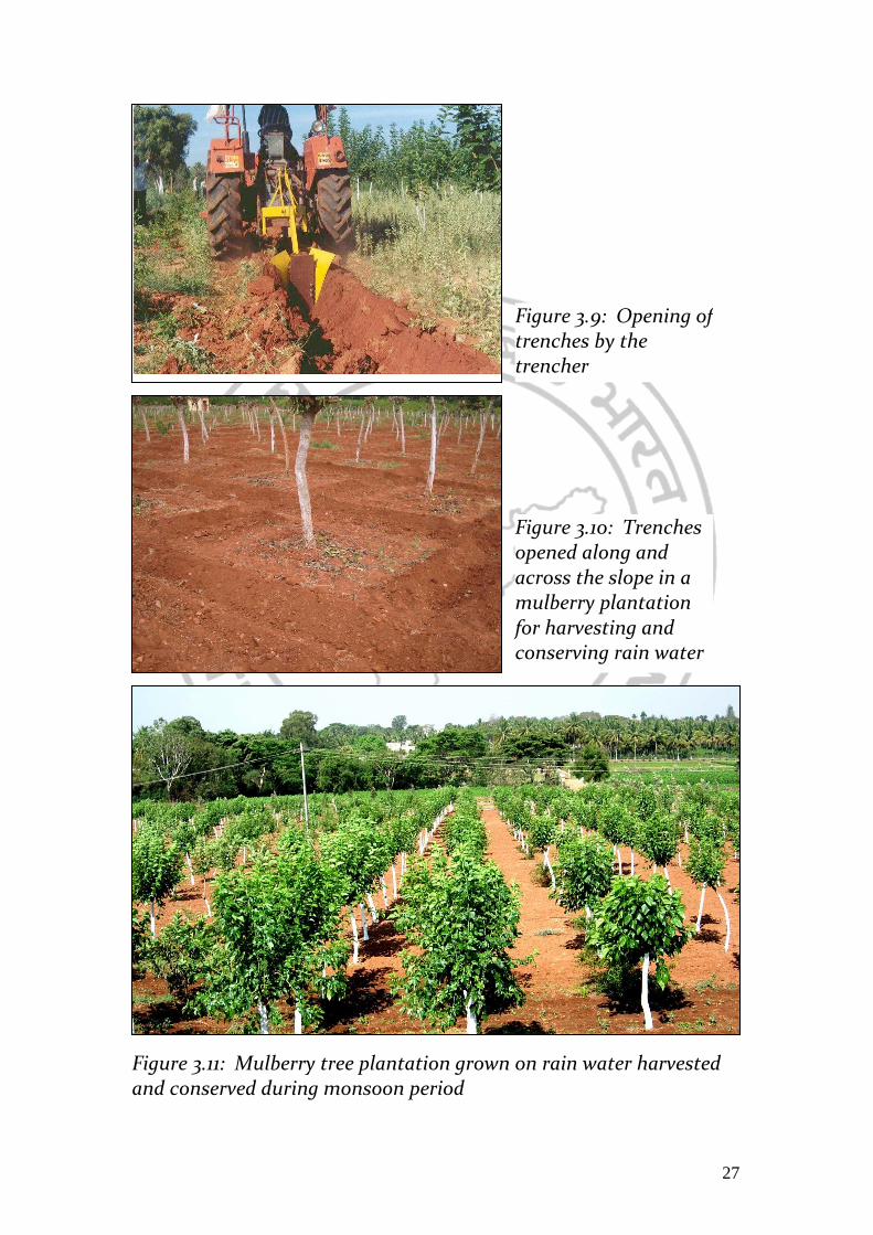
(d) Opening trenches in mulberry plantations In high rainfall areas, trenches should be opened manually or
with the help of tractor operated trencher. These trenches collect the rainwater, which percolates deep into the soil. The trenches should be opened across the slope. The Figure 3.8 shows a tractor-operated trencher.
Figure 3.7: Summer ploughing of fallow and vacant lands around mulberry gardens helps in harvesting and conserving rainwater
Figure 3.8: A tractor operated trencher
27
Figure 3.9: Opening of trenches by the trencher
Figure 3.10: Trenches opened along and across the slope in a mulberry plantation for harvesting and conserving rain water
Figure 3.11: Mulberry tree plantation grown on rain water harvested and conserved during monsoon period

28
The tractor-operated trencher can also be used for opening up trenches in existing mulberry gardens (Figure 3.10). These trenches collect the rainwater and allow it to percolate deep into soil. The mulberry plants grow well with high moisture content leaves due to subsurface water in root zone. Trenching operation, once a year, has been found very useful for mulberry plantations.
(e) Planting mulberry across the slope
In southern India, mulberry is cultivated as low bush plantations. Generally, the mulberry is planted in rows. These days, the paired row system of plantation is widely adopted by the farmers. At the time of plantation of a new mulberry garden, care should be taken to put the mulberry plants across the slope of the field. The mulberry plants which become bushy after some days will reduce the runoff and allow more rainwater to percolate down into the soil. The channels or furrows for irrigation for mulberry plants should be made after the row of plants; this arrangement will be very helpful in curtailing the runoff, as there channels act as a pool of water. The water in these furrows slowly seeps down into the soil. The bushes of mulberry plants almost cover up the soil in the garden within a month of pruning. These mulberry bushes avoid the direct impact of the raindrops on the soil and therefore reduce runoff. It is observed that in well-grown garden, most of the rainwater percolates down into the soil.
Figure 3.12: Tractor trencher opening up trenches in a mulberry garden for harvesting and conserving rainwater

29
(f) Impounding the rainwater in the mulberry garden
The easiest way to harvest and conserve the rainwater in a mulberry garden is impounding it in the field itself. All the outlets of the water from the field should be plugged by raising the bunds all around the field. This method can be well adopted in gardens with red and light soils where infiltration rate is high to percolate the rainwater quickly into the soil.
Figure 3.13: Mulberry plantations cross the land slope helps in harvesting and conserving the rainwater
Figure 3.14: Rainwater collected in furrows in a mulberry garden

30
Figure 3.15: Impounding the rainwater in a mulberry garden by raising the bunds all around the garden
Figure 3.16: An earthen bund with grass plantation is very effective for checking the rainwater flow from a mulberry garden

31
(g) Trenching and Mulching in Mulberry Gardens Some years back, the Karnataka sericulture farmers evolved a technology called trenching and mulching. It consists of opening of knee deep trenches between the rows of mulberry plants and filling them with the mulberry leaves, shoots, and silkworm litter and covering closing the trench with the dug out earth (Figure 3.14). These trenches have been found very ideal for harvesting and conserving the rainwater. The trenches act as pools of the water. The rainwater in the trenches facilitates quick decomposition of the mulberry shoots thus converting them into nutrition rich compost. This technology is spreading very fast among the farmers in Bangalore region and also to other areas in Karnataka, Tamilnadu and Andhrapradesh.
(h) Sub soiling in the existing mulberry gardens
The life of a mulberry plantation is about 12-15 years. Initially, at the time of plantation of a new garden, the soil is tilled upto 30-40 cm before planting mulberry. In subsequent years, digging or ploughing only the topsoil upto depth of 25-25 cm maintains the mulberry gardens and as a result the soil below 30 cm from surface becomes compacted and hard. This reduces drastically the water infiltration rate and water holding capacity of the soil. A tractor-operated subsoiler described in Section (b) of this chapter can be
Figure 3.17: Trenching and mulching in a mulberry garden

32
utilised very effectively to loose the compacted and hard layers. Figure 3.15 shows a tractor-operated subsoiler operating in an existing mulberry garden. The subsoiler loosens the soil upto a depth of 50-60 cm. The best time for subsoiling in the existing mulberry gardens is at the onset monsoon because subsoiler operation requires adequate moisture in the soil. Very good effects of sub soiling were observed in the mulberry gardens of CSRTI, Mysore. Almost all rainwater during the monsoon period was soaked in the soil and there was no runoff. The subsoiler facilitated 100% rainwater harvesting and its conservation in the deep layers of the soil. Due to adequate subsoil water, luxuriant growth of mulberry plants was observed. The leaf quality in the mulberry gardens that weresubsoiled improved significantly.
Figure 3.18: A subsoiler operating in a mulberry garden for loosening the subsurface soil to increase water infiltration and water holding capacity of soil
Figure 3.19: A mulberry garden after subsoiling

33
(i) Runoff collection pits During heavy rains, most of the rainwater flows out of the gardens. This rainwater should be collected and allowed to percolate down into the earth by making pits of different sizes in the lower parts of the garden. The soil taken out from the pits can be used for making the bunds around the pits. The depth of pits may be any where between 30 cm to 3m.on the bunds so that soil does not fall back into the pit. Figures 3.21 & 3.22 show pits dug around mulberry gardens to facilitate collection and percolation of the rainwater into the earth.
Figure 3.20: Luxuriant growth of mulberry plants in gardens after sub soiling
Figure 3.21: Runoff collection pits

34
(j) Farm ponds
A farm pond is a large hole dug out in the earth, usually
rectangular in shape, which harvests rainwater and stores it for future use. It has an inlet to regulate inflow and an outlet to discharge excess water. The pond is surrounded by a small bund, which prevents erosion on the banks of the pond. The size and depth depends on the amount of land available, the type of soil, the farmer’s water requirements, the cost of excavation and the possible uses of the excavated earth. Water from the farm pond can be used for irrigation.
Figure 3.22: Deep pit for runoff collection and percolation
Figure 3.23: View of farm ponds at CSRTI, Mysore for collection of runoff from mulberry gardens

35
The selection of a site for a farm pond is very important. Preferably, the farm pond must be located in areas not suitable for farming. Soil conditions must be carefully considered before making farm ponds. If the soils are sandy, arrangement should be made for lining by using HDPE sheets, etc. for holding water in the pond.
The farm pond can be dug manually or with earth excavation
machines. Use of machines for excavation and transportation is the best method in this context, with human labour being used for levelling, bund formation, and construction.
The farm ponds have many advantages such as:
• They provide water to start growing crops, without waiting for rainfall.
• They provide irrigation water during dry spells between rainfalls. This increases the yield, the number of crops in one year thereby increasing the diversity of crops grown.
• Bunds can be used to raise vegetables and fruit trees, thus supplying the farm household with an additional source of income and of nutritious food.
• Farmers are able to apply adequate farm inputs and perform farming operations at the appropriate time, thus increasing their productivity and confidence in farming.
Figure 3.24: Farm pond with plastic sheet lining

36
• They check soil erosion and minimize siltation of waterways and reservoirs.
• They supply water for domestic purposes and livestock • They promote fish rearing. • They recharge the ground water. • They improve drainage. • The excavated earth has a very high value and can be used to
enrich soil in the fields, levelling land, and constructing farm roads.
(k) Bore well recharging:
Most of the mulberry gardens are irrigated by bore well water in southern India. Hence, the farmers should make appropriate arrangements to recharge the bore wells with rainwater during monsoon rains. Recharging of bore wells will avoid them from drying up, reduction in water yield and lowering of the water table.
For recharging a bore
well, a pit should be dug in the region surrounding the casing pipe and cement rings should be installed in it. Figure 3.25 shows a rainwater recharge pit made around a bore well. The size of the pit should be one meter in diameter and 10 feet in depth. At the bottom of the pit, filter holes should be made and a casing pipe with steel mesh should be fixed tightly to the bore well pipe. This casing pipe will function as a filter. Cement rings matching the bore well’s diameter should be installed till the base of the pit. Figure 3.26 shows various materials to be filled in the recharge pit for filtering of the water.
Figure 3.25: Rainwater recharge pit around the bore well

37
By following the above method, a farmer can recharge his
bore well and keep them alive always. Those having open wells too can adopt this system. By directing the filtered rainwater to the open wells, their water tables could be improved.
Figure 3.26: Filling materials for the
recharge pit
Figure 3.27: A stone check dam near for recharging a bore well

38
(l) Soil Moisture Conservation Techniques for Mulberry Gardens
The availability of the irrigation or rainwater for agriculture in general and mulberry cultivation for silkworm rearing is reducing due to fall in groundwater table mainly because of the large number of bore wells dug by farmers, excessive pumping out of water from the bore wells, intensive cultivation of crops, reduced recharge of the aquifers, etc. Hence, it is essential to conserve the soil moisture in mulberry gardens which require frequent irrigation for production of quality leaves for silkworm rearing. The farmers can adopt following practices for conservation of soil moisture.
(i) Adding Tank Silt and FYM to Soil: Application of tank silt, organic matter or farm yard manure increase the water holding and moisture retention capacity of farm soil. Application of tank silk in sandy and red loamy is very effective and useful for conservation of soil moisture and also for improving soil structure.
Figure 3.28: The use of tank silt increases moisture retention capacity of soil
(ii) Growing Green Manure Crops: The farmers can go for green manure crops like sunhemp (Sesbenia aculeata), dhaincha (Crotolaria intermedio), cowpea (Vigna vignaunguiculata), etc. in the space available between the rows of mulberry plants. The green

39
Sunhemp Dhaincha Cowpea
Figure 3.29: Green manuring in a mulberry garden
manuring crops do not only add nitrogen and organic matter to the soil but also increases its water holding capacity of the soil.
(iii) Mulching: Covering the soil surface with dry leaves, weeds, etc., to check the loss of soil moisture through evaporation is called mulching. The space between the mulberry plants can be covered with mulberry twigs or other materials such as paddy straw, leaf moulds, stubbles, etc. This will protect the soil erosion, conserve soil moisture and suppress weed growth. Mulches also serve as physical barriers that dissipate erosive energy from raindrops, thereby protecting the structure of the soil and improving the permeability of the soil. Mulches serve as vapor barriers thus reducing evaporation of the soil moisture.

40
Figure 3.30: Mulching with mulberry twigs in a mulberry garden for soil moisture conservation
Mulching has been proved very useful to the rainfed mulberry gardens which are entirely dependent on rain water to conserve soil moisture by avoiding run-off loss of rain water from the fields.
*********

41
4. ReferencesReferencesReferencesReferences
1. N IBRAIMO, P MUNGUAMBE Rainwater Harvesting Technologies for Small Scale Rainfed Agriculture in Arid and Semi-arid Areas, Department of Rural Engineering, Faculty of Agronomy and Forestry Engineering, University Eduardo Mondlane
2. OWEIS, T., HACHUM, A. & KIJNE, J. Water harvesting and supplemental irrigation for improved water use efficiency in dry areas. System-Wide Initiative on Water Management (SWIM). Paper number 7.
3. CRITCHLEY, W., & SIEGERT, K., 1991. A manual for the
design and construction of water harvesting schemes for plant
production. Food and Agriculture Organization of the United
Nations (FAO). Rome.
4. CRITCHLEY, W., & SIEGERT, K., 2013. Water harvesting,
Scientific Publishers, India
5. Annual report 2012-13, Central Silk Board, Bangalore
6. http://www.rainwater.org
7. Farm Ponds
http://www.dhan.org/farmponds/farmpond_def.php
8. Rainwater harvesting http://bwssb.org/rain-water-harvesting/
9. VERMA S. 1997. Subsoiler for rainwater harvesting and in-situ
moisture conservation, Indian Silk, July.