xtreme cities x · gorgeous night lights with ground ... locating fsx if not in registry the xtreme...
TRANSCRIPT

1
XTreme Cities X
Configuration Handbook

2
Table of Contents 1. Product Support .............................................................................................................................................................. 4
2. Xtreme Cities Benefits ? ...................................................................................................................................................... 5
3. Xtreme Cities X – Quick Startup .......................................................................................................................................... 6
4. Locating FSX If Not in Registry ............................................................................................................................................ 6
5. Xtreme Cities X– Interface Details ...................................................................................................................................... 7
Validation Process And Error Checking ............................................................................................................................... 7
The Interface ....................................................................................................................................................................... 9
The Must Read Section ................................................................................................................................................... 9
Making Batch Changes To All Cities In A Region ........................................................................................................... 12
Individual City Settings ...................................................................................................................................................... 12
Terrain Mode ................................................................................................................................................................ 12
Scenery Objects Section ................................................................................................................................................ 12
Vector Scenery Section ................................................................................................................................................. 13
“Other” Section ............................................................................................................................................................. 14
Global Settings .................................................................................................................................................................. 15
Seasonal Tree Textures ................................................................................................................................................. 15
Change FSX Location ..................................................................................................................................................... 15
Changing The Light Texture .......................................................................................................................................... 15
6. Night Lighting .................................................................................................................................................................... 16
7. What Is TexturePhoto Terrain ? ........................................................................................................................................ 17
Landclass Terrain ............................................................................................................................................................... 17
Disadvantages of Landclass ........................................................................................................................................... 17
Photoscenery Terrain (Custom Terrain Textures) ............................................................................................................. 17
Disadvantages of Photoscenery .................................................................................................................................... 17
TexturePhoto .................................................................................................................................................................... 18
8. Configuring Flight Simulator For Use With Xtreme Cities ................................................................................................. 19
Scenery Library Layering ................................................................................................................................................... 19
Texture Resolution Setting ................................................................................................................................................ 20
9. FAQ .................................................................................................................................................................................... 21
10. Product Updates ............................................................................................................................................................. 24

3
License Agreement – Flight One Software And Scenery Solutions
Flight One Software, Inc. and Scenery Solutions – Xtreme Cities for Microsoft Flight Simulator
IMPORTANT-READ CAREFULLY: This End-User License Agreement ("EULA") is a legal agreement between you (either an individual or a single entity)
and Flight One Software, Inc. and Scenery Solutions for the product identified above, which includes computer software and may include associated
media, printed materials, and "online" or electronic documentation ("SOFTWARE PRODUCT"). By installing, copying, or otherwise using the
SOFTWARE PRODUCT, you agree to be bound by the terms of this EULA. If you do not agree to the terms of this EULA, do not install or use the
SOFTWARE PRODUCT; you may, however, return it to your place of purchase for a full refund.
SOFTWARE PRODUCT LICENSE
The SOFTWARE PRODUCT is protected by copyright laws and international copyright treaties, as well as other intellectual property laws and treaties.
The SOFTWARE PRODUCT is licensed, not sold.
1. GRANT OF LICENSE. This EULA grants you the following rights:
Installation and Use. You may install and use one copy of the SOFTWARE PRODUCT
Reproduction and Distribution. You may NOT reproduce or distribute any number of copies of, or any part of, the SOFTWARE PRODUCT to any person, or make any part the SOFTWARE PRODUCT accessible to any party on the Internet.
2. DESCRIPTION OF OTHER RIGHTS AND LIMITATIONS.
Limitations on Reverse Engineering, Decompilation, and Disassembly. You may not reverse engineer, decompile, or disassemble the SOFTWARE PRODUCT, except and only to the extent that such activity is expressly permitted by applicable law notwithstanding this limitation.
Separation of Components. The SOFTWARE PRODUCT is licensed as a single product. Its component parts may not be separated for use on more than one computer.
Software Transfer. You may permanently transfer all of your rights under this EULA, provided the recipient agrees to the terms of this EULA.
Termination. Without prejudice to any other rights, Flight One Software, Inc. and Scenery Solutions may terminate this EULA if you fail to comply with the terms and conditions of this EULA. In such event, you must destroy all copies of the SOFTWARE PRODUCT and all of its component parts.
3. COPYRIGHT. All title and copyrights in and to the SOFTWARE PRODUCT (including but not limited to any images, photographs, animations, video,
audio, music, text, and "applets" incorporated into the SOFTWARE PRODUCT), the accompanying printed materials, and any copies of the SOFTWARE
PRODUCT are owned by Flight One Software, Inc. and Scenery Solutions or its suppliers. The SOFTWARE PRODUCT is protected by copyright laws
and international treaty provisions. Therefore, you must treat the SOFTWARE PRODUCT like any other copyrighted material except that you may install
the SOFTWARE PRODUCT on a single computer provided you keep the original solely for backup or archival purposes.
4. U.S. GOVERNMENT RESTRICTED RIGHTS. The SOFTWARE PRODUCT and documentation are provided with RESTRICTED RIGHTS. Use,
duplication, or disclosure by the Government is subject to restrictions as set forth in subparagraph (c)(1)(ii) of the Rights in Technical Data and Computer
Software clause at DFARS 252.227-7013 or subparagraphs (c)(1) and (2) of the Commercial Computer Software-Restricted Rights at 48 CFR 52.227-
19, as applicable. Manufacturer is Flight One Software, Inc. and Scenery Solutions Atlanta, GA.
MISCELLANEOUS
If you acquired this product in the United States, this EULA is governed by the laws of the State of Georgia. If you acquired this product in Canada, this
EULA is governed by the laws of the Province of Ontario, Canada. Each of the parties hereto irrevocably attorns to the jurisdiction of the courts of the
Province of Ontario and further agrees to commence any litigation, which may arise hereunder in the courts located in the Judicial District of York,
Province of Ontario. If this product was acquired outside the United States, then local law may apply.
Should you have any questions concerning this EULA, or if you desire to contact Flight One Software, Inc. and Scenery Solutions, you may visit
www.flight1.com
LIMITED WARRANTY
NO WARRANTIES. Flight One Software, Inc. and Scenery Solutions expressly disclaims any warranty for the SOFTWARE PRODUCT. The
SOFTWARE PRODUCT and any related documentation is provided "as is" without warranty of any kind, either express or implied, including, without
limitation, the implied warranties or merchantability, fitness for a particular purpose, or noninfringement. The entire risk arising out of use or performance
of the SOFTWARE PRODUCT remains with you.
NO LIABILITY FOR DAMAGES. In no event shall Flight One Software, Inc. and Scenery Solutions or its suppliers be liable for any damages whatsoever
(including, without limitation, damages for loss of business profits, business interruption, loss of business information, or any other pecuniary loss)
arising out of the use of or inability to use this Flight One Software, Inc. and Scenery Solutions product, even if Flight One Software, Inc. and Scenery
Solutions has been advised of the possibility of such damages. Because some states/jurisdictions do not allow the exclusion or limitation of liability for
consequential or incidental damages, the above limitation may not apply to you.
4
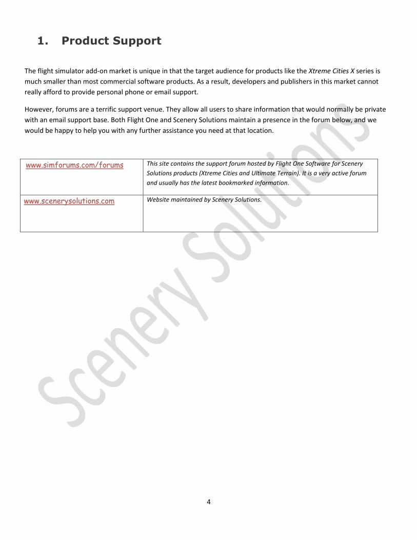
1. Product Support
The flight simulator add-on market is unique in that the target audience for products like the Xtreme Cities X series is
much smaller than most commercial software products. As a result, developers and publishers in this market cannot
really afford to provide personal phone or email support.
However, forums are a terrific support venue. They allow all users to share information that would normally be private
with an email support base. Both Flight One and Scenery Solutions maintain a presence in the forum below, and we
would be happy to help you with any further assistance you need at that location.
www.simforums.com/forums This site contains the support forum hosted by Flight One Software for Scenery
Solutions products (Xtreme Cities and Ultimate Terrain). It is a very active forum
and usually has the latest bookmarked information.
www.scenerysolutions.com
Website maintained by Scenery Solutions.

5
2. Xtreme Cities Benefits ?
Congratulations. You are purchasing a first of its kind scenery product, based on a proprietary technology. Xtreme
Cities is created with new software developed by Scenery Solutions that allows masses of custom buildings to be
displayed, while still allowing for smooth flight on an average hardware system.
Nearly every building is present, even houses, with each object in their real world location. Houses follow actual real-world roads, not the “fake” roads in the Landclass textures.
Proprietary, one-of- a-kind technology, allows custom scenery objects to be created and displayed with a performance level on par with (per object) or better than FSX’s optimized autogen technology.
Gorgeous night lights with ground lighting.
As with our Ultimate Terrain products, XTreme Cities is fully configurable. Each feature can be turned off and on down to either the product or city level.
Proprietary TexturePhoto technology allows for picturesque terrain scenery for non-seasonal areas, with transparent areas for seasonal vegetation. This strategy provides full support for all seasons, which is not normally feasible with Photoscenery terrain due to large download and storage requirements.
For Photoscenery users, Xtreme Cities greatly enhances the terrain by adding buildings, trees and lights in their real-world locations. A real plus for Photoscenery products, which are usually flat and barren.
Works seamlessly with Ultimate Terrain and other similar products.
Multiple versions are available to specifically target users with either the base FSX textures installed or upgraded terrain texture packs from the most popular 3rd party addons. At this point, in addition to the base FSX versions, we provide customer installers for users with “Ground Environment X” or “Orbx FTX Global Base” products installed. This allows Xtreme Cities regions to blend in best with the surrounding landclass textures.
Optional configuration modes to benefit high-altitude flyers who desire the detailed cityscapes with as little VAS (virtual address space) usage or frame rate impact as possible.
Nothing like this has been available to flight simulator users in the past. Xtreme Cities will be the missing piece for many Flight Simulator fans.

6
3. Xtreme Cities X – Quick Startup
After installation, the XTreme Cities X installer will immediately call the XTreme Cities X Setup Tool. The first time the setup tool is executed, it will automatically configure your environment using the default settings. You don't need to do anything else at this point.
4. Locating FSX If Not in Registry
The Xtreme Cities X tool will look in the registry for the location of FSX. If you have moved the FSX location, you can
browse to the new location and change it.
Press the “Change FSX Location” button to do this
You will be shown the current FSX location as found in the windows registry. To change the location press the “Browse
For FSX” button and select the folder containing your FSX.EXE file. A green arrow will indicate that FSX was found at this
location. A red X indicates that the location is invalid.

7
5. Xtreme Cities X– Interface Details
Validation Process And Error Checking
Immediately after the installation process, the Xtreme Cities X Interface will be started. Each time the interface loads it
will validate many of the FSX configuration settings for you and display any unresolved texture references or layering
problems that it finds.
Figure 5-1 (startup process)
In the example above, the validation process found no significant errors. At this point, you can press the OK button to
continue.
In the event that the validation process finds inconsistencies, you will be warned as shown in Figure 3-2. To view the
warning messages, click the “Warning Messages Are Available” button.

8
Figure 3-2 (validation errors found)
Figure 3-3 (warning message)

9
The Interface
The Must Read Section
The XTreme Cities X Setup Tool allows you to make specific configuration changes to each individual city. This level of
configurability is very beneficial as you can tune things to meet your personal needs, This is especially helpful if you
have other 3rd party scenery covering the same areas.
Figure 3-4
When the application starts, all installed product regions will be displayed. In the example above, we have 6 “Installed
Products”. For this example, we will use the USA SouthCentral product

10
Selecting USASouthCentral from the installed product list will display a list of all cities in the product region in the
“Product City Selection” box.
Figure 3-5

11
Now, we can select and configure the individual cities. If you select a city, like “Tulsa” in figure 3-6, you will see the way
Xtreme Cities is currently configured for just that city.
Figure 3-6
The configurations are shown in 3 sections: Vector Scenery, Scenery Objects and Other. To
change the configurations for a city, you will click the various settings in these 3 sections and
then press the “Modify Selected City” button to set the changes. When you make a change,
you will notice that a portion on the right side will contain one of two symbols:
Indicates that all changes have been saved.
Indicates that you have unsaved changes.
When you click the “Modify Selected City” button to save changes, the changes will be saved and
the green symbol will reappear. If you switch to another city or product with changes unsaved,
the changes will just be ignored for the current city.

12
Making Batch Changes To All Cities In A Region
The “Modify Selected City” button makes changes only to the selected city. But, you can make modifications to one city
and have the software duplicate the changes to all cities in a product.
Press the “Modify Current Product” to make the changes to all cities in the current selected product (Installed Products
box).
Individual City Settings
Terrain Mode
The “Terrain Mode” box will set the best individual configurations for you, based on some general conditions. By
default, the Xtreme Cities TexturePhoto coverages are expected to be used.
The “Photoscenery” button will prepare the current selected city for use with an installed photoscenery product which
covers that city area.
“Vector Terrain” will disable the TexturePhoto terrain and the custom ground polygons provided by Xtreme Cities. This
will allow the underlying landclass to be used in the Xtreme Cities area along with other vector features (i.e roads). You
will still get the Xtreme Cities buildings, trees and lights. But, you will see the urban landclass textures with the fake
roads, in addition to any vector roads that are present. We wouldn’t normally recommend this setting. But, some
users may find value in it.
“High Altitude” will only activate library objects, commercial buildings and the lighting. Cityscapes will still be seen
from a distance, which will come as a benefit to high altitude only fliers. This mode will both help with framerates at a
high altitude and also VAS usage.
Scenery Objects Section
You can turn the various types of scenery objects on and off as you wish. The different options are as follows:
Base Buildings–Commercial buildings, storage tanks and railroad cars.
Houses- Residential houses and apartments
Street/Lot Lights–All night lighting
Bridges- Extrusion bridge objects for roads.
Trees – All custom tree objects.
Library Objects – FSX library objects or custom objects

13
Library Objects require more discussion.
Library Objects
Nearly all Xtreme Cities objects are based on our proprietary technology that clusters objects together as one for
efficiency. However, some landmark FSX objects or additional custom objects may also be present in their native forms.
These objects are generally more detailed than the more efficient models normally used in Xtreme Cities.
Detailed FSX library object buildings are a rarity and do not exist in all cities. But, when present, they can hurt frame
rates due to inefficient texture use and/or high polygon counts (especially with the LOD support not present for library
objects in FSX SP2).
Most cities do not have detailed FSX library objects. For example, the City of Houston has 14 library building objects.
The city of Ft Worth, TX has zero. Austin, the capitol of Texas, also has zero detailed buildings shipped with FSX.
When cities do have custom FSX library objects available, we will use them by default. But, we give you the option of
removing those buildings if frame rates are too heavily affected.
Press “Detail” for FSX library objects or uncheck it to remove detailed objects. In some products, we may provide
“Efficient” versions of these library objects. This will be important for some cities, like Seattle, which have a large
number of detailed library objects present.
If you see either button greyed out (efficient is greyed out in our example), then models are not available for the current
city in that version.
Vector Scenery Section
Xtreme Cities use very little vector scenery, with the following exceptions:
1. Water polygons are used for the water areas cut out of the TexturePhoto.
2. Moving road traffic is provided.
3. Detailed ground polygons provide for the green/vegetative areas in the cities.
Because of the FSX scenery boundary limitations, Xtreme Cities provides replacement water all the way out to all QMID
11 boundaries that are affected by the city. This allows a seamless transition between Xtreme Cities and the
surrounding vector scenery features (like Ultimate Terrain X) or even default FSX water.

14
“Other” Section
This section contains other important elements associated with Xtreme Cities. You can toggle these items on and off.
But, you should use caution as they may have undesired results.
Mesh-Xtreme Cities provides its own mesh that is limited to the city boundaries. We use the custom mesh to
make sure building clusters are level with the ground and reduces the chances of floating or sinking buildings.
Autogen Excludes – Autogen is normally excluded automatically when a custom ground texture is used.
However, we provide a separate autogen exclusion file for more precision. This should not be disabled unless
you wish to use vector terrain.
Object Excludes – Because Xtreme Cities provides all the objects in a city, this features excludes all FSX objects
beneath them.
Vector Excludes – This feature excludes the default roads, water and other vector features as necessary.
TexturePhoto – There are 3 different TexturePhoto check boxes, because there are 3 layers of TexturePhoto for
each location. Each layer handles different LOD ranges: Near (LOD 14-16), Medium (LOD 11-13), Far (LOD 4-
10).

15
Global Settings
These settings affect ALL Extreme Cities products installed.
Seasonal Tree Textures
If you desire, you can change the tree textures to match the current season that you wish to fly.
Extreme Cities provides its own textures. However, you can also use the current default installed FSX tree texstures. If
you wish to use the currently FSX tree texture, then check the “Use Seasonal FSX Tree Texture” button. Using the
current FSX tree textures may help to blend scenery areas. So, we recommend doing this.
To save your changes, press the “Modify Tree Textures” button to replace the current texture.
Change FSX Location
The setup tool will look in the windows registry for the FSX installation location. If you have moved your copy of FSX
manually, you should locate it manually by pressing this button.
Changing The Light Texture
Xtreme Cities products provide night lighting objects with transparent ground lighting. We have provided different
options to modify the color the night lighting. Note: The custom installer that you chose will typically install the best
lighting option for you.
This option is important because you may want to match other products that provide night lighting (i.e. UTX or Orbx FTX
Global). Pressing the “Change Light Texture For Selected Product Button” above will display the following window with
your current options.
To change the installed lighting option, make a selection from the list and press the “Install” button.

16
6. Night Lighting
The Xtreme Cities X night lighting is very realistic and frame rate friendly, especially when you consider that each city
typically contains between 18,000 and 60,000 light objects.
The night lights are invisible to the user during the day. But, from the simulators standpoint, the lights are still present
and will take a few extra resources to process. If your computer’s resources are at a minimum, you can save a few
frame rates by disabling the night lighting for daytime flights if you desire.
There are two ways to enable/disable the lights.
1. Prior to flight, you can disable or enable the night lighting using the Xtreme Cities interface.
2. During flight, you can disable or enable the night lighting by lowering the scenery density slider from “Extremely
Dense” to “Very Dense”. Running at the “Very Dense” setting will give you every Xtreme Cities X option except
for night lighting.
Most users will probably not feel a need to disable the night lighting during the day. But, you have that option available
to you.

17
7. What Is TexturePhoto Terrain ?
Before discussing TexturePhoto, here is an overview of the two main types of terrain products available (excluding mesh
for elevations). The two types of terrain textures are “Landclass” and “Custom Terrain Textures”. Photoscenery is an
example of the latter.
Landclass Terrain The default terrain system in Flight Simulator is landclass, which is optimized to minimize disk space. The system
divides the entire world into cells that are roughly 1.2gb square. Each of these squares is assigned to a particular type
of landclass (i.e. Forest, Farmland, Shrubs, Urban, Suburban). Each type of landclass has a unique type of texture
assigned to it. There are roughly 140 different types of landclass textures available in Flight Simulator. Of these 140
types, there are 11 different types of city textures. The rest of the landclass textures are basically all vegetation.
When flying over the Flight Simulator terrain, you will see an appropriate blend of landclass textures put together in a
sort of grid. The edges of the grid are blended to keep the terrain from looking like a bunch of squares.
Disadvantages of Landclass
Landclass is very efficient because there are a little over 8,000 landclass texture images, including seasonal variations,
which can be shared across the entire global for efficiency. These images take up 5gb of disk storage, which is small
considering the alternatives. The drawback to Landclass is that while the images give the impression of reality, the
features in the images are not geographically accurate, especially in urban/suburban areas. In these areas the houses
and other buildings are aligned along “fake” roads built into the textures. These fake roads are not in their real world
locations. When vector roads (i.e. highways, major roads and minor roads) are drawn on top of these images, the
vector roads which are geographically accurate clash with the roads in the Landclass textures.
What about Photoscenery, which is a custom terrain texture ? Well, this also has drawbacks that are discussed in the
next paragraph.
Photoscenery Terrain (Custom Terrain Textures) Photoscenery terrain is drawn using photographic aerial images. It is a fairly popular addon option for Flight Simulator.
While Photoscenery gives the most geographically terrain accuracy available, there are drawbacks.
Disadvantages of Photoscenery
Covering the entire global is not feasible, because the storage requirements and distribution sizes would exceed
the user’s system capacity.
Most Photoscenery does not contain seasonal variations, because this would require separate, colorized images
for each season (spring, summer, fall, winter and hard winter).
Photoscenery does not generally contain a complete set of autogen objects, which means the terrain is usually
flat or with only a few custom buildings appearing.
With Photoscenery it is difficult to blend in with the surrounding landclass along the borders, because of the
color variations. Landclass textures are typically much brighter than photoscenery.
Photoscenery can often lead to long flight load times.
If you are a Photoscenery user, XTreme Cities can really help because objects in Xtreme Cities, including trees, are
positioned in their real world locations. The Xtreme Cities configuration tool has a specific setting for Photoscenery use.

18
TexturePhoto TexturePhoto is a name we give to our proprietary method of drawing the terrain. TexturePhoto attempts to use parts
of the previous strategies combined together.
TexturePhoto does not use Photographic images like Photoscenery. However, we do create custom terrain images for
each “cell” that are based on very accurate city map data containing features like roads, railroads, parks, parking lots,
baseball fields, tracks and other features that are placed in their real-world locations. We use this city map vector data
to “paint” a static image using textures specifically created to match the surrounding landclass. To avoid the seasonal
variation problem associated with Photoscenery, we cut out transparent areas from the static images and allow
vegetation areas and water to shine thru. In addition, we replace the default landclass textures that normally have the
fake roads and houses, with a more appropriate landclass texture that can be used for residential vegetation. We only
need to use the landclass textures for the vegetative areas, because all other non-seasonal features are handled in the
custom terrain textures.
With TexturePhoto, there are no more fake roads in the background landclass images in urban areas.
The TexturePhoto images are still a little large in size. But, we only have to provide enough of the custom images to
cover our city boundary areas. And, not having to provide seasonal variations allows us to provide only 1 set of images
as opposed to 5 sets (1 for each season).
Because we use the existing landclass textures (as custom ground polygons) for vegetation in the transparent areas, the
scenery will not generally be affected when the user purchases popular addon texture replacement packages like (Flight
One’s Ground Environment X or Orbx FTX Global Base Pack). However, to create even better blending, we provide
custom installers for users that have the base FSX package, Ground Environment X or FTX Global Base (and maybe
others in the future).

19
8. Configuring Flight Simulator For Use With Xtreme Cities
Scenery Library Layering
Xtreme Cities products should be positioned above most, if not all, other scenery products. In the screenshot below,
the Xtreme Cities “USA South Central” products is positioned at the top, above all the Ultimate Terrain layers.
The layering between Xtreme Cities products does not matter, because they will each cover different regions. For
example, if you have 2 Xtreme Cities products; “USA SouthCentral” and “USA SouthWest”, it really doesn’t matter which
layer is on top of each other. You just need to make sure that they are both positioned over any other large regional
products that are installed, like Ultimate Terrain X.

20
Texture Resolution Setting
Xtreme Cities TexturePhoto images have a 60cm resolution. For optimal visuals, you should make sure that the “Texture
Resolution” slider in the FSX “Settings – Display” section has a resolution of at least 60cm.

21
9. FAQ
Does XTreme Cities require Ultimate Terrain X to be installed
XTreme Cities is a standalone product and does not require any other product. However, for optimal coverage we
recommend using Ultimate Terrain X to fill in the areas outside of our detailed XTreme Cities city boundaries.
How compatible is XTreme Cities X with Ultimate Terrain X product ?
Xtreme Cities X is completely compatible with Ultimate Terrain. In many cases, Ultimate Terrain will further enhance
Xtreme Cities, because UTX provides better landclass and more accurate roads, which will help with the blending of
products. Also, both XTreme Cities X and Ultimate Terrain X are based on the same commercial data vendor (TomTom).
Is Xtreme Cities compatible with Ground Environment X (GEX) ?
Yes. We highly recommend GEX as a landclass replacement texture package. We have optional installers available
for the best visual performance with GEX.
Is Xtreme Cities compatible with Orbx FTX Global
Yes. We have optional installers available for the best visual performance with Orbx FTX Global Base textures.
How compatible is XTreme Cities X with other vector products, including basic FSX ?
Extra measures were taking to make sure Xtreme Cities X products are as compatible as possible with all other vector
terrain scenery products. We even expanded the Xtreme Cities X water coverage to fill all large QMID 11 boundaries
that are intersected by our scenery, so that no gaps will occur between our city boundaries and the surrounding terrain.
This was necessary because of the way FSX handles exclusion areas for things like water (QMID 11 boundary).
Some very slight anomalies may occur with other vector products or with the default FSX vector data, especially if the
data is misplaced from their real world locations. The blending of water and roads will generally work the best with
Ultimate Terrain, because the expanded water data is based on the same data used in Ultimate Terrain.
If XTreme Cities terrain consists of custom raster terrain images, how are seasonal transitions handled ?
Xtreme Cities has a very clever way of blending static terrain and vector features to allow our city terrain to blend in well
with the surrounding landclass textures. We use static imagery for only the non-vegetation portions of the terrain.
This includes features like roads, railroads, parking lots, walkways, garden paths, gravel pits, shipping grounds,
shorelines, industrial areas and intermittent water areas. We use transparency in the static images to allow custom
vector terrain textures (landclass images) to show thru for water and vegetative seasonal areas like: forests, parks,
grassy areas, etc. Using the landclass textures in the transparent custom portions allows Flight Simulator to handle the
seasonal transitions automatically.
Extreme Cities sounds like Project X that you guys mentioned years ago. Is it the same thing ?
Yes. Project X was only a concept with a prototype a few years ago. Xtreme Cities is a production ready system with all
the technical issues of the past resolved. The development software has taken us a full 2 years of development, with the
theory being initially developed over 10 years ago.

22
How is it possible to get such smooth performance in Xtreme Cities with all those custom building objects ?
First, we use all the well-known methods for getting good frame rates in our scenery. One of these methods involves
using shared texture sheets for the buildings. Most importantly, our great performance comes from a proprietary way
of creating scenery objects which makes tens of thousands of scenery objects appear to the simulator as only a few
hundred.
How efficient is our process ? In a scene with 10,000 building objects spread over a 50 sq/km area, our process might
require FSX to make only about 100 draw calls total to display the buildings. Without using our software strategy,
custom scenery would take AT LEAST 10,000 draw calls minimum to display 10,000 objects. The number of necessary
draw calls for a scene goes up if a developer uses more than 1 draw call per object. Using these numbers as a typical
situation, it is safe to say that our process is at least 100x more efficient when it comes to drawing custom scenery
objects. In fact, our process allows custom buildings to be drawn with about the same efficiency as the FSX autogen
process, which is very efficient but does not handle custom building objects.
I still see some slowdown with XTreme Cities
As we said previously, Xtreme Cities is very efficient. During beta testing, all cities have been reported as flyable by our
users with no stutters. This is amazing considering the sheer number of buildings and other objects present. Without
using our proprietary technology, Flight Simulator would be flyable given the same numbers of custom objects. We
actually did test this comparison by creating a test area with each object being a separate model. During the test, the
Flight Simulator was one big stutter with a frame rate of less than 1.
The level of efficiency in our object creation methods is very similar to the way FSX draws autogen (batching).
However, our city areas are much denser than autogen urban areas, especially downtown. Autogen buildings tend to
be inflated in size to reduce the number of objects. All of our buildings are in their real world size and location. The
downtown areas in Flight Simulator are typically very sparse, because there is almost no autogen due to the downtown
landclass textures used. So, comparing Xtreme Cities to downtown city autogen is not even relevant.
Given the same number of objects displayed, our scenery is nearly identical in performance to autogen. In some tests it
appears more efficient.
The cities are very nice. But, the buildings are not as detailed as I would have liked.
Our goal with Xtreme Cities at this time is to create accurate cityscapes in which every building is sized and positioned in
their real world location, without badly impacting frame rates. Using shared textures is one way we accomplish
performance gains. For commercial buildings over 3 floors in height, we make an attempt to select the most
appropriate texture out of the 64 textures available. Prepar3D versions will be a little more detailed than FSX due to
the increased texture size.

23
I fly helicoptors and cannot land on the buildings
The optimization strategy and complexity used in XTreme Cities to help performance forces us to remove building
crashes. You cannot crash or land on a building as is. However, we realize that this product may be very popular with
helicopter pilots. So, we have created heliports that can be landed on. These heliports are normally in their real-
world locations and often appear on hospital roofs, hi-rises or ground placement. A list of heliports and regional
airports are included as a separate document specific to the product region in question. You will find that this
document was installed with the product.
I live in one of the provided cities but a house object is not present where I live
The scenery boundaries are based on the TomTom 2D Map data that we base our product on. These boundaries always
include the downtown area, extending outward some distance. The boundaries may include portions of suburb cities
and exclude portions of the main city. Typically, Xtreme Cities boundaries are rectangular.
We provide a separate document for each product that shows the exact coverage area for each included city.
The Xtreme Cities Houses Area Smaller Than Autogen Houses
Yes they are. Xtreme cities houses are accurate as they are based on actual house footprints. Autogen buildings are
unrealistically increased in size to give the appearance of a fuller urban landscape.

24
10. Product Updates
We may periodically provide updates to our products. The best place to look for product
announcements will be at the Scenery Solutions site, our support forums or various other social
media sites that we maintain.
Because of the size of the TexturePhoto and object scenery files, we expect updates on these to
be kept to a minimum. However, other features can be enhanced and distributed on a much
smaller level. If you have an enhancement question or suggested, please post it in our support
forum.
Best places to get update news:
Scenery Solutions Website http://www.scenerysolutions.com/news
Flight 1 Support Forum Simforums
Facebook http://www.facebook.com/ScenerySolutions
Twitter #FsxSolutions
Tumblr http://scenerysolutions.tumblr.com