west coast 3-4 '12
TRANSCRIPT

44 March/April 2012 nRoadBike n RoadBikeMag.com
Thanks to the 1967Beach Bill, 100 percentof the Oregon coastlineis public land.

BY JON LANGSTON
In the conversation about riding the West Coast, the stretch from Los Angeles to SanFrancisco gets all the glory, and deservedly so. After all, it’s home to such illustrious placesas Big Sur, Half Moon Bay, Hearst Castle, et al. Moreover, it’s one of the top riding/drivingroads in the country — check that: North America. I mean, of course, the world. So itmakes sense that it receives the lion’s share of attention.
But I’m here to serve notice. While the run up (or down) the central California coast is a funlittle jaunt, if you want to take a real motorcycle journey, ride beyond the sprawl of El Lay and theBay Area. The coastal road runs all the way to Canada, my friends, and from the wineries ofMendocino to the yurts on Yachats to the cheese in Tillamook, there is much to discover among therocky shorelines, towering redwoods, and ocean vistas of the Pacific Northwest.
Shiftless In SeattleSeattle is surely one of America’s great cities. I began my tripin the Emerald City as an excuse to spend a couple of dayswith an old friend; by the time I left, I’d hung out in the dress-ing room of blues legend Jimmie Vaughan at the Triple Door,shook hands with motocross legend Dick Mann, and spentsome quality time with the exact sweater that Kurt Cobainwore in the video for Smells Like Teen Spirit at the ExperienceMusic Project. It was a glorious couple of days, but once Ipicked up a Cory Ness Edition Victory Cross Country fromHinshaw’s, a dealer in neighboring Auburn, Washington, itwas time to head for the coast.
My trip kicked off in Centralia, at the Olympic Club Hotel& Theater, one of the McMenamin’s chain of refurbished (oraltogether repurposed) pubs, hotels, and breweries in thePortland, Oregon, area. This joint was originally a seedydowntown pool hall and rooming house next to the railroadtracks. Today, it features a cozy bar, delicious restaurant, and first-run movie theater, all of whichare restored to pristine, late 19th-century detail. Best, it still rocks the original pool hall, repletewith checkered tile, a huge, wood-burning stove, and hanging chalk on retractable rope above eachtable. The hotel has proper rooms for rent, but I opted instead for one of the flophouse jobs on thesecond floor with a bunkbed and (meticulously spotless) bathroom down the hall. After a long dayat the AHRMA Chehalis Nationals (January/February), taking a bunk at the Oly Club just felt likethe right thing to do. I’ve researched the chain, and decided if I ever make it back to Portland, I’llhappily book my stay at another McMenamin’s, thank you.
I’d planned to head toward the coast directly from Centralia, but if I’ve learned anything aboutmotorcycling, it’s that mental cobwebs are best blown out at high, easy speeds. So the following morn-ing, I jumped on Interstate-5 south and gave the big Vic a purpose-built twist. After a couple of hours,my head felt great, and I’d nearly cleared the Oregon border. At a town called Kelso, I transitioned to
RoadBikeMag.com nRoadBike n March/April 2012 45
tooled. While much of 101 is rural, aspeed limit of 45 mph is pretty standard;occasionally it was boosted to 55, butthose moments are few and far between.Also, the coastal towns and communitiesin the north are in fairly close proximityand have even slower speeds posted with-in city limits. Furthermore, there areplenty of RVs and bicyclists here toimpede your progress. So relax, and takeadvantage of the passing lanes wheneverpossible.US 101 veers slightly inland, and I
rolled through Tillamook, where the name-sake cheese is produced. Tours are avail-able, if you’re onto that sort of thing; I’mmuch more the brewery-tour type, andbesides, it was a beautiful afternoon and Ihad miles to ride. Beyond Tillamook, 101stays away from the shore for 25 miles orso, circumventing Cape Lookout. Here thetowns are more sporadic, the speed limit ismore relaxed, and before the road rejoinswith the shore, it cleaves a mountain pass,where I had the opportunity to cavort witha couple of sportbikes and lean the Cross
Country over, hard. For pure motorcycling enjoyment, this wasthe highlight of Day One.I reached Newport by sunset. A commercial fishing hub west
of Corvallis with a large harbor and plenty of lodging options, thedowntown marina area is bustling with ocean-themed bars andrestaurants. I had a sumptuous bowl of homemade cioppino atKarin and Corky’s Sharks Seafood Bar (if you’ve never tried thisdelicacy, a tomato-based fish stew that originated in the Italianand Portuguese areas of North Beach, San Francisco, I can’t rec-ommend it highly enough), then tipped back a couple of well-deserved pints at the Rogue Ales Public House. At eight o’clock the next morning, the sun was casting long
shadows that stretched across 101. I rode through the SiuslawNational Forest, home to the eminentHeceta Head Lighthouse. Eventually, Ifound myself crawling along in secondgear among a throng of RVers and bicy-clists on a thin, two-lane, asphalt ribbonthat’s carved into the cliffs above theshoreline. The brightest light on the Oregon
coast, the beam from Heceta Head can bespotted more than 20 miles out to sea. It’spurported to be the most-photographedlighthouse in the US, certainly inOregon. Built in 1894, it and the keeper’shouse are listed on the National Registerof Historic Places. The home is actually abed and breakfast; judging by the amount
US Highway 30 West and made for the coast. Obviously, the log-ging industry dominates the forest-laden Pacific Northwest, andthis stretch of the Columbia River basin is the destination forthousands of square miles’ worth of felled wood. Logs turned thewater’s surface brown and formed a floating bridge across theriver as they made their way to the sea. It wasn’t long before Ismelled salt in the air, and after Astoria, Oregon, I turned southon US Highway 101, the Oregon Coast Highway.
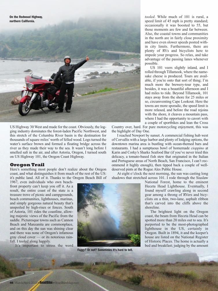
Oregon TrailHere’s something most people don’t realize about the Oregoncoast, and what distinguishes it from much of the rest of the US:it’s public land. All of it. Thanks to the Oregon Beach Bill of1967, even individuals who own beach-front property can’t keep you off it. As aresult, the entire coast of the state is atreasure trove of picnic and campgrounds,beach communities, lighthouses, marinas,and simply gorgeous natural beauty that’sunspoiled by high-rises or fences. Southof Astoria, 101 rides the coastline, allow-ing majestic views of the Pacific from thesaddle. Picturesque towns such as CannonBeach and Manzanita are commonplace,and on this day the sun was shining clearand there was none of Oregon’s infamousgray cloud cover — or its notorious rain-fall. I tooled along happily.It’s important to stress the word
46 March/April 2012 nRoadBike n RoadBikeMag.com
On the Redwood Highway,northern California.
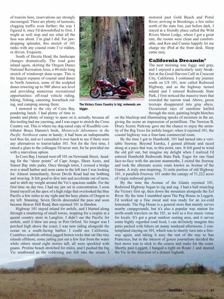
Foggy? Or not? Sometimes it's hard to tell.
motored past Gold Beach and PistolRiver, arriving in Brookings, a few milesnorth of the state line, just before dark. Istayed at a friendly place called the WildRivers Motor Lodge, where I got a greatrate, the rooms were clean and comfort-able, and Ken and Connie happily let mecharge my iPod at the front desk. Sleepcame easy.
California Dreamin’The next morning was foggy and gray,and I enjoyed a particularly tasty break-fast at the Good Harvest Café in CrescentCity, California. I continued my journeysouth on US 101, now called RedwoodHighway, and as the highway turnedinland and I entered Redwoods StatePark, I first noticed the massive trees thatcrowded the narrow road. Above, greentreetops disappeared into gray abyss.Occasional rays of sunshine knifedthrough the mist, painting bright blotches
on the blacktop and illuminating specks of moisture in the air,giving the scene an impression of pointillism. The Newton B.Drury Scenic Parkway gave me the chance to enjoy the seren-ity of the Big Trees for awhile longer; when it rejoined 101, thecoastal highway was a four-lane commercial route.By the time I got to Humboldt, 101 had turned into a veri-
table freeway. Beyond Eureka, I gained altitude and racedalong at a pace that was, to this point, rare. It felt good to windthe old girl out, but imagine my delight when I realized I’dentered Humboldt Redwoods State Park. Eager for one finalface-to-face with the ancient mammoths, I exited the freewayand took the alternate scenic route known as Avenue of theGiants. A truly awe-inspiring, 31-mile portion of old Highway101, it parallels Freeway 101 under the canopy of 51,222 acresof virgin redwood groves. By the time the Avenue of the Giants rejoined 101,
Redwood Highway began to zig and zag. I had a ball musclingthe Victory first up, then down the mountain alongside the EelRiver. By the time I stumbled upon The Peg House in Leggett,I’d worked up a fine sweat and was ready for an ice-coldlemonade. The Peg House is a general store that mainly servesnearby campgrounds, but it’s also a popular way station fornorth-south travelers on the 101, as well as a live music venuefor locals. It’s got a great outdoor seating area, and it servessome highly regarded road food; I can definitely imagine thispatio packed with bikers on sunny weekend afternoons. I con-templated staying on 101, which was to shortly turn into a free-way again, and taking it easy the rest of the way to SanFrancisco, but in the interest of gonzo journalism decided thebest move was to stick to the course and make for the coast.Shortly past Leggett, I banged a right on Route 1 and steeredthe Vic in the direction of a distant fogbank.
of tourists here, reservations are stronglyencouraged. There are plenty of turnouts,clogging traffic even further; the way Ifigured it, once I’d downshifted to first, Imight as well stop and see what all thefuss was about. I’m glad I did. For jaw-dropping splendor, this stretch of 101ranks with any coastal route I’ve ridden,or driven. Exquisite.South of Heceta Head, the landscape
changes dramatically. The road goesinland again, skirting the Oregon DunesNational Recreation Area, a 40-mile-longstretch of windswept dune-scape. This isthe largest expanse of coastal sand dunesin North America, some of the sculpteddunes towering up to 500' above sea leveland providing numerous recreationalopportunities: off-road vehicle riding,hiking, fishing, canoeing, horseback rid-ing, and camping among them. I motored to the city of Coos Bay,
pondering lunch. I had plenty of time toponder and plenty of energy to spare on it, actually, because allthis tooling had me yawning, and I was eager to stretch the CrossCountry out. This is where my dog-eared copy of RoadBike con-tributor Bruce Hansen’s book, Motorcycle Adventures in thePacific Northwest came in handy; it had been an indispensabletool thus far, and so I consulted it over lunch to see if there wereany alternatives to tourist-laden 101. Not for the first time, Iraised a glass to the colleague I’d never met, for he provided mewith a marvelous option.In Coos Bay, I turned west off 101 on Newmark Street, head-
ing for the “shore points” of Cape Arago, Shore Acres, andSunset Bay state parks. Once through town, I crossed a bridgeover a small harbor and soon came to the left turn I was lookingfor. Almost immediately, Seven Devils Road had me bobbingand weaving. It felt good to dive into and accelerate out of turns,and to shift my weight around the Vic’s spacious saddle. For thefirst time on day two, I had my jaw set in concentration. I soonfound myself on the apex of a high ridge that overlooked the bluePacific a few miles to my right and the hazy plains of Oregon tomy left. Stunning. Seven Devils descended the pass and soonbecame Beaver Hill Road, then rejoined 101 in Bandon.Highway 101 stayed inland for awhile, and I blasted along
through a smattering of small towns, stopping for a respite at aquaint country store in Langlois. I didn’t see the Pacific forawhile, until it blew me away in Port Orford. No longer was Iperched high above the coast; I was now riding alongside theocean on a south-facing harbor. I could see California.Countless seabirds orbited jagged brown rocks that sat like tinyislands offshore, some jutting just out a few feet from the waterwhile others stood eight stories tall; all were speckled withguano. Pristine beach stretched for miles, and I pushed the bigVic southward as the reddening sun fell into the ocean. I
RoadBikeMag.com nRoadBike n March/April 2012 47
The Victory Cross Country is big; redwoods arebigger.

While in Oregon, I was impeded by RV traffic and small-town speed limits; the coastal route of northern California issparsely settled and less cluttered with tourists. I was able tocruise for long stretches here, and before I knew it, it was pastnoon and I’d traveled more than a hundred miles. By Salt Point,though, I was forced to alter my riding style. Suddenly, trickyswitchbacks forced me to downshift and move around on thesaddle, and I was attacking curves as hadn’t been necessary allmorning. Beyond Ft. Ross, the climb to over 1,000' was practi-cally immediate. I was again on a high cliff overlooking thePacific, and as I crossed the Russian River at the town ofJenner, I again descended to sea level. Shoreline Highway took me into Sonoma County (Napa’s
cooler brother), through Carmet, then on to Bodega Bay, whereit inexplicably cuts inland for a few miles before returning to theshore and running along beautiful, placid Tomales Bay. Judgingby the size of the homes I was seeing, it was clear that I was get-ting close to San Francisco. I rolled through Point Reyes andunassuming Stinson Beach, then through a pretty, undevelopedstretch where the road climbed high above sea level. I watched amassive fogbank slowly approach the coast. At Muir Beach,Route 1 turns inland, and within minutes, I reached the 101Freeway, made a right, and rode across a foggy Golden GateBridge to the City by the Bay.The following day, I dropped the big Victory off at the
Arlen Ness headquarters in Dublin, near Oakland. I plan to ridefrom San Francisco down to Los Angeles via the coast, so I’llbe able to better compare the two rides. But I predict the south-ern stretch is going to have a lot to live up to. RB
(Note: RoadBike would like to thank the folks at Best Western,who kindly provided the author the opportunity to finish thistour when it appeared fate had other ideas.)
But not before negotiating some of the gnarliest switch-backs the big tourer could handle. I’d anticipated a relaxingride to the shore; what I got was a hair-raising pop quiz on howto guide a fully loaded touring motorcycle with an unladen dryweight of 845 pounds down a steep, narrow, two-lane, moun-tain road in dire need of a manicure. Once I got the hang of it,I was struck by how maneuverable the massive Victory couldbe. For a motorcycle of its size, the Cross Country was certainlyshowing its sprightly side. I rounded a bend to the left. Belowme to the right, the gray Pacific, so blue and placid before,crashed angrily against the jagged shoreline. I couldn’t see thesun for the murky fog, but I knew it was getting late in the day.The thick air was ripe with the scent of eucalyptus; I poweredthrough the dreary, wet fog, past the famed InglenookVineyard. I checked into a hotel in the town of Ft. Bragg justbefore the gray sky turned to black.
Mendocino, Sonoma, and MarinWhere I’m from, it’s called Pacific Coast Highway, but inMendocino County, Route 1 is known as Shoreline Highway— which is fine, because the two roads couldn’t be more dis-similar. Southern California’s Route 1 is teeming with stripmalls and gas stations, and clogged with traffic; ShorelineHighway, on the other hand, is essentially a country road. Itgoes through small, quirky towns with monikers like Elk andGualala as blithely as it scoots past secluded, exclusive devel-opments with lofty names such as Anchor Bay and Sea Ranch.Regardless of the specific locale, though, this is great riding:relaxed in some places and challenging in others, but alwaysinvigorating. Instead of heading due south, the coastal route inthis part of California moves in a distinct southeasterly direc-tion, so the light and landscape were markedly different fromwhat I’d previously experienced.
48 March/April 2012 nRoadBike n RoadBikeMag.com
BEST OF THE WESTGood Harvest CaféCrescent City, CA707/465-6028
Heceta Head LighthouseYachats, OR866/547-3696www.HecetaLighthouse.com
Olympic ClubCentralia, WA 98531866/736-5164www.McMenamins.com
Rogue Ales Public HouseNewport, OR541/265-3188www.Rogue.com
Sharks Seafood BarNewport, OR 541/574-0590www.SharksSeafoodBar.com
The Peg HouseLeggett, CA707/925-6444www.ThePegHouse.net
Wild Rivers Motor LodgeBrookings, OR877/469-5361www.WildRiversMotorLodge.com
RESOURCES Arlen Ness HeadquartersDublin, CA925/479-6350www.ArlenNess.com
Best Western Hotels800/780-7234www.BestWestern.com
Motorcycle Adventures in thePacific Northwest, by BruceHansenWhitehorse Press800/531-1133www.WhitehorseGear.com