vegetative versus wildlife habitat classifications how stuff works
TRANSCRIPT

Vegetative versus Wildlife HabitatClassifications
How stuff works

Vegetative Classifications
•Vegetation Classes aim to reflect differences in vegetation patterns caused by time, climate, soils, topography, and human influences.
•Plant classes, like plant species are hierarchically nested to describe a vegetative community in the appropriate level of detail.
A. PHYSIOGNOMYSystem: Terrestrial/Aquatic - (hydrological regime) Class: Woodland - (spacing & height of dominant form) Subclass: Evergreen Woodland - (morphological & phenological similarity) Group: Temperate Evergreen Needle-leaved - (climate latitude, growth form, leaf form)
Formation: Evergreen needle-leaved forest with conical crowns (mappable units) -

*USGS – 1997 National Vegetation Classification system
•Plant Alliances and associations are the finest level of detail, going beyond the dominant structural species to describe subdominant species often found together.
B. FLORISTICSAlliance (or cover type): Abies lasiocarpa Forest - (dominant species)
Association (or community): Abies lasiocarpa/Vaccinium scoparium [Subalpine fir/Grouseberry] - (subdominant or associated species with similar ecological processes)
Abies lasiocarpa/Vaccinium scoparium forest Subalpine fir/Grouseberry forest

•Numerous vegetation classification systems exist, many of which focus on a specific region.
•This increases their ability to describe local variation and specific plant communities but reduces their relevance to other broad scale systems.
•The result is national vegetation classification systems which broadly describe plant associations and local systems that must be cross walked to other systems for many applications.
Regional Classifications

Wildlife Habitat Classifications
Most all so-called wildlife habitat are actually Vegetation classes determined by individuals
or small groups and then assigned wildlife species to them.
Habitat is mostly implied as componentsto support wildlife but seldom defined.

“Stop thinking like a plant ”
because………. based on a review of about 100,000 literature citations
wildlife information is not collected uniformly
Wildlife Habitat Types are determined based on the similarity of wildlife species that interact or
are associated with different vegetation groups

Animals select habitat in a hierarchical manner:
first level is determined by the species. geographic range;
second level is where a species conducts its daily/seasonal activities (i.e., home range);
third level is for habitat components that are local or site-specific within their home ranges per Hutto (1985).

“Stop calling everything Habitat” Hall et al.1997
because………. the term needs to be redefined by recognizing the
interrelationships of wildlife with different vegetation types. Further, as Hall et al. stated, there is also a need to
standardize terminology
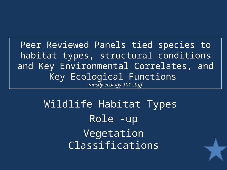
Peer Reviewed Panels tied species to habitat types, structural conditions and Key
Environmental Correlates, and Key Ecological Functions
mostly ecology 101 stuff
Wildlife Habitat Types Role -up
Vegetation Classifications

Our ability to identify floristic types is greaterthan our ability to identify associated fauna.
Therefore, each identifiable vegetation type probably does not represent a unique wildlife-habitat.
Vegetative versus Wildlife HabitatClassifications

Pacific Northwest Habitat Classification
Systems
Segue way into description of habitat crosswalking systems-
<http://icontoo.com/PHaCS/ComplemetarySystems.aspx>

IBIS Proposal

The primary goal:
1)enhancing access to habitat and biodiversity information,
2)updating and refining wildlife habitat mapping at multiple scales,
3)developing GIS repository an decision support tools,
4)developing regional coordination, and
5)conducting outreach and education.

Supporting Addressing Costs
Objectives &Tasks
Subbasin Planning
RegionalData
Center
Core Data
Source
Data Standards
Data Gap
At Risk Data
Currently Allocated
Requested Addition
Total
NED
Operating and Maintaining the Regional Habitat and Biodiversity Information System X X X X X $161,177 $80,495 $238,326 Update and Refine Wildlife Basin, Ecoprovince, and Subbasin Habitat Maps X X X X X $0 $165,530 $165,530 Wildlife Habitat and GIS Repository, Tools and Services X X X X X X $0 $75,777 $75,777 Regional Coordination X X X X X X $0 $465,108 $465,108 Educational Outreach and Publications X X $0 $10,000 $10,000 Total $161,177 $796,909 $954,740


Track Change


Species Accounts for Monitoring
Short-eared Owl
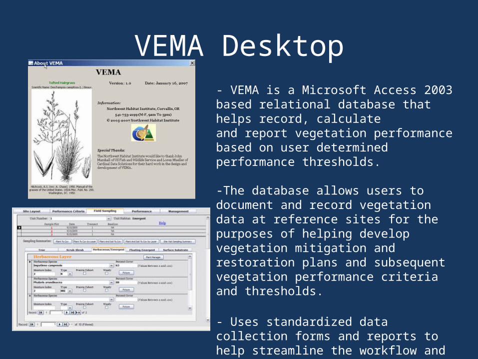
VEMA Desktop- VEMA is a Microsoft Access 2003 based relational database that helps record, calculate and report vegetation performance based on user determined performance thresholds.
-The database allows users to document and record vegetation data at reference sites for the purposes of helping develop vegetation mitigation and restoration plans and subsequent vegetation performance criteria and thresholds.
- Uses standardized data collection forms and reports to help streamline the workflow and tracking of projects.

-Vema Mobile extends field data collection capabilitiesusing handheld computing devices.
-GPS enabled data collection for collecting geographicand tabular information concurrently.
-Automatically syncs with Desktop VEMA to provide seamless data transfer between the office and field.


Coordinate with State, Federal and Tribal organizations at the subbasin or ecoprovince level to assist with data collection like collecting and verifying focal wildlife and habitat facts and records; collection and reporting inventorying and monitoring information….what else
600% increase - Yikes!!
Objective 5 $400,000.00
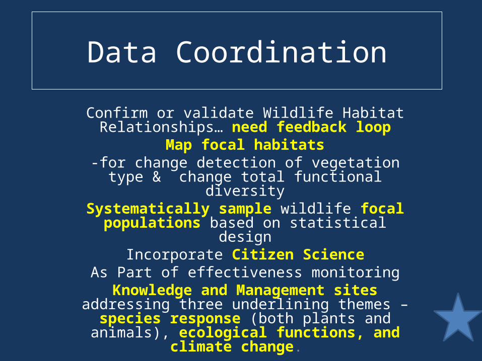
Data Coordination
Confirm or validate Wildlife Habitat Relationships… need feedback loop
Map focal habitats-for change detection of vegetation type &
change total functional diversitySystematically sample wildlife focal
populations based on statistical designIncorporate Citizen Science
As Part of effectiveness monitoringKnowledge and Management sites addressing three underlining themes – species response (both plants and
animals), ecological functions, and climate change.
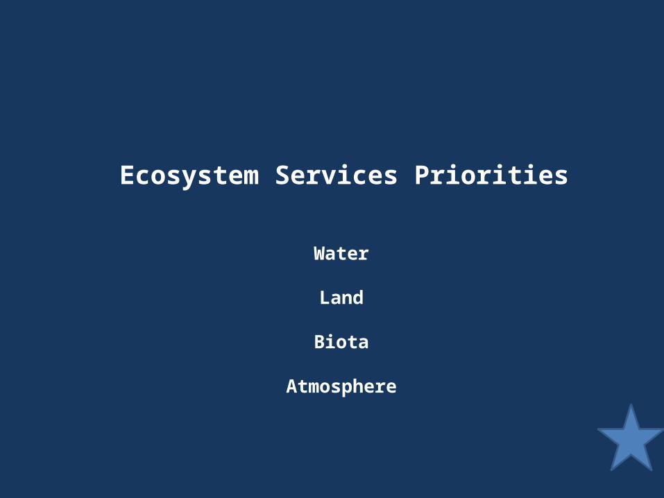
Ecosystem Services Priorities
Water
Land
Biota
Atmosphere
Monitoring
Perspective:
1)Your River now has 1 million people surrounding it, or
2)Your Forest is Falling Apart
Year - Today
Mission: Return Ecosystem Functions


High Level Indicators
Focal Vegetation types amounts and distributionChange of amount and distribution over time
Number of project under, meets, or above goals based on performance objectives