the mughal underground chambers
TRANSCRIPT
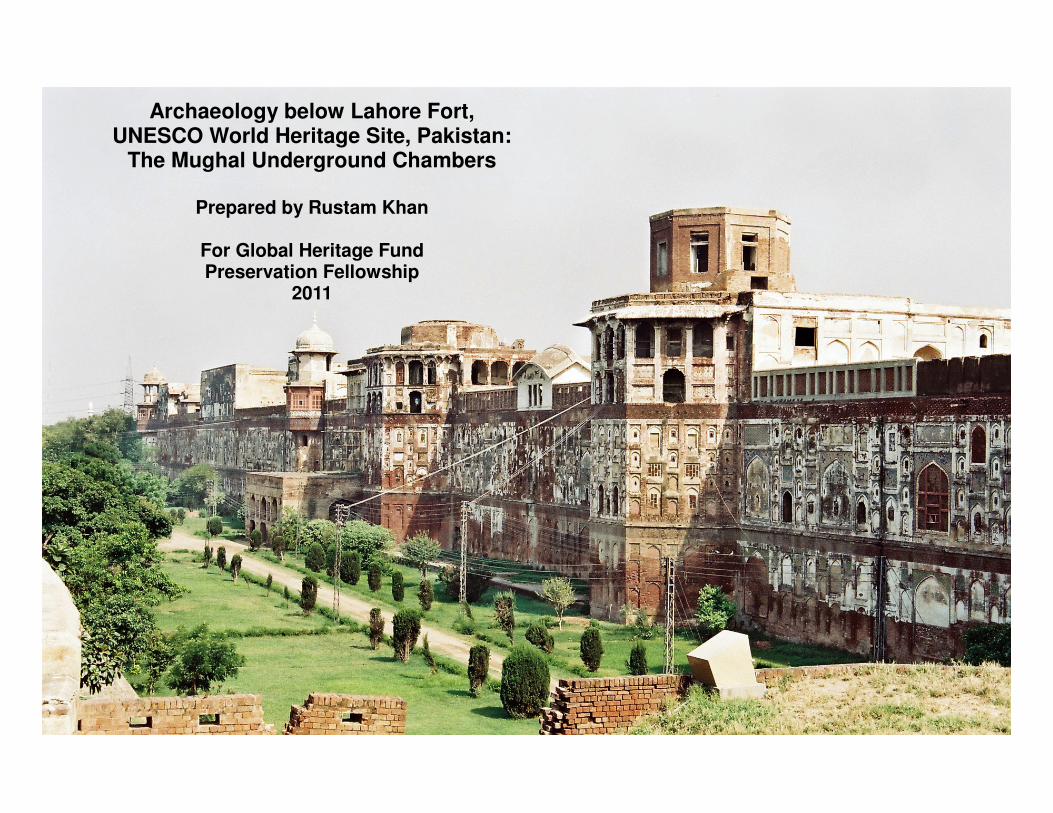
Archaeology below Lahore Fort, UNESCO World Heritage Site, Pakistan:
The Mughal Underground Chambers
Prepared by Rustam Khan
For Global Heritage Fund Preservation Fellowship
2011
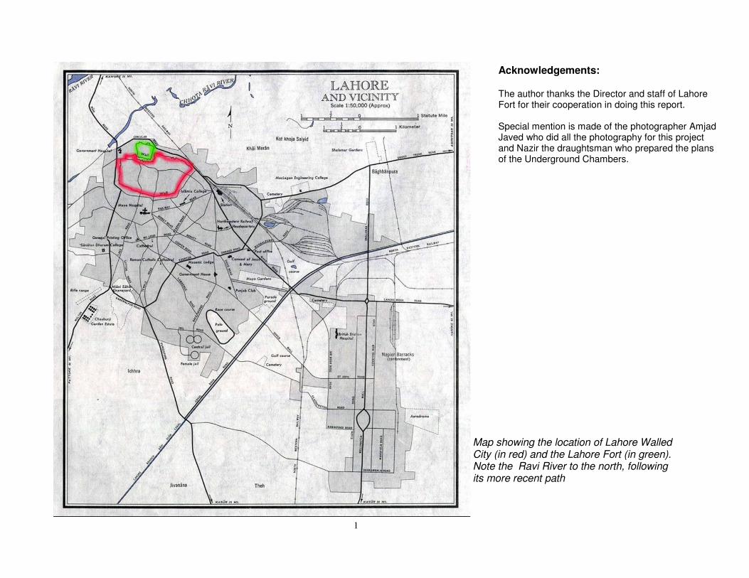
Map showing the location of Lahore Walled City (in red) and the Lahore Fort (in green). Note the Ravi River to the north, following its more recent path
1
Acknowledgements: The author thanks the Director and staff of Lahore Fort for their cooperation in doing this report. Special mention is made of the photographer Amjad Javed who did all the photography for this project and Nazir the draughtsman who prepared the plans of the Underground Chambers.
Archaeology below Lahore Fort, UNESCO World Heritage Site, Pakistan
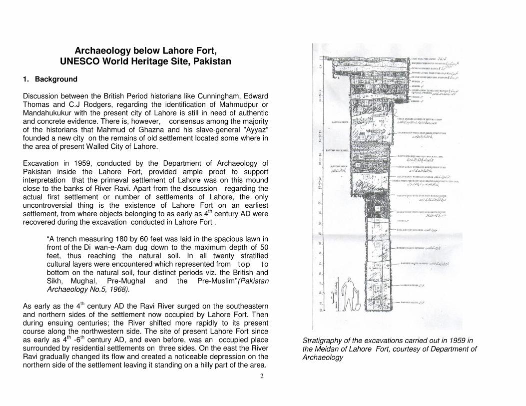
1. Background Discussion between the British Period historians like Cunningham, Edward Thomas and C.J Rodgers, regarding the identification of Mahmudpur or Mandahukukur with the present city of Lahore is still in need of authentic and concrete evidence. There is, however, consensus among the majority of the historians that Mahmud of Ghazna and his slave-general ”Ayyaz” founded a new city on the remains of old settlement located some where in the area of present Walled City of Lahore. Excavation in 1959, conducted by the Department of Archaeology of Pakistan inside the Lahore Fort, provided ample proof to support interpretation that the primeval settlement of Lahore was on this mound close to the banks of River Ravi. Apart from the discussion regarding the actual first settlement or number of settlements of Lahore, the only uncontroversial thing is the existence of Lahore Fort on an earliest settlement, from where objects belonging to as early as 4th century AD were recovered during the excavation conducted in Lahore Fort . “A trench measuring 180 by 60 feet was laid in the spacious lawn in front of the Di wan-e-Aam dug down to the maximum depth of 50 feet, thus reaching the natural soil. In all twenty stratified cultural layers were encountered which represented from top to bottom on the natural soil, four distinct periods viz. the British and Sikh, Mughal, Pre-Mughal and the Pre-Muslim”(Pakistan Archaeology No.5, 1968). As early as the 4th century AD the Ravi River surged on the southeastern and northern sides of the settlement now occupied by Lahore Fort. Then during ensuing centuries; the River shifted more rapidly to its present course along the northwestern side. The site of present Lahore Fort since as early as 4th -6th century AD, and even before, was an occupied place surrounded by residential settlements on three sides. On the east the River Ravi gradually changed its flow and created a noticeable depression on the northern side of the settlement leaving it standing on a hilly part of the area.
Stratigraphy of the excavations carried out in 1959 in the Meidan of Lahore Fort, courtesy of Department of Archaeology
2
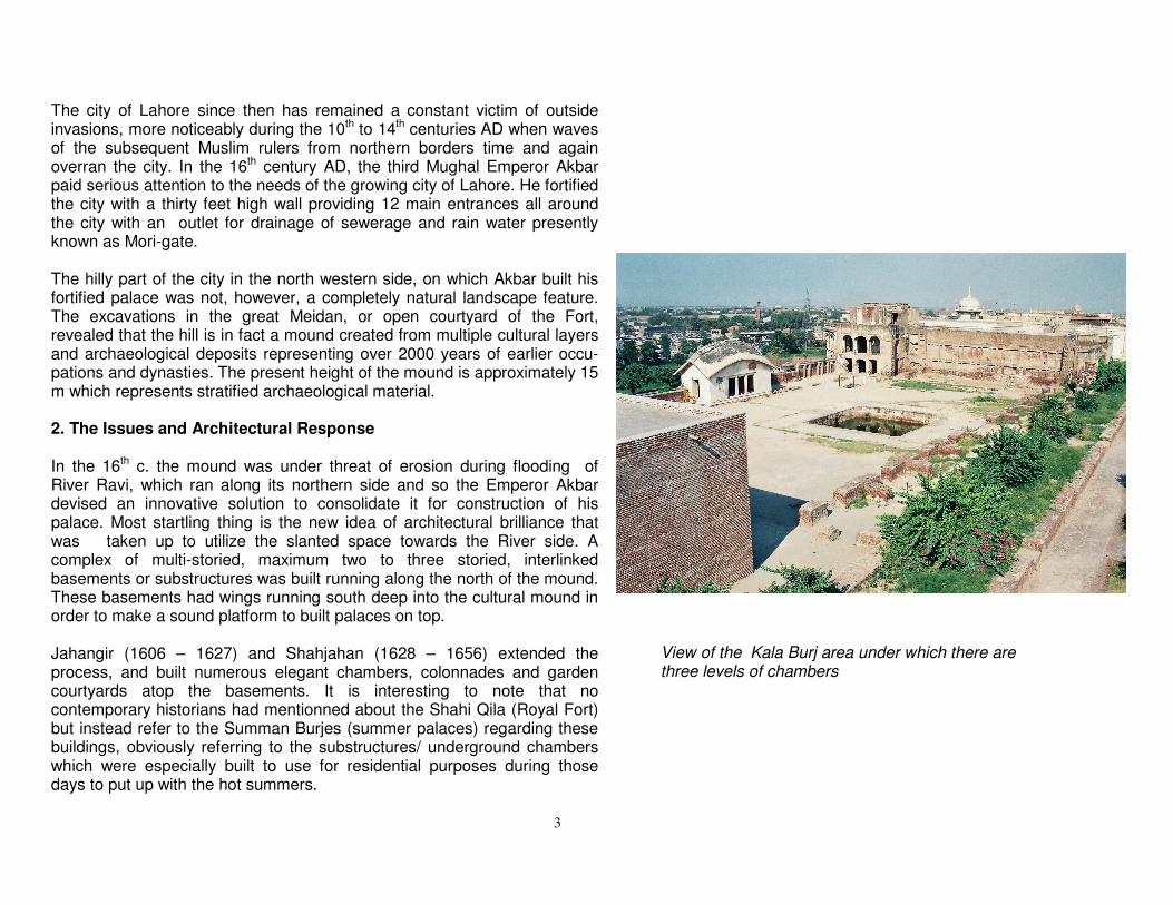
The city of Lahore since then has remained a constant victim of outside invasions, more noticeably during the 10th to 14th centuries AD when waves of the subsequent Muslim rulers from northern borders time and again overran the city. In the 16th century AD, the third Mughal Emperor Akbar paid serious attention to the needs of the growing city of Lahore. He fortified the city with a thirty feet high wall providing 12 main entrances all around the city with an outlet for drainage of sewerage and rain water presently known as Mori-gate. The hilly part of the city in the north western side, on which Akbar built his fortified palace was not, however, a completely natural landscape feature. The excavations in the great Meidan, or open courtyard of the Fort, revealed that the hill is in fact a mound created from multiple cultural layers and archaeological deposits representing over 2000 years of earlier occu-pations and dynasties. The present height of the mound is approximately 15 m which represents stratified archaeological material. 2. The Issues and Architectural Response In the 16th c. the mound was under threat of erosion during flooding of River Ravi, which ran along its northern side and so the Emperor Akbar devised an innovative solution to consolidate it for construction of his palace. Most startling thing is the new idea of architectural brilliance that was taken up to utilize the slanted space towards the River side. A complex of multi-storied, maximum two to three storied, interlinked basements or substructures was built running along the north of the mound. These basements had wings running south deep into the cultural mound in order to make a sound platform to built palaces on top. Jahangir (1606 – 1627) and Shahjahan (1628 – 1656) extended the process, and built numerous elegant chambers, colonnades and garden courtyards atop the basements. It is interesting to note that no contemporary historians had mentionned about the Shahi Qila (Royal Fort) but instead refer to the Summan Burjes (summer palaces) regarding these buildings, obviously referring to the substructures/ underground chambers which were especially built to use for residential purposes during those days to put up with the hot summers.
View of the Kala Burj area under which there are three levels of chambers
3
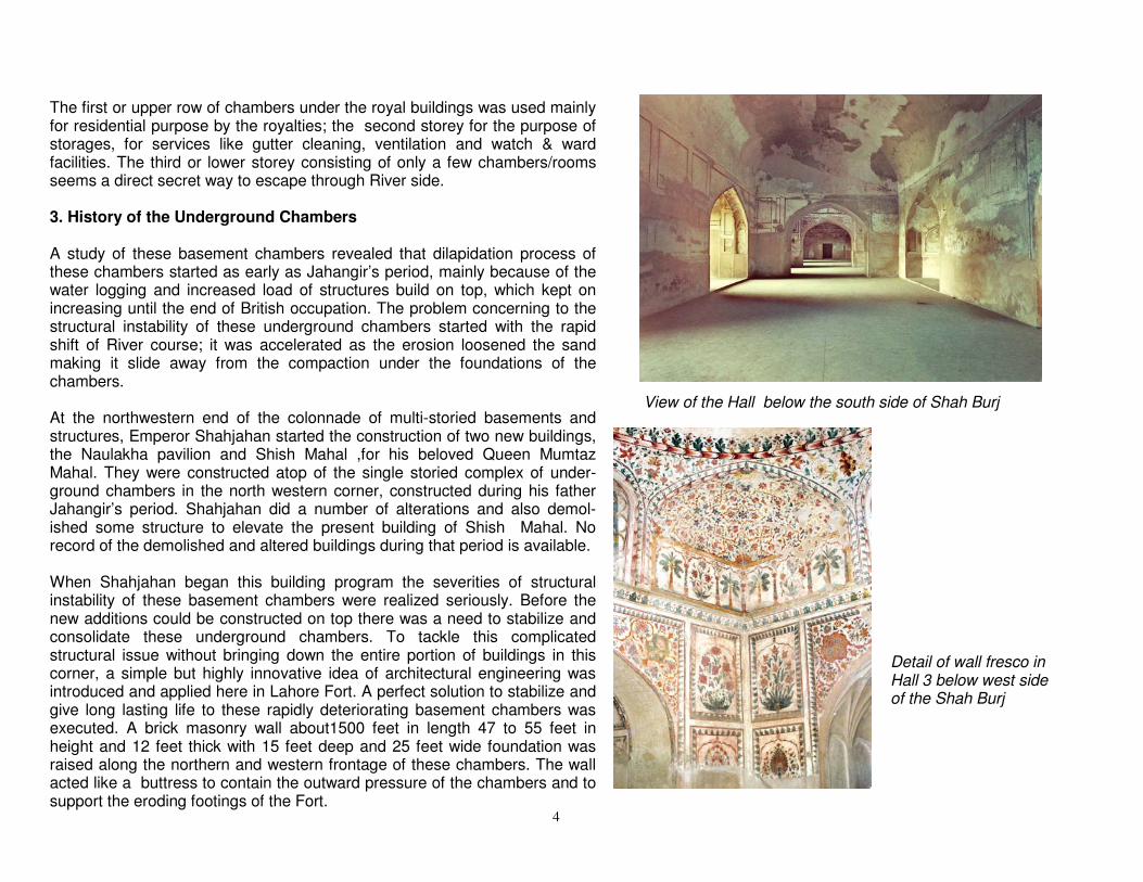
The first or upper row of chambers under the royal buildings was used mainly for residential purpose by the royalties; the second storey for the purpose of storages, for services like gutter cleaning, ventilation and watch & ward facilities. The third or lower storey consisting of only a few chambers/rooms seems a direct secret way to escape through River side. 3. History of the Underground Chambers A study of these basement chambers revealed that dilapidation process of these chambers started as early as Jahangir’s period, mainly because of the water logging and increased load of structures build on top, which kept on increasing until the end of British occupation. The problem concerning to the structural instability of these underground chambers started with the rapid shift of River course; it was accelerated as the erosion loosened the sand making it slide away from the compaction under the foundations of the chambers. At the northwestern end of the colonnade of multi-storied basements and structures, Emperor Shahjahan started the construction of two new buildings, the Naulakha pavilion and Shish Mahal ,for his beloved Queen Mumtaz Mahal. They were constructed atop of the single storied complex of under-ground chambers in the north western corner, constructed during his father Jahangir’s period. Shahjahan did a number of alterations and also demol-ished some structure to elevate the present building of Shish Mahal. No record of the demolished and altered buildings during that period is available. When Shahjahan began this building program the severities of structural instability of these basement chambers were realized seriously. Before the new additions could be constructed on top there was a need to stabilize and consolidate these underground chambers. To tackle this complicated structural issue without bringing down the entire portion of buildings in this corner, a simple but highly innovative idea of architectural engineering was introduced and applied here in Lahore Fort. A perfect solution to stabilize and give long lasting life to these rapidly deteriorating basement chambers was executed. A brick masonry wall about1500 feet in length 47 to 55 feet in height and 12 feet thick with 15 feet deep and 25 feet wide foundation was raised along the northern and western frontage of these chambers. The wall acted like a buttress to contain the outward pressure of the chambers and to support the eroding footings of the Fort.
View of the Hall below the south side of Shah Burj
Detail of wall fresco in Hall 3 below west side of the Shah Burj
4
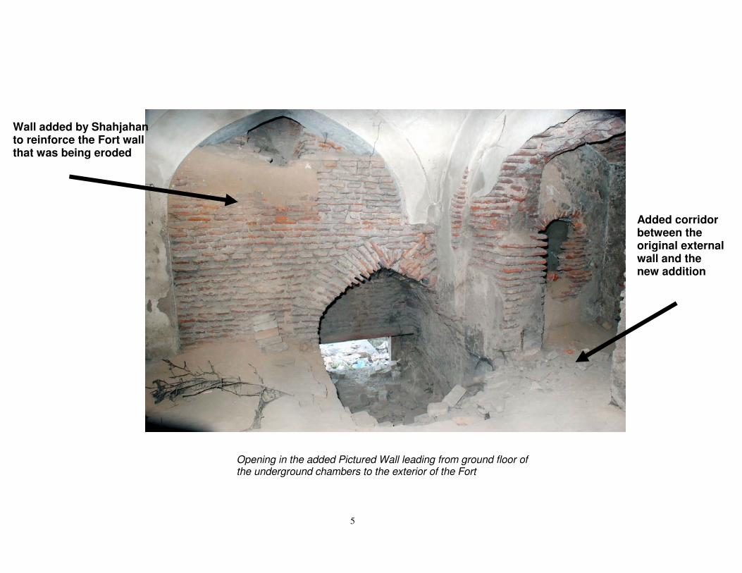
Opening in the added Pictured Wall leading from ground floor of the underground chambers to the exterior of the Fort
Wall added by Shahjahan to reinforce the Fort wall that was being eroded
Added corridor between the original external wall and the new addition
5

Hall 3 under the west side of the Shah Burj with Mughal period fresco
6
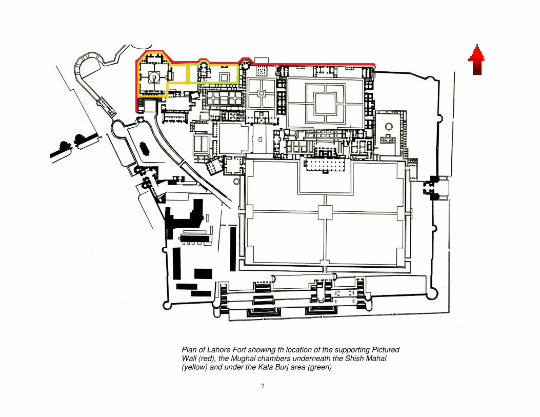
Plan of Lahore Fort showing th location of the supporting Pictured Wall (red), the Mughal chambers underneath the Shish Mahal (yellow) and under the Kala Burj area (green)
7

The wall itself was decorated along its great height and extent with innumerable intricate tile mosaic pictures depicting court life during the Mughal Empire. The entire northwest frontage of wall is decked with 2116 panels of brilliant tile work, and fresco paintings. A succession of square, rectangular and arched panels, are amongst the most remarkable decorative and architectural renderings. This outstanding array of decorations and designs make the Lahore Fort a monument of unique prominence and pride. This wall not only a chief feature of decorations and beauty but also technically serves as a solid and majestic retaining/supporting wall to overcome the issue of erosion and attrition of built portions of Lahore Fort on this side which for the most part rests upon the underground chambers. This wall provided with openings at certain places for ventilation and light. The original ways for going to the River side pierced through the wall are still traceable and most of them can be reclaimed easily. 4. Current Condition and Issues At present this huge retaining wall, known as the Pictured Wall, has developed some serious structural cracks causing it to lose its hold against the fragile construction of basement chambers, especially the sections of two and three storied chambers. The structural problems of these basements are in fact a great threat to the buildings constructed atop, important heritage buildings that are declared as part of the UNESCO World Heritage site. The present managers of the site have focused their attentions on the conservation and preservation and up - lifting of the buildings constructed atop, without realizing the deteriorated and appalling condition of these underground chambers. The chambers are actually bearing the load of the landmark and iconic World Heritage structures above: including Lal and Kala Burj ( Red and Black Towers), Paeen Bagh (ladies’ garden) , Naulakha pavilion and Shish Mahal (Palace of Mirrors) and a number of other important small buildings in this portion. The underground chambers and additional supporting wall have experienced stress and growing damage and instability for centuries but the problems have gone unaddressed.
View of the Pictured Wall along the west of the Fort
Detail of the Pictures Wall
8
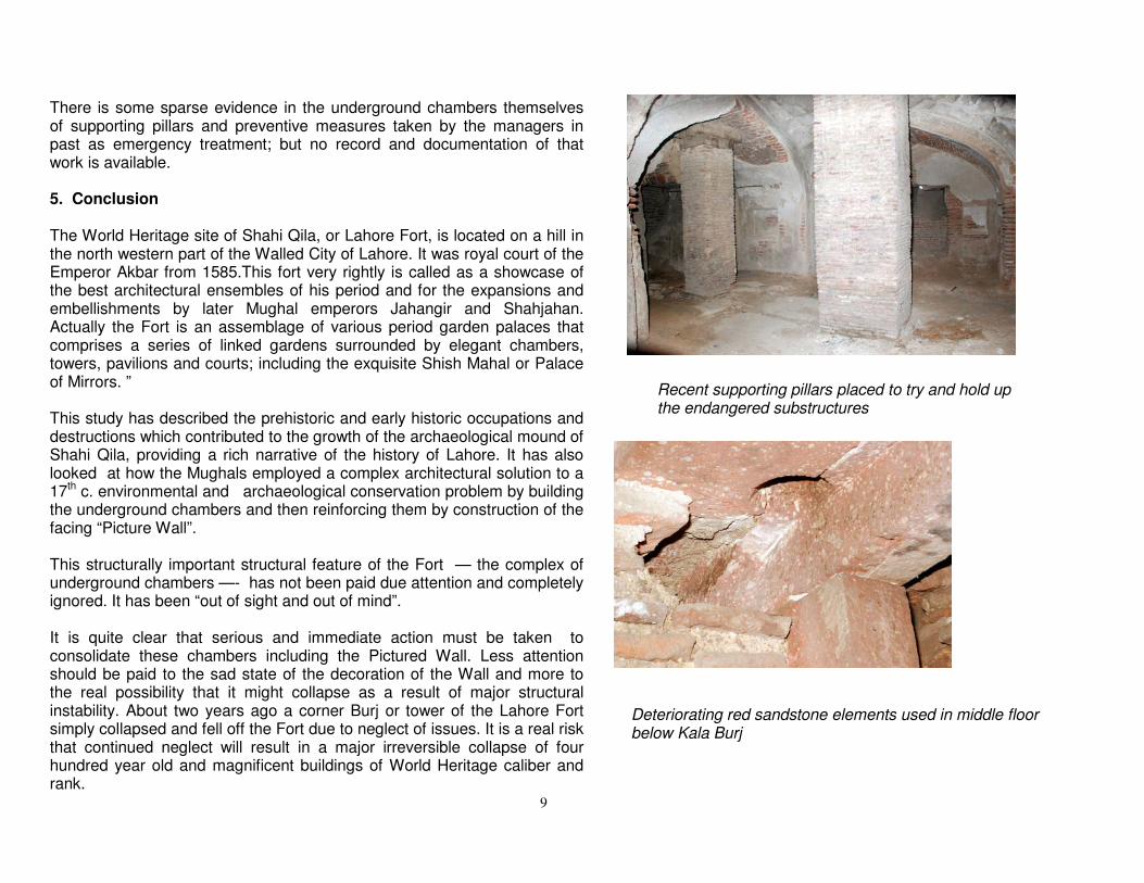
There is some sparse evidence in the underground chambers themselves of supporting pillars and preventive measures taken by the managers in past as emergency treatment; but no record and documentation of that work is available. 5. Conclusion The World Heritage site of Shahi Qila, or Lahore Fort, is located on a hill in the north western part of the Walled City of Lahore. It was royal court of the Emperor Akbar from 1585.This fort very rightly is called as a showcase of the best architectural ensembles of his period and for the expansions and embellishments by later Mughal emperors Jahangir and Shahjahan. Actually the Fort is an assemblage of various period garden palaces that comprises a series of linked gardens surrounded by elegant chambers, towers, pavilions and courts; including the exquisite Shish Mahal or Palace of Mirrors. ” This study has described the prehistoric and early historic occupations and destructions which contributed to the growth of the archaeological mound of Shahi Qila, providing a rich narrative of the history of Lahore. It has also looked at how the Mughals employed a complex architectural solution to a 17th c. environmental and archaeological conservation problem by building the underground chambers and then reinforcing them by construction of the facing “Picture Wall”. This structurally important structural feature of the Fort — the complex of underground chambers —- has not been paid due attention and completely ignored. It has been “out of sight and out of mind”. It is quite clear that serious and immediate action must be taken to consolidate these chambers including the Pictured Wall. Less attention should be paid to the sad state of the decoration of the Wall and more to the real possibility that it might collapse as a result of major structural instability. About two years ago a corner Burj or tower of the Lahore Fort simply collapsed and fell off the Fort due to neglect of issues. It is a real risk that continued neglect will result in a major irreversible collapse of four hundred year old and magnificent buildings of World Heritage caliber and rank.
Recent supporting pillars placed to try and hold up the endangered substructures
Deteriorating red sandstone elements used in middle floor below Kala Burj
9
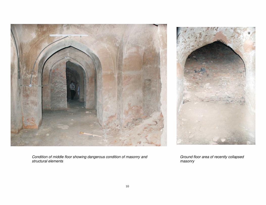
Ground floor area of recently collapsed masonry
Condition of middle floor showing dangerous condition of masonry and structural elements
10
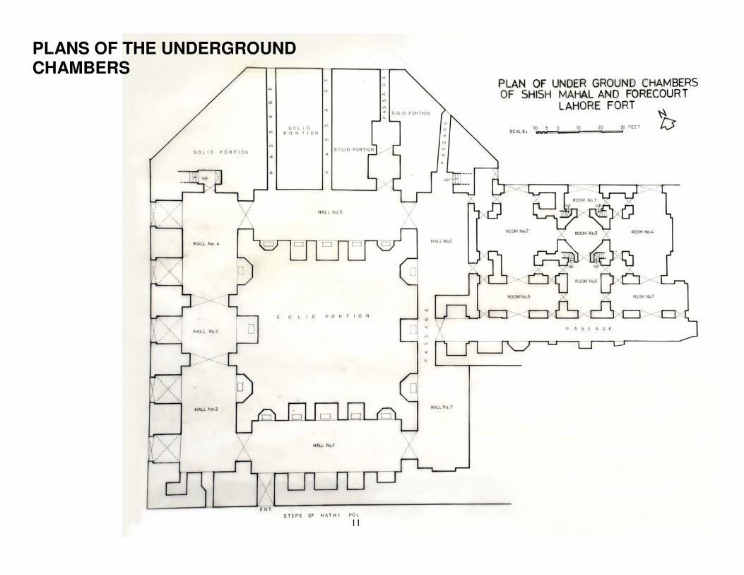
PLANS OF THE UNDERGROUND CHAMBERS
11

12

13

14
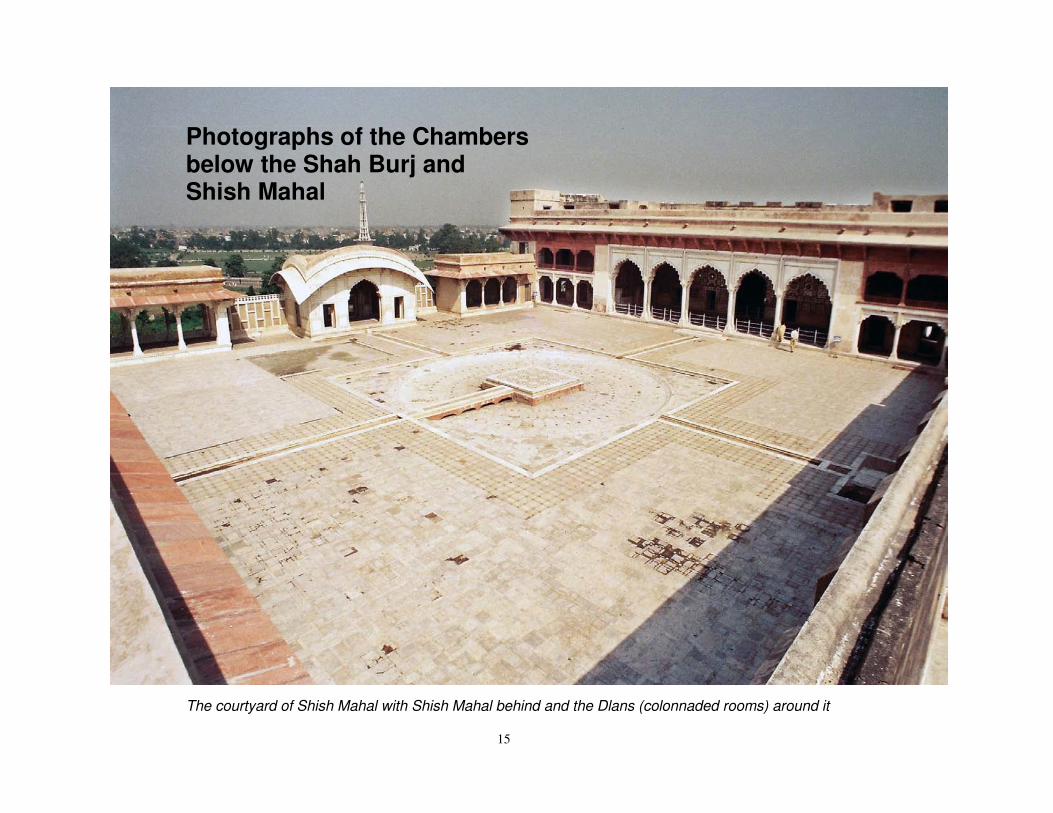
Photographs of the Chambers below the Shah Burj and Shish Mahal
The courtyard of Shish Mahal with Shish Mahal behind and the Dlans (colonnaded rooms) around it
15
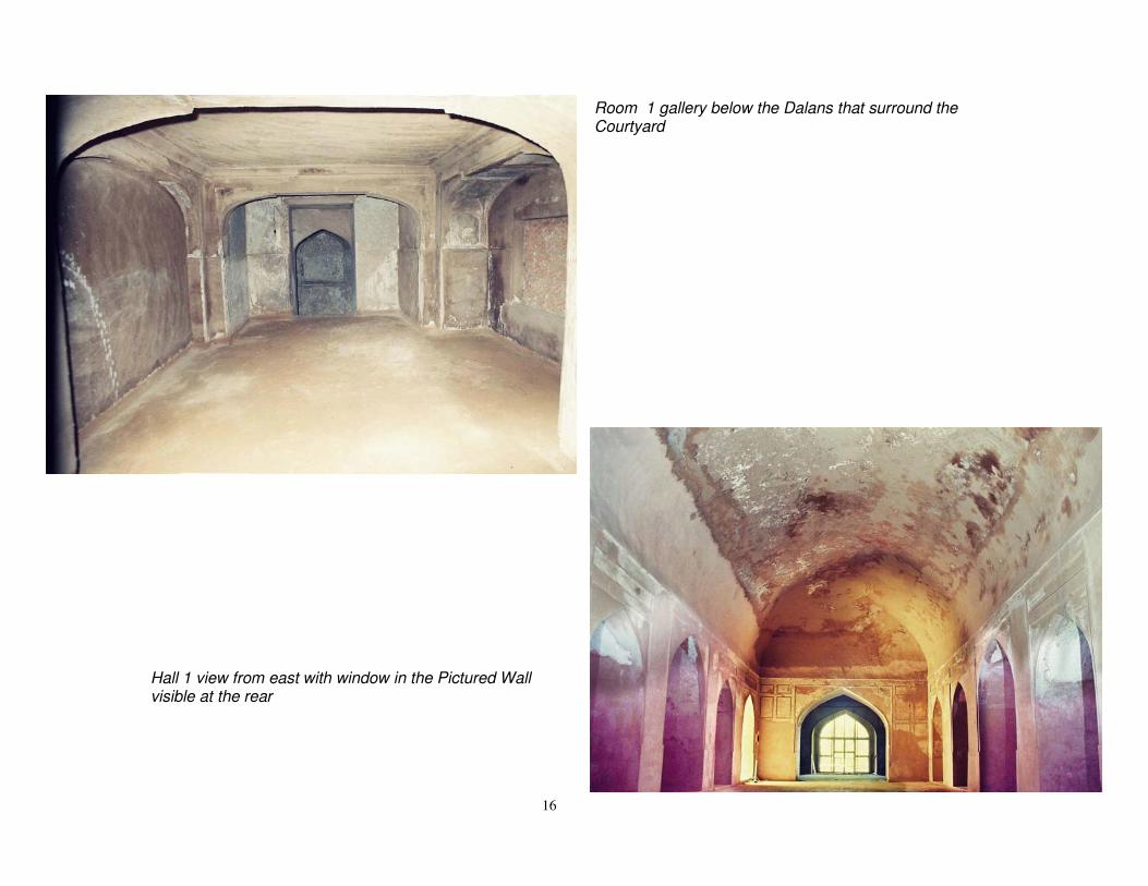
Room 1 gallery below the Dalans that surround the Courtyard
Hall 1 view from east with window in the Pictured Wall visible at the rear
16

Hall 1 and 7 below the Shah Burj, view from west
17
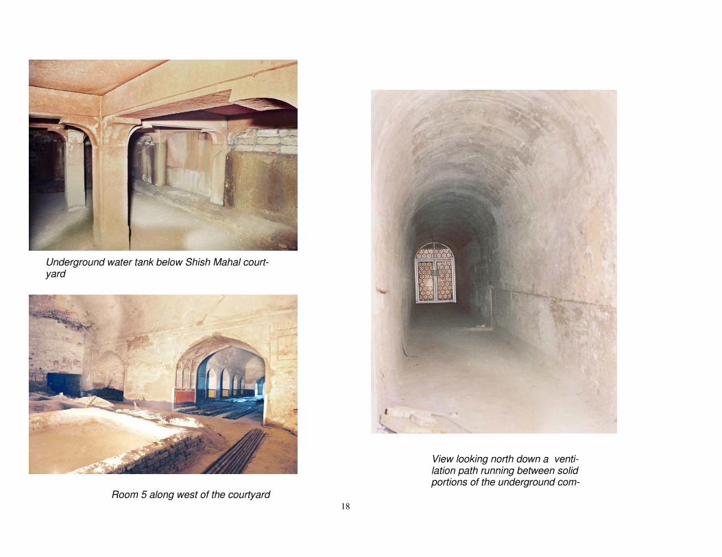
Underground water tank below Shish Mahal court-yard
Room 5 along west of the courtyard
View looking north down a venti-lation path running between solid portions of the underground com-
18

Photographs of the Chambers below Kala Burj
19

Entrance door to underground chambers below Kala Burj
TOP FLOOR OF THE CHAMBERS:
Chamber on the top floor of the complex immediately below the Kala Burj
20
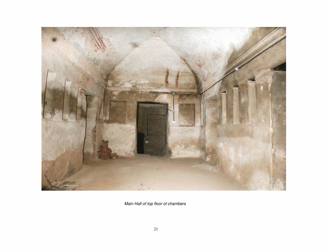
Main Hall of top floor of chambers
21

Corridor of the middle floor chambers Domed area over linking staircase
22
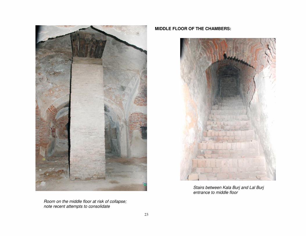
MIDDLE FLOOR OF THE CHAMBERS:
Stairs between Kala Burj and Lal Burj entrance to middle floor
Room on the middle floor at risk of collapse; note recent attempts to consolidate
23

Corridor that joins Pictures Wall (right side) and chambers (left side)
24
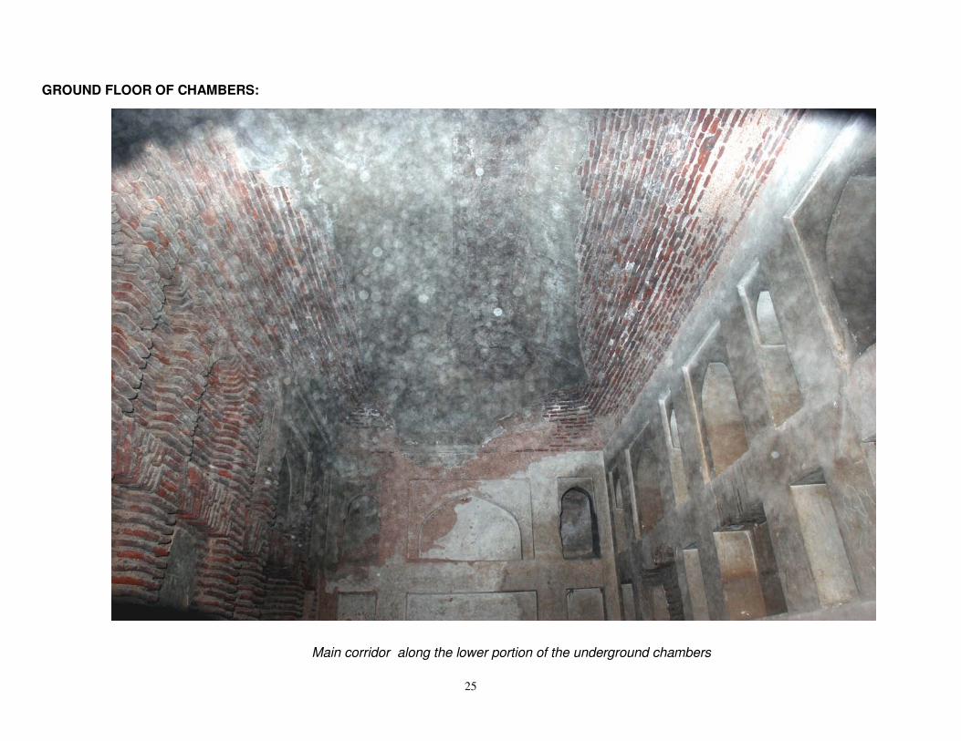
GROUND FLOOR OF CHAMBERS:
Main corridor along the lower portion of the underground chambers
25

Ground floor showing original Mughal ma-sonry and British period intervention
Mughl period chamber at ground level
26

British intervention to consolidate structure
INTERVENTIONS TO TRY AND CONSOLIDATE STRUCTURAL ELEMENTS IN DANGER OF COLLAPSE
27

Interventions: different period s Ground Floor
Modern cement
British period supporting wall
Sikh period patching Mughal original masonry
28
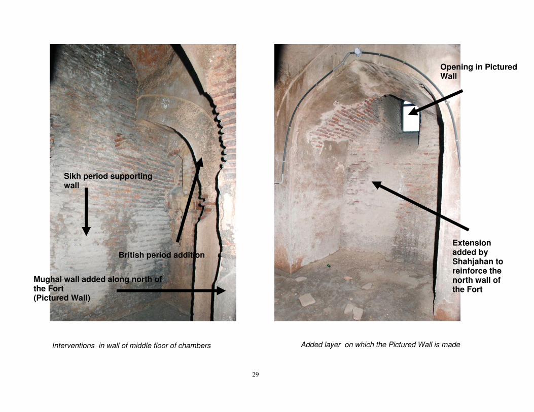
Added layer on which the Pictured Wall is made Interventions in wall of middle floor of chambers
Sikh period supporting wall
British period addition
Mughal wall added along north of the Fort (Pictured Wall)
Opening in Pictured Wall
Extension added by Shahjahan to reinforce the north wall of the Fort
29

British period intervention of a small door to allow access to closed areas of the cham-bers for maintenance
Views of a modern drainage system introduced into the underground chambers to try and solve problems of water damage
30