the location of the temple on the temple mount based on the
TRANSCRIPT

Tuvia Sagiv Shekerka 2008
The location of the Temple on the Temple Mount based on the Aqueduct and rock levels at Mount Moriah in Jerusalem
Outline
A. Difficulties locating the Temple in the Moriah Court (Haram al-Sharif)
B. The location of the Temple according to Ishtori Haparchi
C. The location of the Temple according to Hieronymus
D. The location of the Temple based on the level of the Aqueduct
E. The location of the Temple based on the natural rock face
F. Verifying several alternatives based on the rock level
A. The Central Alternative 1
B. The Central Alternative 2
C. The Northern Alternative
D. The Southern Alternative 1
E. The Southern Alternative 2
� � �
A. Difficulties locating the Temple in the Moriah Court (Haram al-Sharif)
Most researchers and Jewish scholars assume that the Holy of Holies was located where today stands the Dome of the Rock1. However, the Temple and its Courts location is unclear and inconclusive. Although the Mishna (Middot 2, 1) supposedly describes the location of the Temple in relation to the walls of the Temple Mount, they are in fact vague and unclear – "Most of it was to the South, next was to the East, some was to the North, and least was to the West". The text does not supply us with exact measurements, and the meaning of “most” and “least” in this context is unclear. Moses Maimonides (Rambam - Mishna 1, 1) and others interpreted the Mishna as describing the distance between the walls of the Priest's Court and the walls of the Temple Mount. Though another possibility is that the Mishna describes the distance between the walls of the Temple and the walls of the Temple Mount2.
The continuation of the Mishna description "where most of its dimension is most of its use" is also unclear: Does the "use" refer to the open area, or perhaps visa versa – the “use” refers to the Temple, which was mainly to the South3.
There is no archeological evidence of the Second Temple at the site – not a wall, a pillar or a scripture that can assist us, as a starting point, in locating the Temple. Furthermore, the measurements of the Moriah Court (Haram al-Sharif) do not correlate with the Jewish literary sources. According to both the Mishna and Josephus Flavius the Temple Mount Court was a square. The Temple Mount according to Jewish Literary Sources was “500 cubits by 500 cubits” (Mishna, Midot, 2, 1), approximately 15 acres (60 Dunam). According to Josephus Flavius (Jewish Antiquities, 15, 11, 3, 400) the Temple Mount was furlong by furlong (stadia by stadia),
1 See my article “The Temple is at the Southern part of the Temple Mount”, Tchumin 14, p. 438, 6,
See also: Rabi Zalman Koren, “Ve Asu Li Mishkan”, Jerusalem 5767; Dr. Dan Bahat, Atlas Carta of the History of Jerusalem, Jerusalem 1989, p. 41.
This article is an extension of chapter 4 of my afore-mentioned article in Tchumin 14. 2 See Rabi Zalman Koren, Courts of God’s House, Jerusalem 5737, p. 247 The Cover Image: The Fine Art Society, Mr. William Simpson of the Illustrated London News: Pioneer War Artist 1823-1894, London, 1987, The Great Sea, Cistern no’
8, The British Archive Foundation, London. 3 RS”H (Mishna, Middot, 2, 1) interprets: Most of the construction was done to the South of the Mount, since that is where it was most needed; The
least construction was done to the West, since there it is least needed. Though I am not without question regarding this interpretation.

2
approximately 10 acres (40 Dunam). However the current Moriah Court (Haram al-Sharif) is a rectangular trapezoid, measured on average at approximately 300m’ by 500m’, 37.5 acres, 150 Dunam (see Fig. 1). The Moriah Court (Haram Al-Sharif) revealed before us is 2.5 times the size of the Temple Mount, according to the afore-mentioned sources.
B. The location of the Temple according to Ishtori Haparchi
Ishtori Haparchi was a Jewsish scholar and a geographer. He lived in the 13th century and visited and toured Israel. According to his descriptions, the Eastern Gate of the Temple Mount Court was found on the southern third of the eastern wall (Kaftor va Ferach, Jerusalem 5657, 6, 92).
This Eastern Gate was east of the Temple Courts and facing the Court, the Hall and the Temple Gates 4. After all, according to his descriptions, the Temple was in the south, in the area of El-Kas - the Cup - which is South of the Dome of the Rock.
Those who claim that the Temple was at the Dome of the Rock try to explain that Ishtori Haparchi measured the entire Eastern city wall, and that this measurement should be divided into 3 parts, so that the southern part is facing the Dome of the Rock. However, in 1219 the Mamluk ruler, Elmalach Elma’atem, had destroyed the walls of the old city5. During the time of Ishtori Haparchi only the wall of Haram al-Sharif remained. Therefore, his testimony remains valid: The Eastern Gate and the Temple were South of the Dome of the Rock.
C. The location of the Temple according to Hieronymus
Hieronymus, of the 4th and 5th Century, lived in Israel. In his interpretation of the Book of Matthew, Hieronymus writes that Hadrian’s equestrian statue was located directly on the Holy of Holies6. An equestrian statue was not found at the Moriah Court (Haram al-Sharif), however a typical inscription of equestrian statues was found over the Double Gate (see Fig. 2)7. Therefore it is reasonable to assume that indeed there was an equestrian statue at the Moriah Court, and locating its position might help in identifying the Temple’s location.
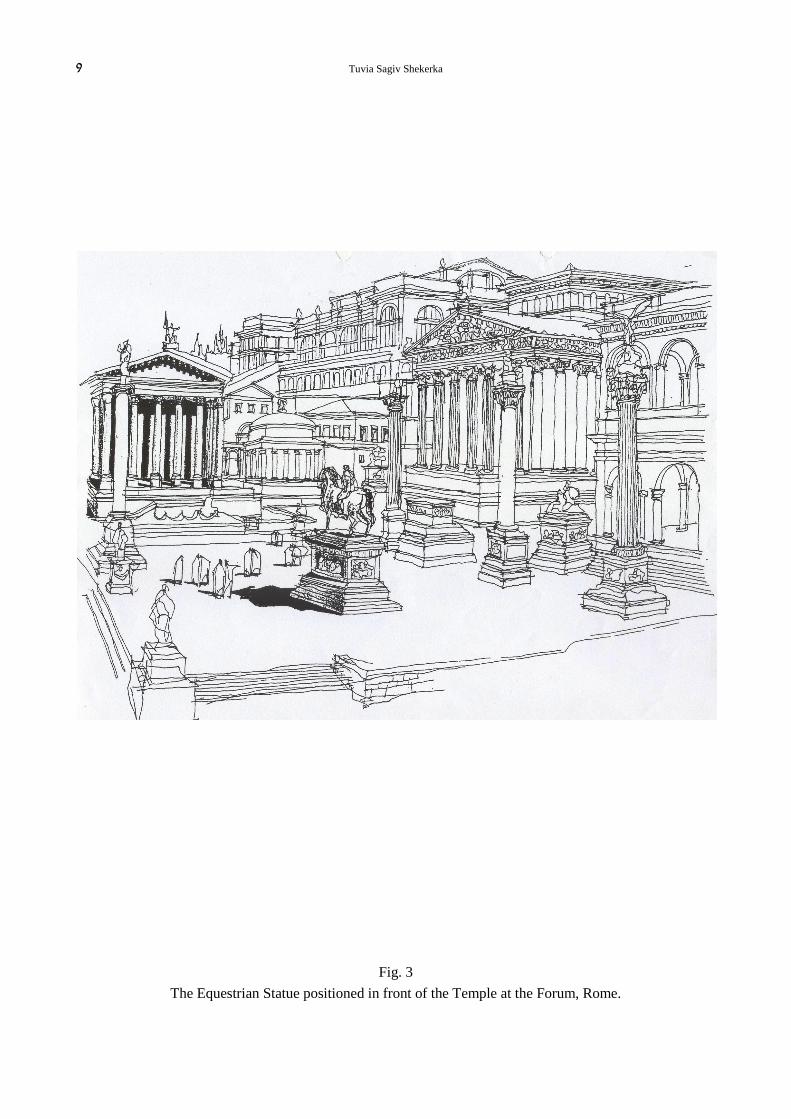
According Roman architectural Order an equestrian statue was placed in an open square in front of the Temple, for example the Forum in Rome (see Fig. 3).
The stones of the Roman Temple in Baal-Bek have a frame etched into them, very much like the Haram al-Sharif in Jerusalem (see Fig. 4). The Baal-Bek site includes a rectangular shaped building that served as a Temple for Jupiter and in front an open court. At the extension of the ‘axis of symmetry’, at the end of the square in front of the Temple, there is a hexagon shaped structure that serves as an entrance hall (Propylon) (see Fig. 5). Throughout the Roman Empire there have been several similar sites such as Basel, Switzerland and Split, Bosnia. These sites were composed of a rectangular structure and in front of it, at the extension of the 'axis of symmetry', a centralized structure shaped as a hexagon, octagon or circle. The Byzantine architecture also adopted this scheme, as found in the Church of the Holy Sepulcher during the Constantine reign (see Fig. 6). The rectangular structure served mostly as a Temple, though the centralized structure had various purposes – an entrance at Baal-Bek, a gathering place in Basel, or a burial ground at both Split and the Church of the Holy Sepulcher8. The Temple of Jupiter in Baal-Bek and the El Aqsa Mosque and Dome of the Rock are both of the same design perception – the Temple of Jupiter consolidates with the El Aqsa Mosque, and the octagon in Jerusalem consolidates with the hexagon in Baal-Bek (see Fig. 7). We can assume that the El Aqsa Mosque and Dome of the Rock are ruins of the Temple of Jupiter built in Jerusalem by Hadrian in the 2nd Century AD9. The Temple of Jupiter in Jerusalem was destroyed during Byzantine rule and was never rebuilt10. The Muslims conquered Jerusalem in
4 As said in the Mishna, Brachot, 9, 5: one shall not decry while facing the Eastern Gate, since one is also facing the Holy of Holies.
5 The Book of Jerusalem, The Crusades and Ayyubid Era, Jerusalem 5751, p. 53. Also in Kaftor Va-Ferach, 41, p. 4155
6 Sh. Yevin, Milhemet Bar Kokhba, Bar Kokhba Rebelion, Jerusalem 5706 p. 185; Thanks to Rabi Zalman Koren who directed me to this information
7 Dr. Dan Bahat, Atlas Carta of the History of Jerusalem, Jerusalem 1989, p. 60
8 Dr. Dan Bahat, Jerusalem – Selection of Plans, Jerusalem 1969, p. 66
9 Cassius Dio wrote of a Temple, Roman History, 69, 11-15
10 In the Meidva Map, Byzantine Era, there is no mention of the Temple Mount area

Tuvia Sagiv Shekerka
3
the 7th Century, restored the ruins of the Roman Temple and covered the walls with Muslim themes and decorations; though it is quite clear that before us stands a Roman structure11.
As aforementioned, it was common practice to place an equestrian statue at the entrance of the Temple; and if the El Aqsa Mosque is in fact the Temple of Jupiter, then the appropriate place to position the equestrian statue is in the open court between the El Aqsa Mosque and the Dome of the Rock, known as El-Kas (The Cup). According to Hieronymus, the equestrian statue was right above the Holy of Holies (see Fig. 8). This conclusion corresponds with the Ishtori Haparchi's descriptions.
D. The location of the Temple based on the level of the Aqueduct
The Temple required a large amount of water – bathing and ritual immersion, rinsing animal sacrifices and cleaning sacrificial blood. The Priests had two water sources – cisterns (that collected rain water), and water that came from the hills of Hebron using the Aqueduct.
In Jewish literary sources we find three uses for water supplied via the Aqueduct. According to the Jerusalemite sources (Yoma, 3, 3) during the days of the first Temple the Aqueduct ran from the Ein Eitam spring to Solomon’s Sea. According to the Babylonian sources, in the days of the second Temple, the water was brought from Ein Eitam to the High Priest’s Mikve (ritual bath). According to the Tosefta, a supplement to the Mishna, (Tosefta, Psahim, 3, 12) the Priests used the aqueduct water to wash the Court. It can be understood from the descriptions of Mishna (Shkalim 4, 2) that there was only one aqueduct. Indeed, there are ruins of an aqueduct leading water from Ein Eitam in Solomon’s pools to the foot of the Jewish quarter. The Aqueduct then continued through Wilsons Arch to the Moriah Court (Haram al Sharif)(see Fig. 9)12. It can be assumed that this is in fact the Aqueduct depicted in the Jewish Literary Sources. Another, higher aqueduct does exist, though it appears to be from a later period. This aqueduct was repaired by soldiers of the Tenth Legion in the 2nd Century, and its ruins were not discovered in Jerusalem13.
The description regarding the waters of Ein Eitam arriving at the Mikve of the High Priest, located above the Water Gate, is based on the Abaye's conclusion, who lived in 4th Century, distant Babylon. His conclusions are a logical deduction based on hearsay, and are not a direct testimony. Even according to Jewish law there is no requirement to use spring water for the bathing of the High Priest. Rain water was allowed for this purpose and may be collected from colonnade roofs surrounding the Court (as understood from Mishna, Mikvaot, 1, 7). Furthermore, a Babylonian version determines that Abaye's descriptions are of water coming from Shen Otem and have nothing to do with the Ein Eitam Aqueduct.
However, there is no doubt regarding the Tosefta descriptions, that water from the Aqueduct was used to wash the Court. The quantity of blood from sacrifices was severe, and it was necessary to wash the Court even during the Sabbath. Raising buckets from the cisterns by wheel was neither sufficient nor permitted on the Sabbath, so the Priests brought water down from the aqueduct to wash the Court. We can conclude from this that the aqueduct was constructed above the Court.
The level of this Aqueduct (+737.5m) defines the highest point of the Temple Floor, its Courts and the Temple Mount (floor level). If we assume that the Holy of Holies was either at the Dome of the Rock or at the Ghost Dome, we realize that the aqueduct is actually below the Courts and the High Priest’s Mikve, and cannot be used to supply water (see Fig. 10)14.
To supply water to these levels, we must locate the Temple floor at a lower site. The only suitable location available is a clear site between the Dome of the Rock and the El Aqsa Mosque (see Fig. 11)15. This correlates with Ishtori Haparchi’s descriptions and the testimony of Hieronymus, as aforementioned.
11 Notice that the central field of pillars, which is wider than the boulevard of pillars to the sides is not typical of a Mosque but of a Roman Basilica.
This Basilica was built from North to South, which means that it cannot be a Christian Basilica. 12 David Amit (ed.), Amichai Mazar, The Aqueducts of Ancient Palestine, Jerusalem 1989, p. 177
13See Footnote no’ 12, p. 189 14 Alternative methods to supply water to the Temple Mount – see articles by Dr. Daniel wiel, Tuchumin 12, pp. 497-508; M. Ben-Ari , Tchumin 16,
pp.503-510 15 See Footnote no’ 1

4
E. The location of the Temple based on the natural rock face
Another factor that may assist us in locating the Temple is the natural rock face. It’s quite obvious that the Temple floor, the Courts and the Temple Mount floor couldn’t possibly be bellow the natural rock face. For this reason, the current rock face defines the lowest possible point for the Temple and its Court’s floors.
Data regarding the height of the rock face, in several places, was collected during the 19th century by the British surveyors Warren, Wilson and others16. The surveyors measured the height of the rock face while on their way down to the cisterns, and once the data was collected, created a topographic map of the Temple Mount.
However, the British surveys cannot be committed to, since they are based on theory and speculation. One example would be where Warren theorized that the rock face below the Double Gate is approximately 10 meters lower than the entrance level of that gate. Excavations done after the ‘Six Day War’ revealed that the rock face is only 2 meters below this entrance (see Fig. 12). For this reason, it is quite clear that Warren’s topographic findings in the South-Western part of Haram Al-Sharif are incorrect.
There are also issues regarding the surveys of the rock face near the cisterns. These surveys were conducted under severe conditions making it difficult to distinguish between natural rock and other stone.
Looking at the maps of the site’s cisterns, it is easy to see that there are differences between the cisterns in the center and North to the cisterns in the South (see Fig. 13). The Northern and the central cisterns are small in size and their shape quite regular; rectangles and circles, or several circles connected together in a cluster of cisterns. On the other hand the Southern cisterns are very large, some regular shaped and some amorphous. We can assume that the central and Northern cisterns were quarried by man, as opposed to the Southern cisterns that were dug out of sewage or were natural caves.
For the sake of discussion we shall refer to the surveys of Warren and Wilson as obligatory, and shall assess five alternatives to locating to Temple according to the level of the rock face. If we find that the rock face is in fact higher than the Temple and its Courts’ floor, then we cannot position the Temple in that suggested location. Each alternative shall be disqualified both for the fact that the Temple and its Courts floors must be above the rock face, and in accordance with the Mishna descriptions (Para 3,3) that the Temple Mount was above hollow ground.
5 alternatives shall be assessed, and for the sake of the assessment we shall detail information regarding the Temple Mount’s height and its Courts. According to descriptions in the Mishna (Middot, 2) and from Josephus Flavius, the Hall, the Temple and the Holy of Holies were on the same level. The Priest’s Court was 6 cubits lower (12 steps)17, and one unified level. The Women’s Court was 16 cubits below the Temple. Based on Josephus Flavius’ descriptions and in light of the analysis of the levels in the Mishna, we can assume that the Temple Mount was on a graduated slope – the Eastern and Western levels the Temple Mount were lower than the Northern, Southern and central levels.
To the East – The difference in height between the Temple Mount and the Hall was 22 cubits, divided as follows: 6 cubits (12 steps) from the Temple Mount level to the Rampart and the Women’s Court; 7.5 cubits (15 steps) from the Women’s Court to the Israel Court; 2.5 cubits to the Priest’s Court; 6 cubits (12 steps) from the Priest’s Court to the Temple.
To the South – According to Josephus Flavius (Wars of the Jews, V, 5, 2) from the Temple Mount to the Rampart you must rise 7 cubits (14 steps), and from there another 2.5 cubits (5 steps) to the Priest’s Court. That is to say, the Southern part of the Temple Mount was lower than the Temple
16 Data from S. Gibson DM. Jacobson, Below the Temple Mount in Jerusalem, B.A.R England 1996
17 According to the Mishna each step was half a cubit (Middot, 2,3)

Tuvia Sagiv Shekerka
5
by only 16 cubits, due to the fact that the Temple Mount was higher in the South. This corresponds to the topographic reality.
To the North – We can assume from the description of the battles, from the conquering of the Antonia Fortress up to the invasion of the Priest’s Court (Wars of the Jews, VI, 1, 7)18, that the space between the Antonia’s Southern wall and the Northern Court wall was very narrow, and left no room for steps. The battles were waged in such a manner that soldiers from both sides crowded face to face and fought sword to sword. It turns out that the floor between the Antonia and the Court wall was level, without stairs, and so the Temple Mount and the Rampart, in this section, were level as well. The Temple Mount to the North was lower than the Temple floor by only 8.5 cubits (12 + 5 steps).
To the West – According to the descriptions of Josephus Flavius (Wars of the Jews, V, 5, 2; V, 1, 5), the Western walls entire height was visible, since there were no stairs covering the wall (in contrast with the other walls) and the difference in level between the Temple Mount and the Court was 15 cubits. Therefore the difference between the Western Temple Mount and the Temple floor was 21 cubits.
F. Verifying several alternatives based on the rock level
A. The Central Alternative 1
According to professor Avi-Yona, Dr. Dan Bahat and Ritmayer19, the Holy of Holies was located on the Rock, where today stands the Dome of the Rock; The Rampart was adjacent to the inner Priests Court wall; and where today stands the El Omaria school, once stood the Antonia Fortress. The length of a cubit, according to this theory, is 50 cm (see Fig. 14)20.
In Fig. 15 and Table 1 we can see that in several places the rock face breaks through the Temple Mount floor, specifically at the Ghost Dome and Cistern (23) 14. In addition, water from the Aqueduct (+737.5) can reach neither the High Priest’s Bath (Mikve) (751.2), nor the Priest’s Court (740.7). Therefore the Holy of Holies cannot be placed at the Dome of the Rock.
B. The Central Alternative 2
According to Rabi Zalman Koren21, the Holy of Holies was at the Dome of the Rock; The Rampart was constructed over the entire, nowadays, upper court (Maztaba) and was bound by an additional wall that does not appear in literary sources. He too assumes that the Antonia Fortress stood where today stands the El Omaria School. According to Rabi Zalman Koren’s theory, the length of a cubit is 57.4 cm (see Fig. 16).
Even though, according to this alternative, the Rampart and its borders were in fact the borders of the entire, nowadays, upper court, the rock face (see Fig. 17 and Table 2) still breaks through several places in the Temple Mount floor and the Rampart, specifically at the Ghost Dome and Cistern (37) 27. In addition, water from the Aqueduct (737.5m) can reach neither the High Priest’s Bath (Mikve) (753.4), nor the Priest’s Court (740.2). Therefore the Holy of Holies cannot be placed at the Dome of the Rock.
C. The Northern Alternative
18 “…in which battle the darts were on both sides useless, as well as the spears, and both sides drew their swords, and fought it out hand to hand…and
confouded, by reason of the narrowness of the place…” translated by William Whiston, The New Complete Works of Josephus, Book 6, Chapter 1, Paragraph 7, 75, 1999.
19 See Footnote no’ 2
20 See Footnote no’ 2. Recently Professor J. Patrick published his article “Mabat Hadash Al Makom Hamikdash, Hashearim Ve-Haleshachot”
(Chidushim Be-Cheker Yerushalayim 12, Ramat Gan 2006), (a new view regarding the location of the Temple, it’s Gates and Chambers). In this article he suggests that the Temple was located on cistern no’ 1 (W). His proposal does not refer to the levels of the Holy of Holies and the Courts. It seems that this proposal encounters problems with the rock face breaking through the floor level and issues regarding the water supply from the Aqueduct.
21 See Footnote no’ 2

6
According to professor A’ Kaufman’s22 theory, the Holy of Holies was at the Ghost Dome and the length of a cubit was 44.6 cm (see Fig. 18).
Here too (see Fig. 19 and Table 3) the rock face breaks through the Courts and Temple Mount floor, specifically at the Rock, where today stands the Dome of the Rock. Furthermore, water from the Aqueduct (737.5m) can reach Neither the High Priest’s Bath (Mikve) (750.4) nor the Priest’s Court (740.1). Therefore the Temple cannot be placed at the Ghost Dome.
D. The Southern Alternative 1
According to this theory, The Holy of Holies was placed around the El Kas region; The Antonia Fortress was at the Dome of the Rock; and water from the Ein Eitam spring went both to the High Priest’s Bath (Mikve) and the Priest’s Court (see Fig. 10, 20)23; the length of a cubit is 44.4 cm.
Although the water does actually reach the High Priest’s Bath (Mikve) (737.5) and the Priest’s Court (727.4), the rock face still breaks through the Temple Mount and its Court’s floor (see Fig 21 and Table 4). Assuming that the British surveys are accurate, the Holy of Holies cannot be placed at this level around El-Kas (the Cup).
E. The Southern Alternative 2
This theory too offers the Holy of Holies at El Kas; The Antonia Fortress was at the Dome of the Rock; however the Aqueduct only reached the Priest’s Court floor (see Fig. 10); the length of a cubit is 44.4 cm.
According to this theory, the Holy of Holies was at El Kas, and water from the Aqueduct reached the Priest’s Court by gravity. The rock face does not breach the built area at all (see Fig. 22 and Table 5).
Only this alternative upholds all the criteria, both regarding the Aqueduct and rock face level. Therefore, we can assume that the location of the Holy of Holies and the Temple were around the El Kas region (the Cup), between the El Aqsa Mosque and the Dome of the Rock.
This conclusion correlates with the Ishtori Haparchi’s descriptions, stating that the Temple and its Gates are at the Southern third of the Eastern Wall. Furthermore, this correlates with Heironymus’ testimony that the Equestrian Statue stood in the court at the front of the Temple, assuming that the El Aqsa Mosque is in fact the Temple of Jupiter.
Let us turn our attention to an important fact: The “Wailing Wall”, to which Jews have prayed for generations, is about 50 meters long, although the entire Western Wall is approximately 500m long. Common practice is to face this section during prayer. According to both Southern Alternatives, this section of the Western Wall is facing the ruins of the Holy of Holies.
Is it possible that this tradition of prayer to the “Wailing Wall” is based on the information that behind this section lay the Holy of Holies?
22 “Beit Hamikdash Hasheni Tsurato Ve-Mikumo”, Har Habait Mikumo Ve-Gvulotav – Hartzaot Beyemey Eyun, Jerusalem 5735 pp. 39-46. See
Article in Tchumin 8, p. 429 23 Founders of this Hypothesis: M. Braver, Foundation Stone / Mistaken Stone or Even Ha-Toin, Jerusalem 5690; J. Rofe, Makom Mikdashenu –
Locating the Temple in the Southern part of the Temple Mount, Niv-Hamidrashiya 5738-9; J. Fergusson, The Temples of the Jews and other Buildings in the Harem in Jerusalem, London 1878; My article: Hamikdash Natun Badarom, Tchumin 14 pp. 437-472
Translated by Roy Avital @ 2008

Tuvia Sagiv Shekerka
7
fig. 1 The Moriah Court (Haram Al-Sharif) positioned upon the Temple Mount.
According to Jewish literary sources: The Temple Mount was 500 by 500 cubits; according to Josephus Flavius: only furlong by furlong (stadia by stadia). The Haram Al-Sharif known to us today is 2.5 times
larger than the Temple Mount.

8
Fig. 2
The inscription above the Double Gate – typical of Equestrian statues
(source: Eli Shiller, El Aqsa Mosque, Jerusalem 1978, p. 20)
Tuvia Sagiv Shekerka
9
Fig. 3
The Equestrian Statue positioned in front of the Temple at the Forum, Rome.

10
Fig. 4
The wall of the Temple Precinct in Baal Bek, Lebanon. The stone’s characteristics and the way they have been placed remind us of the stone walls of the Moriah Court (Haram Al-Sharif) in Jerusalem.

Tuvia Sagiv Shekerka
11
Fig. 5
The plans of the Jupiter Temple in Baal Bek, Lebanon.
This rectangular shaped building served as a Temple for Jupiter. At the extension of the ‘axis of symmetry’, at the end of the square in front of the Temple, there is a hexagon shaped structure that serves as an entrance
hall (Propylon).

12
Fig. 6
A. The Temple in Basel, Switzerland – at the front of the Temple was a rotunda, which served as a place of gathering.
B. Diocletian’s Precinct in Split, Bosnia – in front of the Temple stands Diocletian’s tomb, an octagonal shaped building.
C. Church of the Holy Sepulcher during the Constantine reign – a rectangular structure, an open court and facing it a rotunda. At the center of the rotunda is Jesus’ Tomb.
A
C
B

Tuvia Sagiv Shekerka
13
Fig. 7
A comparison between the plans of the El Aqsa Mosque and Dome of the Rock in Jerusalem, to those of the Temple of Jupiter in Baal Bek, Lebanon. The Temple of Jupiter correlates with the El
Aqsa Mosque, and the octagon in Jerusalem correlates with the hexagon in Baal Bek.

14
Fig. 8
According to Hieronymus’ testimony, the Equestrian statue was exactly above the Holy of Holies

Tuvia Sagiv Shekerka
15
Fig. 9
The path of the aqueducts, from the Hebron Mountains to Jerusalem
[Source: David Amit (ed), The Aqueducts of Ancient Palestine, Jerusalem 1989, p. 171]

16
Fig. 10
1. The Central Alternative (Table 1, 2, 3)
If the Holy of Holies was located were today stands the Dome of the Rock, or at the Ghost Dome, the water can reach neither the Priest’s Court nor the High Priest’s Bath (Mikve).
2. The Southern Alternative 1 (Table 4)
If the Aqueduct reaches both the Priest’s Court and the High Priest’s Bath (Mikve), then the rock face breaks through the Priest’s Court floor.
3. The Southern Alternative 2 (Table 5)
If the Aqueduct only reaches the Priest’s Court, then the rock face does not break through the Priest’s Court floor.
Conclusion: The Temple was south of the Dome of the Rock, in the region of El-Kas (the Cup).
Fig. 10

Tuvia Sagiv Shekerka
17
Fig. 11
Positioning the Temple in the area of El Kas (the Cup), between the El Aqsa Mosque and the Dome of the Rock.
(Source: Dr. Dan Bahat, Jerusalem - A variety of plans of historic structures and sites, Jerusalem 1980, P. 42)

18
Fig. 12
The Southern Wall facade.
The rock face cross-section according to Warren and in light of the Mazar excavations. The rock face is actually 8 meters higher than Warren presumed. Therefore, Warren’s South Western
topographic maps cannot be committed to.

Tuvia Sagiv Shekerka
19
Fig. 13
A diagram of the cisterns in the Moriah Court (Haram Al-Sharif), Jerusalem. The Northern and the central cisterns are small in size and their shape quite regular; rectangles and circles, or several circles connected together in a cluster of cisterns. It seems that these cisterns were
quarried by man. The Southern cisterns, however, are very large, some regular shaped, some amorphous and some found one on top of the other.
(Source: Dr. Dan Bahat, Jerusalem - A variety of plans of historic structures and sites, Jerusalem 1980, P. 43)

20
Fig. 14
The Central Alternative 1
Placing the Temple where today stands the Dome of the Rock - According to professor Avi-Yona, Dr. Dan Bahat and Ritmayer.

Tuvia Sagiv Shekerka
21
Table no. 1
The rock face according to professor Avi-Yona / Dr. Dan Bahat / Ritmayer. The length of a cubit is 50cm; The Holy of Holies was where today stands the Dome of the Rock 743.7m
Cistern no’
Warren Schick
Rock Level above Cistern
Function Function
Level
Rock Breach through the
Floor (meters)
Rampart North 739.2 0.5 (1) 31 739.7
Court 740.7 ----
(2) 30 740.4 Temple Mount North 739.2 1.2
(3) 32 739.4 Temple Mount North 739.2 0.2
(4) 34 736.7 Temple Mount West 733.2 3.5
Priest’s Court 740.7 ---- (5) 28NW 739.1
Temple Mount South 735.7 3.4
(5) 28SE 734.0 Temple Mount South 735.7 ----
(6) 2 734.9 Temple Mount South 735.7 ----
(7) 4 734.9 Temple Mount South 735.7 ----
(8) 3 734.9 Temple Mount South 735.7 ----
(9) 8 731.5 Temple Mount South 735.7 ----
(14) 24 734.3 Temple Mount East 732.7 1.6
(15) 23 729.4 Temple Mount East 732.7 ----
(23) 14 740.4 Temple Mount West 733.2 7.2
(24) 36 739.1 Temple Mount West 733.2 5.9
(28) 22 735.2 Temple Mount East 732.7 2.5
(29) 37 737.6 Temple Mount North 739.2 ----
(34) 29 741.0 Temple Mount North 739.2 1.8
(36) 1 734.7 Temple Mount South 735.7 ----
(37) 27 738.2 Rampart East 735.7 2.5
(--) 38 740.2 Temple Mount North 739.2 1.0
Ghost Dome 742.7 Temple Mount North 739.2 3.5
Function:
Level of -
Relative Height (Cubits)
Height above sea level
Function:
Level of -
Relative Height (Cubits)
Height above sea level
Holy of Holies
0.00 743.7 Rampart West -14 736.7
Priest’s Court -6 740.7 Temple Mount East -22 732.7
Women’s Court
-16 735.7 Temple Mount South -16 735.7
Rampart East -16 735.7 Temple Mount North -9 739.2
Rampart North and
South -9 739.2
Temple Mount West -21 733.2
Conclusion: The rock face breaks through the Temple Mount and its Courts. The Temple cannot be placed where today stands the Dome of the Rock.

22
Fig. 15
The Central Alternative 1, according to professor Avi-Yona, placed upon the Temple Mount’s topography by Warren.
The Holy of Holies was where today stands the Dome of the Rock. In several places the rock face breaks through the Temple Mount and its Court’s floor. Water from the Aqueduct (737.5m) can reach neither the High Priest’s Bath (Mikve), nor the Priest’s Court (740.7m). Therefore the Holy of Holies
cannot be placed at the Dome of the Rock (Cistern numbering by Schick).

Tuvia Sagiv Shekerka
23
Fig. 16
The Central Hypothesis 2, according to Rabi Zalman Koren. The Rampart was constructed over the entire, nowadays, upper court and was bound by an additional wall that does not appear in literary
sources.

24
Table no’ 2
The rock face according to Rabi Zalman Koren. The cubit length is 57.4cm. The Holy of Holies was at the Dome of the Rock 743.7m
Cistern no’ Level
Warren Schick
Rock Level around Cistern
Function Josephus Flavius Koren
Rock Breach through the Floor
(meters)
Ghost Dome 742.8 Rampart North 740.2 738.2 4.6 2.8
(1) 31 739.7 Rampart North 740.2 738.5 1.2 ----
(2) 30 740.4 Rampart North 740.2 738.5 1.9 0.2
(3) 32 739.4 Rampart North 740.2 738.5 0.9 ----
(4) 34 736.7 Rampart West 740.2 738.5 ----
(5) 28NW 739.1 Rampart South 738.5 740.2 0.6 ----
(5) 28SE 734.0 Temple Mount South 734.5 ----
(6) 2 734.9 Temple Mount South 734.5 0.4
(7) 4 734.9 Temple Mount South 734.5 0.4
(8) 3 734.9 Temple Mount South 734.5 0.4
(9) 8 731.5 Southern Entrance 726.0 5.5
(11) 5 730.6 Entrance Area South 726.0 4.6
(14) 24 734.3 Women’s Court Rampart 734.5 ----
(15) 23 729.4 Temple Mount East 731.1 ----
(23) 14 740.4 Temple Mount North 738.5 1.9
(24) 36 739.1 Rampart North 740.2 739.5 0.6 ----
(28) 22 735.2 Temple Mount North 738.5 ----
(29) 37 737.6 Rampart North 738.5 740.2 ----
(34) 29 741.0 Rampart North 740.2 738.5 2.5 0.8
(36) 1 734.7 Temple Mount South 734.5 0.2
(37) 27 738.2 Women’s Court Level 734.5 3.7
(--) 38 740.2 Rampart 740.2 738.2 2.0 ----
Function:
Level of -
Relative Height (Cubits)
Height above sea level
Function:
Level of -
Relative Height (Cubits)
Height above sea level
Holy of Holies 0.00 743.7 Rampart North and South -6 Koren 740.2
Priest’s Court -6 740.2 Temple Mount East -22 731.1
Women’s Court -16 734.5 Temple Mount South -16 734.5
Rampart East -16 734.5 Temple Mount North -9 738.5
Rampart West -9 738.5 Temple Mount West -21 731.6
Rampart North and South
-9 TF”J 738.5
Southern Entrance -30 726
Conclusion: The rock face breaks through the Temple Mount floor and the Rampart. The Temple cannot be placed where the Dome of the Rock stands.

Tuvia Sagiv Shekerka
25
Fig. 17
The Central Alternative 2 according to Rabi Zalman Koren, placed upon the Temple Mount’s topography by Warren.
The Holy of Holies was at the Dome of the Rock, the Rampart was constructed over the entire, nowadays, Upper Court. The rock face breaks through several places in the Temple Mount and its Courts. Water from the Aqueduct (737.5m) can reach neither the High Priest’s Bath (Mikve), nor the Priest’s Court
(740.2m).
Therefore the Holy of Holies cannot be placed at the Dome of the Rock.

26
Fig. 18
The Northern Alternative according to professor A’ Kaufman. The Holy of Holies was at the Ghost Dome.
(Source: Professor A’ Kaufman, The Temple in Jerusalem – Masechet Middot, 5751 no. 40)

Tuvia Sagiv Shekerka
27
Table no’ 3
The rock face according to professor A’ Kaufman. The cubit length is 44.6cm. The Holy of Holies was at the Ghost Dome 742.8m
Cistern no’
Warren Schick
Rock Level around Cistern
Function Function
Level
Rock Breach through the
Floor (meters)
(1) 31 739.7 Priest’s Court 740.1 ----
(2) 30 740.4 Women’s Court 735.7 4.7
(3) 32 739.4 Priest’s Court 740.1 ----
(4) 34 736.7 Temple Mount South 735.7 1.0
(5) 28NW 739.1 Temple Mount South 735.7 3.4
(5) 28SE 734.0 Outside the Site ---- ----
(6) 2 734.9 Outside the Site ---- ----
(7) 4 734.9 Outside the Site ---- ----
(8) 3 734.9 Outside the Site ---- ----
(9) 8 731.5 Outside the Site ---- ----
(11) 5 730.6 Outside the Site ---- ----
(14) 24 734.3 Temple Mount East 733.0 1.3
(15) 23 729.4 Temple Mount East 733.0 ----
(23) 14 740.4 Priest’s Court 740.1 0.3
(24) 36 739.1 Rampart South 738.8 0.3
(28) 22 735.2 Temple Mount East 733.0 2.2
(29) 37 737.6 Women’s Court 735.7 1.9
(34) 29 741.0 Women’s Court 735.7 5.3
(36) 1 734.7 Outside the Site ---- ----
(37) 27 738.2 Temple Mount East 733.0 5.2
(--) 38 740.2 Priest’s Court 740.1 0.1
Dome of the Rock 743.7 Temple Mount South 735.7 8.0
Function:
Level of -
Relative Height
(Cubits)
Height above sea level
Function:
Level of -
Relative Height
(Cubits)
Height above sea level
Holy of Holies 0.00 742.8 Rampart West -9 738.8
Priest’s Court -6 740.1 Temple Mount East -22 733.0
Women’s Court -16 735.7 Temple Mount South -16 735.7
Rampart East -16 735.7 Temple Mount North -9 738.8
Rampart North and South -9 738.8
Temple Mount West -21 733.4
Conclusion: The rock face breaks through the Courts and the Temple Mount floor. The Temple cannot be placed at the Ghost Dome.

28
Fig. 19
The Northern Alternative according to professor A’ Kaufman placed upon the Temple Mount’s topography by Warren.
The Holy of Holies was at the Ghost Dome. The rock face breaks through the Courts and Temple Mount floor, and water from the Aqueduct (737.5m) can reach neither the High Priest’s Bath (Mikva) nor the
Priest’s Court (740.1m).

Tuvia Sagiv Shekerka
29
Therefore the Temple cannot be placed at the Ghost Dome
Fig. 20
The Southern Alternative. The Temple was located between The El Aqsa Mosque and the Dome of the Rock. Two Options correlate with this Alternative:
A. Water from the Aqueduct reached both the level of the High Priest and the level of the Priest’s Court.
B. Water from the Aqueduct reached only the Priest’s Court.

30
Table no’ 4
The rock face according to The Southern Alternative 1. Water from the Aqueduct reached both the High Priest’s Bath (Mikve) and the Priest’s Court. The cubit length is 44cm; The Holy of Holies was at El-Kas
730m; The aqueduct height is 737.5m
Cistern no’
Warren Schick
Rock Level around Cistern
Function Function Level (by High Priest’s
Mikve)
Rock Breach through the
Floor (meters)
(1) 31 739.7 The Antonia 740.0 ----
(2) 30 740.4 The Antonia 740.0 ----
(3) 32 739.4 The Antonia 740.0 ----
(4) 34 736.7 The Antonia 740.0 ----
(5) 28NW 739.1 The Antonia 740.0 ----
(5) 28SE 734.0 Temple Mount North 726.0 8.0
(6) 2 734.9 Hall 730.0 4.9
(7) 4 734.9 Women’s Court 723.0 9.0
(8) 3 734.9 Priest’s Court 727.4 7.6
(9) 8 731.5 Temple Mount South 723.0 8.5
(11) 5 730.6 Temple Mount South 723.0 7.6
(14) 24 734.3 Outside ---- ----
(15) 23 729.4 Outside ---- ----
(23) 14 740.4 The Antonia 744.0 ----
(28) 22 735.2 Outside ---- ----
(29) 37 737.6 The Antonia 744.0 ----
(34) 29 741.0 The Antonia 744.0 ----
(36) 1 734.7 Rampart West 726.0 8.4
(37) 27 738.2 The Antonia 744.0 ----
Function:
Level of -
Relative Height
(Cubits)
Height above sea level
Function:
Level of -
Relative Height
(Cubits)
Height above sea level
Holy of Holies 0.00 730.0 Temple Mount East -22 720.2
Priest’s Court -6 727.4 Temple Mount South -16 723.0
Women’s Court -16 723.0 Temple Mount North -9 726.30
Rampart East -16 723.0 Temple Mount West -21 720.7
Rampart West -9 726.0 High Priest’s Bath
(Mikve) +17 737.5
Rampart North and South -9 726.0
The Antonia +32 744.0
Conclusion: If the level of the Holy of Holies is decided by the level of the High Priest’s Bath (Mikve), the rock face breaks through the Courts and the Temple Mount floor.
Therefore the Temple cannot be placed at this level around El-Kas (the Cup).

Tuvia Sagiv Shekerka
31
Fig. 21
The Southern Alternative 1 placed upon the Temple Mount’s topography.
The holy of Holies was placed at El Kas (the Cup); water from the Aqueduct (737.5m) reached both the High Priest’s Bath (Mikve) (737.5) and the Priest’s Court (727.4m). The rock face still breaks through the
Courts and Temple Mount floor.

32
Table no’ 5
The rock face according to The Southern Alternative 2. Water from the Aqueduct (737.5) reached only the Priest’s Court. The length of a cubit is 44.4cm; The Holy of Holies was at El-Kas (740.1m); The
level of the Aqueduct is 737.5m
Cistern no’
Warren Schick
Rock Level around Cistern
Function Function Level (by
Priest’s Court)
Rock Breach through the
Floor (meters)
(1) 31 739.7 The Antonia 752.4 ----
(2) 30 740.4 The Antonia 752.4 ----
(3) 32 739.4 The Antonia 752.4 ----
(4) 34 736.7 The Antonia 752.4 ----
(5) 28NW 739.1 The Antonia 752.4 ----
(5) 28SE 734.0 Temple Mount North 736.1 ----
(6) 2 734.9 Temple 740.1 ----
(7) 4 734.9 Women’s Court 733.0 ----
(8) 3 734.9 Priest’s Court 737.5 ----
(9) 8 731.5 Temple Mount South 733.0 ----
(11) 5 730.6 Temple Mount South 733.0 ----
(14) 24 734.3 Outside the Site ---- ----
(15) 23 729.4 Outside the Site 733.7 ----
(23) 14 740.4 The Antonia 752.4 ----
(28) 22 735.2 Outside the Site ---- ----
(29) 37 737.6 The Antonia 752.4 ----
(34) 29 741.0 The Antonia 752.4 ----
(36) 1 734.7 Rampart West 736.1 ----
(37) 27 738.2 The Antonia 752.4 ----
Function:
Level of -
Relative Height
(Cubits)
Height above sea level
Function:
Level of -
Relative Height
(Cubits)
Height above sea level
Holy of Holies 0.00 740.1 Temple Mount East -22 730.4
Priest’s Court -6 737.5 Temple Mount South -16 733.0
Women’s Court -16 733.0 Temple Mount North -9 736.1
Rampart East -16 733.0 Temple Mount West -21 730.1
Rampart West -9 736.1 High Priest’s Mikve +17 747.5
Rampart North and South -9 736.1
The Antonia +28 752.4
Conclusion: If Water from the Aqueduct reached only the Priest’s Court, the entire rock face is beneath the Courts and the Temple Mount floor. Both the Aqueduct and the rock face prove that the Temple was
to the South of the Temple Mount, between the El Aqsa Mosque and the Dome of the Rock, in the El-Kas (the Cup) region.

Tuvia Sagiv Shekerka
33
Fig. 22
The Southern Alternative 2 placed upon the Temple Mount’s topography.
The Temple was in the region of El Kas (the Cup); the Aqueduct (737.5m) only reaches the Priest’s Court floor (737.5m) and the rock face does not breach the built area at all. This alternative correlates with the
Mishna descriptions: “the Temple is hollow beneath”. Only in the region of El- Kas, South of the Dome of the Rock, can we place the Holy of Holies. This conclusion correlates with the Ishtori Haparchi’s
descriptions and the testimony of Hieronymus.