suspended sediment and nutrients in the upper cape fear
TRANSCRIPT

U.S. Department of the InteriorU.S. Geological Survey
Scientific Investigations Report 2005–5271
Prepared in cooperation with the Upper Cape Fear River Basin Association
Suspended Sediment and Nutrients in the Upper Cape Fear River Basin, North Carolina, 2002–04, with an Analysis of Temporal Changes, 1976–2004

Cover. Deep River spillway upstream from the U.S. highway 1 bridge in Chatham County, North Carolina (photograph by Ryan B. Rasmussen, U.S. Geological Survey).

Suspended Sediment and Nutrients in the Upper Cape Fear River Basin, North Carolina, 2002–04, with an Analysis of Temporal Changes, 1976–2004
By Timothy B. Spruill, Phillip S. Jen, and Ryan B. Rasmussen
Prepared in cooperation with the Upper Cape Fear River Basin Association
Scientific Investigations Report 2005–5271
U.S. Department of the InteriorU.S. Geological Survey

U.S. Department of the InteriorGale A. Norton, Secretary
U.S. Geological SurveyP. Patrick Leahy, Acting Director
U.S. Geological Survey, Reston, Virginia: 2006
For product and ordering information: World Wide Web: http://www.usgs.gov/pubprod Telephone: 1-888-ASK-USGS
For more information on the USGS--the Federal source for science about the Earth, its natural and living resources, natural hazards, and the environment: World Wide Web: http://www.usgs.gov Telephone: 1-888-ASK-USGS
Any use of trade, product, or firm names is for descriptive purposes only and does not imply endorsement by the U.S. Government.
Although this report is in the public domain, permission must be secured from the individual copyright owners to reproduce any copyrighted materials contained within this report.
Suggested citation:Spruill, T.B., Jen, P.S., and Rasmussen, R.B., 2006, Suspended sediment and nutrients in the upper Cape Fear River basin, North Carolina, 2002–04, with an analysis of temporal changes, 1976–2004: U.S. Geological Survey Scientific Investigations Report 2005–5271, 40 p.

iii
ContentsAbstract ...........................................................................................................................................................1Introduction.....................................................................................................................................................1
Purpose and Scope ..............................................................................................................................2Study Area..............................................................................................................................................2Acknowledgments ................................................................................................................................5
Methods...........................................................................................................................................................5Streamflow .............................................................................................................................................5Water-Quality Data ...............................................................................................................................5Load-Estimation Techniques for Data Collected during 2002–04 ..................................................6Load-Estimation Techniques for Historical Data .............................................................................7Analysis of Temporal Changes ...........................................................................................................7
Streamflow, Suspended Sediment, and Nutrient Concentrations and Loads in the Upper Cape Fear River Basin, 2002–04 .....................................................................................................8
Nutrient and Suspended-Sediment Concentrations .......................................................................9Nutrient and Suspended-Sediment Loads .....................................................................................13
Annual Loads ..............................................................................................................................13Seasonal Loads ..........................................................................................................................14
Historical Changes in Streamflow, Suspended-Sediment, and Nutrient Concentrations and Loads, 1976–2004 ....................................................................................................................16
Streamflow in the Haw River near Bynum .....................................................................................17 Suspended Sediment in the Haw River near Bynum ....................................................................17Total Phosphorus in the Haw River near Bynum ...........................................................................21Total Nitrogen in the Haw River near Bynum .................................................................................22Streamflow in the Deep River at Moncure .....................................................................................24Suspended Sediment in the Deep River at Moncure ...................................................................24Total Phosphorus in the Deep River at Moncure ...........................................................................26Total Nitrogen in the Deep River at Moncure ................................................................................26
Summary and Conclusions .........................................................................................................................26References ....................................................................................................................................................27Appendixes ...................................................................................................................................................31
Figures 1. Locations of sampling sites in the Haw River and Deep River subbasins of the
upper Cape Fear River basin, North Carolina, 2002–04 ..........................................................3 2. Box plots of streamflow in the (A) Haw River near Bynum and (B) Deep River at
Moncure, North Carolina, for water years 2002–04 ................................................................9 3. Water types for the (A) Haw River near Bynum and (B) Deep River at Moncure,
North Carolina, 2002–04 .............................................................................................................10 4. Box plots of (A) total phosphorus, (B) total nitrogen, and (C) suspended-sediment
concentrations in the Haw River near Bynum and the Deep River at Moncure, North Carolina, 2002–04 .............................................................................................................11

iv
5. Seasonal concentrations of (A) suspended sediment, (B) orthophosphate, and (C) total nitrogen in the Haw River near Bynum and the Deep River at Moncure, North Carolina, 2002–04 .............................................................................................................12
6. Seasonal loads of suspended sediment, total phosphorus, and total nitrogen in the Haw River near Bynum and the Deep River at Moncure, North Carolina , for water years 2003 and 2004 ..................................................................................................16
7. Box plots of annual streamflow in the Haw River near Bynum, North Carolina, 1976–2004 .....................................................................................................................................17
8. Relation of (A) suspended-sediment data collected by the U.S. Geological Survey and (B) total suspended-solids data collected by the North Carolina Division of Water Quality to streamflow at the Haw River near Bynum, North Carolina, 1981–2004 .........................................................................................................18
9. Box plots of (A) suspended-sediment concentrations for 1976–85 and 2002–04 from the U.S. Geological Survey, and (B) total suspended-solids concentrations for 1981–91 and 1992–2004 from the North Carolina Division of Water Quality at the Haw River near Bynum, North Carolina .......................................................................19
10. Box plots of suspended-sediment concentrations at four different streamflow ranges for (A) 1976–85 and (B) 2002–04 in the Haw River near Bynum, North Carolina .............................................................................................................................19
11. Total phosphorus data from (A) the North Carolina Division of Water Quality and (B) the U.S. Geological Survey for the Haw River near Bynum, North Carolina, 1980–2004, and trends indicated by LOWESS smooth lines ................................................21
12. Box plots of instantaneous phosphorus loads for 1981–85 and 2002–04 at the Haw River near Bynum, North Carolina .......................................................................22
13. Total nitrogen concentrations from U.S. Geological Survey and North Carolina Division of Water Quality databases for the Haw River near Bynum, North Carolina, 1981–2003 .........................................................................................................23
14. Box plots of annual streamflow in the Deep River at Moncure, North Carolina, 1976–2004 .....................................................................................................................................25
Tables 1. Characteristics of (A) land use and (B) population and wastewater discharges
in the Haw River and Deep River subbasins of North Carolina ............................................4 2. Analytical methods and reporting levels for nutrients and suspended sediment .............5 3. Analytical methods and reporting levels for dissolved major ions and selected
trace elements ..............................................................................................................................6 4. List of regression models included in LOADEST computations ............................................6 5. Selected streamflow statistics from the Haw River near Bynum and the Deep
River at Moncure, North Carolina ..............................................................................................8 6. Statistical summary of nutrient and suspended-sediment concentrations in the
Haw and Deep Rivers, North Carolina, 2002–04 ....................................................................10 7. Nutrient and sediment loads and yields in the Haw and Deep Rivers,
North Carolina, for calendar years 2002 and 2003 ................................................................13 8. Seasonal loads of nutrients and suspended sediment in the Haw River
near Bynum and the Deep River at Moncure, North Carolina, during September 2002–August 2004 ...................................................................................................15

v
9. Annual suspended-sediment loads for calendar year 1976–2003 streamflows in the Haw River near Bynum, North Carolina, for two calibration periods, 1976–89 and 2002–04 ..................................................................................................................20
10. Annual phosphorus loads for calendar year 1976–2003 streamflows in the Haw River near Bynum, North Carolina, for two calibration periods, 1976–89 and 2002–04 .................................................................................................................................22
11. Annual total nitrogen loads for calendar year 1976–2003 streamflows in the Haw River near Bynum, North Carolina, for two calibration periods, 1981–85 and 2002–04 .................................................................................................................................24
12. Annual suspended-sediment loads for calendar year 1976–2003 streamflows in the Deep River at Moncure, North Carolina, for two calibration periods, 1976–83 and 2002–04 ..................................................................................................................26
AppendixesAppendix 1. Nutrient and suspended-sediment concentrations in water samples
from the Haw River near Bynum, North Carolina .........................................................33Appendix 2. Nutrient and suspended-sediment concentrations in water samples
from the Deep River at Moncure, North Carolina ........................................................35Appendix 3. Selected major ions and trace element concentrations in water samples
from (A) the Haw River near Bynum and (B) the Deep River at Moncure, North Carolina ....................................................................................................................37
Appendix 4. Equations used in load calculations for suspended sediment, total nitrogen, and phosphorus in (A) the Haw River near Bynum and (B) the Deep River at Moncure, North Carolina .............................................................................................39
Appendix 5. Planted crop acreage in counties in the upper Cape Fear River basin, 1980–2004 ............................................................................................................................40
vi
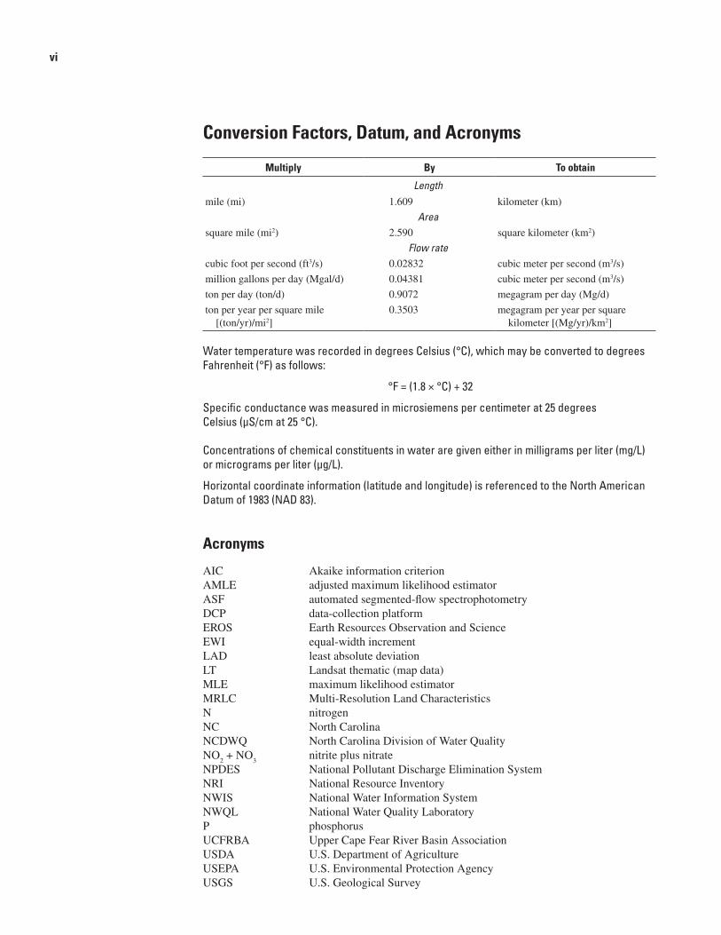
Conversion Factors, Datum, and Acronyms
Multiply By To obtain
Lengthmile(mi) 1.609 kilometer(km)
Areasquaremile(mi2) 2.590 squarekilometer(km2)
Flow ratecubicfootpersecond(ft3/s) 0.02832 cubicmeterpersecond(m3/s)
milliongallonsperday(Mgal/d) 0.04381 cubicmeterpersecond(m3/s)
tonperday(ton/d) 0.9072 megagramperday(Mg/d)
tonperyearpersquaremile[(ton/yr)/mi2]
0.3503 megagramperyearpersquarekilometer[(Mg/yr)/km2]
Water temperature was recorded in degrees Celsius (°C), which may be converted to degrees Fahrenheit (°F) as follows:
°F = (1.8 × °C) + 32
Specific conductance was measured in microsiemens per centimeter at 25 degrees Celsius (µS/cm at 25 °C).
Concentrations of chemical constituents in water are given either in milligrams per liter (mg/L) or micrograms per liter (µg/L).
Horizontal coordinate information (latitude and longitude) is referenced to the North American Datum of 1983 (NAD 83).
Acronyms
AIC AkaikeinformationcriterionAMLE adjustedmaximumlikelihoodestimatorASF automatedsegmented-flowspectrophotometryDCP data-collectionplatformEROS EarthResourcesObservationandScienceEWI equal-widthincrementLAD leastabsolutedeviationLT Landsatthematic(mapdata)MLE maximumlikelihoodestimatorMRLC Multi-ResolutionLandCharacteristicsN nitrogenNC NorthCarolinaNCDWQ NorthCarolinaDivisionofWaterQualityNO
2+NO
3 nitriteplusnitrate
NPDES NationalPollutantDischargeEliminationSystemNRI NationalResourceInventoryNWIS NationalWaterInformationSystemNWQL NationalWaterQualityLaboratoryP phosphorusUCFRBA UpperCapeFearRiverBasinAssociationUSDA U.S.DepartmentofAgricultureUSEPA U.S.EnvironmentalProtectionAgencyUSGS U.S.GeologicalSurvey

AbstractAn investigation of suspended sediment and nutrients
was conducted in the Haw River near Bynum and in the Deep River at Moncure, North Carolina, to characterize water quality based on data collected weekly or biweekly between August 2002 and August 2004. Samples were collected five times per year for selected major ions and trace elements to help in characterizing the water quality at these sampling sites. Sediment and nutrient data collected from 1976 to 2004 also were analyzed to evaluate whether loads and concentrations changed significantly over this period.
The water chemistry in the Haw and Deep Rivers is of mixed ionic composition, although the water chemistry in the Haw River is more variable. Water types in both rivers gener-ally shifted from calcium and bicarbonate in the winter and spring months and during high flows to sodium and chloride during low flows in the summer. Sediment and nutrient loads were estimated for calendar years 2002 and 2003 using the nutrient and suspended-sediment concentration data col-lected between 2002 and 2004 for calibration of regression load models. Sediment and nutrient loads generally were greater in 2003, an unusually wet year, than in 2002. Annual constituent yields generally were higher in the Deep River with the exception of dissolved nitrate and nitrite. Phosphorus loads and concentrations were significantly higher in the Deep River as a result of substantial continuous-discharge sources of phosphorus, particularly near High Point, North Carolina. More stringent wastewater-treatment requirements in the Haw River primarily are responsible for much lower phosphorus concentrations and loads compared with those in the Deep River. Seasonal loads were evaluated at both sites for the period September 2002 through August 2004. Primary transport of nutrients and sediment occurred during spring 2003 and winter 2004.
Historical flow and water-quality data previously collected at both sites by the U.S. Geological Survey and the North Carolina Division of Water Quality were used to
evaluate historical changes through time and to compare information from the two datasets. Historical water-quality changes between 1976 and 2004 were greatest in the Haw River near Bynum, which had a statistically significant (p is less than 0.05) decrease in sediment, total nitrogen, and total phosphorus concentrations and loads. Decreases in cultivated land, improved land-management practices, and improved wastewater-treatment processes since the 1980s are primary reasons for the observed improvement in water quality in the Haw River.
Because sampling was limited for nutrients (16 samples) and sediment (25 samples) in the Deep River, changes in concentrations between the early 1980s and 2002–04 were not statistically detectable (p is greater than 0.05) for suspended sediment, total nitrogen, or total phosphorus. Data from the North Carolina Division of Water Quality also indicated no change between 1992 and 2004. Calculated sediment loads, however, using the load-streamflow regression models calibrated for two separate periods, 1976–83 and 2002–04, indicate that sediment loads may be lower for 2002–04 com-pared with those in the early 1980s. Nutrient concentrations have remained relatively unchanged since the 1980s.
IntroductionThe Upper Cape Fear River Basin Association
(UCFRBA) in North Carolina established a 44-station water-quality sampling network in 2000 to support analyses of water quality in the Haw and Deep River basins and to serve as a basis for providing recommendations to local, State, and Federal authorities regarding maintenance and improvement of water quality and water resources in the upper Cape Fear River basin. The monitoring network was established under an agreement with the North Carolina Division of Water Quality (NCDWQ) and supersedes the NCDWQ in-stream monitoring requirements for point-source discharge facilities that partici-pate in the UCFRBA monitoring program.
Suspended Sediment and Nutrients in the Upper Cape Fear River Basin, North Carolina, 2002–04, with an Analysis of Temporal Changes, 1976–2004
By Timothy B. Spruill, Phillip S. Jen, and Ryan B. Rasmussen

To supplement these data, current information was needed on stream discharge and water quality at selected sites in the basin that are not directly influenced by point sources. Of particular importance were water-quality data for the Haw River above Jordan Lake and the Deep River before its confluence with the Haw River to form the Cape Fear River to document water-quality conditions in the upper part of the basin with respect to nutrients and sediment and excluding the effects of Jordan Lake. Such data, combined with data collected by the Lower Cape Fear River Program and Middle Cape Fear River Basin Association, will provide water-resource managers with a regional perspective on water quality in the Cape Fear River basin. In addition, data collected during the past 30 years from the upper Cape Fear River basin by the U.S. Geological Survey (USGS) and the NCDWQ are valuable in assessing changes in water quality in response to land use and other environmental and climatic factors.
The USGS, in cooperation with the UCFRBA, began a study in 2002 to collect and evaluate current water-quality data over a range of flows in the Deep and Haw Rivers in order to quantitatively assess loads of nutrients and sediment transported from these two major tributaries of the upper Cape Fear River basin. In addition, historical data collected by the USGS and NCDWQ were compiled and analyzed to evaluate whether loads and concentrations of nutrients and sediment have changed over the past approximately 30 years.
Purpose and Scope
This report presents (1) water-quality and streamflow data collected from August 2002 through August 2004 from the Haw River near Bynum and the Deep River at Moncure in North Carolina (fig. 1), and (2) an evaluation of historical data defining general water quality and suspended sediment, total suspended solids, and nutrient loads transported at these two sites between 1976 and 2004 to determine if loads and concentrations have changed. Because the two sampling sites are located at the most downstream part of each river sub-basin (fig. 1), the data can be used to evaluate current (2004) water-quality characteristics in both rivers resulting from land use in the upstream areas. In addition, evaluation of historical data enables the UCFRBA to determine whether water-quality changes have occurred in the basins.
Study Area
The upper Cape Fear River basin is located in the Piedmont Physiographic Province of North Carolina (fig. 1). The entire 3,100-square-mile (mi2) upper Cape Fear River basin (Upper Cape Fear River Basin Association, 2005) consists of the drainage area above the confluence of the Haw and Deep Rivers where they form the Cape Fear River (fig. 1). The headwaters of the Haw River originate near Greensboro,
North Carolina (NC). From there, the river flows eastward through northern Guilford County and then southeast though Burlington in Alamance County and empties into Jordan Lake near Pittsboro in Chatham County (fig. 1). The headwaters of the Deep River also begin in Guilford County but near High Point, and the river flows southeast through Randolph County into Moore County where it turns and flows northeast along the border of Chatham and Lee Counties before joining the Haw River southeast of Moncure to form the Cape Fear River (fig. 1).
The study area includes the entire Deep River subbasin and only part of the Haw River subbasin—Jordan Lake and the creeks that drain into it are excluded (fig. 1). The approxi-mately 2,700-mi2 area (table 1A) of these two subbasins in 2001a consisted primarily of forested areas (49.5 percent of the land use). Developed land and urban areas composed 14.2 percent of the land use in the basin, and cultivated and planted lands composed 25.1 percent. The remaining area was composed of 1.9 percent water and wetlands and 0.3 percent barren land. Although these data are not directly comparable with 1992 dataa, forested areas generally decreased, developed (or urban) areas increased, and cultivated and planted lands remained about the same (table 1A). Human population in the more urban Haw River subbasin is almost twice the popula-tion of the Deep River subbasin and increased approximately 30 percent and 18 percent in the Haw and Deep River subbasins, respectively, between 1990 and 2000 (table 1B). With respect to animal populations, the Deep River subbasin had about 7 times as many swine, 5 times as many poultry, and slightly fewer dairy cattle compared with the Haw River subbasin (table 1B). About 50 National Pollutant Discharge Elimination System (NPDES) wastewater dischargers are in each subbasin in the study area (fig. 1), and almost twice as much waste discharge is permitted in the Haw River subbasin compared with the Deep River subbasin (97 and 53 million gallons per day (Mgal/d), respectively; table 1B).
Two stations were selected for streamflow measurement and water-quality sampling near the confluence of the two rivers—USGS streamgaging station 02096960 on the Haw
aAt least three sources of land-use data were available for the study area—(1) National Multi-Resolution Land Characteristics (MRLC; Bara, 1994) based on Landsat Thematic Mapper (LT) data from 1992 using nationally consistent land-use classes; (2) North Carolina 1996 land-use/land-cover data based on 1993–95 LT land-cover classifica-tions in Earth Satellite Corporation (1997) and used by the North Carolina Division of Water Quality (2005a); and (3) MRLC data based on 2001 Landsat 7 LT data using nationally consistent land-use classes. None of these datasets are directly comparable between years because land-use classifications may differ even though the category names may be identical. The 1992 and 2001 MRLC data were used to characterize general land-use characteristics in the Haw and Deep River subbasins for this report because they are based on consistently pre-processed Landsat 7 LT data that are nationally comparable and readily available, and consistently segregate unmanaged and managed land uses.
2 Suspended Sediment and Nutrients in the Upper Cape Fear River Basin, North Carolina, 2002–2004

Figure 1. Locations of sampling sites in the Haw River and Deep River subbasins of the upper Cape Fear River basin, North Carolina, 2002–04.
Introduction �

2004). Water-quality samples have been collected periodically at this site by the USGS since September 1976. The NCDWQ has collected quarterly to monthly samples for selected chemi-cal constituents, including total suspended solids and nutrients, since July 1968 (North Carolina Division of Water Quality, 2005b).
The sampling site and streamgage on the Deep River at Moncure are located about 4.5 mi upstream from the confluence of the Haw and Deep Rivers (fig. 1). This site was established in July 1930, and streamflow data are still (2004) being collected at this site. Water-quality samples have been collected at this site by the USGS since June 1955; however, like the Haw River, samples were not collected with sufficient frequency for reliable load analysis until 1976 for sediment and 1981 for nutrients. Samples for total suspended solids and nutrients have been collected at this site by the NCDWQ since April 1992 (Andrea Thomas, North Carolina Division of Water Quality, written commun., July 2005).
Table 1. Characteristics of (A) land use and (B) population and wastewater discharges in the Haw River and Deep River subbasins of North Carolina.
[—, no category; land-use data are from 1992 and 2001 Multi-Resolution Land Characteristics (MRLC) land use/land cover coverages available from the U.S. Geological Survey’s Earth Resources Observation and Science (EROS) Data Center in Sioux Falls, South Dakota, and accessed in 2005 at http://edc.usgs.
gov/products/landcover.html]
A. Land use
Land-use class
Haw River subbasin Deep River subbasin Total percentagesSquare miles Percentage Square miles Percentage
1992 2001 1992 2001 1992 2001 1992 2001 1992 2001
Water 17 19.1 1.2 1.5 8.4 9.2 0.6 0.6 0.9 1
Developed 127.8 222.3 10.1 17.5 73.4 163.2 5.1 11.3 7.4 14.2
Barren 5.9 2 0.5 0.2 19.4 4.8 1.3 0.3 0.9 0.3
Forested 747.6 556.6 58.8 43.8 1,052.4 786.2 73 54.5 66.3 49.5
Planted/cultivated 358.4 358.9 28.2 28.2 272.1 321.6 18.9 22.4 23.3 25.1
Shrub/scrub — 47 — 3.7 — 78.1 — 5.4 — 4.6
Grassland/herbaceous — 53.1 — 4.2 — 66.2 — 4.6 — 4.4
Wetlands 15 13.2 1.2 1 16.6 13.1 1.1 0.9 1.2 0.9
Total 1,272 1,272 100 100 1,442 1,442 100 100 100 100
B. Population data and wastewater discharges permitted by the National Pollutant Discharge Elimination System (NPDES) [Data from North Carolina Division of Water Quality (2000, 2005a)]
Population for year(s) shown
Humans 1990 / 2000
Haw River subbasin Deep River subbasin
Swine 1998
Dairy cattle 1998
Poultry 1998
Humans 1990 / 2000
Swine 1998
Dairy cattle 1998
Poultry 1998
391,737 / 506,453 10,250 10,160 5,737,248 216,528 / 256,143 71,129 7,059 31,461,122
NPDES-permitted wastewater discharges
Haw River subbasin Deep River subbasin
Number 53 50
Amount, in million gallons per day 97.3 52.9
4 Suspended Sediment and Nutrients in the Upper Cape Fear River Basin, North Carolina, 2002–2004
River near Bynum, which has a drainage areab of 1,275 mi2, and USGS streamgaging station 02102000 on the Deep River at Moncure, which has a drainage areab of 1,434 mi2 (fig. 1). These two stations drain about 2,700 mi2, or about 90 percent of the upper Cape Fear drainage basin. Because the Haw River above Jordan Lake (fig. 1) is the primary focus of this study, the 10 percent of the Haw River subbasin that includes Jordan Lake and streams draining Chapel Hill and Durham was excluded.
The sampling site and streamgage on the Haw River near Bynum are located about 10 miles (mi) upstream from Jordan Lake (fig. 1). Streamflow data have been collected continu-ously at this site since October 1973 (Ragland and others,
bDrainage areas stored in the U.S. Geological Survey’s National Water Information System (NWIS) generally are determined from 1:24,000 topo-graphic maps published by the U.S. Geological Survey. These drainage areas may vary from areas determined from other sources. Detailed site information for these stations are presented in Ragland and others (2004).

Acknowledgments
This study was conducted by the USGS in cooperation with the UCFRBA. The authors thank Carol Patrick, Mike Hite, and Sydney Miller of the UCFRBA for their cooperation in this study; Susan Gale and Andrea Thomas of the Environ-mental Sciences Section of the NCDWQ; and Tami Idol of the North Carolina Division of Land Resources. Further thanks go to the USGS field office staff in Raleigh, NC; to Mary Giorgino and Carolyn Oblinger of the USGS North Carolina Water Science Center for their support and guidance through-out this project; and to the reviewers of this report.
MethodsMethods that were used in the collection and interpreta-
tion of water-quality data are described here. Methods used for surface-water data collection and analysis and the statistical procedures to analyze the data also are included.
Streamflow
Streamflow, also referred to as stream discharge, was measured and recorded during this investigation according to standard USGS methods (Rantz and others, 1982). Both sites were equipped with data-collection platforms (DCPs) that record river stage at 15-minute intervals. Instantaneous stream-flow was calculated at the time that stream-stage records were transmitted to the USGS National Water Information System (NWIS). Streamflow data have been collected at the Haw River near Bynum since 1973 and at the Deep River at Moncure since 1930 (Ragland and others, 2004).
Water-Quality Data
All water-quality data collected by the USGS in the study area during 2002–04 were collected in accordance with
USGS protocols (U.S. Geological Survey, variously dated). Alkalinity, pH, specific conductance, dissolved oxygen, and temperature were measured in the field. Field properties and nutrient and suspended-sediment samples were collected approximately weekly from August 2002 to January 2004 and biweekly from January 2004 to August 2004. At each site, 10 samples were collected for major ions and trace elements, 7 of which were collected during periods of runoff.
The equal-width-increment (EWI) method of sampling was used, because it ensures a depth- and width-integrated sample representative of the entire stream cross section. Isokinetic samplers were used to collect multiple vertical subsamples while wading the cross section or by deploying a sampler from the bridge during high flows. When conditions did not meet the criteria for EWI sampling (usually when water depths were too shallow), a weighted bottle sampler was used to collect multiple subsamples at equal widths in the river cross section. This approach yields samples that are represen-tative of the cross section but are not depth integrated.
Water-quality samples were processed by compositing the subsamples, filtering appropriate samples through a 0.45-micron filter, filling sample bottles, and preserving the samples. All sample processing was completed onsite and in accordance with USGS protocols and requirements outlined by the USGS National Water Quality Laboratory (NWQL) specific to the analysis being requested. Total suspended- sediment analyses were performed at the USGS Kentucky Water Science Center sediment laboratory in Louisville, Ken-tucky. Samples were analyzed for nutrients, major ions, and trace elements at the NWQL in Denver, Colorado (tables 2, 3). Analytical procedures used for data collected during this investigation are presented in Fishman (1993), and in Fishman and Friedman (1989) for data collected before 1989. Water-quality data collected for this investigation are presented in Appendixes 1–3.
Table 2. Analytical methods and reporting levels for nutrients and suspended sediment.
[ASF, automated segmented-flow spectrophotometry; mg/L, milligrams per liter; ºC, degrees Celsius; pre-1989 reporting levels are in parentheses]
Constituent Method Reporting level
Ammonia plus organic nitrogen, total Colorimetry, ASF, microkjeldahl digestion 0.10 (0.20) mg/L
Ammonia, filtered Colorimetry, ASF, salicylate-hypochlorite 0.010 (0.01) mg/L
Nitrite plus nitrate, filtered Colorimetry, ASF, cadmium reduction-diazotization 0.060 (0.10) mg/L
Nitrite, filtered Colorimetry, ASF, low ionic-strength 0.002 (0.01) mg/L
Orthophosphate, filtered Colorimetry, ASF, phosphomolybdate 0.006 (0.01) mg/L
Phosphorus, total Colorimetry, ASF, microkjeldahl digestion 0.040 (0.01) mg/L
Total suspended sediment Filtration, evaporation at 105 ºC; Gravimetric 1 (1 mg/L) mg/L
Methods 5

Load-Estimation Techniques for Data Collected during 2002–04
Loads were calculated using LOADEST, a software program developed by the USGS (Runkel and others, 2004). The version of LOADEST used for this study fits the natural logarithm of load (concentration multiplied by streamflow) to a loglinear regression model using streamflow (Q), linear or decimal time (dtime), and various func-tions of these two variables automati-cally up to nine parameters (table 4). Additional user-defined variables can be included. The user can select the model based on his or her knowledge of the river system or use the model auto-matically selected by the LOADEST program. The model is calibrated using ordinary least-squares regression, and final load estimates are derived from retransforming the logarithm of the load back to actual loads according to one of three methods—(1) the maximum likelihood estimator (MLE), (2) the adjusted maximum likelihood estima-tor (AMLE), or (3) the least absolute deviation (LAD; Runkel and others, 2004). LOADEST computes loads for
each model by using the AMLE method and all observations in the dataset, and compares the models by using the Akaike information criterion (AIC). The model having the lowest value of the AIC statistic (representing the lowest model error) is selected for use in load estimation. Data collected during 2002–04 from the Haw and Deep Rivers were analyzed using the AMLE method, which was selected for each of the load calculations because of the ability to use censored data with
Table �. Analytical methods and reporting levels for dissolved major ions and selected trace elements.
[mg/L, milligrams per liter; µg/L, micrograms per liter]
Constituent Method Reporting level
Major ions
Calcium Inductively coupled plasma/mass spectroscopy 0.02 mg/L
Magnesium Inductively coupled plasma/mass spectroscopy 0.008 mg/L
Sodium Inductively coupled plasma/mass spectroscopy 0.20 mg/L
Chloride Ion chromatography 0.20 mg/L
Sulfate Ion chromatography 0.18 mg/L
Trace elements
Aluminum Inductively coupled plasma/mass spectroscopy 1.6 µg/L
Arsenic Inductively coupled plasma/mass spectroscopy 0.2 µg/L
Cadmium Inductively coupled plasma/mass spectroscopy 0.04 µg/L
Chromium Graphite furnace atomic absorption 0.8 µg/L
Copper Inductively coupled plasma/mass spectroscopy 0.4 µg/L
Iron Inductively coupled plasma 6 µg/L
Lead Inductively coupled plasma/mass spectroscopy 0.08 µg/L
Manganese Inductively coupled plasma/mass spectroscopy 0.6 µg/L
Mercury Cold vapor atomic fluorescence 0.010 µg/L
Nickel Inductively coupled plasma/mass spectroscopy 0.06 µg/L
Table 4. List of regression models included in LOADEST computations.
[The natural logarithm (ln) of the load (Q * C) equals the following equations where a0 – a
6 equals
regression coefficients, lnQ equals natural logarithm of daily discharge, and dtime equals decimal time]
Model number
Regression model
1 a0 + a
1lnQ
2 a0 + a
1lnQ + a
2lnQ2
3 a0 + a
1lnQ + a
2dtime
4 a0 + a
1lnQ + a
2sin(2�dtime) + a
3cos(2�dtime)
5 a0 + a
1lnQ + a
2lnQ2 + a
3dtime
6 a0 + a
1lnQ + a
2lnQ2 + a
3sin(2�dtime) + a
4cos(2�dtime)
7 a0 + a
1lnQ + a
2sin(2�dtime) + a
3cos(2�dtime) + a
4dtime
8 a0 + a
1lnQ + a
2lnQ2 + a
3sin(2�dtime) + a
4cos(2�dtime) +a
5dtime
9 a0 + a
1lnQ + a
2lnQ2 + a
3sin(2�dtime) + a
4cos(2�dtime) +a
5dtime + a
6dtime2
6 Suspended Sediment and Nutrients in the Upper Cape Fear River Basin, North Carolina, 2002–2004

negligible bias (Cohn, 1988). For the study dataset, where at least monthly samples were available for the entire period (1976–2004), the best model selected by LOADEST was used for load calculations for both stations on the Haw and Deep Rivers. Calendar year loads for 2002 and 2003 were estimated based on the calibration period September 2002 through August 2004. The equations used to estimate loads are presented in Appendix 4.
Load-Estimation Techniques for Historical Data
Reconstruction of loads over time often is problematic because of large gaps in chemical or sediment data. Residuals (the difference between predicted and observed loads) cannot be computed for years when no data are available to calibrate the model or test the performance of the model. The question addressed in this report is whether suspended-sediment, nitro-gen, and phosphorus loads changed between 1976 and 2004. In order to evaluate the effects of change, the loading models generated by using suspended-sediment data for 1976–85 and total phosphorus and total nitrogen data for 1981–85 for the Haw River near Bynum, and suspended-sediment data for 1976–83 and total phosphorus and total nitrogen data for 1981–83 for the Deep River at Moncure, and all nutrient and suspended-sediment data from both stations for 2002–04 were applied to the actual streamflow record for the entire period (1976–2004); the resulting load estimates were compared. For consistency with the statistical analysis of temporal change, described in the next section, the periods of comparison for suspended sediment are 1976–85 and 2002–04 for both sta-tions. For hypothetical reconstruction of loads using historical streamflow data, automatic model selection by LOADEST was used for the Haw River near Bynum. In addition, loads calcu-lated using the LOADEST program for years in which USGS data were available and reported were compared with loads calculated by previous researchers for sediment (Simmons, 1993) and for sediment, total nitrogen, and total phosphorus (Childress and Treece, 1996). All of the basic load models used for hypothetical reconstruction of annual sediment, total nitrogen, and total phosphorus loads are given in Appendix 4. The AMLE method was used as the estimation method for all models.
Historical sediment data for the Deep River at Moncure are available beginning in 1969, although the longest period of regularly collected monthly data occurred between 1981 and 1983. Some summer and fall data are available for 1976–78 and were included in the development of the model so that the total number of sediment samples was 25 for the period 1976–83. Data collected before 1976 were infrequent and appear to be event related; therefore, these data were not included. Historical data for nutrients in the Deep River at Moncure after 1980 are sparse (16 samples), and no USGS suspended-sediment or nutrient data were collected between 1984 and 2002. As a result, nutrient loads could
not be computed for this site for the period 1976–83 because of insufficient data to run the LOADEST model. Because concentration and instantaneous load data for sediment were not available for almost 20 years, only flow was selected as the predictor variable (model 1, table 4) for estimating sediment loads. Sufficient sediment data were available (25 samples) to estimate loads generated from a model calibrated for the period 1976–83 for comparison with loads estimated from the model for the recent period (2002–04).
Analysis of Temporal Changes
Typical approaches to sediment and water-quality sampling for estimating loads may not allow a reliable evaluation of changes in water quality (concentration) over time using trend tests, such as simple correlation analysis or two-sample tests used to test differences between two or more time periods. Most statistical techniques for hypothesis testing require random sampling through time so that all conditions have an equal probability of being represented. The assumption of randomness usually is not entirely true for water-quality sampling where load estimation is the intended goal because either extreme low or high flows are targeted for sampling to allow the development of regression equations for predicting loads or concentrations for load-calculation purposes, thus negating the assumption of randomness for statistical hypothesis testing. A preponderance of high- or low-flow samples will bias statistics generated from such data and may not be representative of the average conditions in the environment. It was assumed for the analysis conducted for this investigation that monthly sampling with some limited, targeted samples of very high and low flows, which probably is typical of most ambient-monitoring networks, was basically suitable for statistical hypothesis testing. Because chemical water-quality data were collected by the USGS from the Haw River near Bynum primarily during the 1987–94 high flows, these data were excluded from the statistical analysis using the Mann-Whitney test (Conover, 1980).
Because loads are calculated by multiplying streamflow by nutrient concentration, loads are always correlated to flow and, thus, must be used carefully when assessing changes in magnitude through time. Decreases or increases in load may be a result of either corresponding decreases or increases in streamflow or nutrient concentrations. For this reason, trends in streamflow, loads, and nutrient concentrations were evalu-ated separately.
For this report, trends in flow and concentration were considered suitable for evaluation (1) if regularly collected data (for example, monthly) were available for the period of record without a large number of targeted high or low flows, and (2) by applying a nonparametric Spearman’s rho correla-tion test (Conover, 1980) to daily flow or monthly concentra-tions of total nitrogen, total phosphorus, and suspended sediment with time. The hypotheses being tested for positive or negative trend with a correlation analysis are as follows:
Methods 7

(1) H0—The paired time and nutrient concentrations
through the period of record are mutually independent and not correlated (null hypothesis).
(2) H1—(a) Larger values of concentration (or load) tend
to be paired with larger values of time (increasing trend or positive correlation), or (b) smaller values of concentration (or load) tend to be paired with larger values of time (decreasing trend or inverse correlation; alternative hypothesis).
The Spearman’s rho correlation coefficient is calculated by using ranks of the raw data. A correlation of 1 or -1 indi-cates a perfect correlation or inverse correlation between two variables, and a zero indicates no correlation. For this report, a trend was considered significant if the p-value generated by the test was less than (<) 0.05 (that is, the significance level, or α, was 0.05).
If data are not available over time to test for monotonic trend with a Spearman’s rho or some other test, it may be possible to test differences in concentrations or loads for the two time periods being compared. If regularly collected data can be assumed to be basically random throughout the period (or periods) of record, a two-sample nonparametric Mann-Whitney test (Conover, 1980) can be applied to the datasets to test the following:
(3) H0—There is no difference in concentrations (or
loads) between the two periods.(4) H
1—The concentrations (or loads) between the two
periods are not identical.It may be possible to divide the data into a before and
after period, in which the approximate midpoint of a continu-ous period of record (for example, for the period 1990–2000, the midpoint is 1995), can be used to split the data for statistical comparison. Alternatively, when data are available for two separate periods, with no or inadequate data available for the period between (for example, 1980–85 and 2000–03), the Mann-Whitney test can be applied to determine if water-quality conditions are different. For this report, the significance level of 5 percent (α = 0.05) was adopted so that values of p < 0.05 were considered statistically significant and the null hypothesis (3) was rejected. In addition to the data collected by the USGS at the sites, total suspended solids, total nitrogen, and total phosphorus data collected by the NCDWQ also were com-pared in selected cases to verify conclu-sions about trends indicated by the USGS data or to evaluate possible differences in information conveyed about concentrations or trends by the two datasets.
Streamflow, Suspended Sediment, and Nutrient Concentrations and Loads in the Upper Cape Fear River Basin, 2002–04
Sample collection began in August 2002 and ended in August 2004. Sampling occurred during unusually dry and wet years compared to the long-term record at both sites. The median streamflows for the Haw River near Bynum for water yearsc 2002, 2003, and 2004 were 169, 1,700, and 636 cubic feet per second (ft3/s), respectively (table 5; fig. 2). The median streamflow for this site from 1976 through 2002 was 570 ft3/s (table 5). Based on available streamflow information (Ragland and others, 2003, 2004; Walters and others, 2005) water years 2002, 2003, and 2004 were very dry, very wet, and about average, respectively. The streamflow patterns at the Deep River at Moncure were similar to those of the Haw River (fig. 2). The median streamflows for the Deep River for water years 2002, 2003, and 2004 were 101, 1,430, and 542 ft3/s, respectively. The 1976–2004 median flow for the Deep River was 512 ft3/s (table 5; fig. 2).
Annual streamflow variation can have several effects on water quality. For nutrients that are derived from continuous
cWater year is the period from October 1 through September 30 and is identified by the year in which the period ends. For example, the 2002 water year began October 1, 2001, and ended September 30, 2002.
Table 5. Selected streamflow statistics for the Haw River near Bynum and the Deep River at Moncure, North Carolina.
[Mean daily streamflows were used to compute statistics for each water year shown]
Streamflow, in cubic feet per second
Water years 1976–2004
Water year 2002
Water year 200�
Water year 2004
Haw River near Bynum
Minimum 0.18 60 106 174
Mean 1,259 370 2,950 938
Median 570 169 1,700 636
Maximum 58,000 6,900 33,300 10,700
Number of values 10,593 365 365 366
Deep River at Moncure
Minimum 18 22 37 105
Mean 1,426 391 3000 1,020
Median 512 101 1,430 542
Maximum 36,800 11,500 29,000 13,000
Number of values 10593 365 365 366
8 Suspended Sediment and Nutrients in the Upper Cape Fear River Basin, North Carolina, 2002–2004

discharge sources (point-source discharges or contaminated ground water), the concentrations generally will be higher (having potential short-term biological effects), and the loads will be lower during dry years. Conversely, nutrient concentrations generally will be lower and the loads will be higher during wet years. For nutrients and sediment derived from diffuse or nonpoint sources associated with runoff, both concentrations and loads generally will be lowest during dry years and highest during wet years.
Five water-quality samples per year were collected at both sites for 2 years and analyzed for selected major ions and trace elements to characterize general water quality in the Haw and Deep Rivers. The analytical results for these samples are given in Appendix 3A (Haw River) and 3B (Deep River). Because of the small number (10) of samples collected during this investigation, reliable load estimates for these constituents could not be made. In general, the water types of the Haw and Deep Rivers are similar and have the same overall characteris-tics—a mixed ionic water type (calcium-magnesium-sodium-potassium-bicarbonate-sulfate-chloride). Calcium was the dominant cation during high flows, which typically occurred
during the winter and spring months, and sodium was the dominant cation during low flows, which typically occurred during the summer and fall months (fig. 3). As noted in Chil-dress and Treece (1996), the dominant water types for streams affected by point sources in the study area are sodium plus potassium and sulfate, whereas streams minimally affected by point sources have a calcium and bicarbonate-dominated water type. From the trace element data (Appendix 3A, B), no dissolved constituent concentrations were measured that exceeded current (2004) water-quality standards for drinking water or aquatic life established by either the NCDWQ or the U.S. Environmental Protection Agency (USEPA).
Nutrient and Suspended-Sediment Concentrations
Nutrient and suspended-sediment samples were collected from the Haw and Deep Rivers over a 2-year period, beginning in August 2002 and ending in August 2004 (table 6). Median concentrations of total nitrogen and ionic forms of nitrogen and suspended sediment appear to be similar at both sites and are not significantly different (p greater than (>) 0.05). On the other hand, orthophosphate and total phosphorus concentra-tions in water samples from the Deep River were significantly (p < 0.05) higher. This difference can be seen more clearly in the box plots shown in figure 4, where the difference in total phosphorus concentrations between the two sites is more apparent than the differences in total nitrogen and suspended-sediment concentrations.
Seasonal concentrations of suspended sediment, ortho-phosphate, and total nitrogen varied (fig. 5). (Orthophosphate was the only form of phosphorus available during the period 2002–04 and is included here for comparison of the effects of the very dry summer in 2002.) Suspended-sediment concentra-tions, except during spring and summer 2003, tended not to vary greatly from one season to the next. The occurrences of relatively high concentrations of suspended sediment during the high flows of the unusually wet spring and summer of 2003 (fig. 5) are indicative of nonpoint sources (for example, erosion from hillsides or banks). Concentrations of total nitro-gen and orthophosphate were higher during the 2002 and 2004 summers, previously noted as dry to average years, and lower during 2003. This generally indicates the influence of continu-ous discharge (wastewater from point sources or ground water) on nutrient concentrations, particularly during low flows.
Wastewater is a continuous source of both nitrogen and phosphorus concentrations in the Haw and Deep Rivers, and substantially higher orthophosphate concentrations occurred in the Deep River during all seasons (fig. 5). This finding is consistent with information presented by the North Carolina Department of Environment and Natural Resources (2004). Very high (median > 1.5 milligrams per liter (mg/L)) con-centrations of total phosphorus occurred between 1998 and 2003 in the Deep River near High Point, NC, and remained high downstream at Ramseur (North Carolina Department of
Figure 2. Streamflow in the (A) Haw River near Bynum and (B) Deep River at Moncure, North Carolina, for water years 2002–04.
Streamflow, Suspended Sediment, and Nutrient Concentrations and Loads in the Upper Cape Fear River Basin, 2002–04 9

Figure �. Water types for the (A) Haw River near Bynum and (B) Deep River at Moncure, North Carolina, 2002–04.
Table 6. Statistical summary of nutrient and suspended-sediment concentrations in the Haw and Deep Rivers, North Carolina, 2002–04.
[+, plus; all values are in milligrams per liter. At each sampling site, 86 values were used to compute statistics for suspended sediment and for each nutrient shown]
Nitrogen, ammonia, dissolved
Nitrogen, ammonia
plus organic,
total
Nitrogen, nitrite
+ nitrate, dissolved
Nitrogen, nitrite,
dissolved
Total nitrogen
Ortho-phosphate, dissolved
Total phosphorus
Suspended sediment
Haw River near Bynum
Minimum 0.005 0.10 0.22 0.0020 0.86 0.012 0.04 3
Mean 0.047 0.66 0.91 0.010 1.6 0.092 0.16 36
Median 0.031 0.60 0.75 0.0075 1.4 0.067 0.13 14
Maximum 0.40 1.7 3.5 0.044 4.5 0.46 0.44 350
Deep River at Moncure
Minimum 0.005 0.31 0.18 0.0020 0.81 0.048 0.08 1
Mean 0.042 0.70 0.90 0.0081 1.6 0.17 0.23 38
Median 0.022 0.60 0.82 0.0080 1.5 0.13 0.21 12
Maximum 0.405 2.7 2.14 0.028 3.9 0.81 0.54 468
10 Suspended Sediment and Nutrients in the Upper Cape Fear River Basin, North Carolina, 2002–2004

Environment and Natural Resources, 2004). Total phosphorus concentrations decreased to about 0.15 mg/L downstream from Ramseur but increased again to above 0.2 mg/L at the NCDWQ monitoring station near Sanford, NC, and remained at this concentration at the NCDWQ monitoring station farther downstream at Moncure. In the Haw River, total phosphorus concentrations were much lower; the median total phosphorus concentration ranged from about 0.1 mg/L in the upper reaches to about 0.25 mg/L at the NCDWQ monitoring station near Burlington, NC, and decreased to about 0.17 mg/L at the monitoring station near Bynum (North Carolina Department of Environment and Natural Resources, 2004).
Anthropogenic sources of nutrients and sediment affect water quality, but a greater overall effect was observed in the Deep River. Both the Haw and Deep Rivers had concentrations of suspended sediment, total nitrogen, and total phosphorus above estimated background concentrations—those that would occur in piedmont streams draining undeveloped forested watersheds. Based on the median concentrations presented for the Haw River near Bynum (table 6) and estimated background concentrations of about 0.5 mg/L for total nitrogen and 0.05 mg/L for phosphorus reported by Simmons and Heath (1982) for streams draining the study area in the Piedmont Physiographic Province, 50 percent of the nitrogen (2 times the background) and more than 66 percent of the
phosphorus (3 times the background) concentrations are derived from anthropogenic sources. The median concentra-tion of suspended sediment in the Haw River near Bynum (14 mg/L, table 6) approximated about 2 to 3 times the median suspended-sediment concentration (5–6 mg/L) reported by Simmons (1993) for piedmont forested watersheds (assumed to represent background or pre-development conditions). Stated another way, anthropogenic sources currently (2004) compose about 50–66 percent of the sediment load in the Haw River.
For the Deep River at Moncure, the median concentra-tions of total nitrogen and total phosphorus (table 6) were approximately 3 times the background total nitrogen and more than 4 times the background total phosphorus concen-trations reported by Simmons and Heath (1982)—higher nutrient enrichment than observed in the Haw River. Based on information presented in Simmons (1993), the median suspended-sediment concentration in the Deep River at Moncure (12 mg/L, table 6) approximated about 2 times that reported for piedmont forested watersheds (5–6 mg/L). Possible reasons for these differences are discussed at the end of the next section.
Figure 4. (A) Total phosphorus, (B) total nitrogen, and (C) suspended-sediment concentrations in the Haw River near Bynum and the Deep River at Moncure, North Carolina, 2002–04.
Streamflow, Suspended Sediment, and Nutrient Concentrations and Loads in the Upper Cape Fear River Basin, 2002–04 11

Figure 5. Seasonal concentrations of (A) suspended sediment, (B) orthophosphate, and (C) total nitrogen in the Haw River near Bynum and the Deep River at Moncure, North Carolina, 2002–04.
12 Suspended Sediment and Nutrients in the Upper Cape Fear River Basin, North Carolina, 2002–2004

Nutrient and Suspended-Sediment Loads
Loads of total nitrogen, total phosphorus, and suspended sediment in the Haw and Deep Rivers were estimated for the 2002 and 2003 calendar years and seasonally for the period 2002–04. Seasons are represented by quarters, using 3-month intervals beginning September 2002 and ending in August 2004. The transport equations used to estimate loads are given in Appendix 4.
Annual LoadsDuring the 2002 calendar year, the Haw River near
Bynum transported 1,400 tons of total nitrogen, 160 tons of total phosphorus, and 56,000 tons of suspended sediment (table 7). In 2003, the river transported 3,400 tons of total nitrogen, 470 tons of total phosphorus, and 230,000 tons of suspended sediment. The yields for total nitrogen were 1.1 tons per year per square mile (tons/yr)/mi² in 2002 and
Table 7. Nutrient and sediment loads and yields in the Haw and Deep Rivers, North Carolina, for calendar years 2002 and 2003.
[%, percent; tons/yr, tons per year; (tons/yr)/mi2, tons per year per square mile; +, plus]
Haw River near Bynum Deep River at Moncure
ConstituentConfidence
interval, lower 95%
Confidence interval,
upper 95%
Load (tons/yr)
Yield ([tons/yr]/mi²)
Confidence interval,
lower 95%
Confidence interval,
upper 95%
Load (tons/yr)
Yield ([tons/yr]/mi²)
2002
Nitrogen, ammonia, dissolved
31 86 54 0.042 38 110 66 0.046
Nitrogen, ammonia + organic, total
570 770 670 0.53 830 1,100 960 0.67
Nitrogen, NO2 +
NO3, dissolved
590 760 680 0.53 590 830 700 0.49
Nitrogen, nitrite, dissolved 8.4 14
11 0.0086 7.3 12 9.6 0.0067
Total nitrogen 1,200 1,500 1,400 1.1 1,500 1,900 1,700 1.2
Orthophosphate, dissolved
43 72 56 0.044 97 130 110 0.1
Total phosphorus 130 200 160 0.13 220 300 260 0.18
Suspended sediment
29,000 97,000 56,000 44 52,000 140,000 88,000 61
2003
Nitrogen, ammonia, dissolved
96 300 180 0.14 120 410 230 0.16
Nitrogen, ammonia + organic, total
1,700 2,200 1,900 1.5 2,300 2,900 2,600 1.8
Nitrogen, NO2 +
NO3, dissolved
1,300 1,700 1,500 1.2 1,400 1,800 1,600 1.1
Nitrogen, nitrite, dissolved
20 32 26 0.020 18 29 23 0.016
Total nitrogen 3,100 3,900 3,400 2.7 3,600 4,400 4,000 2.8
Orthophosphate, dissolved
110 170 140 0.11 230 310 270 0.19
Total phosphorus 400 590 470 0.37 590 910 740 0.52
Suspended sediment
140,000 350,000 230,000 180 220,000 600,000 380,000 270
Streamflow, Suspended Sediment, and Nutrient Concentrations and Loads in the Upper Cape Fear River Basin, 2002–04 1�

2.7 (tons/yr)/mi² in 2003. Total phosphorus yields were 0.13 (ton/yr)/mi² in 2002 and 0.37 (ton/yr)/mi² in 2003. Suspended-sediment yields were 44 (tons/yr)/mi² in 2002 and 180 (tons/yr)/mi² in 2003 (table 7).
The Deep River at Moncure transported 1,700 tons of total nitrogen, 260 tons of total phosphorus, and 88,000 tons of suspended sediment during the 2002 calendar year. In 2003, the river transported 4,000 tons of total nitrogen, 740 tons of total phosphorus, and 380,000 tons of suspended sediment. The yields for total nitrogen were 1.2 (tons/yr)/mi² in 2002 and 2.8 (tons/yr)/mi² in 2003. The yields for total phosphorus were 0.18 (ton/yr)/mi² in 2002 and 0.52 (ton/yr)/mi² in 2003. Suspended-sediment yields were 61 (tons/yr)/mi² in 2002 and 270 (tons/yr)/mi² in 2003 (table 7). The loads of all chemical constituents at each site were significantly higher in 2003 than in 2002, primarily because of the much higher flows during 2003 (fig. 2).
Comparison among sites can be accomplished by evaluating yields, which normalize for differences in drainage area. Yields of total nitrogen, total phosphorus, and suspended sediment generally were higher in the Deep River than in the Haw River (table 7), and yields of orthophosphate, total phosphorus, and sediment were substantially higher during the study period. These differences are the result primarily of lower concentrations in the Haw River, even though the Haw River had higher streamflows (fig. 2). It is not known why the Haw River had generally lower annual yields for nutrients and sediment than the Deep River, given that the Haw River subbasin has more developed and cultivated land and less forested land than the Deep River subbasin (table 1A). The Haw River also is permitted for a total effluent discharge of about 93 Mgal/d compared with 53 Mgal/d in the Deep River (North Carolina Division of Water Quality, 2005b). Based on this information, one might expect poorer water quality in the Haw River, although this is not supported by the data presented in this report. Because the Haw River is classi-fied as Nutrient Sensitive Water by the NCDWQ, however, point-source dischargers along the Haw River are under more stringent discharge limits, particularly in regard to phosphorus, than along the Deep River (Michelle Woolfolk, North Caro-lina Division of Water Quality, oral commun., April 2005); this appears to be a major factor in accounting for lower phosphorus concentrations in the Haw River. Even though the Haw River subbasin has more people, developed lands, and cultivated lands than the Deep River subbasin, the Deep River subbasin above Moncure has 6 times as many swine and 5.5 times as many poultry (table 1B), which are major poten-tial sources of nutrients in watersheds (Mallin, 2000). Another
factor that may contribute to water-quality differences between the two subbasins is the number of impoundments along the two rivers—the Haw River has 59 and the Deep River has 34 (Tammy Idol, North Carolina Division of Land Resources, written commun., 2005). Additional studies that focus on why some of these water-quality differences exist could provide valuable information for future management of the upper Cape Fear River basin.
Seasonal LoadsNutrient and suspended-sediment loads were computed
seasonally for the Haw River near Bynum and the Deep River at Moncure. The seasons were divided into spring, summer, fall, and winter, and each season was composed of a 3-month period beginning in September 2002 and ending in August 2004 for a total of eight seasons.
The highest loads estimated for the Haw River during this period were 1,500 tons of total nitrogen, 234 tons of total phosphorus, and 140,000 tons of suspended sediment, all of which occurred during spring 2003 (table 8). The lowest loads transported in the Haw River during the period were 240 tons of total nitrogen, 26 tons of total phosphorus, and 3,100 tons of suspended sediment. The lowest total phosphorus and suspended-sediment loads occurred in spring 2004, and the lowest total nitrogen load occurred in summer 2004 (table 8).
The highest loads in the Deep River during this inves-tigation also occurred in spring 2003 for all constituents—1,800 tons of total nitrogen, 436 tons of total phosphorus, and 260,000 tons of suspended sediment. The lowest loads transported in the Deep River during this period were 240 tons of total nitrogen, 33 tons of total phosphorus, and 6,700 tons of suspended sediment. The lowest range of loads during the study occurred in spring 2004 for suspended sediment and in summer 2004 for total phosphorus and total nitrogen (table 8).
During this investigation, loads of all constituents at both sites were greatest during the spring and summer 2003, an unusually wet year with a very wet spring and summer, and lowest during the fall and winter months (fig. 6). During 2004, a more typical year hydrologically, primary transport of nutrient and sediment loads occurred during the fall and winter months. Because water year 2003 was much wetter than water year 2004, substantially greater loads were transported during the first four seasons than during the last four at both sites. Both sites had the largest loads of all constituents transported during spring 2003 (table 8).
14 Suspended Sediment and Nutrients in the Upper Cape Fear River Basin, North Carolina, 2002–2004

Table 8. Seasonal loads of nutrients and suspended sediment in the Haw River near Bynum and the Deep River at Moncure, North Carolina, during September 2002–August 2004.
[+, plus; all values are in tons]
SeasonNitrogen, ammonia dissolved
Nitrogen, ammonia +
organic, total
Nitrogen, NO2 + NO�, dissolved
Nitrogen, nitrite
dissolved
Total nitrogen
Ortho- phosphate, dissolved
Total phosphorus
Suspended sediment
Haw River near Bynum
September 2002 – November 2002
29 340 260 3.6 590 26 87 41,000
December 2002 – February 2003
30 350 350 6.3 740 25 80 21,000
March 2003 – May 2003
100 950 540 14 1,500 49 234 140,000
June 2003 – August 2003
38 500 420 5.4 900 42 134 56,000
September 2003 – November 2003
16 220 230 2.0 440 25 58 21,000
December 2003 – February 2004
13 180 250 2.8 440 20 40 6,200
March 2004 – May 2004
7.6 110 190 2.0 310 15 26 3,100
June 2004 – August 2004
6.1 100 150 0.97 240 18 27 4,800
Deep River at Moncure
September 2002 – November 2002
31 480 300 3.9 770 52 108 53,000
December 2002 – February 2003
44 530 450 5.0 1,000 53 154 45,000
March 2003 – May 2003
150 1,400 580 12 1,800 110 436 260,000
June 2003 – August 2003
39 660 410 6.2 1,300 85 143 76,000
September 2003 – November 2003
10 200 240 1.7 430 34 49 13,000
December 2003 – February 2004
13 190 340 1.8 510 27 64 8,200
March 2004 – May 2004
9.9 140 220 1.6 360 24 51 6,700
June 2004 – August 2004
6 110 150 0.95 240 24 33 9,100
Streamflow, Suspended Sediment, and Nutrient Concentrations and Loads in the Upper Cape Fear River Basin, 2002–04 15

HAW RIVER DEEP RIVER
Figure 6. Seasonal loads of suspended sediment, total phosphorus, and total nitrogen in the Haw River near Bynum and the Deep River at Moncure, North Carolina, for water years 2003 and 2004.
collected (monthly to quarterly) suspended-sediment data are available for the Haw and Deep River sites beginning in 1976, although substantially fewer analyses are available for the Deep River at Moncure. Regularly collected total nitrogen and total phosphorus data for the Haw and Deep Rivers are available from 1981.
The general time period between 1976 and 2004 was considered to be appropriate for comparing changes in water quality, particularly in light of 25–30 years of changes in land use and population, improvements in wastewater-treatment plants, regulations banning phosphorus in detergents in 1988 (Childress and Treece, 1996), implementation of nonpoint-source controls as best-management practices, changes in planted agricultural acreage, and other major changes. The
Historical Changes in Streamflow, Suspended-Sediment, and Nutrient Concentrations and Loads, 1976–2004
Although continuous streamflow data are available from the USGS for the Haw River near Bynum since 1973 and for the Deep River at Moncure since 1930, the availability of water-quality data from the USGS at these sites is more limited. The utility of long-term water-quality and streamflow data is that environmental effects of changes in land use or management practices on water quality can be evaluated throughout the period for which data are available. Regularly
16 Suspended Sediment and Nutrients in the Upper Cape Fear River Basin, North Carolina, 2002–2004

approximate midpoint of this period is 1990, which formed the primary division of data for two-sample comparisons of change or for calibration of data between the time periods compared in this report.
The analysis presented here attempts to answer the ques-tion of whether water quality has changed in the Haw River near Bynum or in the Deep River at Moncure since 1976. Pos-sible trends or changes in concentrations through time were evaluated by statistically examining streamflow, total nitrogen, total phosphorus, and suspended-sediment concentrations and loads for the period 1976–2004 for sediment and for the period 1981–2004 for total nitrogen and total phosphorus, using trend-detection techniques as described previously. It is intended that this analysis also will provide a baseline for measuring possible future changes.
Streamflow in the Haw River near Bynum
Using annual streamflows in the Haw River near Bynum for the period 1976–2004 (fig. 7), a slight, but significant decrease in mean daily streamflow was detected using Spearman’s rho (ρ = - 0.04, p < 0.05). Based on the informa-tion shown in figure 7, streamflows were among the lowest in 2002 (similar to those during the late 1980s) and among the highest in 2003 when water-quality samples were collected
as part of this investigation. A wide range of flows, therefore, is represented in the water-quality samples collected during 2002–04. Even though a significant negative trend in stream-flow was detected at the Haw River near Bynum for the period 1976–2004, it was very small (p < - 0.05). This slight long-term trend is assumed to have no discernible effect on water quality. Therefore, a general assumption for trend analysis is that any trend in concentration or load at this site is not related to a trend in streamflow; thus, some other factor is assumed to be responsible for the observed water-quality trend.
Suspended Sediment in the Haw River near Bynum
Suspended-sediment concentration data for the Haw River near Bynum are available from the USGS for the period 1976–94, collected at approximately monthly intervals during 1978–79 and from 1981 to 1985, monthly during 1988–89, and quarterly between 1992 and 1994. One sample was collected in 1998. Only high flows were sampled for sediment between 1988 and 1998. These data are not suitable for trend analysis of concentrations, however, because low to moderate flows were not represented during these years. Samples were collected weekly to biweekly as part of this study between 2002 and 2004. Monthly data for total suspended solids also
Figure 7. Annual streamflow in the Haw River near Bynum, North Carolina, 1976–2004.
Historical Changes in Streamflow, Suspended-Sediment, and Nutrient Concentrations and Loads, 1976–2004 17

are available from the NCDWQ for 1980–2004. Because the NCDWQ data were collected monthly through the period, these data are suitable for either analysis of monotonic trend or a before and after analysis using a two-sample test. The relations of NCDWQ total suspended-solids data and USGS suspended-sediment data to streamflow data collected by the USGS are shown in figure 8, which indicates a similar positive correlation with streamflow and good comparability at this site. In general, however, total suspended-solids data are not considered to be a suitable measure of suspended material in open-channel environments because of negative or low bias—total suspended-solids and suspended-sediment data from natural waters are not comparable and should not be used interchangeably (Gray and others, 2000). It was assumed, however, that a low bias may not necessarily affect the occur-
rence of possible time trends and that total suspended-solids data may be useful for trend comparisons.
A Mann-Whitney test (Conover, 1980) was applied to test for differences in suspended-sediment concentration between the 1976–85 data and the 2002–04 data from the USGS. Data collected between 1988 and 1998 were not suitable for inclusion in the analysis, as indicated previously. Suspended-sediment concentrations have decreased significantly (p < 0.004) since the early 1980s from a median of 40 mg/L to 14 mg/L during 2002–04 (fig. 9A). This decrease in suspended-sediment concentration is parallel to a significant decrease (p < 0.0001) in total suspended-solids concentra-tion from a median of 10 mg/L to 7 mg/L (fig. 9B). Because suspended sediment is highly correlated to streamflow, the decrease in concentrations could be attributed to flow differ-ences alone if streamflows were different between the two
Figure 8. Relation of (A) suspended-sediment data collected by the U.S. Geological Survey and (B) total suspended-solids data collected by the North Carolina Division of Water Quality to streamflow at the Haw River near Bynum, North Carolina, 1981–2004.
18 Suspended Sediment and Nutrients in the Upper Cape Fear River Basin, North Carolina, 2002–2004

periods (1981–85 and 2002–04). Lower concentra-tions could be correlated to lower flows during the later period. Based on analysis of the data from the two periods, however, there was no significant differ-ence (p > 0.05) in instantaneous streamflow values (streamflow measurements made at the time samples were collected). Thus, the difference was not due to differences in streamflow.
Suspended-sediment concentrations for 1976–85 and 2002–04 were subdivided into four different streamflow ranges to compare concentration char-acteristics within each streamflow category. Higher median concentrations of suspended sediment and a greater range in streamflows occurred during the 1976–85 period compared with the 2002–04 period (fig. 10). These results confirm that suspended-sediment concentrations were higher before 1985 in comparison with the 2002–04 period, particularly with respect to streamflow greater than 5,000 ft3/s.
Suspended-sediment concentrations have decreased since the early 1980s, as demonstrated in the previous discussion; therefore, generally lower loads for the later calibration period (2002–04) would be expected. Suspended-sediment loads were computed twice to test this hypothesis—first using the LOADEST program to select the best of nine regres-sion models (table 4) using the 1976–89 data early in the period (Appendix 4), and then using the LOADEST-selected best regression model using only the 2002–04 data (Appendix 4) and applying
Figure 9. (A) Suspended-sediment concentrations for 1976–85 and 2002–04 from the U.S. Geological Survey, and (B) total suspended-solids concentrations for 1981–91 and 1992–2004 from the North Carolina Division of Water Quality at the Haw River near Bynum, North Carolina.
Figure 10. Suspended-sediment concentrations at four different streamflow ranges for (A) 1976–85 and (B) 2002–04 in the Haw River near Bynum, North Carolina.
Historical Changes in Streamflow, Suspended-Sediment, and Nutrient Concentrations and Loads, 1976–2004 19

each model to the entire period of record (1976–2003) for streamflow (table 9). The loads generated for years having calibration data are actual estimated loads (because data were collected during the same period) and are shaded in table 9. The load values that are not shaded are hypothetical estimates based on streamflow and the regression model calibrated with data only from the period indicated.
Hypothetical suspended-sediment loads that would have been transported during the streamflow period 1976–2003 (median load using 2002–04 calibration data was 66,483 tons, table 9) were about 75 percent lower than loads calculated using the 1976–89 calibration data (median load for the entire streamflow period 1976–2003 was 287,132 tons, table 9). Because it has been shown that suspended sediment
is significantly correlated to flow, however, it is possible that part of this difference is a result of lower streamflows during 2002 and 2003 com-pared with 1976–89 flows. In fact, the median flow was only slightly (about 15 percent) lower during 2002–03 (1,140 ft3/s, primarily because of the generally high flows during 2003) compared with the median flow for the period 1976–89 (1,307 ft3/s), further supporting the conclu-sion that suspended-sediment concentrations decreased as a result of some other factor.
The average calendar-year loads for 1976–89 generated from the LOADEST calibration in this analysis when compared with the average water-year loads from Childress and Treece (1996) were about 20 percent lower for the same period (1989–94). The load estimates from Childress and Treece (1996), however, fall within the 95-percent confidence interval generated by LOADEST. Loads generated for the period 1976–79 (218,000 tons) using the 1976–89 model were about 17 percent higher than the estimated average annual load (180,000 tons) for the Haw River near Bynum reported by Simmons (1993) for the period 1970–79, again well within the expected 95-percent confidence interval.
The observed decrease in suspended- sediment loads between 1976–89 and 2002–04 in the Haw River may be a result of several factors. Cropland decreased substantially between 1980 and 2000—planted crop acreage in the basin decreased about 20 percent between 1982 and 1997 based on National Resource Inventory (NRI) data from the U.S. Department of Agricul-ture (USDA) (North Carolina Division of Water Quality, 2005a). Most of this decrease occurred in the 1980s. Based on crop statistics from the USDA for counties in the upper Cape Fear River basin (U.S. Department of Agriculture, 2004), total planted acreage decreased from about 330,000 acres in 1980 to about 245,000 acres in 1990, or about 24 percent (Appendix 5).
Erosion associated with farming practices is well documented (Welsch, 1991; Lal, 1995; Pimentel and others, 1995), and it is likely that the decrease in cultivated land in the basin is a major factor in the observed suspended- sediment decrease during the study period. Annual erosion from forests is about 40 pounds
Table 9. Annual suspended-sediment loads for calendar year 1976–2003 streamflows in the Haw River near Bynum, North Carolina, for two calibration periods, 1976–89 (shaded) and 2002–04 (shaded).
[Annual water-year loads from Childress and Treece (1996) are given for comparison]
Calendar year
Suspended- sediment
load, in tons,1976–89
Suspended- sediment
load, in tons,2002–04
Suspended- sediment
load, in tons,
from Childress and Treece (1996)
1976 26,184 17,731
1977 43,051 23,063
1978 364,851 150,976
1979 438,146 164,179
1980 76,776 35,177
1981 124,482 41,013
1982 346,573 115,131
1983 166,966 66,483
1984 441,460 135,661
1985 272,081 78,970
1986 18,596 8,271
1987 561,460 133,412
1988 28,792 11,475
1989 437,338 112,095 406,000
1990 287,132 73,123 377,000
1991 229,357 57,713 425,000
1992 181,897 45,150 206,000
1993 374,586 86,448 479,000
1994 213,940 48,307 280,000
1995 947,247 139,387
1996 2,709,284 268,932
1997 273,049 51,817
1998 722,783 119,955
1999 389,255 58,459
2000 147,424 29,103
2001 119,098 22,254
2002 E 403,078 55,977
2003 E 1,723,580 225,375E Calendar year loads for 2002 and 2003 were estimated based on the calibration period
September 2002 through August 2004.
20 Suspended Sediment and Nutrients in the Upper Cape Fear River Basin, North Carolina, 2002–2004

per acre compared with about 14,000 pounds per acre from cropland in the United States (Pimentel and others, 1995). Even though population and urbanization increased in the basin (North Carolina Division of Water Quality, 2000, 2005a), these factors are overshadowed by the dramatic decrease in agricultural land use in the basin that occurred during the 1980s and by improvements in crop-management practices since the 1980s. These findings are in agreement with those of Richter and others (1995), who determined that sediment transport in the Yadkin River basin in the North Carolina Piedmont decreased by about 30 percent from the 1950s to the 1990s, primarily because of an approximate 50-percent decrease in cropland during the period and improvements in crop-management practices since the early 1990s, even though residential and urban areas increased by 80 percent.
Total Phosphorus in the Haw River near Bynum
Total phosphorus data are available for the Haw River near Bynum from the USGS for three periods—monthly between 1981 and 1986, quarterly between 1992 and 1995, and monthly or biweekly from August 2002 through August 2004. Monthly phosphorus data for the Haw River also are available from the NCDWQ for January 1980 through 2004. Both total phosphorus concentrations and loads decreased in the Haw River between 1980 and 2004. Total phosphorus concentrations decreased significantly between the periods 1976–85 and 2002–04 (p < 0.001) from a median of 0.34 mg/L to a median of 0.13 mg/L, according to USGS data and corroborated by NCDWQ data (fig. 11). Using load data computed by LOADEST, the decrease in phosphorus loads
Figure 11. Total phosphorus data from (A) the North Carolina Division of Water Quality and (B) the U.S. Geological Survey for the Haw River near Bynum, North Carolina, 1980–2004, and trends indicated by LOWESS smooth lines.
Historical Changes in Streamflow, Suspended-Sediment, and Nutrient Concentrations and Loads, 1976–2004 21

between 1981–85 and 2002–04 was similar to the decrease in sediment—more than 50 percent for annual loads (table 10). The total phosphorus loads reported by Childress and Treece (1996) are between the 1981–85 and 2002–04 model calcula-tions. The lower phosphorus loads observed during 2002–04 compared with those in the 1980s are consistent with data from other studies, both nationally and locally.
Dissolved phosphorus concentrations decreased nation-wide in many streams in response to a ban on phosphorus in detergents in 1988 (Smith and others, 1993). This decrease also was noted by Childress and Treece (1996) for streams draining into Jordan Lake, including the Haw River near Bynum. Data from both the USGS and NCDWQ indicate a significant decrease in total phosphorus concentrations in the basin since 1980, primarily because of decreased point-source discharges. The median orthophosphate concentration (the dis-solved portion of total phosphorus) decreased from 0.2 mg/L during 1981–85 to about 0.06 mg/L during 2002–04, account-ing for more than 50 percent of the observed decrease in total phosphorus. A comparison of 1981–85 instantaneous total phosphorus loads (median of 0.86 ton per day) with 2002–04 data (median of 0.46 ton per day) also indicated a significantly lower load (p < 0.01) during the later period (fig. 12).
Total Nitrogen in the Haw River near Bynum
Most total nitrogen data from the USGS for the Haw River near Bynum are available for three periods—monthly between 1981 and 1985, quarterly or less frequently between 1992 and 1998, and monthly or biweekly from August 2002 through August 2004. Monthly total nitrogen data also are available from the NCDWQ for January 1980 through 2004. As with suspended sediment and total phosphorus, concentra-tions of total nitrogen from USGS data were significantly lower (p < 0.001) using a Mann-Whitney (Conover, 1980) test for differences during the later sampling period (median of 2.2 mg/L compared with a median of 1.4 mg/L). Concentra-tions of dissolved Kjeldahl nitrogen (organic nitrogen plus ammonia) decreased by half from a median concentration of 1.25 to 0.61 mg/L (p < 0.05) between 1981–85 and 2002–04, and accounted for much of the observed decrease in total
Table 10. Annual phosphorus loads for calendar year 1976–2003 streamflows in the Haw River near Bynum, North Carolina, for two calibration periods, 1981–85 (shaded) and 2002–04 (shaded).
[Annual water-year loads from Childress and Treece (1996) are given for comparison]
Calendar year
Phosphorus load,
in tons,1981–85
Phosphorus load,
in tons,2002–04
Phosphorus load,
in tons,from Childress
and Treece (1996)
1976 324 106
1977 334 112
1978 699 335
1979 798 359
1980 373 145
1981 334 122
1982 682 290
1983 575 235
1984 740 332
1985 558 214
1986 209 68
1987 501 260
1988 264 85
1989 740 305 480
1990 620 238 490
1991 460 189 490
1992 453 167 310
1993 552 251 530
1994 393 163 360
1995 631 265
1996 760 338
1997 434 175
1998 553 280
1999 460 165
2000 409 141
2001 246 98
2002 E 464 162
2003 E 1,054 485E Calendar year loads for 2002 and 2003 were estimated based on the
calibration period September 2002 through August 2004.
Figure 12. Instantaneous phosphorus loads for 1981–85 and 2002–04 at the Haw River near Bynum, North Carolina.
22 Suspended Sediment and Nutrients in the Upper Cape Fear River Basin, North Carolina, 2002–2004

nitrogen concentrations in the USGS data. Although the USGS total nitrogen concentrations appear to have decreased, the NCDWQ data did not indicate a corresponding decrease in total nitrogen concentrations for the period 1981–2003, during which total nitrogen concentrations remained at about 1.5 mg/L (fig. 13).
Based on the USGS data, instantaneous total nitrogen loads were not significantly different (p > 0.05) between the two calibration periods 1981–85 and 2002–04 (median of
Figure 1�. Total nitrogen concentrations from U.S. Geological Survey and North Carolina Division of Water Quality databases for the Haw River near Bynum, North Carolina, 1981–2003.
6.6 tons per day compared with a median of 4.2 tons per day, p = 0.08), although the variance was significantly lower during the later period (1,343 compared with 298). Annual total nitrogen loads, however, calculated by the LOADEST program using the 2002–04 model were about 40 percent lower than loads computed using the 1981–85 model (table 11). Because the regression models include flow and seasonal variation, the results from the LOADEST program are probably the most reliable.
Historical Changes in Streamflow, Suspended-Sediment, and Nutrient Concentrations and Loads, 1976–2004 2�

Streamflow in the Deep River at Moncure
Although the annual median streamflows for the Deep River at Moncure, shown in fig. 14, do not indicate a long-term trend, a significant decreasing trend in streamflow was detected for the period 1981–2003 using Spearman’s rho on daily mean streamflows (ρ = - 0.03, p < 0.05). As indicated previously for the Haw River, this change is not considered to be a significant factor in controlling water quality or explanatory for any observed trend over the past 20–30 years. Based on the information presented in figure 14, water-quality samples were collected for this investigation at streamflows that were among the lowest (2002), similar to those during the late 1980s, and the highest (2003) measured for the entire period (1980–2004).
Suspended Sediment in the Deep River at Moncure
Between 1976 and 1978, eight suspended-sediment samples were collected in the Deep River at Moncure by the USGS. Quarterly suspended-sediment samples were collected between 1981 and 1983. Because of the relatively few samples collected during 1976–83, it is difficult to reliably assess trends or changes through time. Statistical comparisons were possible, however, using the Mann-Whitney test, and enough suspended-sediment data (25 samples) were available to esti-mate loads using the LOADEST program and the calibrated model for two periods, 1976–83 and 2002–04.
Suspended-sediment concentrations were not signifi-cantly lower (p > 0.05) during 2002–04 (median of 12 mg/L) compared with concentrations observed during 1976–83 (median of 23 mg/L). The small sample size (25 samples) and large variability for the early period make it difficult to statisti-cally discern a difference. The total suspended-solids data collected by the NCDWQ during 1992–97 and 1998–2002 also do not indicate a significant (p > 0.05) difference in concentrations between the two periods.
The suspended-sediment loads for calendar years 1976–2003 were computed using a model calibrated with the historical dataset (1976–83) and compared with loads from a model calibrated with the current dataset (2002–04). Using this procedure, much larger loads (about a factor of 2 or greater) were calculated for the 1976–83 period than for the 2002–04 period (table 12). These results are not in agreement with results from the two-sample statistical tests; however, because the LOADEST model accounts for streamflow and concentration and considering that cropland decreased between 1980 and 1990 (Appendix 5), it appears likely that suspended-sediment loads have decreased somewhat in the Deep River since the late 1970s and early 1980s.
Table 11. Annual total nitrogen loads for calendar year 1976–2003 streamflows in the Haw River near Bynum, North Carolina, for two calibration periods, 1981–85 (shaded) and 2002–04 (shaded).
[Annual water-year loads from Childress and Treece (1996) are given for comparison]
Calendar
year
Total nitrogen
load, in tons,1981–85
Total nitrogen
load, in tons, 2002–04
Total nitrogen
load, in tons,
from Childress and Treece (1996)
1976 1,790 1,118
1977 1,820 1,133
1978 4,209 2,476
1979 4,520 2,659
1980 2,295 1,395
1981 1,730 1,089
1982 3,939 2,308
1983 3,580 2,095
1984 4,403 2,573
1985 2,903 1,742
1986 1,183 783
1987 3,218 1,938
1988 1,467 943
1989 4,129 2,422 2,800
1990 3,518 2,065 2,900
1991 2,785 1,677 2,900
1992 2,511 1,526 1,800
1993 3,579 2,110 3,100
1994 2,418 1,473 2,100
1995 3,268 1,951
1996 3,869 2,306
1997 2,664 1,607
1998 3,690 2,182
1999 2,289 1,403
2000 2,261 1,380
2001 1,528 972
2002 E 2,248 1,364
2003 E 5,968 3,445 E Calendar year loads for 2002 and 2003 were estimated based on the
calibration period September 2002 through August 2004.
24 Suspended Sediment and Nutrients in the Upper Cape Fear River Basin, North Carolina, 2002–2004

Figu
re 1
4.
Annu
al s
tream
flow
in th
e De
ep R
iver
at M
oncu
re, N
orth
Car
olin
a, 1
976–
2004
.
Historical Changes in Streamflow, Suspended-Sediment, and Nutrient Concentrations and Loads, 1976–2004 25

Total Phosphorus in the Deep River at Moncure
Sampling for nutrients in the Deep River was conducted by the USGS during 1981–83. Total suspended-solids and nutrient data are available from the NCDWQ for the period 1992–2004. Based on the USGS data, total phosphorus concentrations in the Deep River were not significantly (p > 0.05) different for the period 1981–83 (median of 0.22 mg/L) than for 2002–04 (median of 0.21 mg/L), and total phosphorus concentrations have remained near those measured in the early 1980s. No influence related to improve-ments in wastewater treatment or the ban on phosphorus in detergents was evident in the available phosphorus data. As indicated previously, the occurrence of continuous discharges (from point sources or ground water) of phosphorus upstream from this site are the likely source of elevated phosphorus concentrations in the Deep River. Nutrient loads for the period 1981–83 could not be estimated from the USGS data because too few samples (< 24) were available for calibration using the LOADEST program.
Total Nitrogen in the Deep River at Moncure
As with total phosphorus, total nitrogen concentrations were not significantly different (p > 0.05) in the Deep River for the period 1981–83 (median of 1.75) than for 2002–04 (median of 1.5). Data from the NCDWQ also did not signifi-cantly (p > 0.05) differ for the two periods 1992–97 (median of 1.17) and 1997–2002 (median of 1.11), although these data-collection periods do not reflect any changes since the late 1970s or early 1980s, which are the focus of this report. Although both the USGS and NCDWQ datasets do not indicate a significant change through time for either compari-son period, total nitrogen concentrations were significantly (p < 0.05) higher in the USGS data than in the NCDWQ data, indicating that the data are not directly comparable and may yield significantly different values for load calculations.
Summary and ConclusionsWater-quality samples were collected from the Haw
River near Bynum and the Deep River at Moncure, NC, over a 2-year period beginning in August 2002 and ending in August 2004. Regular sampling was conducted at approximately 1- to 2-week intervals for nutrients and suspended sediment. Sampling for nutrients, suspended sediment, major ions, and trace elements was conducted during targeted runoff events. Samples were collected over a wide range of hydrologic conditions during the 2-year sampling period, beginning with an extremely dry water year (2002), continuing through an extremely wet water year (2003), and ending during a more hydrologically normal water year (2004). This range of streamflows provides a useful dataset for comparing water-quality characteristics and nutrient and sediment loads in
Table 12. Annual suspended-sediment loads for calendar year 1976–2003 streamflows in the Deep River at Moncure, North Carolina, for two calibration periods, 1976–83 (shaded) and 2002–04 (shaded).
Calendar year
Suspended- sediment
load, in tons,1976–84
Suspended- sediment
load, in tons,2002–04
1976 120,900 50,229
1977 174,031 69,169
1978 354,560 134,469
1979 510,623 188,153
1980 148,588 60,383
1981 77,231 32,188
1982 323,263 126,352
1983 334,818 130,050
1984 539,219 201,398
1985 315,449 118,995
1986 42,755 18,363
1987 243,932 91,609
1988 72,277 30,602
1989 466,355 176,545
1990 247,544 98,553
1991 181,069 71,377
1992 133,334 54,201
1993 348,962 131,104
1994 128,071 51,269
1995 381,169 144,421
1996 294,742 112,914
1997 255,027 98,784
1998 632,064 227,694
1999 187,904 73,529
2000 101,454 42,496
2001 55,928 22,847
2002 E 156,266 62,016
2003 E 538,047 202,519
E Calendar year loads for 2002 and 2003 were estimated based on the calibration period September 2002 through August 2004.
26 Suspended Sediment and Nutrients in the Upper Cape Fear River Basin, North Carolina, 2002–2004

these two major river basins in the Piedmont Physiographic Province.
Based on analysis of the major ion composition, water in both the Haw and Deep Rivers is of mixed ionic composi-tion that tends to be dominated by calcium and bicarbonate during high flows in the winter and spring and by sodium and chloride during low flows in the summer and fall. In general, the ionic composition of water in the Haw River near Bynum was more variable than in the Deep River at Moncure. Average concentrations of suspended sediment and total nitrogen in water from both rivers were similar. During the investigation, however, total phosphorus concentrations were significantly higher in the Deep River (median of 0.21 mg/L) than total phosphorus concentrations in the Haw River (median of 0.13 mg/L), which is indicative that more phosphorus enters the Deep River basin through continuous (point-source or ground-water) discharges.
Annual loads were computed for calendar years 2002 and 2003 using data collected during this investigation. During calendar year 2002, the Haw River near Bynum transported 1,400 tons of total nitrogen, 160 tons of total phosphorus, and 56,000 tons of suspended sediment. In 2003, the Haw River transported 3,400 tons of total nitrogen, 470 tons of total phosphorus, and 230,000 tons of suspended sediment. The yields for total nitrogen were 1.1 (tons/yr)/mi² in 2002 and 2.7 (tons/yr)/mi² in 2003. The yields for total phosphorus were 0.13 (ton/yr)/mi² in 2002 and 0.37 (ton/yr)/mi² in 2003. Suspended-sediment yields were 44 (tons/yr)/mi² in 2002 and 180 (tons/yr)/mi² in 2003. The reported annual loads for the Haw River were estimated to be generally within 30–50 per-cent of the actual loads transported.
Loads and yields were consistently higher in the Deep River than in the Haw River for total nitrogen, total phosphorus, and suspended sediment. The Deep River at Moncure transported 1,700 tons of total nitrogen, 260 tons of total phosphorus, and 88,000 tons of suspended sediment during calendar year 2002. During calendar year 2003 the river transported 4,000 tons of total nitrogen, 740 tons of total phosphorus, and 380,000 tons of suspended sediment. The yields for total nitrogen were 1.2 (tons/yr)/mi² in 2002 and 2.8 (tons/yr)/mi² in 2003. The yields for total phosphorus were 0.18 (ton/yr)/mi² in 2002 and 0.52 (ton/yr)/mi² in 2003. Suspended-sediment yields were 61 (tons/yr)/mi² in 2002 and 270 (tons/yr)/mi² in 2003.
Loads were also calculated to provide insight on the seasonal transport of loads of nutrients and sediment in the Haw and Deep Rivers. During this investigation, loads of all constituents analyzed were greatest during the spring and sum-mer months of 2003, an extremely wet year, and lowest during the fall and winter months. During 2004, a more normal year hydrologically, primary transport occurred during the winter months. Because water year 2003 was much wetter than water year 2004, significantly greater loads during the first four seasons were transported than the last four at both sites. The largest loads of all constituents sampled during the spring of 2003 were transported at both sites.
Compared with the Haw River, the Deep River gener-ally had higher yields of sediment and nutrients, particularly phosphorus, even though the Deep River basin generally has more forested land, less cropland, and less developed land. Possible reasons for higher yields in the Deep River than in the Haw River include (1) more stringent regulations for discharg-ers along the Haw River, because it is designated as Nutrient Sensitive Water by the NCDWQ; (2) substantially more livestock present in the Deep River basin, particularly poultry; and (3) more dams located on the Haw River (59) than on the Deep River (34).
Historical streamflow and water-quality data at both sites, collected by the USGS and the NCDWQ, were used to evaluate historical changes through time and to compare information provided by the two datasets. Water-quality changes were greatest in the Haw River near Bynum, with a definable decrease in suspended-sediment, total nitrogen, and total phosphorus concentrations and loads. Loss of cropland between 1980 and 1990 and improved land-management practices account for the decrease in suspended-sediment loads, and improved wastewater-treatment practices in the Haw River basin account for the lower nutrient concentrations. Because of the small number of nutrient and suspended- sediment samples collected in the Deep River, changes over time were not detected using a Mann-Whitney two-sample test for suspended sediment, total nitrogen, or total phosphorus. A regression model calibrated for the 1981–83 streamflow and concentration data, however, yielded hypothetical loads twice those calculated using 2002–04 data, indicating that suspended-sediment loads have decreased since the early 1980s in the Deep River. Nutrient concentrations in the Deep River, however, have remained relatively unchanged since the early 1980s.
References
Bara, T.J., comp., ed., 1994, Multi-resolution land character-istics consortium documentation notebook [Environmental Monitoring and Assessment Program (EMAP)—Landscape Characterization, Contract 68-DO-0106]: Research Triangle Park, NC, ManTech Environmental Technology, Inc. [vari-ously paged].
Childress, C.J.O., and Treece, M.W., Jr., 1996, Water and bed-material quality of selected streams and reservoirs in the Research Triangle area of North Carolina, 1988–94: U.S. Geological Survey Water-Resources Investigations Report 95–4282, 79 p.
Cohn, T.A., 1988, Adjusted maximum likelihood estimation of the moments of lognormal populations from type I censored samples: U.S. Geological Survey Open-File Report 88–350, 34 p.
References 27

Conover, W.J., 1980, Practical non-parametric statistics: New York, John Wiley and Sons, 493 p.
Earth Satellite Corporation (EarthSat), 1997, Comprehensive land cover mapping for the State of North Carolina—Final report prepared for North Carolina Center for Geographic Information and Analysis, March 1997, Appendix A, Land cover classification system; accessed July 28, 2005, at http://cgia.cgia.state.nc.us/cgdb/refdocs/lc96/apdx-a.html
Fishman, M.J., 1993, Methods of analysis by the U.S. Geo-logical Survey National Water Quality Laboratory— Determination of inorganic and organic constituents in water and fluvial sediments: U.S. Geological Survey Open-File Report 93–125, 217 p.
Fishman, M.J., and Friedman, L.C., eds., 1989, Methods for determination of inorganic substances in water and fluvial sediments: U.S. Geological Survey Techniques of Water-Resources Investigations, book 5, chap. A1, 545 p.
Gray, J.R., Glysson, G.D., Turcios, L.M., and Schwarz, G.E., 2000, Comparability of suspended-sediment concentration and total suspended solids data: U.S. Geological Survey Water-Resources Investigations Report 00–4191, 14 p.
Lal, R., 1995, Global soil erosion by water and carbon dynam-ics, in Lal, R., Kimble, J., Levine, E., and Stewart, B.A., eds., Soils and global change: Boca Raton, FL, CRC Lewis Publishers, p. 131–142.
Mallin, M.A., 2000, Impacts of industrial animal production on rivers and estuaries: American Scientist v. 88, no. 1, p. 26–37.
North Carolina Department of Environment and Natural Resources, 2004, Basinwide assessment report, Cape Fear River basin: Raleigh, North Carolina Department of Environment and Natural Resources, Division of Water Quality, Environmental Sciences Section, 337 p.; accessed in January 2005 at http://www.esb.enr.state.nc.us/Basinwide/CPF%202004%20Report%20Final.pdf
North Carolina Division of Water Quality, 2000, Basinwide planning program—2000 Cape Fear River basinwide water quality plan; accessed in December 2004 at http://h2o.enr.state.nc.us/basinwide/Capefear/capefearindex.htm
North Carolina Division of Water Quality, 2003, Water qual-ity standards for freshwater classifications, April 1, 2003; accessed May 25, 2005, at http://h2o.enr.state.nc.us/csu/fwtabapr03.pdf
North Carolina Division of Water Quality, 2005a, Basinwide planning program—DRAFT March 2005 Cape Fear River basinwide water quality plan; accessed on July 28, 2005, at http://h2o.enr.state.nc.us/basinwide/draftCPFApril2005.htm
North Carolina Division of Water Quality, 2005b, NC Division of Water Quality ambient monitoring network—Data for Cape Fear River basin; accessed July 26, 2005, at http://h2o.enr.state.nc.us/esb/stations/ams.htm
Pimentel, D., Harvey, C., Resosudarmo, P., Sinclair, K., Kurz, D., McNair, M., Crist, S., Shpritz, L., Fitton, L., Saffouri, R., and Blair, R., 1995, Environmental and economic costs of soil erosion and conservation benefits: Science, v. 267, no. 5201, p. 1117–1123.
Ragland, B.C., Barker, R.G., and Robinson, J.B., 2003, Water resources data, North Carolina, water year 2002: U.S. Geo-logical Survey Water-Data Report NC–02–1B, 665 p.
Ragland, B.C., Barker, R.G., and Robinson, J.B., 2004, Water resources data, North Carolina, water year 2003: U.S. Geo-logical Survey Water-Data Report NC–03–1B, 796 p.
Rantz, S.E., and others, 1982, Measurement and computation of streamflow: v. 1. Measurement of stage and discharge; v. 2. Computation of discharge: U.S. Geological Survey Water-Supply Paper 2175, 631 p.
Richter, D.D., Korfmacher, K., and Nau, R., 1995, Decreases in Yadkin River basin sedimentation—Statistical and geo-graphic time-trend analyses, 1951 to 1990: Raleigh, NC, Water Resources Research Institute of The University of North Carolina, Report No. 297, 93 p.
Runkel, R.L., Crawford, C.G., and Cohn, T.A., 2004, Load estimator (LOADEST)—A FORTRAN program for estimating constituent loads in streams and rivers: U.S. Geological Survey Techniques and Methods, book 4, chap. A5, 75 p.
Simmons, C.E., 1993, Sediment characteristics of North Carolina streams, 1970–79: U.S. Geological Survey Water- Supply Paper 2364, 84 p.
Simmons, C.E., and Heath, R.C., 1982, Water-quality char-acteristics of streams in forested and rural areas of North Carolina: U.S. Geological Survey Water-Supply Paper 2185, chap. B, 33 p.
Smith, R.A., Alexander, R.B., and Lanfear, K.J., 1993, Stream water quality in the conterminous United States—Status and trends of selected indicators during the 1980’s, in U.S. Geo-logical Survey, 1993, National water summary 1990–91—Hydrologic events and stream water quality: U.S. Geologi-cal Survey Water-Supply Paper 2400, p. 111–140.
Upper Cape Fear River Basin Association, 2005, Description of the association and the upper Cape Fear River basin; accessed on May 26, 2005, at http://www.cfra-nc.org/ucfrba.htm
28 Suspended Sediment and Nutrients in the Upper Cape Fear River Basin, North Carolina, 2002–2004

U.S. Department of Agriculture, 2004, National Agricultural Statistics Service, Quick stats—Agricultural statistics database; accessed in May 2005 at http://www.nass.usda.gov/QuickStats/
U.S. Geological Survey, variously dated, National field manual for the collection of water-quality data: U.S. Geological Survey Techniques of Water-Resources Investigations, book 9, chaps. A1–A9, available online at http://pubs.water.usgs.gov/twri9A
References 29
Walters, D.A., Robinson, J.B., and Barker, R.G., 2005, Water-resources data, North Carolina, water year 2004: U.S. Geo-logical Survey Water-Data Report NC–04–1, 1,295 p.
Welsch, D.J., 1991, Riparian forest buffers—Function and design for protection and enhancement of water resources: Radnor, PA, U.S. Department of Agriculture, Forest Service Technical Publication NA–PR–07–91.


Appendixes
Appendix 1. Nutrient and suspended-sediment concentrations in water samples from the Haw River near Bynum, North Carolina
Appendix 2. Nutrient and suspended-sediment concentrations in water samples from the Deep River at Moncure, North Carolina
Appendix �. Selected major ions and trace element concentrations in water samples from (A) the Haw River near Bynum and (B) the Deep River at Moncure, North Carolina
Appendix 4. Equations used in load calculations for suspended sediment, total nitrogen, and phosphorus in (A) the Haw River near Bynum and (B) the Deep River at Moncure, North Carolina
Appendix 5. Planted crop acreage in counties in the upper Cape Fear River basin, 1980–2004


Appendix 1. Nutrient and suspended-sediment concentrations in water samples from the Haw River near Bynum, North Carolina.—Continued
[mg/L, milligrams per liter; N, nitrogen; P, phosphorus; —, no data; <, less than; E, estimated]
Date Time
Ammonia plus organic
nitrogen, water, unfiltered, in
mg/L as N
Ammonia, water,
filtered, in mg/L as N
Nitrite plus
nitrate, water,
filtered, in mg/L as N
Nitrite, water,
filtered, in mg/L as N
Total nitrogen,
water, unfiltered,
in mg/L as N
Ortho- phosphate,
water, filtered, in mg/L as P
Phosphorus, water,
unfiltered, in mg/L
Suspended sediment,
in mg/L
8/14/2002 0930 0.97 0.038 0.53 0.007 1.5 0.252 — 6
8/20/2002 0945 1.20 0.056 1.18 0.015 2.3 0.276 — 7
8/27/2002 1300 1.70 0.239 2.17 0.044 3.9 0.462 — 9
9/4/2002 1200 0.72 0.086 0.73 0.010 1.5 0.058 — 17
9/11/2002 1145 0.60 0.016 0.81 0.004 1.4 0.083 — 9
9/17/2002 1030 0.72 0.026 1.00 0.005 1.7 0.089 — 9
9/17/2002 1100 0.74 0.025 1.01 0.005 1.8 0.091 — 7
9/25/2002 1100 1.00 0.036 3.46 0.016 4.5 0.327 — 18
10/1/2002 1145 0.92 0.025 2.72 0.012 3.6 0.255 — 4
10/7/2002 1100 0.83 0.026 3.14 0.016 4.0 0.278 — 5
10/15/2002 1430 0.81 0.095 1.34 0.013 2.1 0.067 — 41
10/22/2002 1330 0.60 0.052 0.84 0.011 1.4 0.056 — 10
10/29/2002 0915 0.89 0.046 1.55 0.013 2.4 0.177 — 46
11/5/2002 1100 0.53 0.020 0.75 0.010 1.3 0.069 — 6
11/12/2002 0900 0.72 0.025 0.63 0.009 1.3 0.080 — 55
11/19/2002 1145 0.67 0.063 0.41 0.009 1.1 0.034 0.11 30
11/26/2002 1000 < 0.1 0.023 0.96 0.011 — 0.044 < 0.04 5
12/3/2002 0845 0.58 < 0.015 1.49 0.007 2.1 0.109 0.15 5
12/9/2002 0930 0.71 0.077 0.73 0.008 1.4 0.058 0.12 12
12/17/2002 0915 0.60 0.064 0.51 0.008 1.1 0.021 0.12 51
1/8/2003 0930 0.40 0.018 0.60 0.008 1.0 0.022 0.07 11
1/14/2003 0915 0.48 0.041 1.10 0.022 1.6 0.035 0.07 7
1/21/2003 0900 0.50 0.018 1.31 0.020 1.8 0.032 0.08 5
1/30/2003 0945 0.65 0.099 1.45 0.042 2.1 0.043 0.08 6
2/5/2003 0915 0.45 0.018 0.63 0.011 1.1 0.015 0.07 8
2/7/2003 1145 0.85 0.249 0.59 0.030 1.4 0.127 0.22 38
2/11/2003 0930 0.50 0.062 0.53 0.012 1.0 0.023 0.08 12
2/21/2003 1200 1.00 0.395 0.92 0.031 1.9 0.039 0.10 18
2/25/2003 0900 0.68 0.039 0.40 0.008 1.1 0.012 0.17 58
3/7/2003 0915 0.69 0.108 0.41 0.014 1.1 0.049 0.15 51
3/21/2003 0845 1.00 0.105 0.22 0.007 1.3 0.024 0.33 218
3/24/2003 1200 0.56 0.039 0.39 0.009 1.0 0.015 0.13 32
4/1/2003 0915 0.64 0.066 0.48 0.016 1.1 0.031 0.13 31
4/8/2003 0930 0.80 0.045 0.30 0.008 1.1 0.039 0.19 137
4/10/2003 1030 0.62 0.056 0.25 0.006 0.9 0.068 0.19 86
4/15/2003 0845 0.73 0.026 0.40 0.007 1.1 0.037 0.09 28
4/22/2003 0915 0.46 0.015 0.71 0.009 1.2 0.035 0.09 19
5/2/2003 1130 0.55 < 0.015 0.57 0.005 1.1 0.049 0.10 9
5/9/2003 1030 0.50 E 0.014 0.98 0.007 1.5 0.088 0.13 5
5/14/2003 0845 0.47 E 0.011 0.69 0.006 1.2 0.073 0.11 6
5/23/2003 1000 0.92 0.048 0.53 0.012 1.5 0.045 0.24 80
5/28/2003 0930 0.55 0.037 0.31 0.009 0.9 0.026 0.07 66
6/2/2003 1100 0.55 E 0.013 0.48 0.007 1.0 0.033 0.11 18
Appendixes ��

Appendix 1. Nutrient and suspended-sediment concentrations in water samples from the Haw River near Bynum, North Carolina.—Continued
[mg/L, milligrams per liter; N, nitrogen; P, phosphorus; —, no data; <, less than; E, estimated]
Date Time
Ammonia plus organic
nitrogen, water, unfiltered, in
mg/L as N
Ammonia, water,
filtered, in mg/L as N
Nitrite plus
nitrate, water,
filtered, in mg/L as N
Nitrite, water,
filtered, in mg/L as N
Total nitrogen,
water, unfiltered,
in mg/L as N
Ortho- phosphate,
water, filtered, in mg/L as P
Phosphorus, water,
unfiltered, in mg/L
Suspended sediment,
in mg/L
6/13/2003 0930 0.69 0.024 0.52 0.007 1.2 0.075 0.20 52
6/20/2003 0930 0.92 0.036 0.54 0.010 1.5 0.072 0.27 90
6/24/2003 0900 0.61 E 0.009 0.60 0.003 1.2 0.040 0.10 13
7/10/2003 0915 0.48 0.018 1.10 0.007 1.6 0.198 0.27 12
7/14/2003 1230 1.30 0.041 0.33 0.007 1.6 0.029 0.44 237
7/23/2003 0900 0.57 E 0.013 0.80 0.005 1.4 0.080 0.17 352
7/29/2003 1030 0.53 E 0.01 0.54 0.004 1.1 0.080 0.14 8
8/5/2003 0900 0.78 0.032 0.38 0.005 1.2 0.047 0.19 80
8/12/2003 0930 0.62 0.033 0.28 0.005 0.9 0.035 0.11 27
8/27/2003 0845 0.51 < 0.015 0.44 0.004 1.0 0.047 0.11 15
9/3/2003 0915 0.67 0.023 0.43 0.006 1.1 0.051 0.13 27
9/12/2003 0900 0.47 < 0.015 0.75 0.004 1.2 0.041 0.10 10
9/17/2003 0915 0.79 < 0.015 1.12 0.005 1.9 0.093 0.28 177
9/24/2003 0915 1.00 0.043 0.24 0.007 1.3 0.031 0.28 168
10/1/2003 0915 0.52 < 0.015 0.55 E 0.002 1.1 0.062 0.12 12
10/7/2003 0900 0.52 < 0.01 1.20 0.003 1.7 0.198 0.25 6
10/15/2003 1030 0.42 < 0.01 0.67 0.003 1.1 0.082 0.13 11
10/20/2003 1030 0.51 < 0.01 0.74 0.003 1.2 0.069 0.10 3
10/31/2003 1245 0.52 0.023 0.94 0.005 1.5 0.152 0.20 12
11/12/2003 0900 0.45 < 0.01 1.12 0.004 1.6 0.165 0.22 6
11/21/2003 1000 0.54 0.023 1.23 0.005 1.8 0.165 0.23 8
11/28/2003 1100 0.46 E 0.009 0.91 0.003 1.4 0.087 0.13 4
12/11/2003 1330 1.00 0.042 1.18 0.007 2.2 0.075 0.28 77
12/23/2003 1100 0.48 0.044 0.69 0.005 1.2 0.055 0.12 9
1/6/2004 0900 0.41 E 0.005 1.29 0.005 1.7 0.084 0.13 5
1/20/2004 0930 0.53 < 0.01 1.28 0.006 1.8 0.056 0.11 4
2/3/2004 0930 0.55 E 0.007 1.45 0.014 2.0 0.048 0.09 11
2/18/2004 1100 0.48 0.063 0.86 0.015 1.3 0.059 0.12 12
3/8/2004 0915 0.64 0.013 0.76 0.013 1.4 0.063 0.14 22
3/18/2004 0900 0.64 0.038 0.84 0.008 1.5 0.065 0.13 15
3/30/2004 0930 0.56 0.023 0.84 0.006 1.4 0.307 0.37 8
4/13/2004 1000 0.64 0.106 0.97 0.013 1.6 0.152 0.20 17
5/12/2004 1030 0.65 0.035 0.72 0.008 1.4 0.074 0.13 35
5/27/2004 0900 0.57 0.048 1.02 0.010 1.6 0.266 0.33 8
6/10/2004 0915 0.50 0.030 0.83 0.007 1.3 0.099 0.16 20
6/22/2004 0915 0.56 0.041 1.10 0.010 1.7 0.103 0.17 16
7/9/2004 0930 0.54 0.094 0.56 0.006 1.1 0.060 0.11 12
7/15/2004 0945 0.50 0.029 1.03 0.007 1.5 0.100 0.14 9
7/20/2004 0930 0.64 0.141 1.33 0.015 2.0 0.102 0.17 28
7/27/2004 1415 0.60 0.025 0.94 0.005 1.5 0.095 0.14 8
7/30/2004 1015 0.94 0.080 2.77 0.017 3.7 0.138 0.28 69
8/3/2004 0945 0.62 0.024 0.63 0.006 1.2 0.060 0.15 26
8/6/2004 1015 0.58 0.035 0.75 0.006 1.3 0.066 0.14 15
8/15/2004 0845 0.82 0.079 2.01 0.013 2.8 0.090 0.21 51
�4 Suspended Sediment and Nutrients in the Upper Cape Fear River Basin, North Carolina, 2002–2004

Appendix 2. Nutrient and suspended-sediment concentrations in water samples from the Deep River at Moncure, North Carolina.—Continued
[mg/L, milligrams per liter; N, nitrogen; P, phosphorus; —, no data; E, estimated; <, less than]
Date Time
Ammonia plus organic
nitrogen, water, unfiltered, in
mg/L as N
Ammonia, water,
filtered, in mg/L as N
Nitrite plus nitrate,
water, filtered, in mg/L as N
Nitrite, water,
filtered, in mg/L as N
Total nitrogen,
water, unfiltered,
in mg/L as N
Ortho- phosphate,
water, filtered, in mg/L as P
Phosphorus, water,
unfiltered, in mg/L
Suspended sediment,
in mg/L
8/14/2002 1300 0.63 0.018 0.18 0.005 0.8 0.568 — 1
8/20/2002 1345 0.68 0.020 0.47 0.009 1.1 0.704 — 4
8/27/2002 0930 0.81 0.072 0.34 0.011 1.1 0.806 — 18
9/4/2002 1530 0.96 0.134 1.14 0.018 2.1 0.149 — 18
9/11/2002 0945 0.79 0.049 2.14 0.028 2.9 0.47 — 6
9/17/2002 1230 0.68 0.023 0.91 0.009 1.6 0.202 — 17
9/25/2002 0845 0.62 0.023 0.67 0.006 1.3 0.213 — 28
10/1/2002 0915 0.60 0.019 1.82 0.011 2.4 0.518 — 6
10/7/2002 1315 0.55 0.016 0.92 0.007 1.5 0.389 — 2
10/12/2002 1130 2.70 0.155 1.20 0.020 3.9 0.138 — 468
10/15/2002 1130 1.20 0.184 1.09 0.022 2.3 0.128 — 27
10/22/2002 1030 0.70 0.057 0.86 0.011 1.6 0.124 — 20
10/29/2002 1115 0.64 0.019 1.22 0.009 1.9 0.159 — 10
11/5/2002 0915 0.90 0.021 0.93 0.009 1.8 0.152 — 7
11/12/2002 1030 0.75 0.022 1.08 0.013 1.8 0.151 — 8
11/19/2002 1330 0.91 0.032 0.59 0.007 1.5 0.118 0.22 38
11/26/2002 1115 0.53 E 0.014 0.88 0.005 1.4 0.096 0.13 4
12/3/2002 1030 0.48 E 0.011 1.15 0.004 1.6 0.129 0.17 4
12/9/2002 1100 0.80 0.045 0.91 0.006 1.7 0.1 0.17 17
12/17/2002 1100 0.63 0.047 0.72 0.006 1.4 0.072 0.15 19
1/8/2003 1100 0.50 0.040 0.79 0.010 1.3 0.112 0.18 9
1/14/2003 1045 0.39 0.028 0.99 0.011 1.4 0.1 0.14 6
1/21/2003 1030 0.33 E 0.012 1.17 0.005 1.5 0.092 0.12 3
1/30/2003 1130 0.35 E 0.011 1.73 0.011 2.1 0.216 0.25 4
2/5/2003 1115 0.75 0.301 0.96 0.015 1.7 0.109 0.16 15
2/11/2003 1100 0.52 0.050 0.69 0.012 1.2 0.053 0.12 16
2/21/2003 1000 0.60 0.051 0.74 0.008 1.3 0.09 0.17 18
2/25/2003 1030 0.82 0.094 0.57 0.009 1.4 0.048 0.19 66
3/6/2003 1445 1.00 0.029 0.46 0.006 1.5 0.07 0.30 205
3/21/2003 1030 1.70 0.096 0.39 0.008 2.0 0.128 0.54 309
3/24/2003 0945 0.70 0.074 0.35 0.008 1.1 0.048 0.16 45
4/1/2003 1030 1.30 0.058 0.64 0.009 1.9 0.086 0.19 31
4/8/2003 1115 0.81 0.050 0.46 0.006 1.3 0.064 0.21 91
4/10/2003 1145 1.00 0.070 0.33 0.006 1.4 0.116 0.30 125
4/15/2003 1015 0.70 0.113 0.39 0.008 1.1 0.051 0.12 148
4/22/2003 1115 0.39 0.022 0.66 0.004 1.1 0.055 0.08 9
5/2/2003 0945 0.44 < 0.015 0.86 0.006 1.3 0.095 0.13 4
5/9/2003 0900 0.85 0.071 0.58 0.012 1.4 0.111 0.19 20
5/14/2003 1300 0.55 E 0.008 0.81 0.009 1.4 0.137 0.18 20
5/28/2003 1100 0.77 0.045 0.47 0.012 1.2 0.095 0.21 61
6/2/2003 0945 0.65 0.019 0.57 0.008 1.2 0.079 0.18 31
6/13/2003 1100 0.68 0.020 0.53 0.008 1.2 0.134 0.22 30
6/20/2003 1100 1.10 0.062 0.51 0.011 1.6 0.108 0.31 120
Appendixes �5

Appendix 2. Nutrient and suspended-sediment concentrations in water samples from the Deep River at Moncure, North Carolina.—Continued
[mg/L, milligrams per liter; N, nitrogen; P, phosphorus; —, no data; E, estimated; <, less than]
Date Time
Ammonia plus organic
nitrogen, water, unfiltered, in
mg/L as N
Ammonia, water,
filtered, in mg/L as N
Nitrite plus nitrate,
water, filtered, in mg/L as N
Nitrite, water,
filtered, in mg/L as N
Total nitrogen,
water, unfiltered,
in mg/L as N
Ortho- phosphate,
water, filtered, in mg/L as P
Phosphorus, water,
unfiltered, in mg/L
Suspended sediment,
in mg/L
6/24/2003 1030 0.71 0.019 0.78 0.009 1.5 0.154 0.24 12
7/3/2003 0915 1.10 0.058 0.58 0.010 1.7 0.162 0.41 197
7/10/2003 1045 0.55 < 0.015 0.78 0.005 1.3 0.156 0.23 9
7/16/2003 1000 0.58 0.015 0.80 0.004 1.4 0.103 0.18 27
7/23/2003 1030 0.59 0.016 0.88 0.005 1.5 0.143 0.21 15
7/29/2003 1130 0.61 < 0.015 1.30 0.006 1.9 0.163 0.26 12
8/5/2003 1030 0.88 0.060 0.46 0.009 1.3 0.125 0.27 53
8/27/2003 1015 0.51 < 0.015 0.70 0.003 1.2 0.114 0.19 10
9/3/2003 1045 0.62 0.029 1.19 0.010 1.8 0.119 0.23 40
9/12/2003 1045 0.57 < 0.015 0.72 0.004 1.3 0.156 0.24 17
9/17/2003 1030 0.51 < 0.015 0.81 0.004 1.3 0.14 0.23 10
9/24/2003 1030 1.20 < 0.015 0.53 0.004 1.7 0.098 0.41 195
10/1/2003 1100 0.61 < 0.015 0.58 0.004 1.2 0.126 0.23 41
10/7/2003 1030 0.50 < 0.01 0.79 0.004 1.3 0.133 0.21 6
10/15/2003 1200 0.34 E 0.007 0.91 0.004 1.3 0.096 0.15 6
10/20/2003 1200 0.47 E 0.007 1.18 0.004 1.6 0.149 0.20 7
10/31/2003 1430 0.45 E 0.009 0.82 0.004 1.3 0.074 0.11 13
11/12/2003 1030 0.45 < 0.01 0.88 0.003 1.3 0.137 0.19 6
11/21/2003 1200 0.47 E 0.005 0.95 0.003 1.4 0.109 0.18 9
11/28/2003 1215 0.44 < 0.01 1.58 0.004 2.0 0.241 0.33 10
12/11/2003 1500 1.60 0.099 1.27 0.011 2.9 0.168 0.46 162
12/23/2003 1230 0.54 0.022 1.07 0.006 1.6 0.091 0.16 10
1/6/2004 1045 0.31 E 0.009 1.23 0.002 1.5 0.091 0.14 7
1/20/2004 1100 0.36 < 0.01 1.08 0.002 1.4 0.071 0.13 9
2/3/2004 1100 0.36 < 0.01 1.12 0.002 1.5 0.051 0.09 5
2/18/2004 1300 0.52 0.034 0.79 0.007 1.3 0.06 0.12 16
3/8/2004 1045 0.49 0.022 0.80 0.008 1.3 0.084 0.15 10
3/18/2004 1100 0.74 0.040 0.79 0.007 1.5 0.057 0.14 32
3/30/2004 1100 0.38 < 0.01 0.64 0.003 1.0 0.068 0.12 8
4/13/2004 1200 0.43 0.026 0.55 0.003 1.0 0.076 0.11 10
5/12/2004 1145 0.60 0.024 1.07 0.011 1.7 0.133 0.21 12
5/27/2004 1030 0.42 0.027 0.71 0.008 1.1 0.136 0.21 9
6/10/2004 1115 0.57 0.024 1.52 0.011 2.1 0.231 0.31 12
6/22/2004 1045 0.50 0.019 1.40 0.006 1.9 0.351 0.40 8
7/9/2004 1115 0.60 0.013 1.26 0.006 1.9 0.198 0.26 12
7/15/2004 1115 0.60 0.021 1.01 0.008 1.6 0.236 0.31 8
7/20/2004 1115 0.59 0.012 1.03 0.005 1.6 0.316 0.39 23
7/27/2004 1530 0.57 0.022 1.40 0.009 2.0 0.334 0.39 5
7/30/2004 1130 0.68 0.039 1.96 0.014 2.6 0.354 0.43 19
8/3/2004 1045 0.58 0.022 0.82 0.006 1.4 0.223 0.29 9
8/6/2004 1130 0.73 0.026 1.61 0.015 2.3 0.244 0.33 9
8/10/2004 1015 0.58 0.027 1.68 0.009 2.3 0.304 0.35 2
8/15/2004 0945 1.40 0.405 0.81 0.014 2.2 0.205 0.33 57
�6 Suspended Sediment and Nutrients in the Upper Cape Fear River Basin, North Carolina, 2002–2004

App
endi
x �A
. Se
lect
ed m
ajor
ions
and
trac
e el
emen
t con
cent
ratio
ns in
wat
er s
ampl
es fr
om th
e Ha
w R
iver
nea
r Byn
um, N
orth
Car
olin
a.
[mg/
L, m
illig
ram
s pe
r lit
er: µ
g/L
, mic
rogr
ams
per
liter
; E, e
stim
ated
; <, l
ess
than
; wat
er-q
ualit
y st
anda
rds
(Nor
th C
arol
ina
Div
isio
n of
Wat
er Q
ualit
y, 2
003)
for
fre
shw
ater
in N
orth
Car
olin
a fo
r aq
uatic
life
(A
L),
hu
man
hea
lth (
HH
), a
nd w
ater
sup
ply
(WS)
are
in m
illig
ram
s pe
r lit
er u
nles
s ot
herw
ise
note
d: f
or c
hlor
ide,
AL
= 2
30, W
S =
250
; for
sul
fate
, WS
= 2
50; f
or a
rsen
ic, A
L =
50,
HH
= 1
0, W
S =
10;
for
cad
miu
m,
AL
= 2
µg/
L; f
or c
hrom
ium
, AL
= 5
0 µg
/L; f
or c
oppe
r, A
L =
7 µ
g/L
; for
iron
, AL
= 1
,000
µg/
L; f
or le
ad, A
L =
25
µg/L
; for
man
gane
se, W
S =
200
µg/
L; f
or m
ercu
ry, A
L =
25
µg/L
; for
nic
kel,
AL
= 8
8 µg
/L,
WS
= 2
5 µg
/L]
Dat
eTi
me
Cal-
cium
, w
ater
, fil
tere
d,
in m
g/L
Mag
-ne
sium
, w
ater
, fil
tere
d,
in m
g/L
Sodi
um,
wat
er,
filte
red,
in
mg/
L
Chlo
-ri
de,
wat
er,
filte
red,
in
mg/
L
Sulfa
te,
wat
er,
filte
red,
in
mg/
L
Alu
mi-
num
, w
ater
, fil
tere
d,
in µ
g/L
Ars
enic
, w
ater
, fil
tere
d,
in µ
g/L
Cad-
miu
m
wat
er,
filte
red,
in
µg/
L
Chro
-m
ium
, w
ater
, fil
tere
d,
in µ
g/L
Copp
er,
wat
er,
filte
red,
in
µg/
L
Iron
, w
ater
, fil
tere
d,
in µ
g/L
Lead
, w
ater
, fil
tere
d,
in µ
g/L
Man
-ga
nese
, w
ater
, fil
tere
d,
in µ
g/L
Mer
-cu
ry,
wat
er,
filte
red,
in
µg/
L
Nic
kel,
wat
er,
filte
red,
in
µg/
L
2/7/
203
1145
6.96
2.9
12.7
10.2
13.3
52E
0.2
E 0
.03
< 0
.81.
724
00.
1642
.5<
0.0
21.
28
3/21
/203
0845
3.83
1.71
3.14
3.84
6.1
770.
4<
0.0
4<
0.8
1.8
303
0.25
138
< 0
.02
0.73
4/10
/203
1030
4.15
1.79
3.09
2.77
5.6
960.
3<
0.0
4E
0.4
2.1
267
0.15
39.9
< 0
.02
0.73
5/23
/203
1000
5.99
2.48
5.1
5.06
6.8
320.
3<
0.0
4<
0.8
2.6
218
0.14
21.3
< 0
.02
1.02
7/14
/203
1230
4.93
1.98
4.47
3.78
5.2
190.
5<
0.0
4<
0.8
2.1
160
0.11
36.4
< 0
.02
0.85
7/20
/204
0930
5.6
2.26
21.9
11.6
19.2
120.
50.
09<
0.8
2.3
790.
1815
.2<
0.0
22.
09
7/27
/204
1415
7.2
3.58
21.5
18.3
16.7
130.
50.
04<
0.8
2.1
175
0.15
56.5
< 0
.02
1.46
7/30
/204
1015
9.3
3.31
40.8
23.7
28.5
100.
50.
24E
0.5
310
10.
229
.4<
0.0
22.
87
8/3/
204
0945
6.77
2.77
12.4
10.4
9.99
9.1
0.4
E 0
.04
< 0
.82.
414
10.
1228
.7<
0.0
21.
12
8/15
/204
0945
8.54
3.1
31.1
21.3
26.2
23.7
0.6
0.34
< 0
.83.
518
10.
4125
.7<
0.0
23.
19
Appendixes �7

App
endi
x �B
. Se
lect
ed m
ajor
ions
and
trac
e el
emen
t con
cent
ratio
ns in
wat
er s
ampl
es fr
om th
e De
ep R
iver
at M
oncu
re, N
orth
Car
olin
a.
[mg/
L, m
illig
ram
s pe
r lit
er: µ
g/L
, mic
rogr
ams
per
liter
; E, e
stim
ated
; <, l
ess
than
; wat
er-q
ualit
y st
anda
rds
(Nor
th C
arol
ina
Div
isio
n of
Wat
er Q
ualit
y, 2
003)
for
fre
shw
ater
in N
orth
Car
olin
a fo
r aq
uatic
life
(A
L),
hu
man
hea
lth (
HH
), a
nd w
ater
sup
ply
(WS)
are
in m
illig
ram
s pe
r lit
er u
nles
s ot
herw
ise
note
d: f
or c
hlor
ide,
AL
= 2
30, W
S =
250
; for
sul
fate
, WS
= 2
50; f
or a
rsen
ic, A
L =
50,
HH
= 1
0, W
S =
10;
for
cad
miu
m,
AL
= 2
µg/
L; f
or c
hrom
ium
, AL
= 5
0 µg
/L; f
or c
oppe
r, A
L =
7 µ
g/L
; for
iron
, AL
= 1
,000
µg/
L; f
or le
ad, A
L =
25
µg/L
; for
man
gane
se, W
S =
200
µg/
L; f
or m
ercu
ry, A
L =
25
µg/L
; for
nic
kel,
AL
= 8
8 µg
/L,
WS
= 2
5 µg
/L]
Dat
aTi
me
Cal-
cium
, w
ater
, fil
tere
d,
in m
g/L
Mag
-ne
sium
, w
ater
, fil
tere
d,
in m
g/L
Sodi
um,
wat
er,
filte
red,
in
mg/
L
Chlo
-ri
de,
wat
er,
filte
red,
in
mg/
L
Sulfa
te,
wat
er,
filte
red,
in
mg/
L
Alu
mi-
num
, w
ater
, fil
tere
d,
in µ
g/L
Ars
enic
, w
ater
, fil
tere
d,
in µ
g/L
Cad-
miu
m
wat
er,
filte
red,
in
µg/
L
Chro
-m
ium
, w
ater
, fil
tere
d,
in µ
g/L
Copp
er,
wat
er,
filte
red,
in
µg/
L
Iron
, w
ater
, fil
tere
d,
in µ
g/L
Lead
, w
ater
, fil
tere
d,
in µ
g/L
Man
-ga
nese
, w
ater
, fil
tere
d,
in µ
g/L
Mer
-cu
ry,
wat
er,
filte
red,
in
µg/
L
Nic
kel,
wat
er,
filte
red,
in
µg/
L
10/1
2/02
1130
4.79
1.72
5.08
6.09
6.8
931.
1<
0.0
4<
0.8
4.4
409
0.24
94.5
< 0
.02
1.18
3/6/
0314
453.
941.
774.
284.
715.
913
40.
3<
0.0
4<
0.8
219
80.
1134
< 0
.02
0.69
3/21
/03
1030
3.82
1.53
33.
314.
816
40.
6<
0.0
4<
0.8
3.6
437
0.25
42.2
< 0
.02
0.76
4/10
/03
1145
3.86
1.62
2.95
3.17
510
00.
5E
0.0
3<
0.8
3.4
222
0.15
18.6
E 0
.01
0.86
7/3/
0309
156.
142.
475.
697.
555.
340
0.8
< 0
.04
< 0
.83.
429
30.
3311
.1<
0.0
20.
99
7/20
/04
1115
8.55
4.07
16.6
1613
.619
1<
0.0
4<
0.8
2.5
276
0.12
76.2
< 0
.02
1.22
7/27
/04
1530
9.97
5.14
20.3
22.5
16.7
111
E 0
.02
E 0
.62.
218
6 E
0.0
858
.7<
0.0
21.
4
7/30
/04
1130
10.9
4.62
24.6
27.2
19.5
7.1
0.9
E 0
.02
< 0
.82.
597
.5E
0.0
648
.1<
0.0
21.
54
8/3/
0410
457.
763.
3211
.713
.29.
913
0.9
E 0
.02
< 0
.82.
322
80.
147
.9<
0.0
20.
94
8/15
/04
0945
7.12
2.78
8.46
10.1
9.16
51.5
1<
0.0
4<
0.8
3.6
415
0.19
2.78
< 0
.02
1.21
�8 Suspended Sediment and Nutrients in the Upper Cape Fear River Basin, North Carolina, 2002–2004

App
endi
x 4.
Eq
uatio
ns u
sed
in lo
ad c
alcu
latio
ns fo
r sus
pend
ed s
edim
ent,
tota
l nitr
ogen
, and
pho
spho
rus
in (A
) the
Haw
Riv
er n
ear B
ynum
an
d (B
) the
Dee
p Ri
ver a
t Mon
cure
, Nor
th C
arol
ina.
A. H
aw R
iver
equ
atio
ns
Nitr
ogen
, am
mon
ia, d
isso
lved
(-2.
337)
+ (
1.20
5) ln
Q +
(0.
090)
lnQ
²
Nitr
ogen
, nitr
ite, d
isso
lved
(-3.
542)
+ (
0.92
6) ln
Q +
(0.
011)
lnQ
² + (
0.31
8) s
in(2�d
tim
e) +
(0.
065)
cos
(2�d
tim
e) +
(-0
.298
) dt
ime
Nitr
ogen
, am
mon
ia +
org
anic
, tot
al(0
.729
) +
(1.
065)
lnQ
+ (
0.06
3) ln
Q² +
(-0
.074
) si
n(2�
dtim
e) +
(-0
.070
) co
s(2�
dtim
e)
Nitr
ogen
, NO
2 + N
O3,
diss
olve
d(1
.036
) +
(0.
709)
lnQ
+ (
-0.0
31)
lnQ
²
Ort
hoph
osph
ate,
dis
solv
ed(-
1.55
4) +
(0.
712)
lnQ
+ (
0.07
23)
lnQ
² + (
-0.1
97)
sin(
2�dt
ime)
+ (
-0.0
99)
cos(
2�dt
ime)
+ (
0.19
5) d
tim
e
Tota
l pho
spho
rus
(-0.
275)
+ (
1.13
8) ln
Q +
(0.
067)
lnQ
² + (
-0.1
27)
sin(
2�dt
ime)
+ (
-0.1
45)
cos(
2�dt
ime)
Tota
l nitr
ogen
(1.6
14)
+ (
0.88
5) ln
Q +
(0.
032)
lnQ
²
Susp
ende
d se
dim
ent
(4.1
71)
+ (
1.71
2) ln
Q +
(0.
065)
lnQ
² + (
-0.2
71)
sin(
2�dt
ime)
+ (
-0.3
69)
cos(
2�dt
ime)
Tota
l pho
spho
rus
198
1–85
(-0.
371)
+ (
0.97
0) ln
Q +
(-0
.359
) si
n(2�
dtim
e) +
(-0
.074
) co
s(2�
dtim
e)
Tota
l nitr
ogen
198
1–85
(1.3
39)
+ (
0.98
2) ln
Q
Susp
ende
d se
dim
ent
1976
–89
(3.8
94)
+ (
1.82
2) ln
Q +
(0.
084)
lnQ
² + (
-0.3
88)
sin(
2�dt
ime)
+ (
-0.4
99)
cos(
2�dt
ime)
+ (
0.05
0) d
tim
e
B. D
eep
Rive
r equ
atio
ns
Nitr
ogen
, am
mon
ia, d
isso
lved
(-3.
238)
+ (
1.24
5) ln
Q +
(0.
108)
lnQ
2
Nitr
ogen
, nitr
ite, d
isso
lved
(-4.
301)
+ (
1.02
7) ln
Q +
(0.
011)
lnQ
2 + (
-0.0
01)
sin(
2�dt
ime)
+ (
-0.2
53)
cos(
2�dt
ime)
+ (
-0.3
26)
dtim
e
Nitr
ogen
, am
mon
ia +
org
anic
, tot
al(0
.117
) +
(1.
174)
lnQ
+ (
0.05
1) ln
Q2 +
(-0
.188
) si
n(2�
dtim
e) +
(-0
.142
) co
s(2�
dtim
e) +
(-0
.078
) dt
ime
Nitr
ogen
, NO
2 + N
O3,
diss
olve
d(0
.650
) +
(0.
922)
lnQ
+ (
-0.0
45)
lnQ
2 + (
-0.1
66)
sin(
2�dt
ime)
+ (
0.15
2) c
os(2�d
tim
e) +
(0.
213)
dti
me
Ort
hoph
osph
ate,
dis
solv
ed(-
1.45
3) +
(0.
796)
lnQ
+ (
0.06
7) ln
Q2 +
(-0
.261
) si
n(2�
dtim
e) +
(-0
.239
) co
s(2�
dtim
e)
Tota
l pho
spho
rus
(-0.
440)
+ (
1.01
6) ln
Q +
(0.
138)
lnQ
2
Tota
l nitr
ogen
(1.1
39)
+ (
1.03
9) ln
Q +
(-0
.152
) si
n(2�
dtim
e) +
(0.
001)
cos
(2�d
tim
e)
Susp
ende
d se
dim
ent
(3.1
53)
+ (
1.69
5) ln
Q +
(0.
114)
lnQ
2 + (
-0.2
67)
sin(
2�dt
ime)
+ (
-0.3
26)
cos(
2�dt
ime)
Susp
ende
d se
dim
ent 1
976–
84(3
.793
) +
(1.
654)
lnQ
Susp
ende
d se
dim
ent 2
002–
04(3
.464
) +
(1.
61)
lnQ
Appendixes �9

Appendix 5. Planted crop acreage in counties in the upper Cape Fear River basin, 1980–2004.
[Data are from the U.S. Department of Agriculture (2004)]
40 Suspended Sediment and Nutrients in the Upper Cape Fear River Basin, North Carolina, 2002–2004

Prepared by:U.S. Geological SurveyEnterprise Publishing NetworkNorth Carolina Water Science Center3916 Sunset Ridge RoadRaleigh, NC 27607
A PDF version of this publication is available online at URL http://pubs.water.usgs.gov/sir2005-5271/

Spruill and others—Suspended Sedim
ent and Nutrients in the U
pper Cape Fear River Basin, N
orth Carolina, 2002–04, w
ith an Analysis of Tem
poral Changes, 1976–2004 USGS SIR 2005–5271
Printed on recycled paper