streams 101: stream basics & planning for flood resiliency
TRANSCRIPT

Hudson Estuary Watershed Resiliency Project
www.hudsonestuaryresilience.netBuilding Long-term Resilience to Extreme Weather and Climate Change in the
Hudson Estuary Watershed
A program of Cornell Cooperative Extension in partnership with the NYS DEC Hudson River Estuary Program, NY Water Resources Institute and Cornell University with support from the NYS Environmental
Protection Fund.
Streams 101: Stream Basics & Planning
for Flood Resiliency

Hudson Estuary Watershed Resiliency Project
www.hudsonestuaryresilience.net
An initiative of Cornell Cooperative Extension of
Columbia-Greene, Dutchess and Orange Counties in
partnership with the NYS DEC Hudson River Estuary
Program, NY Water Resources Institute and Cornell
University with support from the NYS Environmental
Protection Fund.
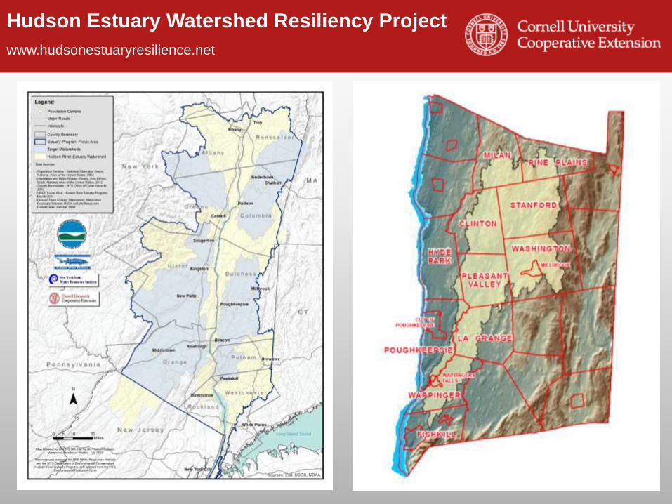
Hudson Estuary Watershed
Resiliency Project

Hudson Estuary Watershed Resiliency Project
www.hudsonestuaryresilience.net
Hudson Estuary

Hudson Estuary Watershed Resiliency Project
www.hudsonestuaryresilience.net
4
The area of land
in which all
precipitation
(rain, snow, etc.)
that falls on it
drains to a
common
waterway, such
as a stream,
lake, estuary,
wetland, aquifer,
or even the
ocean.
What is a Watershed?
Hudson Estuary Watershed Resiliency Project
www.hudsonestuaryresilience.net
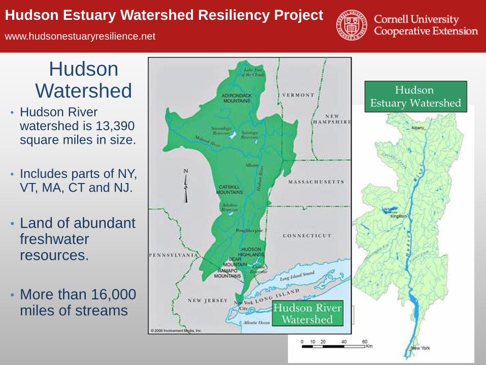
Hudson Watershed
• Hudson River watershed is 13,390 square miles in size.
• Includes parts of NY, VT, MA, CT and NJ.
• Land of abundant freshwater resources.
• More than 16,000 miles of streams
Hudson Estuary Watershed
Hudson Estuary Watershed Resiliency Project
www.hudsonestuaryresilience.net

Hudson Estuary Watershed Resiliency Project
www.hudsonestuaryresilience.net
The ability to plan for, withstand,
and recover from severe events
- without suffering permanent loss
of functions, devastating damage,
diminished productivity or
decreased quality of life.
signsofpolitics.blogspot.com/2009/03/around-and-about-resilience.html
What is Resiliency?

Hudson Estuary Watershed Resiliency Project
www.hudsonestuaryresilience.net
Flood Outreach and Education
http://www.hudsonestuaryresilience.net/
Hudson Estuary Watershed Resiliency Project
www.hudsonestuaryresilience.net
Outline
• Why are we here?
• Causes of increased flooding in our
municipalities
• A closer look at what is happening in our
streams
• How we are impacting streams (and
making flooding worse)
• Solutions and Resources

Hudson Estuary Watershed Resiliency Project
www.hudsonestuaryresilience.net
Why we are here… Catskill, NY Aug. 28, 2011
alloveralbany.com
Albany, NY
Albany, NY August 5, 2014

Hudson Estuary Watershed Resiliency Project
www.hudsonestuaryresilience.net
Where Are We: NFIP?NYS, 11/10 NYS 8/12 NYS, 3/13 U.S., 1/13
Policies 162,965 167,455 176,000 5.6 million
Premiums $147 Million $157 Million $170 million $3.6 billion
Coverage $38.6 Billion $41.4 Billion $42 billion $1.3 trillion
Claims to Date 84,825 105,674 162,504 2.0 million
Claim
Payments
$631 Million $1.2 Billion $3.1 Billion $45.5 billion
National NFIP
Program Debt$18.8 billion before Sandy. $9 billion more?
•Prior to 2005, Program was largely self supporting.
•Policy structure not set up to handle catastrophic losses.
•Fund was never capitalized.
•1% of policies represent 1/3 of all claims.
•Congress wants program to be on a sounder financial footing.
•It will take years to pay off debt.
Slide credit: Bill Nechamen, NYS DEC, Floodplain Management Section

Hudson Estuary Watershed Resiliency Project
www.hudsonestuaryresilience.net
Why is this happening?
• Increased precipitation
• Land use changes

Hudson Estuary Watershed Resiliency Project
www.hudsonestuaryresilience.net
Our climate is changing
Temperature changes from 1991-2012 compared to the 1901-1960 average (and compared to the 1951-1980 average for Alaska and Hawai‘i). NOAA NCDC / CICS-NC

Hudson Estuary Watershed Resiliency Project
www.hudsonestuaryresilience.net
Era of Extreme Weather
The map shows percent
increases in the amount
of precipitation falling in
very heavy precipitation
events (defined as the
heaviest 1% of all daily
events) from 1958 to
2011 for each region. Source: National Climate Assessment,
2014
Precipitation changes are
occurring now.

Hudson Estuary Watershed Resiliency Project
www.hudsonestuaryresilience.net
Say it isn’t so!
Northeast Regional Climate Center, 2003
Cornell Bulletin 1009, July 1966
Hudson Estuary Watershed Resiliency Project
www.hudsonestuaryresilience.net
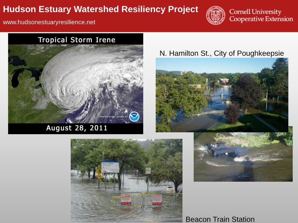
Beacon Train Station
N. Hamilton St., City of Poughkeepsie

Hudson Estuary Watershed Resiliency Project
www.hudsonestuaryresilience.net
Land Use

Hudson Estuary Watershed Resiliency Project
www.hudsonestuaryresilience.net
Impervious Surfaces
• Materials like cement, asphalt, roofing, and compacted soil
that prevent water from seeping/percolating into the ground.

Hudson Estuary Watershed Resiliency Project
www.hudsonestuaryresilience.net
Stormwater
runoff

Hudson Estuary Watershed Resiliency Project
www.hudsonestuaryresilience.netBuilding Long-term Resilience to Extreme Weather and Climate Change in the
Hudson Estuary Watershed
As Impervious Surfaces increase…
• Infiltration
decreases
• Surface
Runoff
increases

Hudson Estuary Watershed Resiliency Project
www.hudsonestuaryresilience.net
Human Impacts on Stream Stability
Roadways, culverts
& ditches
Change in
Land Cover
Dams & Diversions
Floodplain Development

Hudson Estuary Watershed Resiliency Project
www.hudsonestuaryresilience.net
What in the World Are We To Do?
• We live in close proximity to streams
and rivers.
• Much of our infrastructure is
vulnerable to flood damage.
• Many of our streams have unstable
reaches due to flooding &/or
development.
• Extreme precipitation events are
increasing the likelihood of flooding.
• We having a growing population and
therefore a demand for more
development.

Hudson Estuary Watershed Resiliency Project
www.hudsonestuaryresilience.net
Stream Science & Flood Resiliency
Luna Leopold
Dave Rosgen
Hudson Estuary Watershed Resiliency Project
www.hudsonestuaryresilience.net
What’s happening in our streams?
• Why are we here?
• Causes of increased flooding in our municipalities
• A closer look at what is happening in our streams
• Back to Basics
• What is a Floodplain
• How Energy Moves Through a Stream
• Streams Move More than Water
• How we are impacting streams (and making
flooding worse)
• Solutions and Resources

Hudson Estuary Watershed Resiliency Project
www.hudsonestuaryresilience.net
Precipitation
Infiltration
Evaporation
Condensation
Back to Basics: The Water Cycle
Hudson Estuary Watershed Resiliency Project
www.hudsonestuaryresilience.net
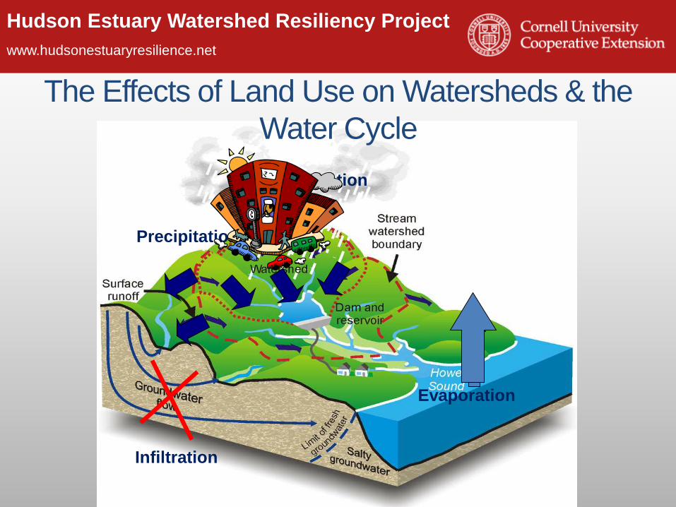
Precipitation
Infiltration
Evaporation
Condensation
The Effects of Land Use on Watersheds & the
Water Cycle

Hudson Estuary Watershed Resiliency Project
www.hudsonestuaryresilience.net
or Base Flow
Bankfull Flow: is associated with the flow
that just fills the channel to the top of its
banks and at a point where the water begins
to overflow its banks onto a floodplain.
Parts of a Stream
Base Flow: low flow or dry weather
flow. The component of streamflow
that comes from ground-water
discharge into streams.
Stream Channel: the physical
confine of a stream (river)
consisting of a bed (stream bottom)
and stream banks (stream sides).

Hudson Estuary Watershed Resiliency Project
www.hudsonestuaryresilience.net
Types of Flows
Base Flow
Bankfull
Flood

Hudson Estuary Watershed Resiliency Project
www.hudsonestuaryresilience.net
or Base Flow
Riparian: the area between land and
flowing surface water.
Parts of a Stream
Floodplain: land adjacent to a stream or
river that experiences periodic flooding or
is part of the river during storm
conditions

Hudson Estuary Watershed Resiliency Project
www.hudsonestuaryresilience.net
Riparian Zone/Buffer

Hudson Estuary Watershed Resiliency Project
www.hudsonestuaryresilience.net
Riparian Wetlands
• http://youtu.be/ucb-Y8iipng
Otter Creek Video
http://youtu.be/ucb-Y8iipng
Hudson Estuary Watershed Resiliency Project
www.hudsonestuaryresilience.net
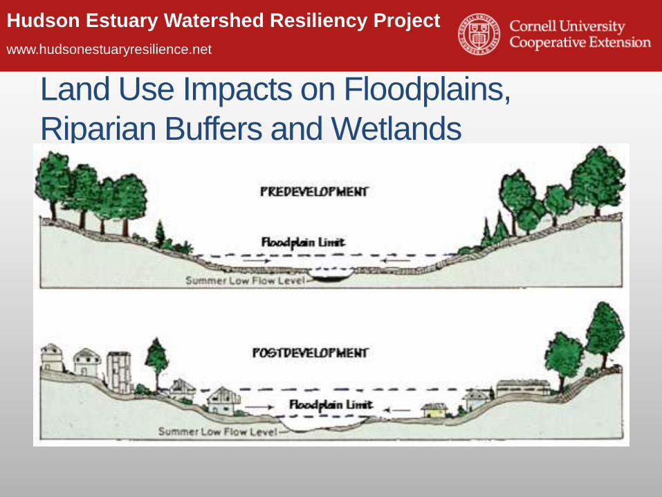
Land Use Impacts on Floodplains,
Riparian Buffers and Wetlands• Pre and Post Floodplain development

Hudson Estuary Watershed Resiliency Project
www.hudsonestuaryresilience.net
Loss of Floodplain Forests & Wetlands

Hudson Estuary Watershed Resiliency Project
www.hudsonestuaryresilience.net
Why Do Streams Look the Way They Do?
• Topography
• Geology
• Amount of
Water
• Land Use

Hudson Estuary Watershed Resiliency Project
www.hudsonestuaryresilience.net
Streams Move Water
Velocity – speed of water
Discharge – quantity of
water passing a fixed
location or the volume flow
rate
Stream stage – depth of
water
Photo: USGS
http://waterdata.usgs.gov/

Hudson Estuary Watershed Resiliency Project
www.hudsonestuaryresilience.net
Flowing Water Moves Sediment• As water moves over the land it picks up sediment, forming the stream channel
• Streams create and maintain their shape and size themselves, a result of:• Volume of water
• Amount of sediment
• Type of sediment
Hudson Estuary Watershed Resiliency Project
www.hudsonestuaryresilience.net
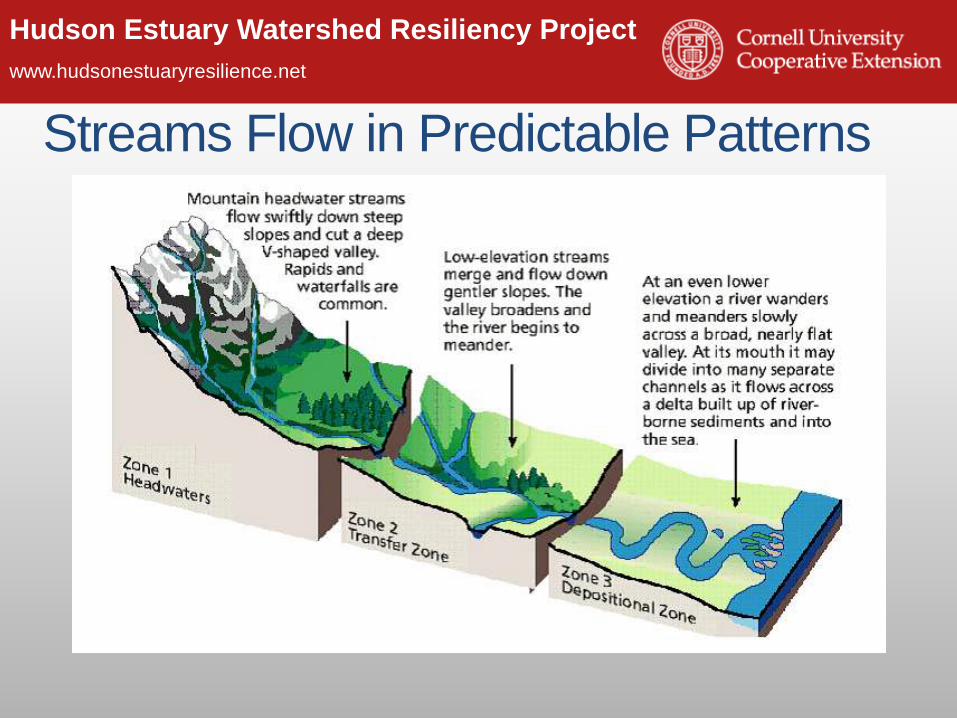
Streams Flow in Predictable Patterns

Hudson Estuary Watershed Resiliency Project
www.hudsonestuaryresilience.net
Upland Stream Type: Step - Pool
Adapted from Applied River Morphology, Dave Rosgen, 1996
Dissipating Energy Naturally
Hudson Estuary Watershed Resiliency Project
www.hudsonestuaryresilience.net
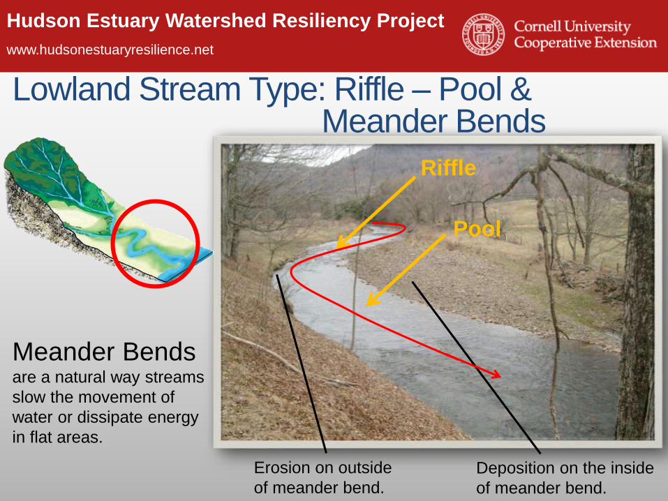
Deposition on the inside
of meander bend.
Erosion on outside
of meander bend.
Lowland Stream Type: Riffle – Pool & Meander Bends
Meander Bends are a natural way streams
slow the movement of
water or dissipate energy
in flat areas.
Riffle
Pool

Hudson Estuary Watershed Resiliency Project
www.hudsonestuaryresilience.net
Balancing Act• Streams are said to be in equilibrium or
balance when the volume of water is enough to transport the available sediment without building up the channel (deposition) or cutting down the channel (erosion).
Hudson Estuary Watershed Resiliency Project
www.hudsonestuaryresilience.net
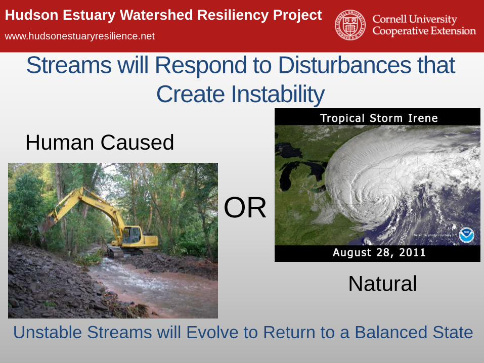
Streams will Respond to Disturbances that
Create Instability
Unstable Streams will Evolve to Return to a Balanced State
Human Caused
OR
Natural

Hudson Estuary Watershed Resiliency Project
www.hudsonestuaryresilience.net
Stream Channel EvolutionUpland - limited floodplain Lowland with floodplain
Hudson Estuary Watershed Resiliency Project
www.hudsonestuaryresilience.net
Further impacting our streams (aka
making flooding worse)
• Why are we here?
• Causes of increased flooding in our
municipalities
• A closer look at what is happening in our
streams
• How we are impacting streams (and
making flooding worse)
• Solutions and Resources

Hudson Estuary Watershed Resiliency Project
www.hudsonestuaryresilience.net
Human Impacts on Streams – Flood Response
Flood Response May Cause Stream Instability
Dredging
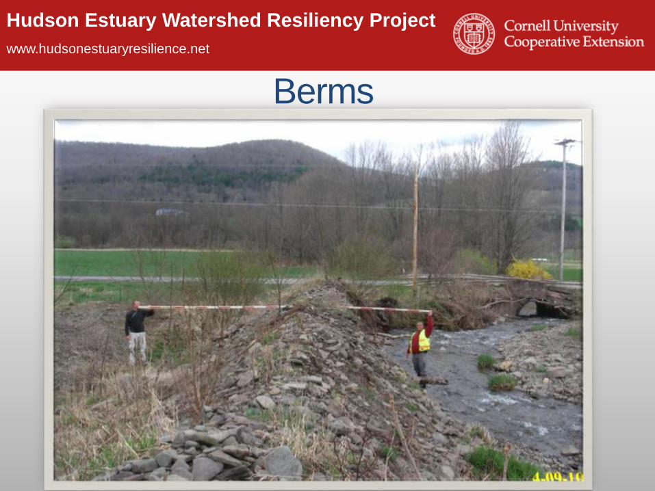
Berms
Channel
Straightening
Tree Removal

Hudson Estuary Watershed Resiliency Project
www.hudsonestuaryresilience.netDoes Dredging help flooding?

Hudson Estuary Watershed Resiliency Project
www.hudsonestuaryresilience.net
Hudson Estuary Watershed Resiliency Project
www.hudsonestuaryresilience.net
Berms
Hudson Estuary Watershed Resiliency Project
www.hudsonestuaryresilience.net
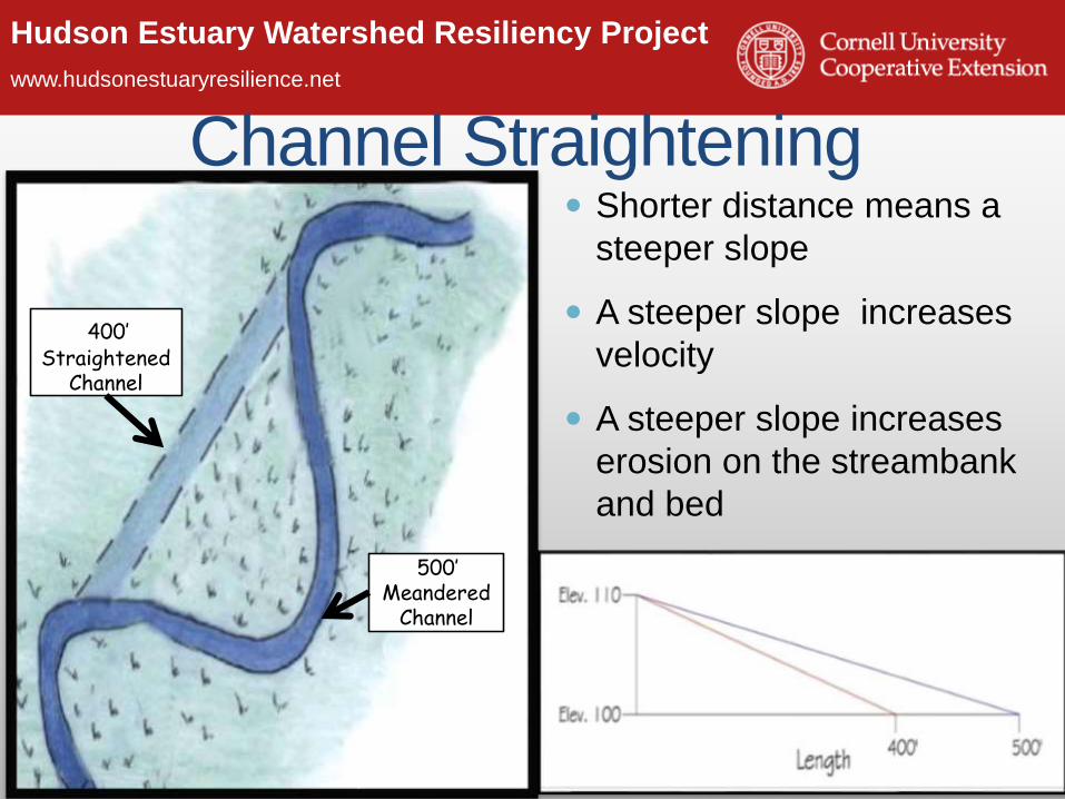
Channel Straightening
48
Shorter distance means a
steeper slope
A steeper slope increases
velocity
A steeper slope increases
erosion on the streambank
and bed
400’ Straightened
Channel
500’ Meandered
Channel
Hudson Estuary Watershed Resiliency Project
www.hudsonestuaryresilience.net

Hudson Estuary Watershed Resiliency Project
www.hudsonestuaryresilience.net
Human Impacts on Stream Stability
Roadways, culverts
& ditchesChange in Land Cover
Dams & Diversions
Floodplain Development
What Can We Do?!!!

Hudson Estuary Watershed Resiliency Project
www.hudsonestuaryresilience.net
Solutions & Resources:• Local wetland and riparian buffer
ordinances.
• Stream Corridor Protection
Greenway Guide
• NYS DEC Trees for Tribs plantings
to restore riparian buffers.
• Encourage forest and wetland
stewardship by property owners.
Conservation

Hudson Estuary Watershed Resiliency Project
www.hudsonestuaryresilience.net
Smart Growth / Better Site Design / Low
Impact Development
“Narrow streets with short setbacks … are safer …
use less land, reduce stormwater runoff and cut
construction and maintenance costs…”
Hudson Estuary Watershed Resiliency Project
www.hudsonestuaryresilience.net
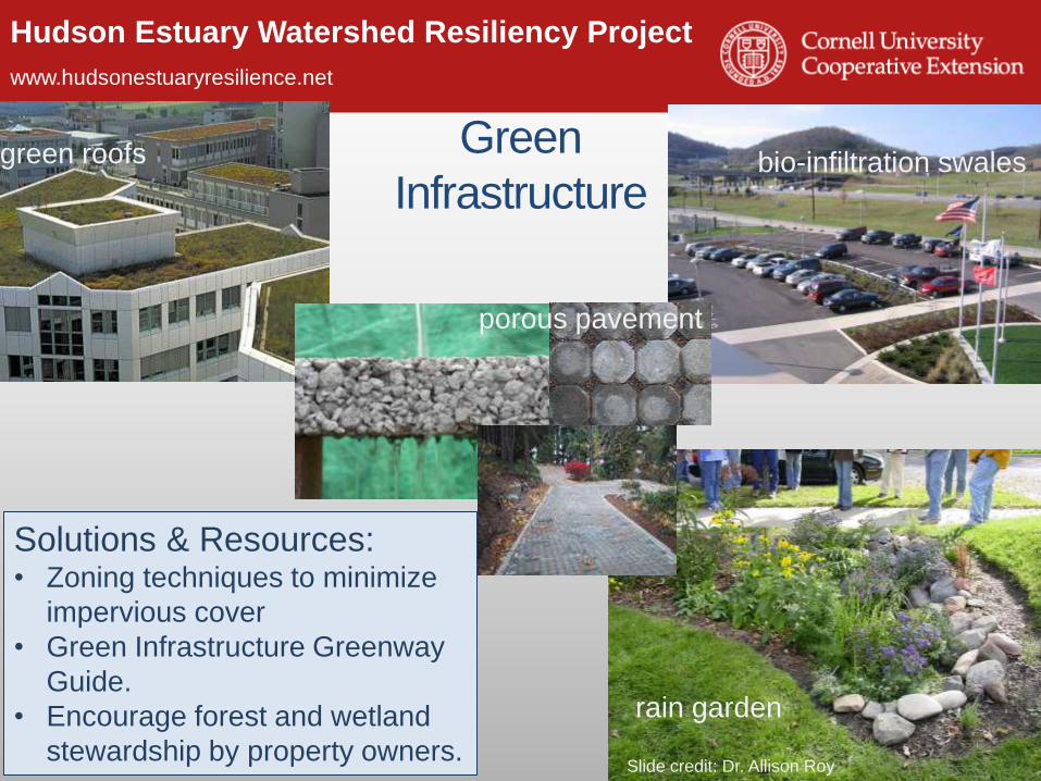
green roofs bio-infiltration swalesGreen
Infrastructure
rain garden
porous pavement
Slide credit: Dr. Allison Roy
Solutions & Resources:• Zoning techniques to minimize
impervious cover
• Green Infrastructure Greenway
Guide.
• Encourage forest and wetland
stewardship by property owners.

Hudson Estuary Watershed Resiliency Project
www.hudsonestuaryresilience.net
Planning &
Preparedness

Hudson Estuary Watershed Resiliency Project
www.hudsonestuaryresilience.net
Reconsider Land Use Within Floodplains
Solutions & Resources:• Zoning Codes and Overlay
Districts
• Pace Land Use Law Center
Gaining Ground database
• Flooding and Land Use Planning:
A Guidance Document for
Municipal Officials and Planners

Hudson Estuary Watershed Resiliency Project
www.hudsonestuaryresilience.net
Take Stock of Your InfrastructureBridgesCulverts
Roadside Ditching
Solutions & Resources:• Culvert sizing initiative in the Hudson Valley
• Research & Outreach on Roadside Ditches & Flooding
• Innovations on bridge construction for flood resiliency piloted in
Delaware County
• Post Flood Stream Intervention Training for Highway Personnel
Hudson Estuary Watershed Resiliency Project
www.hudsonestuaryresilience.net
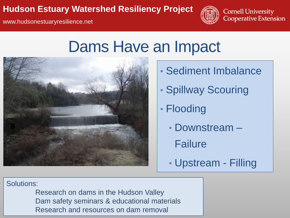
Dams Have an Impact
• Sediment Imbalance
• Spillway Scouring
• Flooding
• Downstream –
Failure
• Upstream - Filling
Solutions:
Research on dams in the Hudson Valley
Dam safety seminars & educational materials
Research and resources on dam removal
Hudson Estuary Watershed Resiliency Project
www.hudsonestuaryresilience.net
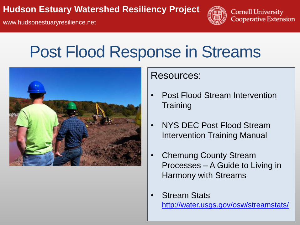
Post Flood Response in Streams
Resources:
• Post Flood Stream Intervention
Training
• NYS DEC Post Flood Stream
Intervention Training Manual
• Chemung County Stream
Processes – A Guide to Living in
Harmony with Streams
• Stream Stats http://water.usgs.gov/osw/streamstats/

Hudson Estuary Watershed Resiliency Project
www.hudsonestuaryresilience.net
Flood Resiliency ~ Take Home Messages• Streams move water & sediment.
• Streams move in predictable patterns
across the land.
• Streams are dynamic systems that
respond to disturbance.
• Human infrastructure & actions can
cause stream disturbance.
• Recent advances provide tools for
communities to work with streams.
• Communities find pro-active solutions to
flooding.

Hudson Estuary Watershed Resiliency Project
www.hudsonestuaryresilience.net
Partner AcknowledgementsLower Hudson Coalition of Conservation Districts
NYC Department of Environmental Protection
Natural Resource Conservation Service
USGS NY Water Science Center
NY Extension Disaster Education Network
County Planning Departments
Cary Institute of Ecosystem Studies
Hudson River Watershed Alliance
Hudsonia, Inc.
Trout Unlimited
Local watershed groups Larry Federman

Hudson Estuary Watershed Resiliency Project
www.hudsonestuaryresilience.net
Hudson Estuary Watershed Resiliency
Project Team
CCE Columbia & Greene CountiesLiz LoGiudice, Audrey Kropp, Ron
Frisbee, Marilyn Wyman
518 622-9820 x 33
CCE Orange CountyRosemarie Baglia
(845) 344-1234
CCE Dutchess CountyCarolyn Klocker, Neil Curri, Camille
Marcotte, Sean Carroll
(845) 677-8223 x135
Cornell UniversityShorna Allred
(607)255-2149
Hudson River Estuary ProgramScott Cuppett
(845) 256-3029
NYS Water Resources InstituteChristina Tonitto
(607) 252-6825