staff report: permit amendmentdocuments.coastal.ca.gov/reports/2016/9/w13a-9-2016.pdffence); 2)...
TRANSCRIPT

STATE OF CALIFORNIA - NATURAL RESOURCES AGENCY EDMUND G. BROWN, JR., GOVERNOR
CALIFORNIA COASTAL COMMISSION South Coast Area Office 200 Oceangate, Suite 1000 Long Beach, CA 90802-4302 (562) 590-5071
W13a Filed: 03/16/2016 180th Day: 09/12/2016 Staff: M. Alvarado-LB Staff Report: 08/26/2016 Hearing Date: 09/07/2016
STAFF REPORT: PERMIT AMENDMENT
Application No.: 5-13-039-A1 Permittee: Capistrano Shores, Inc. Agent: Sherman Stacey Location: 1880 N. El Camino Real (Capistrano Mobile Home Park), San
Clemente (Orange County) (APN: 691-432-02) Description of Original Replacement of existing electrical, CATV, telephone, gas, Project Approved in 2013: sewer and water lines servicing a 90 unit beachfront mobile
home park; new utility lines are proposed approximately 20-30 feet inland from their current location along a beachfront property, and abandoning existing lines in place. The project includes installation of associates transformers.
Description of Proposed Request for re-pavement and widening of private frontage First Amendment: road; removal of an existing 6-ft. high chain-linked fence; construction of a 6-ft. high, approximately 0.70-mile
long, concrete wall, to be located approximately 7-ft. east (inland) of the existing fence, architectural wall features (i.e. 4 in. cap and 7.33 ft. high columns at varying intervals) and 11.1-ft. high front entry; relocation of 19 trash enclosures (with new 10-ft. high trellises) and eight utility transformers; and removal and replacement of new landscaping. The proposed development will result in an additional approximately 7-8 ft. encroachment into the Orange County Transportation Authority railroad right-of-way and in modifications to existing drainage culverts.
Staff Recommendation: Approval with conditions

5-13-039-A1 (Capistrano Shores, Inc.)
2
SUMMARY OF STAFF RECOMMENDATION The project site is within the Capistrano Shores Mobile Home Park (“Park”) located at 1880 N. El Camino Real in the City of San Clemente, and located directly seaward of El Camino Real (“ECR”), which is the first public road that is parallel to the sea. The Park is a legal non-conforming use on a stretch of beach developed with a single row of 90 mobile/manufactured homes parallel to the shoreline on a lot zoned OS2 Privately Owned Open Space (intended for open space – no formal easement) and designated Open Space in the City of San Clemente Land Use Plan (LUP). The applicant, Capistrano Shores, Inc. (“CSI”) is a non-profit mutual benefit corporation and owner of the Park. The proposed project site is a longitudinal portion of the railroad right-of-way paralleling the coast that is leased to CSI by Orange County Transportation Authority (“OCTA”). According to the applicant, the Park currently encroaches 20 ft. into the railroad right-of-way pursuant to a pre-Coastal Act long term license agreement with Atchison, Topeka and Santa Fe (“AT&SF”); in 1993, AT&SF sold the railroad property to OCTA. As defined in the license agreement, the use of the licensed property is limited to only mobile home park accessory and infrastructure improvements. No work is proposed to the existing bulkhead, revetment, mobile/manufactured homes, or work/office unit. The standard of review for the proposed development is the Chapter 3 policies of the Coastal Act; the San Clemente Land Use Plan (LUP) policies, however, provide guidance from which the Commission can evaluate the adequacy of the proposed project’s mitigation of impacts. The major issues raised by this proposed development relate to consistency with the visual resource, public access, hazards, and biological resource policies of the Coastal Act. The issue with regards to visual resources concerns the importance of protecting coastal views, and of restoring and enhancing the visual quality in visually degraded areas where feasible. The applicant is requesting to 1) repave and widen Senda de la Playa, the private frontage road (consisting of paved road, landscape area, and fence); 2) remove an existing 6-ft. high chain-linked fence that runs along the frontage and inland length of the Park, 3) construct a 6-ft. high, approximately 0.70-mile long, concrete wall, to be located approximately 7-8 ft. east (inland) of the existing fence, with architectural wall features (i.e. 4-in. cap and 7.33-ft. high columns at varying intervals) and 11.1-ft. high front entry, 4) replace the existing landscaping that is adjacent to and runs parallel to the fence with new landscaping; and 5) relocate 19 trash enclosures (with new 10-ft. high trellises) and eight above-ground utility transformers (Exhibit 2 & 3). The proposed development will result in an additional approximately 7-8 ft. encroachment into the OCTA railroad right-of-way, and in modifications to the existing drainage culverts located in this encroachment area (Exhibit 2). Section 3025l of the Coastal Act states that where feasible, permitted development shall be sited and designed to restore and enhance visual quality in visually degraded areas. Public coastal views that exist between the mobile/manufactured homes are being partially obstructed by the existing landscaping, meshed chain-linked fence and trash enclosures. With the proposed replacement of the existing vegetation, replacement of the fence, and relocation of the trash enclosures and transformers, there is an opportunity to protect existing public views and enhance and restore these public blue water views that exist between the mobile/manufacture homes along the Park, as viewed from ECR, Metrolink (commuter rail system), and the inland public trail path located within the canyon. For instance, the existing landscaping consists of trees and bushes that vary in height and extend as high as 20 ft. Once the existing landscaping is removed, the public coastal views that were previously partially obstructed by this landscaping will be enhanced. Whether this enhancement is preserved is contingent on the proposed location and size of the new landscaping. Also, because visibility of

5-13-039-A1 (Capistrano Shores, Inc.)
3
development and coastal view obstruction increases the closer development is to the viewer (along ECR, Metrolink, and public trail), the new replacement fence/wall should be sited at the same location as the existing fence to minimize blockage of any public coastal views. The applicant is also proposing to widen the existing private frontage road, which currently encroaches 20 ft. inland into the railroad right-of-way pursuant to a pre-Coastal Act license agreement, and to construct a new concrete wall establishing the new boundary of the Park. In 1992, the license agreement was amended to modify the width of the lease area to 25 ft. In 2014, OCTA signed a new license agreement with CSI, establishing a wider lease area of 27.55 ft. CSI has not improved beyond the current 20 ft. encroachment area, and with the proposed road widening, the Park will encroach into the railroad right-of-way by an additional approximately 7-8 ft. The railroad right-of-way is presently owned and managed by OCTA, a public agency, and should be reserved to address potential future public access needs, such as those arising out of sea level rise related issues. For instance, in the event that the mobile/manufactured homes need to be relocated due to hazards, to avoid significant public access impacts along the beach, the Park may need to be moved further inland to minimize risks to life and property pursuant to Section 30253 of the Coastal Act. The construction of a wall further inland could create a more permanent impediment and could significantly hamper the relocation of mobile/manufactured homes further landward. Furthermore, the Park is an existing non-conforming use and the widening of the encroachment area and the construction of a concrete wall into the railroad right-of-way for private mobile home park improvements would fortify the permanence of this non-conforming private use. To ensure that the public visual quality is restored and enhanced, and that the proposed development occur within the existing improved footprint of Park, staff recommends Special Condition 3 & 5 requiring the following revisions be made to the proposal: an open fence design (e.g. wrought iron fence) be proposed in place of a concrete wall, where the proposed will be aligned and located in the same location as the existing fence; the transformers and trash enclosures be vertically aligned with the existing mobile/manufactured homes and not directly inland of any side yard; to maintain an open appearance, no portion of the trash enclosures should extend above 6 ft.; new landscaping will be situated and maintained consistent with the approved fence height of 6ft., except in areas vertically aligned with the 3-ft. mobile/manufactured home side yard setbacks, in which case the landscaping will be maintained no higher than 42-in.; and that the proposed improvements only occur within the existing footprint of the Park and not further extend into the railroad right-of-way beyond the existing approximately 20 ft. wide lease area. As conditioned, the proposed project can be found consistent with the relevant policies of the City’s Local Coastal Land Use Plan, used as guidance, and with the visual resource, public access, and hazards policies of the Coastal Act. Commission Staff recommends approval of the amendment request with four special conditions, which: 3) require the applicant to submit revised project plans that reflect the changes to the development plan as a result of Commission action on this permit amendment request; 4) revised landscaping plans; 5) require that all development occur in compliance to the proposal, subject to the conditions herein; and 6) resolves any conflict between the terms and conditions imposed by the local government and those of this permit. The applicant does not agree with the staff recommendation. PROCEDURAL NOTE: The Commission’s regulations provide for referral of permit amendment requests to the Commission if:

5-13-039-A1 (Capistrano Shores, Inc.)
4
1) The Executive Director determines that the proposed amendment is a material change, 2) Objection is made to the Executive Director’s determination of immateriality, or 3) The proposed amendment affects conditions required for the purpose of protecting a coastal
resource or coastal access. If the applicant or objector so requests, the Commission shall make an independent determination as to whether the proposed amendment is material. 14 Cal. Admin. Code 13166. The subject application is being forwarded to the Commission because the Executive Director has determined that the proposed amendment is a material change and has the potential to negatively impact coastal resources or coastal access.
Staff Note: The standard of review for the proposed project is the policies and provisions of the Coastal Act regarding visual resources and public access. Due to Permit Streamlining Act requirements, the Commission must act upon this permit amendment application at the September 2016 Commission meeting.

5-13-039-A1 (Capistrano Shores, Inc.)
5
TABLE OF CONTENTS I. MOTION AND RESOLUTION .................................................................................................... 6
II. STANDARD CONDITIONS ........................................................................................................ 6
III.SPECIAL CONDITIONS ............................................................................................................ 7
IV.FINDINGS AND DECLARATIONS ........................................................................................ 10
A. PROJECT DESCRIPTION AND LOCATION ................................................................................. 10 B. PROJECT HISTORY ................................................................................................................. 11 C. VISUAL RESOURCES .............................................................................................................. 11 D. PUBLIC ACCESS..................................................................................................................... 15 E. HAZARDS............................................................................................................................... 17 F. BIOLOGICAL RESOURCES ....................................................................................................... 19 G. LOCAL COASTAL PROGRAM .................................................................................................. 20
H. CALIFORNIA ENVIRONMENTAL QUALITY ACT ...................................................................... 20
APPENDICES Appendix A – Substantive File Documents EXHIBITS Exhibit 1 – Project Location and Aerial Exhibit 2 – Site Plan and Representative Detailed Site Plan Exhibit 3 – Representative Elevation Plans Exhibit 4 – Cross Section Exhibit 5 – Photographs of Site Exhibit 6 – Letter of Opposition

5-13-039-A1 (Capistrano Shores, Inc.)
6
I. MOTION AND RESOLUTION Staff Recommendation of Approval Staff recommends that the Commission adopt the following resolution. The motion passes only by affirmative vote of a majority of the Commissioners present.
Motion:
I move that the Commission adopt the staff recommendation to approve Coastal Development Permit Amendment 5-13-039-A1, with the approval subject to the conditions set forth in the staff recommendation, by adopting the resolution set forth in the staff report.
Staff recommends a YES vote on the foregoing motion. Passage of this motion will result in conditional approval of the permit amendment in part, denial of the permit amendment in part, and adoption of the following resolution and findings. The motion passes only by affirmative vote of a majority of the Commissioners present. Resolution:
The Commission hereby approves the coastal development permit amendment for the proposed development and adopts the findings set forth below on the grounds that the development, as amended and subject to conditions, will be in conformity with the policies of Chapter 3 of the Coastal Act. Approval of the permit complies with the California Environmental Quality Act because either 1) feasible mitigation measures and/or alternatives have been incorporated to substantially lessen any significant adverse effects of the development on the environment, or 2) there are no further feasible mitigation measures or alternatives that would substantially lessen any significant adverse impacts of the development on the environment. II. STANDARD CONDITIONS This permit is granted subject to the following standard conditions: 1. Notice of Receipt and Acknowledgment. The permit is not valid and development shall not
commence until a copy of the permit, signed by the permittee or authorized agent, acknowledging receipt of the permit and acceptance of the terms and conditions, is returned to the Commission office.
2. Interpretation. Any questions of intent of interpretation of any condition will be resolved by
the Executive Director or the Commission. 3. Assignment. The permit may be assigned to any qualified person, provided assignee files with
the Commission an affidavit accepting all terms and conditions of the permit. 4. Terms and Conditions Run with the Land. These terms and conditions shall be perpetual,
and it is the intention of the Commission and the permittee to bind all future owners and possessors of the subject property to the terms and conditions.
5-13-039-A1 (Capistrano Shores, Inc.)
7
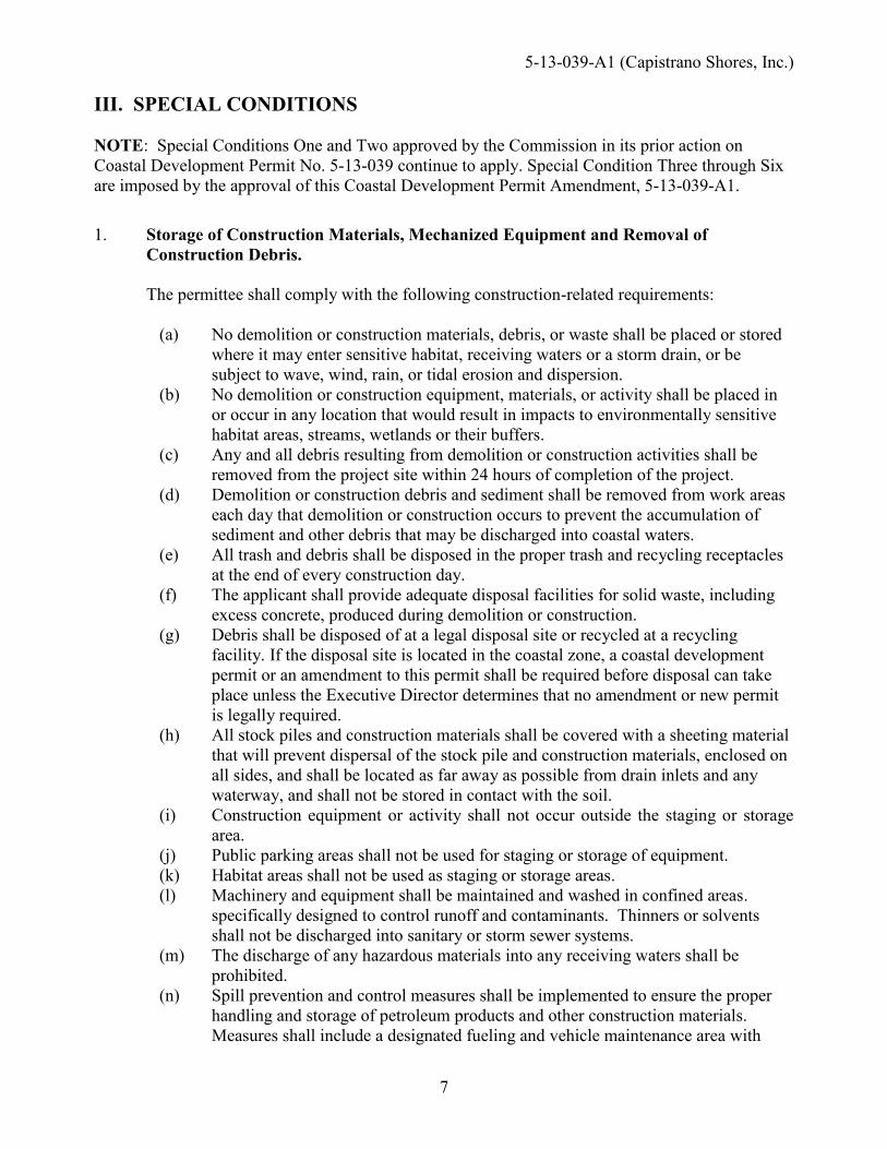
III. SPECIAL CONDITIONS NOTE: Special Conditions One and Two approved by the Commission in its prior action on Coastal Development Permit No. 5-13-039 continue to apply. Special Condition Three through Six are imposed by the approval of this Coastal Development Permit Amendment, 5-13-039-A1. 1. Storage of Construction Materials, Mechanized Equipment and Removal of
Construction Debris. The permittee shall comply with the following construction-related requirements:
(a) No demolition or construction materials, debris, or waste shall be placed or stored
where it may enter sensitive habitat, receiving waters or a storm drain, or be subject to wave, wind, rain, or tidal erosion and dispersion.
(b) No demolition or construction equipment, materials, or activity shall be placed in or occur in any location that would result in impacts to environmentally sensitive habitat areas, streams, wetlands or their buffers.
(c) Any and all debris resulting from demolition or construction activities shall be removed from the project site within 24 hours of completion of the project.
(d) Demolition or construction debris and sediment shall be removed from work areas each day that demolition or construction occurs to prevent the accumulation of sediment and other debris that may be discharged into coastal waters.
(e) All trash and debris shall be disposed in the proper trash and recycling receptacles at the end of every construction day.
(f) The applicant shall provide adequate disposal facilities for solid waste, including excess concrete, produced during demolition or construction.
(g) Debris shall be disposed of at a legal disposal site or recycled at a recycling facility. If the disposal site is located in the coastal zone, a coastal development permit or an amendment to this permit shall be required before disposal can take place unless the Executive Director determines that no amendment or new permit is legally required.
(h) All stock piles and construction materials shall be covered with a sheeting material that will prevent dispersal of the stock pile and construction materials, enclosed on all sides, and shall be located as far away as possible from drain inlets and any waterway, and shall not be stored in contact with the soil.
(i) Construction equipment or activity shall not occur outside the staging or storage area.
(j) Public parking areas shall not be used for staging or storage of equipment. (k) Habitat areas shall not be used as staging or storage areas. (l) Machinery and equipment shall be maintained and washed in confined areas.
specifically designed to control runoff and contaminants. Thinners or solvents shall not be discharged into sanitary or storm sewer systems.
(m) The discharge of any hazardous materials into any receiving waters shall be prohibited.
(n) Spill prevention and control measures shall be implemented to ensure the proper handling and storage of petroleum products and other construction materials. Measures shall include a designated fueling and vehicle maintenance area with

5-13-039-A1 (Capistrano Shores, Inc.)
8
appropriate berms and protection to prevent any spillage of gasoline or related petroleum products or contact with runoff. The area shall be located as far away from the receiving waters and storm drain inlets as possible.
(o) Best Management Practices (BMPs) and Good Housekeeping Practices (GHPs) designed to prevent spillage and/or runoff of demolition or construction-related materials, and to contain sediment or contaminants associated with demolition or construction activity, shall be implemented prior to the on-set of such activity
(p) All BMPs shall be maintained in a functional condition throughout the duration of construction activity.
2. Construction Staging Area. The permittee shall comply with the following construction
staging area(s) restrictions to avoid impacts to public access, to beach areas or to sensitive habitat areas.
(a) Construction equipment or activity shall not occur outside the staging area (b) Beach areas shall not be used as staging areas (c) Vegetated areas shall not be used as staging areas (d) The staging area for construction of the project shall not obstruct vertical or lateral
access to the beach. The permittee shall undertake development in accordance with the approved final plans.
Any proposed changes to the approved final plans shall be reported to the Executive Director. No changes to the approved final plans shall occur without a Commission amendment to this coastal development permit unless the Executive Director determines that no amendment is legally required.
3. Revised Plans.
a. PRIOR TO ISSUANCE OF THIS COASTAL DEVELOPMENT PERMIT AMENDMENT, 5-13-039-A1, the applicant shall submit, for the review and approval of the Executive Director, two (2) sets of final revised project plans. The revised final project plans and project description shall reflect the following:
(i) Fence Design Alternatives 1. The fence shall be a wrought iron fence, or other similar, visually open
design, consistent with the provisions of public safety, subject to the review and approval of the Executive Director. Alternative designs may be allowed if the Executive Director determines that such designs are consistent with the intent of this condition and serve to minimize adverse effects to public views.
2. The proposed fence shall be designed to be the minimum possible height that would be consistent with the requirements of the resource agencies and the provisions of public safety, but in no event shall be higher than 6 ft.
3. The fence plan shall consist of supporting dimensions indicating a minimum of 4-inch spacing between bars. The proposed shall be aligned and located at the same location as the existing fence.
(ii) Trash Enclosures and Transformers

5-13-039-A1 (Capistrano Shores, Inc.)
9
1. Trash enclosures (and switchgear and fuse enclosures) and transformers shall be centered and vertically aligned with existing mobile/manufactured home lots and not directly aligned with any side yard. If the transformers cannot be relocated laterally along with the trash enclosures, the transformers shall be sited and designed adjacent to the fence line without any solid enclosure. Bollards can be used if protection is necessary.
2. No portion of the enclosures shall exceed the height of 6 ft. (iii) Encroachment Area
The proposed improvements shall only occur within the existing improved footprint of the Park and not further extend into the railroad right-of-way beyond the existing approximately 20 ft. wide improved lease area as depicted in Exhibit 2, page 2.
4. Landscaping − Drought Tolerant, Non-Invasive Plants. A. PRIOR TO ISSUANCE OF THE COASTAL DEVELOPMENT PERMIT, the applicant
shall submit, in a form and content acceptable to the Executive Director, two (2) full size sets of final revised landscaping plans, which shall include and be consistent with the following: i. Vegetated landscaped areas shall only consist of native plants or non-native
drought tolerant plants, which are non-invasive. No plant species listed as problematic and/or invasive by the California Native Plant Society (http://www.CNPS.org/), the California Invasive Plant Council (formerly the California Exotic Pest Plant Council) (http://www.cal-ipc.org/), or as may be identified from time to time by the State of California shall be employed or allowed to naturalize or persist on the site. No plant species listed as a “noxious weed” by the State of California or the U.S. Federal Government shall be utilized within the property. All plants shall be low water use plants as identified by California Department of Water Resources (See: http://www.water.ca.gov/wateruseefficiency/docs/wucols00.pdf).
ii. Landscaping shall be situated and maintained consistent with the approved fence height of 6ft. as described in Special Condition 3, except in areas vertically aligned with the 3-ft. mobile/manufactured home side yard setbacks, in which case the landscaping will be maintained no higher than 42-in.
iii. No climbing/creeping vegetation shall be planted. 5. Approved Development - Permit Compliance. All development must occur in strict
compliance with the plans approved by the Commission, subject to the special conditions. Any proposed change or deviation from the approved plans shall be submitted to the Executive Director to determine whether an amendment to this permit is necessary pursuant to the requirements of the Coastal Act and the California Code of Regulations. No changes to the approved plans shall occur without a Commission amendment to this coastal development permit unless the Executive Director determines that no amendment is required.
6. Local Government Approval. The proposed development is subject to the review and
approval of the local government (City of San Clemente). This action has no effect on conditions imposed by a local government pursuant to an authority other than the Coastal Act, including conditions of the City of San Clemente Planning Division Resolution No. PC 15-003. In the event of conflict between the terms and conditions imposed by the local

5-13-039-A1 (Capistrano Shores, Inc.)
10
government and those of the coastal development permit, the terms and conditions of Coastal Development Permit Amendment No. 5-13-039-A1 shall prevail.
IV. FINDINGS AND DECLARATIONS A. PROJECT DESCRIPTION AND LOCATION
The proposed development is an infrastructure improvement project. The applicant is requesting to 1) repave and widen Senda de la Playa, the private frontage road (consisting of paved road, landscape area, and fence) from approximately 36-ft. to 44-ft.; 2) remove an existing 6-ft. high chain-linked fence that runs along the length and frontage of the Park; 3) construct a 6 ft. high, approximately 0.70-mile long, concrete wall designed in the Spanish Colonial Revival architectural style, to be located approximately 7-8 ft. east of the existing fence, with architectural wall features (i.e. 4 in. cap and 7.33 ft. high columns at varying intervals) and 11.1 ft. high front entry; 4) replace the existing landscaping that runs parallel to the fence with new landscaping; and 5) relocate 19 trash enclosures (with new 10-ft. high trellises) and eight above-ground utility transformers (Exhibit 2 & 3). The proposed development will result in an additional approximately 7-8 ft. encroachment into the Orange County Transportation Authority (“OCTA”) railroad right-of-way, and in modifications to the existing drainage culverts located in this encroachment area (Exhibit 2). The project site is located between the first public road and the sea and seaward of the Orange County Transportation Authority (OCTA) railroad tracks and within the Capistrano Shores Mobile Home Park (“Park”) at 1880 N. El Camino Real in the City of San Clemente, Orange County (Exhibits 1). The Park is an existing legal non-conforming use on a stretch of beach developed with a single row of 90 mobile/manufactured homes parallel to the shoreline on a lot zoned OS2 Privately Owned Open Space (intended for open space – no formal easement) and designated Open Space in the City of San Clemente Land Use Plan (LUP). The applicant, Capistrano Shores, Inc. (“CSI”) is a non-profit mutual benefit corporation and owner of the Park. The Park is bordered by an undeveloped privately owned beach parcel to the north, a public municipal beach to the south, the Pacific Ocean is immediately adjacent to the west and the OCTA railroad tracks and N. El Camino Real (aka Pacific Coast Hwy) border the site to the east. The Park is comprised of 90 individual mobile home spaces and an on-site management office on a perched sandy beach protected by timber bulkhead and a rock revetment. The pre-Coastal Act timber bulkhead and rock revetment exists along the entire length of the Park. The Park is configured in a straight line with all units facing the ocean, a rock revetment on the seaward side of the units and an access road on the inland side of the units (Exhibit 1). The applicant, Capistrano Shores, Inc. (“CSI”) is a non-profit mutual benefit corporation and owner of the Park. The proposed project site is a longitudinal portion of the railroad right-of-way that is leased to CSI by OCTA. According to the applicant, the Park currently encroaches 20 ft. into the railroad right-of-way pursuant to a pre-Coastal Act long term license agreement with Atchison, Topeka and Santa Fe (“AT&SF”); in 1993, AT&SF sold the railroad property to OCTA. As defined in the license agreement, the use of the licensed property is limited to only mobile home park accessory and infrastructure improvements. No work proposed to the existing bulkhead, revetment, mobile/manufactured homes, or work/office unit. The Park is private and not open to the public. The nearest public beach access is at the North Beach access point immediately to the south of the site; vertical public access to the beach from the mobile home park is not available (Exhibit 1). Lateral access along the beach in front of the mobile home park and bulkhead/rock revetment is only accessible during low tide; during high tide the

5-13-039-A1 (Capistrano Shores, Inc.)
11
waves crash up against the rock revetment. Pursuant to the grant deed property description of the parcels owned by Capistrano Shores, Inc. comprising Capistrano Shores Mobile Home Park, property ownership of the common area seaward of the Unit Space property lines extends from the bulkhead to the ordinary high tide line. Seaward of the bulkhead is an approximately 30-feet wide beach area owned in common by the mobile home park corporation up to the ordinary high tide line (per the legal property description). A large portion of the rock revetment remains buried depending on varying sand level elevations throughout the year. B. PROJECT HISTORY
On May 8, 2013, the Commission’s original approval of Coastal Development Permit (CDP) No. 5-13-039 permitted the replacement of existing electrical, CATV, telephone, gas, sewer, and water lines servicing the 90-unit beachfront Capistrano Shores Mobile Home Park. These utility lines were to be abandoned in place and the new lines were to be approximately 30 feet inland of the abandoned lines. The installation of the new utility lines was completed consistent with the plans approved by CDP No. 5-13-039. The new gas line, which is fed by the existing gas company high pressure main, was installed the length of the mobile home park to provide individual service to individual mobile home units. The capacity of gas service did not increase with the new line. New electrical/CATV/telephone lines were also installed but the associated new transformers have not yet been installed. A new water line was placed with new connections for each mobile home unit. The new water line did not increase capacity but does provide water service to up to two new fire hydrants to service the mobile home park. The municipal sewer main is underneath the access road, and a new series of sewer collection lines is proposed underneath the road to connect each mobile home site to the City’s main line. The electrical/CATV/telephone lines were placed within the same conduit. The gas line was placed in the same trench as the electrical line. Water and sewer lines were placed in individual trenches. All new lines were placed under an the private frontage access road, Senda de La Playa, approximately 20-30 feet further east (inland) than the previously existing lines which were under the existing mobile home units. Presently, the applicant is requesting to augment the 2013 operational improvements project by requesting an amendment to CDP No. 5-13-039 for additional infrastructure improvements and to relocate the transformers approved in the original permit. C. VISUAL RESOURCES Section 3025l of the Coastal Act states: The scenic and visual qualities of coastal areas shall be considered and protected as a
resource of public importance. Permitted development shall be sited and designed to protect views to and along the ocean and scenic coastal areas, to minimize the alteration of natural land forms, to be visually compatible with the character of surrounding areas, and, where feasible, to restore and enhance visual quality in visually degraded areas...
The standard of review is the Chapter 3 policies of the Coastal Act. While the certified San Clemente Land Use Plan (LUP) (certified by the Commission in 1988) is not the standard of review, the LUP policies provide guidance from which the Commission can evaluate the significance of the project’s impacts.

5-13-039-A1 (Capistrano Shores, Inc.)
12
In this case, the certified San Clemente Land Use Plan echoes the priority expressed in the Coastal Act for preservation of scenic and visual qualities of coastal areas: Policy VII.3 states, in relevant part:
The Scenic and visual qualities of coastal areas shall be considered and protected as a resource of public importance. Permitted development shall be site and designed:
a. To protect public views to and along the ocean and scenic coastal area. b. To minimize the alteration of coastal bluffs and canyons. c. Where feasible, to restore and enhance visual quality in visually degraded areas.
Policy XII states:
Maintain the visual quality, aesthetic qualities and scenic public views in the Coastal Zone. Policy XII.4 states:
Preserve the aesthetic resources of the City, including coastal bluffs, visually significant ridgelines, and coastal canyons, and significant public views.
Policy XIV.8 states:
Maintain a healthy coastline, preventing degradation of the community’s visual and environmental resources.
Policy XII.9 states: Promote the preservation of significant public view corridors to the ocean. In past Commission actions (CDP Nos. 5-09-179, 5-09-180, and 5-14-1582; and CDP Application Nos. 5-10-180 and 5-11-033) pertaining to development in the Park, the Commission has found that development in the Park must be sited and designed to protect views of the coast from public vantage points (e.g. public trails, recreational areas, and El Camino Real (or Pacific Coast Highway)). In addition, it is through the coastal development permit process that the Commission ensures that proposed development is consistent with the Coastal Act, including that the development does not adversely impact views to and along the coast. The beach in front of the Park is narrow and varies from a few feet to 70-ft. depending on the season. During low tide, this beach is used by sunbathers and beach strollers, and it is a popular surfing location. However, high tide extends up to the existing rock revetment, which makes public access difficult to impossible during high tide. Looking inland from this beach when public access is available, views of the coastal bluffs at the Marblehead Coastal site are already obstructed by the existing mobile/manufactured homes at the Park; therefore, the proposed development (i.e. concrete wall, trash enclosures, transformers, landscaping, access road widening) will not result in further visual obstruction of the coastal bluffs from the beach. The proposed development is seaward from the public trails along the coastal bluffs inland of the first public road at the Marblehead coastal site (Exhibit 1). The Marblehead 247-acre large-scale, mixed use development coastal project (CDP No. 5-03-013) was approved by the Coastal Commission in 2003, which included extensive public trails to and along the bluffs, public parks, preservation of coastal canyons and bluffs and riparian areas. With the exception of the lowest public trail path located within the canyon of the Marblehead site, public coastal views will not be further obstructed by the proposed development beyond the views already obstructed by the existing

5-13-039-A1 (Capistrano Shores, Inc.)
13
legally developed mobile/manufactured homes at the Park looking seaward from the public trails at the Marblehead Coastal site. The Park is located directly in front of the public trails, and other recreational and public access areas, such as the heavily used Metrolink (commuter rail system) and El Camino Real (“ECR”), which is the first public road that is parallel to the sea. Therefore, because the project site is located between the first public road and the sea, any redevelopment of the Park has the potential to significantly impact public views from ECR and the trails. The proposed development is located within the public view corridor of ECR, which currently consists of vehicle lanes, class II bicycle lanes, and pedestrian/bicycle land on inland shoulder, but will also consist of pedestrian and class I bicycle lanes on the ocean side of ECR in the near future. On August 13, 2015, the Commission approved Coastal development Permit (CDP) No. 5-15-0154 to modify ECR’s lane configuration from Avenida Estacion to Camino Capistrano to implement a 0.9-mile long, 8- to 11-ft. wide Class I bicycle and 5-ft. wide pedestrian lane on the ocean side of ECR; a class I bicycle lane is separated by a concrete median, and a class II bicycle lane is separated by a painted median. Because of the Park’s close proximity to ECR, the proposed project will be highly visible from these public amenities and has the potential to impact public coastal views. The issue with regards to visual resources concerns the importance of protecting coastal views, and of restoring and enhancing visual quality in visually degraded areas where feasible. The proposal includes the removal of an existing 6-ft. high chain-linked fence that runs along the length of the Park, and the replacement of the fence with the construction of a 6-ft. high, approximately 0.70-mile long, concrete wall, to be located approximately 7-8 ft. east (inland) of the existing fence, with architectural wall features (i.e. 4-in. cap and 7.33-ft. high columns at varying intervals) and 11.1-ft. high front entry (Exhibit 2 & 3). Originally, the applicant proposed to remove and replace the existing chain-linked fence in-kind, but relocated in the same location as the presently proposed wall. The proposal was amended by the applicant in order to obtain the required local governmental approval from the City of San Clemente (Resolution No. PC 15-003). The City is in support of the wall proposed in the Spanish Colonial Revival architectural style, as it states that it will serve as an improved gateway streetscape into the city. The intended purpose of the concrete wall is to enhance the safety residents and visitors of the Park due to the property’s proximity (and proposed closer proximity) to the train. In addition, the wall was also intended to serve as a sound wall. However, due to the proposed 6-ft. height of the wall and the project site’s approximately 3-ft. elevation difference with the railroad tracks, the applicant has indicated that the proposed wall will not effectively function as a sound wall (Exhibit 4). On top of the elevation difference, the commuter train has a height of 15.5-ft. Therefore, the point source of concern, the Metrolink, will emit sound waves over the wall and any sound attenuation will not be perceivable. The proposal also involves the replacement of the existing landscaping, that is adjacent to and runs parallel to the fence, with new landscaping, and the relocation of 19 trash enclosures (with new 10-ft. high trellises) and eight above-ground utility transformers (Exhibit 2 & 3). In the original permit (CDP No. 5-13-039), the transformers were approved to be installed 15-ft. inland of the existing chain-linked fence. The applicant has indicated, however, that because of the location, OCTA required that the transformers be relocated on the seaward side of the proposed wall; therefore, it is currently being proposed to relocate the transformers 10 ft. further inland of previously approved locations along the seaward side of the proposed relocated wall.

5-13-039-A1 (Capistrano Shores, Inc.)
14
Section 3025l of the Coastal Act states that where feasible, permitted development shall be sited and designed to restore and enhance visual quality in visually degraded areas. Public coastal views that exist between the mobile/manufactured homes along the Park as viewed from public areas are partially being obstructed by the existing landscaping, meshed chain-linked fence and 6ft. high trash enclosures (Exhibit 5 & 7). With the proposed replacement of the existing vegetation, replacement of the fence, and relocation of the trash enclosures and transformers, there is an opportunity to protect existing public views and enhance and restore some of these public blue water views that exist between the mobile/manufacture homes along the Park as viewed from ECR, MetroLink, and the public trail path located within the canyon of the Marblehead site (Exhibit 5 & 7). For instance, the existing landscaping consists of trees and bushes that vary in height and extend as high as 20 ft. Once the existing landscaping is removed, the public coastal views offered between the mobile/manufactured homes that were previously partially obstructed by this landscaping will be enhanced. Whether this enhancement is preserved is contingent on the proposed location and size of the new landscaping and construction/installation of solid development (e.g. solid wall and enclosures). With the construction of a solid wall and enclosures with features that extend beyond the proposed 6 ft. height, the visual quality from ECR, Metrolink, and the public trails will regress. The chain-linked fence to be removed should be replaced with a fence of an open design to avoid blocking any public coastal views between the mobile/manufacture homes. Also, because visibility of development and coastal view obstruction increases the closer development is to the viewer (along ECR, Metrolink, and the public trails), the new replacement fence should be sited at the same location as the existing fence to minimize blockage of any public coastal views. In addition, the trash enclosures and above-ground utility transformers should be situated in a manner to prevent potential adverse visual impacts and, therefore, should be centered and vertically aligned with existing mobile/manufactured home lots and not directly aligned with any side yard. If the transformers cannot be relocated laterally along with the trash enclosures, the transformers shall be sited and designed adjacent to the fence line without any solid enclosure. Bollards can be used if protection is necessary. Although there is a line of mobile/manufactured homes and accessory structures seaward of the proposed wall and within the viewshed of ECR, Metrolink, and Marblehead trails, an open design, such as a wrought iron fence, will open the area up and provide additional depth of view and enhance the coastal views between the mobile/manufactured homes. For an open design, the wrought iron fence should consist of a minimum of 4-inch spacing between bars and should not extend higher than 6 ft. To ensure that the public visual quality is restored and enhanced, staff recommends Special Condition 3 & 4 requiring the following revisions be made to the proposal: an open fence design (e.g. wrought iron fence) be proposed in place of a concrete wall, where the proposed will be aligned and located in the same location as the existing fence; the transformers and trash enclosures be vertically aligned with the existing mobile/manufactured homes and not directly inland of any side yard; to maintain an open appearance, no portion of the trash enclosures should extend above 6 ft.; and new landscaping will be situated and maintained consistent with the approved fence height of 6ft., except in areas vertically aligned with the 3-ft. mobile/manufactured home side yard setbacks, in which case the landscaping will be maintained no higher than 42-in. On July 5, 2016, the South Coast District office has received a letter from the Vonne M. and Thomas F. Barnes, a local resident, in opposition of the construction of a 6-ft. solid wall (Exhibit

5-13-039-A1 (Capistrano Shores, Inc.)
15
6). The letter raised issues that concerned the visual and aesthetic impacts resulting from the proposed development from public areas that offer coastal views. On August 4, 2016, Mrs. Barnes provided staff renderings for public access and photos of the project site to supplement her original letter. A few of these photos have been attached to this staff report to represent her concerns; see Exhibit 6, page 7-9. These photos were taken along the inland shoulder of ECR adjacent to the Marblehead bluffs. As conditioned, the proposed project can be found consistent with the relevant policies of the City’s Local Coastal Land Use Plan, used as guidance, and with the visual resource policies (Section 30251) of the Coastal Act. D. PUBLIC ACCESS Section 30210 of the Coastal Act states:
In carrying out the requirement of Section 4 of Article X of the California Constitution, maximum access, which shall be conspicuously posted, and recreational opportunities shall be provided for all the people consistent with public safety needs and the need to protect public rights, rights of private property owners, and natural resource areas from overuse.
Section 30212 of the Coastal Act states, in part: (a) Public access from the nearest public roadway to the shoreline and along the coast
shall be provided in new development projects except where: (2) Adequate access exists nearby, or, Section 30213 of the Coastal Act states: Lower cost visitor and recreational facilities shall be protected, encouraged,
and, where feasible, provided. Developments providing public recreational opportunities are preferred.
Section 30223 of the Coastal Act states:
Upland areas necessary to support coastal recreational uses shall be reserved for such uses, where feasible.
As shown in Exhibits 1, the project site is located between the first public road and the sea directly seaward of the Orange County Transportation Authority (“OCTA”) railroad tracks. The Park is improved with a pre-Coastal Act continuous timber bulkhead and rock revetment on the seaward side. Vertical coastal public access is not available through the Capistrano Shores Mobile Home Park (“Park”); therefore, no construction impacts to beach public access are anticipated. During low tide, the public has lateral access from the North Beach access point along the wet sand beach between the surf and the rock revetment in front of the mobile park; however, often during high tide the waves come up to the rock revetment impeding lateral public access. Vertical public access to the beach exists nearby at Poche Beach, approximately 480 yards north of the Park (Exhibit 1).

5-13-039-A1 (Capistrano Shores, Inc.)
16
Public beach access from the southern end of the mobile home park is available at the North Beach public access point (Exhibit 1). The adjacent North Beach area is a heavily used public beach. North Beach is a popular regional coastal access point as it is located along a popular regional bike route along El Camino Real, it is also the trailhead to the popular San Clemente Coastal Trail, and is the site of a Metrolink/Amtrak train stop. North Beach is identified as a primary beach access point in the City with the greatest number of public parking spaces (approximately 250 off-street and 100 on-street) in the City’s certified LUP. Because of the supply of public parking, popularity of the adjacent North Beach area, and the location of vertical access north of the mobile home park at Poche Beach, the public beach in front of the mobile home park is used by sunbathers, and beach strollers, and the beach is a popular surfing location. The applicant is proposing to widen the existing private frontage road, which currently encroaches into the railroad right-of-way by extending 20-ft. inland beyond the Park’s property line pursuant to a pre-Coastal Act license agreement according to the applicant, and to construct a new concrete wall establishing the new boundary of the Park. In 1992, the license agreement was amended to modify the width of the lease area to 25 ft. In 2014, OCTA signed a new license agreement with CSI, establishing a wider lease area of 27.55 ft. CSI has not improved beyond the current 20 ft. encroachment area, and with the proposed road widening, the Park will encroach into the railroad right-of-way by an additional approximately 7-8 ft. According to the applicant, the road widening is necessary to accommodate a private pedestrian walkway to help improve safety. However, documentation has not been provided to demonstrate that the Park is unable to operate safely without the private pedestrian walkway. Furthermore, the Coastal Act does not provide assurances that a private property owner is entitled to a private pedestrian walkway at the expense of protecting public access and recreation. In addition, the railroad right-of-way is presently owned and managed by OCTA, a public agency, and should be reserved to address potential future public access needs, such as those arising out of sea level rise related issues. The Park is located within the tsunami inundation zone according to the California Emergency Management Agency (“CalEMA”) associated with risks, such as flooding, related to development sited so close to the ocean. The existing timber bulkhead and rock revetment currently offer the Park protection from wave uprush hazards. However, it is impossible to completely predict what conditions the Park may be subject to in the future. Future expansion of the existing shoreline protection to address such threats could conflict with Coastal Act requirements regarding public access and recreation, shoreline sand supply, and protection of views to and along the shoreline. For any type of future shoreline hazard response, alternatives to the shoreline protection must be considered that will lessen or eliminate impacts to coastal and recreational resources including, but not limited to, scenic visual resources, recreation, and shoreline processes. Alternatives would include but are not limited to: relocation and/or removal of all or portions of the mobile home and ancillary improvements that are threatened, and/or other remedial measures capable of protecting the mobile home without shoreline stabilization devices. Alternatives must be sufficiently detailed to enable the Coastal Commission to evaluate the feasibility of each alternative, and whether each alternative is capable of minimizing risks to life and property from erosion and other coastal hazards.

5-13-039-A1 (Capistrano Shores, Inc.)
17
If the existing shoreline protection is modified or removed at a future date, the new mobile units could be re-located and/or removed and replaced with a smaller and/or differently configured unit that provides an adequate setback from the shoreline to avoid hazards. According to the Federal Railroad Association (FRA), alternatives and different conceptual corridor alignments and station options for the Los Angeles to San Diego (LOSSAN) rail corridor are being considered. These proposed rail corridor improvements include potentially removing or relocating the OCTA rail tracks that are currently adjacent to the Park. In the event that the mobile/manufactured homes need to be relocated due to hazards, to avoid significant public access impacts along the beach, the Park may need to be moved further inland to minimize risks to life and property pursuant to Section 30253 of the Coastal Act. The construction of a concrete wall with deepened footings that is sited more inland and encroaches further into the railroad right-of-way could create a more permanent impediment and could preclude the relocation of mobile/manufactured homes further landward. The railroad right-of-way should also be reserved for future public access improvements such as for trails or parking in the event that the rail line abandons the use of the tracks. Moreover, the Park is an existing non-conforming use and the widening of the encroachment area and the construction of a concrete wall further into the railroad right-of-way for private mobile home park improvements would fortify the permanence of this non-conforming private use and make it that much more difficult to bring the site and use into conformity with existing land use policies if the mobile home park ever ceases to exist. Accordingly, staff recommends that the proposed development occur within the existing improved footprint of the Park. Special Condition 3, also requires that the revised plans show that the proposed infrastructure improvements only occur within the existing footprint of the Park and not further extend into the railroad right-of-way beyond the existing approximately 20 ft. wide lease area. As conditioned, the Commission finds the development consistent with the public access and recreation policies of Chapter 3 of the Coastal Act. E. HAZARDS Section 30253 of the Coastal Act states, in relevant part:
New development shall: (a) Minimize risks to life and property in areas of high geologic, flood, and fire hazard. (b) Assure stability and structural integrity, and neither create nor contribute significantly to erosion, geologic instability, or destruction of the site or surrounding area or in any way require the construction of protective devices that would substantially alter natural landforms along bluffs and cliffs.
Capistrano Shores Mobile Home Park (“Park”) is bordered by an undeveloped privately owned beach parcel to the north, a public municipal beach to the south, the Pacific Ocean is immediately adjacent to the west and the OCTA railroad tracks and N. El Camino Real (aka Pacific Coast Hwy) border the site to the east. Presently, there is a narrow public beach in front of the Park that varies in width from a few feet to 70 feet, depending on the season. The shore protection of the Park primarily consists of a quarry stone revetment; a timber bulkhead abuts the stone revetment on its landward side, which is then back-filled with a 6-10 foot wide perched beach that runs the length of the mobile home park. The revetment is composed of meta-volcanic quarry stones. High tide

5-13-039-A1 (Capistrano Shores, Inc.)
18
extends up to the existing rock revetment. No improvements are proposed to the existing bulkhead and revetment. Section 30253(a) states that new development shall minimize risks to life and property in areas of high geologic, flood, and fire hazard. Since the proposed improvements (i.e. concrete wall, landscaping, trash enclosure and transformer relocation, road widening) are landward of existing development (mobile/manufactured homes) which has escaped storm damage during severe storm events, the proposed development is not anticipated to be subject to wave hazard related damage. However, beach areas are dynamic environments, the property may be subject to unforeseen changes. It is not possible to completely predict what conditions the proposed structure may be subject to in the future. Consequently, it is foreseeable that the proposed structure may be subject to wave uprush hazards. Future expansion of the existing shoreline protection to address such threats could conflict with Coastal Act requirements regarding public access and recreation, shoreline sand supply, and protection of views to and along the shoreline. As noted above in Section D of this staff report, alternatives to the shoreline protection must be considered that will eliminate impacts to coastal and recreational resources including, but not limited to, scenic visual resources, recreation, and shoreline processes for any type of future shoreline hazard response. Alternatives would include but are not limited to: relocation and/or removal of all or portions of the mobile home and ancillary improvements that are threatened, and/or other remedial measures capable of protecting the mobile home without shoreline stabilization devices. The applicant is currently proposing to widen the existing private frontage road (including paved road, landscape and fence area) from approximately 36 ft. to 44 ft., which currently encroaches 20 ft. inland into the railroad right-of-way pursuant to a pre-Coastal Act license agreement, and to construct a new concrete wall. The proposed development will result in the Park encroaching into the railroad right-of-way by an additional approximately 7-8 ft. As noted in Section D, the railroad right-of-way should be reserved to address potential future hazard and public access needs, such as those arising out of sea level rise related issues. For instance, in the event that the mobile/manufactured homes need to be relocated due to hazards, to avoid significant public access impacts along the beach, the Park may need to be moved further inland to minimize risks to life and property pursuant to Section 30253 of the Coastal Act. The construction of a wall further inland and encroaching further into the railroad right-of-way could significantly hamper the relocation of mobile/manufactured homes further landward to minimize risks to life and property in this area of high flood and geologic hazard. Accordingly, staff recommends that the proposed development occur within the existing improved footprint of Park, which preserves the option of relocating the wall further inland and providing additional space for relocating the mobile homes and infrastructure in the future if necessary due to sea level rise. Special Condition 3, also that the revised plans show that the proposed infrastructure improvements only occur within the existing footprint of the Park and not further extend into the railroad right-of-way beyond the existing approximately 20 ft. wide lease area to ensure that the proposed project is consistent with public access and hazards policies of the Coastal Act, and to ensure that the proposed project does not result in future adverse effects to coastal processes. Only as conditioned does the Commission find the proposed development consistent with the hazards Chapter 3 policies of the Coastal Act.

5-13-039-A1 (Capistrano Shores, Inc.)
19
F. BIOLOGICAL RESOURCES Section 30230 of the Coastal Act states:
Marine resources shall be maintained, enhanced, and where feasible, restored. Special protection shall be given to areas and species of special biological or economic significance. Uses of the marine environment shall be carried out in a manner that will sustain the biological productivity of coastal waters and that will maintain healthy populations of all species of marine organisms adequate for long-term commercial, recreational, scientific, and educational purposes.
Section 30231 of the Coastal Act states:
The biological productivity and the quality of coastal waters, streams, wetlands, estuaries, and lakes appropriate to maintain optimum populations of marine organisms and for the protection of human health shall be maintained and, where feasible, restored through, among other means, minimizing adverse effects of waste water discharges- and entrainment, controlling runoff, preventing depletion of ground water supplies and substantial interference with surface water flow, encouraging waste water reclamation, maintaining natural vegetation buffer areas that protect riparian habitats, and minimizing alteration of natural streams.
Section 30240 of the Coastal Act states:
(a) Environmentally sensitive habitat areas shall be protected against any significant disruption of habitat values, and only uses dependent on those resources shall be allowed within those areas.
(b) Development in areas adjacent to environmentally sensitive habitat areas
and parks and recreation areas shall be sited and designed to prevent impacts which would significantly degrade those areas, and shall be compatible with the continuance of those habitat and recreation areas.
The applicant describes the license property to be an unused portion of the railroad right-of-way. However, within the license property, there exist drainage culverts. The construct and condition of the culverts and the presence of natural resources within these culverts are currently unknown. To avoid any negative impacts to potential natural resources, the proposed development should be limited to occur only within the existing developed footprint of the Park. Special Condition 3 requires that the proposed improvements only occur within the existing footprint of the Park and not further extend into the railroad right-of-way beyond the existing approximately 20 ft. wide lease area. LANDSCAPING Native terrestrial habitat in the area is located near the Capistrano Shores Mobile Home Park (“Park”) along the Marblehead coastal bluffs. The applicant is proposing landscaping; therefore, the Commission imposes Special Condition 4, which implements the installation of non-invasive, drought-tolerant vegetation, and does not allow for the planting of invasive and climbing/creeping vegetation within the proposed project site.

5-13-039-A1 (Capistrano Shores, Inc.)
20
CONCLUSION The Commission, therefore, finds that, as conditioned to require the proposed development be limited to occur within the existing improved footprint of the Park, construction-related requirements and best management practices, non-invasive drought tolerant landscaping and native landscaping, the development will be consistent with Section 30230, 30231 and 30240 of the Coastal Act. G. LOCAL COASTAL PROGRAM
Section 30604(a) of the Coastal Act provides that the Commission shall issue a coastal development permit only if the project will not prejudice the ability of the local government having jurisdiction to prepare a Local Coastal Program that conforms to Chapter 3 policies of the Coastal Act. The Commission certified the Land Use Plan for the City of San Clemente on May 11, 1988, and certified an amendment approved in October 1995. On April 10, 1998, the Commission certified with suggested modifications the Implementation Plan portion of the Local Coastal Program. The suggested modification s expired on October 10, 1998. The City re-submitted on June 3, 1999, but withdrew the submittal on October 5, 2000. The certified Land Use Plan has specific policies addressing the protection of scenic and visual qualities of coastal areas. As stated in the previous sections of this report, the proposed development will have a significant individual and cumulative impact on public coastal views from the Metrolink, public trails, and El Camino Real, which is the first public road that is parallel to the sea. The proposed development will be inconsistent with the view protection and enhancement policies of the LUP and approval of the development will prejudice the City’s ability to prepare a Local Coastal Program (LCP) consistent with the Chapter 3 policies of the Coastal Act. Therefore, only as conditioned, to protect the views from the public facilities, will the development be consistent with the policies of the LUP and not prejudice the City’s ability to prepare a LCP. The proposed development, as conditioned, is consistent with the policies contained in the certified Land Use Plan. Moreover, as discussed herein, the development, as conditioned, is consistent with the Chapter 3 policies of the Coastal Act. Therefore, approval of the proposed development, as conditioned, will not prejudice the City's ability to prepare a Local Coastal Program for San Clemente that is consistent with the Chapter 3 policies of the Coastal Act as required by Section 30604(a). H. CALIFORNIA ENVIRONMENTAL QUALITY ACT Section 13096 of Title 14 of the California Code of Regulations requires Commission approval of Coastal Development Permits to be supported by a finding showing the permit, as conditioned by any conditions of approval, to be consistent with any applicable requirements of the California Environmental Quality Act (CEQA). Section 21080.5(d)(2)(A) of CEQA prohibits a proposed development from being approved if there are feasible alternatives or feasible mitigation measures available which would substantially lessen any significant adverse effect that the activity may have on the environment. As stated in the previous sections of this report, the proposed development with the proposed concrete wall, trellises, relocation of trash enclosures and transformers, new landscaping, and increased encroachment area into the railroad right-of-way can have significant cumulative impact
5-13-039-A1 (Capistrano Shores, Inc.)
21
on public views from El Camino Real, which is the first public road parallel to the sea. The alternatives available to the applicant include the no project alternative and the alternative recommended by staff. Staff is recommending that the proposed improvements consist of a more open design and that they be relocated to avoid encroaching further into the railroad right-of-way to enhance public views and preserve the right-of-way to address future needs related to public access and hazards. As stated and conditioned by this permit, staff has determined that the proposed development is a feasible alternative which would substantially lessen any significant adverse impact on the environment. The City of San Clemente is the lead agency for purposes of CEQA compliance. As determined by the City, the project is categorically exempt pursuant to CEQA Guidelines section 15303 as a Class 3 Item (construction of accessory structures). In order to ensure compliance with resource protection policies of the Coastal Act, the proposed development is conditioned for additional mitigation measures. The conditions are: 3) require the applicant to submit revised project plans that reflect the changes to the development plan as a result of Commission action on this permit amendment request; 4) revised landscaping plans; 5) require that all development occur in compliance to the proposal, subject to the conditions herein; and 6) resolves any conflict between the terms and conditions imposed by the local government and those of this permit. As conditioned, the proposed development is consistent with the visual resource protection, public access, hazards, and biological resource policies of the Coastal Act and there are no feasible alternatives or additional feasible mitigation measures available which would substantially lessen any significant adverse effect, which the activity may have on the environment. Therefore, the Commission finds that the proposed development, as conditioned to mitigate the identified impacts, is the least environmentally damaging feasible alternative and is consistent with the requirements of the Coastal Act and CEQA.
Appendix A – Substantive File Documents
1. City of San Clemente certified Land Use Plan 2. Coastal Development Permit No. 5-13-039

Capistrano Mobile Home Park Property
Public Beach
Public Beach

Capistrano Shores Mobile Home Park
Railroad tracks Public trail path in
canyon at
Marblehead site
Marblehead Site


Photos of project site at Capistrano Shores Mobile Home Park taken from ocean side of El Camino
Real (or Pacific Coast Highway)


Photos of project site at Capistrano Shores Mobile Home Park taken from public trail path within
canyon at Marblehead site

Item W13A, CDP Amendment Application No. 5-13-039-A1 Capistrano Shores Mobile Home Park
6 foot high
6 foot high
6 foot high


Diagram of the site area showing public direct access from El Camino Real along the north side of the Capistrano Shores Business Office and down stairs to the beach. Also shown is a public walkway along the top of the lateral revetment that interconnects with the running along beside the Business Office. To the south are stairs to the beach from the revetment.
Satellite photo (google) north side of the Capistrano Shores Business Office is 15 feet wide. Ocean is seen over the rock wall.

With the wall removed to open the easement for public access there could be a walkway to a set of stairs to the beach in front of Capistrano Shores
This is a satellite (google) photo of the top of the Capistrano Shores Business Office as viewed from the ocean towards El Camino Real. The proposed public access walkway is on the north (left side) of the building where the tree and redwood colored ground and two lounge chairs are shown.

Modification of a 15 foot wide easement on the north side of Capistrano Shores Business Office could provide a public walkway and stairs to the beach
A public walkway running across the top of the lateral revetment could provide additional public access


Ocean view obstructed by what appears to be unpermitted out building between trailers, overgrown trees taller than trailers, and green
tarp along the chain/barbed wire link fencing
Ocean view between trailers obstructed by overgrown trees taller than trailers, and green tarp along the chain/barbed wire link fencing

Bike rider along Pacific Bike Trail looking at public ocean view between trailers
Pedestrian walking along public access along [inland shoulder of] El Camino Real

Bike rider going by public ocean view between trailers
Bike rider in Pacific Bike Lane looking at the public ocean view between the trailers; Public ocean view blocked by white fending and green tarp can be seen through trees which are taller than the trailers