southwell flood modelling & feasibility integrated ... - southwell a… · southwell flood...
TRANSCRIPT
Southwell Flood Modelling & Feasibility Study Integrated Catchment Modelling using ISIS-TUFLOW-ESTRY Richard James
11th November 2015
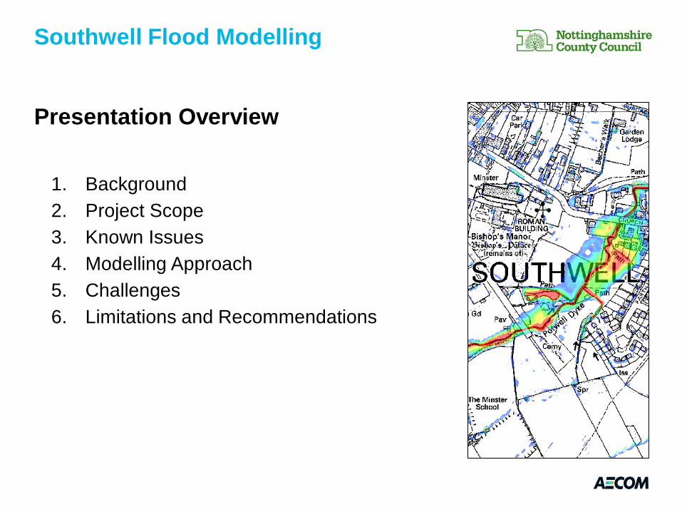
Presentation Overview
1. Background
2. Project Scope
3. Known Issues
4. Modelling Approach
5. Challenges
6. Limitations and Recommendations
Southwell Flood Modelling
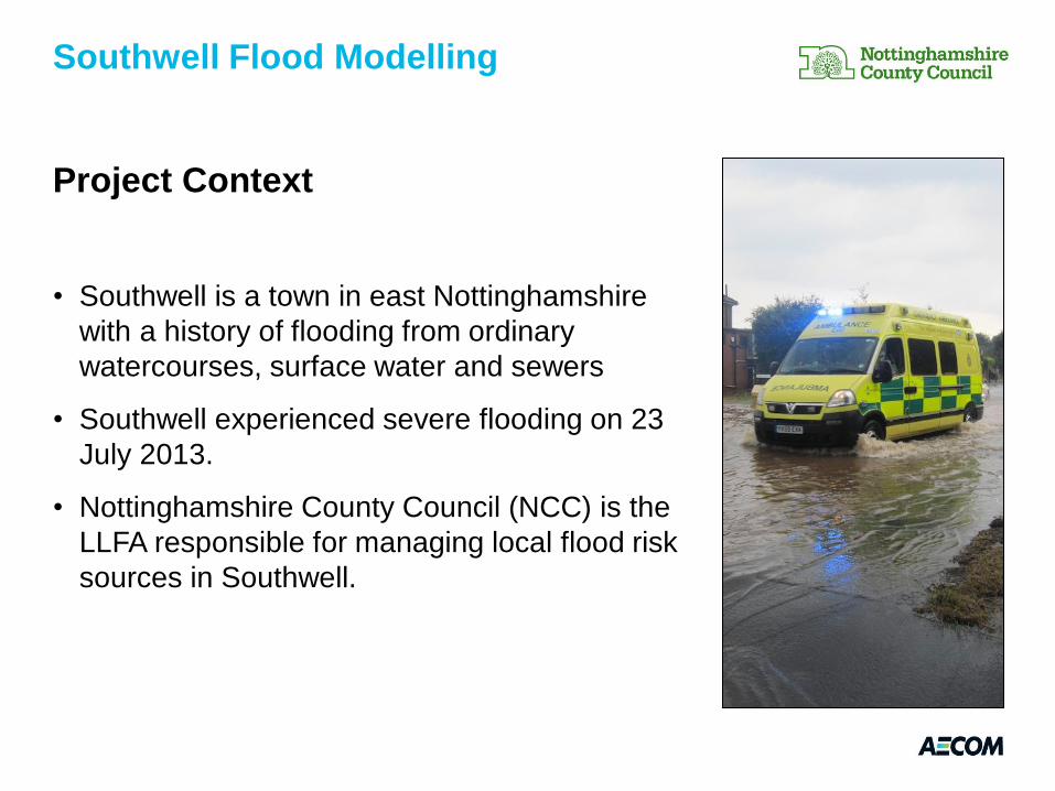
Project Context
• Southwell is a town in east Nottinghamshire
with a history of flooding from ordinary
watercourses, surface water and sewers
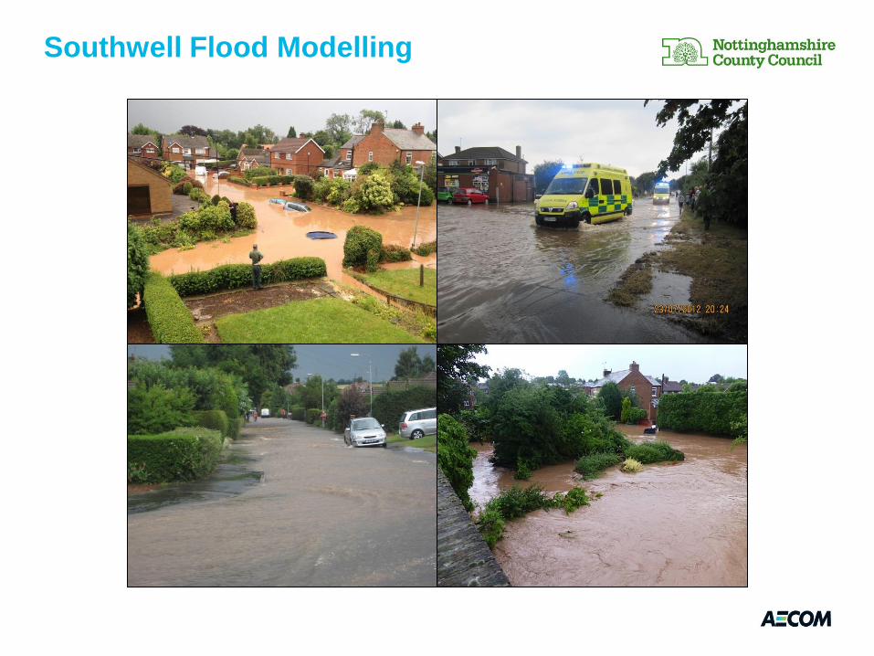
• Southwell experienced severe flooding on 23
July 2013.
• Nottinghamshire County Council (NCC) is the
LLFA responsible for managing local flood risk
sources in Southwell.
Southwell Flood Modelling
Southwell Flood Modelling
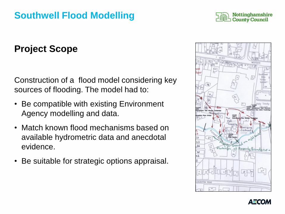
Project Scope
Construction of a flood model considering key
sources of flooding. The model had to:
• Be compatible with existing Environment
Agency modelling and data.
• Match known flood mechanisms based on
available hydrometric data and anecdotal
evidence.
• Be suitable for strategic options appraisal.
Southwell Flood Modelling
Southwell Flood Modelling
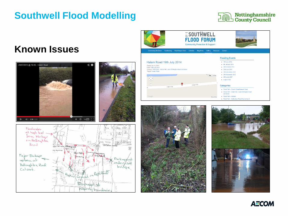
Known Issues
Southwell Flood Modelling
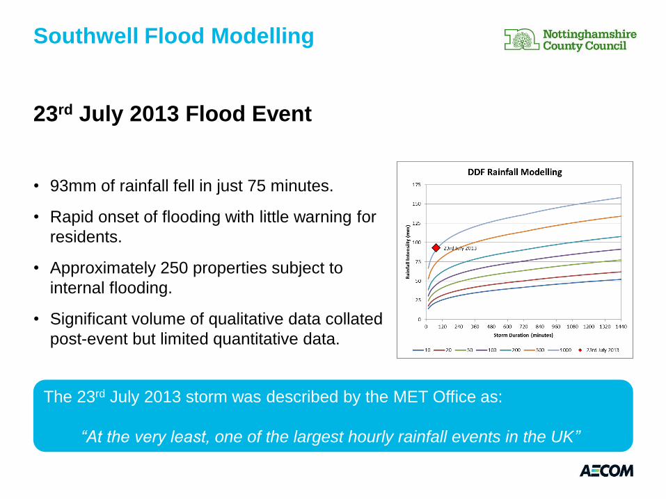
23rd July 2013 Flood Event
• 93mm of rainfall fell in just 75 minutes.
• Rapid onset of flooding with little warning for
residents.
• Approximately 250 properties subject to
internal flooding.
• Significant volume of qualitative data collated
post-event but limited quantitative data.
Southwell Flood Modelling
The 23rd July 2013 storm was described by the MET Office as:
“At the very least, one of the largest hourly rainfall events in the UK”
Southwell Flood Modelling

Southwell Flood Modelling
Modelling Approach
• Conventional methods of design flow estimation were considered unsuitable.
• Client requirement to understand surface water flood mechanisms.
• Discrete surface water and fluvial models were considered but were not
thought to be representative of the key flooding mechanisms in isolation.
• An integrated catchment approach created one holistic model.
• Integrated modelling allowed for appraisal of options on a number of sources
simultaneously.
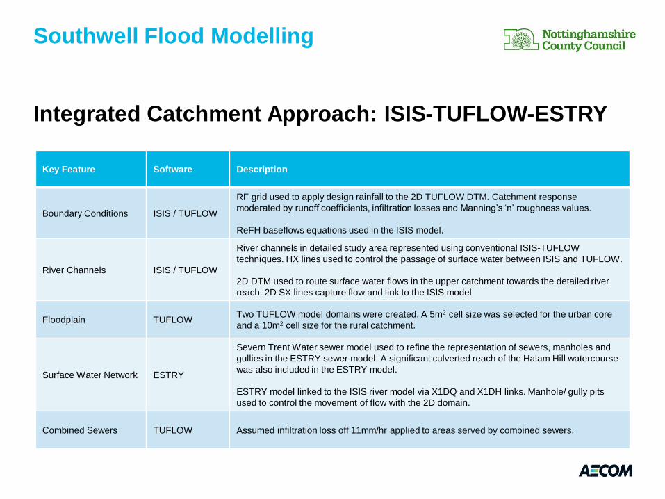
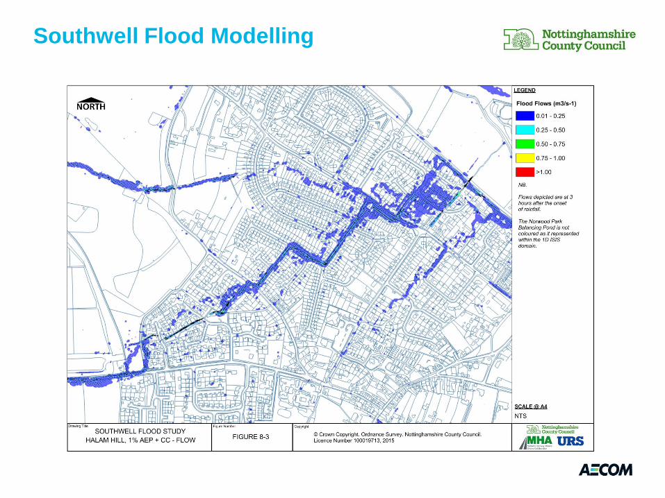
Integrated Catchment Approach: ISIS-TUFLOW-ESTRY
Southwell Flood Modelling
Key Feature Software Description
Boundary Conditions ISIS / TUFLOW
RF grid used to apply design rainfall to the 2D TUFLOW DTM. Catchment response
moderated by runoff coefficients, infiltration losses and Manning’s ‘n’ roughness values.
ReFH baseflows equations used in the ISIS model.
River Channels ISIS / TUFLOW
River channels in detailed study area represented using conventional ISIS-TUFLOW
techniques. HX lines used to control the passage of surface water between ISIS and TUFLOW.
2D DTM used to route surface water flows in the upper catchment towards the detailed river
reach. 2D SX lines capture flow and link to the ISIS model
Floodplain TUFLOW Two TUFLOW model domains were created. A 5m2 cell size was selected for the urban core
and a 10m2 cell size for the rural catchment.
Surface Water Network ESTRY
Severn Trent Water sewer model used to refine the representation of sewers, manholes and
gullies in the ESTRY sewer model. A significant culverted reach of the Halam Hill watercourse
was also included in the ESTRY model.
ESTRY model linked to the ISIS river model via X1DQ and X1DH links. Manhole/ gully pits
used to control the movement of flow with the 2D domain.
Combined Sewers TUFLOW Assumed infiltration loss off 11mm/hr applied to areas served by combined sewers.
Southwell Flood Modelling
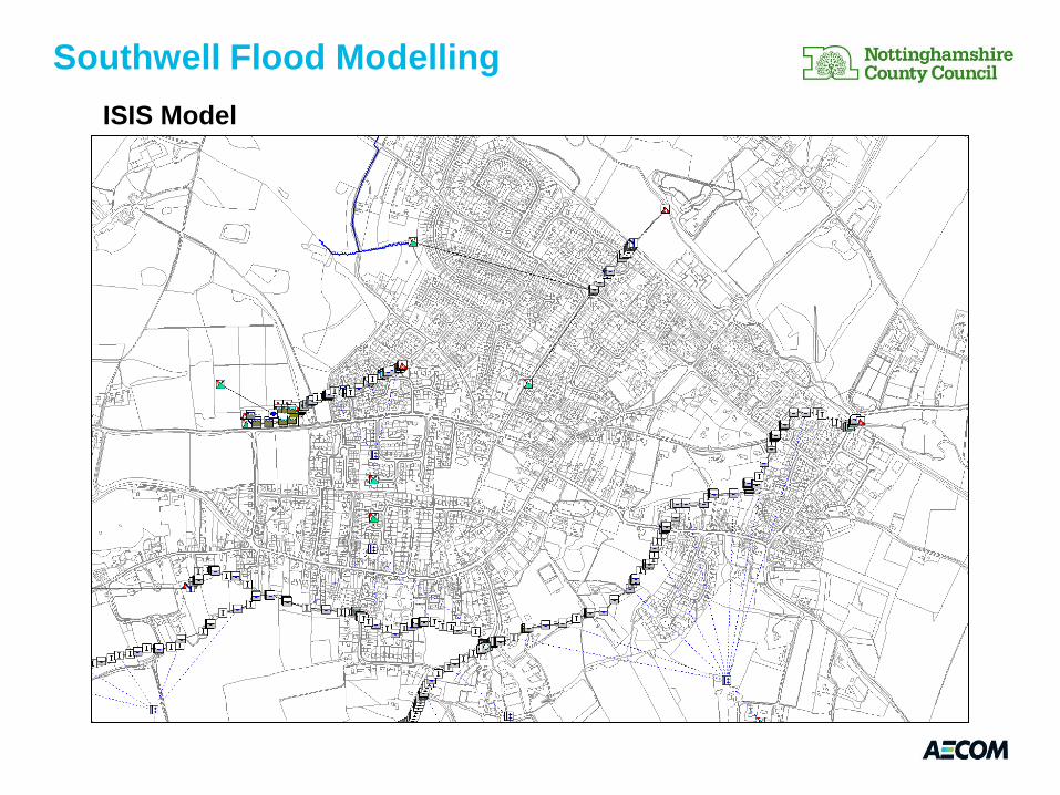
ISIS Model
Southwell Flood Modelling
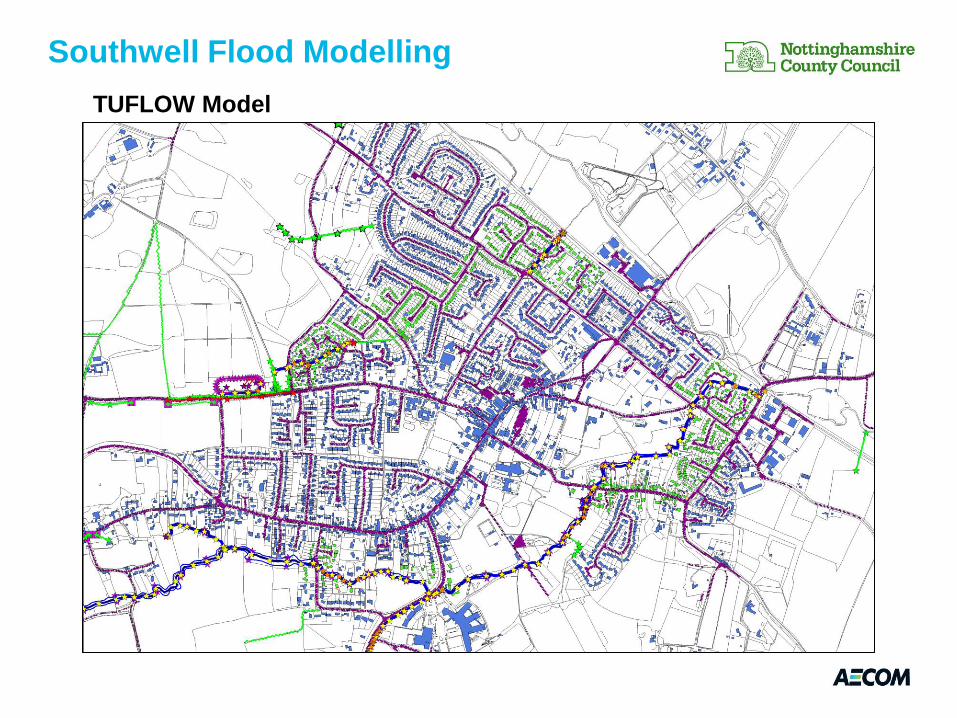
TUFLOW Model
Southwell Flood Modelling
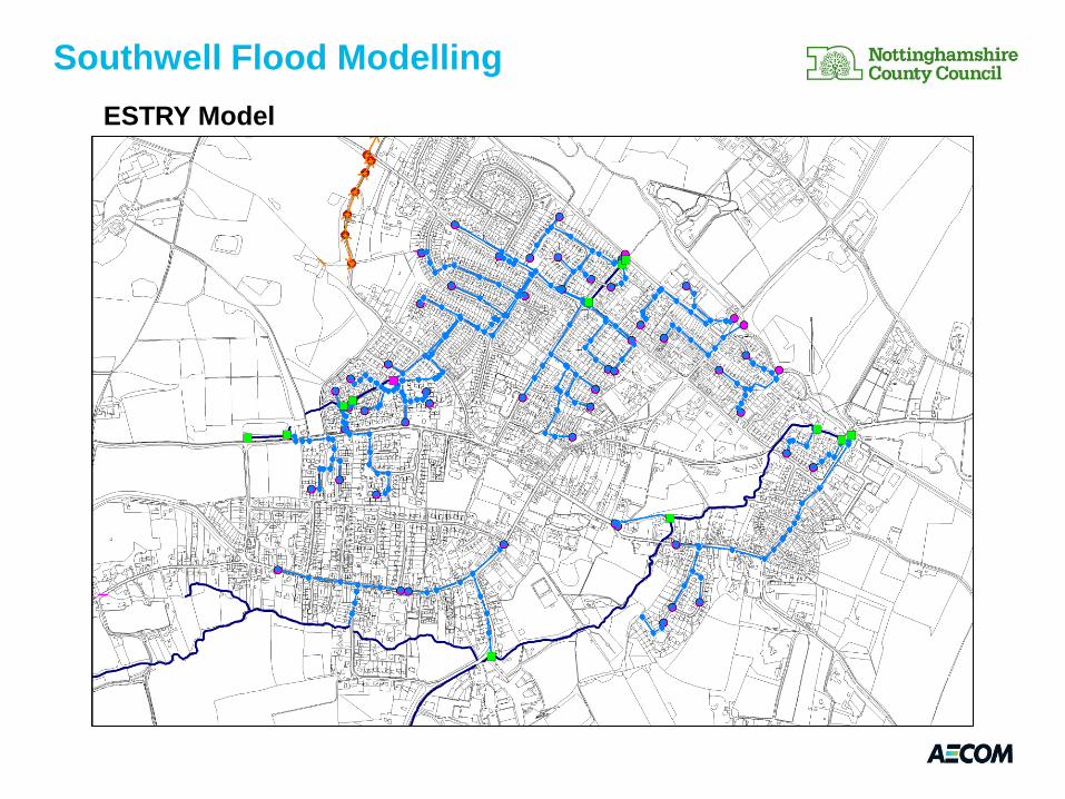
ESTRY Model
Southwell Flood Modelling
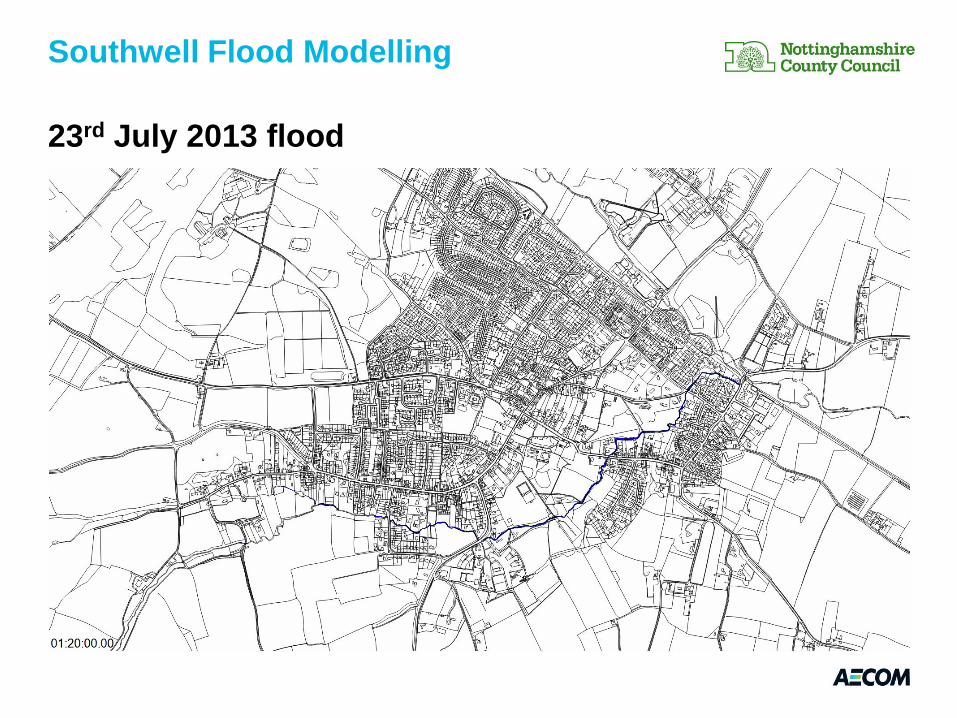
23rd July 2013 flood
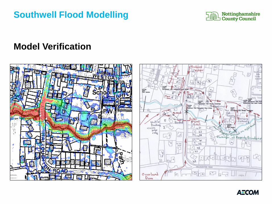
Model Verification
Southwell Flood Modelling
Model Verification
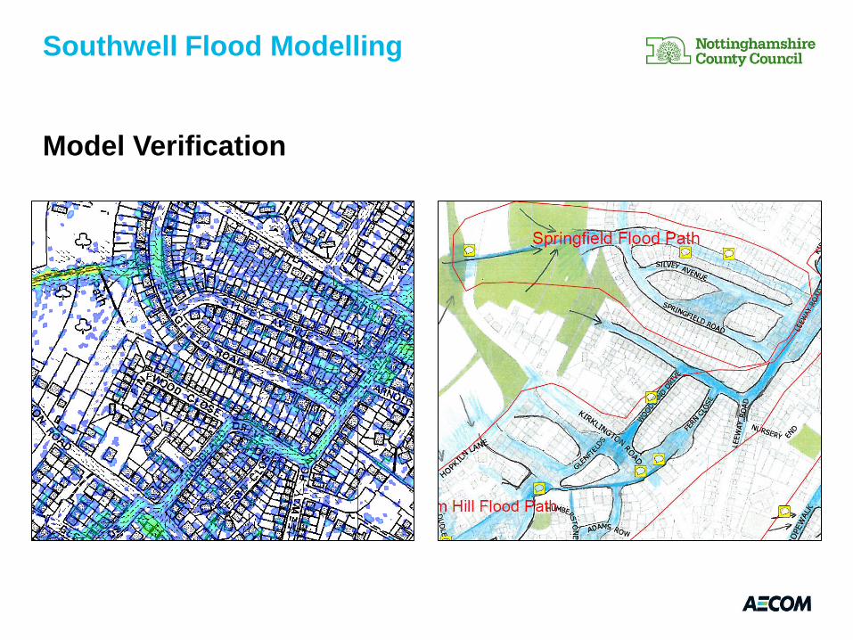
Southwell Flood Modelling
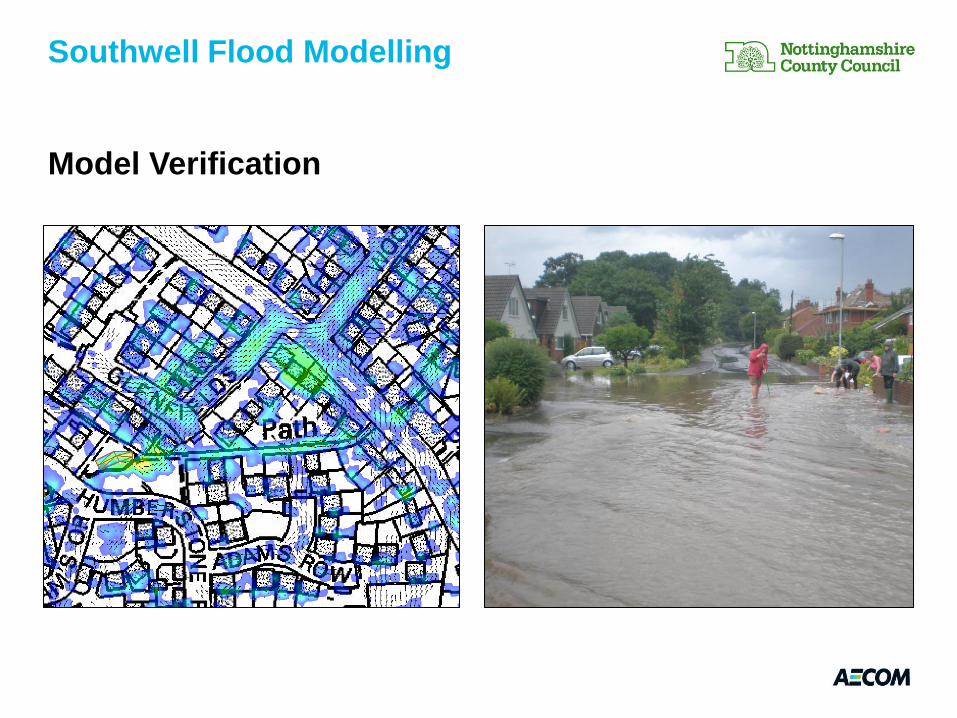
Model Verification
Southwell Flood Modelling

Southwell Flood Modelling
Southwell Flood Modelling
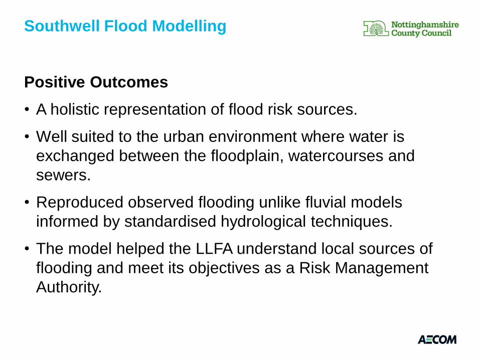
Positive Outcomes
• A holistic representation of flood risk sources.
• Well suited to the urban environment where water is
exchanged between the floodplain, watercourses and
sewers.
• Reproduced observed flooding unlike fluvial models
informed by standardised hydrological techniques.
• The model helped the LLFA understand local sources of
flooding and meet its objectives as a Risk Management
Authority.
Southwell Flood Modelling
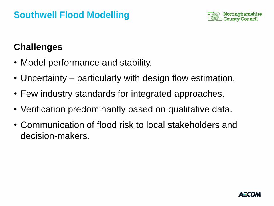
Challenges
• Model performance and stability.
• Uncertainty – particularly with design flow estimation.
• Few industry standards for integrated approaches.
• Verification predominantly based on qualitative data.
• Communication of flood risk to local stakeholders and
decision-makers.
Southwell Flood Modelling
Limitations & Recommendations
• Most applicable for small, flashy catchments where
baseflow or variable catchment wetness not a factor in
catchment response.
• Well suited for catchments where conventional techniques
of design flow estimation are not applicable.
• Significant verification and analysis required to have
confidence in design flow estimates.
• Long model run times – can have significant implications
for programme when options appraisal is required.
Southwell Flood Modelling
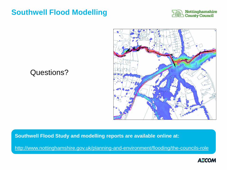
Questions?
Southwell Flood Modelling
Southwell Flood Study and modelling reports are available online at:
http://www.nottinghamshire.gov.uk/planning-and-environment/flooding/the-councils-role