situation report abyei natural resources conflict
TRANSCRIPT
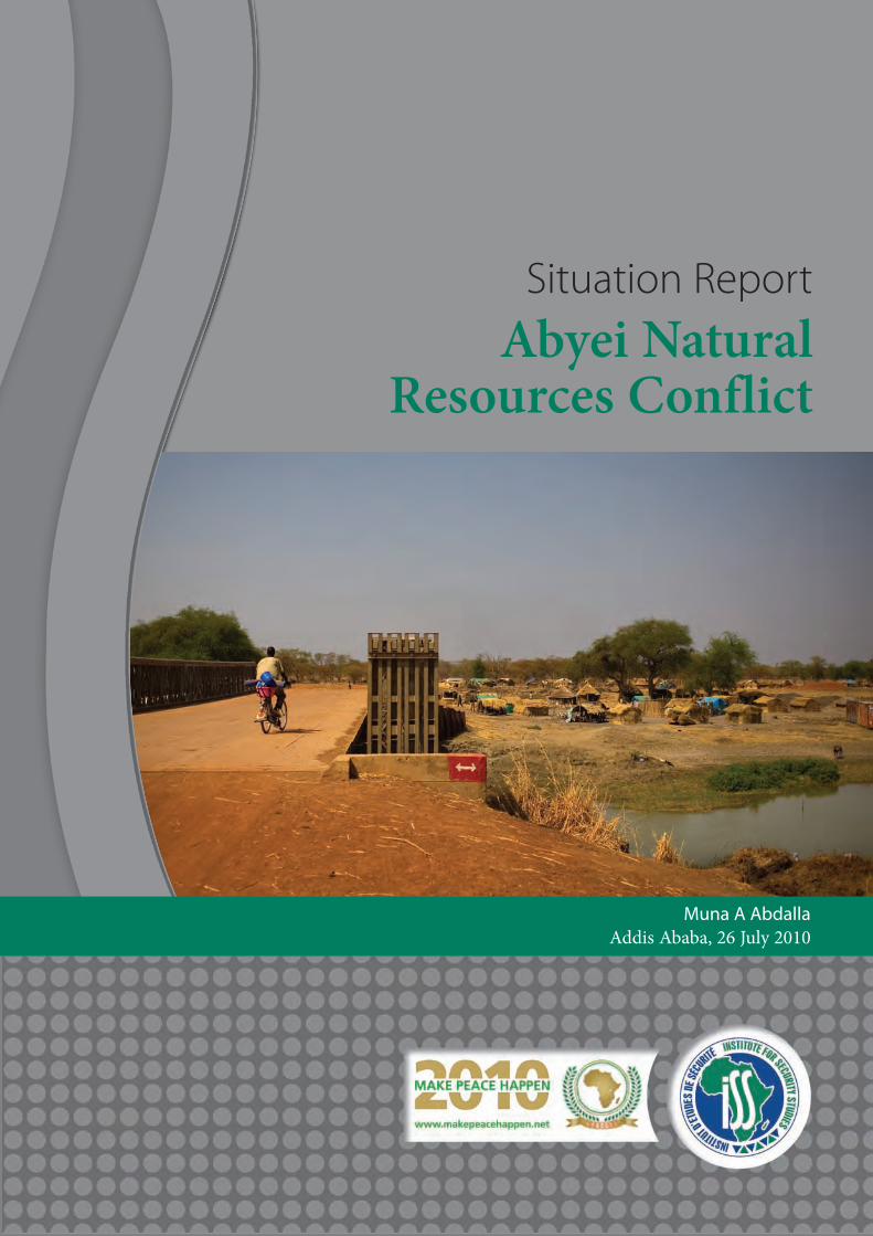
Situation ReportAbyei Natural
Resources Conflict
Muna A AbdallaAddis Ababa, 26 July 2010
Situation ReportAbyei Natural
Resources Conflict
Muna A AbdallaAddis Ababa, 26 July 2010

Abyei Natural Resources Conflict Situation Report
Introduction . . . . . . . . . . . . . . . . . . . . . . . . . . . . . . . . . . . . . . . . . . . . . . . . . . . . . . . . . . . . . . . . . . . . . . . . . . . . . . . . . . . . . . . . . . . . . . . . . . . . . . . . . . .1
The two conflicting ethnic groups . . . . . . . . . . . . . . . . . . . . . . . . . . . . . . . . . . . . . . . . . . . . . . . . . . . . . . . . . . . . . . . . . . . . . . . . . . . . . . . . . . .1
Drivers of the conflict . . . . . . . . . . . . . . . . . . . . . . . . . . . . . . . . . . . . . . . . . . . . . . . . . . . . . . . . . . . . . . . . . . . . . . . . . . . . . . . . . . . . . . . . . . . . . . . . .2
Manipulating the intangible factors in the conflict . . . . . . . . . . . . . . . . . . . . . . . . . . . . . . . . . . . . . . . . . . . . . . . . . . . . . . . . . . . . . . . . . .2
The tangible factors (natural resources) . . . . . . . . . . . . . . . . . . . . . . . . . . . . . . . . . . . . . . . . . . . . . . . . . . . . . . . . . . . . . . . . . . . . . . . . . . . . .3
The border dispute . . . . . . . . . . . . . . . . . . . . . . . . . . . . . . . . . . . . . . . . . . . . . . . . . . . . . . . . . . . . . . . . . . . . . . . . . . . . . . . . . . . . . . . . . . . . . . . . . . .4
Invoking environmental concerns in conflict resolution . . . . . . . . . . . . . . . . . . . . . . . . . . . . . . . . . . . . . . . . . . . . . . . . . . . . . . . . . . . .6
Peace Park or Transboundary Protected Area (TBPA) . . . . . . . . . . . . . . . . . . . . . . . . . . . . . . . . . . . . . . . . . . . . . . . . . . . . . . . . . . . . . . . .6
Conclusion . . . . . . . . . . . . . . . . . . . . . . . . . . . . . . . . . . . . . . . . . . . . . . . . . . . . . . . . . . . . . . . . . . . . . . . . . . . . . . . . . . . . . . . . . . . . . . . . . . . . . . . . . . . .6
Contents

1Abyei Natural Resources Conflict Situation Report
INTRODUCTION
This report explores the major factors underlying theviolent conflict in Abyei. It aims to contribute to policy-relevant knowledge of the link between resources andconflict and to propose a general framework for action.
It examines the territorial attachment of conflictinggroups and establishes a link between intensification ofconflict and the changes in livelihoods resulting fromenvironmental stresses and overexploitation of assets. Thereport will also examine efforts to demarcate borders andits potential for solving the problem. It will also explorethe peace-building potential of envisioned peace parks inthe ecologically sensitive zone of multiple jurisdictions,Abyei, with focus on the formation of conservation zonesin which the sharing of physical space can build andsustain peace.
This study, based on qualitative research conducted inSudan in October 2009, took in an extensive literaturereview of historical materials written by colonialadministrators as well as Sudanese historians andpoliticians, newspaper articles and conferencesproceedings. It has benefited from field study in Sudan,which allowed informal discussions and interviews withleaders and members of the two conflicting communities,non-governmental organisations (NGOs) and UnitedNations Missions in Sudan (UNIMS) personnel,researchers and informed individuals.
Abyei is a narrow patch of land that straddles theborder between North and South Sudan. Administratively,it falls under the jurisdiction of West Kurdofan (NorthSudan). However, the 2005 Comprehensive PeaceAgreement (CPA) between the National Congress Party(NCP) and Sudan People's Liberation Movement/Army(SPLM/SPLA) granted Abyei a special administrativestatus.1 Thus, pending the 2011 referendum, Abyei iscurrently a political entity attached to neither the Northnor the South.
The Abyei conflict is the outcome of several complexprocesses that interact with and reinforce each other.Despite being rich in natural resources, it has remainedone of the least-developed regions in the country. As withthe other peripheral regions, it was subject to the northerngovernment's policy of socioeconomic and culturalmarginalisation. Therefore, the political development ofAbyei has been characterised by aggressive suppression ofethnic and religious identity. It has also been marked bycontinuous attempts to revolt and change the status quo.The conflict of Abyei has been an important driving forcefor the civil war in Sudan, which started in 1983, yetdomestic politics have always kept it on the backburner.Recently, the long-standing conflicts have developed intodangerous bouts of violence, setting off vicious cycles ofattacks involving heavily armed forces.
The conflict involves the Dinka Ngok ethnic groupssupported by the SPLM, on the one hand, and theMisseriya ethnic groups supported by the government ofKhartoum on the other. For both groups the area holdsintrinsic economic, sociocultural, political andinstitutional values that have been inherited overgenerations. The two groups compete over which hasrights to the territory and essentially the right to grazingand water resources.
The livelihood of the population of Abyei is directlyconnected to its natural resources: communities areeither pastoralist or agropastoralist. Their survival isalmost completely dependent on natural resources andthe environment. Their ability to use resources andmanage relations in a way that preserves the environmentand secures its use by all is critical for their survival. Anysolution needs to consider this.
It is proposed here that the whole area of Abyeishould be designated as a Peace Park that transcendspolitical boundaries and units and allows equitablesharing of resources, reduce the tension along the borderbetween the South and the North, and preserve andprotect the environment from overgrazing andencroachment of oil exploration activities.
From reviewing massive sources related to the conflictof Abyei, it became clear that there is a lack of the type ofstudies that address the following issues:
n The factors that surround the conflict processes in their multiplicity and their interaction
n The policy and institutions that influence people's livelihood strategies and the decision-making process
n The perspective of the people affected by the conflict, their assets, entitlements, and the specificand differentiated vulnerabilities
n Previous experiences of community in self-governance of natural resources
THE TWO CONFLICTING ETHNIC GROUPS
The current Abyei population is a mixture of severalimmigrations and an amalgamation of various ethnicgroups that settled around the triangle of Bahr AlArab/Kiir2 River at different times. The area is inhabitedpermanently by the Dinka Ngok, and seasonally it isvisited by the Misseriya ethnic groups. The Misseriyabelong to a larger group, predominantly Arab Muslim,named Al Baggara. The Dinka Ngok belong ethnicallyand racially to the South, and are predominantlyChristian. The Ngok is a branch of the larger Nyloticethnic group of Dinka, which represents around 35 per
Institute for Security Studies2
cent of the population of the south. The Ngok is dividedalong several subgroups and nine chiefdoms, led by aparamount chief.
Despite their racial and cultural differences, the twoethnic groups had an amicable relationship across thetraditionally demarcated boundaries and managednatural resources wisely. They also overcame theirdifferences using their own traditional mechanisms forconflict management and resolution. However, it hasbecome clear that the conflict has tested the limits of alltraditional mechanisms.
DRIVERS OF THE CONFLICT
Generally, territorial conflict is directly linked to theimportance of the territory to a certain population group.In other words, territorial attachments of a populationgroup relate to the tangible and/or intangible (indivisible)qualities of the territory,3 in particular land and naturalresources. Natural resources provide important sourcesfor conflict. Both scarcity4 and abundance5 of resourcescan contribute to competition, and the consequenteruption of violent conflict. However, there are alsocircumstances where abundance and scarcity have notcontributed to conflict. The point of departure is thatscarcity and abundance are likely to generate conflictwhere populations are marginalised and where there is abreakdown in the legitimacy of political authority andeffectiveness of the state.6
The intangible qualities relate to the history, religionand culture that form the identity of the conflictinggroups. Conflict over intangible qualities is believed to bemore violent, intractable and prone to reemerge afterlong periods of apparent dormancy, than conflict overtangible factors.7 This is due to the way actors use theindivisibility rhetoric to deny other groups territorialrights. In the case of Abyei, the indivisible factors havebeen portrayed as being the most important for theDinka Ngok.8
Globalisation has complicated domestic territorialconflict by widely opening the door for a new powerdynamic in the internal affairs of sovereign states.9
Multinational corporates become the major determinantof the extent of territorial tangibility with potentially far-reaching consequences for territorial conflict.10 Henceintrastate territorial conflict becomes complex andinvolves several internal and external parties.
MANIPULATING THE INTANGIBLEFACTORS IN THE CONFLICT
The issues of identity and attachments to the land areimportant in explaining the way the two conflicting
groups of Abyei have expressed their territorial identitiesand institutional allegiances. Abyei assumes major social,political and functional significance for both groups.Both have lived and worked on this land for many yearsand both have a strong moral claim to it. But theseidentities and attachments clash, as each group seesAbyei as its exclusively.
The Dinka Ngok harbour exceptionally strongsentimental attachments to Abyei, which has formed andconsolidated their identities for generations. It has astrong religious and cultural significance; it is the shrineof their ancestors and shall also hold theirs.11 Abyei hasgiven birth to some of the most powerful armedresistance movements in the country. Both Anania (1)and Anania (2) resistance movements were started byintellectuals from the Dinka Ngok of Abyei, many ofwhom were leaders or members of these movements.12
The Anania (2) movement evolved into the SPLM/SPLA.When the central government clamped down on themovements, it dealt a particularly savage blow to theDinka Ngok of Abyei, the demographic effect of which isstill felt.
The Misseriya refute the contention of the DinkaNgok that the territory of Abyei belongs exclusively tothem. The Misseriya settled in the area before the 17thcentury. It has equally shaped their way of life andidentity, and constitutes a significant part of their history,legends, values and tradition. The irreconcilable claimson the indivisible salience of the territory have led tostifled negotiations, and the collapse of any settlementproposal. The rhetoric of indivisibility of the territory hasbeen used by elites from both sides to rally support fortheir groups and to pressurise their rivals into makingcompromises.13 Recognising the importance ofhomelands, sacred sites, identity ties etc. to each group,this should not preclude the other group from its rightsin the area.
Indivisibility of the territory is proven to be a sociallyconstructed phenomenon, it is 'neither an objective,inherent property nor territory, nor subjective andreducible to individual consciousness'.14 In practice,territories are physically divisible, and the notion of theirindivisibility remains dynamic and diverges across timeand space. Experiences have shown that indivisibleterritory can 'become divisible through partition, sharedsovereignty, compensation, or other mechanisms ofdivision'.15 In particular, sharing in the form ofTransboundary Protected Areas are good examples wherethe intangible salience of the territory, eg historical andcultural possessions, is protected and maintained jointlyto promote peace and cooperation. However, this willrequire the willingness of the key actors in the conflict tocompromise to reach an equitable and fair settlement.16
THE TANGIBLE FACTORS (NATURAL RESOURCES)
Natural resources provide a strong base for territorialattachments, and territorial disputes are directly orindirectly connected to natural resources. In theliterature, both scarcity and abundance of naturalresources are linked to violent conflicts. Abyei commandsboth abundance and scarcity of resources. It has anabundance of renewable natural resources that should besufficient for the daily survival of both groups. It has alsoa large oil reserve that is being exploited by variousmultinational companies. However the geographicaldistribution of renewable resources and the unequalability to access them have contributed to the scarcity ofwater and grazing land to one group. Oil explorationshave heightened such scarcity. Furthermore, the system ofrevenue allocation is likely to contribute to increasedconflicts in the area.
The oil
Oil and other lucrative natural resources such asdiamonds and uranium have provided a strong base forviolent conflict in different parts of the world. Thesetypes of conflicts are often referred to as 'resource wars'.17
Examples of these are the wars of the DemocraticRepublic of Congo, Sierra Leone and Angola, amongothers.18 There is also an argument that availability ofsuch resources is often associated with separatist trends,particularly in areas where extensive exploration andprocessing take place and where the community isgenerally marginalised.19 The conflict involving Tuareg inthe Sahel is a good example.
Abyei is considered one of the most oil rich areas inSudan, with a quarter of total crude oil output of theentire country. But because the development of the oilsector in Sudan has been influenced greatly by thecomplex political environment of the country, the oilresource did not contribute to the human and economicdevelopment of the area. To the contrary, it causedsuffering, sustaining one of the longest civil wars inAfrica, that between the North and the South of Sudan.Oilfields were a vital source of revenue for the Khartoumgovernment's war against the South. The multinationalcompanies operating in the area are not neutral in thiswar. Their activities remain strongly linked to profit-seeking rationales as well as to state interests. Therefore,historically these companies were 'deterrents to peace in[that] long-standing and devastating civil war'.20
Since its discovery, the North has taken control ofSudan's oil, and after the signing of the CPA the revenuewas shared with the South. Notwithstanding the signingof the CPA between the SPLM and the government of
Khartoum, sharing of Abyei's oil remains one of the mostfiercely contested issues between the two parties.According to the CPA, revenue from oil produced in thesouth should be divided equally between the governmentsof Khartoum and of Southern Sudan after deducting 2 percent for each of the oil-producing states. Revenue sharingfrom Abyei oil has a slightly different formula from thatof the rest of the country. It was agreed that Abyei oilrevenue should be divided as follows: 50 per cent for thenational government, 42 per cent for the government ofSouthern Sudan, 2 per cent for Abyei and 2 per cent forthe two major ethnic groups in Abyei, the Dinka Ngokand the Misseriya. However, more than five years aftersigning the CPA, the South still does not have its fairshare of Sudan's oil.21
Sudan uses both multinational and national oilcompanies to produce oil. Companies provide capitalinvestment for production and divide crude oil betweenthem and the government of Sudan through a contractualmechanism of production-sharing agreements (PSAs).Some sources, including a report by Global Witness andthe Southerners themselves, raised doubts on theaccuracy of figures provided by the oil companies and thegovernment of Khartoum.22 A major problem with thecurrent revenue-sharing formula is that it lackstransparency. Agreements on the revenue sharingbetween the government and the companies are keptsecret. The 2011 referendum on the status of Abyei willbring to an end the wealth-sharing deal between the twoparties. But termination of the deal will not be simple. Forboth the North and the South, oil matters significantlyand has constituted a significant source of revenue. Morethan 90 per cent of the income of the government ofSouth Sudan, and more than 50 per cent of domesticrevenue of the government in the North, come from oilrevenue.
A zero-sum perception of the outcome of thereferendum prevails, ie that the referendum will certainlycreate a winner and a loser in the game. Winning willtranslate into both total control of oil revenue andenhanced capability for other actions. The deployment ofboth Northern and Southern troops along the border thatseparates the North from the South, may help to explainhow determined each is not to lose.
The shape and nature of the outcome of thereferendum will significantly be influenced by both thesystem of revenue allocation and the nature of oilexploration. This matter calls for an accountable andtransparent system of oil revenue allocation that allowsfair sharing of oil. Furthermore, any solution shouldengage the marginalised communities. The conflict in oilcould possibly be transformed into cooperation byidentifying mutual gains and building upon them.
3Abyei Natural Resources Conflict Situation Report
Institute for Security Studies4
Grazing land and livelihoods
An intrinsic link has been assumed between scarcity ofresources and intrastate armed conflict.23 Competition overscarce resources often develops into violent conflict andwar, but there are also examples where resource abundanceand scarcity have not led to conflict. The conditions inwhich resource scarcity leads to conflict relate basically todependence on these resources. It is useful to highlight thevulnerability of individuals and groups that makes themsensitive to resource scarcity. Livelihoods and vulnerabilityanalysis supports this assumption. People becomevulnerable when their access to livelihood resources isblocked. Blaikie et al24 conceptualised vulnerability as afunction of economic and political structures andprocesses that limit people's capacity to deal with shocks(such as scarcity of resources). In the case of Abyei this isparticularly relevant. The conflict over the naturalresources of Abyei is explained in terms of thevulnerability of groups and their complete dependence onthese resources.
The population of Abyei are either pastoralist oragropastoralist. Their survival is almost completelydependent on climatic conditions and their ability to useand manage human/environment relations in a way thatpreserves the environment and secures its use by all. Thepopulation have developed the best techniques to deal withthe wide variation in agro-ecological zones. They grazetheir cattle in an annual cycle. The Misseriya trek to Abyeifrom Babanusa and Al Muglad towns and cross the regionon their way to Bahr Al Arab/Kiir River in November.They leave the area in May or June when the Dinka Ngoktake their turn. During the dry season, the Misseriyareturn to graze their cattle and so forth. For generations,they lived side by side and preserved the environment.Conflict erupted sometimes, but they were almost alwaysable to overcome and solve their differences usingtraditional mechanisms of conflict management andresolution.
At the end of each seasonal grazing trip, seniors andleaders of each ethnic group held forums to addressproblems during the trip, including animal injuries orattacks on humans. They proposed solutions to theoriginal cause and restitution, and compensation measuresfor loss and destruction. These forums were uniquelydemocratic and allowed the groups to manage livelihoodresources and solve conflicts. However, these mechanismsare no longer able to deal with conflict. The involvement ofnew parties in the conflict has weakened and manipulatedtraditional institutions and made it harder to resolveconflict peacefully.25 Furthermore, the militarisation oftribal hierarchies and accessibility of modern weaponshave introduced an alternative source of power and controland have elevated the conflict to a new level.
Although Abyei is endowed with fertile pasture groundsand a network of waterways flowing into Bahr AlArab/Kiir River, access to these resources has beenrestricted to one group. The redrawing of Abyei areaborders by the Permanent Court of Arbitration (PCA) inThe Hague has led to the loss of a large tract of fertilepasture. Lack of pastoral water points and the blockage ofstock routes make it impossible for cattle to survive in thedry season.
Furthermore, the amount of grazing land has shrunk,while the numbers of people and livestock have keptgrowing. Commercial farming continues to encroach onthe pastures and trails of the Misseriya northward,pushing them to the south.26 But from the south, theextensive oil exploration that started around 1970 andintensified during the 1990s has also cut across fertilepasture lands and trails. The government of Sudan haslicensed more than 1,1 million square kilometres for oilexploration.27 The exploration structures have disturbedboth the ecological and social environment. As a result,the Misseriya are pushed further into a marginal landthat is less able to support their livestock, leading toovergrazing of pastures and loss of assets.
Therefore, it becomes a matter of survival for theMisseriya to fight their way through to the water in BahrAl Arab/Kiir River.28 Actions taken by the group shouldbe understood as mechanisms to survive in the face ofmultiple constraints. Diminishing access to water andgrazing land is expected to exacerbate post-2011referendum results, particularly in case of secession and ifAbyei's population chooses to belong to the South. TheMisseriya then will have to remain within the North, andAbyei become part of the neighbouring canton. But if theneighbour is unwilling to share resources then Misseriyahas two choices, either to abandon the mode of livelihoodthey followed for generations or keep following it at anycost. The choice for them seems to be very clear. Withoutnegotiating a transboundary resource area, conflict in thiszone will escalate. Any solution has to take into accountthe livelihoods of both population groups.
THE BORDER DISPUTE
The major disputes over Abyei hinge on which of the twoethnic groups arrived first and to which geographicalarea. The two parties (the Misseriya backed by thegovernment of Khartoum, and the Dinka Ngok backed bygovernment of South Sudan) have opposing answers tothese questions. Each claims to have settled in the areabefore the other. The Misseriya claim that they were thefirst to settle and this is why the area is named after them– Dar Misseriya, or Misseriya homeland.29 However thereis no evidence to support their claim. The Dinka Ngok
5Abyei Natural Resources Conflict Situation Report
too claim that their nine chiefdoms existed in the arealong before any other group. But again their claim haslittle evidence to support it. The area known today asAbyei was occupied until the 17th century by the Nubaand Dajo ethnic groups, which are now not part of theconflict. Then Arab ethnic groups (from which theMisseriya descend) landed in the area from the ArabianPeninsula.30 The Arab groups removed the Nuba and theDajo. Some took refuge in the mountains, while otherswere subdued and enslaved by the Arab invaders,forming the major labour force for their cotton farms.The Arab groups continued to live in the area, where theyfought bitter wars against each other or forged allianceswith indigenous ethnic groups, including the Dinka. The date of the arrival of the Dinka Ngok to the area ofAbyei varies historically, but it is generally agreed thatthey arrived from the Upper Nile and settled in theriverine area between Bahr Al Arab/Kiir River andNgol/Ragaba ez Zarga during the 19th century (1830).31
Their settlement in the area is linked to recurring floodsof the White Nile.32
Lack of proper historical sourcing for events andgeographical boundaries made it extremely difficult toprovide acceptable answers to the disputing parties. But itis certain that both the Misseriya and the Dinka Ngokhave lived and worked on this particular land, theirrelationships evolving from total exploitation tocooperation, with intervals of conflict. They both havestrong moral claims to the land. They are both unlikely togive up their claim without a fight. Therefore, there is aneed for the type of solution that caters for sharing andmanaging of transboundary systems in both cases:secession or unity.
The Abyei Boundary Commission (ABC)
The CPA includes provisions for the establishment of theAbyei Boundary Commission (ABC) to define the exactborders of Abyei and to define the area of the nine DinkaNgok chiefdoms that was annexed to Kurdofan in 1905.The ABC is made up of 15 members drawn from theNational Congress Party (NCP), SPLM, the Dinka Ngokof Abyei, the Misseriya and experts with a soundknowledge of Sudan's history. The ABC report presentedto the Presidency in July 2005 made several proposals.33 Itdefined the northern limit of the area of the nine NgokDinka chiefdoms as latitude 10°10'N, from longitude27°50'E to longitude 29°00'E. Both the Dinka Ngok andthe Misseriya share secondary rights to the area betweenlatitude 10°10'N and latitude 10°35'N. The shared area isto be divided equally between the two. The northernlimit of Abyei area is located at approximately latitude10°22'N. The eastern boundary is located along longitude
29°32'E extending the Kurdofan-Upper Nile boundarynorthwards up to latitude 10°22'N and corresponds withthe original claim of the Dinka Ngok and SPLM. Thesouthern boundary of the Abyei area is left untouchedalong the Kurdofan-Bahr el-Ghazal-Upper Nile boundaryat the time of independence in 1956. The ABC did notmake any specific verdict on the western boundary.The government of Khartoum could not agree on theextent of the area defined by the ABC on the groundsthat the committee had exceeded its mandate. Theredrawn boundaries had ceded some of the mostlucrative oilfields to South Sudan. The Misseriya rejectedthe ABC decision on the basis that the new boundarieshad taken large tract of their fertile pasture land. Theyvowed to protect their land and to fight if the ABCdecision was implemented. The SPLM and the DinkaNgok viewed the ABC decision as fair and that, accordingto the agreements signed by both parties, it should befinal and binding.
The disagreements between the two parties peakedwhen both the government of Khartoum and the SPLMdemobilised their armed forces. In May 2008, the tensionexploded into full-scale fighting in Abyei town. Anagreement called the Abyei Road Map was signedbetween the SPLM and the government of Khartoum,which ended the fighting. Based on the Abyei Road Mapthe two conflicting parties agreed to refer the case to thePCA in The Hague, for a final and binding decision.
Decision of the PCA
The main tasks of the PCA were to determine whetherthe ABC Experts exceeded their mandate in defining thearea of the nine Dinka Ngok chiefdoms and define theboundaries of the area.34 The PCA found that the ABCdid not exceed its mandate in interpreting the mandate inthe manner that experts did … '[but have] exceeded theirmandate with respect to some of their conclusions'.35 Forexample, there was little evidence to support theproposition of latitude line 10°35'N as the northern limitof the Dinka Ngok and the Misseriya's shared rights, andthe consequent placement of the northern limit of theAbyei area at latitude 10°22'N.
The tribunal ruled that the northern boundary runsin a straight line at approximately latitude 10°22'N asdefined by the ABC. As for the eastern boundary, thecourt found that the ABC had drawn it withoutconclusive evidence. Therefore, the PCA re-drew theeastern and western boundaries of the area to run in astraight line along longitude 29°'E, from latitude 10°10'Nsouth to the Kurdofan-Upper Nile boundary defined on 1January 1956. The western boundary of the area is theKurdofan-Darfur boundary as defined on 1 January 1956
that runs along longitude 27°50'E, from latitude 10°10'N.The Tribunal ruled that the nine Dinka Ngok chiefdomsrun along latitude 10°10'N between longitudes 27°50'Eand 29°'E, and mainly around the watercourses of BahrAl Arab/Kiir River, Ragaba Umm Biero and Ragaba ezZarga.
With the redrawing of the eastern and westernborders, some of the key oilfields (Heglig and Bamboo)were given to North Sudan, with implications for revenuesharing for the population of Abyei area. This matter waslater disputed by the SPLM. Furthermore, the newboundaries mean that significant numbers of the Abyeipopulation are no longer eligible to vote in thereferendum on the future status of Abyei. The newborders have dissected the natural resource systems,creating serious implications for the Misseriya group andthe ecosystem. The Misseriya have once again lost a largetract of their fertile pasture land and have been furtherpushed to a marginal land that is less able to supporttheir livestock.
It becomes very difficult to have boundary lines thatare mutually agreed upon by all parties. Tension andsporadic conflicts are mounting, with the backing of theSPLM/SPLA and the government of Khartoum for theirrespective ethnic groups.
INVOKING ENVIRONMENTALCONCERNS IN CONFLICT RESOLUTION
As stated above, natural resources and environmentalconcerns are key contributory factors in the currentconflict. Therefore, environmental concerns should bethe major contributory factor to the peace-buildingprocess and its sustainability. It is proposed here that thewhole area of Abyei should be designated as a Peace Parkthat transcends political boundaries and units. Theobjective would be to reduce the tension along the borderbetween the South and the North, and preserve andprotect the environment from overgrazing andencroachment of mining activities.
PEACE PARK OR TRANSBOUNDARYPROTECTED AREA (TBPA)
Different forms of cooperation can take place betweenadjoining protected areas divided by international or sub-national boundaries. These zones have symbolic value forpeaceful cooperation and coordinated conservationmanagement efforts between nations. The term PeacePark – sometimes referred to as TransboundaryProtected Area (TBPA) – refers to protected areas acrossborders.36 Peace Parks are defined as: 'TransboundaryProtected Areas that are formally dedicated to the
protection and maintenance of biological diversity, and ofnatural and associated cultural resources, and to thepromotion of peace and cooperation.'37 Experience hasshown that Peace Parks have mitigated conflict byturning environmental factors in conflicts intocooperation elements in peace-building. For example,Bolivia and Guatemala built an effective Peace Park in theshared conservation zones of La Ruta Maya, which hasenhanced and facilitated peace-building between the twonations. Similarly, Peru and Ecuador have resolved acentury-and-a-half violent border conflict through theestablishment of the TBPA of Sierra del Condor(Mountain Range) Corridor.
Notwithstanding its apparently self-evident benefits,transferring the conflict zone into a protected area andopening up administrative and boundaries has seriouspolitical ramifications. It superimposes additional layersof politics and raises important questions aboutmanagement and authority. Therefore, it requires firstand foremost a serious and sincere political commitmentof the two parties to resolving the conflict and to theoverall development of the area, taking into accountmutual and separate interests.
Abyei Peace Park
A Peace Park is envisaged to bring about a newly logicalspace shared equitably by both ethnic groups. It shouldspan administrative boundaries and form a large andcompletely adaptable zone and management body. Thisproject can take place regardless of the outcome of the2011 referendum to build confidence for the futurerelations between the North and the South in secession orin unity. For the population of Abyei, the biophysicalzone has always been far more important than thepolitical one. Historically they shared an amicablerelationship across the traditionally demarcatedboundaries, and managed natural resources wisely. Thepeace park will only allow this relationship to continue ina more formal and organised way. A Peace Park willrequire the reforming of old structures to respond to thechanges and to reflect separate and mutual interests.
CONCLUSION
The above discussion has highlighted the factorsunderlying the conflict of Abyei, including themechanisms that link resources to conflict. It appears thatthere is a direct relationship between reduced ordiminished access to resources and the conflict of Abyei.Grazing land and water are very important to thelivelihood of the population, but managing theseresources is equally important. The two conflicting
Institute for Security Studies6
7Abyei Natural Resources Conflict Situation Report
groups had managed to share an amicable relationshipacross the traditionally demarcated boundaries, managednatural resources wisely and solved conflicts using theirown social institutions. However, when access to resourceswas reduced or blocked, the conflict took a different turn.Efforts to settle the disputes through legal means havebecome technically complex and legally controversial. Itbecomes very difficult to have a boundary line that ismutually agreed upon, and it has also become difficult toshare resources as in the past.
The conflict of Abyei has become more complex forreasons of territorial attachment of each of the conflictinggroups. Abyei assumes major economic, social, culturaland historical significance. But the elites have manipulatedthis in a way that undermines prospects for peace.
Any practical and forward-looking solution shouldtake into account the livelihoods of the population of thearea. It should take into consideration the issues ofidentity and attachments to the land for both conflictinggroups. Without defining a clear way through whichnatural and physical resources are to be shared equitablyin either secession or unity, the conflict is likely tocontinue.
Therefore, it is proposed that the whole area of Abyeishould be designated as a Peace Park that transcendspolitical boundaries and units, and allows the communityto share and manage natural resources. The objective ofthe Peace Park would be to reduce the tension along theborder between the South and the North, and preserveand protect the environment from overgrazing andencroachment of exploration activities.
NOTES
1 Article 2.1, Abyei Protocol2 The Misseriya call it Bahr Al Arab or the Arabian River. The
Dinka Ngok call it River Kiir 3 John D Fearon, Rationalist explanations for war, International
Organization 49 (1994), 379-4144 Ole Magnus Theisen, Blood and soil? Resource scarcity and
internal armed conflict revisited, Journal of Peace Research 45(6)(2008), 801-818
5 M Renner, The anatomy of resource wars, WorldWatch Paper162 (2002), Washington DC: WorldWatch Institute
6 Blaikie Piers, Cannon Terry, Davis Ian and Ben Wisner, At risk: natural hazards, people's vulnerability, and disasters, New York:Routledge, 2003
7 John D Fearon, Rationalist explanations for war, International Organization 49 (1994), 379-414
8 F Deng, Property and value interplay among the Nilotes of the Southern Sudan, Iowa Law Review 51(3)
9 Miles Kahler and Barbara F Walter (eds), Territoriality and conflict in an era of globalization, Cambridge: CambridgeUniversity Press, 2006
10 Luke A Patey, Understanding multinational corporations in war-torn societies: Sudan in Focus, 2006, DIIS Brief, DanishInstitute for International Studies, Strandgade 56, CopenhagenK, 2
11 An interview with Kuol Deng Kuol Arop, Paramount Chief of Dinka Ngok
12 Deng Alor, «_______» _____ ____ ____ ______ ____ ____ __ _(1-2),
Al Shahafa daily newspaper 5297, 18 March 2008,http://www.alsahafa.info/index.php?type=3&id=2147487115(accessed 14 November 2009)
13 Various group meetings with people from Abyei in Khartoum, October 2009
14 Stacie E Goddard, Indivisible territory and the politics of legitimacy: Jerusalem and Northern Ireland, Cambridge:Cambridge University Press, 2009, 7
15 Goddard, Indivisible territory and the politics of legitimacy: Jerusalem and Northern Ireland, 3
16 DG Pruitt, Indirect communication and the search for agreement in negotiation, Journal of Applied Social Psychology 1(1971), 205-239, cited in Paul R Hensel1 and Sara McLaughlinMitchell, Issue indivisibility and territorial claims, GeoJournal64 (2005), 275-285
17 M Renner, The anatomy of resource wars, WorldWatch Paper162 (2002), Washington DC: WorldWatch Institute
18 Renée Gendron and Evan Hoffman, Resource scarcity and the prevention of violent conflicts, Peace & Conflict Review 4(1),(2009)
19 Karen Ballentine and Heiko Nitzschke, The political economy of civil war and conflict transformation, Berghof ResearchCenter for Constructive Conflict Management (2005),http://www.berghof-handbook.net/uploads/download/dialogue3_ballentine_nitzschke.pdf
20 Luke A Patey, Understanding multinational corporations in war-torn societies: Sudan in Focus, DIIS Brief, Danish Institutefor International Studies, Strandgade 56, Copenhagen K,(2006), 2
21 Fuelling mistrust: the need for transparency in Sudan oil industry, Global Witness, September 2009
22 Ibid23 Theisen, Blood and Soil? Resource scarcity and internal armed
conflict revisited, 801-81824 Blaikie et al, At risk: natural hazards, people's vulnerability, and
disasters25 An interview with Amir Isameal Hamdeen, Khartoum,
October 200926 Mohamed Elamin Abdelgadir, Peaceful co-existence in Abyie
locality: thinking ahead, report on workshop entitled Conflicttransformation and peace building in Abyie area, 1-2December 2004, Khartoum, Sudan
27 Fuelling mistrust: the need for transparency in Sudan's oil industry, Global Witness, September 2009
28 An interview with Amir Isameal Hamdeen, Khartoum,October 2009
8
29 SM Eldebailo, Abyei conflict: the inferno of Nivasha or the paradise of peace? 27 October 2009, Sudanonline electronicnewspaper, http://www.sudaneseonline.com/en2/publish/Articles_and_Analyses_12/Abyei_conflict.shtml
30 KDD Henderson, The migration of the Messeriya into south west Kurdofan, Sudan Notes and Records 22(1), (1939), 55-62
31 Douglas Johnson, Reconstructing a history of local floods in the upper Nile region of the Sudan, International Journal ofAfrican Historical Studies 3 (1992)
32 Ibid 33 Abyei Boundary Commission Report, July 2005, Sudan Tribune
exclusive document, http://www.sudantribune.com/spip.php?article11633
34 Permanent Court of Arbitration, Abyei arbitration: final award rendered, The Hague, Netherlands, PCA 23562, 2009
35 Permanent Court of Arbitration, Abyei arbitration: final award rendered, The Hague, Netherlands, PCA 23562, 2009
36 The world's first international peace park – Waterton-Glacier International Peace Park – was established in 1932 across theUnited States/Canada border. The goal of establishing the parkwas to promote peace and goodwill between the two countries.Since then there have been around 227 transboundaryprotected areas around the world
37 Trevor Sandwith, Clare Shine, Lawrence Hamilton and David Sheppard, Transboundary Protected Areas for peace andcooperation, Best Practice Protected Area Guidelines IUCN 7(2001), xi, 111
Institute for Security Studies

ISS Head OfficeBlock D, Brooklyn Court, 361 Veale Street
New Muckleneuk, PretoriaTel: (27-12) 346 9500 Fax: (27-12) 346 9570
E-mail: [email protected]
ISS Addis Ababa OfficeFirst Floor, Ki-Ab Building,Alexander Pushkin Street,
Pushkin Square, Addis AbabaTel: (251-11) 372 1154/5/6 Fax: (251-11) 372 5954
E-mail: [email protected]
ISS Cape Town Office2nd Floor, The Armoury, Buchanan Square
160 Sir Lowry Road, Woodstock, Cape TownTel: (27-21) 461 7211 Fax: (27-21) 461 7213
E-mail: [email protected]
ISS Nairobi OfficeBraeside Gardens, Lavington,
Gitanga off Muthangari Road, NairobiTel: (254 -20) 386 1625 Fax: (254-20) 386 1639
E-mail: [email protected]
ISS Pretoria OfficeBlock C, Brooklyn Court, 361 Veale Street
New Muckleneuk, PretoriaTel: (27-12) 346 9500 Fax: (27-12) 460 0998
E-mail: [email protected]
www.issafrica.org
This publication was made possible through funding provided by the German Federal Foreign Office and Humanity United. In addition, general Institute funding is provided by the governments of Denmark, the Netherlands, Norway and Sweden.
9 781920 422202
Situation Report