school of civil & environmental engineering · japan-australia workshop on joint qzss projects,...
TRANSCRIPT

28/05/15
1
Japan-Australia Workshop on Joint QZSS Projects, Sydney, Australia, 11 July 2014 Australian Institute of Mining Surveyors, Annual conference, Sydney 14-15 August 2014
School of Civil & Environmental Engineering
Implications of a next generation datum in Australia on mining
operations: A discussion.
Craig Roberts
Senior lecturer Surveying and Geospatial
Engineering group
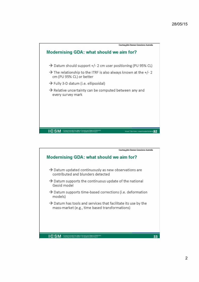
Who’s heard of the GDA2020?
28/05/15
2
Courtesy John Dawson Geoscience Australia
Courtesy John Dawson Geoscience Australia

28/05/15
3
Who’s heard of the ITRF ?
International Terrestrial Reference Frame
6"
The$Interna*onal$Terrestrial$Reference$Frame$(ITRF)$
Courtesy Joel Haasdyk

28/05/15
4
International Terrestrial Reference Frame
http://itrf.ensg.ign.fr/GIS/index.php
Four main geodetic techniques are used to compute accurate coordinates: GPS, VLBI, SLR, and DORIS. Since the tracking network equipped with the instruments of those techniques is evolving and the period of data available increases with time, the ITRF is constantly being updated. 11 realizations of the ITRS were set up from 1988. The latest is the ITRF2008. All these realizations include station positions and velocities.
Who’s heard of the IGS ?
International GNSS Service

28/05/15
5
IGS network: a subset of ITRF
http://igscb.jpl.nasa.gov/components/prods_cb.html
International GNSS Service (IGS)

28/05/15
6
International GNSS Service The IGS collects, archives, and distributes GPS and GLONASS observation
data sets of sufficient accuracy to meet the objectives of a wide range of scientific and engineering applications and studies. These data sets are
analyzed and combined to form the IGS products.
Glonass orbits
IGS Tracking stations coordinates
Velocities?
28/05/15
7
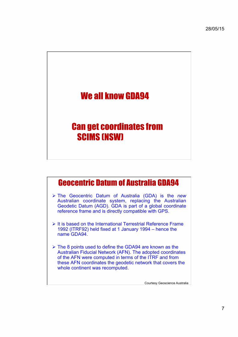
We all know GDA94
Can get coordinates from SCIMS (NSW)
Geocentric Datum of Australia GDA94 ! The Geocentric Datum of Australia (GDA) is the new
Australian coordinate system, replacing the Australian Geodetic Datum (AGD). GDA is part of a global coordinate reference frame and is directly compatible with GPS.
! It is based on the International Terrestrial Reference Frame 1992 (ITRF92) held fixed at 1 January 1994 – hence the name GDA94.
! The 8 points used to define the GDA94 are known as the Australian Fiducial Network (AFN). The adopted coordinates of the AFN were computed in terms of the ITRF and from these AFN coordinates the geodetic network that covers the whole continent was recomputed.
Courtesy Geoscience Australia

28/05/15
8
Australian Fiducial Network (AFN)
Australian National Network (ANN) consists of 78 stations at an approx 500km spacing ( ).
GDA94 – Gazetted coordinates of the AFN

28/05/15
9
National Geospatial Reference System
GDA94 densified under Auscope project
We’ve all used CORS networks
Continuously Operating Reference Station networks
28/05/15
10
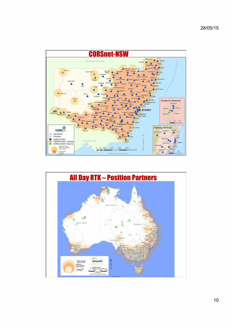
CORSnet-NSW
All Day RTK – Position Partners

28/05/15
11
SmartNetAUS - Leica
All give coordinates in GDA/MGA
…. ever noticed a difference between CORS derived coordinate
and SCIMS coordinate?

28/05/15
12
23"
Distor+ons"are"Systema+c"
• Site$transforma*ons$or$‘Localisa*ons’$are$currently$used$to$account$for$distor*ons$• Transforma+on"tools"must"be"developed"(e.g."NTv2"Grid)""
" "AND"these"must"es+mate"uncertainty"
(Joel$Haasdyk$and$Tony$Watson,$LPI$NSW,$APAS$Conference$2013)$
GDA94:$problems,$issues,$complica*ons$Modelling$known$distor*ons$e.g.$NSW$SCIMS$to$GDA94(2010)$
Ever used AUSPOS ?

28/05/15
13
AUSPOS V2.0 uses the Auscope network giving 20mm positions with one hour of
date. Coordinates given in ITRF, GDA and MGA.
http://www.ga.gov.au/earth-monitoring/geodesy/auspos-online-gps-processing-service.html
AUSPOS output

28/05/15
14
Ever used PPP ?
Precise point positioning

28/05/15
15
Post-Processed PPP – Canadian System
NRCAN’s online CSRS-PPP http://webapp.csrs.nrcan.gc.ca
Courtesy Thomas Grinter
Is this MGA94?
Ever used Trimble RTX ?
Hybrid differential/ PPP service

28/05/15
16
Trimble CentrePoint RTX
Combines NRTK and PPP (Precise Point Positioning). Released in 2012. Worldwide system:
– Sparse global CORS network: • All Trimble receivers:
– Same make. – Same model. – Same firmware. – Same antennas. – Same setup/install.
– Services delivered by: • Satellite communications (via OmniSTAR). • Mobile communications (worldwide).
<4 cm HZ (95% CI) positioning worldwide.
Example output from Trimble’s RTX
28/05/15
17
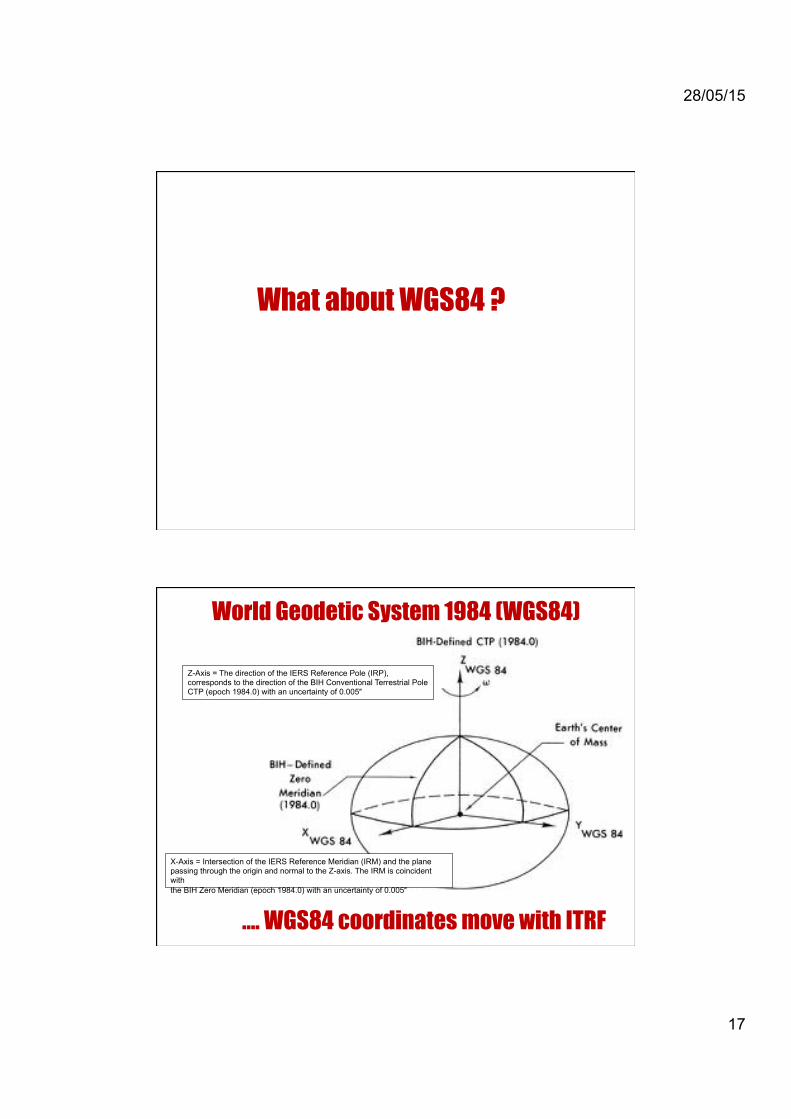
What about WGS84 ?
World Geodetic System 1984 (WGS84)
Z-Axis = The direction of the IERS Reference Pole (IRP), corresponds to the direction of the BIH Conventional Terrestrial Pole CTP (epoch 1984.0) with an uncertainty of 0.005″
X-Axis = Intersection of the IERS Reference Meridian (IRM) and the plane passing through the origin and normal to the Z-axis. The IRM is coincident with the BIH Zero Meridian (epoch 1984.0) with an uncertainty of 0.005″
…. WGS84 coordinates move with ITRF

28/05/15
18
ANS → Johnston → AGD66 → UTM → AMG66
ANS → Johnston → AGD66 → TM → ISG – (2° zones)
ANS → Johnston* → AGD84 → UTM → AMG84
GRS80 → AFN → GDA94 → UTM → MGA94
WGS84 → control → WGS84 → UTM → WGS84 (grid??)
GRS80 → IGS → ITRF2008 → UTM → ITRF (grid??)
Note: For most intents and purposes, ITRF2008 and WGS84 are considered identical.
Shapes, Datums and Grids Shape → connection → Datum → projection → Map Grid
Stat
ic
Next Generation Datum ! New mass market or niche positioning services may or may not offer
MGA coordinates ! Surveyors must know from which datum and epoch their solutions
derive → metadata. ! Dawson/Woods parameters cater for stable plate movements. They
do not account for intra-plate deformations.

28/05/15
19
Drivers for Datum modernisation current datum is not good enough
50"mm"
300"mm"
Distor+ons!""
Courtesy Joel Haasdyk
Drivers for Datum modernisation deformation demands datum maintenance
Meckering,"WA"
Oct"1968"
Canterbury","NZ"
2010/11"
Courtesy Joel Haasdyk
28/05/15
20
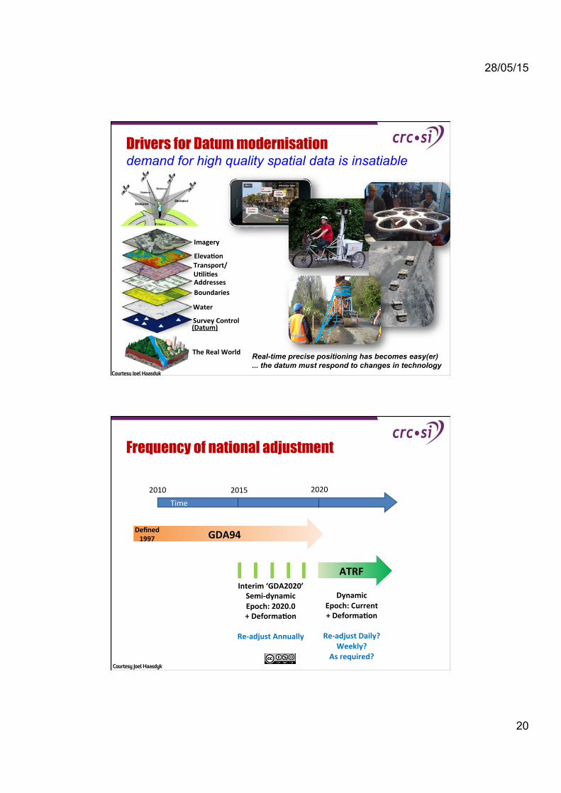
Imagery"
Eleva+on"Transport/"
U+li+es"Addresses"
Boundaries"
Water"
Survey"Control"
The"Real"World"
Drivers for Datum modernisation demand for high quality spatial data is insatiable
Real-time precise positioning has becomes easy(er) ... the datum must respond to changes in technology
(Datum)"
Courtesy Joel Haasdyk
Frequency of national adjustment
$$$$$Time$
GDA94"
2010$ 2015$ 2020$
Interim"‘GDA2020’"
SemiYdynamic"
Epoch:"2020.0"
+"Deforma+on"
"
ReYadjust"Annually"
"
Dynamic"
Epoch:"Current"
+"Deforma+on"
$ReYadjust"Daily?"
Weekly?"
As"required?"
Defined"
1997"
ATRF"
Courtesy Joel Haasdyk

28/05/15
21
New Software and Hardware
DynaNet"‘Phased$Adjustment’$
• No$limit$on$sta*ons$• No$limit$on$measurements$• Rigorous$Adjustment$$$$"$Coordinates$+$Uncertainty$
Na+onal"Compu+ng"
Infrastructure"(NCI)$$$$$$$$400,000$sta*ons$+$2,500,000$measurements$$$$$$$$$$$$$$$$$25$hours$to$adjust$
eGeodesy"• XML$based$on$GML$• Transfer$of$data$and$results$
"
$Courtesy Joel Haasdyk
The Finer Details: Options to Consider $$
1. Adopt a modern, homogenous, national adjustment
2. Update from ITRF92 to latest ITRF
3. Choice of Static / Semi-Dynamic / Dynamic Datum
4. Choice of Reference Epoch (Past, Present, or Future)
5. Choice of Deformation Model
6. Frequency of National Adjustment
�$
�$
Courtesy Joel Haasdyk
28/05/15
22
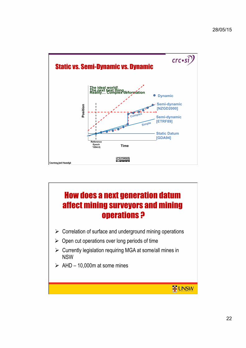
Static vs. Semi-Dynamic vs. Dynamic
18th Association of Public Authority Surveyors Conference 12Z14$March$2013,$Canberra,$ACT,$Australia$
Time
P
ositi
on
Reality… Complex deformation The ideal world! The next best thing…
Reference Epoch
‘1994.0)
Semi-dynamic [NZGD2000]
Dynamic
Semi-dynamic [ETRF89]
Static Datum [GDA94]
Simple
Complex
Courtesy Joel Haasdyk
How does a next generation datum affect mining surveyors and mining
operations ? ! Correlation of surface and underground mining operations ! Open cut operations over long periods of time ! Currently legislation requiring MGA at some/all mines in
NSW ! AHD – 10,000m at some mines