role of geo-spatial techniques for urban watershed
TRANSCRIPT

w w w. g e o k n o . c o m
Role of Geo-spatial techniques for
Urban Watershed Management with
focus on Restoration & Preservation of
Water bodies
Dr. B. Sakthivel
Head – Water Resources

Geokno The LiDAR Company
Spinoff from IIT Kanpur (2009)
Introduced LiDAR technology to Infrastructure
Industry
Awarded Best Startup 2011 by
ISBA
Only company in India to own high end equipment in
all the three platforms
Most experienced LiDAR company
in India
Providing end to end solution for Infrastructure
projects

Engineering Grade LiDAR Platforms
Geokno HeliMapper: Only company in India with Aerial LiDAR capability
Geokno Mobile Mapper: Only machine in India with 1 cm accuracy
Terrestrial LiDAR: 7 mm accuracy
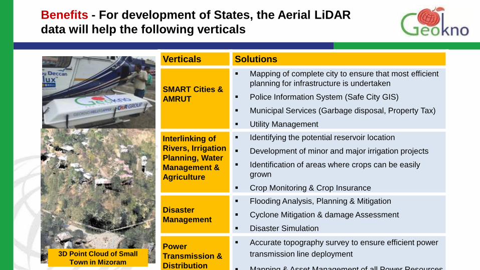
Verticals Solutions
SMART Cities &
AMRUT
Mapping of complete city to ensure that most efficient
planning for infrastructure is undertaken
Police Information System (Safe City GIS)
Municipal Services (Garbage disposal, Property Tax)
Utility Management
Interlinking of
Rivers, Irrigation
Planning, Water
Management &
Agriculture
Identifying the potential reservoir location
Development of minor and major irrigation projects
Identification of areas where crops can be easily
grown
Crop Monitoring & Crop Insurance
Disaster
Management
Flooding Analysis, Planning & Mitigation
Cyclone Mitigation & damage Assessment
Disaster Simulation
Power
Transmission &
Distribution
Accurate topography survey to ensure efficient power
transmission line deployment
Mapping & Asset Management of all Power Resources
Benefits - For development of States, the Aerial LiDAR
data will help the following verticals
3D Point Cloud of Small
Town in Mizoram

Verticals Solutions
Roads &
Railways
Get accurate Survey even under forest cover
Efficient route can help save upto 20% to 30% of project
cost (eg route length reduction in hilly terrain itself will
help in major savings)
Construction Management during construction phase
Asset Management and O&M after construction
Land Records
(NLRMP
Program)
Complete mapping of all land parcels (Digital - National
Land Records Modernization Program)
Digitization of existing land records and Geo-referencing
Super-imposition of LiDAR survey data and geo-
referenced land parcels to create up to date Land
records
Forest
Carbon Mapping of the state so as to ensure carbon
credits which can help fund infrastructure projects
Efficient mapping and management of forest areas
Benefits - For development of States, the Aerial LiDAR
data will help the following verticals

People and Water
Asia: 60% of world population, 36% of world’s water
INDIA: >17% of world population 4% of world’s water

Large cities 2005
Large cities 2015
The urban water challenge Growing - and thirsty - mega cities
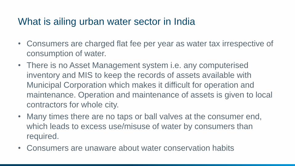
What is ailing urban water sector in India
• Consumers are charged flat fee per year as water tax irrespective of
consumption of water.
• There is no Asset Management system i.e. any computerised
inventory and MIS to keep the records of assets available with
Municipal Corporation which makes it difficult for operation and
maintenance. Operation and maintenance of assets is given to local
contractors for whole city.
• Many times there are no taps or ball valves at the consumer end,
which leads to excess use/misuse of water by consumers than
required.
• Consumers are unaware about water conservation habits
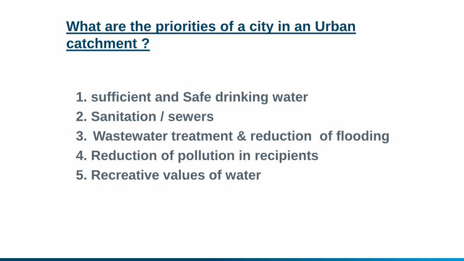
What are the priorities of a city in an Urban
catchment ?
1. sufficient and Safe drinking water
2. Sanitation / sewers
3. Wastewater treatment & reduction of flooding
4. Reduction of pollution in recipients
5. Recreative values of water

Drought
Water for
food Energy
Domestic
water Water
quality
Challenges
Institutional and
human capacity Flood
Ecology
Groundwater
Navigation
Climate change
Cyclones
Coastal
erosion

Climate impacts on sewer systems We just witnessed in Chennai more precipitation,
but in shorter and more heavy bursts!
Result: Flooding
Action: Intelligent modelling, forecast and control
Adapting to climate change And urban Flood Management

Ensemble based uncertainty estimation in Watershed Management

Seamless weather generation and prediction
Future History
Weather radar
nowcast
Short-range, limited
area NWP forecast
Medium-range,
NWP forecast
Seasonal, long-range
forecast (NWP, WG)
Multi-decadal forecast
(Climate model, WG)

GPM satellites – a new and promising data source
• Rainfall in 0.1 degree grid
• Every 30 minutes
• Available after 6 hours
• Replaces TRMM

Integrated
urban water
plan
Other
facilities
Urban
developme
nt master
plan
City plans
City management
Public
Legislation
Institutional
framework
Basin Management
FRAMEWORK FOR INTEGRATED URBAN WATER MANAGEMENT AND LAND USE PLANNING

Planning
Scenario
Analysis
Economics
Presentation
Reporting
WEB - Mobile
Modeling
Optimization
Forecasting
Automation
Real Time Operations
Data and Information
Real Time
GIS
Smart Urban Water Management

Smart Urban watershed Management
Integrated Control and Operations - collection, treatment, discharge systems
resilient systems for the future
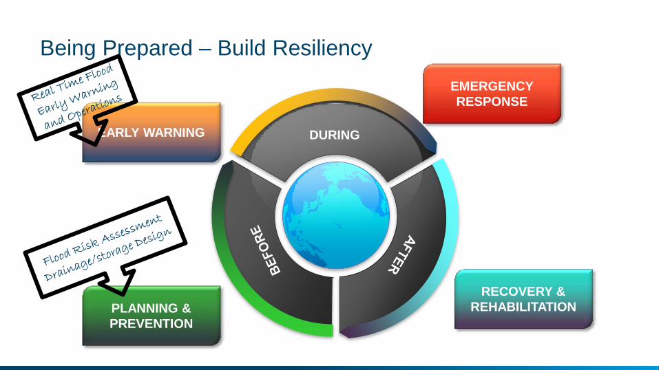
Being Prepared – Build Resiliency
DURING
PLANNING &
PREVENTION
EMERGENCY
RESPONSE
RECOVERY &
REHABILITATION
EARLY WARNING

Urban catchment management through water bodies restoration
• Change in drainage pattern
• Over exploitation of groundwater
• Pollution
• Encroachment of water spread
and hydraulic structures
• Change of land use
• Solid waste dumping
• Ecological and biodiversity
problems

Smart City Planning for Water(shed)Management
Water Management should be at the heart of all Smart city planning
Present planning is limited to treatment of waste water, quality monitoring and
smart metering.
No clear plans on how the proposed smart cities are linked with their urban water
catchments to ensure sustainable provision of water
Lakes, ponds and wetlands in urban areas are being reclaimed for building and
development instead of water sources of GW recharge
Better recycle and reuse methods using geospatial technologies shall be needed.
Immediate priority to ensure better watershed management both in the basin that
supplies water to urban areas and in urban areas

Intelligent watershed management in cities
• Strategies for “Handling more water at less costs”
• Seeing storm water as a resource and not as a problem.
• Using the urban landscape
for storing water
• Development of Green
Roof technologies
• Other rainwater harvesting
methods
• Treatment of rainwater for
secondary use

Waste water management-Shouldn’t we move from Sewer
Centric Approach to River Centric Approach for domestic
sewage? • Treat water in the bed of Nalas itself before discharge into water bodies
instead of transporting to a large sewage treatment plant
• Faster construction
• Stink free stretches
• Various options:
− Submerged Aerobic Fixed Film Reactor (SAF)
− Moving Bed Bio-form Reactor (MBBR)
− Conventional Activated Sludge (CAS)
− Filter Media
− Membrane Bioreactor (MBR)
− There is a Strong case to start building packaged STPs in Nalas rather
than conventional large STPs in Indian cities.

Technology Landscape: Packaged STPs Example
24
• Submerged Air
Systems are
generically low
cost.
• Very few moving
parts translate
into low
maintenance.
• No monitoring,
or chemical
dosing translate
into very low
opex.

© Waterneer, 2015. All Rights Reserved - Confidential
Restaurant over SAF based STP in Thailand

What can be done:
• Remove all or part of the subsidies on water in a phased manner
• Increase the awareness of the value of water
• Increase the understanding that safe water is an economic good for
the people
• We are used to pay for everything else!!

Intelligent utilisation of the urban areas !
With the aid of technology you can:
• Preserve water, when it is there!
• Avoid loss of water in piping systems
• Consider recharging the groundwater resources!
• Handle floodings intelligently
• Prepare the urban areas to handle floods
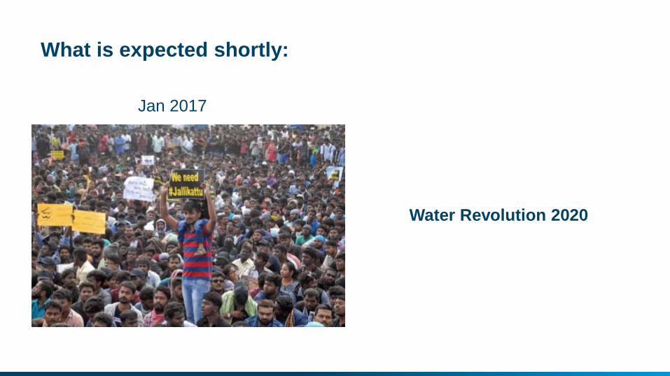
What is expected shortly:
Jan 2017
Water Revolution 2020