regional evaluation workflow
TRANSCRIPT
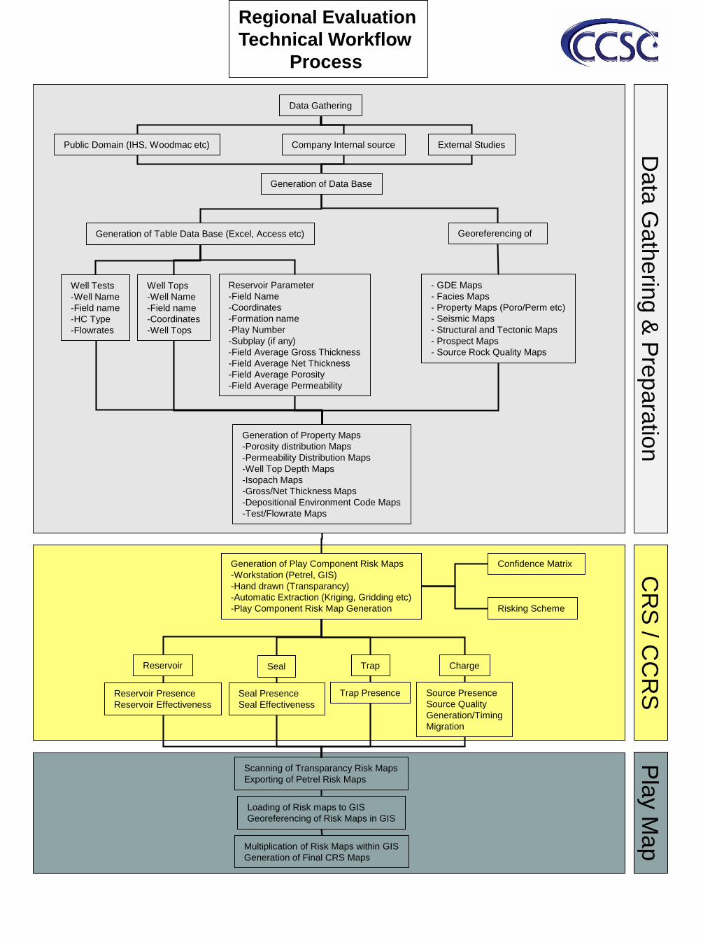
Regional Evaluation
Technical Workflow
Process
Generation of Play Component Risk Maps
-Workstation (Petrel, GIS)
-Hand drawn (Transparancy)
-Automatic Extraction (Kriging, Gridding etc)
-Play Component Risk Map Generation
Reservoir Seal
Reservoir Presence
Reservoir Effectiveness
Seal Presence
Seal Effectiveness
Scanning of Transparancy Risk Maps
Exporting of Petrel Risk Maps
Loading of Risk maps to GIS
Georeferencing of Risk Maps in GIS
Multiplication of Risk Maps within GIS
Generation of Final CRS Maps
Trap Charge
Trap Presence Source Presence
Source Quality
Generation/Timing
Migration
Confidence Matrix
Risking Scheme
CR
S / C
CR
SP
lay M
ap
Data Gathering
Public Domain (IHS, Woodmac etc) Company Internal source External Studies
Generation of Table Data Base (Excel, Access etc)
Well Tops
-Well Name
-Field name
-Coordinates
-Well Tops
Reservoir Parameter
-Field Name
-Coordinates
-Formation name
-Play Number
-Subplay (if any)
-Field Average Gross Thickness
-Field Average Net Thickness
-Field Average Porosity
-Field Average Permeability
Well Tests
-Well Name
-Field name
-HC Type
-Flowrates
Georeferencing of
Generation of Data Base
Generation of Property Maps
-Porosity distribution Maps
-Permeability Distribution Maps
-Well Top Depth Maps
-Isopach Maps
-Gross/Net Thickness Maps
-Depositional Environment Code Maps
-Test/Flowrate Maps
- GDE Maps
- Facies Maps
- Property Maps (Poro/Perm etc)
- Seismic Maps
- Structural and Tectonic Maps
- Prospect Maps
- Source Rock Quality Maps
Data
Ga
the
ring &
Pre
para
tion