queen elizabeth ii business park
DESCRIPTION
A description of the Queen Elizabeth II Business Park ASPTRANSCRIPT
QEII Business Park Local Area Structure Plan
Submitted on behalf of
and
September 2012

LEDUC County i September 2012 QEII Business Park LASP Lovatt Planning Consultants
QEII BUSINESS PARK LOCAL AREA STRUCTURE PLAN
Table of Contents
1. INTRODUCTION .............................................................................................................. 1
1.1 Purpose ........................................................................................................................ 1 1.2 Location and Legal Description .................................................................................... 1 1.3 Policy Context .............................................................................................................. 1
2. THE DEVELOPMENT AREA ............................................................................................... 3
2.1 Topography and Vegetation ........................................................................................ 3 2.2 Geotechnical Conditions .............................................................................................. 3 2.3 Wetland Assessment ................................................................................................... 3 2.4 Phase 1 Environmental Site Assessments .................................................................... 3 2.5 Existing Land Use ......................................................................................................... 4 2.6 Surrounding Land Use .................................................................................................. 4 2.7 Municipal Reserve ........................................................................................................ 4 2.8 Nisku Spine Road ......................................................................................................... 4 2.9 Freeway Corridor ......................................................................................................... 4 2.10 Historical Resources ..................................................................................................... 5
3. LAND USE CONCEPT ........................................................................................................ 6
3.1 Introduction ................................................................................................................. 6 3.2 Proposed Development Concept ................................................................................. 6
4. TRANSPORTATION .......................................................................................................... 8
4.1 Queen Elizabeth II Highway (Gateway Boulevard/ Calgary Trail) ................................ 8 4.2 Existing Business Access .............................................................................................. 8 4.3 Nisku Spine Road ......................................................................................................... 8 4.4 Local Subdivision Road Network .................................................................................. 8 4.5 Transportation Impact Analysis ................................................................................... 9
5. UTILITY SERVICES .......................................................................................................... 10
5.1 Water ......................................................................................................................... 10 5.2 Sanitary Sewer Service ............................................................................................... 10 5.3 Storm Water Management Facilities (SWMF) ........................................................... 10 5.4 Shallow Utilities ......................................................................................................... 10
6. IMPLEMENTATION AND STAGING ................................................................................. 11
Appendix A: Historical Resources Assessment

LEDUC County ii September 2012 QEII Business Park LASP Lovatt Planning Consultants
QEII Business Park LOCAL AREA STRUCTURE PLAN
List of Figures
After Page
Figure 1: Location ................................................................................................................ 1
Figure 2: Leduc North Major Area Structure Plan ................................................................. 2
Figure 3 Natural Features.................................................................................................... 3
Figure 4: Development Concept ........................................................................................... 6
Figure 5: Transportation ...................................................................................................... 8
Figure 6: Water Distribution .............................................................................................. 10
Figure 7: Sanitary Sewage System ...................................................................................... 10
Figure 8: Storm Water Management .................................................................................. 10
Figure 9: Potential Staging ................................................................................................. 11
LEDUC County 1 September 2012 QEII Business Park LASP Lovatt Planning Consultants
1. INTRODUCTION
1.1 Purpose
The purpose of this Local Area Structure Plan (LASP) is to provide a framework to guide the future subdivision and development of a site located within the boundaries of the Leduc County North Major Area Structure Plan. The Leduc County Major North Area Structure Plan (ASP) is a broad policy based document that requires the preparation of more detailed plans to consider land use, patterns of development, location of roads and municipal servicing at the local level.
The LASP is referred to as the QE II Business Park and has been prepared on behalf of Hopewell Developments (Leduc) Inc. Hopewell is the sole owner of the Plan Area which comprises some 96.2 hectares (237.6 acres). The Plan area location is shown on Figure 1.
Because the LASP is a statutory plan and not a plan of subdivision, all boundaries and parcel sizes shown on the maps contained herein need to be verified at the time of subdivision. It is assumed that minor deviations to the Future Land Use Concept will be permitted. Any major deviations to this LASP will require an amendment.
1.2 Location and Legal Description
The QEII LASP area is located in Leduc County directly east of the QEII Highway and CP Rail corridor, and 1.5 miles north of Highway 625 (see Figure 1). The Plan area is bounded to the north, south and west by existing industrial development, and to the east by cultivated agricultural lands.
The Plan area includes an undeveloped industrial subdivision comprising five lots extends along the east side of 8th Street that parallels the rail line and provides access to the LASP site. This subdivision is legally described as Plan 012 6297 and contains 12.46 hectares (30.79 acres). The remaining 83.7 hectare (206.8 acress) of the Plan area is legally described as Lot 3, Block 3, Plan 072 1326 and includes the NW ¼ of 5‐51‐24 W4M and the west ½ of the NE ¼ of 5‐51‐24 W4M. As is noted above, the combined area of the two Plans is 96.2 hectares.
1.3 Policy Context
The LASP complies with the County’s statutory plans. It also complies with the principles and policies of the Capital Region Growth Plan.
1.3.1 Capital Region Growth Plan
Compliance with the Capital Region Growth Plan (CRGP) is a provincially mandated requirement through the Municipal Government Act. A fundamental principle of the Capital Region Plan is the requirement to intensify development in order to minimize the development footprint and utilize existing and future infrastructure as efficiently as possible.
The Plan area is contained within Priority Growth Area “Ce” of the CRGP. The intent of the Capital Region Growth Plan (CRGP) is that growth be directed to Priority Growth Areas and that land use and infrastructure investment decisions be integrated. Specifically, the CRGP requires that new development:
• Promote an integrated and strategic approach to planning for future growth;
• Make key infrastructure investments that best compliment existing infrastructure, services and land uses in the Capital Region; and,
• Co‐ordinate decisions to sustain economic growth.


LEDUC County 2 September 2012 QEII Business Park LASP Lovatt Planning Consultants
This LASP recognizes the requirements of the CRGP by promoting a strategic approach to planning, investing in key infrastructure that compliments existing infrastructure, and by encouraging economic growth. In particular, the LASP recognizes the right‐of‐way requirements for Nisku Spine Road which is shown on the Regional Transportation Infrastructure Map of the December Addendum to the CRGP. The future Spine Road extends along the east boundary of the Plan area.
1.3.2 Municipal Development Plan (1999)
The Municipal Development Plan (MDP) adopted in 1999 describes planning objectives and policies for a range of land uses including business industrial. Map 3 of the MDP ‐ Future Land Use Policy has been amended to include the Leduc North Major ASP Land Use Strategy as a policy overlay. This LASP complies with the MDP policies and land uses.
1.3.3 Leduc County North Major Area Structure Plan
As is noted in Section 1.1, the QE II Plan area is included in the Leduc County North Major ASP (NMASP) which was adopted by Leduc County in October of 2004 (see Figure 2). The NMASP provides a long‐range land use strategy for an extensive area and establishes goals and policies to guide land use change within the Leduc North area. It requires that more detailed LASPs be prepared in advance of development. This LASP meets that requirement and the uses proposed generally comply with the combination of Business Park and Business Industrial land uses designated for the Plan area by the NMASP.
It is important to note however that the NMASP shows the alignment for the future Nisku Spine Road as bisecting the most easterly potion of the QE II Plan area. The lands to the west of the future Spine Road are designated Business Industrial Area by the NMASP whereas the lands to the east are designated Business Park Area. The recently adopted Functional Plan for the Spine Road confirms that the road will extend along the east boundary of the QE II Plan area rather than bisecting it. This means all of the QE II Plan area should be designated Business Industrial Area to maintain a logical planning unit.
1.3.4 Leduc County Land Use Bylaw 7‐08
Existing zoning is shown on Figure 1. The westerly two thirds of the Plan area including the existing five lot subdivision are zoned Industrial (IND) by Leduc County’s Land Use Bylaw (7‐08 March 2008). The easterly 32 hectare portion of the Plan area is zoned Agricultural (AG). This LASP will provide the statutory planning basis for rezoning the 32 hectares from AG to IND.
1.3.5 Edmonton International Airport Vicinity Protection Area Regulations (AVPA)
The Edmonton International Airport Vicinity Protection Area Regulation (AR 63/81) regulates development on lands in the vicinity of the airport. The AVPA regulation allows for a variety of industrial and commercial activities. The NMASP states that the land use strategy proposed is consistent with the proposed AVPA Regulations. This means that the LASP also will be consistent with AVPA Regulation.
1.3.6 Highway 2 Corridor Design Guidelines
The Highway 2 Corridor Design Guidelines were approved in 1995 and apply to lands located adjacent to or that are visible from the QE II Highway. The Design Guidelines are non‐binding but provide design recommendations to improve the aesthetics of new development along the Corridor.


LEDUC County 3 September 2012 QEII Business Park LASP Lovatt Planning Consultants
2. THE DEVELOPMENT AREA
2.1 Topography and Vegetation
The Plan area contains no significant physical features (see Figure 3). The land slopes from east to west into the Blackmud Creek drainage channel that parallels CP Rail and the QE II Highway to the west. The creek then trends to the northwest under both CP and the Highway. Although some scattered shrubs are evident in the westerly two thirds of the Plan area, it is mostly cultivated.
2.2 Geotechnical Conditions
Soil and near surface groundwater conditions were investigated by CT & Associates Engineering Inc. in 2007. CT Engineering has provided a current 2012 addendum to the 2007 investigation to recognize elapsed time. The addendum concludes that site conditions have not changed.
Generally the site is covered with 0.1 to 0.3 metres of topsoil, underlain with clay/clay till. Multiple locations show the clay/clay till being underlain by bentonite and bedrock. At completion of drilling, no groundwater or sloughing was encountered at most of the borehole locations.
Generally the site is considered feasible for commercial/industrial development, though based on the shallow high plastic bedrock soils and bentonite, special considerations in design and construction will be necessary. The full geotechnical report and the addendum letter are provided under separate cover.
2.3 Wetland Assessment
A Wetlands Assessment was completed by Stantec Consulting Ltd. in 2009. Although there are several wetlands within the subject property, Public Lands will not be claiming any of the wetlands (per meetings held in May 2009). Because of the proximity of the parcel to the International Airport, and the resultant restrictions on storm water management facilities from the Airport Vicinity Protection Area, limited opportunity exists to develop on‐site compensation for wetlands disturbed by development. Compensation is required for the disturbance of any existing wetland in order to comply with Alberta Environment’s no net loss policy. Due to the limited opportunity for on‐site compensation, the Stantec report proposes that any compensation required under the Water Act be completed through financial payment, perhaps financing a wetland project off‐site. The total wetland area of the Plan area that would require compensation if disturbed is 2.193 hectares. Compensation is required at a minimum ratio of 3:1. The Wetland Assessment is provided under separate cover.
2.4 Phase 1 Environmental Site Assessments
Two Phase 1 Environmental Sites Assessments were undertaken in 2006 for the Plan area: one for the westerly two thirds of the Plan area by CT & Associates Engineering; and, a second by Stantec Consulting for the easterly one third. The Site Assessments are provided under separate cover. The CT & Associates Assessment concludes that no environmental concerns related to historic or current activities exist. However, the Assessment also determined that a small four by six metre area of unknown fill material that appears to be related to a former roadway should be further investigated although it appears unlikely that any environmental risk exists. The type of fill will be determined at the time of site grading and if warranted will be further investigated. The Stantec Assessment determined that no potential environmental concerns exist. Given that the existing five lot subdivision was registered in 2001, it is assumed that this subdivision is also unencumbered by any environmental concerns.


LEDUC County 4 September 2012 QEII Business Park LASP Lovatt Planning Consultants
2.5 Existing Land Use
Other than an Atco gas pipeline that runs adjacent to the north boundary of the NW‐5‐51‐24‐4, no developments exist within the Plan area.
2.6 Surrounding Land Use
The Plan area is surrounded by a combination of industrial and agricultural development.
To the south, a lay down yard with ancillary structures exist adjacent to 8th Street with cultivated farmland further to the east of the lay down yard. A future freeway is being proposed by Alberta Transportation that will require a 150 metres wide right‐of‐way extending along the entire south side of the Plan area.
To the west, a row of developed industrial lots front onto the west side of 8th Street.
To the north, a vacant parcel exists that is owned by Finning. It may be used in future by Finning to operate its caterpillar parts and services business. The 2008 WAM LASP applies to these and other lands to the north and northeast. The road linkages established by the WAM LASP are recognized by this LASP. Again however, the alignment shown for the Nisku Spine Road by the WAM LASP is not consistent with the current alignment.
To the east, the land is mostly cultivated farmland but is slated for future business park and estate residential development by the LNMASP.
2.7 Municipal Reserve
Municipal Reserve owing will be by Deferred Reserve Caveat (DRC). DRC #012414693 for 6.39 hectares is registered on title for the NW ¼ of 5‐51‐24‐4 which is part of Lot 3 Block 3 Plan 0721326. This caveat includes Municipal Reserve owing for the five lot subdivision registered as Plan 0126297. At the time of subdivision of Stage 1, the existing DRC will be discharged and a new DRC for 8.37 hectares Municipal Reserve owing will be registered on the title of the remnant parcel (remainder of Lot 3 Block 3 Plan 0721326).
2.8 Nisku Spine Road
As is noted in Section 1, the Functional Plan for Nisku Spine Road has confirmed the alignment and right‐of‐way requirements for this regional arterial that extends along the east boundary of the QE II Business Park Plan area. The Spine Road will be an extension of 91st Street in Edmonton and will initially be constructed from 41st Avenue which defines the boundary between Edmonton and Leduc County, to 25th Avenue in Nisku Business Park. The Integrated Regional Transportation Master Plan that has been adopted by the Capital Region Board shows that, in the long term, Nisku Spine Road will extend around the east side of the City of Leduc to link with Highway 2A which in turn links to the QE II Highway. The landowner will allow Leduc County to secure the Nisku Spine Road right‐of‐way through a combination of purchase and dedication at the time of subdivision. Any lands separated by the Spine Road from the balance of the Plan area will be purchased by the County.
2.9 Freeway Corridor
Alberta Transportation has identified the need for a freeway to be constructed in some 40 to 50 years to serve the Capital Region. A potential freeway corridor has been proposed that impacts the southerly 150 metres of the Plan area. An interchange may be constructed at the southeast corner of the Plan area where the freeway will intersect with the Nisku Spine Road. The County will provide for any right of way requirements for this interchange. No direct access from the Plan area will be permitted to the freeway.

LEDUC County 5 September 2012 QEII Business Park LASP Lovatt Planning Consultants
Access to the development will be from Nisku Spine Road, at an intersection that will be located approximately 800 metre north of the freeway/Spine Road interchange.
2.10 Historical Resources
An Historical Resources Assessment was undertaken by The Archaeological Group in February 2012. The Overview concluded that due to the poorly drained nature of the western two thirds of the Plan area and the intensive previous agricultural disturbance in the eastern one third, the potential for the discovery of intact, previously unrecorded heritage resources is low, and no further Historical Resources Assessment work is recommended. A Historical Resources Act clearance has been granted by Alberta Culture. Both the Assessment and the Clearance from Alberta Culture are contained in Appendix A.

LEDUC County 6 September 2012 QEII Business Park LASP Lovatt Planning Consultants
3. LAND USE CONCEPT
3.1 Introduction
The Development Concept proposed for the Plan area is illustrated by Figure 4. The development of the QE II Business Park will enhance the strong industrial base already existing in Leduc County. The proximity of the Business Park to major transportation facilities such as the Queen Elizabeth II Highway (Gateway Boulevard/ Calgary Trail) Corridor, Anthony Henday Drive, Highway 19/625, the Edmonton International Airport and the CP Rail line makes the Plan area a very attractive location for industrial businesses.
Industrial uses are proposed to comply with the County’s Industrial District as defined by the Land Use Bylaw. The purpose of this District is to accommodate a range of compatible industrial and commercial uses, the location of which is typically guided by an Area Structure Plan or Area Redevelopment Plan. Such uses should have a low to moderate impact on adjacent land uses. It is proposed that the easterly 32 hectare portion of the Plan area that is currently zoned Agricultural be rezoned to Industrial.
3.2 Proposed Development Concept
The development concept focuses on efficiency by minimizing road length while maximizing the number of industrial lots. Twenty two (22) new industrial lots are proposed ranging in size from 1.35 hectares to 5.69 hectares. Parcel sizes may vary at the time of subdivision. The smaller lots provide opportunities for consolidation thereby maximizing flexibility to meet variations in market demand.
A Storm Water Management Facility is proposed to be contained within a 4.71 hectare future Public Utility Lot located in the northwest corner of the plan area to take advantage of the natural topography. The exact design and configuration of this facility will be determined at the time of detailed design and subdivision
To accommodate the future freeway, Alberta Transportation requires that a single parcel be created to allow for the proposed 150 metre wide right‐of‐way within the Plan area. As such, Lot 1 Block 2 Plan 0126297 will be subdivided to create a 150 metre wide remnant parcel that will be consolidated with the remnant of Lot 3 Block 3 Plan 0721326 to create a single parcel. Given the 40 to 50 year time frame for the potential construction of the freeway, an industrial use that complies with the Land Use Bylaw can exist until such time as the right‐of‐way is required. It will then be purchased by Alberta Transportation. Development permit applications will be referred to Alberta Transportation as required by the County and provincial legislation. Development permit applications will need to consider the Highway 2 Corridor Design Guidelines. A caveat on title will be registered by Alberta Transportation at the time of subdivision.
Primary access into the QEII Business Park will be off the future Nisku Spine Road. An east/west internal subdivision road is proposed to connect the Spine Road to 8th Street providing for a second access into the Plan area. Connectivity to the north is proposed to parallel the Spine Road. Two cul de sacs extend from the east/west subdivision road to the south. Access to the consolidated remnant parcel is available off 8th Street.
Internal subdivision roads are proposed to be 34 metres wide. As such, a relaxation of the 6.0 metre front yard setback as per the Industrial District may be considered. Transportation is discussed in greater detail in Section 4.


LEDUC County 7 September 2012 QEII Business Park LASP Lovatt Planning Consultants
Employment at full build out is projected to be 1,673 based on 26 jobs/net hectare as per the 2011 Industrial Land Strategy prepared for the City of Edmonton. The 26 jobs/net hectare applies to the types of general industrial uses proposed for the QE II Business Park.
Table 1 provides Development Statistics for the Plan area. _____________________________________________________________________________________
Table 1 ‐ Development Statistics
Area (ha)Gross Area 96.2
Nisku Spine Road 4.8Fragment East of Spine Road 2.8
Municipal Reserve Owing (DRC) 8.4Developable Area 88.6
Stormwater Management Facilities 4.7Local Roads 6.9
Industrial Lots 60.6Remnant 16.4
Note: A 2.8 hectare fragment separated by Nisku Spine Road from the balance of the Plan area is assumed to be purchased by the County as part of the right‐of‐way for the Nisku Spine Road since this fragment is sterilized for industrial development as part of the QE II Business Park.
_____________________________________________________________________________________

LEDUC County 8 September 2012 QEII Business Park LASP Lovatt Planning Consultants
4. TRANSPORTATION
4.1 Queen Elizabeth II Highway (Gateway Boulevard/ Calgary Trail)
Although the QE II Highway (Gateway Boulevard/ Calgary Trail) does not directly border the Plan area, all highly visible developments in this area adjacent to the QE II are governed by the Highway 2 Corridor Landscape Design Guidelines to ensure high quality appearance. No direct access to the QE II from the Plan area exists now or in the future.
4.2 Existing Business Access
Existing businesses located between QE II and the Plan area are currently accessed by means of 8th Street, which parallels QE II northbound and turns eastward at 41 Avenue SW. 41 Avenue SW exits onto 101 Street SW/Range Road 244 and will intersect with the future Nisku Spine Road. The proposed internal roadway system for the Plan area assumes the extension of 34th Avenue to provide one direct link between 8th Street to Nisku Spine Road. The introduction of this link will increase accessibility and shorten commutes.
The enhanced accessibility provided will increase safety by expanding egress options in case of emergencies. As well, a future interchange at 41 Avenue and QE II Highway will eventually eliminate the existing north access from 8th Street/41 Avenue rendering the Spine Road connector essential.
4.3 Nisku Spine Road
The current primary access to the LASP area is from the north via the 41st Avenue arterial that turns into southbound 8th Street. Access from the south can be obtained by following Township Road 510 west to 8th Street, then northbound. The approved proposed Nisku Spine Road alignment runs north‐south on the east edge of the Plan area. Direct access to parcels from the Spine Road will not be permitted. Ultimately, a signalized all‐directional access will be provided from the LASP area to/from the Nisku Spine Road.
The April 2008 Off‐site Levy Bylaw (and any amendments thereto) requires that participating land owners proportionately pay their share to Leduc County for the construction of Nisku Spine Road. The proposed Nisku Spine Road is a six lane facility to be constructed in a 60 metre wide right‐of‐way. Developers will be required to complete ultimate grading but are only required to construct the first two lanes. The final construction will be initiated as traffic counts dictate and will be funded with contributions from the Off‐site Levy Bylaw and built as per designs approved by Leduc County.
4.4 Local Subdivision Road Network
The proposed internal local road network is based on a rural cross section with ditches. The local network will provide direct access to all internal industrial parcels. As is noted in Section 3, direct access from the Nisku Spine Road will not be allowed. All internal road right‐of‐ways will be 34 metres wide. Figure 5 shows the proposed road network. The east‐west connector roadway (34th Avenue) will run from 8th Street to the future Nisku Spine Road. Access to development in the Plan area will be via the 34th Avenue connection to 8th Street until such time that construction of the Spine Road is completed.
The parcels to the north will be accessible directly from the collector road. Two cul‐de‐sacs to the south will provide access to the remaining parcels. The remnant parcel of the south 150m of the development will have access from 8th Street. The collector connection to the Spine Road in the north‐east corner of the LASP will provide the opportunity for roadway extension to development north of the LASP boundary in the future.

LEDUC County 9 September 2012 QEII Business Park LASP Lovatt Planning Consultants
4.5 Transportation Impact Analysis
A Transportation Impact Analysis (TIA) was undertaken by Bunt & Associates to determine the impacts of the proposed development traffic on the existing roadway network, and identify connections with future roadway systems. The TIA considered the closure of 8th Street at 41 Avenue in the study horizon.
The study concludes that the initial intersection of the collector road intersection (37 Avenue) with the Nisku Spine Road will not be signalized. However, within the study horizon, (2022) it is expected that signalization will be required. Additionally, it is anticipated that by 2022 the Nisku Spine Road will be four lanes with dedicated right and left turn lanes, and 37 Avenue will have dedicated left turn lanes. To accommodate this, the initial construction of 37 Avenue will create adequate pavement width for creation of the left turn lanes in the future without requiring roadway widening.
The collector road connection (34 Avenue) with 8th Street is expected to operate well as a stop controlled condition without requirement for dedicated turn lanes.
LEDUC County 10 September 2012 QEII Business Park LASP Lovatt Planning Consultants
5. UTILITY SERVICES
5.1 Water
Water service will be extended from the west and carried through the site to provide servicing for the subdivision. The new water line will tie‐in to the existing regional water line parallel to 8th Street. A connection with the future watermain on the Spine Road is proposed. This will provide long term looping for the water system and allow for possible future extension to the north and east. Water mains will follow the internal roadways of the Plan area and are shown on Figure 6.
Lot purchasers will be responsible for their own water service connections to the mains provided within the LASP boundary.
5.2 Sanitary Sewer Service
Sanitary servicing will be brought into the development from the existing 375mm sewer main that runs parallel to 8th Street on the east side of the roadway (see Figure 7). This sanitary sewer main connects to the South East Regional Trunk line (SERT) near the north boundary of the LASP.
The new sanitary sewer will be located within the proposed road right‐of‐way paralleling the internal road network. The sanitary system will be designed to handle expected flows for commercial / business development of lots proposed within the 83.6 hectare Plan area. The opportunity to oversize the sanitary service to facilitate extension to further development in the north or east exists. However implementation will depend on consultation with the County.
5.3 Storm Water Management Facilities (SWMF)
Onsite overland drainage patterns are generally from the east to the west (see Figure 8). The proposed site grading will shift the overland drainage to flow southeast to the northwest. A 4.71 hectare SWMF is proposed in the northwest corner of the site. Overland flows will be directed to the SWMF through the roadway ditch system. From the SWMF, an underground storm pipe will discharge water into the 8th Street ditch system where it flows through a system of culverts to the west into the Blackmud Creek. Discharge from the facility will be limited to a flow rate of 4.0l/s/ha.
The Storm Water Management Facility will be designed as a dry pond with a shallow vegetated swale along the bottom to provide necessary water quality treatment. Open water within the facility will be restricted to adhere with the requirements of the Airport Vicinity Protection Area Regulations. The wetland vegetation and naturalization of the facility will consider passive bird hazard mitigation measures to ensure that birds do not use the site, especially large flocking waterfowl such as gulls and geese. The facility will be designed to comply with Alberta Environment’s regulations for water quality and treatment.
5.4 Shallow Utilities
Shallow utilities including street lighting, natural gas, power, and communication lines are available for extension into the Plan area from adjacent developments. Gas, power, telephone and cable TV lines will be located in the road right‐of‐way or through easements on private land. Services will be available to all parcels. Connections to lots will be the responsibility of landowners and individual developers.


LEDUC County 11 September 2012 QEII Business Park LASP Lovatt Planning Consultants
6. IMPLEMENTATION AND STAGING
The Land Use Bylaw will be amended for the easterly 32 hectares of the Plan area such that the existing Agricultural District is rezoned to Industrial District.
Development of the Plan area is potentially proposed to be completed in six stages, beginning at the west limits of the site then moving to the east. The first stage of construction will involve the SWMF and the extension of 34 Avenue east into the Plan area. Sufficient temporary access will be provided during all phases of construction.
The consolidated remnant required for the Freeway Corridor will be created at the time of the second stage of subdivision. Access to the remnant exists off 8th Street.
It is important to note that the staging being proposed is conceptual. Construction will proceed in an orderly fashion dependent upon market conditions and development constraints. Detailed subdivision applications will be submitted to Leduc County for review and approval by the Subdivision Authority.


Appendix A
Historical Resources Overview

Appendix A
Historical Resources Overview

Statement of Justification for Historical Resources ActRequirements for projects other than small-scale oil and gas
This document contains sensitive information about Historic Resources that are protected underprovisions of the Alberta Historical Resources Act. This information is to be used to assist inplanning the proposed project only. It is not to be disseminated, and no copies of this documentare to be made without written permission of Historic Resources Management Branch, AlbertaCulture and Community Spirit.
Project Name or Project Identifier
Nisku QEII Business Park in LSD’s 10-15 Section 5-51-24-W4M
Disposition Type & NumberName: Walt KowalCorporate name of consulting company: The Archaeology GroupAddress: 2526 Bell Court S.W. Edmonton, Alberta T6W 1J8Phone number: (780) 438-4262Fax number: (780) 439-4285E-mail address: [email protected]
Name of proponent contact: Seldon Dean, Senior Project ManagerCorporate name of proponent: Hopewell Development CorporationAddress: 6th Floor, 1122 – 4th Street SWCalgary, AlbertaT2R 1M1Tel. (403) 298-8107Fax (403) 234-9340E-mail address: [email protected] of agent: Dana LeitheadCorporate name of agent: AL-TERRA Engineering Ltd.Address: 4010 – 76 AvenueEdmonton, AlbertaT6B 2P1Tel. (780) 577-4309Cell (780) 913-8252Fax (780) 440-2585E-mail: [email protected]
Lands Affected 96 ha
Legal Description Identifier HRVLSD’s 10 to 15 Section 5-51-24-W4M N/A N/A
Activity type and Anticipated Ground Disturbance
The proposed project will entail the creation of a business park on previously undevelopedland and the expected building foundation excavations, infrastructure excavations, drainageoperations, and road work could result in the total disturbance of the area upper layers ofsediment in the project area wherein any cultural materials would be expected to be found.

Existing Disturbance
Existing disturbance is present in LSD’s 11 to 14 due to forest clearing that occurred between2003 and 2006, and the presence of an old road bed that runs north/south through the westend of the development area in LSD’s 12 and 13, the creation of a dugout in the northernmargin of LSD 13. LSD’s 10 and 15 have been under cultivation for at least 50 years and adugout was excavated in LSD 10.
Landscape and Environmental Information
The proposed project is located within the Central Parkland Ecoregion. Geology is coarse-grained Glacio-Lacustrine sediment. The terrain in the study area is generally flat andfeatureless and the western 1/3 is poorly-drained with a number of small active andephemeral wetlands present. LSD’s 11 to 14 were not previously cultivated which suggeststhat this area was considered unsuitable even for agriculture.
Archaeological Sites in Vicinity = FhPi-9, FhPj-6, FiPi-15, FiPj-11, and FiPj-88 (see Figure 3).
Archaeological Sites Impacted = NoneHistoric Structures in Vicinity = NoneHistoric Structures Impacted = NoneRegistered Historic Structures in Vicinity = NoneRegistered Historic Structures Impacted = None
Previous Permits in Project Vicinity = 77-012, 77-043, 77-054, 82-003, and 06-621
Previous Permits in Impact Area = None
Illustrative Materials
Figure 1. Map showing the location of the proposed Nisku QEII Business Park in LSD’s 10-15 Section5-51-24-W4M (after 1:50,000 NTS Maps 83 H/5 – Leduc and H/6 – Cooking Lake).
Figure 2. 2006 air photo of the proposed Nisku QEII Business Park project area.
Figure 3. Map showing the location of previously recorded Historical Resources sites in the vicinity ofthe proposed Nisku QEII Business Park project (after 1:50,000 NTS Maps 83 H/5 – Leducand H/6 – Cooking Lake).

Evaluation
There are no previously recorded sites within the study area (See Figure 3), but 5 sites have
been found within 5 kilometers of the study area. All of these located sites are isolated finds
and all have been assigned an Historic Resource Value = 0 (HRV=0). The fact that few sites
have been found in the general area suggests that this general area may not have been a
high use area by prehistoric people.
The terrain in the study area is generally flat and featureless and the western 1/3 is poorly-
drained with a number of small active and ephemeral wetlands present. LSD’s 11 to 14 were
not previously cultivated which suggests that this area was considered unsuitable for
agriculture. While treed areas appears on Figure 1, air photos revealed that the trees were
cleared sometime between 2003 and 2006, due to the snow cover in the area at present the
amount of ground disturbance caused by the tree clearing was not ascertained. While
Blackmud Creek flows north/south immediately to the west of the development area, the
poorly-drained nature of the area closest to the creek suggests that this area is considered to
have low archaeological potential.
LSD’s 10 and 15 have been cultivated for at least the last 50 years. The fact that these lands
had been cultivated or previously disturbed would suggest that this area could be considered
to have low archaeological potential for undisturbed archaeological sites, and there would be
no archaeological potential within the cultivated area.
Recommendations (Recommendations regarding archaeological resources must be made by aprofessional archaeologist.)
Due to the poorly-drained nature of western 2/3 of the study area and the intensive previousagricultural disturbance in the eastern 1/3 of the project area it is concluded that there is lowpotential for the discovery of intact, previously unrecorded heritage resources within theproposed project area, and no further Historical Resources Assessment work isrecommended for the proposed Nisku QEII Business Park in LSD’s 10-15 Section 5-51-24-W4M.
Recommendations made by:
Walt Kowal
Date: February 8, 2012

Figure 1. Map showing the location of the proposed Nisku QEII Business Park in LSD’s 10-15 Section 5-51-24-W4M(after 1:50,000 NTS Maps 83 H/5 – Leduc and H/6 – Cooking Lake).

Figure 2. 2006 air photo of the proposed Nisku QEII Business Park project area.

Figure 3. Map showing the location of previously recorded Historical Resources sites in the vicinity of the proposedNisku QEII Business Park project (after 1:50,000 NTS Maps 83 H/5 – Leduc and H/6 – Cooking Lake).

Application for Historical Resources Act Clearance
Activity Administration
Date Received: February 21, 2012 HRM File: 4835-12-0032
Purpose of Application: All New Lands Additional Lands No New Lands
Project Category: Subdivisions (4835)
Project Type:
Project Identifier: Nisku QEII Business Park in LSDs 10 to15 Section 5-51-24-W4MAdditional Identifier(s):
Key Contact: Mr. Walt A Kowal Affiliation: Archaeology Group Inc.Address: 2526 Bell Court SW Walt City / Province: Edmonton, ABPostal Code: T6W 1J8 Phone: (780) 438-4262E-mail: [email protected] Fax: (780) 439-4285
Your File Number: 780 438-4262
Is the Proponent the same as the Key Contact? Yes No If no, complete the following:Proponent: Hopewell Development Corporation Contact Name: Seldon DeanAddress: 6th Floor, 1122 ¿ 4th Street SW City / Province: Calgary, ABPostal Code: T2R 1M1 Phone: (403) 298-8107E-mail: [email protected] Fax: (403) 234--934
Proposed Development Area Land OwnershipMER RGE TWP SEC LSD List FRH SA CU CT
4 24 51 5 10,11,12,13,14,15
Listed Lands AffectedMER RGE TWP SEC LSD HRV Category
HRM File: 4835-12-0032 Page 1 of 2
Electrical / Utility Water Supply Line Sewage Line
ESRI Shapefiles are attached(yes/no)
No
Approximate Project Area (ha) 96Lot, Block, PlanOther Reference Number
Residential Subdivision
Other
Commercial Subdivision Industrial Subdivision Area Structure Plan /
Outline Plan Access Road
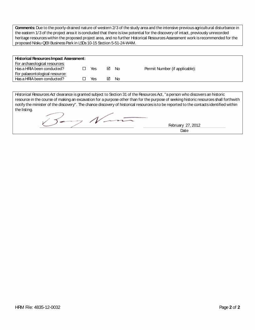
Comments: Due to the poorly-drained nature of western 2/3 of the study area and the intensive previous agricultural disturbance inthe eastern 1/3 of the project area it is concluded that there is low potential for the discovery of intact, previously unrecordedheritage resources within the proposed project area, and no further Historical Resources Assessment work is recommended for theproposed Nisku QEII Business Park in LSDs 10-15 Section 5-51-24-W4M.
Historical Resources Impact Assessment:For archaeological resources:Has a HRIA been conducted? Yes No Permit Number (if applicable):For palaeontological resource:Has a HRIA been conducted? Yes No
Historical Resources Act clearance is granted subject to Section 31 of the Resources Act, "a person who discovers an historicresource in the course of making an excavation for a purpose other than for the purpose of seeking historic resources shall forthwithnotify the minister of the discovery". The chance discovery of historical resources is to be reported to the contacts identified withinthe listing.
HRM File: 4835-12-0032 Page 2 of 2
DateFebruary 27, 2012