public document pack ab - democracy.peterborough.gov.uk
TRANSCRIPT

There is an induction hearing loop system available in all meeting rooms. Some of the systems are infra-red operated, if you wish to use this system then please contact Karen Dunleavy on 01733 452233 as soon as possible. Did you know? All Peterborough City Council's meeting agendas are available online or via the modern.gov app. Help us achieve our environmental protection aspirations and view this agenda online instead of printing it.
AB PLANNING AND ENVIRONMENTAL PROTECTION COMMITTEE
TUESDAY 26 NOVEMBER 2019 1.30 PM
Bourges/Viersen Rooms - Town Hall
AGENDA
Page No
1. Apologies for Absence
2. Declarations of Interest
At this point Members must declare whether they have a disclosable pecuniary interest, or other interest, in any of the items on the agenda, unless it is already entered in the register of members’ interests or is a “pending notification “ that has been disclosed to the Solicitor to the Council.
3. Members' Declaration of intention to make representations as Ward Councillor
4. Development Control and Enforcement Matters
4.1 18/02196/MMFUL - Dogsthorpe Landfill Site Welland Road Dogsthorpe Peterborough
5 - 22
4.2 19/01212/WCPP - The Blue Bell 10 High Street Glinton Peterborough
23 - 30
4.3 19/00725/FUL - St Josephs Catholic Church Gladstone Street Millfield Peterborough
31 - 50
Emergency Evacuation Procedure – Outside Normal Office Hours
Public Document Pack
1

In the event of the fire alarm sounding all persons should vacate the building by way of the nearest escape route and proceed directly to the assembly point in front of the Cathedral. The duty Beadle will assume overall control during any evacuation, however in the unlikely event the Beadle is unavailable, this responsibility will be assumed by the Committee Chair. In the event of a continuous alarm sounding remain seated and await instruction from the duty Beadle.
Recording of Council Meetings: Any member of the public may film, audio-record, take photographs and use social media to report the proceedings of any meeting that is open to the public. Audio-recordings of meetings may be published on the Council’s website. A protocol on this facility is available at: http://democracy.peterborough.gov.uk/ecSDDisplay.aspx?NAME=Protocol%20on%20the%20use%20of%20Recording&ID=690&RPID=2625610&sch=doc&cat=13385&path=13385
Committee Members:
Councillors: G Casey (Vice Chairman), C Harper (Chairman), P Hiller, R Brown, Warren, Hussain, Iqbal, Jones, B Rush, Hogg and Bond
Substitutes: Councillors: N Sandford, Simons, E Murphy and Yurgutene
Further information about this meeting can be obtained from Karen Dunleavy on telephone 01733 452233 or by email – [email protected]
CASE OFFICERS: Planning and Development Team: Nicholas Harding, Mike Roberts, Janet Maclennan, David
Jolley, Louise Simmonds, Sundas Shaban, Amanda McSherry, Matt Thomson, Michael Freeman, Jack Gandy, Carry Murphy and Chris Mohtram
Minerals and Waste: Alan Jones Compliance: Nigel Barnes, Julie Robshaw, Glen More, Andrew Dudley NOTES: 1. Any queries on completeness or accuracy of reports should be raised with the Case Officer,
Head of Planning and/or Development Management Manager as soon as possible. 2. The purpose of location plans is to assist Members in identifying the location of the site.
Location plans may not be up-to-date, and may not always show the proposed development.
2

3. These reports take into account the Council's equal opportunities policy but have no implications for that policy, except where expressly stated.
4. The background papers for planning applications are the application file plus any documents
specifically referred to in the report itself. 5. These reports may be updated orally at the meeting if additional relevant information is received after their preparation.
3

This page is intentionally left blank
4

Print Date: 12/11/2019
Committee Location Plan 18/02196/MMFUL Dogsthorpe Landfill Site Welland Road Peterborough NTS
±© OS Crown Copyright Licence 1000242361:10,000
0 140 280 420 56070Meters
Scale5

This page is intentionally left blank
6

Planning and EP Committee Item No. 1 Application Ref: 18/02196/MMFUL Proposal: Dewatering of waterbody and infill with approx. 375,000 cubic meters
of construction,demolition and excavation waste, with restoration to grassland and a new surface water management system
Site: Dogsthorpe Landfill Site, Welland Road, Dogsthorpe, Peterborough Referred by: Director of Place and Economy Applicant: Mr Mat Nicholson FCC Environment Agent: Mr Alistair Hoyle Axis PED Ltd Site visit: 21.12.2018 Case officer: Mr A O Jones Telephone No. 01733 454440 E-Mail: [email protected] Recommendation: GRANT subject to the signing of a LEGAL AGREEMENT and relevant conditions 1 Description of the site and surroundings and Summary of the proposal Site Description Dogsthorpe landfill is situated to at the north east urban edge of Peterborough. It is bounded by the A47 to the north, beyond which lies Dogsthorpe Star Pit SSSI, Welland Road to the north west, the A15 to the west / southwest and the A1139 to the east, beyond which lies the village of Eye, Peterborough Garden Park lies immediately to the south of the site, beyond the Car Dyke which runs along the southern boundary. A small cluster of waste and industrial sites are based at the west / northwest of the site. Access is provided to the A47, via Welland Road at the northwest of the site. The proposal site incorporates the existing access road and infrastructure associated with the landfill site (e.g the wheelwash and weighbridge), and follows the internal haul road that runs along the northern side of the site to the lagoon that sits at the eastern end of the site surrounded by a belt of tree planting some 20-30 years old. Proposal Permission is being sought for the dewatering of the lagoon at the eastern end of the landfill site, and the infill of approximately 375,000 cubic metres of construction, demolition and excavation waste, over a 6 year period, with restoration to an agricultural grassland area, and implementation of a modified surface water management system serving the wider landfill site. The construction of the void is expected to generate approximately 12,000 cubic metres of material, to be stockpiled in a suitable location on the wider site before used for restoration purposes. The infill works are proposed to take place within the previously approved operational hours for the landfill site (0600 -1800 Mondays to Saturdays and 0800 - 1200 hours Sundays, Bank and Public Holidays) and will involve an estimated 25 deliveries per day (i.e. 50 HGV movements to and from the site).
7

The proposed restoration scheme has been amended to include conservation grassland to the margins of the agricultural grassland and waterbody, with a hedgerow proposed along the western edge of the proposed landform to delineate the grassland areas. The proposal is EIA development, under Schedule 1 of the Town and Country Planning (Environmental Impact Assessment) Regulations and is accompanied by an Environmental Statement. The Environmental Statement has been presented in such a way as to account for the proposed changes (since permitted) to the landfill, including the additional time for the completion of restoration and the amended restoration scheme for the wider site. 2 Planning History
Reference Proposal Decision Date
16/00013/MMFUL Erection of reverse osmosis treatment plant and associated pipeline and leachate/acid tanks
Permitted 14/03/2016
15/01214/MMFUL Inert recycling facility Permitted 29/01/2016
13/01562/WCMM Non-compliance of C2 and C4 of planning permission 08/01032/WCMM - To amend the approved plans and continue landfill operations until 31 December 2019
Permitted 07/08/2014
08/01032/WCMM Non - compliance of C2, 7 ,8 and 17 of planning permission 06/00316/WCMM
Permitted 15/12/2008
06/00316/WCMM Modification to approved scheme for refilling and restoration at Dogsthorpe landfill site
Permitted 29/07/2008
97/P0085 Application for the determination of new conditions for extraction of clay and restoration to agricultural use by landfill
Permitted 25/04/1997
T1968 Permission to work clay on land near Dogsthorpe Brickworks
Permitted 30/01/1953
18/02185/WCMM Variation of condition C1, 2 and 4 (to extend the date for final restoration and amend the restoration scheme) of planning permission 13/01562/WCMM
Permitted 27/09/2019
3 Planning Policy Decisions must be taken in accordance with the development plan policies below, unless material considerations indicate otherwise. Cambridgeshire & Peterborough Mineral and Waste Core Strategy DPD (2011) MW02 - Strategic Vision and Objectives for Sustainable Waste Management Development Growth will be supported by a network of waste management facilities which will deliver sustainable waste management. The facilities will be 'new generation' which will achieve higher levels of waste recovery and recycling in line with relevant targets. They will also be of high-quality design and operation, contributing towards addressing climate change and minimising impacts on communities in Cambridgeshire and Peterborough. There will be a network of stand-alone facilities but also co-located facilities in modern waste management 'eco-parks'. The network will manage a wide range of wastes from the plan area, contributing to self-sufficiency but also accommodating the apportioned waste residues from London or authorities in the East of England. Any long distance movement of waste should be through sustainable transport means - such
8

facilities will be safeguarded via Transport Zones. A flexible approach regarding different types of suitable waste technology on different sites will be taken and Waste Consultation Areas and Waste Water Treatment Works Safeguarding Areas will be designated to safeguard waste management sites from incompatible development. A proactive approach to sustainable construction and recycling will be taken and strategic developments will need to facilitate temporary waste facilities to maximise the reuse, recovery and recycling of inert and sustainable construction waste throughout the development period. Where inert waste cannot be recycled it will be used in a positive manner to restore sites. The natural and built historic environment will continue to be protected with an increased emphasis on operational practices which contribute towards climate change and minimise the impact of such development on local communities. (Policy CS2 sets out a list of strategic objectives to support this vision; those of relevance will be discussed in the body of the report). MW14 - The Scale of Waste Management Provision Sets out the amounts of waste provision and timescales for the various types of waste management facility to be provided for by the Waste Planning Authority by 2026. MW18 - Waste Management Proposals Outside Allocated Areas Waste management development proposals outside allocated areas will be considered favourably where they meet the listed criteria. MW20 - Inert Landfill Strategic allocation is made at Block Fen/Langwood Fen Area of Search. Sites to deliver the remaining 3.69 million cubic metres capacity will be made at mineral extraction sites requiring restoration and identified in the Site Specific Proposals Plan. MW22 - Climate Change Minerals and waste proposals will need to take account of climate change over the lifetime of the development, setting out how this will be achieved. Proposals will need to adopt emissions reduction measures and will need to set out how they will be resilient to climate change. Restoration schemes which contribute to climate change adaption will be encouraged. MW24 - Design of Sustainable Minerals and Waste Management Facilities All proposals for minerals and waste management development must achieve a high standard in design and environmental mitigation. Waste Management proposals must be consistent with guidance set out in The Location and Design of Waste Management Facilities SPD. MW25 - Restoration and Aftercare of Mineral and Waste Management Sites Minerals workings and waste management sites will be restored to a beneficial afteruse with aftercare arrangements. Restoration proposals will be considered on a site by site basis but must meet the criteria set out in the policy. MW29 - The Need for Waste Management Development and the Movement of Waste Proposals for new or extended waste management development will be permitted where they meet a demonstrated need within Cambridgeshire and Peterborough. Applicants will be required to enter into binding restrictions on catchment area, tonnages and/or types of waste. Permission may be granted for development involving importation of waste from outside the Plan area where it is demonstrated it is sustainable. MW30 - Waste Consultation Areas Waste Consultation Areas will be identified through the Core Strategy and Site Specific Proposals Plan and development will only be permitted in these areas where it is demonstrated it will not prejudice future or existing planned waste management operations.
9

MW32 - Traffic and Highways Minerals and Waste development will only be permitted where it meets the criteria set out in this policy. MW33 - Protection of Landscape Character Minerals and Waste development will only be permitted where it can be assimilated into the local landscape character in accordance with the Cambridgeshire Landscape Guidelines, local Landscape Character Assessments and related SPDs. MW34 - Protecting Surrounding Uses Mineral and waste management development will only be permitted where it can be demonstrated (with mitigation where necessary) there is no significant harm to the environment, human health or safety, existing or proposed neighbouring land uses, visual intrusion or loss of residential/other amenity. MW35 - Biodiversity and Geodiversity Mineral and waste management development will only be permitted where there will likely be no significant adverse affect on local nature conservation or geological interest. Where it is demonstrated there are overriding benefits to the development compensation and/or mitigation measures must be put in place. Proposals for new habitat creation must have regard to the Peterborough Biodiversity Action Plan and supporting Habitat and Species Action Plans. MW39 - Water Resources and Water Pollution Prevention Mineral and waste management development will only be permitted where it is demonstrated there is no significant adverse impact or risk to; a. Quantity or quality of groundwater/water resources b. Quantity or quality of water enjoyed by current abstractors unless alternative provision is made c. Flow of groundwater in or near the site Adequate water pollution control measures will need to be incorporated. Peterborough Local Plan 2016 to 2036 LP26 - Green Wedges Green wedges have been identified to fulfil specific functions and aims. Permission for development within these area will only be granted where it can be demonstrated that this would not be contrary or detrimental to the objectives. Development adjacent to them will only be granted where there would be no adverse impact on their function. 4 Consultations/Representations PCC Peterborough Highways Services (05.04.19) No objection. The increase in vehicles as a result of the application is low, and it is noted that the Household Waste Recycling Centre has been relocated, significantly reducing the traffic levels in the immediate vicinity. Lead Local Drainage Authority (28.06.19) Further to the original submission, additional clarifications and details, including, for example, drainage calculations and cross sectional drawings of proposed lagoons and ditches, have been provided, and subject to appropriate control of the proposed drainage scheme, the proposal is acceptable. PCC Wildlife Officer (31.01.19) Final comments 15.09.2019 The Great Crested Newts identified in the pond to the northwest of the site and in the ditch along the northern site boundary are likely to be affected, but a detailed GCN mitigation strategy will be
10

required which can be secured by condition (through an Ecological Management Plan - EMP). Detailed mitigation measures will also be required in the EMP in relation to the identified population of Grass Snakes found within the Eastern Void area. Other measures, including additional surveys, will also be required for other protected species, including nesting birds, water voles and badgers. Advice is also provided regarding the Japanese Knotweed identified in the Eastern Void Area. The restoration scheme has been revised from that originally proposed (i.e. generally grassland), to include conservation grassland margins to the agricultural grassland and hedgerow along the western flank. Although additional previously suggested revisions, including hedgerow boundaries to all margins, and the creation of shallow gradients and areas within the water body have not been incorporated into the restoration scheme, the proposed scheme has been checked against the consented scheme to establish if net gains for biodiversity will be provided (as required by the NPPF para. 170). It is accepted that the revised restoration scheme will provide a marginal increase in the area of priority habitats. PCC Pollution Team (22.02.19) No objections, subject to appropriate controls with regards provision and use of a wheel-wash, operational hours, dust suppression and the control of noise. It is noted that the odour management is typically subject to Environment Agency permit condition, however such conditions should be replicated to ensure any odour arising from the de-watering operation is appropriately controlled. Natural England - Consultation Service (05.02.19) No objection. The proposal will not have significant adverse impacts on protected sites or landscapes, in particularly the Dogsthorpe Star Pit SSSI or the Nene Washes SSSI. Environment Agency (09.05.19) The Environment Agency confirm that the application should be viewed as an 'inert fill' application, and that the entirety of the proposed operations will be regulated by the Environmental Permit (this includes cell engineering and dewatering operations, including the proposed discharge of water to Car Dyke). The lagoon is formed in a borrow pit excavated into the underlying Oxford Clay which is not in continuity with the Car Dyke; the landfill is engineered to landfill directive standards and will be properly contained so there should be no pollution from this to the lagoon. The proposed activity will not have a detrimental impact on the water quality of Car Dyke. Replacing the existing pumped surface water scheme with a more sustainable gravity based system is supported. Highways England (24.01.19) No objections. The proposal is unlikely to materially change traffic generations, rather, it will extend the life time of the site in traffic terms. Eye Parish Council No comments received Local Residents/Interested Parties Initial consultations: 576 Total number of responses: 2 Total number of objections: 2 Total number in support: 0 An objection has been received highlighting concerns about heavy traffic on Welland Road, and the adjacent roundabout at the A47 / A16, and that the weight limit on Welland Road is being ignored, and the impact of additional heavy traffic around the landfill site in the centre of five residential areas. A query was also raised as to why the lake area is not being used as natural expansion of the Star Pit nature reserve
11

An objection has also been raised with concerns about the drainage proposals, and if the reduction in the lake size will contribute to more water overflowing onto the A47, and then the Star Pit SSSI, during winter months and sudden downpours. Another objection has been received raising concerns about the noise and dust implications for health and well being of nearby residents, and concerns about future property sales. A petition with 29 signatories against the extended use of the landfill site due to road safety concerns on the two main roundabouts near the site (presumed to be the two roundabouts on the A47) has also been submitted. The petition also refers to an article in the 'Evening Telegraph' concerning two people being killed on this stretch of road "which is now regarded as a very hazardous area". It is noted that consultation for this application and that for the variation of condition application, to allow additional time for, and to amend the restoration of, the remainder of the landfill site, were undertaken simultaneously, and therefore comments that may have been provided for one application have been taken into consideration for both. 5 Assessment of the planning issues The Principle of Development The main considerations are: A) Suitability of the proposal b) Water management c) Air quality / odour d) Noise e) Transportation and Traffic f) Nature Conservation and Ecology a) Suitability of the proposal The proposed works include the infill of the lagoon at the eastern end of the existing Dogsthorpe landfill site. As such, the proposal must accord with policies CS 2 of the Cambridgeshire and Peterborough Minerals and Waste Core Strategy (the Core Strategy) to support the strategic vision and objectives for sustainable waste management development. In particular the proposal must contribute to a network of waste management facilities capitalising on the synergies between different types of waste management techniques. The proposal must be considered in light of the National Planning Policy for Waste, which requires landfill sites to be restored to beneficial after uses at the earliest opportunity and to high environmental standards. The National Planning Policy for Waste sets out a number of requirements for waste planning authorities to consider when determining waste planning applications, including the requirement to "concern themselves with implementing the planning strategy in the Local Plan". It also highlights the need for Waste Planning Authorities to work on the assumption that the relevant pollution control regime will be properly applied and enforced. What has been proposed is for the use of infill materials, that for planning purposes are considered to be 'inert', to be used to enhance the surface water management system over the wider landfill site, and to provide additional agricultural grassland and ecological enhancements. The proposals are therefore considered primarily against the waste spatial strategy as set out in the Core Strategy, and operations will also be subject to Environment Agency permitting. The Environment Agency have confirmed that the proposal should be viewed as an 'inert fill' application as the material used to restore the site is described as consisting of soils and construction and demolition materials; however they also acknowledge that the infill material may
12

be coded as non-hazardous, in accordance with the Landfill Tax (Qualifying Material) Order 2011, on the waste transfer notes under which the material will be transported to the site Although the proposal site is not allocated for inert fill, it sits within the Waste Consultation Area associated with the wider Dogsthorpe landfill site (policy site ref). Core Strategy policy CS30 states that development (within a WCA) will only be permitted where it does not prejudice existing or future planned waste management operations. As the proposal will improve the sustainability of the existing surface water management scheme (by providing a gravity, rather than a pumped, system), it is considered that it will enhance the existing waste management operation at the landfill site. The scale of waste management provision (policy CS14) sets out the requirement for the delivery of inert landfill void space over the Plan period to which the proposals will contribute. The location of such facilities is guided principally (CS15) by the Minerals and Waste Management Key Diagram and additional factors, including for example, site availability. Of the sites within Peterborough identified for inert fill in policy W2 of the SSP, nominal capacity is currently available, and all face uncertainty in providing significant capacity in the short term. Notwithstanding that there are some mineral sites not allocated for inert fill which have benefitted from permission, it is also acknowledged that there is limited availability of inert fill capacity coming forward at the strategic Block Fen / Langwood Fen allocated site (policy CS20), and it has been accepted that there may be a requirement to divert inert fill in the plan area to other available sites. The Core Strategy (policy CS29), seeks to ensure that excessive provision (of waste management facilities) is not made within the Plan area, as such, the applicant has confirmed that they will enter into binding restrictions (a legal agreement) on the tonnages and catchment area for acceptance of waste, i.e. no more than 20percent (%) by weight of the waste imported to the site shall come from an area outside 32 kilometre radius of the site and / or the areas within the boundaries administered by Peterborough City Council and Cambridgeshire County Council. The proposal site is also located within a 'Green Wedge' (Peterborough Local Plan policy LP26); the proposal is not considered to be contrary or detrimental to the function of the green wedge in this location as the separate identity, local and historical character of the surrounding settlements will not be affected, and the open and undeveloped character of the Green Wedge will be retained through the restoration proposals. b) Water management The Environmental Statement accompanying the application is supported by a Flood Risk Assessment and further information and clarifications, including calculations, specifications for the proposed drainage system and maintenance schedules have been provided to demonstrate the suitability of the proposed scheme. The Environment Agency has expressed their support for the replacement of the existing pumped surface water scheme with a gravity based system which is considered more sustainable. Despite the significant reduction in the size of the eastern lagoon, the Lead Local Flood Authority are satisfied that the proposed surface water management system is acceptable and will not lead to an increase in flood risk either on or off site. It is understood that the size and scale of the eastern lagoon is related to the historic design of the landfill site and this area was extracted to provide clay to be used for engineering purposes (i.e. it was not specifically designed at its current size for the purposes of water retention to reduce flood risk and the flood risk calculations provided with this application demonstrate that the proposed lagoon provides of sufficient capacity for flood risk purposes). The proposed changes to the Surface Water Management (SWM) scheme include changes to the entire system around the landfill site, which can be controlled by condition. The de-watering and engineering of the eastern lagoon comprising 'phase 1'. The second and third phase of works includes remodelling of the ditches and lagoons to the south and north of the site, with the fourth
13

and final phase including the ditches, deflection bunds and new lagoons to be provided at the western end. Such phasing can be controlled by condition to ensure the continuity and completion of works to minimise and prevent flood risk. The lagoon, being excavated as a 'borrow pit', sits within the underlying Oxford clay, is not in continuity with the Car Dyke (where the SWM discharges) or the nearby Star Pit SSSI (i.e. the low permeability of the clay prevents groundwater from flowing), and, with the engineering of the landfill site being to appropriate standards, any water flowing from the site should be that which is shed from the surface. The Environment Agency has confirmed that there will be no detrimental impact on the water quality of the Car Dyke, and Natural England has confirmed that there will be no significant adverse impact on the Star Pit SSSI. Although an objection has been raised, with concerns that reducing the lagoon size will contribute to flood risk on the surrounding roads and the Star Pit SSSI, further to the revisions and clarifications to the proposed surface water management system, neither the Environment Agency, the North Level IDB or the Lead Local Flood Authority have raised any objections, and the Environment Agency has emphasised the sustainability benefits of a gravity based Surface Water Management system in preference to the pumped system currently in operation. The proposal has demonstrated that there would be no significant adverse impact or risk to the quantity or quality of surface or ground water resources, and subject to appropriate control of the implementation of the proposed SWM is in accordance with Core Strategy policy CS39. c) Air quality / odour The Air Quality assessment accompanying the Environmental Statement considers the potential impacts of dust and fine particulate matter arising during earthworks, importation and restoration activities, including vehicle movements and emissions. The Environment Agency has confirmed that the site will be subject to Environmental Permit, which would seek to effectively control dust and odour emissions. Given that the nearest sensitive receptors (residential use) are located less than 150m from the north east and southeast of the site (at Chancery Lane and Peterborough Road, Eye), and less than 100m on the A1139, consideration needs to be given as to whether the proposal is an acceptable use of land, in this location. There is also residential development to the west of the site, within 150m, however considering the layout and proposed use of the site, with access provided at the west, and the engineering and infill operations at the east, primarily for dust and odour impacts, consideration should be given to the severity of impacts at the closest residential receptors to the east and south of the site. The Environment Agency has confirmed that all aspects of the proposed operation, including the de-watering and engineering of the void, as well as the infill operation, will be subject to Environmental Permit control, and the initial response of the Pollution Control Officer advised that conditions relating to dust suppression (use of wheelwash and provision of bowser to dampen internal haul roads) would be adequate. With regards to odour, the Air Quality assessment only considered the impact of the waste disposal operation, rather than the de-watering of the lagoon. Given the change in fill material for the proposal area from that used to fill the historical area of the site (i.e. the use of inert materials rather than 'non-hazardous' which may contain significant a significant proportion of potentially odours biodegradable material) the odour impacts of the infill operation are considered to be negligible. However, with regards to the de-watering operation, further information has been provided which acknowledges that although the cell preparation works may give rise to odourous emissions, the location of such works (at the bottom of the void) and the short term nature of the work (approximately 3 months) will mean that any such odours are unlikely to give rise to significant adverse impacts and effects. Additionally, any silts / excavated material from the base of the lagoon will be stockpiled centrally within the site, distant from any receptors, and seeded prior to re-use for restoration purposes.
14
Given the potential short-term impact of the de-watering and cell engineering, and the controls likely to be required through Environmental Permit conditions, it is considered necessary to control by condition the immediate response procedure that can be implemented in the event of reasonable complaint. Additionally, ensuring the appropriate management of any potentially odourous materials to be stockpiled can also be controlled by condition (which will also enable an appropriate understanding of the impact on providing the restoration scheme across the wider site). Taking into consideration the potential severity and duration, and mitigation measures, the proposal is considered to have demonstrated that there would be no significant harm to the environment, human health or safety, existing or proposed land uses or loss to residential amenity with regards to air quality including dust and odour, in accordance with Core Strategy policy CS34. d) Noise The Noise assessment accompanying the Environmental Statement considers the proposal alongside the ongoing restoration works for the existing landfill site (i.e. a further 5 years of importation and spreading of soils), the existing background sound levels, including the cumulative impacts of the existing gas engines and the proposed additional residential receptors off Newborough Road. The identified sensitive receptors are essentially the same as for those affected by dust and odour issues (see above). The character and nature of activities undertaken at the western end of the site are understood, and essentially unchanged from those historically associated with the site (i.e. access, haul road, wheelwash and weighbridge), the greatest consideration needs to be given to those receptors at the eastern and southern side of the site (i.e. Chancery Lane and Peterborough Road, Eye, and the isolated property on the A1139), and have been undertaken in compliance with noise controls associated with the historical landfilling of the site. In addition to the historical mitigation measures, which include control over the normal operating hours, and regular maintenance of plant and machinery, additional noise screening bunds are proposed to be placed around the north and southeast corners of the void space when operations are within 3m of the existing ground level. With regard to the proposed operational hours, it is not considered necessary for the site to operate on the hours historically associated with the operation of the landfill, which required extend daytime and weekend hours to allow for the receipt of municipal waste at the site. As such, the hours can be controlled by condition to reflect more normal daily working practices to minimise amenity impacts for surrounding uses. The Environment and Pollution Control Officer has confirmed that the historical noise controls imposed on the landfill can be effectively carried over for this proposal to ensure that suitable noise levels can be achieved at the identified receptors. The additional noise control measures (i.e. the screening bunds) can also be controlled by condition. As such, and through appropriate control by condition, the overall noise impacts are considered to be negligible and the proposal is considered to accord with Core Strategy policy CS34 with regards to protecting surround uses from noise. e) Transportation and Traffic The Transport and Highways section of the Environmental Statement accompanying the application analyses the impacts of the proposal on the local highway network, considering both the existing ongoing restoration works (i.e. the importation of soils to restore the landfill site) and the vehicle movements associated with this proposal, alongside the 457 dwellings off Newborough Road which have reserved matters approval (16/01197/REM). The assessment estimates that to import 600,00o tonnes of fill material over a 6 year period will equate to 25 imports per day, resulting in a total of 50 HGV movements, alongside the ongoing restoration works this equates to a 'worst case scenario' (i.e. where the two landfill based operations are running contiguously) approximately 100 movements per day.
15

An objection, and a petition have been received which highlight concerns about heavy traffic using the Welland Road and the nearby roundabouts at the junctions of the A47 and A16, and the A47 and the A15. The Local Highway Authority (LHA), and Highways England (HE, with responsibility for the A47) have both been consulted on the application, and neither have raised objections. The LHA note that the increase in vehicles as a result of the application is low, and that the Household Waste Recycling Centre has been relocated, significantly reducing the overall traffic levels in the immediate vicinity. HE confirm that the proposal is unlikely to materially change traffic generation in the area, rather it will extend the life time of the site in traffic terms. Notwithstanding this extension to the lifetime of the site, the Environmental Statement notes that the junction of the A47 / A16 is not predicted to reach capacity by the future assessed year of 2028, by which time both the landfill restoration works, and this proposal are expected to have ceased. The existing site access from the Welland Road is considered suitable to continue to be used, and it is expected that deliveries to the site will come from the trunk road network, rather than the Welland Road which is subject to a weight restriction. It is noted that a heavy goods vehicle carrying out remedial works within a development site or providing services within a restricted area is permitted. The proposal has a suitable access to the highways network and would not cause unacceptable harm to the environment, road safety or residential amenity and enforcement of highway regulations is not a planning issue. Furthermore, neither the LHA nor HE have raised any objections to the proposal, which is considered to be in accordance with Core Strategy policy CS32. f) Nature Conservation and Ecology The NPPF aims to ensure the conservation and enhancement of the natural environment (Ch.11). For this proposal, consideration needs to be given to both the operation of the development, and the proposed afteruse, with the final restoration having to strike a balance between the proposed afteruses of both agriculture and biodiversity enhancement, whilst acknowledging the functional requirements of the surface water management system. The Wildlife Officer has assessed the submitted Ecology and Nature Conservation chapter (and associated appendices) of the Environmental Statement, and has confirmed that subject to appropriate control with regards the proposed mitigation measures, that there will be no adverse impacts on protected habitats or species. With regards to impacts on ground nesting birds, mitigation includes appropriate timing of vegetation removal. Further surveys of water voles and badgers, which are believed to be present in the local area, need to be subject to further survey prior to the commencement of works. Details of the required hibernacula (for grass snakes present in the area) can be provided in the landscape and habitat management plan. With regards to Great Crested Newts, a small population has been found in one of the ditches affected by changes to the surface water management system, and although it is acknowledged that the requisite license can be obtained from Natural England, the location of proposed terrestrial and aquatic habitat enhancement measures must be controlled by condition The restoration proposals initially submitted with the application would have provided a significant reduction in the overall area of priority habitat creation compared to the approved scheme, and were not therefore considered acceptable, However, the restoration proposals have subsequently been revised to ensure provision of a similar area of ecological enhancements as the currently approved scheme.
16

The proposed biodiversity enhancements encompass the creation of marginal conservation grassland strips flanked by hedgerow. Potential amendments to the lagoon, which may have provided significant habitat enhancements have been rejected by the applicant, citing maintenance issues with the lagoon. Although it is disappointing that such opportunities have been missed, the enhancements proposed are considered to present biodiversity enhancements of equal or better value than those provided under the extant approved scheme, thereby complying with existing policy requirements. It is noted that the emerging Environment Bill places a requirement on developers to provide for a 10% net gain in biodiversity, and although it is questionable as to whether a 10% gain has been achieved in this instance, limited weight can be placed on this emerging policy at this moment in time. The ecological impacts of the proposal have also been considered, and there are no significant impacts on protected habitats or species provided that the proposed mitigation measures in the submitted Ecological Appraisal and surveys and Natural England have confirmed that there are no significant impacts on designated sites, including Dogsthorpe Star Pit SSSI and the Nene Washes SSSI, SPA, SAC and RAMSAR. The underlying geology and physical separation provided by the A47 also limits the potential for the site restoration to specifically complement the Dogsthorpe Star Pit, and the biodiversity enhancement measures are therefore viewed discretely for their inherent value. There are no significant adverse impacts on sites of bio or geo diversity importance, and it is not considered that there will be any fundamental alterations to the landscape character of the area when compared to the extant proposals, and the balance of restoration objectives is, on balance, considered appropriate, albeit with missed opportunities to provide an even greater level of biodiversity enhancements. The method of working and proposed restoration scheme are therefore considered appropriate, albeit appropriate control needs to be exercised on the management and aftercare of the restoration scheme, and the proposal is considered to accord with Core Strategy Policies CS24, CS25, CS33 and CS35, and paragraph 170 of the National Planning Policy Framework. 6 Conclusions The NPPF states that there is a presumption in favour of sustainable development - in terms of decision taking this means approving development proposals that accord with the development plan without delay. The application has been consider in light of the Cambridgeshire and Peterborough Minerals and Waste development Plan, the NPPF and accompanying Planning Practice Guidance, and the National Planning Policy for Waste. The site is not allocated for inert fill but the proposal complies with policies CS14 and CS15 of the Core Strategy with regards the provision and location of waste management, and due to the limited availability of inert fill capacity coming forward at the strategic Block Fen / Langwood Fen allocated site (policy CS20) it is accepted that there may be a requirement to divert infill in the plan area to other available sites. The use of catchment restrictions ensures the proposal accords with policy CS29. An Environmental Statement accompanies the application which is considered to be comprehensive and meets the requirements set out in the Town and Country Planning Environmental Impact Assessment Regulations 2017. Detailed topic areas have been assessed and considered:- noise, dust and air quality impacts have been considered and are in accordance with policy CS34. Highway and traffic issues, including safety of all road users in the vicinity of the site, have been considered and is in compliance with policy CS32. With regards to landscape and visual impacts, the proposal is in compliance with policies CS24, CS33 and CS24. The impact on water resources and the water environment have been assessed and the proposal is in compliance with policy CS39. The impacts on ecology, site restoration and provision of biodiversity enhancements has also been considered and the proposal is in compliance with policies CS25, CS34 and CS35.
17

Cumulative impacts with the ongoing restoration works at the adjacent Dogsthorpe landfill site have also been taken into account. Comments of consultees and representations have been taken into account and suitable conditions attached to address any issues raised and in all other respects the proposal is acceptable. As such, there is no reason not to approve the application in line with Section 38(6) of the Planning and Compulsory Purchase Act. 7 Recommendation The case officer recommends that Planning Permission is GRANTED subject to the signing of a LEGAL AGREEMENT and the following conditions: If the required Section 106 legal agreement is not completed within a reasonable period, then the Committee delegates the issuing of a notice of refusal to the Executive Director of Place and Economy on the grounds that the development has failed to adequately mitigate its impacts. C 1 The development hereby permitted shall be begun before the expiration of three years from
the date of this permission. Reason: In accordance with Section 91 of the Town and Country Planning Act 1990 (as
amended). C 2 The development shall be carried out in complete accordance with the following submitted plans; Statutory Plan (red line plan), drawing number 2284-03-101, dated December 2018 General Arrangement Plan, drawing number 2284-03-102, dated December 2018 Revised Restoration Scheme, Figure 3.5(Rev. D), dated August 2019 Phasing Plan for SWM System, drawing number WR7433/DR/05(Rev. 1) dated 15/05/19 Proposed Surface Water Management System, drawing number WR7433/DR/01(Rev. 5), dated 26/07/19 Noise Site Boundary Screens, Figure 6.2, dated December 2018. The details of which are approved except as amended by the following conditions. Reason: For the avoidance of doubt and to enable the Waste Planning Authority to
adequately control the development to minimise the impact on the amenities of the local area in accordance with Cambridgeshire and Peterborough Minerals and Waste Core Strategy policies CS2 and CS34.
C 3 The importation of restoration materials and completion of all restoration and landscaping
works shall be completed within 9 years of the date on this decision notice, or within 12 months of the final importation of fill material, whichever is the sooner.
Plant, machinery, buildings and structures not required for the operation of the
landfill gas power station, nor the leachate treatment plant, shall be removed within 6 months of the final importation of fill material, and the site shall be fully restored to an agricultural and nature conservation after use within 12 months of the final importation of fill material.
Reason: To minimise the duration of the adverse impacts and disturbance hereby permitted
in
18

the interests of the amenity of the local area in accordance with Cambridgeshire and Peterborough Minerals and Waste Core Strategy policies CS25 and CS34.
C 4 No development shall commence until and unless a scheme for the appropriate storage
and re-use of the material to be excavated during the construction of the void, has been submitted to, and approved in writing by, the Local Planning Authority. The scheme shall include, but is not necessarily limited to, identifying the location for the proposed stockpile, management of the stockpile, identifying the location for the stockpiled materials re-use, and identifying the restoration and aftercare requirements for the area where the stockpile has been located.
The storage and re-use of the excavated material shall thereafter be carried out in complete
accordance with the approved scheme. Reason: To ensure that any excavated materials are stored in an appropriate location to
minimise amenity impacts, and re-used in a suitable location to enable appropriate restoration, in accordance with Cambridgeshire and Peterborough Minerals and Waste Core Strategy Policies CS25 and CS34.
C 5 Vehicular access to and from the site shall be by way of the existing site access to Welland
Road only, as shown on the 'Statutory Plan', drawing number 2284-03-101, dated December 2018.
Reason: In the interests of highway safety in accordance with Cambridgeshire and
Peterborough Minerals and Waste Core Strategy policy CS32. C 6 Only inert wastes of a type akin to that set out in the "Waste Acceptance (Waste Types and
Leachate Source Term" (doc. ref. 4232/R/005/01) shall be accepted for disposal at the site. Reason: In the interests of water pollution prevention in accordance with the
Cambridgeshire and Peterborough Minerals and Waste Core Strategy policy CS39. C 7 Prior to the importation of any waste materials, a scheme for the phasing of the fill
operation must be submitted to, and approved in writing by, the Local Planning Authority. Thereafter, the development hereby approved shall be carried out in complete accordance
with the approved scheme. Reason: To ensure a timely restoration of the site to a beneficial afteruse in accordance
with Cambridgeshire and Peterborough Minerals and Waste Core Strategy policy CS25.
C 8 No commercial vehicles leaving the site shall enter the public highway unless their
wheels and chassis have been cleaned to prevent material being deposited on the public highway.
Reason: In the interests of highway safety in accordance with Cambridgeshire and
Peterborough Minerals and Waste Core Strategy policy CS32. C 9 Except in emergencies, no operations authorised or required by this permission shall be
carried out except between the following times:
19
0700 hours and 1800 hours Mondays to Saturdays and at no other times including Sundays, Bank Holidays and Public Holidays. Reason: In the interests of residential amenity in accordance with Cambridgeshire and
Peterborough Minerals and Waste Core Strategy policy CS34. C10 A bowser shall be available at all times as required to dampen internal haul roads and
operational areas as necessary to prevent the egress of dust from the site. Reason: In the interests of protecting surrounding uses in accordance with Cambridgeshire
and Peterborough Minerals and Waste Core Strategy policy CS34. C11 The scheme for the control of noise as outlined in Chapter 6 of the Environmental
Statement (dated December 2018), including the provision of 3m noise screens as depicted on Figure 6.2 (Noise Site Boundary Screens), dated December 2018, when operations are within 3m of ground level, shall be complied with at all times. Notwithstanding the details within the ES, the level of noise emitted from the development during normal operations and maintenance shall not exceed 55dB expressed as an LAeq, 1hr, between the permitted hours of 0700 hours and 1800 hours Mondays to Saturdays and 52dB expressed as an LAeq, 1hr, at any other time at noise sensitive properties.
C12 Noise monitoring shall be undertaken in accordance with a scheme to include, but not
necessarily limited to, the noise assessment to be undertaken within 28 days of notice issued by the Local Planning Authority in the event of reasonable complaint, to be submitted prior to the first deposit of waste. The development shall thereafter be carried out in accordance with the approved scheme.
Reason: In the interests of protecting surrounding uses in accordance with Cambridgeshire
and Peterborough Minerals and Waste Core Strategy policy CS34. C13 For temporary operations essential for site preparation work and restoration such as bund
formation and removal, and soil replacement, the free field noise level due to operations at the nearest point to the locations identified in condition 11, shall not exceed 70 dB LAeq, 1 hour (free field). The Planning Authority shall be notified between 7 and 21 days in advance of essential temporary operations. Temporary operations shall not take place for more than eight weeks in any calendar year.
Reason: In the interests of the amenity of the nearest residential occupiers in accordance with Cambridgeshire and Peterborough Minerals and Waste Core Strategy policy CS34.
C14 All buildings or tanks to be used for the storage of fuels, together with ancillary handling
equipment including pumps and valves shall be contained with an impervious bunded area of at least 110% of the storage capacity and shall enclose within their curtilage all fill and draw pipes, vents, gauges and sight glasses. There must be no drain through the bund floor or walls.
Reason: In the interests of the prevention of pollution in accordance with Cambridgeshire
and Peterborough Minerals and Waste Core Strategy policy CS39. C15 The drainage and surface water management of the development shall be carried out
in complete accordance with the following submitted plans and documents, including the 'lifetime maintenance' of the surface water management system;
20

Proposed Surface Water Management System, drawing number WR7433/DR/01, rev dated 26/07/19 Phasing Plan for SWM System, drawing number WR7433/DR/05, rev 2, dated 04/11/2019 Catchment Areas, drawing number WR7433/DR/06, dated 22/01/2018 Section Location Plan, drawing number WR7433/DR/07, dated 24/07/2019 Sections Sheet 1, drawing number WR7433/DR/08, dated 24/07/2019 Sections Sheet 2, drawing number WR7433/DR/09, dated 24/07/2019 Specification for Construction of the Surface Water Management Scheme at Dogsthorpe Landfill Site, Doc. ref. WR7433/01, dated January 2019 Maintenance for the Surface Water Management Scheme at Dogsthorpe Landfill Site, Doc. ref. WR7433/04, dated July 2019
Reason: In the interests of water resources management and prevention of floodrisk in accordance with Cambridgeshire and Peterborough Minerals and Waste Core Strategy policy CS34.
C16 No development shall commence until and unless a scheme for the control of odour during
the de-watering of the waterbody and construction of the voidspace, is submitted to, and approved in writing by, the Local Planning Authority. The scheme shall include, but is not necessarily limited to, the complaint receipt and investigation procedure, control and prevention of odour measures, and mitigation measures to be implemented within 24 hours notice of any complaint received by the operator.
The development thereafter shall be carried out in complete accordance with the approved
scheme. Reason: To secure an appropriate odour management scheme in the interests of the
nearest residential occupiers in accordance with Cambridgeshire and Peterborough Minerals and Waste Core Strategy policy CS34. This is a pre-commencement condition because appropriate controls needs to be exercised on the initial activities which may give rise to odour nuisance.
C17 The development as hereby approved shall be carried out in complete accordance with the
mitigation and surveying requirements as set out in Chapter 5.0 - Ecology and Nature Conservation, and accompanying appendices, of the Environmental Statement (dated December 2018) in relation to nesting birds and badgers, and to include appropriate surveying for Water Voles.
Reason: To protect species of nature conservation importance, in accordance with
Cambridgeshire and Peterborough Minerals and Waste Core Strategy policy CS35. C18 No development shall take place until and unless a Landscape and Habitat Management
Plan (LHMP) based on the Revised Restoration scheme, Figure 3.5, Rev. D, dated August 2019, has been submitted to, and approved in writing by, the Local Planning Authority. The LHMP shall include, but is not necessarily limited to, the timing of planting, species numbers, size, spacing and density, seedmix, location of hibernacula and Great Crested Newt habitat enhancement areas, and aftercare management for a period of 5 years.
The development shall thereafter be carried out in complete accordance with the
approved LHMP. From the completion of restoration, the date of which is to be agreed in writing with the Planning Authority, the aftercare of the site shall commence, it shall endure for a period of 5 years and shall be carried out in complete accordance with the approved scheme.
.
21

Reason: To secure appropriate restoration in accordance with Cambridgeshire and Peterborough Minerals and Waste Core Strategy policies CS25, CS33 and CS34. This is a pre- commencement condition to ensure that appropriate mitigation measures are aligned with the programme of works and to mitigate the impacts on protected species.
C19 No topsoil or basal clay shall be removed from the site. Reason: For the avoidance of doubt of the extent of the proposed development and
operations hereby permitted in accordance with Cambridgeshire and Peterborough Minerals and Waste Core Strategy policies CS34 and CS39.
Copies to Cllrs. Simons. Allen. Brown
22

The Site
Print Date: 12/11/2019
Committee Location Plan 19/01212/WCPP The Blue Bell 10 High Street Glinton Peterborough NTS
±© OS Crown Copyright Licence 1000242361:1,000
0 10 20 30 405Meters
Scale23

This page is intentionally left blank
24

DCCORPT_2018-04-04 1
Planning and EP Committee 26 November 2019 Item No. 2 Application Ref: 19/01212/WCPP Proposal: Variation of Condition C6 (hours of use of the development) of planning
permission 17/01167/FUL Site: The Blue Bell, 10 High Street, Glinton, Peterborough Applicant: Mr Chris Cocker Greene King PLC Agent: Miss Emma Arnold Concept IDL Ltd Referred by: Head of Planning Reason: Previous Committee decision Site visit: 24.10.2019 Case officer: Mr Jack Gandy Telephone No. 01733 452595 E-Mail: [email protected] Recommendation: GRANT subject to relevant conditions
1 Description of the site and surroundings and Summary of the proposal Site and Surroundings The application site comprises the Grade II Listed Blue Bell public house in Glinton, located within the Glinton Conservation Area. The designated heritage asset itself is predominantly stone built with welsh slates tiles to the roof. The Blue Bell public house is set back approximately 60 metres from High Street, which allows for the provision of an access, parking and recreational green space to the front. Surrounding uses to the area include St Benedict's Church, a primary school, a village shop/post office and various residential properties. Proposal Permission is sought to vary condition 6 of planning permission reference 17/01167/FUL. This permission granted was for an outdoor dining area comprising of jumbrella with seating, with an extension of the hard surface serving the existing patio area. Timber posts, ‘square arches’, lighting, screens partially enclosing a dining area and finally acoustic fencing were also approved, with the removal of the willow tree along with additional landscaping also accepted. The proposed variation seeks to allow the extended hours granted temporary consent (09:00 to 23:00) to be made permanent. For the avoidance of doubt, the approved condition is as follows: For a temporary period up to the 30 November 2018, the development hereby permitted shall not be open for use by patrons of the Bluebell Public House or members of the public outside the hours of 09:00 and 23:00 on any day. Thereafter, the development hereby permitted shall not be open for use by patrons of the Bluebell Public House or members of the public outside the hours of 09:00 and 21:00 on any day. Reason: To allow the extended hours to be tested to see whether issues that arise from the development hereby permitted would unacceptably harm the amenity of surrounding neighbours, in accordance with Policy PP3 of the Peterborough Planning Policies DPD (2012). For Members information, a copy of the previous Committee Report is appended.
25

DCCORPT_2018-04-04 2
2 Planning History Reference Proposal Decision Date 17/00273/FUL Construction of pergola, works to trees,
erection of three shed structures, five square arches, timber posts with festoon lighting, addition of fixed seating, steps and disappearing path
Refused 06/06/2017
17/01167/FUL A new alfresco dining area, to include loose and fixed seating with Jumbrella; Works to Willow tree and planting of replacement trees; New step and disappearing path to the grass field; New timber posts, festoon and wall lighting; New screens to partially enclose dining area ; New fencing and new planting; New green oak square arches down the garden
Permitted 22/09/2017
3 Planning Policy Decisions must be taken in accordance with the development plan policies below, unless material considerations indicate otherwise. National Planning Policy Framework (February 2019) Paragraph 180 - Pollution New development should be appropriate for its location taking into account the likely effects (including cumulative effects) of pollution on health, living conditions and the natural environment. In doing so they should mitigate and reduce to a minimum potential adverse impacts resulting from noise from new development and avoid noise giving rise to significant adverse impacts on health and quality of life, identify and protect tranquil areas which have remained relatively undisturbed by noise and limit the impact of light pollution from artificial lighting on local amenity, intrinsically dark landscapes and nature conservation. Peterborough Local Plan 2016 to 2036 LP17 - Amenity Provision LP17a) Part A Amenity of Existing Occupiers- Permission will not be granted for development which would result in an unacceptable loss of privacy, public and/or private green space or natural daylight; be overbearing or cause noise or other disturbance, odour or other pollution; fail to minimise opportunities for crime and disorder. 4 Consultations/Representations PCC Pollution Team (08.11.19) Objection - The original permission granted the temporary use of the development permitted under 17/01167/FUL during the hours of 09:00 to 23:00. Throughout this time, this section did not receive any noise complaints in relation to this use. As stated in comments in the previous application, specific regard to the use of outdoor areas the Institute of Acoustics Guide for Noise from Pubs and Clubs recommends that: - "Careful consideration should always be given to the siting of gardens ... intended for the use of patrons, in order to minimise the risk of disturbance to neighbours. The use of gardens ... where noise disturbance has arisen, or may arise, should not commence before the start of normal trading hours (12:00hrs) and should normally cease at dusk or 21:00hrs whichever is the earlier".
26

DCCORPT_2018-04-04 3
- "... where there are nearby noise sensitive premises (residents) the use of external lighting in garden ... areas late into the evening is undesirable, unless required for health and safety or security reasons. The provision of such lighting may encourage patrons to congregate in these areas, and cause noise disturbance at this more sensitive time." These statements are clear that noise from people socialising in environments such as this is inherently hard to control, therefore hours of use are generally the most effective method. The hours proposed are in excess of the hours recommended in the IOA guide. The Blue Bell is in close proximity to 4 residential properties along Rectory Lane and one property on the High Street, that are likely to be affected by the use of this area, albeit as already stated this section has not received any noise complaints. Noise levels are not a suitable mechanism for establishing the likely acceptability of use (as with many other leisure activities), since there are no accepted standards for comparing any predicted levels against in these instances (unlike, for example, the comparison of the effect of industrial noise upon residential premises [BS4142:2014]). Subjective assessments are the most suitable way of judging likely acceptability, where each person is entitled to a view as to whether the activities are acceptable, and there not being a right or a wrong way to come to any conclusion in these respects. When considering complaints of nuisance under the Environmental Protection Act 1990, it is important to note that planning decisions that alter the character of the area and therefore affect the acceptability of particular noise and use, impact on whether certain activities would be judged as nuisances [Wheeler v JJ Saunders Ltd, 1996]. The designation via the planning regime of areas suitable for certain uses is has an important contribution to the operation of the decision making process in the statutory nuisance regime. Consequently, should following the granting of this application, residents complain about noise emitted from this development it is highly unlikely that any action would be possible under the statutory nuisance regime. Therefore the means of retort for complainants is likely to be limited to the Licensing regime and a review of the premises licence. PCC Tree Officer (11.09.19) No objections - This proposal has no bearing on tree/landscape issues on site. PCC Conservation Officer (10.09.19) No objection - This is a matter of amenity consideration and not one for the Conservation Officer to comment upon. Glinton Parish Council (20.09.19) Objection - Glinton Parish Councillors are unanimous in their opposition to the removal of condition C6 (opening hours) of Planning Permission 17/01167/FUL and request that the temporary condition is made permanent. The draft minutes of Glinton Parish Council’s meeting are as follows: The concerns of the nearest neighbours in two properties in Rectory lane were noted and their stated observations that despite the nature of the condition restricting the hours of operation, customers could be heard in the grounds until long after 9pm and at times until midnight. Councillors also observed that customer behaviour up to 9pm was no indication of the behaviour after 9pm to later hours. Glinton Parish Council unanimously supported the legitimate concerns of neighbours and requested the planning authority to make permanent Condition C6 (opening hours) and furthermore raised concerns as to how the restrictions were enforced".
27

DCCORPT_2018-04-04 4
Local Residents/Interested Parties Initial consultations: 9 Total number of responses: 1 (Glinton Parish Council) Total number of objections: 0 Total number in support: 0 No public / neighbour representations have been received from local residents. A site notice was erected adjacent to the access to the public house. 5 Assessment of the planning issues Given that this application seeks variation to Condition 6 (hours of use of the development) of planning permission 17/01167/FUL, only the impacts arising from this variation can be considered. The only consideration is therefore the impact upon neighbour amenity. a) Neighbour amenity The rear pub garden to the Blue Bell is surrounded by residential properties, with the nearest neighbour to the outside seating area at No. 1 Rectory Lane. Prior to the approval of 17/01167/FUL, the rear garden had long been used by customers of the Blue Bell Public House. As set out in Section 1, the elements that required planning permission and were subsequently approved included: - the extension of the patio area and additional hard surfacing; - Green oak timber screens and square arches; - The erection of 1.8 metre high fencing; and - Jumbrella and 'L-shaped’ fixed seating area Since the planning application (reference 17/01167/FUL) was permitted, the works to the rear garden have been completed. There are not outstanding elements that are required to be constructed or be installed. The pub garden has unrestricted use in terms of planning, given that the use of the pub and garden have long been established without restrictions imposed by planning condition in terms of hours of use. In order for a condition to be imposed, it must meet 6 key tests as set out in paragraph 55 of the National Planning Policy Framework (NPPF). One of these tests requires that conditions relate only to the development to be approved and therefore, in determining the earlier application, Officers could not impose a conditions that restricted the hours of use of the wider pub garden. Accordingly, Condition 6 related only to the hours of use of the development approved under 17/01167/FUL, and not the opening hours of the rear garden. At the time of granting planning application reference 17/01167/FUL, it was acknowledged that the intensified use of the pub garden, resulting from the development, could result in increased noise and general disturbance to occupants of No. 1 Rectory Lane, given the proximity of the development to this property along with the increased intensity of customers within the rear pub garden. Furthermore, it was acknowledged that it was not possible to take action under statutory noise nuisance powers in respect of noise arising from people talking, and therefore it was the role of the planning system to ensure this impact is fully considered. In light of this, it was considered appropriate to restrict the hours of use of the development (primarily the fixed seats and ‘jumbrella’) to 21:00hrs to protect the amenities of neighbouring occupants. However, given the viability implications that could impact upon the Blue Bell (a material planning consideration), in line with Officer recommendation, Members of the Committee agreed to allow the development to be used up to 23:00hrs for a temporary period up to 30 November 2018. This temporary period was granted to give the owners/operators of the Public House sufficient time to demonstrate whether the development could be operated without causing
28

DCCORPT_2018-04-04 5
unacceptable harm to surrounding neighbour amenity. The development was completed on 15 May 2018 (as confirmed by the Applicant), and to date, no complaints have been made to either the Planning, Licensing or Environmental Health departments. It is noted that Glinton Parish Council have raised objection to the proposal and advised that residents adjacent to the Blue Bell have been in contact with the Parish Council to state the use has been open up until midnight (outside the hours permitted by condition), with varying customer behaviours observed. However, no formal complaints have been raised. It is also noted that the Council’s Pollution Control Officer has raised objection to the proposed variation of hours, as they consider that the proposed hours are in excess of established guidance and could pose an unacceptable harm to neighbour amenity that could not be dealt with through statutory noise nuisance measured. These concerns are acknowledged however it is considered that the Applicant has adequately demonstrated that the development, and extended hours of use of the development, have not resulted in significant additional harm to neighbour amenity above and beyond the lawful use of the pub garden that has been long-established. It is therefore considered that the variation of condition to allow the development to operate on a permanent basis is acceptable and could not reasonably be sustained at appeal if refused. On the basis of the above, the proposal is considered to be in accordance with Policy LP17 of the Peterborough Local Plan (2019). b) Other matters As a variation of condition application, if approved, re-grants planning permission and is a decision in its own right, any relevant conditions relating to the ‘parent’ permission must be re-imposed. In respect of application reference 17/01167/FUL, some conditions required details to be submitted for approval to the Local Planning Authority. As these submission elements were complied with, the conditions should be amended to reflect this. In addition, as the development was fully completed, conditions relating to compliance with materials and an arboricultural method statement are no longer required. 6 Conclusions Subject to the imposition of the attached conditions, the proposal is acceptable having been assessed in the light of all material considerations, including weighing against relevant policies of the development plan. Specifically, the proposal variation of condition would not unacceptably impact upon the amenity of surrounding residents, in accordance with Policy LP17 of the Peterborough Local Plan (2019). 7 Recommendation The Executive Director of Place and Economy recommends that the amendment to the existing Planning Permission is GRANTED subject to the following conditions: C 1 The development hereby permitted shall be maintained in accordance with the following
approved plans and details: - Proposed Elevations (Drawing number No 2177-04 Revision D); - Tree Positions Plan (Drawing number 2177-08 Revision B); - Proposed Layout Plan (Drawing number 2177-02 Revision K); - Tree Protection Plan (Drawing number 2177-09 Revision B); - Proposed Block Plan (Drawing number 2177-06 Revision E); - Existing Elevations (Drawing number 2177-03 Revision A); - Existing Block Plan (Drawing number 2177-05 Revision B); - External Details (Drawing number 2177-07 Revision B);
29

DCCORPT_2018-04-04 6
- Existing Layout Plan (Drawing number 2177-01 Revision B); - Tree Protection Plan Statement Revision A (Dated 9th June 2017); - Heritage Statement Revision A; - Design and Access Statement Revision A (Dated 2nd June 2017); and - Visual Tree Assessment (Dated 7th April 2017). Reason: For the avoidance of doubt and in the interests of proper planning. C 2 The development hereby permitted shall not be open for use by patrons of the Bluebell
Public House or members of the public outside the hours of 09:00 and 23:00 on any day. Reason: In the interests of neighbour amenity, in accordance with Policy LP17 of the
Peterborough Local Plan (2019). C 3 The acoustic fencing shown on drawing number 2177-04 Revision D "Proposed Elevations"
and Drawing number 2177-02 Revision K "Proposed Layout Plan" shall be maintained as such in perpetuity.
Reason: In the interests of protecting the amenity of the occupiers of No 1 Rectory Lane
from the impacts of noise from the proposal, in accordance with Policy LP17 of the Peterborough Local Plan (2019).
Copies to Councillors Hiller and Holdich
30
The Site
Print Date: 12/11/2019
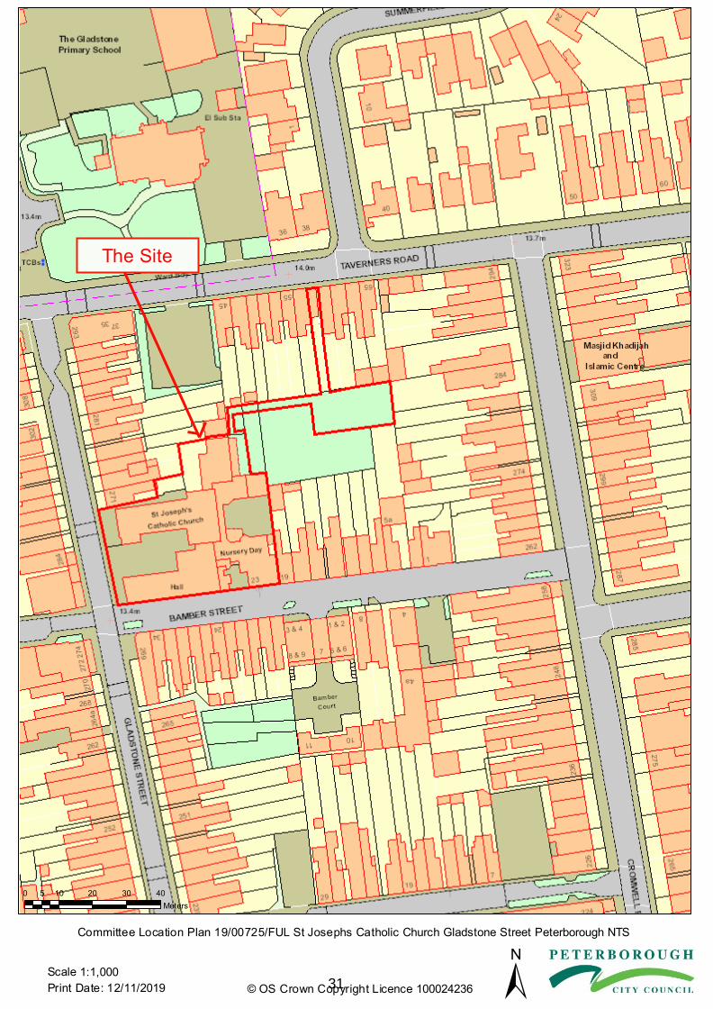
Committee Location Plan 19/00725/FUL St Josephs Catholic Church Gladstone Street Peterborough NTS
±© OS Crown Copyright Licence 1000242361:1,000
0 10 20 30 405Meters
Scale31

This page is intentionally left blank
32

DCCORPT_2018-04-04 1
Planning and EP Committee Item No. 3 Application Ref: 19/00725/FUL Proposal: Demolition and partial demolition of buildings, the erection of three storey
building comprising 14 flats, and the provision of 8 staff parking spaces, including the provision of hard standing and access road.
Site: St Joseph’s Catholic Church, Gladstone Street, Millfield, Peterborough Applicant: Mr Cereste Agent: ARC Survey & Design Consultants Ltd Site visit: 10.09.19 Reason for Call in: The Applicant is a Councillor; and the application has been called in
by Councillor Jamil due to concerns of design and overdevelopment of the site
Case officer: Mr N Harding Telephone No. 01733 453410 E-Mail: [email protected] Recommendation: GRANT subject to: no material objections being received further to re-
consultation with members of the public and the Local Highway Authority; securing of a satisfactory drainage strategy; and relevant conditions.
1 Description of the site and surroundings and Summary of the proposal Site Description The application site comprises St Joseph’s Catholic Church, Church Hall and Children’s Nursery, situated on the corner of Gladstone Street and Bamber Street. The Church and Hall are accessed via a pedestrian and vehicle access from Gladstone Street, and the Children’s Nursery has a pedestrian access onto Bamber Street. In 2003 planning permission was granted to extend the children’s nursery where it was noted that there are no planning conditions that restrict the number of children which can be accommodated on site. The latest Ofsted report for the nursery states that 94 children were attending, and that there are 9 members of staff. The application site is within the Bamber Street Local Centre, where there are three ground floor retail units, two of which have canopies to front, with residential above. The character of the area otherwise comprises two storey semi-detached and terraced residential properties that abut the back edge of the footpath, utilising either a red brick, buff brick or render external walling, the majority of which are reliant upon on-street car parking. None of the buildings on site are listed or locally listed, and the site is not within a Conservation Area. Pre-Amble In 2007 planning permission was granted under App Ref: 07/01649/FUL for the 'conversion of church and church hall to 8x 1-bed dwellings'. The site would have otherwise remained unchanged, with the exception of a remote car parking area which was to be created within a central area of landscaping to the north-east. This car park was to provide car parking for nursery staff, who have historically parked on the application site. Vehicle and pedestrian access would be situated between No's 57 and 59 Taverners Road. This permission was not implemented however, and has subsequently lapsed.
33

DCCORPT_2018-04-04 2
Proposal Further to the receipt of amended plans, the application seeks planning permission to demolish the Church and Hall, and erect a three storey building to create 14x 1-bed apartments. In addition, 14x off-street car parking spaces and a small amenity space/drying area would be situated on site to serve the proposed apartments, and 8x parking spaces for nursery staff would be created to the north-east of the site, access to which would be gained from Taverners Road to the north. The proposed building would have an overall footprint of 15m x 17.2m and proposes to stand at 9.3m in height, utilising a flat roof. Each unit would be provided with a bedroom, kitchen/living room area and bathroom. Proposed materials are as follows: Walling - White render and grey cladding Roofing - Flat roof with aluminium edging Windows - White UPVC Doors - Aluminium Fencing - 1m high bow top railings to Gladstone Street and Bamber Street The scheme has been amended to include; - Revised Site Location Plan to include the satellite car parking area, to provide staff parking for 8x vehicles and access from Taverners Road; and - Amended car parking and bin store arrangement for the proposed residential units. At the time of writing this report, the amended plans are subject to public consultation, which ends on 20th November 2019. Any new information or letters of representation received will be included within the Update Report. 2 Planning History Reference Proposal Decision Date 07/01649/FUL Conversion of church and church hall to 8
dwellings Permitted 06/10/2008
06/01022/FUL Conversion to 4 self-contained flats Withdrawn by Applicant
06/09/2006
03/00173/FUL Extension to nursery Permitted 09/04/2003 P0179/76 Day Nursery and play space (outline) Permitted 02/04/1976
3 Planning Policy Decisions must be taken in accordance with the development plan policies below, unless material considerations indicate otherwise. National Planning Policy Framework (February 2019) Section 15 - Conserving and enhancing the natural environment Section 16 - Conserving and enhancing the historic environment Peterborough Local Plan 2016 to 2036 (2019) LP02 - The Settle Hierarchy and the Countryside The location/scale of new development should accord with the settlement hierarchy. Proposals within village envelopes will be supported in principle, subject to them being of an appropriate scale. Development in the open countryside will be permitted only where key criteria are met.
34

DCCORPT_2018-04-04 3
LP03 - Spatial Strategy for the Location of Residential Development Provision will be made for an additional 21,315 dwellings from April 2016 to March 2036 in the urban area, strategic areas/allocations. LP08 - Meeting Housing Needs LP8a) Housing Mix/Affordable Housing - Promotes a mix of housing, the provision of 30% affordable on sites of 15 of more dwellings, housing for older people, the provision of housing to meet the needs of the most vulnerable, and dwellings with higher access standards LP13 - Transport LP13a) New development should ensure that appropriate provision is made for the transport needs that it will create including reducing the need to travel by car, prioritisation of bus use, improved walking and cycling routes and facilities. LP13b) The Transport Implications of Development- Permission will only be granted where appropriate provision has been made for safe access for all user groups and subject to appropriate mitigation. LP13c) Parking Standards- permission will only be granted if appropriate parking provision for all modes of transport is made in accordance with standards. LP16 - Urban Design and the Public Realm Development proposals would contribute positively to the character and distinctiveness of the area. They should make effective and efficient use of land and buildings, be durable and flexible, use appropriate high quality materials, maximise pedestrian permeability and legibility, improve the public realm, address vulnerability to crime, and be accessible to all. LP17 - Amenity Provision LP17a) Part A Amenity of Existing Occupiers- Permission will not be granted for development which would result in an unacceptable loss of privacy, public and/or private green space or natural daylight; be overbearing or cause noise or other disturbance, odour or other pollution; fail to minimise opportunities for crime and disorder. LP17b) Part B Amenity of Future Occupiers- Proposals for new residential development should be designed and located to ensure that they provide for the needs of the future residents. LP19 - The Historic Environment Development should protect, conserve and enhance where appropriate the local character and distinctiveness of the area particularly in areas of high heritage value. Unless it is explicitly demonstrated that a proposal meets the tests of the NPPF permission will only be granted for development affecting a designated heritage asset where the impact would not lead to substantial loss or harm. Where a proposal would result in less than substantial harm this harm will be weighed against the public benefit. Proposals which fail to preserve or enhance the setting of a designated heritage asset will not be supported. LP28 - Biodiversity and Geological Conservation Part 1: Designated Site International Sites- The highest level of protection will be afforded to these sites. Proposals which would have an adverse impact on the integrity of such areas and which cannot be avoided or adequately mitigated will only be permitted in exceptional circumstances where there are no suitable alternatives, over riding public interest and subject to appropriate compensation. National Sites- Proposals within or outside a SSSI likely to have an adverse effect will not normally be permitted unless the benefits outweigh the adverse impacts.
35

DCCORPT_2018-04-04 4
Local Sites- Development likely to have an adverse effect will only be permitted where the need and benefits outweigh the loss. Habitats and Species of Principal Importance- Development proposals will be considered in the context of the duty to promote and protect species and habitats. Development which would have an adverse impact will only be permitted where the need and benefit clearly outweigh the impact. Appropriate mitigation or compensation will be required. Part 2: Habitats and Geodiversity in Development All proposals should conserve and enhance avoiding a negative impact on biodiversity and geodiversity. Part 3: Mitigation of Potential Adverse Impacts of Development Development should avoid adverse impact as the first principle. Where such impacts are unavoidable they must be adequately and appropriately mitigated. Compensation will be required as a last resort. LP32 - Flood and Water Management Proposals should adopt a sequential approach to flood risk management in line with the NPPF and council's Flood and Water Management SPD. Sustainable drainage systems should be used where appropriate. Development proposals should also protect the water environment. LP33 - Development on Land Affected by Contamination Development must take into account the potential environmental impacts arising from the development itself and any former use of the site. If it cannot be established that the site can be safely developed with no significant future impacts on users or ground/surface waters, permission will be refused. 4 Consultations/Representations PCC S106 Planning Obligations Officer No objections - The application has been accompanied by a Viability Assessment which has demonstrated that the conversion of the existing buildings to residential would not be viable. PCC Conservation Officer No objection – The NPPF requires that the effect of an application on the significance of a non-designated heritage asset should be taken into account in determining the application. In weighing applications that directly or indirectly affect non-designated heritage assets, a balanced judgement will be required having regard to the scale of any harm or loss and the significance of the heritage asset. The Church and Church Hall are some of the best preserved buildings in the vicinity and forms a local landmark. The buildings are not listed or locally listed, nor is the site within a Conservation Area. As such the buildings are deemed to be a non-designated heritage asset due to its good quality appearance and strong links with the social history of the surrounding area in both education and religion.
The proposed large, three storey flat roofed block of flats on the corner is considered to be architecturally basic and replacing what exists with something of limited streetscene, landmark value, or coherence with its surroundings. Despite that the proposal would retain some of the original building, this is considered to be a token piece of the building of very small proportion located at the rear of the site, thus losing the prominent gables fronting Gladstone Street in their entirety and the landmark nature of the site.
36

DCCORPT_2018-04-04 5
From a heritage consideration the substantial demolition of this building would result in the loss of a non-designated heritage asset and detriment to heritage significance and integrity of the area. The National Planning Policy Framework (NPPF) 2019 contains a general presumption in favour of sustainable development, but development is not considered sustainable if it causes harm to heritage assets.
However, it has been demonstrated that the conversion of the existing buildings to residential would not be viable, therefore the loss of these buildings is regrettably accepted. PCC Archaeological Officer No objection - The proposed development site contains no known archaeological heritage assets. Information pertaining to the general area is unclear, despite antiquarian observations of a possible Roman settlement and a road off Taverners Road. Cartographic evidence (Ordnance Survey Map Series) shows that the complex of the Church and Church Hall was already extant in the late 19th century, when the church was used as a Boys and Girls' school, and the hall as a 'mission room' and, later, infant school, with little alteration to the original layout in plan. According to the submitted plans, the Church Hall facing onto Bamber Street is to be demolished, with the retention of its easternmost quarter to be annexed to a new three storey flat block. The Church is to be almost entirely demolished to create parking spaces. Although unscheduled, the Church and Church Hall, as an architectural complex, contribute to enhance the character of the area. In addition, the complex has historic significance which derives from the use of the buildings as education establishments. Therefore, a historic building survey should be carried out prior to any demolition/alteration works. It may also be appropriate to undertake additional recording during dismantling. The recording should be extended to cover the monitoring of all groundwork operations, as these could expose buried remains of archaeological significance. PCC Pollution Team No objection - As the proposal involves demolition of an existing building in a residential area, demolition and construction should be carried out in such a manner so as not to cause nuisance to existing dwellings / businesses. The internal layout of the building and layout of rooms on different floors should be considered. PCC Peterborough Highways Services Comments – With respect to the submitted Parking Survey, the car park on Bamber Street is only available to resident permit holders. The one in Taverners Road is open to the public and provides potentially four parking spaces overnight, according to the survey. To confirm the requirements, for a development of 14 flats the LHA would need to insist on 4 visitor car parking spaces being available. Officer note: An amended parking arrangement for staff parking and on-site parking serving the flats is currently with the Local Highway Authority, and further information will be provided within the Update Report. Police Architectural Liaison Officer (PALO) No objection - This area is a high demand on calls for service to the Police and partner agencies and locally there have been reports of anti-social behaviour and burglary. Therefore conditions are sought with respect to lighting the car park area, access control to the building, details of cycle security and additional external/security lighting.
37

DCCORPT_2018-04-04 6
Lead Local Drainage Authority Comments – Additional information is required, specifically with respect to details of the existing surface water drainage arrangements and clarification that on site storage will achieve a 100-year critical rainfall event +40% climate change allowance. Comments have also been provided with respect to the appropriateness of ACO channels over SuDS features, e.g. block paving, and further information is sought with respect to the proposed attenuation crates given the groundwater level. Anglian Water Services Ltd Objects - The surface water strategy/flood risk assessment submitted with the planning application relevant to Anglian Water is unacceptable. No evidence has been provided to show that the surface water hierarchy has been followed as stipulated in Building Regulations Part H. This encompasses the trial pit logs from the infiltration tests and the investigations in to discharging to a watercourse. If these methods are deemed to be unfeasible for the site, we require confirmation of the intended manhole connection point and discharge rate proposed before a connection to the public surface water sewer is permitted. We would therefore recommend that the applicant needs to consult with Anglian Water and the Environment Agency. We request that the agreed strategy is reflected in the planning approval. Environment Agency No objection PCC Wildlife Officer No objection - No evidence of any bat roosts were found during the survey, however it was noted that the roof voids of the buildings were not surveyed due to lack of access. Whilst the presence of pigeons suggests there are unlikely to be any roosting bats present, an informative relating to the legal protection of bats is recommended, along with installation of new bat roosting features, as recommended in the report. Evidence of nesting birds was found in the buildings, therefore standard bird nesting Informative should be attached should the scheme be approved. As mitigation it is requested that a range of bird nesting features are installed that cater for a number of different species such as House Sparrow, Starling & Swift. Details regarding numbers, designs and locations should be provided by the applicant which may be secured via a suitably worded condition. Waste Management No objection - The plans note that bins would be collected by a commercial waste company. In the event that the Council were to collect the bins, the bin store area would need to be relocated closer to the highway in accordance with RECAP guidance. 4 x 1100L bins (split 2 x Residual, 2 x co-mingled recycling), 1 x 140L communal food waste bin. In light of the one way system on Gladstone Street, consideration needs to be made for the time the collection crew take to collect bins so I recommend the bin store is placed as close as possible to the highway. Local Residents/Interested Parties Initial consultations: 22 Total number of responses: 5 Total number of objections: 5 Total number in support: 0 First Round 4x letters of representation have been received raising the following concerns:
38

DCCORPT_2018-04-04 7
- Lack of parking in the area; - The area suffers from anti-social behaviour; - Loss of privacy; - Overdevelopment for the site; three storeys is too tall; - Out of keeping with the area; - Increase in litter; and - Local residents concerns are being ignored. The 5th response relates to comments received from Councillor Jamil, who has requested that the application be determined by the Planning and Environmental Protection Committee as the development is not in keeping with the rest of the properties in the vicinity and is too large a development in an already congested part of the ward. Officer note: At the time of writing this report the application is out for public re-consultation. Should any additional letters of representation be received, these will be included within the Update Report. 5 Assessment of the planning issues The main considerations are:
a) Principle of development b) Viability c) Design and heritage d) Access and parking e) Drainage f) Neighbour amenity g) Amenity for future occupants h) Archaeology i) Biodiversity j) Contamination
a) The Principle of Development The application site is situated within the urban area of the City, therefore the principle of residential development on this site would accord with Policies LP2 and LP3 of the Peterborough Local Plan (2019), subject to satisfactory assessment against the following matters. b) Viability The application has been accompanied by a Viability Assessment, which has been submitted to demonstrate that the conversion of the existing buildings to residential would not be a viable business proposal. The Council's Planning Obligations Officer has reviewed this document and, whilst the assessment has been based on 2008 figures, when taking into account the cost of inflation and in the experience of the Officer, updated figures would still result in a deficit and would still demonstrate that the conversion of the existing buildings to residential would not be viable. As such the conversion of the existing buildings would not be a viable business proposition, which factors into the Officers assessment below. c) Design and Heritage Considerations Demolition and proposed replacement building The proposal would result in the demolition and partial demolition of the Church and Hall respectively. As set out above, these buildings are not listed nor are they locally listed, as such these have been identified by the Council's Conservation Officer as non-designated heritage assets, and are '... some of the best preserved buildings in the vicinity, in terms of retaining much of their original historic appearance, materials and detailing'. The site forms a local landmark and is deemed to be a non-designated heritage asset due to its good quality appearance and strong links with the social history of the surrounding area in both education and religion.
39
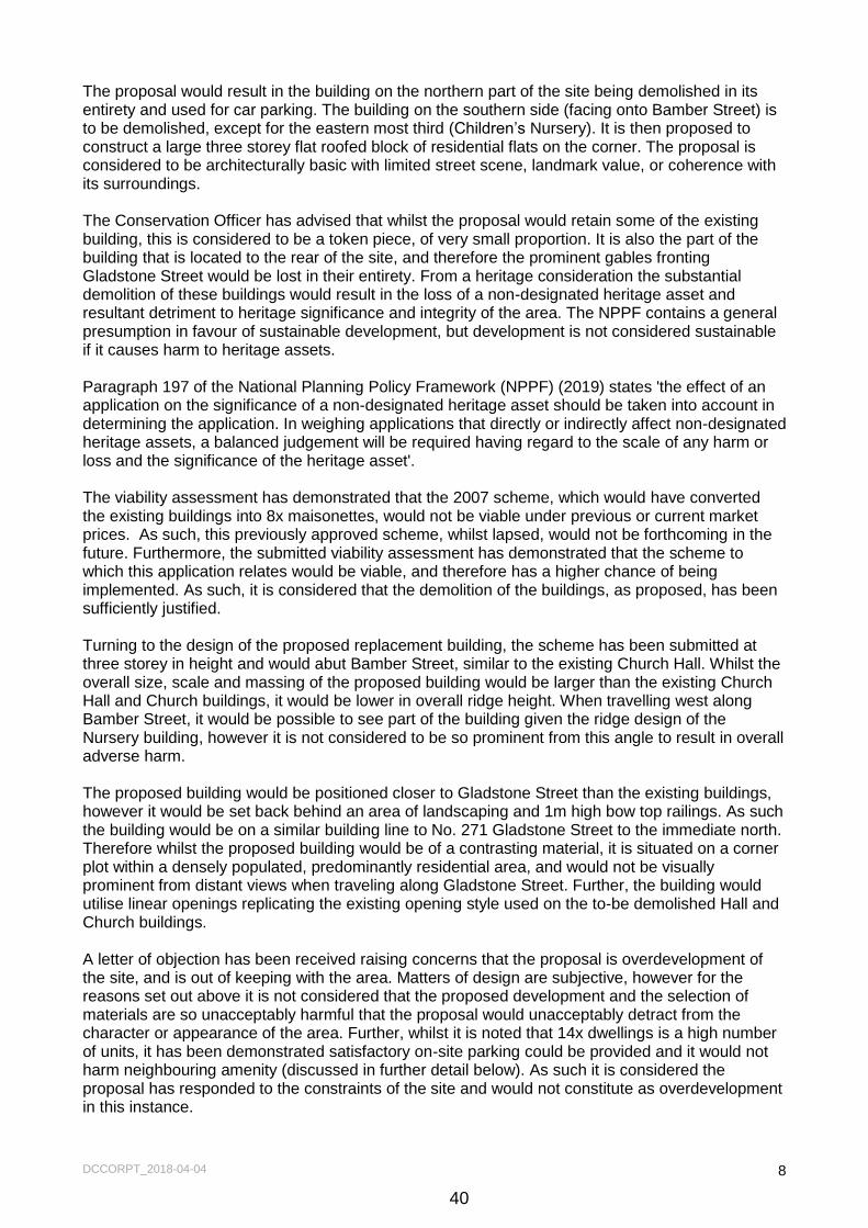
DCCORPT_2018-04-04 8
The proposal would result in the building on the northern part of the site being demolished in its entirety and used for car parking. The building on the southern side (facing onto Bamber Street) is to be demolished, except for the eastern most third (Children’s Nursery). It is then proposed to construct a large three storey flat roofed block of residential flats on the corner. The proposal is considered to be architecturally basic with limited street scene, landmark value, or coherence with its surroundings. The Conservation Officer has advised that whilst the proposal would retain some of the existing building, this is considered to be a token piece, of very small proportion. It is also the part of the building that is located to the rear of the site, and therefore the prominent gables fronting Gladstone Street would be lost in their entirety. From a heritage consideration the substantial demolition of these buildings would result in the loss of a non-designated heritage asset and resultant detriment to heritage significance and integrity of the area. The NPPF contains a general presumption in favour of sustainable development, but development is not considered sustainable if it causes harm to heritage assets. Paragraph 197 of the National Planning Policy Framework (NPPF) (2019) states 'the effect of an application on the significance of a non-designated heritage asset should be taken into account in determining the application. In weighing applications that directly or indirectly affect non-designated heritage assets, a balanced judgement will be required having regard to the scale of any harm or loss and the significance of the heritage asset'. The viability assessment has demonstrated that the 2007 scheme, which would have converted the existing buildings into 8x maisonettes, would not be viable under previous or current market prices. As such, this previously approved scheme, whilst lapsed, would not be forthcoming in the future. Furthermore, the submitted viability assessment has demonstrated that the scheme to which this application relates would be viable, and therefore has a higher chance of being implemented. As such, it is considered that the demolition of the buildings, as proposed, has been sufficiently justified. Turning to the design of the proposed replacement building, the scheme has been submitted at three storey in height and would abut Bamber Street, similar to the existing Church Hall. Whilst the overall size, scale and massing of the proposed building would be larger than the existing Church Hall and Church buildings, it would be lower in overall ridge height. When travelling west along Bamber Street, it would be possible to see part of the building given the ridge design of the Nursery building, however it is not considered to be so prominent from this angle to result in overall adverse harm. The proposed building would be positioned closer to Gladstone Street than the existing buildings, however it would be set back behind an area of landscaping and 1m high bow top railings. As such the building would be on a similar building line to No. 271 Gladstone Street to the immediate north. Therefore whilst the proposed building would be of a contrasting material, it is situated on a corner plot within a densely populated, predominantly residential area, and would not be visually prominent from distant views when traveling along Gladstone Street. Further, the building would utilise linear openings replicating the existing opening style used on the to-be demolished Hall and Church buildings. A letter of objection has been received raising concerns that the proposal is overdevelopment of the site, and is out of keeping with the area. Matters of design are subjective, however for the reasons set out above it is not considered that the proposed development and the selection of materials are so unacceptably harmful that the proposal would unacceptably detract from the character or appearance of the area. Further, whilst it is noted that 14x dwellings is a high number of units, it has been demonstrated satisfactory on-site parking could be provided and it would not harm neighbouring amenity (discussed in further detail below). As such it is considered the proposal has responded to the constraints of the site and would not constitute as overdevelopment in this instance.
40

DCCORPT_2018-04-04 9
The benefits of bringing forward 14x additional dwellings into the Urban Area of the City is considered to outweigh the retention of two underused buildings, despite their notable good quality appearance and strong links with the social history of the surrounding area. Subject to conditions being attached with respect to levels, material detailing and details of hard and soft landscaping, the proposed development would not unacceptably harm the character or appearance of the immediate area, in accordance with Policies LP16 and LP19 of the Peterborough Local Plan (2019) and Paragraph 197 of the NPPF (2019). Staff Parking The proposed development would create an area of staff car parking area to the north-east of the Nursery to off-set the loss of staff car parking that would result from the proposed residential development. This is reflective of the 2007 scheme (previously permitted) and is included within the amended scheme submitted. Subject to conditions being attached with respect to hard surfacing of the access and parking area, and associated boundary treatments, this element of the proposal would not unacceptably harm the character or appearance of the immediate area. d) Access and Parking The Local Highway Authority (LHA) has advised that 14x parking spaces could be provided on site to serve the proposed 14x 1-bed dwellings, which accords with the Council’s adopted minimum parking standards set out in Policy LP13. Whilst the development is also required to provide 4x visitor spaces, further to reviewing the submitted parking survey, it has been demonstrated that there would be space within a public car park on Taverner’s Road (which is owned by the Council and is located 100 metres around the corner to the north) that could accommodate this number of vehicles. Accordingly, the proposal would not place undue pressure on the surrounding highway network in terms of parking demand. Further to the receipt of amended plans, a satellite parking area has been incorporated into the proposed scheme, which would be capable of providing 8x staff car parking. Access to this parking would be gained from Taverners Road. This new information is currently with the Local Highway Authority, and their further response to this element of the proposal will be provided within the Update Report. e) Drainage A Surface Water Drainage Strategy (Hemmings, October 2019) has accompanied the application. The Lead Local Flood Authority (LLFA) has advised that further information is required, such as clarification as to the existing surface water drainage arrangement and confirmation that satisfactory storage would be provided in site (i.e. 100-year critical rainfall event +40% climate change allowance). Further, the LLFA has advised that a more suitable method of attenuating surface water on site (i.e. block paving rather than the use of ACO channels proposed) and an alternative attenuation crate arrangement should be considered due to groundwater level. This has been communicated to the Applicant, and it is considered that once this information has been provided and the suggestions set out above have been incorporated into the drainage design, a satisfactory surface water drainage scheme for the site can be accommodated. Further information in this regard shall follow within the Update Report. f) Neighbouring Amenity Demolition and proposed replacement building Whilst no letters of representation have been received raising amenity as a concern, the matter of neighbouring amenity remains a material planning consideration.
41

DCCORPT_2018-04-04 10
The proposed building would introduce windows over three floors. Situated to the south, on the opposite side of Bamber Street, are two storey residential properties with a retail unit with flat above on the corner to Gladstone Street. Whilst the proposal would introduce facing windows serving principal rooms, given that there is a road intervening, which carries both vehicle and pedestrian traffic, the relationship is acceptable in this instance. It should be further noted that buildings that abut the back edge of the footway is a characteristic of the area. On the west side of Gladstone Street, again, there are a number of residential properties with retail at ground floor and what appear to be flats above. Similarly, given that there is an intervening road which carries both vehicle and pedestrian traffic, the relationship is considered to be acceptable in this instance. Situated to the north is 271 Gladstone Street, which appears to be occupied as a house of multiple occupation and is within the ownership of the Applicant. This property is served by a small rear yard, however its original garden would become an amenity area serving future occupiers of this proposal. There are also facing ground floor and first floor facing windows, situated on a two storey off-shoot at the rear of the building. At the time of writing this report, it has not been possible to establish exactly what these windows serve, and whilst experience would suggest these are secondary windows serving either a kitchen or bathroom, a worst-case scenario approach to their assessment is necessary. On the north elevation of the proposed building there are a number of facing openings serving the ground floor, first floor and second floor flats. Given that there would be two metre high intervening boundary treatment between the application site and this property, it is not considered the proposed ground floor flats would result in a loss of amenity to this neighbour. The first floor flats (1-1 and 1-5) and second floor flat (2-1) would introduce facing windows serving primary habitable rooms (bedroom and living rooms). There would be separation distance of 20m between Flats 1-1 and 2-1 and No. 271's facing openings, which is considered to be an acceptable separation distance to ensure no undue loss of privacy would result. However, there would only be a separation distance of 14.5m from the living room window servicing Flat 1-5 and No. 271's facing windows. This room is served by both front and rear facing window, which looks out onto Gladstone Street and the proposed car parking area, and therefore this first floor side facing opening can be omitted by way of condition to maintain the amenity of neighbouring occupants. There is also a second floor side facing opening serving a circulation space, which can also be omitted by way of condition. It is noted that No. 271 does not have a rear garden and is served by a yard only, and would be overlooked by the proposed development, however given that it is a rear yard only and not, for example, a garden forming a primary amenity space, this carries less weight and the relationship is accepted in this instance. As such the proposed development would not have an unacceptably adverse impact on the outlook or privacy of No. 271 Gladstone Street, and the relationship is accepted. No. 273 to the north does have a full length garden representative of neighbouring properties along Gladstone Street, however there would be a separation distance in excess of 21m from the first and second floor facing windows, and the relationship is accepted. The Council’s Pollution Control Officer has advised that the demolition of the existing buildings, and construction activities for the replacement building, could give rise to unacceptable noise and general disturbance to neighbouring occupants if not correctly managed. Therefore it is considered necessary to impose a condition to secure a Demolition and Construction Management Plan. On this basis, the proposed development would not result in an unacceptable adverse overbearing impact on neighbouring properties, nor would it result in an unacceptable loss of outlook, light or privacy, and would accord with Policies LP16 and LP17 of the Peterborough Local Plan (2019).
42

DCCORPT_2018-04-04 11
Staff Parking The proposed development would create an area of staff car parking to the north-east of the Nursery, which is reflective of the 2007 scheme. The parking area would only be used by Nursery staff during opening hours, and the comings and goings of 8 vehicles is not considered to result in unacceptably adverse harm to neighbouring amenity by reason of noise and general disturbance. This was the conclusion drawn in the granting of the 2007 scheme and Officers do not consider that the relationship is altered through the current proposal. g) Amenity of Future Occupiers The proposed development would abut Bamber Street, which is a shared surface arrangement (i.e. there is no differentiation within the road between pedestrian and vehicle space). Units 0-2 and 0-3 would have windows serving principal rooms positioned adjacent to the highway, which would normally be resisted by Officers. However, this arrangement and layout is characteristic of the built form of the locality, including properties situated directly opposite. It is recognised that future occupiers, particularly of Unit 0-2, would likely be required to close their curtains or blinds for the majority of the day, however as this is representative of the area, the layout is accepted in this instance. Unit 0-5 would have a ground floor side facing opening and east facing opening serving a living room, which looks out onto the vehicle access and pedestrian access respectively. However, a primary outlook onto the street would also be provided and therefore this relationship is accepted in this instance. Unit 0-1 would face out onto the car park, whereby there is opportunity to introduce some defensive landscaping, which shall be secured by planning condition. The Police Architectural Liaison Officer has raised no objection to the proposal subject to a condition being attached with respect to lighting the car park area, access control to the building, details of cycle security and additional external/security lighting. It is noted that there would be a pedestrian passage to the west of the building between the car park and Bamber Street. Officers have strong concerns that this would provide a second pedestrian access into the car park with little to no natural surveillance. Therefore a condition shall be imposed requiring this to be gated and only be accessible for servicing. The proposal does provide a small area of amenity space to the north-east corner of the site, however it is recognised in reality this will be a drying area and secure bike store area. That said, a communal drying area is considered sufficient to serve the development in this instance, and primary rooms would otherwise be served by a satisfactory outlook and levels of natural light. Furthermore, it is not uncommon for flat developments to have no formal outside amenity space and on balance, an acceptable level of amenity would be afforded to future occupants. As such the proposal would accord with Policy LP17 of the Peterborough Local Plan (2019). h) Archaeology The Councils Archaeological Officer has raised no objection to the proposal, advising that the site contains no known archaeological heritage assets. However, the Church and Church Hall, as an architectural complex, contribute to enhance the character of the area as well as having historic significance which derives from the use of the buildings as education establishments. Therefore, the Officer has advised that a historic building survey should be carried out prior to any demolition/alteration works. It may also be appropriate to undertake additional recording during dismantling. The recording should be extended to cover the monitoring of all groundwork operations, as these could expose buried remains of archaeological significance. Subject to a historic building survey being carried out and recording during dismantling the loss of the Church and Church Hall, the proposal would accord with Policies LP19 of the Peterborough Local Plan (2019) and Paragraph 189 of the NPPF (2019).
43

DCCORPT_2018-04-04 12
i) Biodiversity The application was accompanied by a bat survey (Hillier Ecology, July 2019), which has been assessed by the Council’s Wildlife Officer. No evidence of any bat roosts was found during the survey, however it was noted that the roof voids of the buildings were not surveyed due to lack of access. Whilst the presence of pigeons suggests that roosting bats are unlikely to be present, an informative relating to the legal protection of bats is necessary, along with installation of new bat roosting features, as recommended within the ecological survey. Evidence of nesting birds was found in the buildings, therefore it has been suggested by the Wildlife Officer that a standard bird nesting informative be attached should the scheme be approved. As mitigation, it is requested by the Wildlife Officer that a range of bird nesting features are installed to cater for a number of different species such as House Sparrow, Starling & Swift. Details regarding numbers, designs and locations should be provided by the Applicant, which may be secured via a suitably worded condition. The proposed development would introduce an area of car parking to the north-east of the nursery to provide car parking for staff members. As set out above, this area has historically been accepted as staff parking and therefore a condition shall be appended to secure hard and soft landscaping of this area, as well as the proposed dwellings. Subject to these conditions there would be no net loss to the overall biodiversity value of the site, and the proposal would accord with Policy LP28 of the Peterborough Local Plan (2019) j) Contamination The Councils Pollution Control Officer has raised no objections to the proposal however they have requested that a condition be appended that in the event contaminated land is found, works cease and the land investigated (and remediated where necessary). Subject to this condition the proposal would accord with Policies LP17 and LP33 of the Peterborough Policies DPD (2019) and Paragraphs 178-180 of the NPPF (2019). k) Other Matters Water Efficiency – In accordance with LP32, to minimise impact on the water environment all new dwellings should achieve the Optional Technical Housing Standard of 110 litres per day per person for water efficiency as described by Building Regulation G2. A compliance condition shall be appended for the avoidance of doubt. The following matters were raised within letters of representation which are not covered elsewhere within this report: - Lack of parking in the area Officer Response: As set out within the Highway section above, it is noted that the area does suffer from historic parking issues. However, the scheme would be able to provide satisfactory off-street parking to serve future occupiers; it has been demonstrated that there is capacity for visitors within a public car park from Taveners Road; and staff parking would be secured by planning condition(s). - The area suffers from anti-social behaviour Officer Response: There is nothing to suggest that this proposed development would result in increased levels of anti-social behaviour, and has received no objections from the Police Architectural Liaison Officer. - Increase in litter
44
DCCORPT_2018-04-04 13
Officer Response: The development would be provided with satisfactory bin storage on site, and would be collected by a private refuse collection company. A bin store area to serve the proposed flats would be located at the front of the site. - Local residents concerns are being ignored. Officer Response: The application has been advertised in accordance with the Town and Country Planning (Development Management Procedure) Order 2015 (as amended) and all the planning related matters raised within the letters of representation received have been considered within this report. Any additional letters of representation received as a result of public consultation will be included within the Update Report. 6 Conclusions Subject to the imposition of the attached conditions, the proposal is acceptable having been assessed in the light of all material considerations, including weighing against relevant policies of the development plan and specifically: - The proposed development would be situated within the urban area of the city, therefore the principle of development is in accordance with Policies LP2 and LP3 of the Peterborough Local Plan (2019); - The proposed development would result in the loss of two non-designated heritage assets, however their loss has been justified and the proposed development would not harm the character or appearance of the immediate area, therefore the proposal would accord with Policies LP16 and LP19 of the Peterborough Local Plan (2019) and Paragraph 197 of the NPPF (2019); - The proposed development would not unacceptably harm the amenity of adjoining neighbours, and satisfactory amenity would be provided for future occupiers, in accordance with Policies LP17 and LP32 of the Peterborough Local Plan (2019); - The proposed development would not adversely affect the biodiversity value of the site, and would accord with LP28 of the Peterborough Local Plan (2019); - The proposal would make provision for surface water drainage and uncovering unsuspected contamination, in accordance with Policies LP32 and 33 of the Peterborough Local Plan (2019), and Paragraphs 178-180 of the NPPF (2019); and - The proposed development would not constitute a highway safety hazard and sufficient car parking could be accommodated onsite, in accordance with Policy LP13 of the Peterborough Local Plan (2019). 7 Recommendation The case officer recommends that planning permission is GRANTED subject to: no objections being raised as part of the neighbour re-consultation process; securing a satisfactory surface water drainage strategy for the site; and the following conditions: C 1 The development hereby permitted shall be begun before the expiration of three years from
the date of this permission.
Reason: In accordance with Section 91 of the Town and Country Planning Act 1990 (as amended).
C 2 The materials to be used in the construction of the external surfaces of the building hereby permitted shall match those set out in the submitted application form and shown on the submitted plans.
Reason: For the Local Planning Authority to ensure a satisfactory external appearance, in
accordance with Policy LP16 of the Peterborough Local Plan (2019).
45

DCCORPT_2018-04-04 14
C 3 If, during development, contamination not previously considered is identified, then the Local Planning Authority shall be notified immediately and no further work shall be carried out until a method statement detailing a scheme for dealing with the suspect contamination has been submitted to and agreed in writing with the Local Planning Authority. The development shall thereafter not be carried out except in complete accordance with the approved scheme.
Reason: To ensure all contamination within the site is dealt with, in accordance with
Paragraphs 178-180 of the NPPF (2019) and Policy LP32 of the Peterborough Local Plan (2019).
C 4 No development (including demolition) shall take place unless and until a Demolition and
Construction Management Plan has been submitted to and approved in writing by the Local Planning Authority. The Demolition and Construction Management Plan shall include (but not limited to) the following:
i) Hours of working and deliveries; ii) Parking, Turning and Loading/Unloading areas for all construction/contractors vehicles; iii) Site compounds/storage areas; and iv) Wheel cleansing facility details. Note Officers would expect hours of delivery for HGVs to take place between 09:30 and
15:45 Monday to Friday only to avoid peak hours. The demolition and construction works shall thereafter only take place in strict accordance
with the approved Demolition and Construction Management Plan. Reason: In order to protect the amenities of neighbouring occupants and in the interests of
highway safety, in accordance with Policies LP13 and LP17 of the Peterborough Local Plan (2019). This is a pre-commencement condition as these details need to be agreed before development commences on site.
C 5 Notwithstanding the submitted information, no land raising is permitted and the finished
floor levels of the ground floor residential units hereby permitted shall be no more than 100mm above the existing ground floor level.
Reason: In order to protect and safeguard the amenities of the adjoining occupiers, in
accordance with Policy LP17 of the Peterborough Local Plan (2019). C 6 Prior to occupation of any residential unit hereby permitted, space shall be laid out and
made available for 14x vehicles to park in accordance with Drawing 1633-PR101 B. These parking bays shall be marked to refer to the property to which they relate and shall not thereafter be used for any purpose other than the parking of vehicles in connection with the use of the new residential units hereby permitted in perpetuity.
Reason: To ensure the development is provided with satisfactory parking, in accordance
with Policy LP13 of the Peterborough Local Plan (2019). C 7 Prior to occupation of any residential unit hereby permitted, details of secure cycle parking
capable of accommodating 14x cycles shall be submitted to and approved in writing by the Local Planning Authority. The details shall show 'Sheffield' style stands with shelters that are covered and secure.
Thereafter, the cycle parking shall be implemented in accordance with the approved details prior to first occupation of the first residential unit and thereafter be retained and maintained as such in perpetuity, available for use by future occupiers.
46

DCCORPT_2018-04-04 15
Reason: In the interest of ensuring that the site is served by sufficient cycle parking and to encourage more sustainable methods of travel to/from the site, in accordance with Policy LP13 of the Peterborough Local Plan (2019)
C 8 Prior to occupation of any residential unit hereby permitted, the following details shall be
submitted to and approved in writing to the Local Planning Authority.
- an audio access control system to serve the development; and - a secure boundary treatment and external lighting to serve both the car park serving the
permitted residential units and staff nursery car park (as shown on Drawing 1633-E01 B ‘Location Plan’).
Thereafter, the audio access control system, secure boundary treatment and external lighting scheme shall be implemented in accordance with the approved details prior to the occupation of any residential unit, and thereafter retained and maintained as such in perpetuity.
Reason: In the interest of protecting the amenity of future occupiers from crime and anti-
social behaviour, in accordance with Policies LP16 and LP17 of the Peterborough Local Plan (2019).
C 9 Notwithstanding the approved drawings, the following windows/openings (as shown on
Drawings 1633-PR101 B ‘Proposed Site Plan and Floor Plans’, 1633-PR102 A ‘Proposed Elevations’ and 1633-PR103 A ‘Proposed Floor Plans’) shall be omitted:
- First floor openings serving Units 1-5 to the northern elevation; and - Second floor opening serving the hallway / circulation area. Reason: For the avoidance of doubt and in the interest of protecting neighbouring amenity,
in accordance with Policy LP17 of the Peterborough Local Plan (2019). C10 Prior to occupation of any residential unit hereby permitted, a scheme for the provision of
bat and bird boxes (to accommodate House Sparrow, Starling & Swift) shall be submitted to and approved in writing by the Local Planning Authority. Thereafter, the bat and bird boxes shall be implemented prior to occupation of any residential unit in accordance with the approved details and retained in perpetuity.
Reason: In the interest of preserving the biodiversity value of the site, in accordance with
Policy LP28 of the Peterborough Local Plan (2019). C11 No demolition shall take place unless and until (including stripping out works), a Level 2
Historic Building Survey of all parts of the buildings to be affected by the proposed development has been carried out (pre-works, during works, and post works), and submitted to and approved in writing by the Local Planning Authority.
The survey must be undertaken in accordance with the guidelines set by Historic England (2015, Understanding Historic Buildings: A Guide to Good Recording Practice). The recording must be undertaken by heritage professionals. Both the exterior and interior of the buildings should be inspected, described and photographed. The examination of the buildings should result in an analysis of its development and use. Reason: To ensure that historic building features are properly examined and recorded, in accordance with Section 16 of the National Planning Policy Framework (2019) and Policy LP19 of the Peterborough Local Plan (2019). This is a pre-commencement condition as these details need to be recorded before development comments on site.
47

DCCORPT_2018-04-04 16
C12 No development (including demolition) shall take place unless and until a scheme for the hard and soft landscaping of the site has been submitted to and approved in writing by the Local Planning Authority. The scheme shall include details of the following:
- Planting plans including retained trees, species, numbers, size and density of planting; - Details of all boundary treatments, including treatment to the proposed Nursery staff car
parking area; and - Bin storage areas.
The approved hard landscaping scheme shall be carried out prior to the first occupation of any residential unit, and retained thereafter.
The soft landscaping shall be carried out within the first available planting season following first occupation of the first residential unit or, alternatively, in accordance with a timetable for landscape implementation which has been approved as part of the submitted landscape scheme.
Any trees, shrubs or hedges forming part of the approved landscaping that die, are
removed or become diseased within five years of the implementation of the landscaping scheme shall be replaced during the next available planting season by the developers, or their successors in title with an equivalent size, number and species to those being replaced. Any replacement trees, shrubs or hedgerows dying within five years of planting shall themselves be replaced with an equivalent size, number and species.
Reason: In the interests of visual amenity and enhancement of biodiversity, in accordance
with Policies LP16 and LP28 of the Peterborough Local Plan (2019). C13 No development (including demolition) shall take place unless and until the staff car parking
area shown on Drawing 1633-E01 D (Location Plan) has been laid out and made available for use by staff of the Nursery. This shall include the erection of boundary treatments to No’s 57 and 59 Taveners Road and associated security measures. The car parking area shall thereafter be retained and maintained in perpetuity for staff parking in association with the Nursery, and for no other use or user.
This area shall not be used for the pick-up and drop-off of children, nor shall it be used by delivery vehicles.
Reason: To ensure the development provides satisfactory parking to serve the development and to protect the amenity of neighbour occupiers, in accordance with Policies LP13 and LP17 of the Peterborough Local Plan (2019).
C14 Prior to occupation of any residential unit hereby permitted 2m x 2m vehicle to pedestrian
visibility splays shall be laid out on both sides of the access onto Gladstone Street. The splays shall be provided and maintained thereafter free from any obstruction over a height of 600mm within an area of 2m x 2m measured from and along the back of the highway boundary.
Reason: To ensure the development does not constitute a highway safety hazard, in
accordance with Policy LP13 of the Peterborough Local Plan (2019). C15 The development hereby approved shall achieve the Optional Technical Housing Standard
of 110 litres per person per day, in accordance with Building Regulations G2.
Reason: To minimise impact on the water environment, in accordance with Policy LP32 of the Peterborough Local Plan (2019).
48

DCCORPT_2018-04-04 17
C16 The development hereby permitted shall be carried out in accordance with the following approved plans:
1633-E01 D (Location Plan)
1633-E02 (Existing Plans and Elevations)
1633-PR101 B (Proposed Site Plan and Floor Plans)
1633-PR102 A (Proposed Elevations)
1633-PR103 A (Proposed Floor Plans) Reason: To clarify the approved details and to ensure the development accords with the
reasoning and justification for granting approval. Copies to Cllrs. Jamil. Iqbal. Hussain
49

This page is intentionally left blank
50