plate tectonics. earth’s lithospheric crust divided into large and small crustal plates makes up...
TRANSCRIPT

Plate Tectonics

Earth’s Lithospheric CrustDivided into large and small crustal platesMakes up the ocean floor and the continental land masses, along with the upper mantle.

The oceanic crust averages 8 km deep but is dense enough to support the continental crust riding on it. The continental crust averages 35 km deep – both are relatively thin.
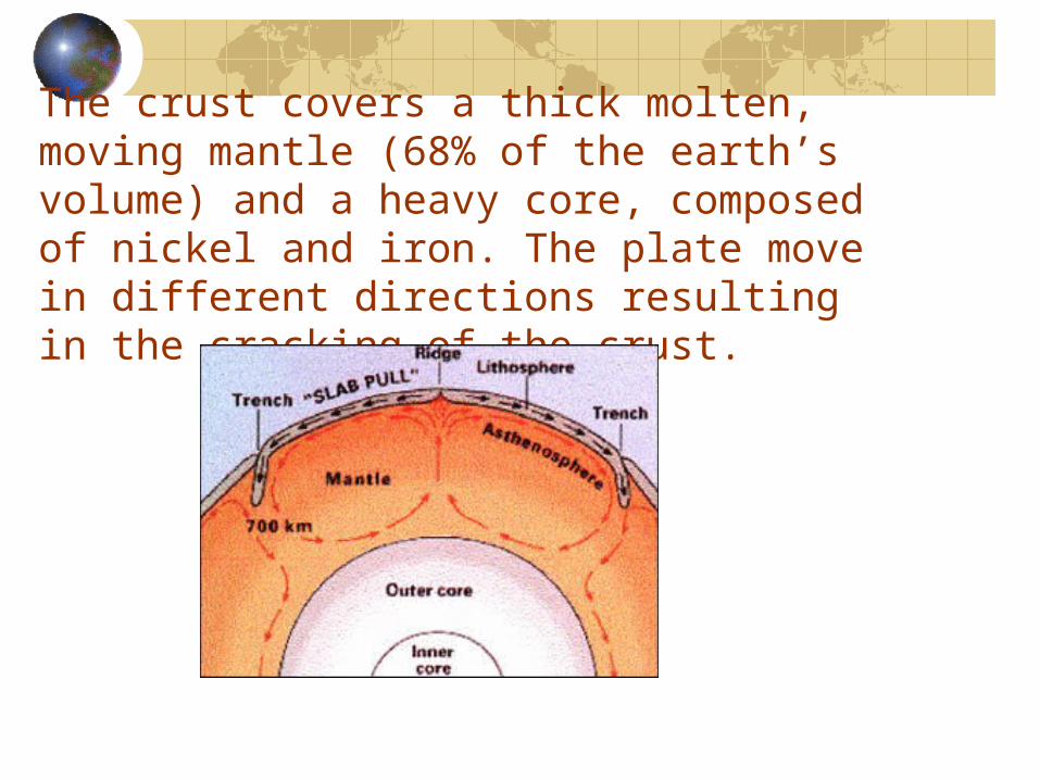
The crust covers a thick molten, moving mantle (68% of the earth’s volume) and a heavy core, composed of nickel and iron. The plate move in different directions resulting in the cracking of the crust.

Major plate boundaries can be mapped using seismic activity.

The Major Plates:

Plate Boundaries
What happens when plates meet?

Oceanic to Oceanic boundary – divergentBoth plates are composed of basalt, also Mg, Fe, and SiBoth are made of high density rockThe result is a vent, mid-ocean ridge is and example.

Continental to Continental boundary - convergent
Both plates are granite, also Si and ALPlates have low density rockThe result is that edges are forced up into mountains.

Oceanic to Continental boundary – a convergent, subduction zone, plate edges over-ride or slide past others
Lighter continental plate edge override the denser oceanic plateOceanic plate edge are subducted down into the asthenosphere and are re-meltedThe result - Trenches

What the Boundaries Look Like:

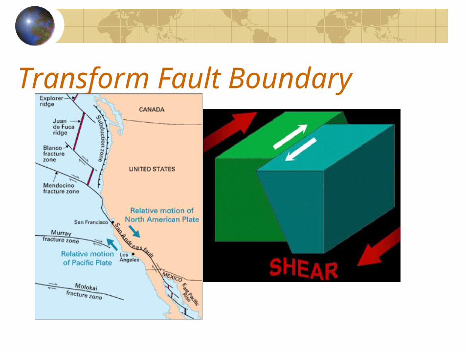
Transform Fault Boundary

What’s at the boundary lines?

1912, Alfred Wegener proposed the idea of a super-continent called Pangea that broke apart to form today’s land masses
The ReasonsThe continent’s shape roughly fit togetherThe rocks and fossils of different continents matched

Harry Hess and J Wilson propose a mechanism to explain continental movement in the early 60’s. to avoid critism the termed it “geo-poetry”
In 1969 the Glomar Challenger drilled a series of holes in the Mid-Atlantic ridge. What they found changed geology and oceanography.


Continental Rocks date the Earth at about 5 billion years old. Since the ocean floor is lower in the lithosphere, scientists expected to find older rocks at those depths.Continental geology’s law of Superposition states that oldest rocks are laid down first and should be found horizontally lowest in a bed unless uplifted.

They found no rock older than 3 billion years and most were younger. How could the ocean floor be younger than the continents riding on it?

The Deep Sea Drilling project showed that rocks became older as they moved away from the mid ocean ridge. Oceanic geology showed rock layers are created vertically.The MOR seemed to be a parallel distance from continents on either side.

Core samples revealed matching striping in rocks on both sides of the MOR.

In 1977, Project FAMOUS photographed magma squeezing out of the MOR and creating new ocean floor.

Scientists, Mathews and Vine had data for a cohesive theory on plate tectonics. The sea floor was spreading – moving continents with it. The theory of sea floor spreading explained continental drift. Proving Wegener to be correct.