perspectivas de actualización: cambios en el análisis … · perspectivas de actualización:...
TRANSCRIPT

Febrero 2014
Perspectivas de actualización: cambios en el análisis de series cartográficas
Ing. Francisco Javier Jiménez Nava Director General Adjunto de Recursos Naturales y Medio Ambiente
INEGI

Content
• Background
• Production and Updating
• Where are we going…


Mexico for its location, shape, soils, and climate, topographic and geologic characterisitics, presents a wide range of ecological conditions, which has resulted in a wealth and diversity of natural resources.
Natural Resources Information


Information is available at the scales 1: 50,000, 1: 250,000 and 1: 1 million, plus a national soil erosion data set in scale 1: 250,000. Currently there are two Soil national data sets at 1: 250 000, elaborated in GIS environment with field verification. The data set includes information from more than 10,000 soil profiles in field sites all over the country. The soil types are based on the classification of the FAO World Base for Soil Resources (WRB).
Soil Information
National Soils Data Set, series II generated from 2002-2007
WRB 1998 Soil Classification (Adapted by INEGI 2000)
National Soil Erosion Data Set Generated between 2008-2013
10.4011.70
13.70 13.70
28.30
9.10 8.60
18.20
TIPOS DE SUELO DE MÉXICO(Prcentaje)

• The National Soil Data Set series III is under development • Based on the FAO WRB 2014 soil classification. • In parallel the soil profile data set is being developed. • Also in development: National Soil Erosion Data Set series II • Several National Data Sets of soil properties; like depth, texture are being
generated by Spatial Statistics Methods.
P r o s p e c t s

Land Use and Vegetation Information
Since 1978 five 1:250,000 National Land Use and Vegetation Data Sets (series) have been developed in the following time periods:
Vegetation and Land Use change statistics have been derived using the five data sets
-
20.00
40.00
60.00
80.00
100.00
120.00
SERIE I(1985)
SERIE II(1993)
SERIE III(2002)
SERIE IV(2007)
SERIE V(2011)
Mil
es d
e K
m2
Cambios en la Selva Húmeda
VEGETACIÓN NATURAL
VEGETACIÓN SECUNDARIA
VEGETACIÓN INDUCIDA
AGRICULTURA
International collaborative projects with Canada and the United States.
Land Cover Information System (SICT). 1:50 000
220 data sets available
North American Land Change Monitoring System (NALCMS) Mapa de Cobertura del Suelo de América del Norte, 2005

• Update Land Use and Vegetation information and produce the National Data Set series VI by 2017
• Design and develop strategies for statistical quality control data and the constant improvement in the quality of the data.
• Generating Land Cover information by digital processing of remote sensing imagery.
P r o s p e c t s

• The data sets contain data about the surface rocks:
• Rock type.
• Age.
• Areas of economic interest (mines, material banks, geothermal areas, etc.).
• Geologic Data are useful for themmes as mineral and oil prospection, risk assessment, road planning and construction, among others.
Geological Information
Geological Phenomena National Inventory Layers: • Coastal Erosion (being updated) • mass movement (updated 2014) • Subsidence (being updated), • Volcanism, seismicity, Floods
Costal Erosion Susceptibility Maps: Yucatán, Campeche, Tabasco, Veracruz and Quintana Roo
Mass Movement Susceptibility Maps: Zongolica Sierra of Chiapas, the Huasteca Region and the Chiconquiaco Region
Subsidence Susceptibility Maps : Valley of Aguascalientes, Graben of Villa de Reyes, SLP, San Luis Potosi, Queretaro, Guanajuato Bajio.
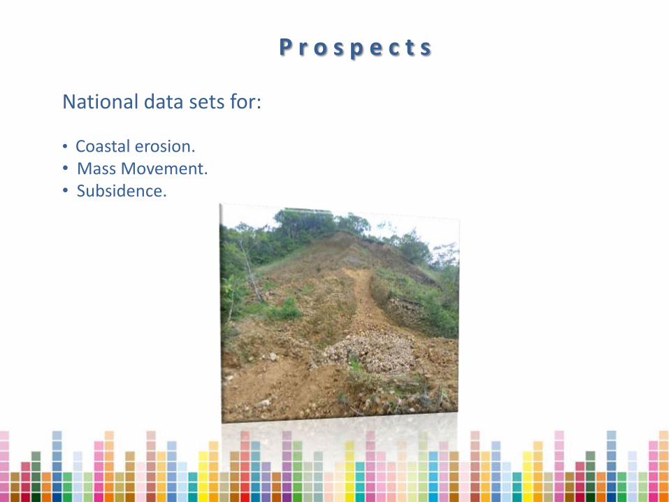
National data sets for:
• Coastal erosion. • Mass Movement. • Subsidence.
P r o s p e c t s

Surface Water Information
Runoff Units
(Polygons)
Hydrographic Divission
(Polygons)
Field data sampling sites (Points)
Water bodies
(Polygons)
Flooding prone areas
(Polygons)
Precipitation (Lines)
Hydrographic network (Lines)
Gauge stations (Points)
Water treatment plants (Points)
Individual digital data sets at 1: 250 000, Series I and II

The new data sets are being produced for physical units: river basins or watersheds.
The approach is to make an complete description and analysis of the watershed: climate, relief, geology, soils, vegetation and human influence. The text includes statistical tables, as well as the map layers for each themme.
Distribution of Primary Vegetation Types
Cuadro 3.1
Vegetación Clave %
Evergreen Tropical Forest SAP 74.86
Fir Forests BS 7.16
Gallery Vegetation VG 6.33
Oak Forest BQ 5.80
Mountain Cloud Forest BM 3.47
Semideciduous Tropical Forest SMS 1.78
Mezquital MKX 0.31
Natural Grasslands PN 0.27
Deciduous Tropical Forest SMC 0.02
Source: INEGI. Conjunto de Datos Vectoriales de Vegetación Primaria. 1:1 000 000 (2003)
P r o s p e c t s

Groundwater Information
Digital data sets at 1: 250,000 and national data sets series I and II
Geohydrologic Unit
Static level contour lines
Sampled wells
Polygon layers
Line layers
Point layers
Restricted water extraction areas Well concentration areas
Geologic structures
Section lines
Groundwater flow direction

In 2007 we initiated the development of the study of groundwater for hydrogeological zones, Currently on the website of INEGI there are 38 sets of data layers and maps in pdf to download and it is intended that by 2017 the first production cycle is closed with approximately 65 zones studied.
Geohydrologic Units
Acquifer vulnerability
Restricted area
Sea water intrusion
Static Level Heigth Contour Lines
Static Depth Contour Lines
Geologic structures
Section Line
Wells, springs, cenotes
Hydrogeologic parameters
PIPEM
Groundwater flow direction
Polygon layers
Line layers
Point layers
P r o s p e c t s

This activity has its origins from 1968, when the newly born mapping agency, began to carry out the mapping of natural resources. It has an estimated collection of 16,000 petrographic paper reports with their respective thin section from samples from all around the country as well as a database of 8,000 updated records.
Petrographic Information
Sieve analysis of coastal sediments to support the project of coastal erosion, beginning in 2012-2015 to date a total of 390 analyzed samples. Normative documents as the petrographic data dictionary are being developed.

Generate products derived from the database of the petrographic and paleontological sample analysis. Disseminate Petrographic and Paleontological in the WEB.
P r o s p e c t s

The laboratory performs physical and chemical analysis to water and soil samples. Presently is under the process of accreditation in the Standard NMX-EC-17025-IMNC-2006 / ISO / IEC 17025: 2005. As part of the laboratory modernization, several new analysis instruments and other equipment have been acquired, as well as a laboratory areas reorganization has been made.
Soil and Water Laboratory

P r o s p e c t s
• Advance in all the Laboratory Standard Documents.
• Continue the Laboratory Modernization
• Provide laboratory services to internal and external users.

Botanical Information
The INEGI Herbarium was created in 1975, in order to preserve the plant samples collected during the field trips as part of the Land Use and Vegetation Mapping.
This collection mainly contains species characteristic of different plant communities of the country; consisting of 40,000 specimens. Each specimen data is also contained in a database.
The Herbarium is open to the general public, students and researchers.
Herbario INEGI Procesamiento e identificación

Especies colectadas en matorral desértico rosetófilo
Incorporación de la información florística a la cartografía
To continue generating and providing basic, current, reliable and timely information about the country's flora.
Increase the storage capability of the Herbarium
Digitize all the specimens in the Herbarium
P r o s p e c t s

FEATURES NUMBER
REEFS 597
CAYS (KEYS) 304
SEA AND COASTAL ISLANDS 3,210
TOTAL 4,111
FEATURES SURFACE Km
2 %
REEFS 358.8 4.5%
CAYS 106.4 1.3% SEA AND COASTAL ISLANDS 7,559.9 94.2%
TOTAL 8,025.8 100%
ZONIFICATION AND REGIONALIZATION
200 msnm
Pleamar
Baja mar
Nivel medio del mar
Región Batial
Región Nerítica
Región Abisal
Región Hadal
Plataforma Continental
Ta
lud
co
nti
ne
nta
l
Zona Abisal
Zona Hadal
Planicie Costera
200 mbnm
ZONA COSTERA ZONA MARINA COSTERA ZONA MARINA
Zona fótica
Zona afótica
ZONA CONTINENTAL
0 msnm
2 000 mbnm
6 000 mbnm
10 000 mbnm
ALTITUD
PROFUNDIDAD
DISTRIBUTION OF ISLAND FEATURES
Island Catalogue

P r o s p e c t s
Publication of the Catalog

Multi-user environment
Data Base Prototype
Headquarters: data distribution
and validation
Regional offices: supervision.
State offices; data generation by specialists in each themme.
A single database is used in the headquarters, regional and state offices.
Integration of Natural Resources Data

P r o s p e c t s Development of WMS and WCS services to support the Natural Resources Mapping Activities
Digital Soil Image Maps: 1:50,000:
http://10.109.1.71/cgi-bin/mapserv?map=/hdd_4/wms/suelos_50k_raster/wms_suelos50k.map&
Digital Topographic Image Maps 1:250,000:
http://10.109.1.71/cgi-bin/mapserv?map=/hdd_4/wms/topo_250k_test/wms_topo_250k_test.map&
State and Municipal Geostatistical Division 2005:
http://10.109.1.71/cgi-bin/mapserv?map=/hdd_4/wms/wms_mgm/wms_mgm_pg.map&
Shaded relief image; 30 m resolution
http://10.109.1.71/cgi-bin/mapserv?map=/hdd_4/wms/wcs_sombreado/wms_somb.map&
SPOT imagery 2010-2011
http://10.109.1.71/cgi-bin/mapserv?map=/hdd_4/wms/spot_2010_2011/wms_spot_2010_11.map&
Rapid Eye imageryt 2012 RGB bands 5-4-3
http://10.109.1.71/cgi-bin/mapserv?map=/hdd_3/data_rapideye/multi_rapideye.map&
Landsat 8 imagery RGB bands 4-3-2
http://10.109.1.71/cgi-bin/mapserv?map=/hdd_1/data_landsat8/multi_landsat8.map&
National Digital Elevation Model 30 m INEGI, Versión 1.0.0
http://10.109.1.71/cgi-bin/mapserv?map=/hdd_4/WCS/mod_dig_elev_nal.map&


Trends in geospatial information management in the next 5 to 10 years
Quality assurance through standards
United Nations Committee of Experts on Global Geospatial Information
Management (UN-GGIM)
Creating new data and active participation in society
National Datasets and Big Data
Proliferation of high resolution satellite images
Using the cloud
Open Source Software and Data

Challenges ...
Generate and georeference statistical information (censuses, surveys and administrative records). Implement a national
grid for statistics data.
Reference Information
Statistical Information Geographic Information
Linking