pennsylvania’s carbon capture · pennsylvania’s carbon capture utilization and storage research...
TRANSCRIPT
www.dcnr.state.pa.us
Pennsylvania’s Carbon Capture
Utilization and Storage
Research
Kristin Carter, Assistant State Geologist
PA DCNR, Bureau of Topographic & Geologic Survey
Pittsburgh, PA
1
www.dcnr.state.pa.us
Today’s Focus
• CCUS – what is it, and why do we care?
• Geologic research at different scales
• Reservoir characterization
• Using PETRA to do the work
2

CCUS
• Carbon dioxide
sequestration
• Geologic carbon
sequestration
• Carbon capture
and storage (CCS)
• Carbon capture
utilization and
storage (CCUS)
3
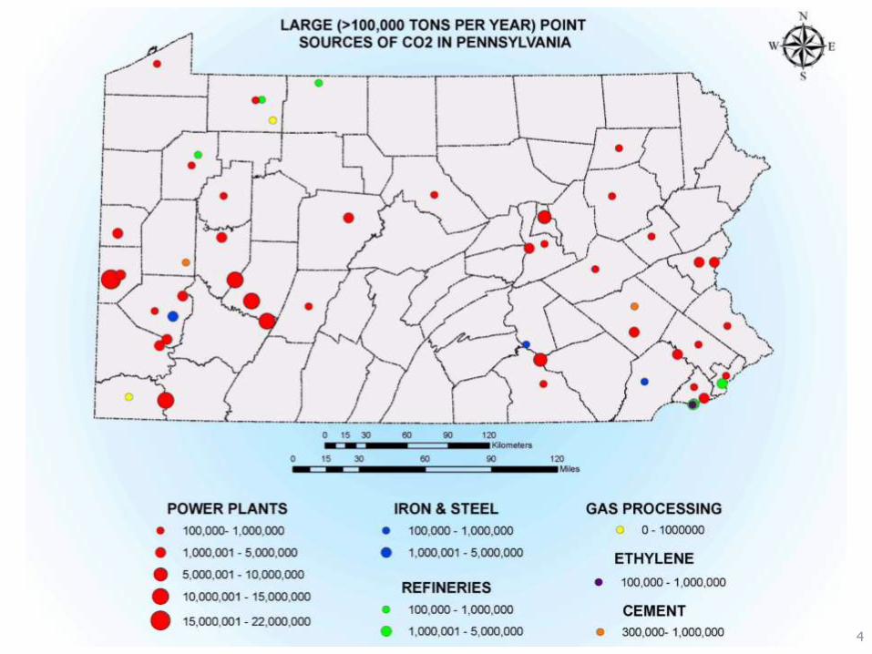
4

www.dcnr.state.pa.us
PA’s Work Over the Years
• Midwest Regional Carbon Sequestration
Partnership (MRCSP): 2003 – 2017
• Carbon Management Advisory Group
(CMAG): 2008
• Carbon Sequestration Technical
Assessment (CSTA): 2009
• Mid-Atlantic U.S. Offshore Carbon Storage
Resource Assessment: 2016 – 2018
5

www.dcnr.state.pa.us
Generalized Findings
• Pennsylvania has significant and varied
geologic resources that could be used to
store CO2
• At any given site/hub, multiple reservoirs
may have to be utilized
• A CCS network can be developed safely
• Infrastructure will be important to match
source to sinks
6
www.dcnr.state.pa.us
Opportunities
• Participate in development of federal
policy/regulation for pore space ownership
• Pursue CCUS – enhanced oil and/or gas
recovery projects
• Major CO2 sources could pursue linkages
to offshore CCS projects
7

Research at Different Scales
• Region
• Province
• Field
• Pool
810
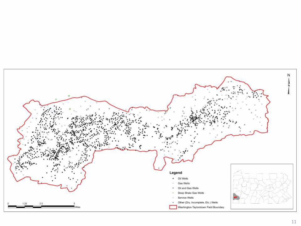
911
www.dcnr.state.pa.us
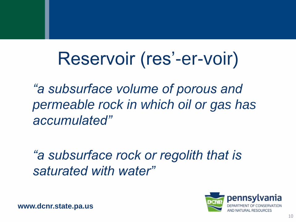
Reservoir (res’-er-voir)
“a subsurface volume of porous and
permeable rock in which oil or gas has
accumulated”
“a subsurface rock or regolith that is
saturated with water”
10

Why do we need reservoirs?
• Produce fluids – oil, gas, water, brine
• Store fluids – natural gas, petrochemicals
• Dispose fluids – wastewater, greenhouse
gases
Pore space11
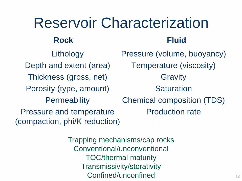
Reservoir CharacterizationRock
Lithology
Depth and extent (area)
Thickness (gross, net)
Porosity (type, amount)
Permeability
Pressure and temperature
(compaction, phi/K reduction)
Fluid
Pressure (volume, buoyancy)
Temperature (viscosity)
Gravity
Saturation
Chemical composition (TDS)
Production rate
12
Trapping mechanisms/cap rocks
Conventional/unconventional
TOC/thermal maturity
Transmissivity/storativity
Confined/unconfined
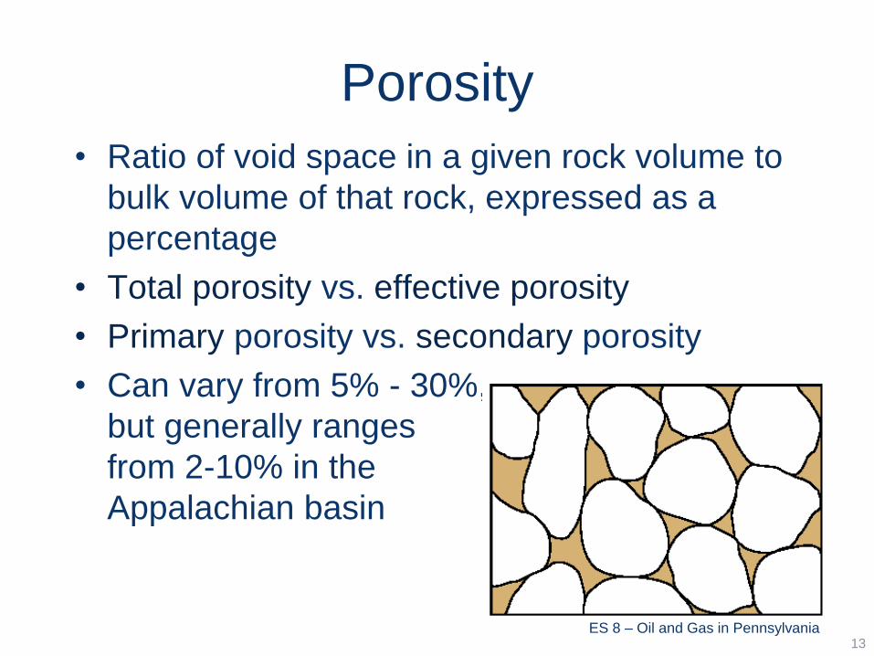
Porosity
• Ratio of void space in a given rock volume to
bulk volume of that rock, expressed as a
percentage
• Total porosity vs. effective porosity
• Primary porosity vs. secondary porosity
• Can vary from 5% - 30%,
but generally ranges
from 2-10% in the
Appalachian basin
13ES 8 – Oil and Gas in Pennsylvania
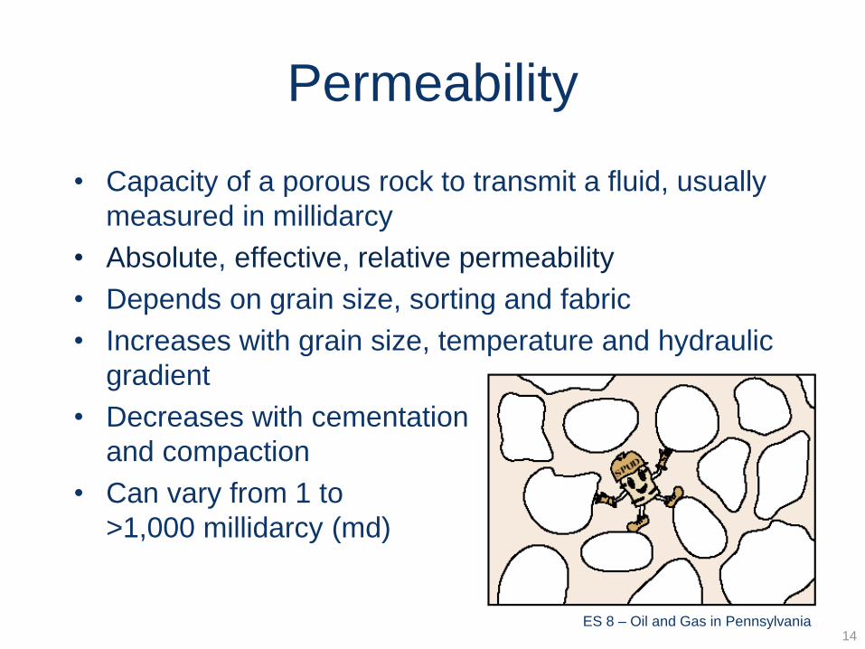
Permeability
• Capacity of a porous rock to transmit a fluid, usually
measured in millidarcy
• Absolute, effective, relative permeability
• Depends on grain size, sorting and fabric
• Increases with grain size, temperature and hydraulic
gradient
• Decreases with cementation
and compaction
• Can vary from 1 to
>1,000 millidarcy (md)
14ES 8 – Oil and Gas in Pennsylvania
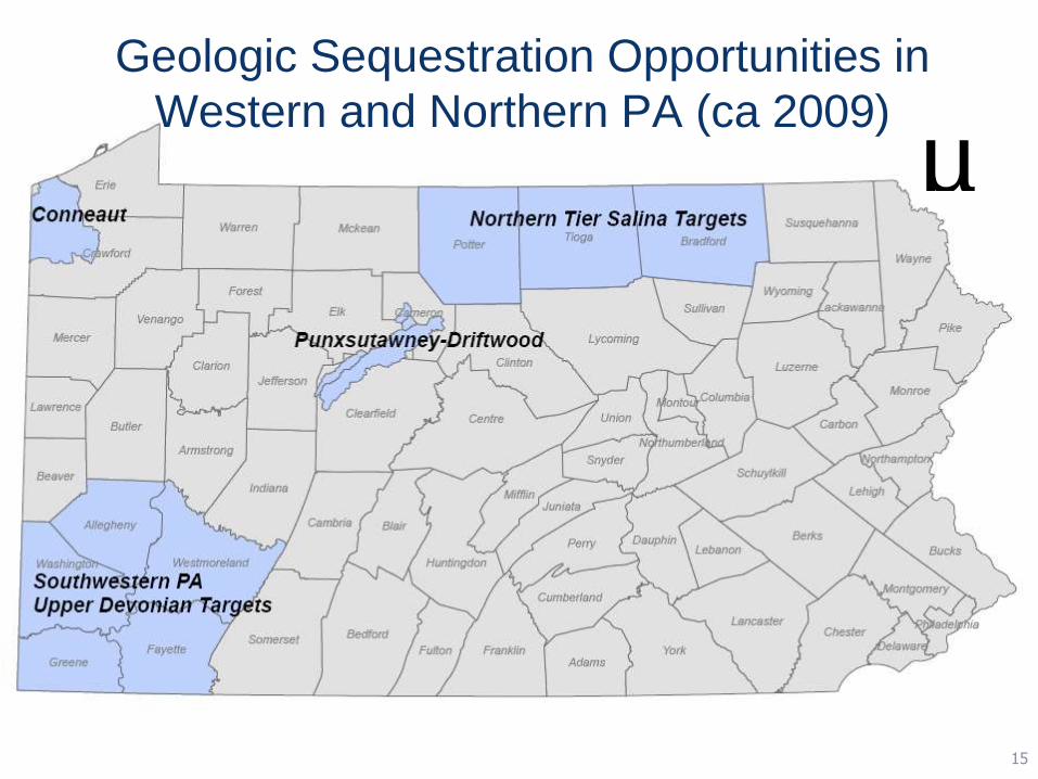
Geologic Sequestration Opportunities in
Western and Northern PA (ca 2009)
µ
15
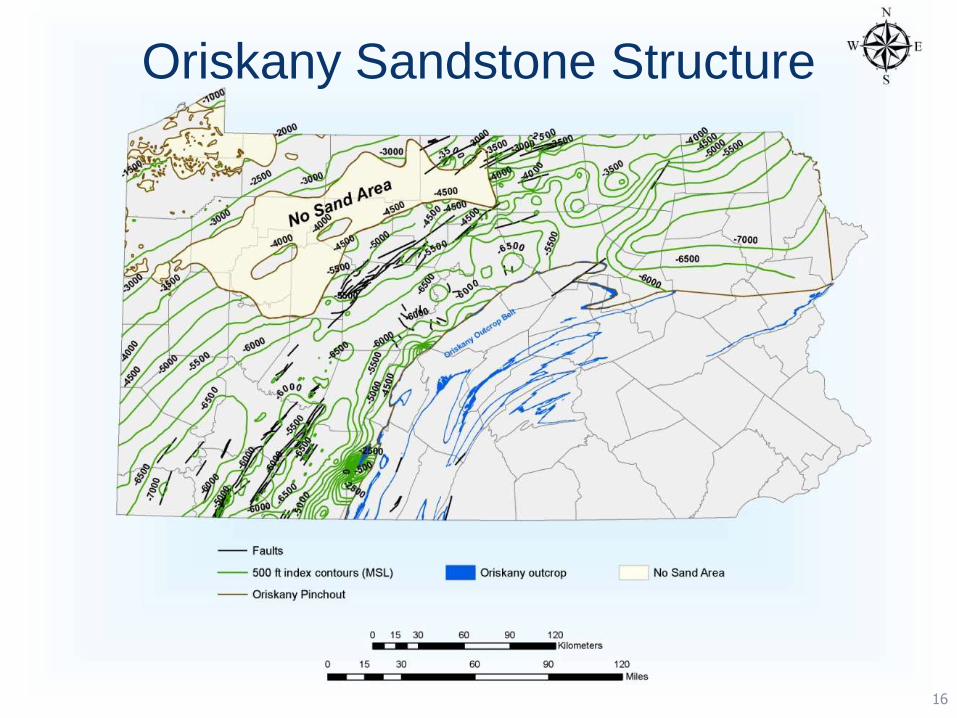
Oriskany Sandstone Structure
16
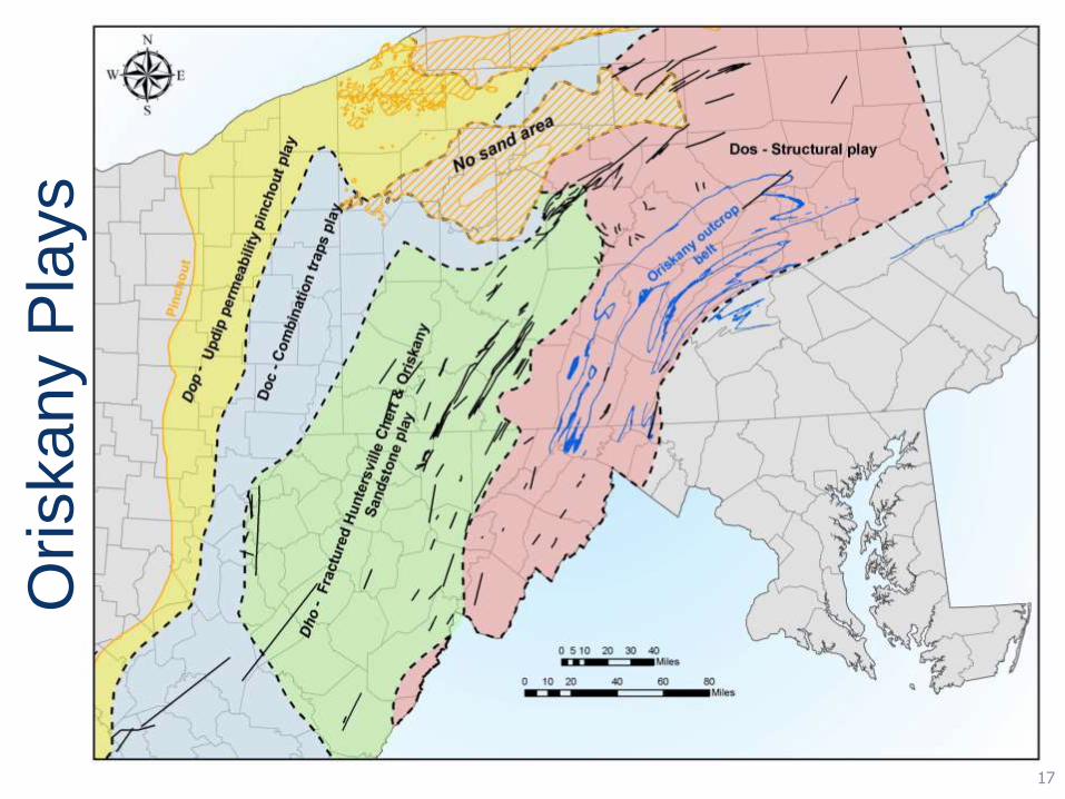
Oriskany P
lays
17
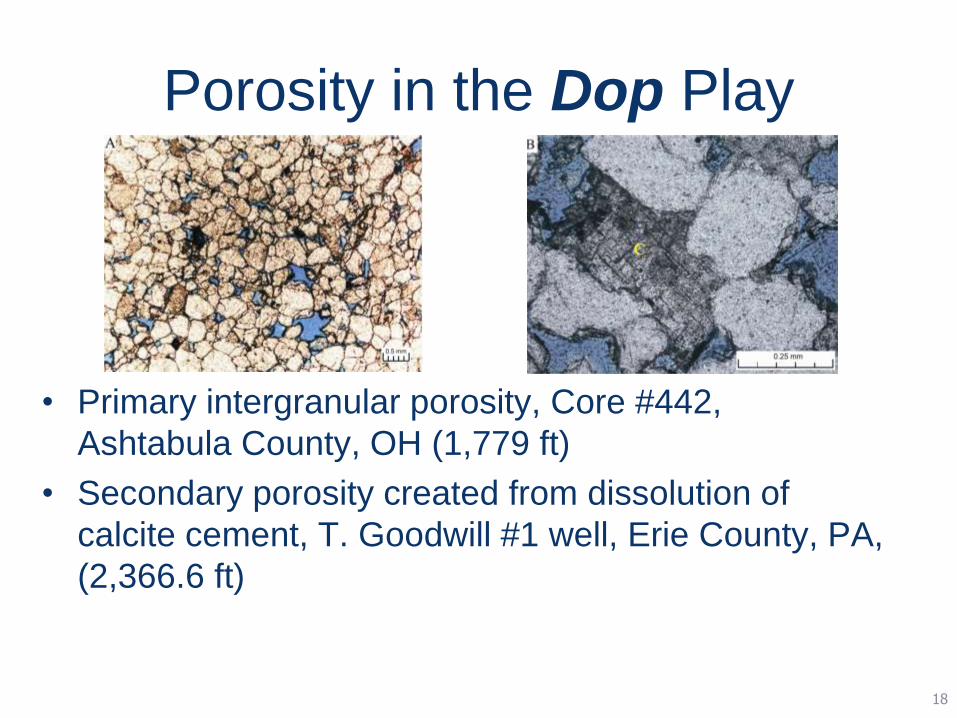
Porosity in the Dop Play
• Primary intergranular porosity, Core #442,
Ashtabula County, OH (1,779 ft)
• Secondary porosity created from dissolution of
calcite cement, T. Goodwill #1 well, Erie County, PA,
(2,366.6 ft)
18

Porosity in the Doc Play
• Syntaxial quartz overgrowths reducing primary intergranular
porosity, pressure solution pits coated with illite, Core #2914,
Mahoning County, OH (3,330 ft)
• Quartz overgrowths and calcite cement, Core #2914,
Mahoning County, OH (3,332.6 ft)
19
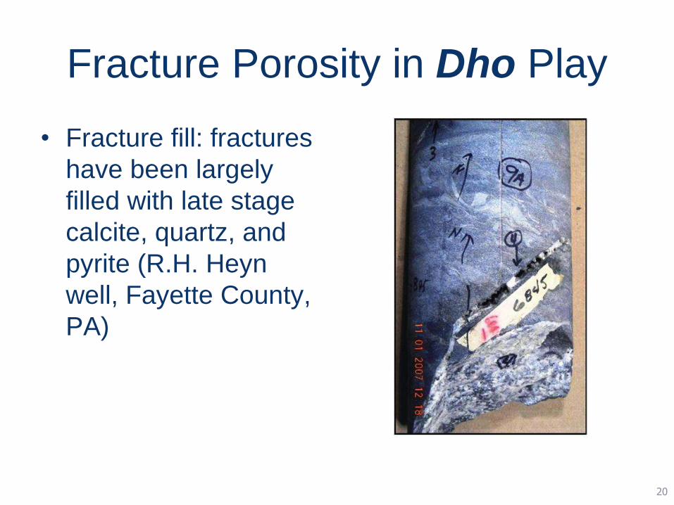
Fracture Porosity in Dho Play
• Fracture fill: fractures
have been largely
filled with late stage
calcite, quartz, and
pyrite (R.H. Heyn
well, Fayette County,
PA)
20
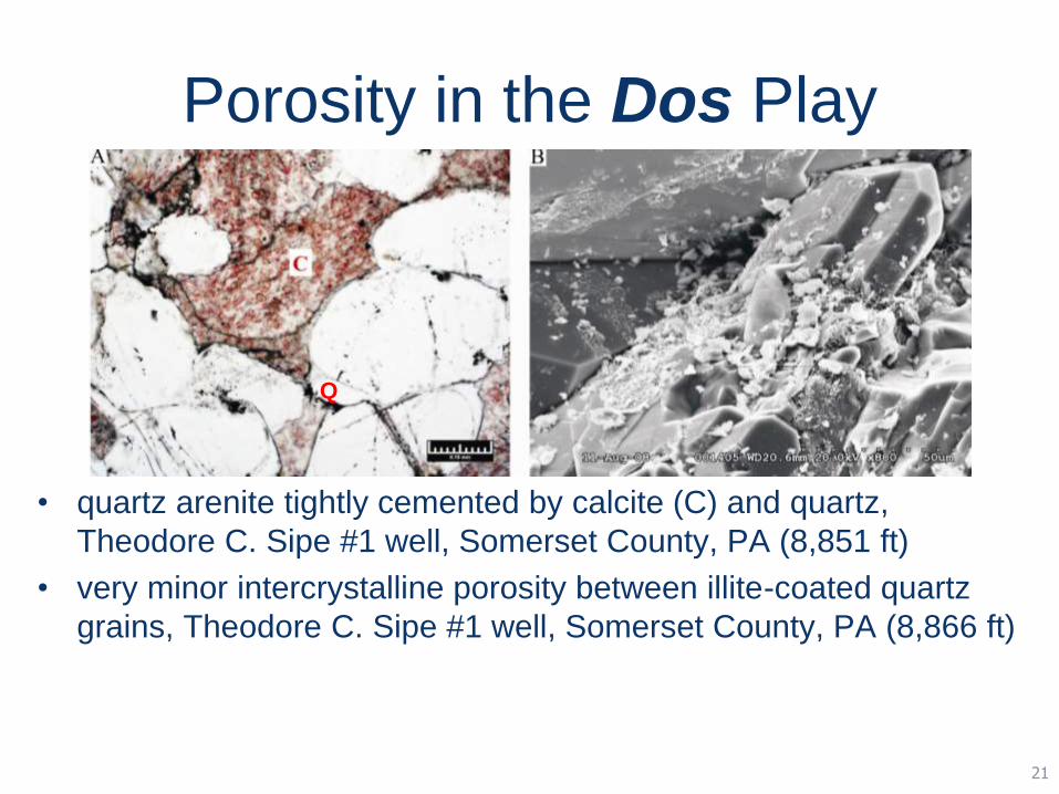
Porosity in the Dos Play
• quartz arenite tightly cemented by calcite (C) and quartz,
Theodore C. Sipe #1 well, Somerset County, PA (8,851 ft)
• very minor intercrystalline porosity between illite-coated quartz
grains, Theodore C. Sipe #1 well, Somerset County, PA (8,866 ft)
Q
21

CCUS Opportunities (ca 2016)
25

Generalized Subsurface
Stratigraphy
• Paleozoic strata
• Siliclastics, coals,
carbonates and
shales
• Production and
storage
• Miscible and
immiscible
26

www.dcnr.state.pa.us
IHS PETRA• Software with data management, manipulation
and visualization capabilities
• Integrates geological, geophysical, petrophysical and engineering data into project files
• Created by geologists for geologists
• Windows-based application that interfaces well with other applications (e.g., GIS, Excel, EDWIN, etc.)
24
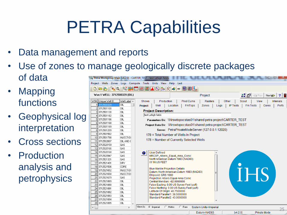
PETRA Capabilities
• Data management and reports
• Use of zones to manage geologically discrete packages
of data
• Mapping
functions
• Geophysical log
interpretation
• Cross sections
• Production
analysis and
petrophysics
25
Database Management
• Data is added to a project by various means,
including importation from other software, key
entry, calculations and visual interpretations
• Interactive with mapping, cross section and other
modules (i.e., changes made in one module
immediately update database)
• Use of zones streamlines data organization
• Importation/exportation flexibility
26

Making Maps
• Map projection is easily set, and can be modified
as necessary to accommodate new data
• Structure contour maps
• Base maps
• Isopach maps
• Attribute maps
• Bubble maps
27

Making and Using Cross Sections
• Section lines chosen in the map module are
automatically generated in the cross section module
• Cross sections can be stratigraphic or structural, and
may be exaggerated as necessary
• Fault gaps may be added to cross sections
• Any data/log images in the database may be posted
to cross sections
• Can be used to facilitate regional correlations, or
simply as a graphical presentation of subsurface
geology
28
Geophysical Log Interpretation
• Imports both LAS (digital) and Raster (analog)
images of geophysical logs
• Raster images need to be straightened and
depth-registered prior to use
• Raster images can also be digitized to aid in
petrophysical evaluations, or just to “clean up” the
appearance of a log in cross section
• Log correlation is interactive with database
29

An Effective Tool…
• Subsurface data management
• Regional correlation of subsurface formations
• Development of structure contour, isopach and/or
groundwater contour maps
• Preparation of graphics for technical
papers, poster sessions, etc.
30
1 mile
Approximate scale
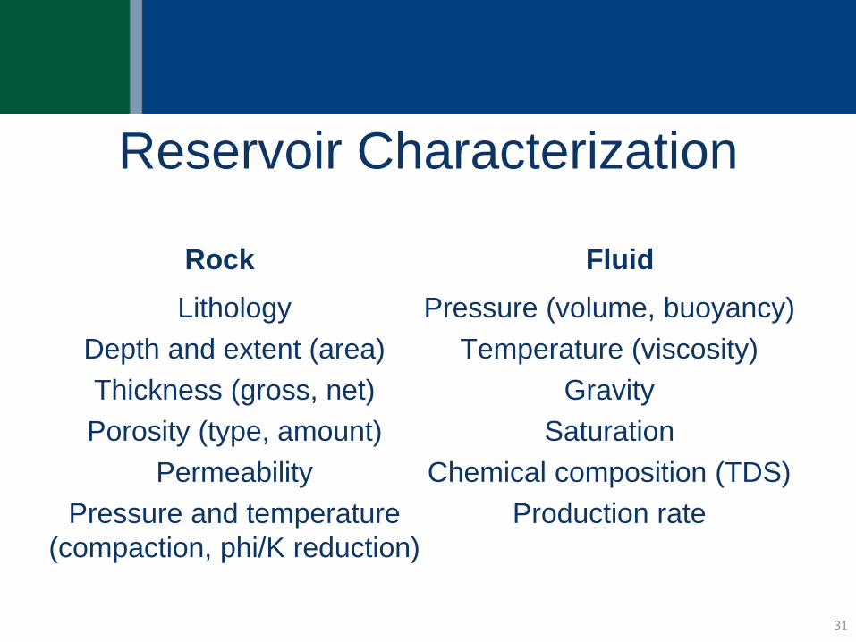
Reservoir Characterization
Rock
Lithology
Depth and extent (area)
Thickness (gross, net)
Porosity (type, amount)
Permeability
Pressure and temperature
(compaction, phi/K reduction)
Fluid
Pressure (volume, buoyancy)
Temperature (viscosity)
Gravity
Saturation
Chemical composition (TDS)
Production rate
31
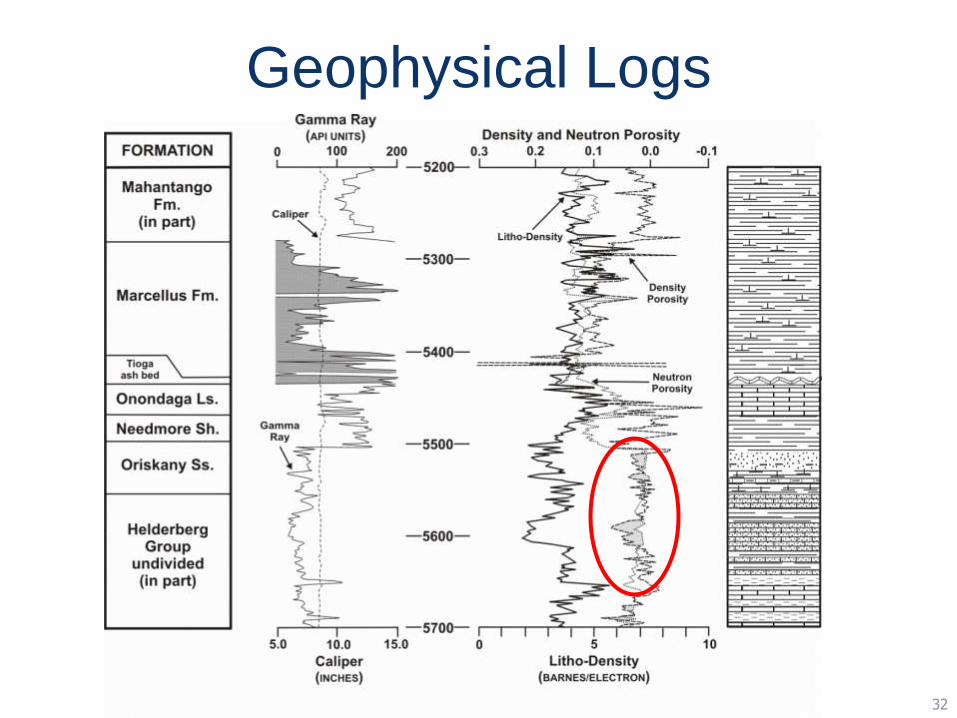
Geophysical Logs
32
www.dcnr.state.pa.us
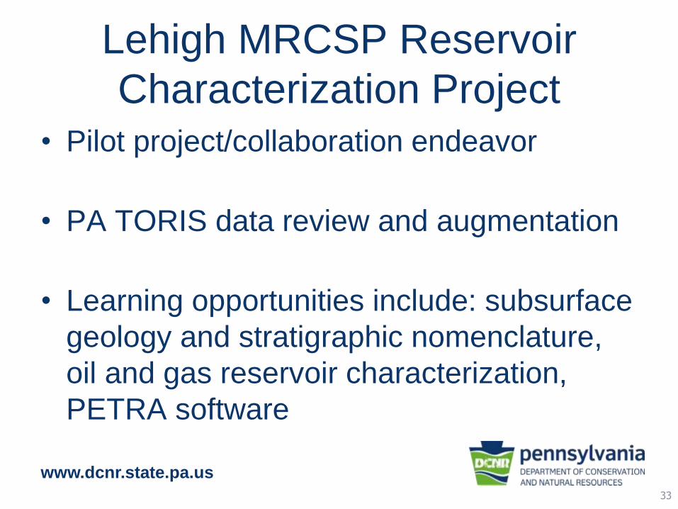
Lehigh MRCSP Reservoir
Characterization Project• Pilot project/collaboration endeavor
• PA TORIS data review and augmentation
• Learning opportunities include: subsurface
geology and stratigraphic nomenclature,
oil and gas reservoir characterization,
PETRA software
33
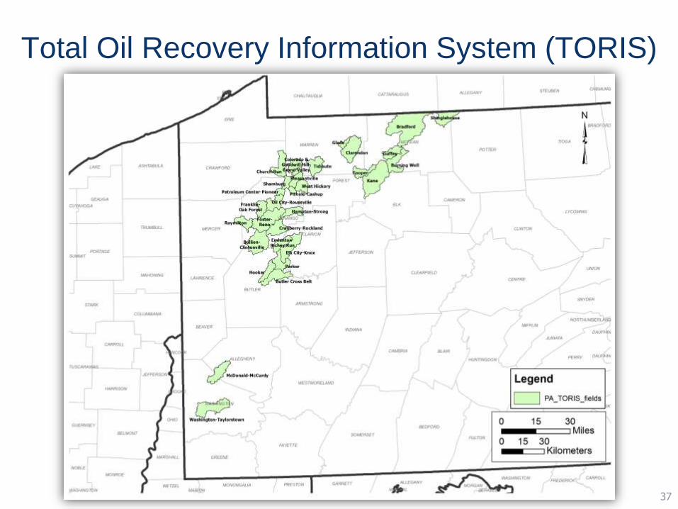
Total Oil Recovery Information System (TORIS)
37

35
Oil Production
from Upper Devonian Sandstones
www.dcnr.state.pa.us
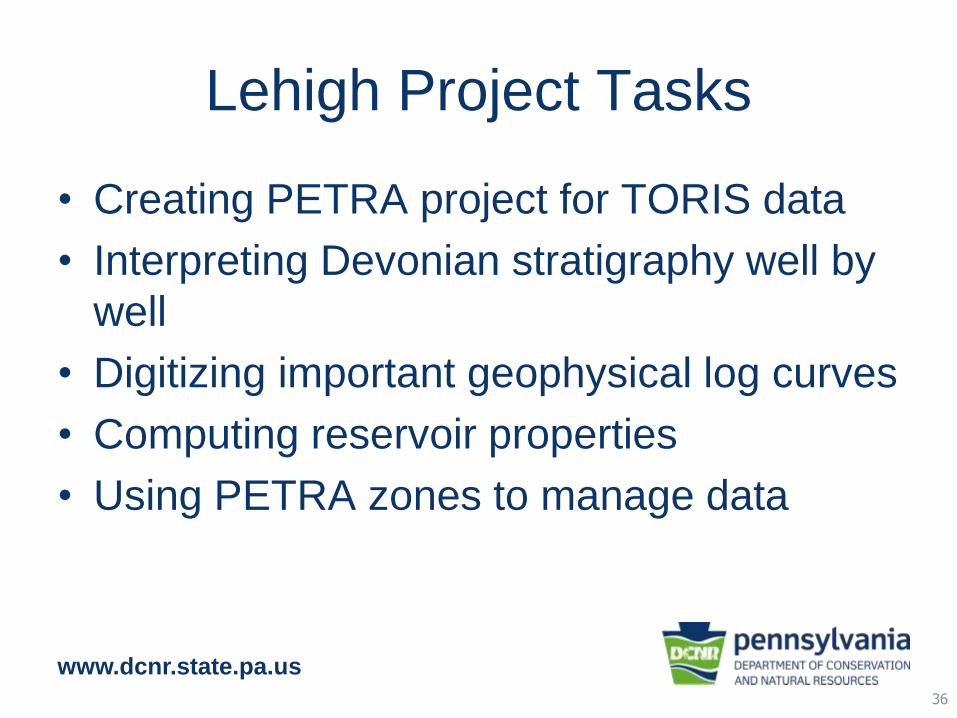
Lehigh Project Tasks
• Creating PETRA project for TORIS data
• Interpreting Devonian stratigraphy well by
well
• Digitizing important geophysical log curves
• Computing reservoir properties
• Using PETRA zones to manage data
36
www.dcnr.state.pa.us
Thank you!
Kris Carter (‘93)
Pennsylvania Geological Survey
(412) 442-4234
37