passive microwave sensors lidar remote sensing laser altimetry · –rayleigh-jeans approximation...
TRANSCRIPT
Passive Microwave SensorsLIDAR Remote Sensing
Laser Altimetry28 April 2003
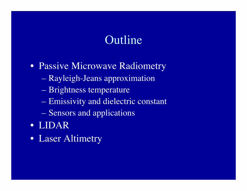
Outline
• Passive Microwave Radiometry– Rayleigh-Jeans approximation– Brightness temperature– Emissivity and dielectric constant– Sensors and applications
• LIDAR• Laser Altimetry
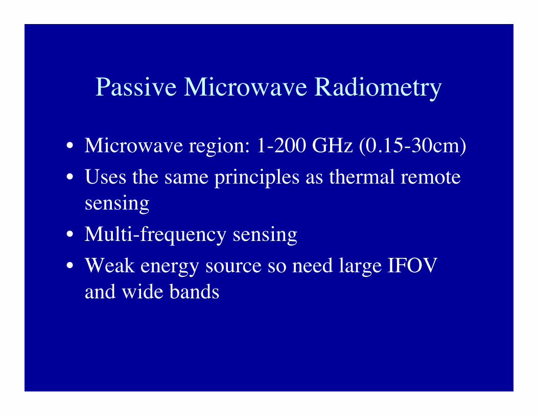
Passive Microwave Radiometry
• Microwave region: 1-200 GHz (0.15-30cm)• Uses the same principles as thermal remote
sensing• Multi-frequency sensing• Weak energy source so need large IFOV
and wide bands
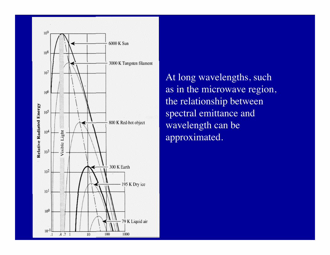
At long wavelengths, suchas in the microwave region,the relationship betweenspectral emittance andwavelength can beapproximated.
Rayleigh-Jeans Approximation
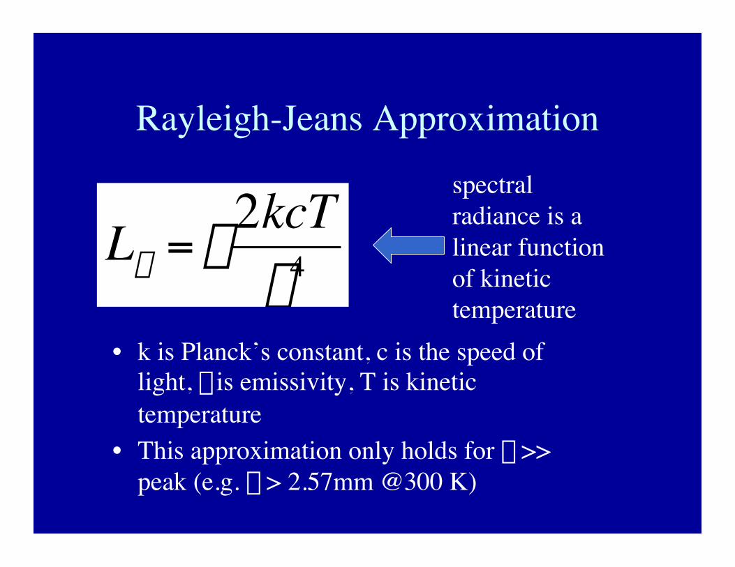
• k is Planck’s constant, c is the speed oflight, e is emissivity, T is kinetictemperature
• This approximation only holds for l >>peak (e.g. l > 2.57mm @300 K)†
Ll = e2kcT
l4
spectralradiance is alinear functionof kinetictemperature
Microwave Brightness Temperature
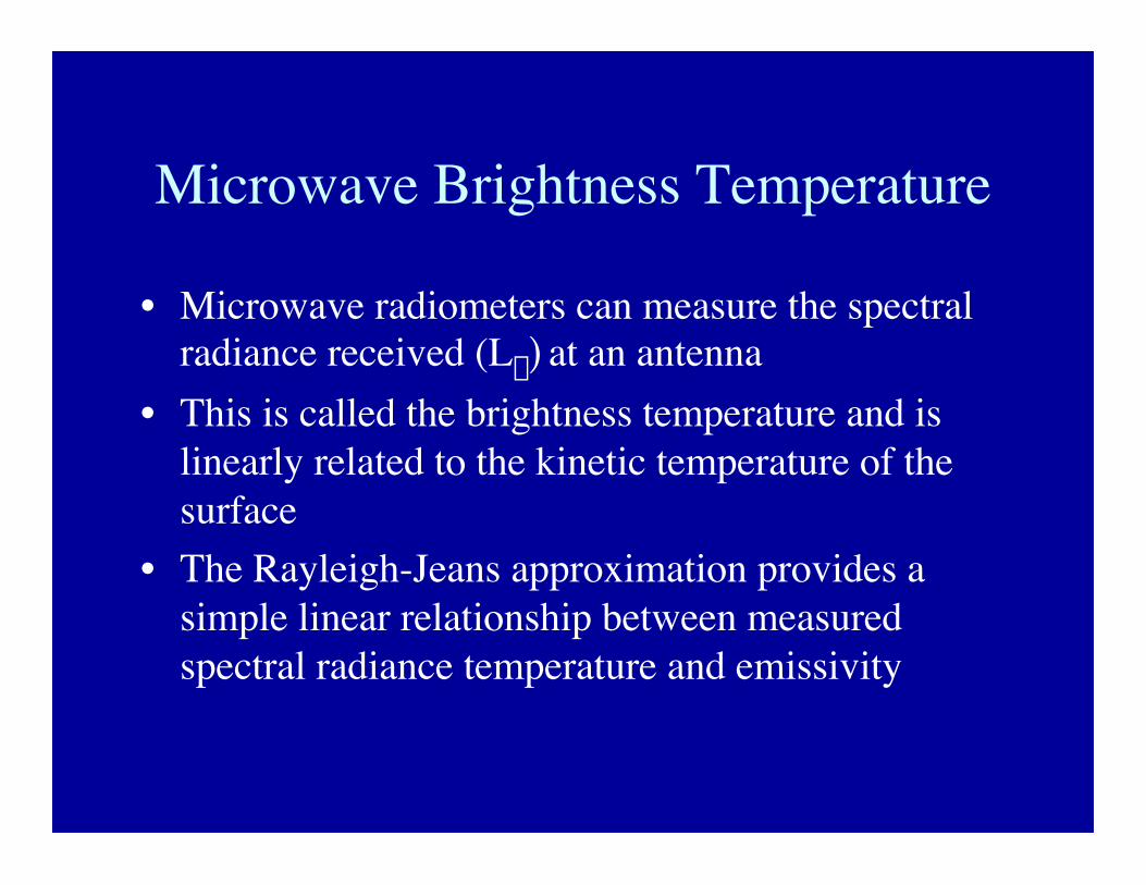
• Microwave radiometers can measure the spectralradiance received (Ll) at an antenna
• This is called the brightness temperature and islinearly related to the kinetic temperature of thesurface
• The Rayleigh-Jeans approximation provides asimple linear relationship between measuredspectral radiance temperature and emissivity
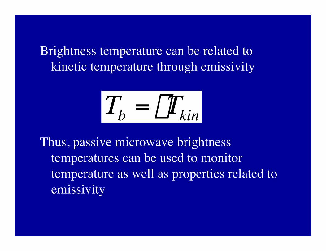
Brightness temperature can be related tokinetic temperature through emissivity
Thus, passive microwave brightnesstemperatures can be used to monitortemperature as well as properties related toemissivity
†
Tb = eTkin
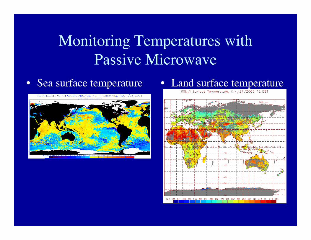
Monitoring Temperatures withPassive Microwave
• Sea surface temperature • Land surface temperature
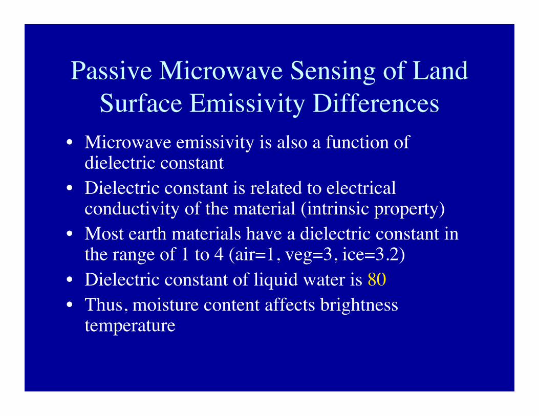
Passive Microwave Sensing of LandSurface Emissivity Differences
• Microwave emissivity is also a function ofdielectric constant
• Dielectric constant is related to electricalconductivity of the material (intrinsic property)
• Most earth materials have a dielectric constant inthe range of 1 to 4 (air=1, veg=3, ice=3.2)
• Dielectric constant of liquid water is 80• Thus, moisture content affects brightness
temperature
Soil
Tb
snow water equivalent
Soil
DrySnow
Wet snow is a strong absorber/emitter
Snow Emissivity Example
Soil
WetSnow
(1)
(2)
(3)
dry snow
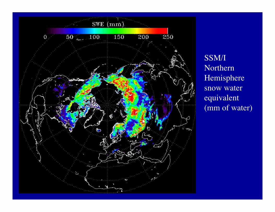
SSM/INorthernHemispheresnow waterequivalent(mm of water)
Atmospheric Effects• Atmospheric attenuation increases with
frequency from 1 to 1000 GHz• At frequencies less than 50 GHz, there’s
little effect of clouds and fog on brightnesstemperature (it “sees through” clouds)
• Thus, PM can be used to monitor the landsurface under cloudy conditions
• In atmospheric absorption bands, PM isused to map water vapor, rain rates, clouds
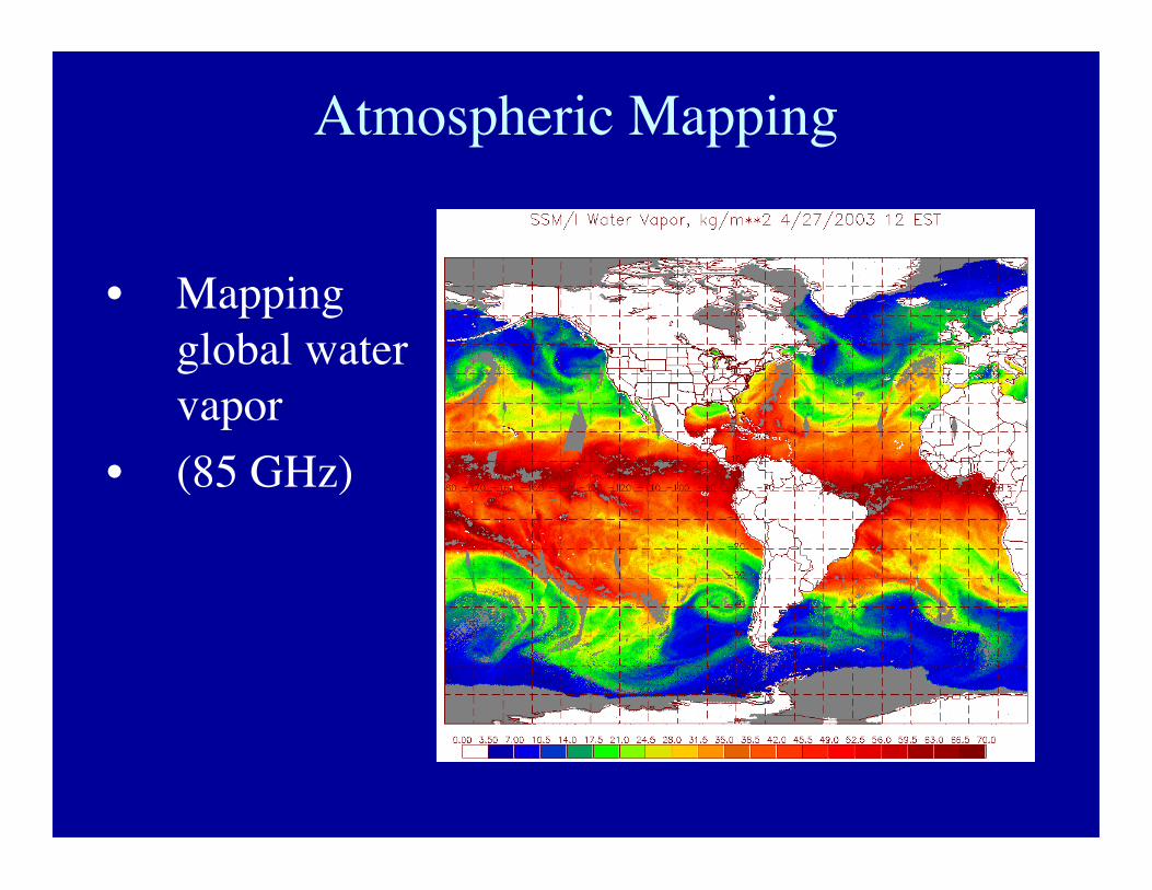
Atmospheric Mapping
• Mappingglobal watervapor
• (85 GHz)
Passive Microwave Radiometry
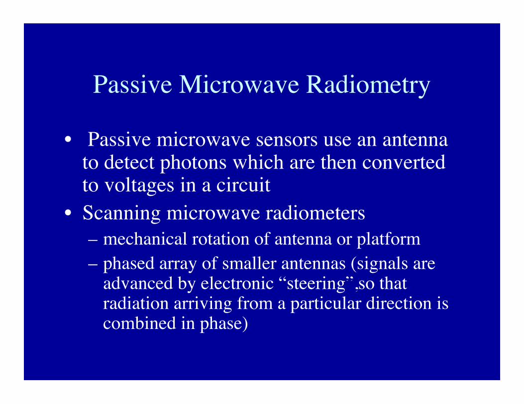
• Passive microwave sensors use an antennato detect photons which are then convertedto voltages in a circuit
• Scanning microwave radiometers– mechanical rotation of antenna or platform– phased array of smaller antennas (signals are
advanced by electronic “steering”,so thatradiation arriving from a particular direction iscombined in phase)
Scanning MicrowaveRadiometers
• Scanning Multichannel Microwave Radiometer(SMMR) 1981- 1987
• Special Sensor Microwave/Imager (SSM/I) 1987-present
• Tropical Rainfall Measuring Mission (TRMM)1997-present
• Advanced Microwave Scanning Radiometer(AMSR) 2002-present
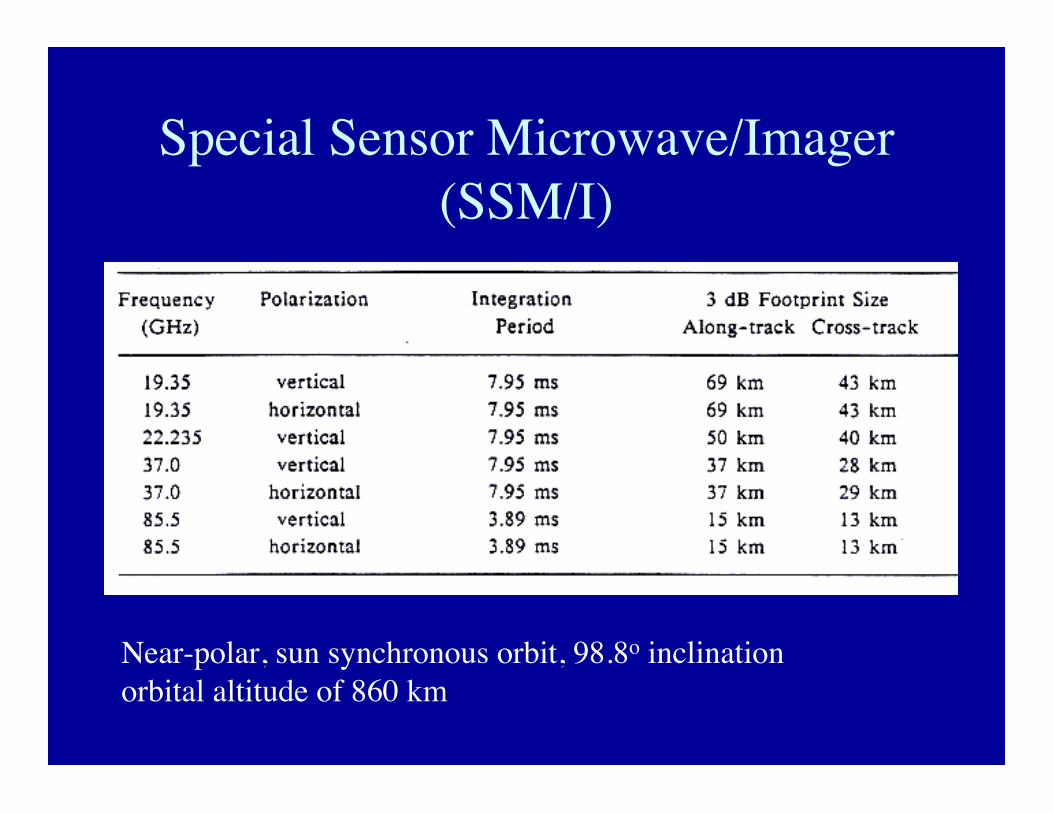
Special Sensor Microwave/Imager(SSM/I)
Near-polar, sun synchronous orbit, 98.8o inclinationorbital altitude of 860 km
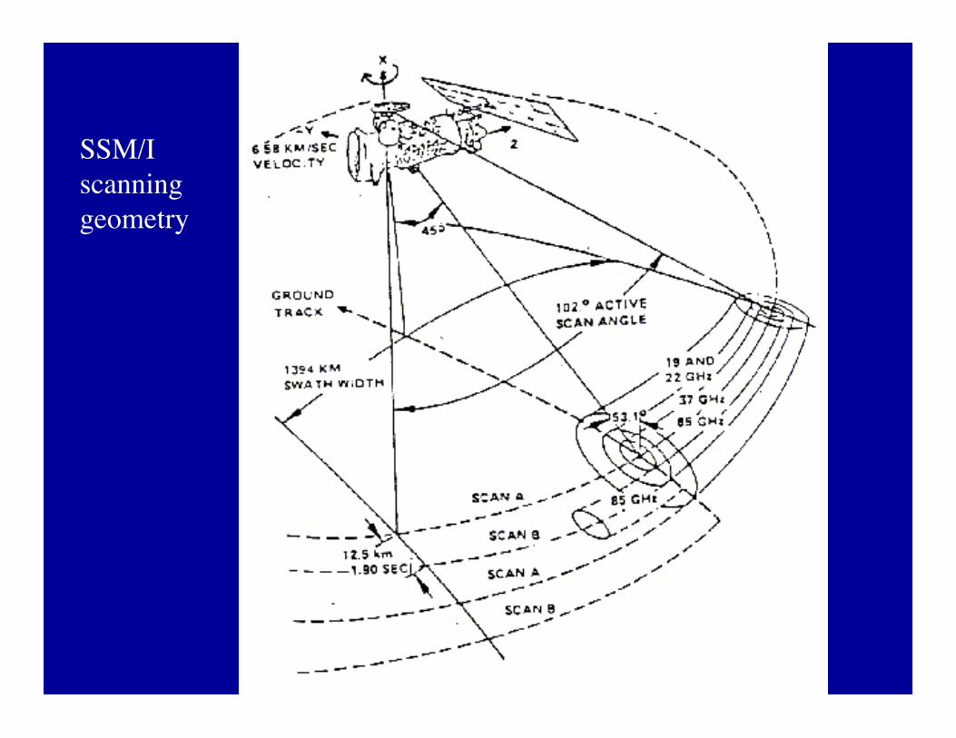
SSM/Iscanninggeometry
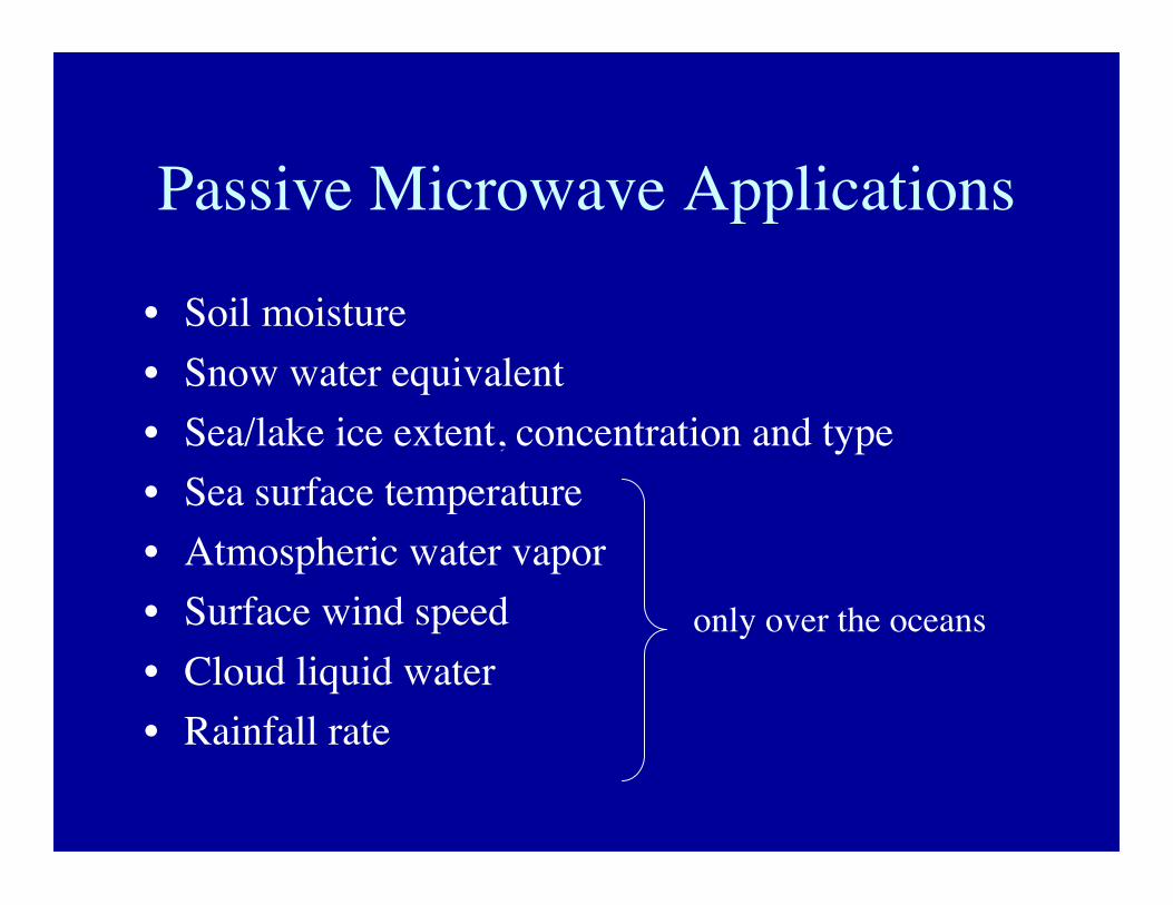
Passive Microwave Applications
• Soil moisture• Snow water equivalent• Sea/lake ice extent, concentration and type• Sea surface temperature• Atmospheric water vapor• Surface wind speed• Cloud liquid water• Rainfall rate
only over the oceans

LIDAR and Laser Altimetry
• LIDAR = Light detection and ranging• Based on transmission and measurement of laser
light (typically green or NIR)• Return power is indicative of reflectance of the
surface• Shape of return pulse provides estimate of
vegetation canopy structure and density• Timing of return pulse gives information on
surface elevation
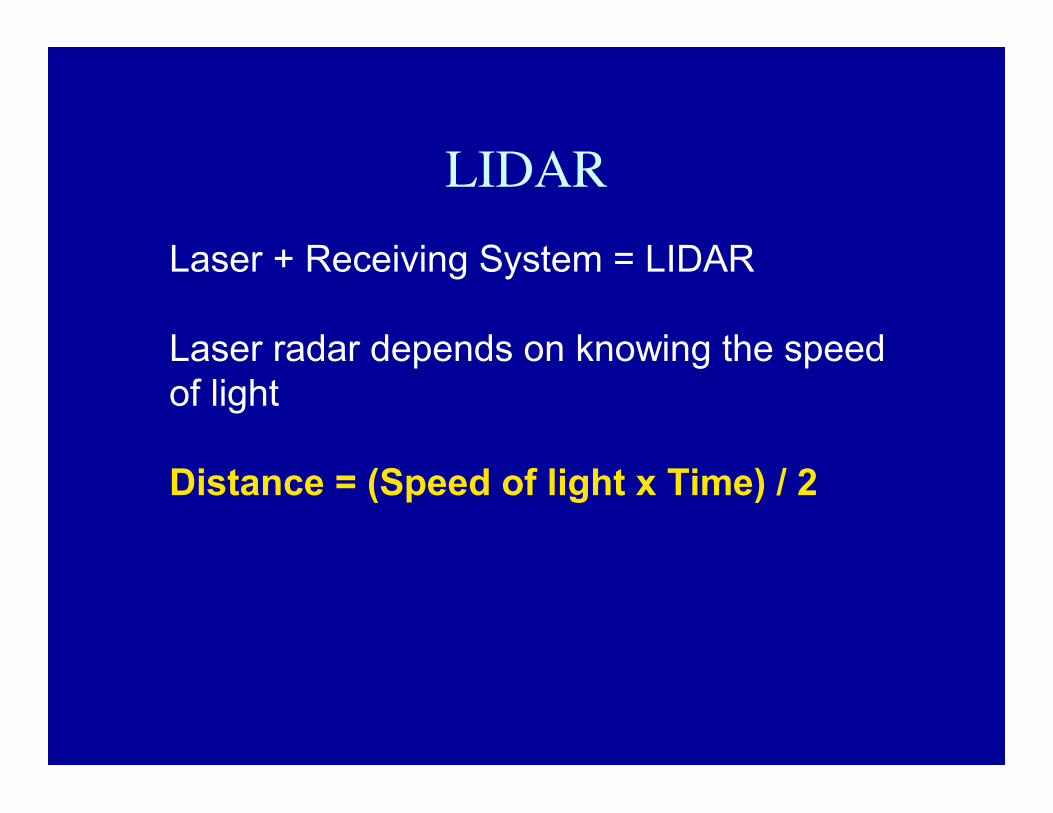
LIDARLaser + Receiving System = LIDAR
Laser radar depends on knowing the speedof light
Distance = (Speed of light x Time) / 2
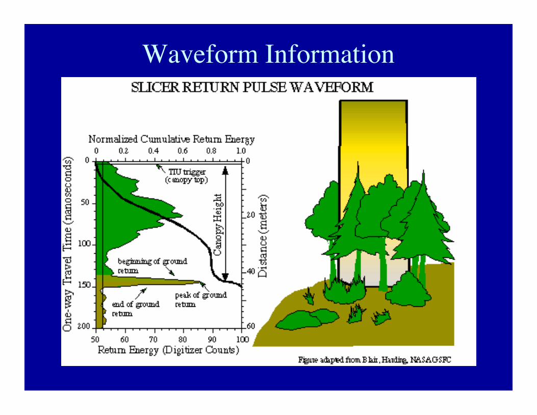
Waveform Information
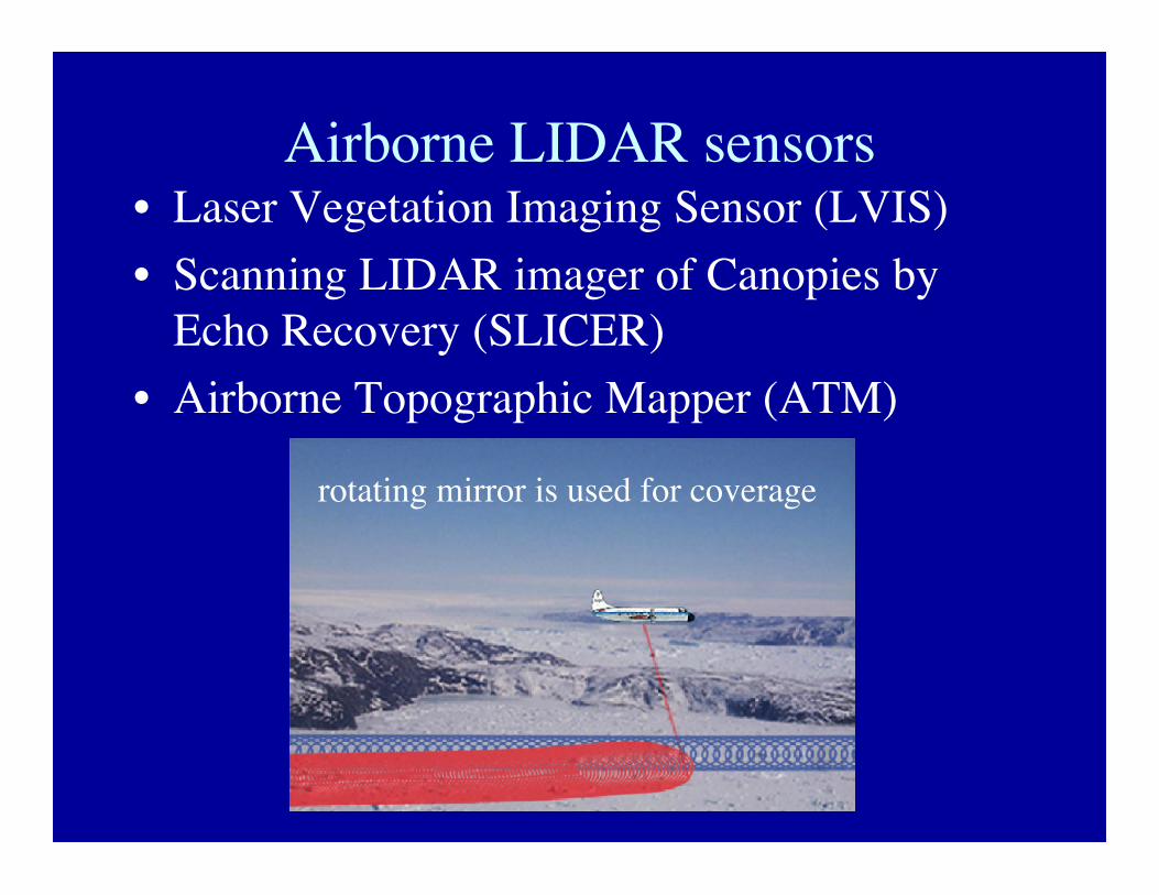
Airborne LIDAR sensors• Laser Vegetation Imaging Sensor (LVIS)• Scanning LIDAR imager of Canopies by
Echo Recovery (SLICER)• Airborne Topographic Mapper (ATM)
rotating mirror is used for coverage
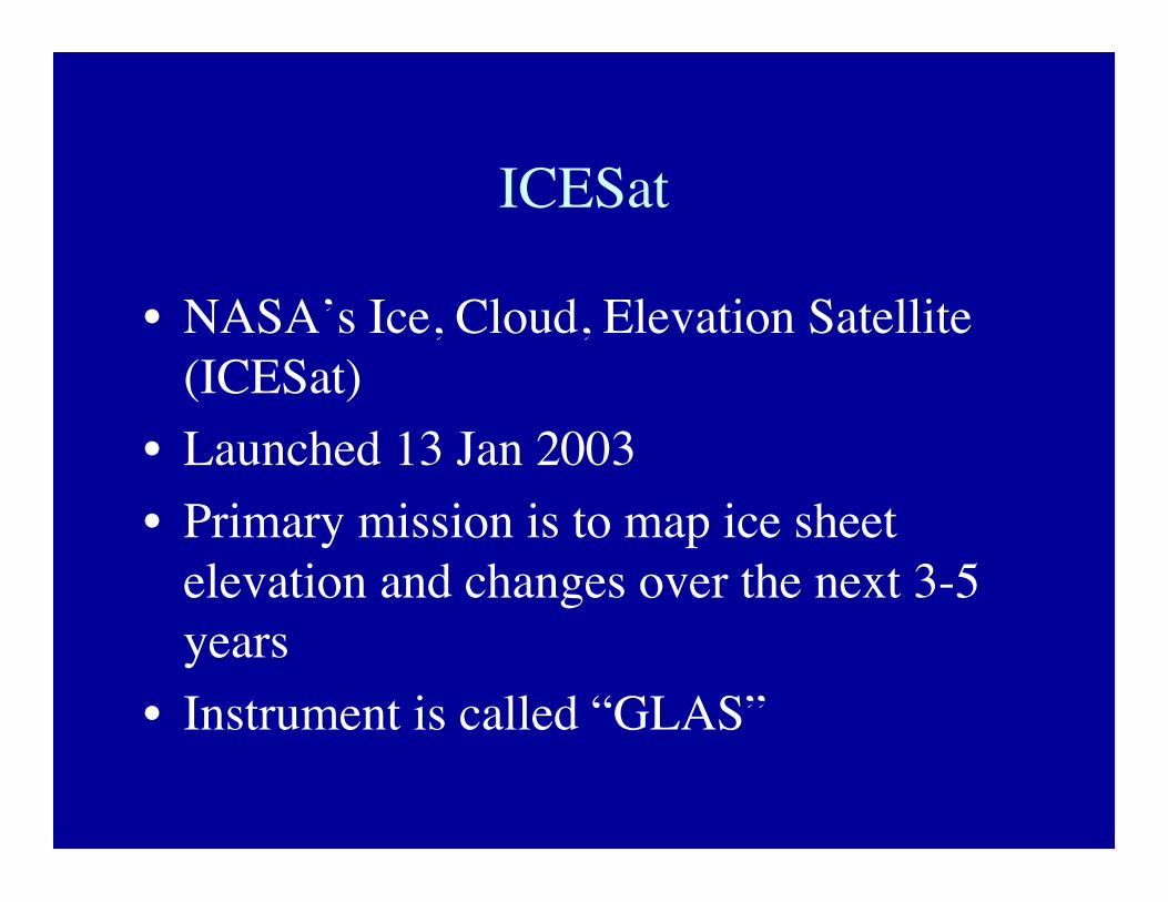
ICESat
• NASA’s Ice, Cloud, Elevation Satellite(ICESat)
• Launched 13 Jan 2003• Primary mission is to map ice sheet
elevation and changes over the next 3-5years
• Instrument is called “GLAS”
Geosciences Laser Altimeter System (GLAS)
• Frequency-doubled laser system:– 1064 nm (NIR) laser wavelength is used for
altimetry– 532 nm (green) laser wavelength is used for
atmospheric characterization (aerosols)• 40 pulses per second are transmitted• 70m diameter ground footprint, 175m spacing• Returned photons are collected through a 1-
meter diameter telescope• Return time, return power, and waveform
provide important information about the surface
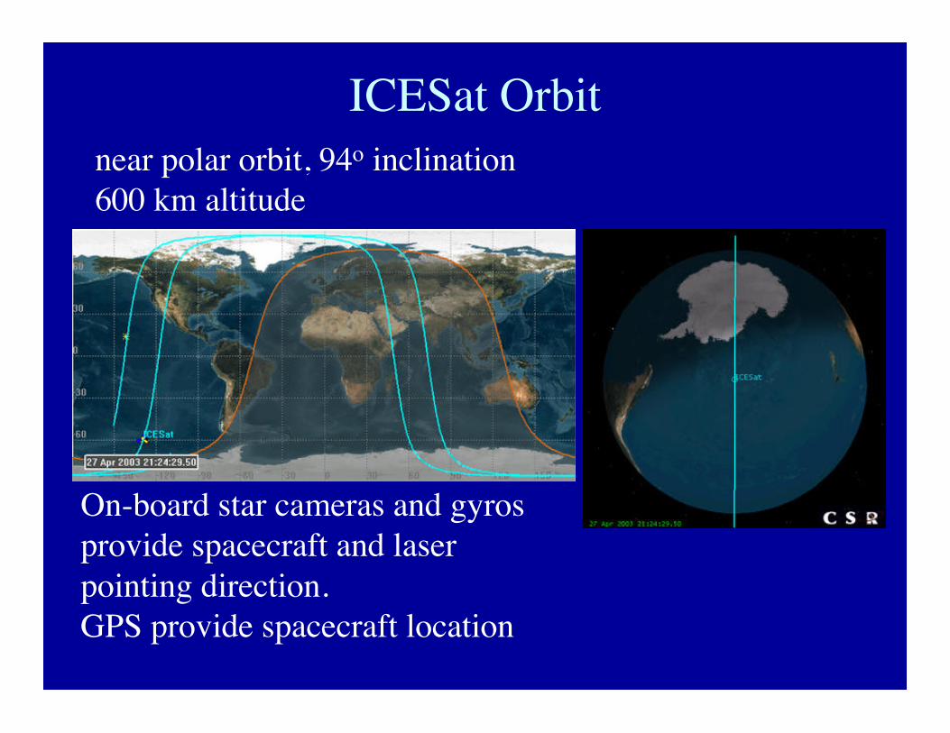
ICESat Orbitnear polar orbit, 94o inclination600 km altitude
On-board star cameras and gyrosprovide spacecraft and laserpointing direction.GPS provide spacecraft location
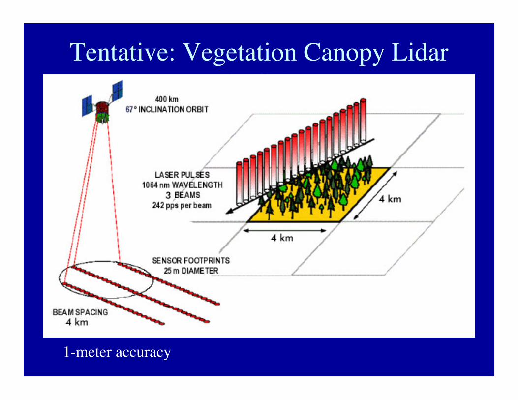
Tentative: Vegetation Canopy Lidar(VCL)
1-meter accuracy