satellite altimetry - tu delft
TRANSCRIPT
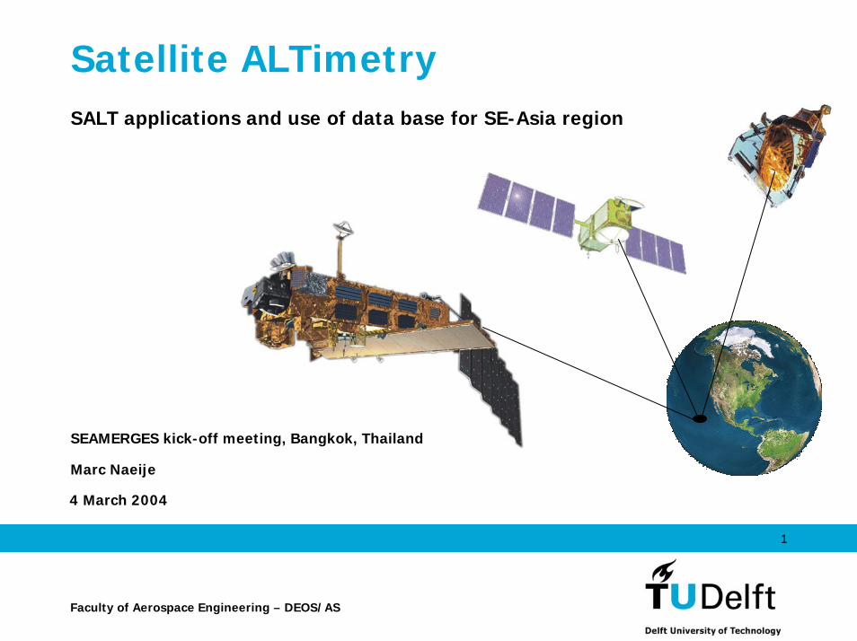
Satellite ALTimetrySALT applications and use of data base for SE-Asia region
SEAMERGES kick-off meeting, Bangkok, Thailand
Marc Naeije
4 March 2004
1
Faculty of Aerospace Engineering – DEOS/AS
SEAMERGES altimeter theme:summary
• The specific needs of the ASEAN partners in the SEAMERGES project are a dedicated HRD programmein 3 areas of high-precision space geodetic technologyprovided by skilled and experienced EC partners, as well as an introduction to the application of the acquired technology in a number of intra-ASEAN and EC common applied research projects. This themecovers Satellite ALTimetry (SALT) technology.
4 March 2004 2
SEAMERGES altimeter theme:description (I)
• Though satellite altimetry may be based on the simple fact thattime is distance, the processing and interpretation of the data is quite complex: you have to take into account the instrument design, calibration, validation, atmospheric path delays, geophysical corrections, reference system, precise orbitdetermination and space and time sampling characateristics.
• The result is very rewarding: the ability to observe relative and absolute sea level. Altimetric data helps monitoring sea levelchange and its coastal applications, regional geodetic datum realization and maintenance, research on geodynamics and masstransport and their consequence for regional and global climate, to name a few applications.
4 March 2004 3

SEAMERGES altimeter theme:description (II)• DEOS has a long-standing altimeter experience and is Principal
Investigator in many missions.• The SE-Asia region has been explored already for regional tide
modelling, wave climate and internal waves. • SEAMERGES brings in expertise and data that contributes to the
development of local research groups and companies that support governments and industry in coastal management and off-shoreactivities.
• By initiating research cooperation, organising workshops and hands-on training with altimeter database tools, and the integrationof the altimetry with GPS, InSAR and in-situ measurements, intraregional cooperative research can be stimulated and developed toan international standard and help in the advancement of altimetrybased science, operations and commerce.
4 March 2004 4

SEAMERGES altimeter programme:seminar
• The SALT technology and application courses willinclude the necessary theoretical background (introducing the space borne altimeter and its widerange of applications), the introduction to RADS (the DEOS/NOAA Radar Altimeter Database System) and altimeter processing, and the opportunity to getacquainted with the RADS database and tools by"hands-on" training.
• More details: to be determined.
4 March 2004 5
Why Altimetry?
• All-weather round the globe monitoring system;• Contributes to environmental studies, in particular
ocean and ice;• Allows effective monitoring and management of the
Earth’s resources;• Enables better understanding of fluid and solid Earth
processes.
4 March 2004 6

Altimetry basics
Radar pulsesIlluminating the sea surface.
4 March 2004 7
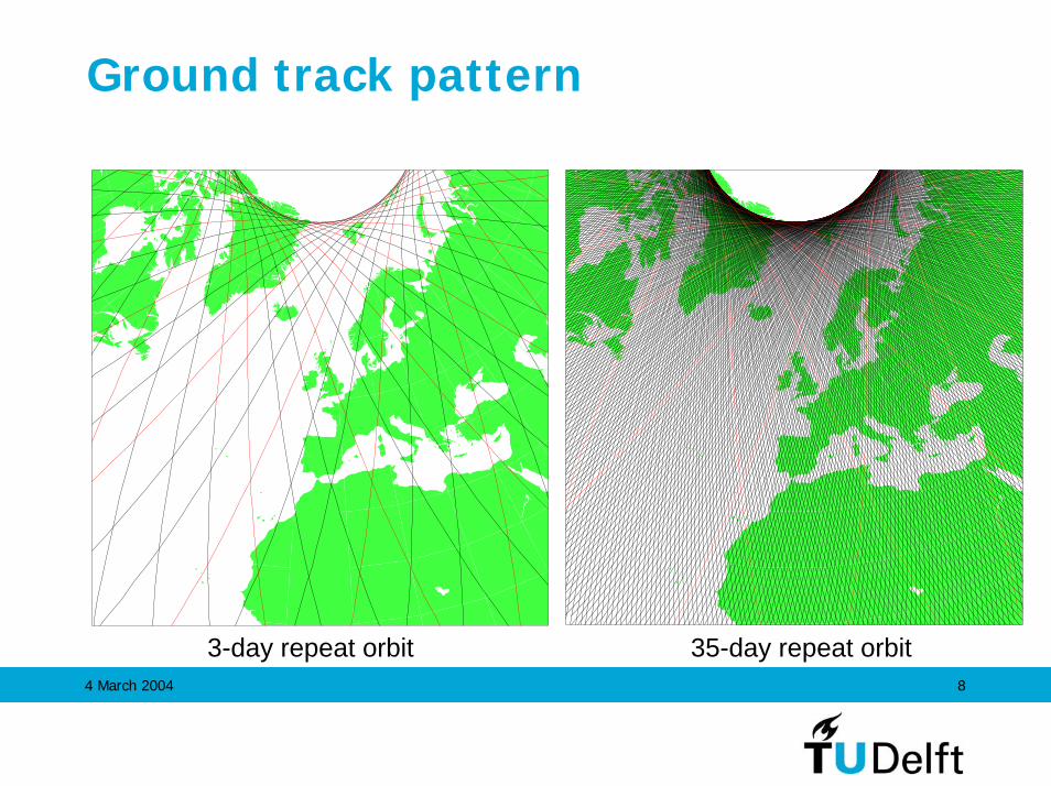
Ground track pattern
3-day repeat orbit 35-day repeat orbit4 March 2004 8
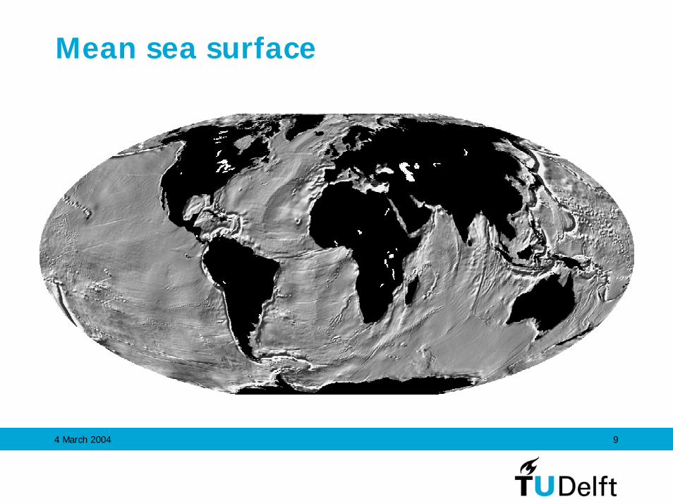
Mean sea surface
4 March 2004 9

North Atlantic: Gibbs fracture zone
4 March 2004 10
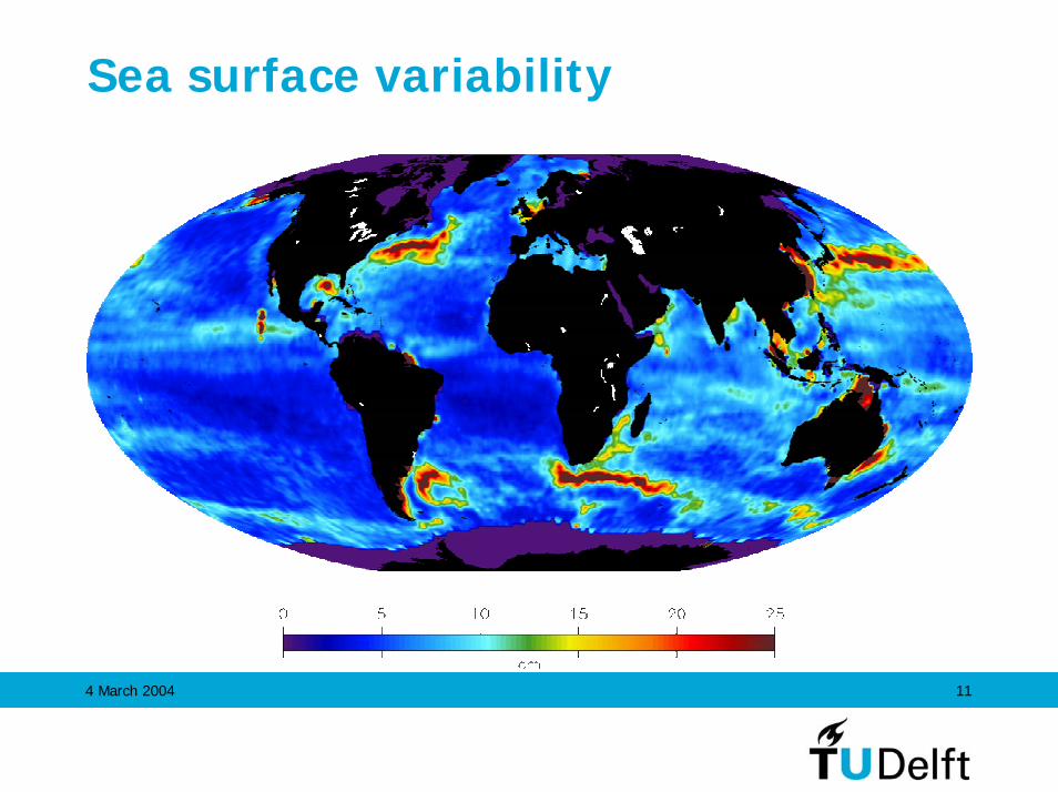
Sea surface variability
4 March 2004 11
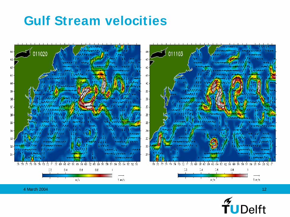
Gulf Stream velocities
4 March 2004 12

El Niño - southern oscillation
4 March 2004 13
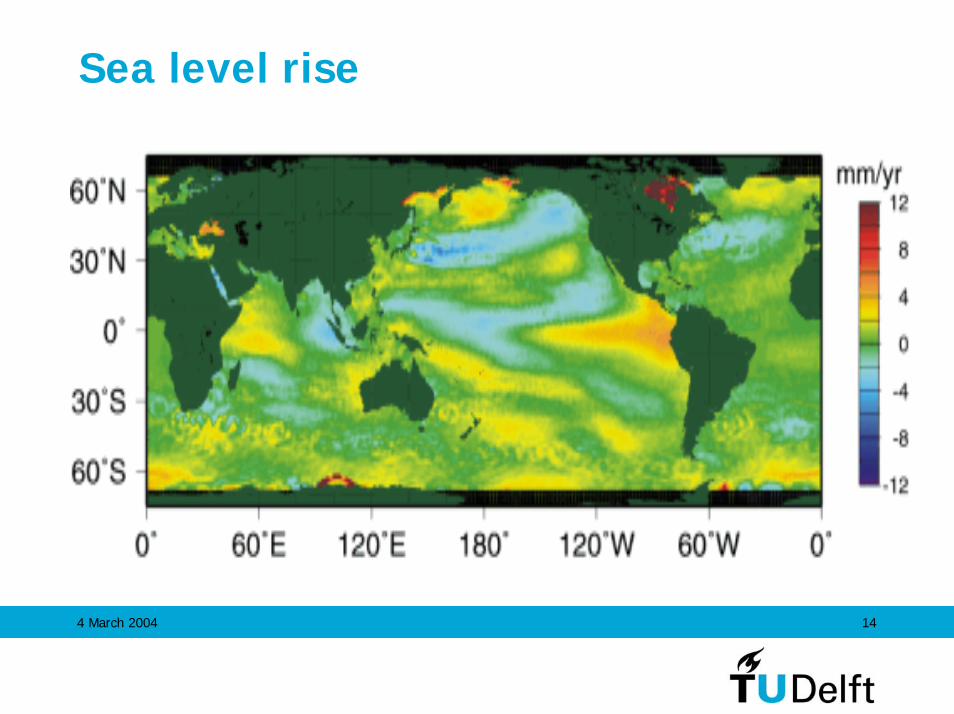
Sea level rise
4 March 2004 14
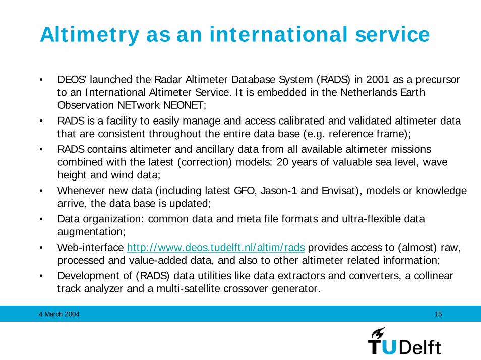
Altimetry as an international service
• DEOS' launched the Radar Altimeter Database System (RADS) in 2001 as a precursor to an International Altimeter Service. It is embedded in the Netherlands Earth Observation NETwork NEONET;
• RADS is a facility to easily manage and access calibrated and validated altimeter data that are consistent throughout the entire data base (e.g. reference frame);
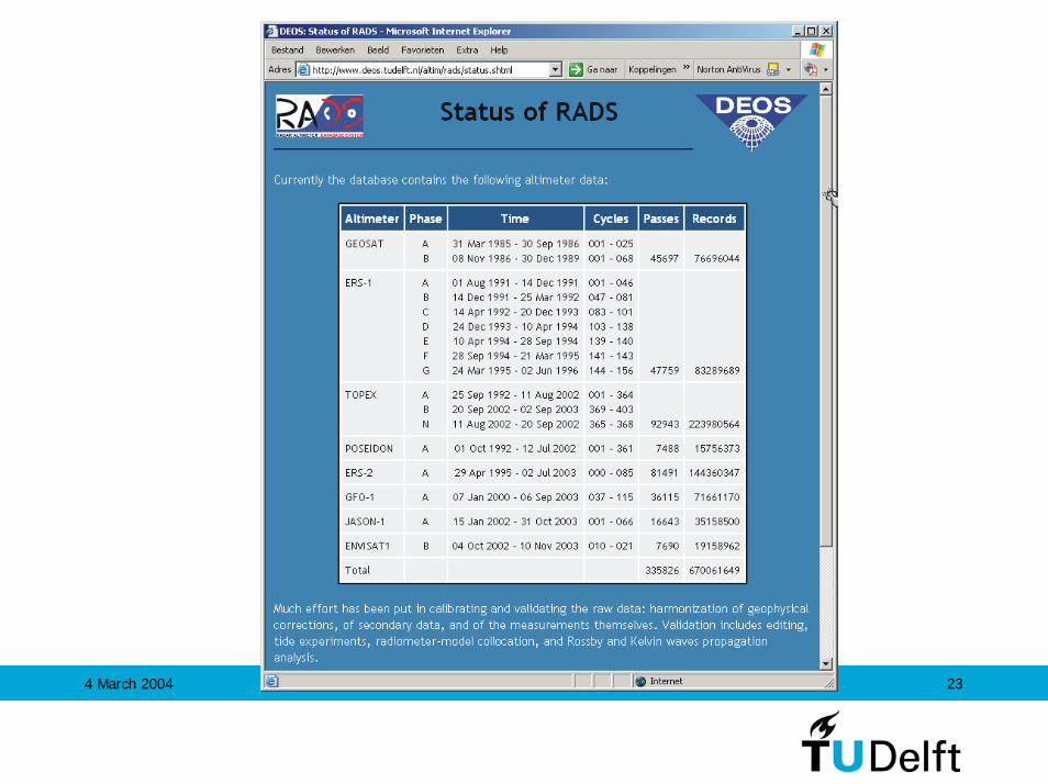
• RADS contains altimeter and ancillary data from all available altimeter missions combined with the latest (correction) models: 20 years of valuable sea level, wave height and wind data;
• Whenever new data (including latest GFO, Jason-1 and Envisat), models or knowledge arrive, the data base is updated;
• Data organization: common data and meta file formats and ultra-flexible data augmentation;
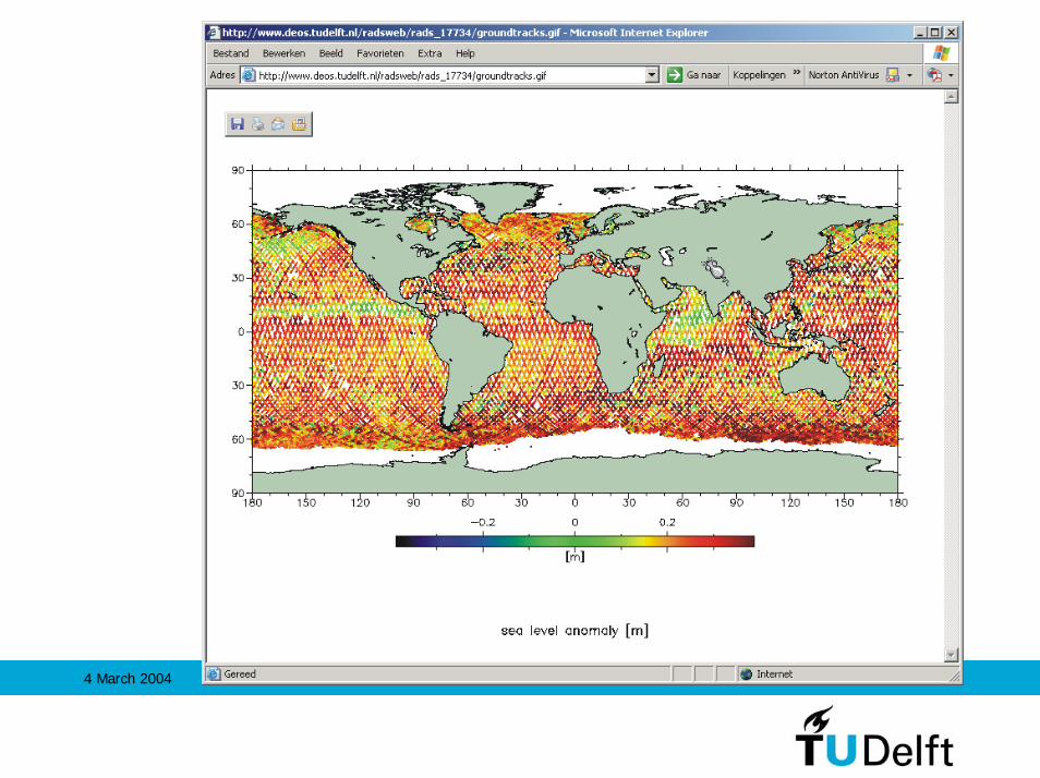
• Web-interface http://www.deos.tudelft.nl/altim/rads provides access to (almost) raw, processed and value-added data, and also to other altimeter related information;
• Development of (RADS) data utilities like data extractors and converters, a collinear track analyzer and a multi-satellite crossover generator.
4 March 2004 15

Radar Altimeter Database System
Data base
Settings
Programs
Interface
Creation Tools(used to generate
data base)
Utilities(Data manipulation)
User-specific Tools(created using RADS
library)
Development Tools(Utilities underdevelopment)
Global Settings(regulated by namelists
in $RADSROOT directory)
User Settings(regulated by namelists
in ~/.rads)
Local Settings(regulated by namelists
in working directory)
Command line arguments(common to most utilities)
Phase A(GM)
Phase B(ERM)
Geosat
Phase A...
Phase G
ERS-1
Phase A Phase B(interleaved)
TOPEX Poseidon
ERS-2 GFO Jason-1 Envisat
RADS Library(data reading, selection,
conversion, editing,arithmatic, manipulation)
4 March 2004 16
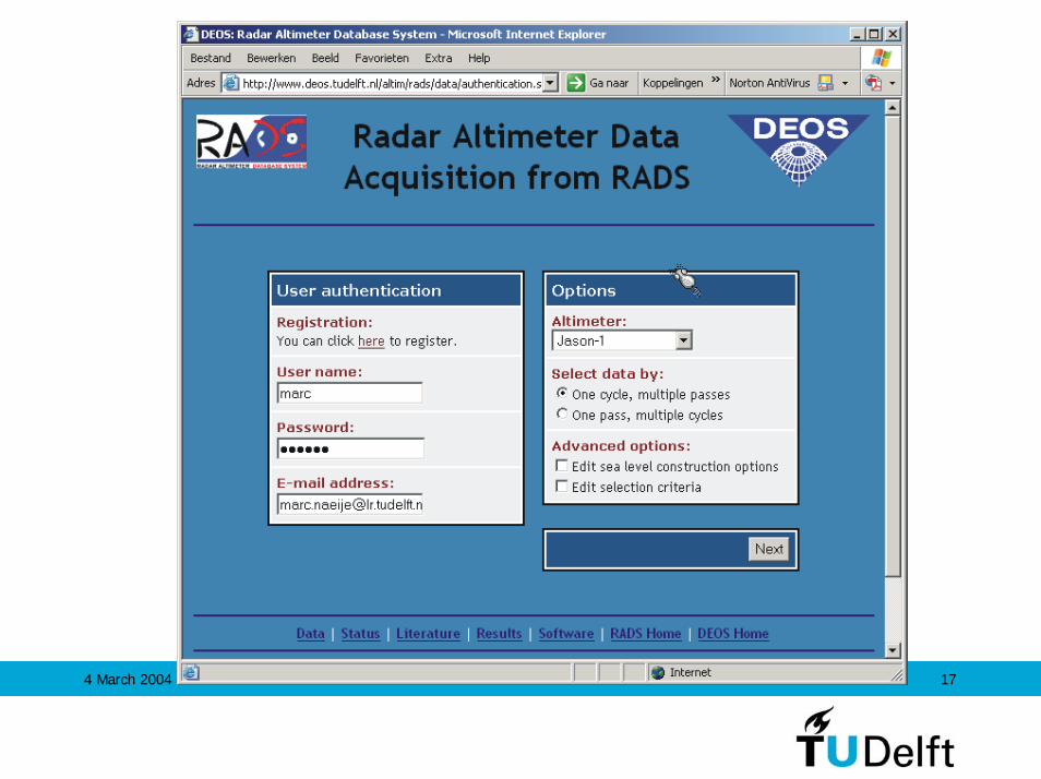
4 March 2004 17
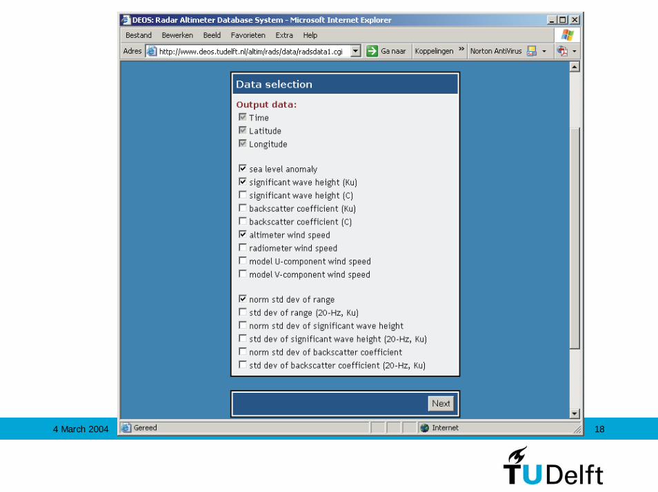
4 March 2004 18

4 March 2004 19
4 March 2004 20
4 March 2004 21
4 March 2004 22
4 March 2004 23

In the SAT2SEA project, Delft Hydraulics (WL|Delft) and DEOS investigated the application of altimetry in local sea level and storm surge predictions, by assimilating the data in a time stepping high resolution hydro-dynamic model. The area of interest is the Indonesian region which exhibits some complex bathymetry, consisting of several deep sub basins such as the Sulu, Celebes, Andaman and Banda seas, connected by barrier reefs and narrow channels.Ocean tide modelling has also played an important role in this project. The image gives evidence for the presence of internal tides in the Sulu Celebes area shown as a surface rippling effect in the M2 field recovered using a response method along the TOPEX/ POSEIDON ground tracks on a 1-second interval. The surface ripples, obtained by high-pass filtering the results, perfectly reveal the internal baro-clinic tidal effects. This is related to the dissipation of tidal energy, partly occurring in shallow waters due to bottom friction, but also in parts in the deep ocean.
4 March 2004 24