nasa global flood mapping systemworld food program nrcc –national response coordination center...
TRANSCRIPT
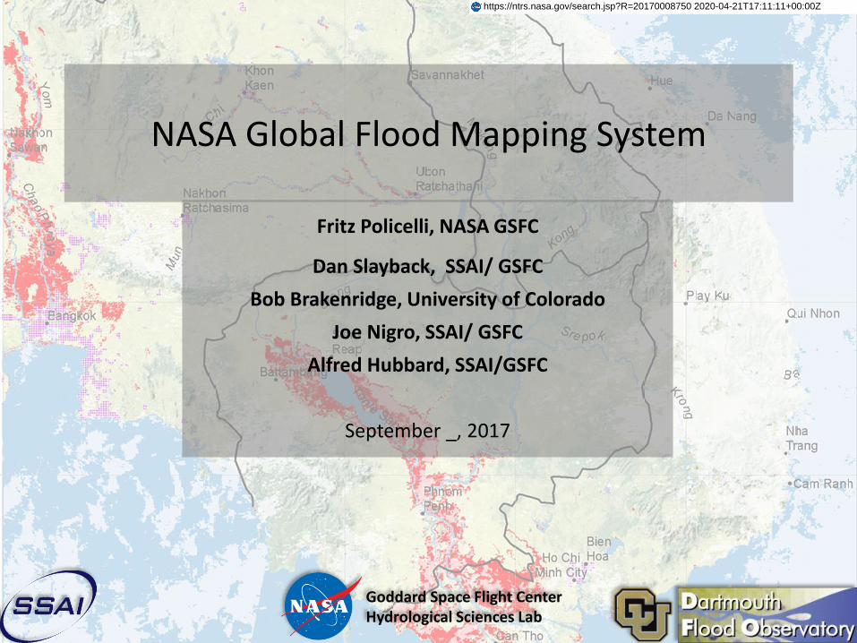
NASA Global Flood Mapping System
Fritz Policelli, NASA GSFC
Dan Slayback, SSAI/ GSFC
Bob Brakenridge, University of Colorado
Joe Nigro, SSAI/ GSFC
Alfred Hubbard, SSAI/GSFC
September _, 2017
Goddard Space Flight CenterHydrological Sciences Lab
https://ntrs.nasa.gov/search.jsp?R=20170008750 2020-04-21T17:11:11+00:00Z
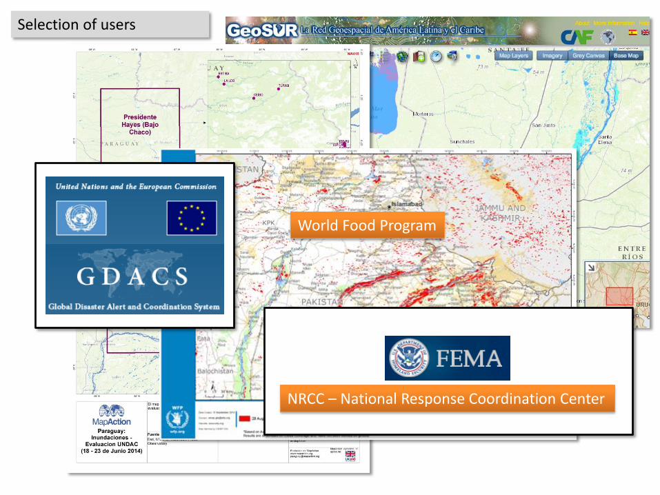
GeoSURMapAction
World Food Program
NRCC – National Response Coordination Center
Selection of users
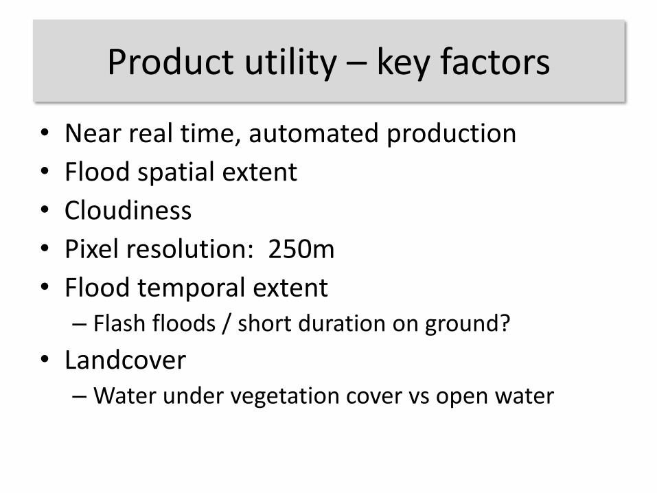
Product utility – key factors
• Near real time, automated production
• Flood spatial extent
• Cloudiness
• Pixel resolution: 250m
• Flood temporal extent– Flash floods / short duration on ground?
• Landcover– Water under vegetation cover vs open water
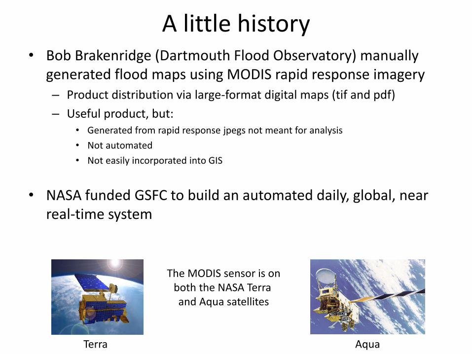
A little history• Bob Brakenridge (Dartmouth Flood Observatory) manually
generated flood maps using MODIS rapid response imagery– Product distribution via large-format digital maps (tif and pdf)
– Useful product, but:• Generated from rapid response jpegs not meant for analysis
• Not automated
• Not easily incorporated into GIS
• NASA funded GSFC to build an automated daily, global, near real-time system
Terra Aqua
The MODIS sensor is onboth the NASA Terra and Aqua satellites
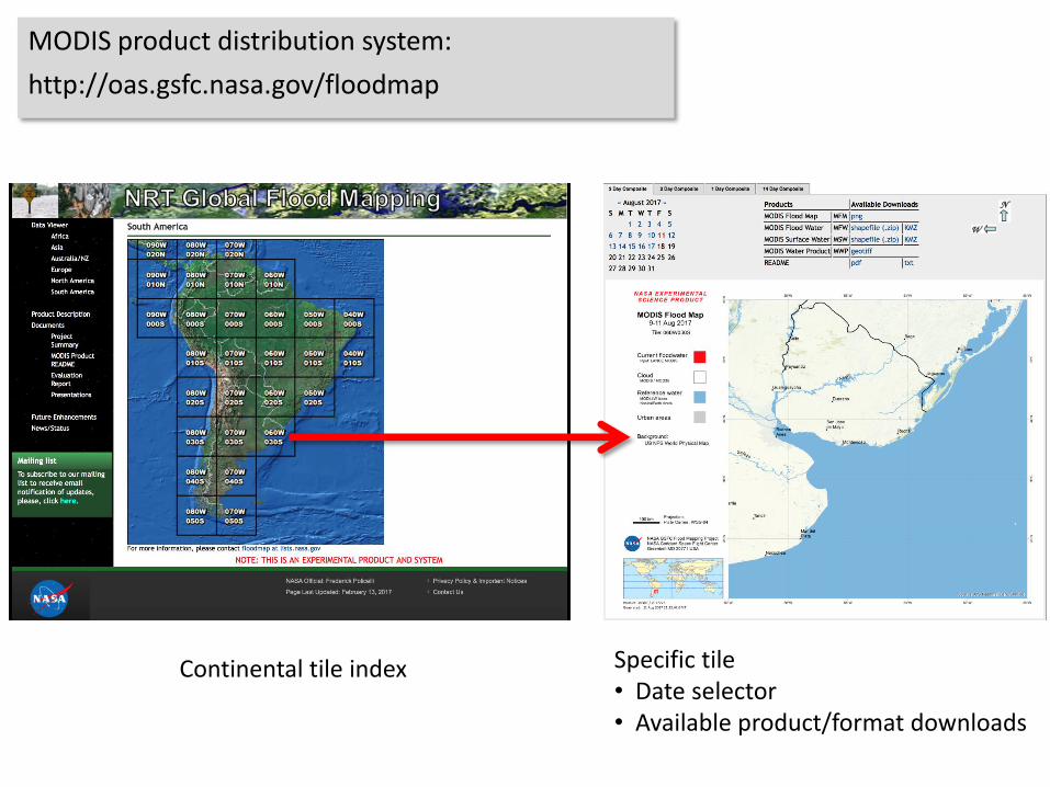
Continental tile index Specific tile • Date selector• Available product/format downloads
MODIS product distribution system:
http://oas.gsfc.nasa.gov/floodmap
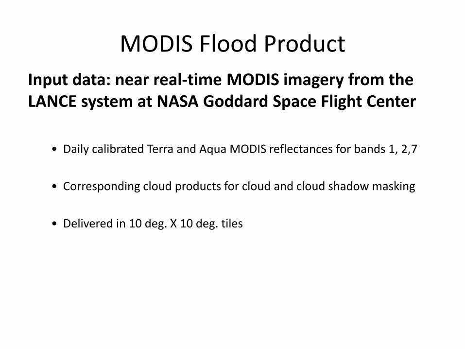
MODIS Flood Product
Input data: near real-time MODIS imagery from the LANCE system at NASA Goddard Space Flight Center
• Daily calibrated Terra and Aqua MODIS reflectances for bands 1, 2,7
• Corresponding cloud products for cloud and cloud shadow masking
• Delivered in 10 deg. X 10 deg. tiles
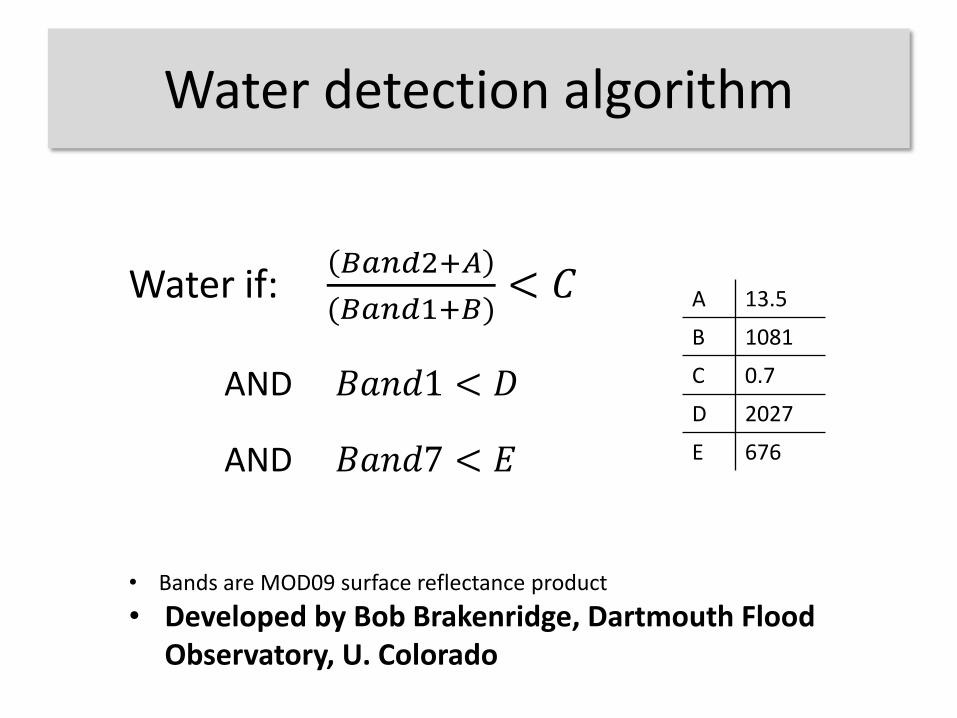
Water detection algorithm
Water if: 𝐵𝑎𝑛𝑑2+𝐴
(𝐵𝑎𝑛𝑑1+𝐵)< 𝐶
AND 𝐵𝑎𝑛𝑑1 < 𝐷
AND 𝐵𝑎𝑛𝑑7 < 𝐸
A 13.5
B 1081
C 0.7
D 2027
E 676
• Bands are MOD09 surface reflectance product
• Developed by Bob Brakenridge, Dartmouth Flood Observatory, U. Colorado
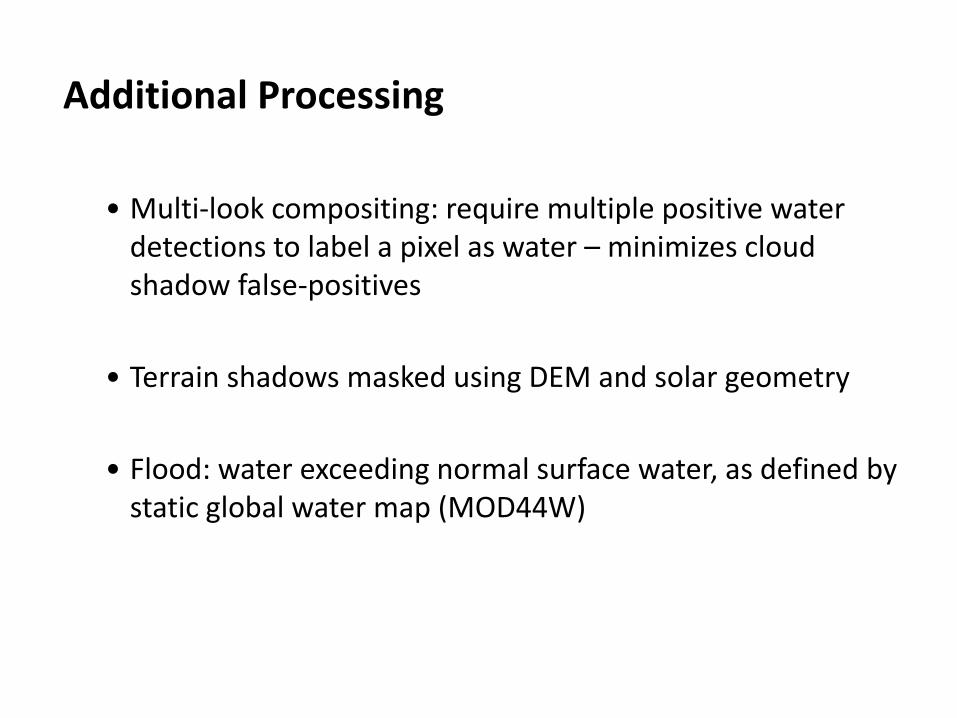
Additional Processing
• Multi-look compositing: require multiple positive water detections to label a pixel as water – minimizes cloud shadow false-positives
• Terrain shadows masked using DEM and solar geometry
• Flood: water exceeding normal surface water, as defined by static global water map (MOD44W)
Automated MODIS Flood Map Production System
• Fully automated (since Nov 2011)
• 223 10x10° tiles x 3 products (2-day, 3-day, 14-day) = 669 daily product suite generated
• Product suite includes: geotiffs, shapefiles, KML (Google Earth), and graphic maps (png)
• Products typically available within 6 hours of Aqua overpass (~ 8:00 PM local time)
• Delivery via web download
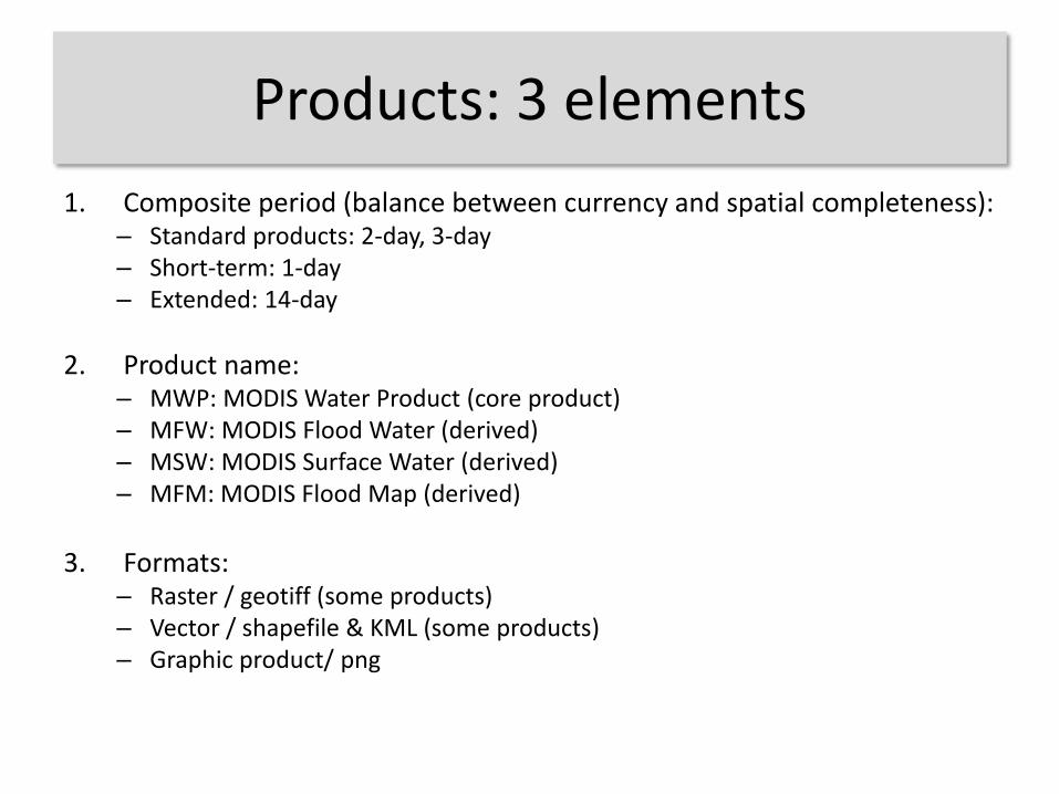
Products: 3 elements
1. Composite period (balance between currency and spatial completeness):– Standard products: 2-day, 3-day– Short-term: 1-day – Extended: 14-day
2. Product name:– MWP: MODIS Water Product (core product)– MFW: MODIS Flood Water (derived)– MSW: MODIS Surface Water (derived)– MFM: MODIS Flood Map (derived)
3. Formats:– Raster / geotiff (some products)– Vector / shapefile & KML (some products)– Graphic product/ png

MODIS Flood Map Compositing
• 1-day composite: requires 1 water observation over current day’s imagery (potentially 2 observations with Terra and Aqua). Not normally generated.
• 2-day: requires 2 water observations over 2 days of imagery (potentially 4 observations).
• 3-day: requires 3 water observations over 3 days of imagery (potentially 6 observations).
• 14-day: second order composite, combining the 14 previous 3-day products. Provides a recent-historical view.
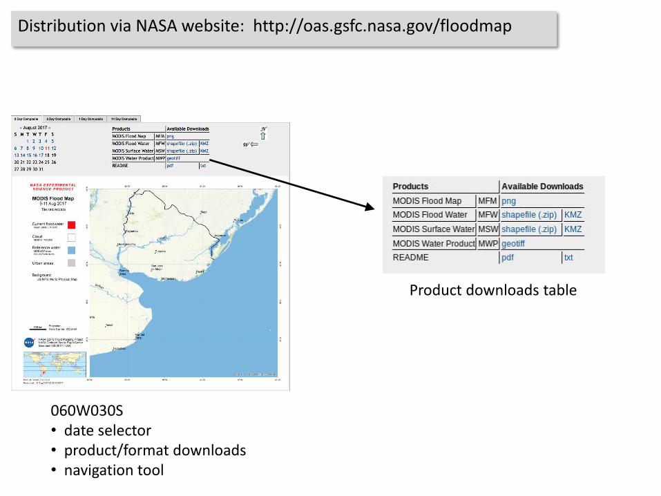
Distribution via NASA website: http://oas.gsfc.nasa.gov/floodmap
Product downloads table
060W030S• date selector• product/format downloads• navigation tool
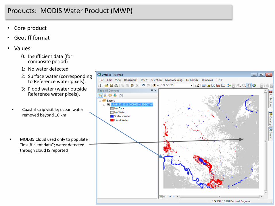
Products: MODIS Water Product (MWP)
• Values:
0: Insufficient data (for composite period)
1: No water detected
2: Surface water (corresponding to Reference water pixels).
3: Flood water (water outside Reference water pixels).
• Core product
• Geotiff format
• MOD35 Cloud used only to populate “Insufficient data”; water detected through cloud IS reported
• Coastal strip visible; ocean water removed beyond 10 km
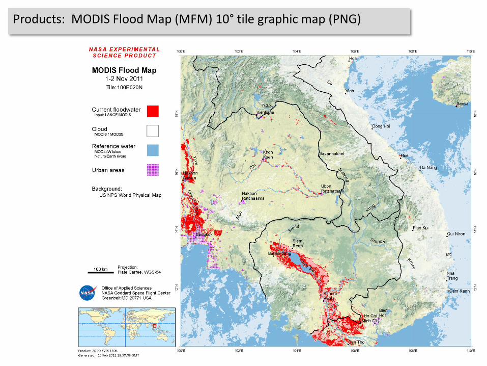
Products: MODIS Flood Map (MFM) 10° tile graphic map (PNG)

Products: MODIS Surface & Flood Water (MSW, MFW) shapefiles
• Vectorized from MWP (raster) product
• Does not indicate where insufficient data to determine (value 0 of MWP product)
• Provides area and centroid per polygon
• Production can fail if too many polygons
• KML production skipped if #polygons > 15000

Products: MODIS Surface & Flood Water KML files (Google Earth)
KML files in Google Earth:
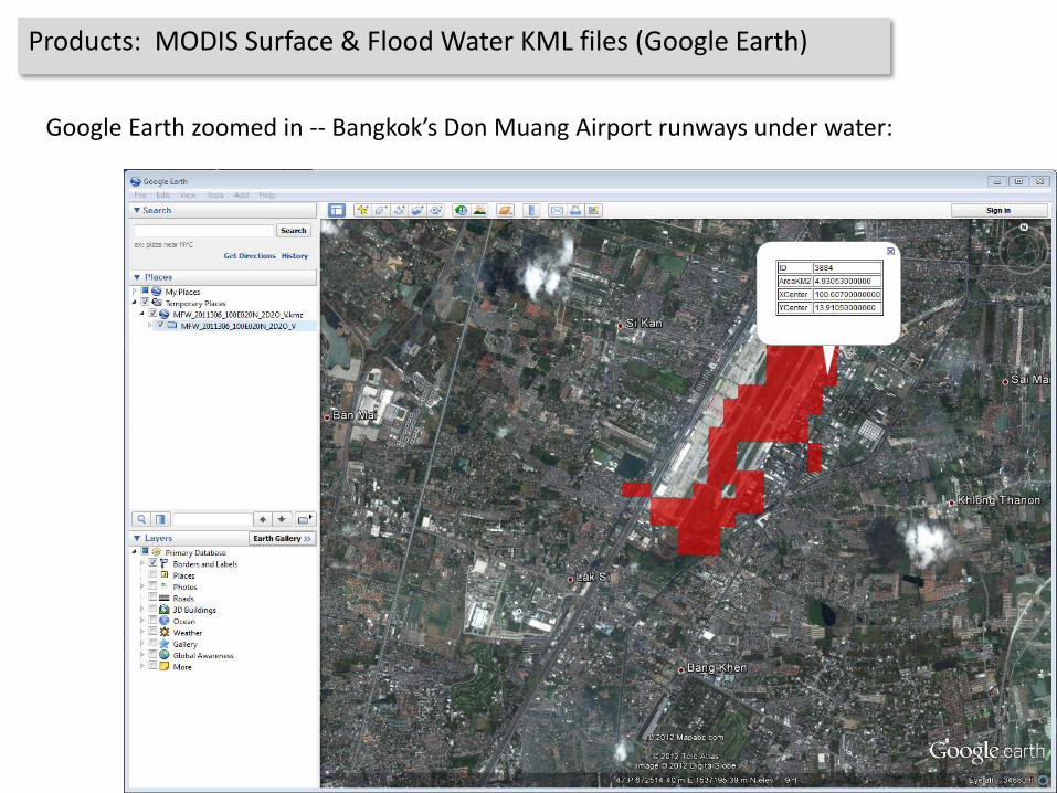
Products: MODIS Surface & Flood Water KML files (Google Earth)
Google Earth zoomed in -- Bangkok’s Don Muang Airport runways under water:
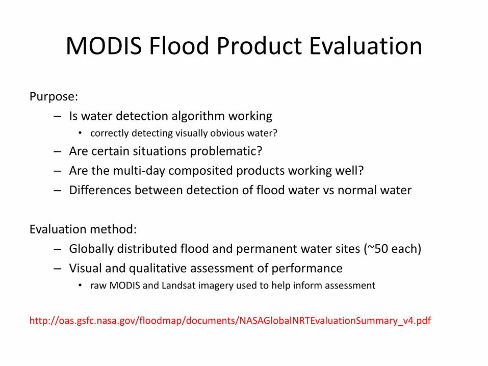
MODIS Flood Product Evaluation
Purpose:
– Is water detection algorithm working• correctly detecting visually obvious water?
– Are certain situations problematic?
– Are the multi-day composited products working well?
– Differences between detection of flood water vs normal water
Evaluation method:
– Globally distributed flood and permanent water sites (~50 each)
– Visual and qualitative assessment of performance• raw MODIS and Landsat imagery used to help inform assessment
http://oas.gsfc.nasa.gov/floodmap/documents/NASAGlobalNRTEvaluationSummary_v4.pdf
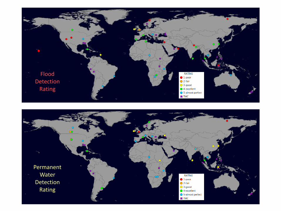
PermanentWater
DetectionRating
FloodDetection
Rating
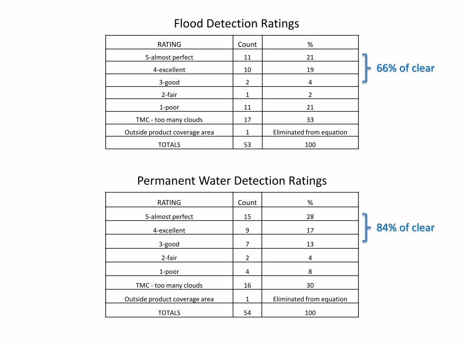
Flood Detection Ratings
RATING Count %
5-almost perfect 15 28
4-excellent 9 17
3-good 7 13
2-fair 2 4
1-poor 4 8
TMC - too many clouds 16 30
Outside product coverage area 1 Eliminated from equation
TOTALS 54 100
RATING Count %
5-almost perfect 11 21
4-excellent 10 19
3-good 2 4
2-fair 1 2
1-poor 11 21
TMC - too many clouds 17 33
Outside product coverage area 1 Eliminated from equation
TOTALS 53 100
Permanent Water Detection Ratings
66% of clear
84% of clear

Bosnia and Herzegovina: 22 May 2014
Flood water
Non-flood water
Insufficient Data
Landsat 8May 22, 2014
MODIS NRT productMay 22, 2014
Landsat 8October 19, 2013
Correct flood identification

Flood water
Non-flood water
Insufficient Data
National Geographic base map
Landsat 8 Pre-floodApr 21, 2013
Landsat 8 FloodJan 2, 2014
MODIS NRT productJan 3, 2014
Brazil: 02 January 2014
Correct flood and permanent water identification
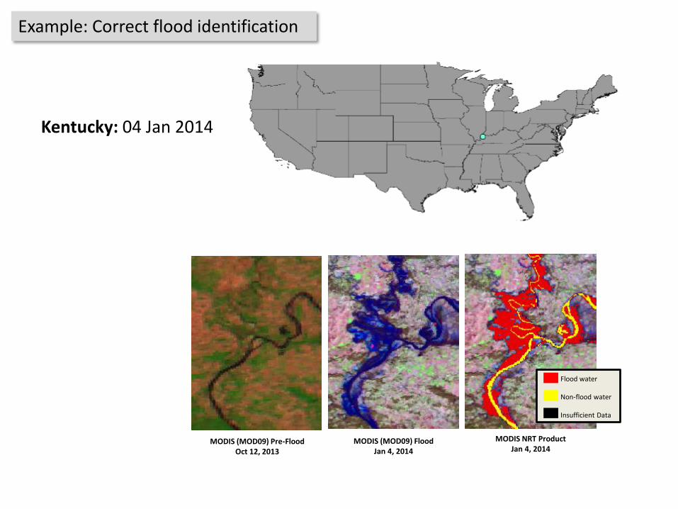
MODIS (MOD09) Pre-FloodOct 12, 2013
MODIS (MOD09) FloodJan 4, 2014
MODIS NRT ProductJan 4, 2014
Kentucky: 04 Jan 2014
Flood water
Non-flood water
Insufficient Data
Example: Correct flood identification
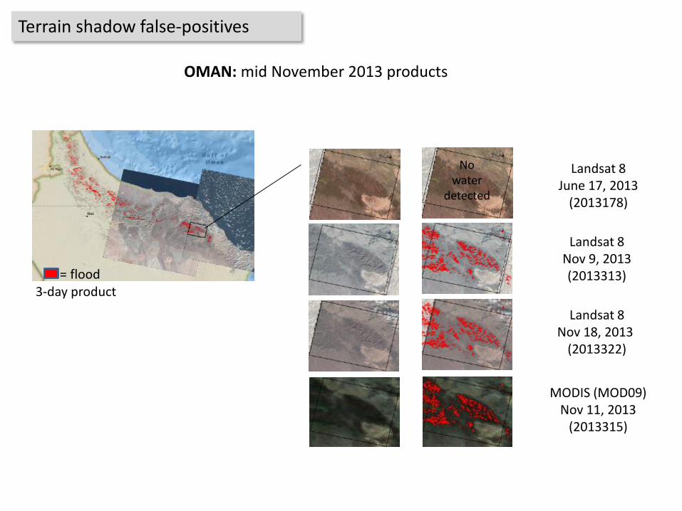
3-day product
Landsat 8June 17, 2013
(2013178)
= flood
Landsat 8Nov 18, 2013
(2013322)
MODIS (MOD09)Nov 11, 2013
(2013315)
Landsat 8Nov 9, 2013(2013313)
Nowater
detected
OMAN: mid November 2013 products
Terrain shadow false-positives

Mauna Loa, Hawaii: 17 Dec 2013
Landsat 8
Flood water
Non-flood water
Insufficient Data
MODIS NRT Product
Example: Barren rock / volcanic false positives

Australia: 04 July 2014
Input data: MOD09, 04 Jul 2014 2-day Product on MOD09
Flood water
Non-flood water
Insufficient Data
3-day Product
3-day product removes most cloud shadow false positives
Example: Cloud shadow false-positives
Flood water
Non-flood water
Insufficient Data
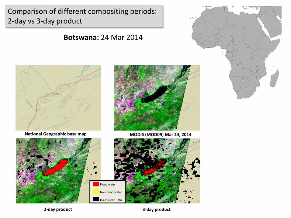
Botswana: 24 Mar 2014
MODIS (MOD09) Mar 24, 2014National Geographic base map
3-day product 2-day product
Comparison of different compositing periods: 2-day vs 3-day product
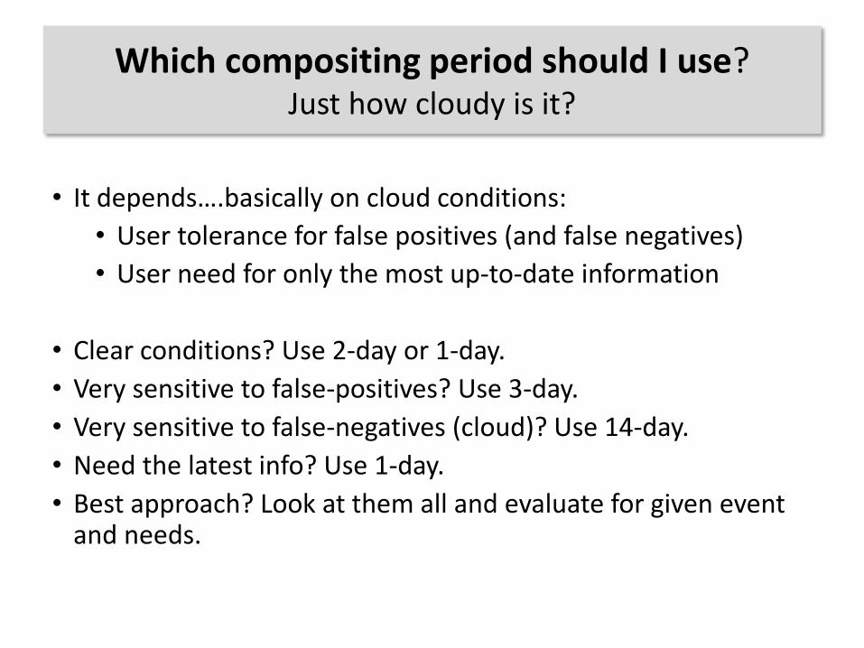
Which compositing period should I use? Just how cloudy is it?
• It depends….basically on cloud conditions:
• User tolerance for false positives (and false negatives)
• User need for only the most up-to-date information
• Clear conditions? Use 2-day or 1-day.
• Very sensitive to false-positives? Use 3-day.
• Very sensitive to false-negatives (cloud)? Use 14-day.
• Need the latest info? Use 1-day.
• Best approach? Look at them all and evaluate for given event and needs.
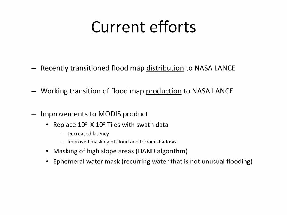
Current efforts
– Recently transitioned flood map distribution to NASA LANCE
– Working transition of flood map production to NASA LANCE
– Improvements to MODIS product
• Replace 10o X 10o Tiles with swath data– Decreased latency
– Improved masking of cloud and terrain shadows
• Masking of high slope areas (HAND algorithm)
• Ephemeral water mask (recurring water that is not unusual flooding)

Comments/ Questions ?