mojave desert ecosystem program (mdep) environmental data ...€¦ · april 12, 2010. mdep mobile...
TRANSCRIPT
Mojave Desert Mojave Desert
Ecosystem Program Ecosystem Program
(MDEP)(MDEP)
Environmental DataEnvironmental Data
Collaboration Collaboration
‐
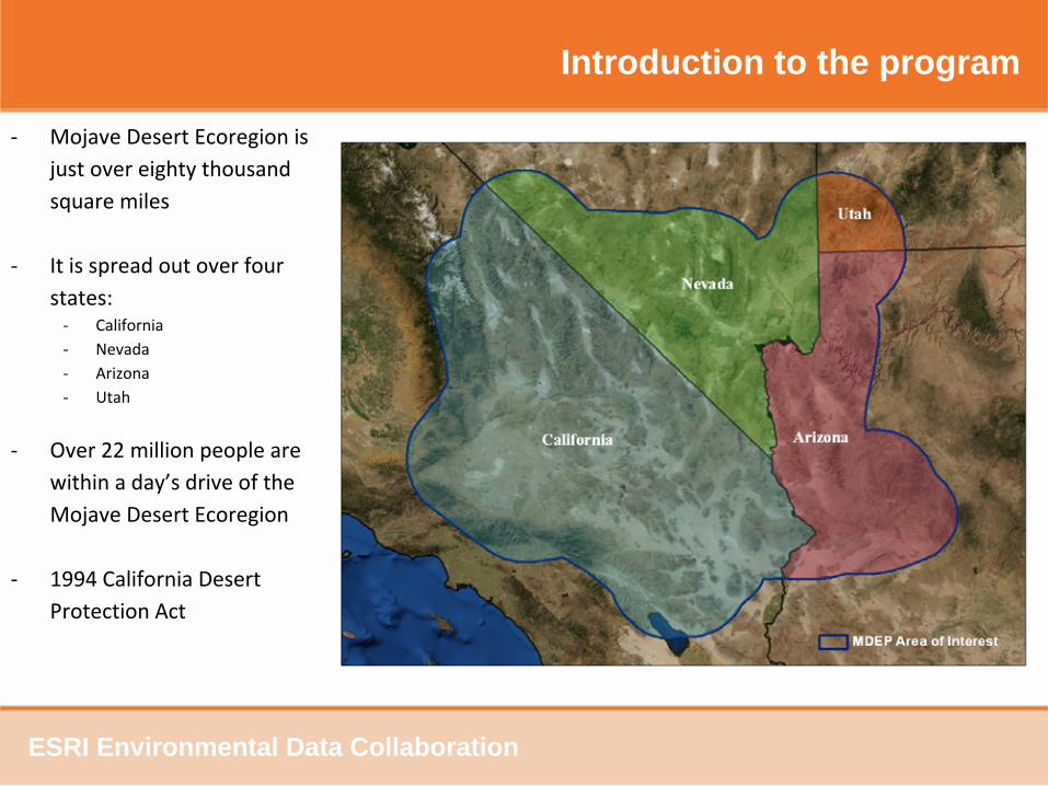
Mojave Desert Ecoregion is
just over eighty thousand
square miles
‐
It is spread out over four
states:‐
California‐
Nevada‐
Arizona‐
Utah
‐
Over 22 million people are
within a day’s drive of the
Mojave Desert Ecoregion
‐
1994 California Desert
Protection Act
Introduction to the program
ESRI Environmental Data Collaboration

Government Partnerships at the federal
level.‐The Desert Managers Group ‐The Mojave Desert Initiative‐Southern Nevada Agency Partnership
National efforts ‐DOI Desert Landscape Conservation
Cooperative‐BLM Ecoregional Assessments
State efforts‐Desert Renewable Energy Conservation
Plan
Local efforts‐Coachella Valley Association of
Governments
Introduction to the program
ESRI Environmental Data Collaboration
Overview of core aspects
MDEP was established in 1995 under a joint plan between DOD and DOI
MDEP services the Mojave Ecoregion–
Partnerships between the various federal agencies along with partnerships at the state and local
levels throughout the four states makes it possible for MDEP to support such a large ecoregion
MDEP achieves true collaboration–
Collaboration happens not just at the MOU level but even down to
resources, support and data
from all federal, state and local government along with education and nonprofit groups in each of
the four states within the Mojave Ecoregion.
MDEP data repository solution–
The program was charged with the duty of being a regional data repository storing thousands of
data layers and records which it has successfully done for over 15 years.
–
This concept has grown from a repository solution to web hosting, extranet support and various IT
project support solutions all in the efforts of obtaining better
data on the region.–
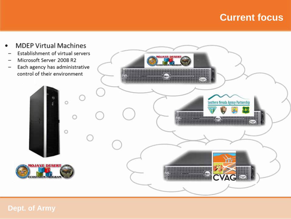
With implementation of current software and hardware from the government various IT solutions
such as virtual machines, remote application services, and other
robust solutions are now available
for agencies to utilize within the region.
Dept. of Army

Overview of core aspects
MDEP solutions benefit efforts at the national, state and local levels.–
Data sharing capabilities that meet national cloud system guidelines to data transfer methods to local
agencies
–
IT support and storage capabilities to satisfy various needs of the various groups who collaborate with
the program
–
An operational structure that meets many of the government guide
lines and goals even those called
out in the December 2010 25 point implementation plan for IT management from the White House.
MDEP services the public directly–
Through four websites, educational program support and publications such as print exhibits for
museums.
MDEP is seen within the region as a flexible and valued solution–
Connectivity to larger organization systems to server data into their environments–
Connectivity to smaller organizations to share a finer level of data to member organizations.
Dept. of Army
Current focus
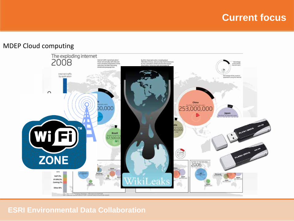
MDEP Cloud computing
ESRI Environmental Data Collaboration
Current focus
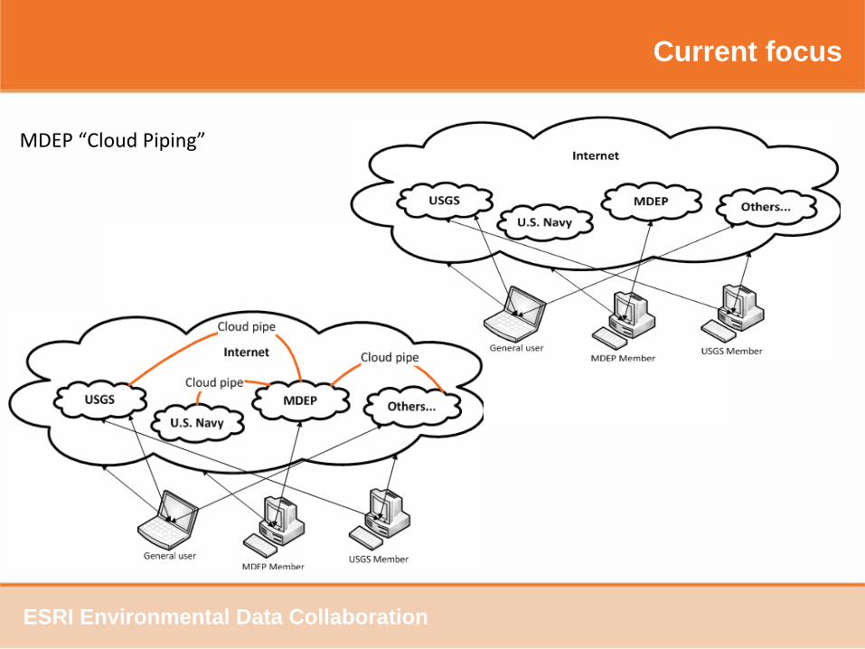
MDEP “Cloud Piping”
ESRI Environmental Data Collaboration
Current focus
Dept. of Army
Current focus
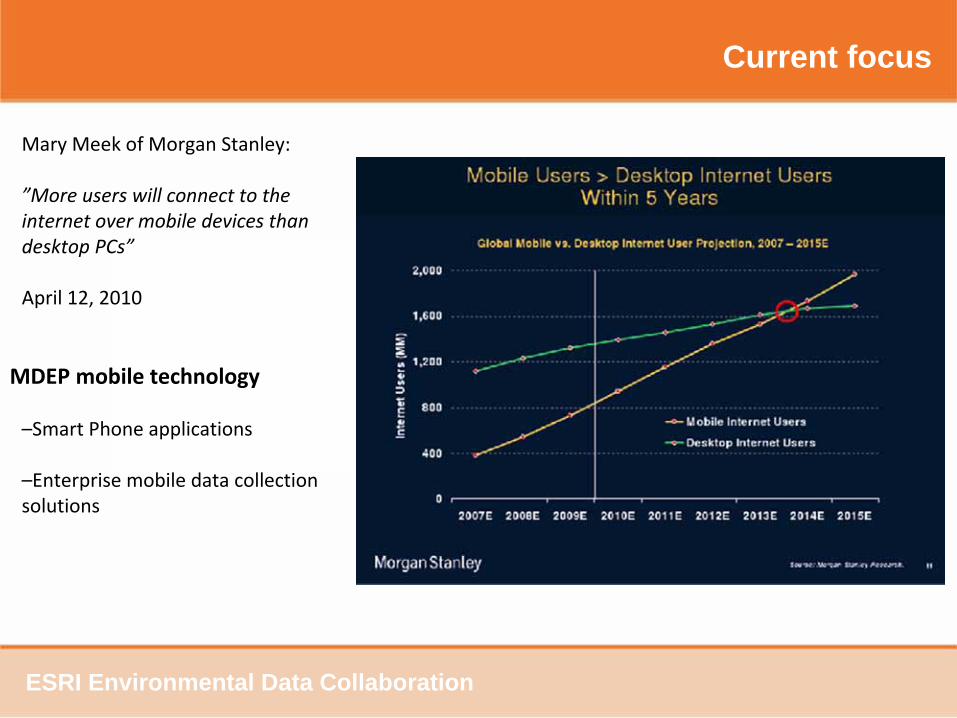
Mary Meek of Morgan Stanley:
”More users will connect to the
internet over mobile devices than
desktop PCs”
April 12, 2010
MDEP mobile technology
–Smart Phone applications
–Enterprise mobile data collection
solutions
ESRI Environmental Data Collaboration
Current focus
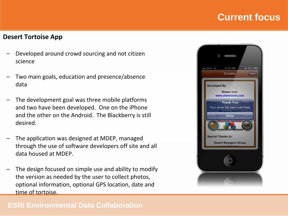
Desert Tortoise App
–
Developed around crowd sourcing and not citizen
science
–
Two main goals, education and presence/absence
data
–
The development goal was three mobile platforms
and two have been developed. One on the iPhone
and the other on the Android. The Blackberry is still
desired.
–
The application was designed at MDEP, managed
through the use of software developers off site and all
data housed at MDEP.
–
The design focused on simple use and ability to modify
the version as needed by the user to collect photos,
optional information, optional GPS location, date and
time of tortoise.
ESRI Environmental Data Collaboration
Current focus
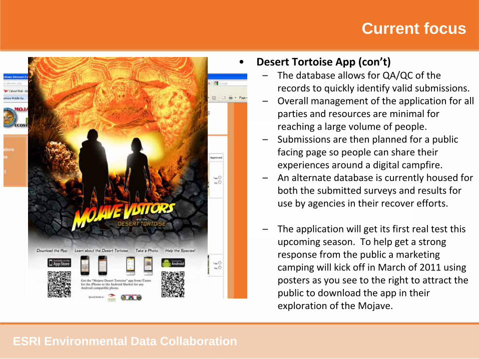
• Desert Tortoise App (con’t)–
The database allows for QA/QC of the
records to quickly identify valid submissions.
–
Overall management of the application for all
parties and resources are minimal for
reaching a large volume of people.
–
Submissions are then planned for a public
facing page so people can share their
experiences around a digital campfire.
–
An alternate database is currently housed for
both the submitted surveys and results for
use by agencies in their recover efforts.
–
The application will get its first real test this
upcoming season. To help get a strong
response from the public a marketing
camping will kick off in March of 2011 using
posters as you see to the right to attract the
public to download the app in their
exploration of the Mojave.
ESRI Environmental Data Collaboration
Current focus
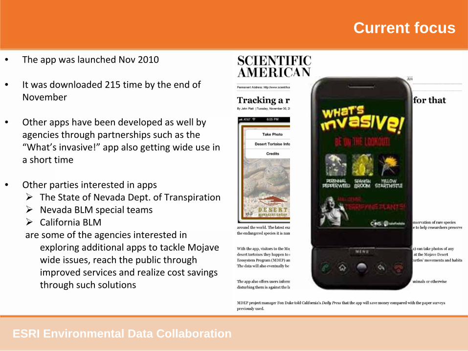
• The app was launched Nov 2010
• It was downloaded 215 time by the end of
November
• Other apps have been developed as well by
agencies through partnerships such as the
“What’s invasive!”
app also getting wide use in
a short time
• Other parties interested in apps
The State of Nevada Dept. of Transpiration
Nevada BLM special teams
California BLM are some of the agencies interested in
exploring additional apps to tackle Mojave
wide issues, reach the public through
improved services and realize cost savings
through such solutions
ESRI Environmental Data Collaboration
Current focus
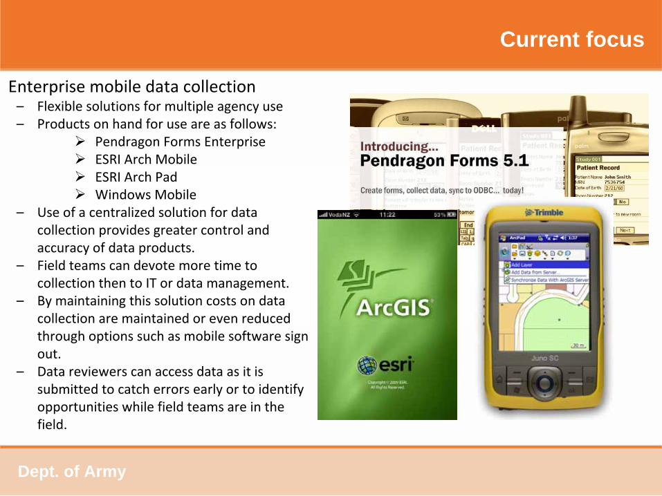
Enterprise mobile data collection –
Flexible solutions for multiple agency use–
Products on hand for use are as follows:
Pendragon
Forms Enterprise
ESRI Arch Mobile
ESRI Arch Pad
Windows Mobile –
Use of a centralized solution for data
collection provides greater control and
accuracy of data products.
–
Field teams can devote more time to
collection then to IT or data management.
–
By maintaining this solution costs on data
collection are maintained or even reduced
through options such as mobile software sign
out.
–
Data reviewers can access data as it is
submitted to catch errors early or to identify
opportunities while field teams are in the
field.
Dept. of Army
Current focus
•
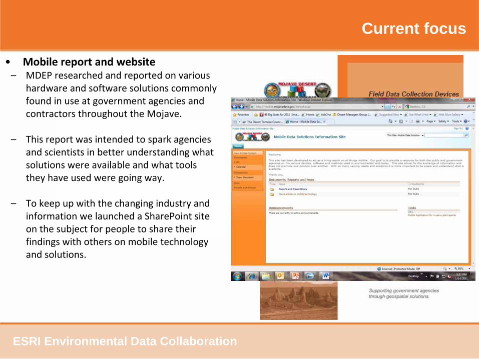
Mobile report and website–
MDEP researched and reported on various
hardware and software solutions commonly
found in use at government agencies and
contractors throughout the Mojave.
–
This report was intended to spark agencies
and scientists in better understanding what
solutions were available and what tools
they have used were going way.
–
To keep up with the changing industry and
information we launched a SharePoint site
on the subject for people to share their
findings with others on mobile technology
and solutions.
ESRI Environmental Data Collaboration

Current focus
Distributed data model for consideration
VS
ESRI Environmental Data Collaboration
Thank youThank you
Visit us at Visit us at www.mojavedata.govwww.mojavedata.gov