marker #389 to hunter valley road ometion ateetember€¦ · by the 2013 flood at 2 locations and...
TRANSCRIPT
Competion Date:September 2015
Marker #389 to Hunter Valley Road
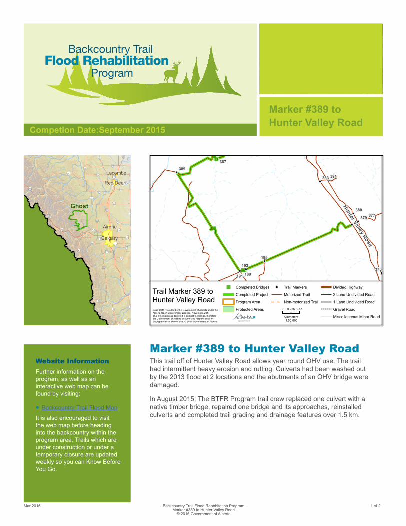
Marker #389 to Hunter Valley RoadThis trail off of Hunter Valley Road allows year round OHV use. The trail had intermittent heavy erosion and rutting. Culverts had been washed out by the 2013 flood at 2 locations and the abutments of an OHV bridge were damaged.
In August 2015, The BTFR Program trail crew replaced one culvert with a native timber bridge, repaired one bridge and its approaches, reinstalled culverts and completed trail grading and drainage features over 1.5 km.
93
22
27
5
7
2
9
6
42
3
22
22X
1
72
2A
22
22
54
11 12
53
13
11
50
1A
21
20 2A
1A
2
93
40
66
8
24
2
6
23
Ghost
Calgary
Airdrie
Red Deer
Lacombe
Hunter Valley Road
387
377
193
189375
379
391383
195
191
389
380
") Completed Bridges
Completed Project
Program Area
Protected Areas
! Trail Markers
Motorized Trail
Non-motorized Trail
Divided Highway
2 Lane Undivided Road
1 Lane Undivided Road
Gravel Road
Miscellaneous Minor Road
Trail Marker 389 toHunter Valley RoadBase Data Provided by the Government of Alberta under theAlberta Open Government Licence. November, 2014.The information as depicted is subject to change, thereforethe Government of Alberta assumes no responsibility fordiscrepancies at time of use. © 2014 Government of Alberta
0 0.450.225
Kilometers1:50,000
Mar 2016 1 of 2Backcountry Trail Flood Rehabitation Program Marker #389 to Hunter Valley Road
© 2016 Government of Alberta
Website InformationFurther information on the program, as well as an interactive web map can be found by visiting:
• Backcountry Trail Flood Map
It is also encouraged to visit the web map before heading into the backcountry within the program area. Trails which are under construction or under a temporary closure are updated weekly so you can Know Before You Go.
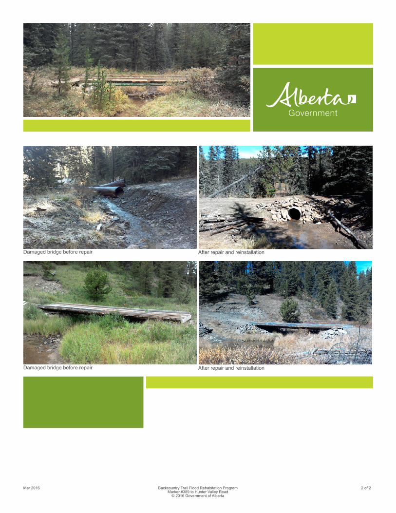
Damaged bridge before repair
Damaged bridge before repair
After repair and reinstallation
After repair and reinstallation
Mar 2016 2 of 2Backcountry Trail Flood Rehabitation Program Marker #389 to Hunter Valley Road
© 2016 Government of Alberta