langwarrin flora and fauna reserve management plan 2002 · web viewotion. of. the. reserve. as....
TRANSCRIPT
This Management Plan for Langwarrin Flora and Fauna Reserve is approved for implementation. Its purpose is to direct all aspects of management in the reserve until the plan is reviewed. A Draft Management Plan for the reserve was published in September 2001. A total of seven submissions were received and have been considered in developing this approved Management Plan.
Copies
This plan may be down-loaded from the Parks Victoria website 'www.parkweb.vic.gov.au'. Copies of the plan may be purchased for $8.80 (including GST) from:
Parks Victoria Information Centre Level 10, 535 Bourke StreetMELBOURNE 3000 VIC
NRE Information Centre 8 Nicholson StreetEAST MELBOURNE VIC 3002
Parks Victoria Rosebud Office Mornington Western Port District Hinton StreetROSEBUD 3939
Information
For further information on the plan please contact the Chief Ranger Mornington Western Port District at the address above (telephone 03 5986 8987).

LANGWARRIN FLORA AND FAUNA RESERVE
MANAGEMENT PLAN
JULY 2002

2 Langwarrin Flora and Fauna Reserve
Published in July 2002 by Parks Victoria
Level 10, 535 Bourke Street Melbourne, Victoria 3000.
National Library of Australia Cataloguing-in-Publication entry
Parks Victoria.
Langwarrin Flora and Fauna Reserve management plan.
Bibliography.ISBN 0 7311 8319 3.
1. National parks and reserves – Victoria - Langwarrin - Management. 2. Langwarrin Flora and Fauna Reserve (Vic.). I Title.
333.783099452
Disclaimer:
Every effort has been made to ensure that the information in this report is accurate. Parks Victoria does not guarantee that the publication is without flaw of any kind and therefore disclaims all liability for any error, loss or other consequence which may arise from you relying on any information in the publication.
Cover: Langwarrin Flora and Fauna Reserve, looking across the Reservoir (Photo: David Preece)
Printed on recycled paper to help save our natural environment

Langwarrin Flora and Fauna 3
Langwarrin Flora and Fauna Reserve is recognised as an important area for the conservation of indigenous flora and fauna on the fringe of Melbourne.
The Reserve is renowned for remnant stringybark woodland and sand heaths, which have been largely cleared throughout the region. While the reserve is relatively small, comprising 214 hectares, it’s importance for biodiversity conservation is highlighted by it’s rich flora diversity comprising about 300 indigenous species.
Managed primarily for nature conservation purposes, the reserve provides good opportunities for visitors to enjoy recreational activities in relatively natural settings. The reserve is popular for walking, jogging and nature study and visitors make use of the track
network to access diverse vegetation communities and historic sites remaining from almost 100 years of past military use.
This Approved Plan establishes the long-term management framework to protect and enhance the conservation values of the reserve as well as ensuring quality visitor experiences. Basic facilities and access will be improved in keeping with the largely undeveloped nature of the reserve.
I thank those individuals and organisations who made submissions on the Draft Plan and I look forward to the continuing community support in managing the reserve.
Sherryl Garbutt MPMinister for Environment and Conservation
FOREWOR
4 Langwarrin Flora and Fauna Reserve

APPROVED MANAGEMENT
Langwarrin Flora and Fauna 5
This approved management plan has been prepared under section 18 of the National Parks Act 1975 (Vic.) and is approved for implementation.
The plan provides the basis and direction for the future management of Langwarrin Flora and Fauna Reserve.
Chloe MunroSecretary to theDepartment of Natural Resources and Environment
It was finalised following careful consideration of the seven submissions received on the Draft Management Plan published in September 2001.
Mark Stone Chief Executive Parks Victoria

FOREWOR
6 Langwarrin Flora and Fauna

SUMMAR
Langwarrin Flora and Fauna 7
Langwarrin Flora and Fauna Reserve is one of few remaining areas on the south-eastern fringe of the Melbourne metropolitan area, set aside for the protection of flora and fauna. Most of the areas close to Melbourne and on the Mornington Peninsula were cleared following European settlement.
Land now included in the reserve was mostly protected from clearing, initially by the topography and poor soils and drainage which reduced its value for agriculture, and subsequently by acquisition and reservation for military purposes from 1887 to 1979. The area has a colourful and important place in military history.
The reserve has high conservation values including samples of native vegetation types that are becoming uncommon and species that are threatened as a result of continued suburban development. Approximately 45 percent of the plant species indigenous to the Mornington Peninsula occur in the reserve, including a diverse orchid flora. Previously cleared areas used for military purposes are now heavily infested by woody weeds and other exotic vegetation.
Significant management directions are summarised below:
• The reserve will continue to be managed as an important conservation area.
• Threatened flora species and the reserve’s important fauna habitats will be given special protection.
• The overall good condition of the sand dune and woodland communities and ephemeral wetlands will be maintained. Degraded areas will be restored where not providing for recreational use.
• The reserve will remain largely undeveloped and facilities for passive recreation will be focused at the Old Hospital Site. Active recreation activities will be encouraged at alternative locations away from the reserve.
• Interpretive trails will be established to enhance visitor appreciation and enjoyment of the reserve’s diverse natural values and cultural history.
• The community will be encouraged to continue involvement in the management of the reserve.

FOREWOR
8 Langwarrin Flora and Fauna

CONTENT
Langwarrin Flora and Fauna 9
FOREWORD iii
SUMMARY vii
1 INTRODUCTION 1
1.1 Location and planning area 11.2 Creation of the reserve 11.3 Developing the management plan 1
2 BASIS 2
2.1 Regional context 22.2 Reserve values and significance 22.3 Past land use 22.4 The reserve visitor 32.5 Legislation and guidelines 3
3 STRATEGIC DIRECTIONS 5
3.1 Reserve vision 53.2 Zoning 53.3 Management directions 5
4 STRATEGIES FOR CONSERVATION 8
4.1 Geological and landform features 84.2 Vegetation 84.3 Fauna 104.4 Landscape 114.5 Fire management 114.6 Pest plants and animals, and diseases 134.7 Soil conservation 144.8 Aboriginal cultural heritage 154.9 Post-settlement cultural heritage 15
5 STRATEGIES FOR VISITORS 17
5.1 Information, interpretation and education 175.2 Access and amenity 175.3 Walking 185.4 Cycling 185.5 Horse riding 195.6 Orienteering 195.7 Public safety 20
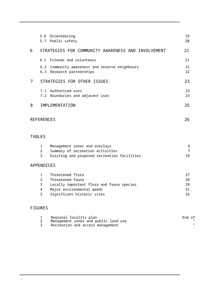
6 STRATEGIES FOR COMMUNITY AWARENESS AND INVOLVEMENT 21
6.1 Friends and volunteers 21

1 Langwarrin Flora and Fauna
6.2 Community awareness and reserve neighbours 216.3 Research partnerships 22
7 STRATEGIES FOR OTHER ISSUES 23
7.1 Authorised uses 237.2 Boundaries and adjacent uses 23
8 IMPLEMENTATION 25
REFERENCES 26
TABLES
1 Management zones and overlays 62 Summary of recreation activities 73 Existing and proposed recreation facilities 19
APPENDICES
1 Threatened flora 272 Threatened fauna 283 Locally important flora and fauna species 294 Major environmental weeds 315 Significant historic sites 32
FIGURES
1 Regional locality plan End of plan2 Management zones and public land use "3 Recreation and access management "
Langwarrin Flora and Fauna 1
1 INTRODUCTION
1.1 Location and planning areaThe Langwarrin Flora and Fauna Reserve is located 5 km east of Frankston and 42 km south-east of Melbourne, in the northern part of the Mornington Peninsula (figure1). The reserve covers an area of 214 hectares.
1.2 Creation of the reserveHistorical records indicate that land included in the reserve was originally occupied by the Boonerwrung tribe of Aboriginals. Following European settlement at Port Phillip, the area was most likely grazed by stock and subsequently alienated by the Crown.
The land was resumed by the Victorian Government during the period 1886–1889 for the creation of the Langwarrin Military Reserve.
At Federation in 1901, the military reserve passed to the Commonwealth Government for military training purposes. Military use continued until 1979 when the reserve was declared surplus to Commonwealth needs.
During the period from 1908 onwards, the military reserve was leased for grazing, and in latter years, used for activities such as horse riding and scout camps. Local naturalists and conservation groups, particularly the Langwarrin Reserve Conservation Committee, pressured the Commonwealth Government to cease activities damaging the bushland and to protect its natural values. An ecological evaluation of the reserve (Calder 1975) documented its natural and historical features and conservation values, and recommended control by a competent management authority.
In January 1980, the Commonwealth agreed to lease the Langwarrin Military Reserve to the Victorian Minister for Conservation for the purpose of protecting conservation values. On 28 June 1982, the State Government purchased the reserve from the Commonwealth.
The reserve was proclaimed on 11 December 1985 as a result of the National Parks (Further Amendment) Act 1984 (Vic.) and included in Schedule 3 of the National Parks Act. Small areas were excised to allow roundabouts to be constructed on Robinsons Road in 1988 and 1995, and the site of a pre-existing gun club was excised in 1995.
1.3 Developing the management plan
This plan has been developed by Parks Victoria through a process of review of the Langwarrin Flora and Fauna Reserve Proposed Management Plan prepared in 1986 in the context of current circumstances and experience in managing the reserve since its proclamation in 1985. The review included careful consideration of the views of key stakeholders including the Friends of Langwarrin Flora and Fauna Reserve, local interest groups, Aboriginal community representatives and individuals.
The Langwarrin Flora and Fauna Reserve Draft Management Plan was released for public comment, and distributed widely to State-wide and local stakeholders in September 2001. The seven written submissions received on the draft plan were carefully considered in preparing the approved plan.

2 Langwarrin Flora and Fauna
2 BASIS
2.1 Regional contextPort Phillip Bay, the Mornington Peninsula and Western Port form the most popular informal recreation area in Victoria, and the parks and reserves in the area are the setting for a wide variety of recreation activities. It is estimated there are up to 5 million visitors a year to the parks and reserves in this region. Major parks include the Mornington Peninsula National Park, Arthurs Seat State Park and French Island National Park.
The reserve lies within the semi-rural and rural residential areas adjacent to the urban areas of the City of Frankston. Other nearby reserves include the proposed Pines Flora and Fauna Reserve located three kilometres to the north, the Mount Eliza Regional Park, the proposed Northern Westernport Nature Conservation Reserve and the Royal Botanic Gardens, Cranbourne.
The Langwarrin Flora and Fauna Reserve is well used and enjoyed by visitors, primarily from the nearby residential communities, and attracts about 60,000 visitors per year.
2.2 Reserve values and significanceThe reserve makes a valuable contribution to Victoria's parks and reserves system, which aims to protect viable, representative samples of the State's natural environments occurring on public land. Parks and reserves also provide opportunities for visitors to enjoy and appreciate their natural and cultural values, and many make important contributions to tourism.
The reserve is assigned Category III (Other Parks) of the International Union for the Conservation of Nature (IUCN) United Nations’ list under National Parks and Protected Areas. Category III areas are managed primarily for the conservation of significant natural features.
The reserve is also listed on the Register of the National Estate, in recognition of its outstanding values and importance as a part of our heritage.
The reserve is significant as one of the few remaining areas with remnant indigenous vegetation on the south-eastern fringe of the Melbourne metropolitan area and the northern part of the Mornington Peninsula.
The significant features of the reserve are summarised below:
Natural values
• Vegetation of State significance comprising about 300 indigenous flora species including about 50 orchids and uncommon remnant Stringybark woodland and sand heath communities now largely cleared in the region.
• Fauna comprising approximately half of the mammal species known to exist on the Mornington Peninsula, including two threatened species, and 98 species of birds.
Cultural values
• Isolated evidence of Aboriginal use, particularly stone scatters.
• Historic sites associated with military use including the Old Hospital Site, the reservoir and earthen stop butts associated with rifle ranges.
Recreation values
• Opportunities for walking, cycling and natural and cultural history study in a relatively natural setting.
2.3 Past land useThe reserve was used for military purposes from 1886–1979. From 1908, it was leased for grazing, and in the later period, activities such as horse riding and scout camps. Past land use, including fire management practices, have had a significant influence on the structure and composition of the existing vegetation. There are four readily identifiable areas in the reserve with distinct variations in the nature and quality of the vegetation. The area’s natural and conservation values have been protected since its proclamation as a reserve in 1985.

Langwarrin Flora and Fauna 3
Basis
2.4 The reserve visitorThe Island, Bays and Peninsulas Regional Tourism Development Plan (Tourism Victoria 1997) provides for the promotion of the reserve as an area of high conservation significance.
The reserve is one of several key natural and cultural heritage attractions within the Frankston area linked by a tourism drive and promoted through pre-visit information.
Parks Victoria uses an integrated approach to park management to ensure a balance is maintained between protecting the natural and cultural values of parks and reserves and enhancing visitor experience.
While it is recognised there is a high and increasing demand for informal recreation activities in fringe metropolitan areas, future visitor management for the reserve will address the following considerations:
• the relatively small size of the reserve and its importance as a protected area for the conservation of flora and fauna;
• the availability and accessibility of other parks and reserves in the region providing for a broad range of recreation opportunities, activities and visitor facilities;
• future potential linkages with other open space areas and opportunities to explore the reserve as part of the network;
• provision of on-site information to enable visitors to appreciate, understand and enjoy the reserve’s features and risks to themselves or the reserve’s environment;
• provision of basic comfort facilities and services such as parking, toilets, shaded picnic seating and information.
Reserve visits
Current estimates of visitor numbers indicate that the reserve receives about 60,000 day visits per year.
No formal surveys have been undertaken to determine the visitor demographics, use patterns or visitor needs. Informal monitoring indicates that local people living within a short drive and neighbours primarily use the reserve
and that most visits occur on weekends and holidays. The reserve is popular for early morning and evening walking and jogging. The internal track network provides substantial opportunities for walking and cycling.
2.5 Legislation and guidelinesThe reserve is reserved and managed under the National Parks Act. The Act requires the Secretary to the Department of Natural Resources and Environment to preserve and protect the natural condition of the reserve and its natural and other features and, subject to this, to provide for the use of the reserve by the public for enjoyment, recreation and education. The Act also provides for appropriate research. Sections 4 (Objects) and 18 of the National Parks Act provide the basis for management of the reserve.
As the organisation charged with the management of the Parks and Reserves system, Parks Victoria is responsible for management of the Langwarrin Flora and Fauna Reserve and development of a plan of management.
The aims for the reserve, which are consistent with the legislation and broadly govern all aspects of reserve management, are as follows:
Resource conservation
• Preserve and protect the natural environment.
• Allow natural environmental processes to continue with the minimum of interference.
• Maintain biodiversity.
• Conserve features of archaeological, historical and cultural significance.
Reserve protection
• Protect human life, the reserve and adjacent lands from damage by fire.
• Eradicate or otherwise control introduced plants, animals and diseases.
The Reserve visit
• Provide opportunities for appropriate recreation and tourism.
• Promote and encourage an appreciation, understanding and enjoyment of the
4 Langwarrin Flora and Fauna
reserve natural and cultural values and its recreational opportunities.
• Encourage appropriate reserve use and visitor behaviour.
• Take reasonable steps to ensure the safety of visitors.
Other
• Provide for and encourage scientific research, surveys and monitoring that will contribute to a better understanding and management of the reserve.
• Co-operate with local, State and interstate government authorities, the community and other interested organisations to assist in management of the reserve.
The reserve is also managed in accordance with Parks Victoria’s operational policies and conservation objectives and other plans and guidelines, including:
• The Draft Port Phillip East Regional Fire Protection Plan (NRE 2000);
• Code of Practice for Fire Management on Public Land (CNR 1995a).
Ba
Langwarrin Flora and Fauna 5
3 STRATEGIC DIRECTIONS
3.1 Reserve visionFuture visitors to the Langwarrin Flora and Fauna Reserve will find a relatively intact remnant of indigenous vegetation, representative of a natural system that was once extensive across the south-east Melbourne region.
Visitors enjoy exploring self-guiding interpretive trails which feature key elements of the reserve’s diverse floral communities and fauna habitats and its role in Australian and Victorian military history. Priority is given to conservation and protection works and visitor facilities are in keeping with the largely undeveloped nature of the reserve.
The reserve is highly valued by the local community for recreation opportunities and relaxation and learning experiences in natural settings. The Friends group and other volunteers enjoy their association with the reserve and continue to make substantial contributions to the reserve’s management.
3.2 ZoningA management zoning scheme has been developed to:
• provide a geographic framework in which to manage the reserve;
• indicate which management directions have priority in different parts of the reserve and the types and levels of use appropriate throughout the reserve;
• assist in minimising existing and potential conflicts between uses and activities, or between those and the protection of the reserve’s values; and
• provide a basis for assessing the suitability of future activities and development proposals.
The whole of the reserve is designated as Conservation and Recreation Zone.
Overlays are also used to indicate management requirements additional to those of the underlying management zone.
A Special Management Area - Public Utility overlay applies to the power transmission lines which traverse the northern boundary of the reserve. A Special Management Area - Historic Site overlay applies to the Old Hospital Site and surrounds and other key historic sites identified for interpretive purposes.
Management zone and overlay characteristics are shown in table 1, and the locations of the zone and overlays are shown in figure 2.
3.3 Management directionsMajor management directions for the reserve are outlined below.
Resource conservation• The existing good species diversity,
structure and age class diversity of the sand dune communities will be maintained and the cover of the communities increased over the entire dune area, in the long-term.
• The overall existing good condition and age class diversity of the Eucalypt Woodland community will be maintained commencing with restoration of the small areas with less intact under- and middle- storeys, in the long-term.
• A Eucalypt Woodland community will be progressively restored over about two thirds of the disturbed area and the remainder, covering the Old Hospital Site and open space areas, will be maintained for recreation use.
• The ephemeral wetlands and existing indigenous grassland and other flora on the firebreaks will be maintained and the cover of indigenous vegetation progressively increased.
• Cultural and historic features will be protected and preserved, and interpreted where appropriate.
• Fire regimes necessary for the maintenance of indigenous communities and habitats will be developed and implemented.
Strategic
6 Langwarrin Flora and Fauna
TABLE 1 MANAGEMENT ZONES AND OVERLAYS
CONSERVATION ANDRECREATION ZONE
SPECIAL MANAGEMENT AREA—PUBLIC UTILITY OVERLAY
SPECIAL MANAGEMENT AREA—HISTORIC SITES OVERLAY
AREA/LOCATION 214 ha, 100% of thereserve.
Major power transmission line easement generally traversing the northern boundary of the reserve.
5 ha, 2% of the reserve.
Old Hospital Site and other key historic sites (appendix 5).
3.5 ha, 1.7% of the reserve.
VALUES Important natural values and scope for recreation opportunities.
Generally disturbed area carrying power transmission lines.
Modified areas with significant values requiring special management.
GENERAL MANAGEMENT Protect sensitive naturalenvironments and provide for sustainable dispersed recreation activities and small-scale recreation facilities without significant impact on natural processes.
FIRE MANAGEMENT Fuel reduction and ecological burning using minimal impact techniques.
Highlight areas where special management provisions are needed to provide for a non-standard use or activity.
Area subject to fire protection slashing program and other vegetation modification.
Conserve historic values and manage vegetation for access and interpretive purposes.
Prescribed burning to manage invasive vegetation.
VEHICLE ACCESS Management vehicle and emergency access only.
Management vehicle and emergency access only.
Management vehicle and emergency access only.
SIGNAGE Directional, identification, interpretation and information.
Regulatory and safety signs. Identification andinterpretive signs.
• Priority will be given to the protection of threatened flora and fauna.
• The impacts of pest animals particularly foxes and feral cats and environmental weeds will be progressively minimised.
• The reserve and neighbouring assets will be protected against wildfires.
The reserve visit
• A better understanding of the natural and cultural values will be promoted, primarily through establishment of interpretive walks.
• Provision will be made for recreation activities as shown in table 2 in keeping with the reserve’s distinctive undeveloped character.
• A level of recreation facilities will be provided that maintains largely natural settings and complements the reserve’s opportunities for walking, cycling, picnicking and nature study.
Community awareness and involvement
• Volunteers, researchers and the general community will be actively encouraged to participate in management programs.

Strategic
Langwarrin Flora and Fauna 7
TABLE 2 SUMMARY OF RECREATION ACTIVITIES
ACTIVITY CONSERVATION AND RECREATION ZONE
Picnicking Y
Walking Y
Camping N
Bicycle riding YC
Horse riding YC
Orienteering YC
Rock climbing/Abseiling N/A
Fishing N
Fossicking N
Hang gliding, Paragliding N/A
Firewood collection N
Hunting N
Dog walking N
Nature observation/study Y
KEY:Y YesYC Conditional - refer relevant section for details N Not appropriateN/A Not applicable

8 Langwarrin Flora and Fauna
4 STRATEGIES FOR CONSERVATION
4.1 Geological and landform features
The geological formations of the present land surface are Silurian mudstones, Baxter sandstones and Pleistocene sand sheets and dunes. These formations have evolved through climate changes and fluctuating sea levels.
The reserve’s main landform feature is a sand dune, oriented along a north-west to south-east axis, forming a ridge above the surface of the older geological formations. The highest point of this dune occurs in the north-west corner of the reserve and is 117 m above sea level.
Generally the sand dune is not subject to damage from visitor use.
Aim• Protect areas of geological interest and
minimise impacts of visitors.
Management strategy• Monitor and minimise any impact of
management activities and visitor use on the sand dune feature.
4.2 VegetationCheal (1984) described eight vegetation communities for the reserve using dominant and characteristic species to name them. An additional community, predominantly herbland and small in area reported by Coutts (1992) remains undescribed.
The vegetation includes important remnants of indigenous vegetation types that are becoming uncommon and threatened as a result of suburban development. In particular, the Mealy Stringybark (Eucalyptus cephalocarpa) dominated woodland on sandy loams that has been mostly cleared to make way for development of Melbourne south-eastern suburbs, is rare and poorly represented in other reserves. Sand heath communities are also uncommon although they are represented in some nearby reserves including the proposed Pines Flora and Fauna Reserve and the Royal Botanic Gardens at Cranbourne.
About 300 indigenous flora species - approximately 45 per cent of the plant species indigenous to the Mornington Peninsula - occur in the reserve, including a particularly diverse orchid flora of at least 50 species.Four species are listed as threatened in Victoria (appendix 1). Many species, including a number of the orchids, are locally rare and not well represented in nearby reserves. Cheal (1984) identified many species in the reserve considered to be rare on the Mornington Peninsula. Sixteen of these species are locally important (appendix 3). Additions to the list are expected with further study.
The environmental factors influencing the distribution of vegetation communities, fauna habitat values, threats and management requirements for the vegetation communities are well documented (Cheal 1984; Opie 1983; and CFL 1986).
The structure and composition of existing vegetation has been strongly influenced by past changes to drainage patterns, clearing, grazing, introduction of exotic species, prescribed burning and wildfires. Much of the change can be attributed to the past military use of the area (section 4.9). The current management practices of slashing of firebreaks and prescribed burning are also major influences on the structure and composition of the vegetation.
Over the past 20 years, Parks Victoria and the then National Parks Service have implemented programs of prescribed burning aimed at creating a mosaic of vegetation age classes and achieving pest plant control as recommended by Cheal (1984). The effectiveness of this burning program to achieve long-term vegetation management outcomes is not yet clear. The Friends of Langwarrin Flora and Fauna Reserve have carried out an extensive program of hand removal works to control pest plants. The control of woody weeds in the dune heathland has been successful, particularly where hand removal of the weeds has been implemented. Prescribed burning is carried out in accordance with the Code of Practice for Fire Management on Public Land

Strategies for
Langwarrin Flora and Fauna 9
(CNR 1995) and Parks Victoria’s operational policies (section 4.5).
A wildfire in December 1999 burnt a significant portion of the reserve that had not been subject to prescribed burning, and has resulted in only two areas remaining unburnt over the past 20 years. These areas include an area of approximately 16 ha of Mealy Stringybark Woodland and a similar-sized area of mixed Open and Closed Heath and Closed Scrub communities. The wildfire killed extensive stands of Sweet Pittosporum and Sallow Wattle as well as Tea Tree.
As a result of the past changes, the following four areas have been identified on the basis of their distinctive combinations of composition and condition of vegetation:
• a dune area covered by Open and Closed Heath, which covers about a third of the reserve and has indigenous vegetation cover of about 70%;
• an Open Woodland area which is most widespread and is in overall good condition, although some areas have high levels of the woody weeds particularly in the understorey and middle-storey;
• a disturbed area, mostly previously cleared, with indigenous vegetation cover of about 30 per cent and vegetation in poor condition; and
• the firebreak grasslands, where indigenous vegetation cover has gradually increased to over 70 per cent as a result of weed control and slashing to allow natural regeneration.
The major threats to the vegetation include invasive weeds, diseases and altered fire regimes. Exotic trees and other introduced species, formerly associated with the military use of the site, are invading adjacent areas and mature specimens may pose risks to visitors. Cinnamon Fungus (Phytophthora cinnamomi) was confirmed to be present in the reserve at a number of locations in late 2001 (section 4.6).
A program to monitor all burnt areas is required in order to assess impacts on flora values and review prescribed burning activities.
Aims• Improve the condition of indigenous
vegetation communities and maintain natural ecological processes.
• Provide special protection for threatened species.
• Restore degraded areas to their natural state as far as practicable.
• Improve knowledge of flora and associated management requirements.
Management strategies• Manage Flora and Fauna Guarantee Act
listed species in accordance with approved Action Statements.
• Prepare and implement management programs in order to:
• restore indigenous vegetation cover in the Open and Closed Heath to at least 85%;
• restore cover of understorey and middle storey in the Open Woodland to good condition;
• restore the disturbed area to structurally diverse Woodland – Closed Wet Scrub and increase species diversity;
• continue restoration of indigenous grasses and other herbaceous flora in semi-natural and pasture grass areas of the firebreak;
• maintain unburnt areas of Woodland and Heathland in an unburnt condition for at least 10 years.
• Develop and implement a program to monitor the effectiveness of all burns in achieving conservation and protection objectives and amend the burning program accordingly (section 4.5).
• Monitor threatened species (appendix 1) and record results on Parks Victoria’s Environmental Information System.
• Identify key flora information needs and seek to meet through the Parks Victoria Research Partners Program.

Langwarrin Flora and Fauna 1
Strategies for
• Develop and implement a Cinnamon Fungus control program (section 4.6).
• Avoid further interference to the natural drainage patterns.
• Encourage flora surveys, especially following fires.
4.3 FaunaThe reserve is an important habitat area and refuge for native fauna, particularly small mammals (Calder 1975). Approximately half of the mammals known to exist on the Mornington Peninsula are found in the reserve.
The known native fauna recorded in the reserve include 98 bird species, 16 mammal species and 10 species of reptiles and amphibians. Invertebrate fauna have not been fully investigated although it is expected that the reserve contains many locally indigenous species including the Freshwater Jellyfish (Craspedacusta sowerbyi), which infrequently inhabits the reservoir (Coutts 1992 pers. comm.).
The New Holland Mouse, which is critically threatened in Victoria and the Swamp Skink, which is listed as vulnerable in Victoria, have been recorded in the reserve (appendix 2). Surveys are required to determine the continued presence and/or the distribution of these species.
The New Holland Mouse has not been recorded in the reserve since 1984. The lack of any record may be due to predation by foxes and cats or potentially inappropriate fire frequencies. The mouse exhibits a strong preference for Dry Sandy Heaths (Leptospermum myrsinoides) between two and eight years after burning or clearing. In the first two years after fire, the heath has too little ground cover for the mouse and after eight years the productivity of critical food plants decreases greatly. Burning prescriptions have been applied in the reserve since 1980 to establish a mosaic of vegetation age classes and provide long-term habitat for the New Holland Mouse.
The Southern Brown Bandicoot shows a preference for younger vegetation where the insects comprising its diet are more readily available. The burning regime for the New
Holland Mouse would also promote this species. Competition for food by rabbits may constrain an increase in the population.
The wildfire in December 1999 and an earlier prescribed burn have resulted in more than half of the reserve being recently burnt. Burning for fauna habitat management purposes will not be required for the next five years.
The most notable bird species is the Southern Emu-wren, a species which was once common on the eastern side of Port Phillip Bay but is now limited to small disjunct colonies. Habitat for the Southern Emu-wren is threatened by Coast Wattle, an invasive species that has been controlled to some extent by a fire that burnt most of the community in 1984. Control of invasive weeds should be undertaken so as to minimise disturbance to the Southern Emu- wren (Cheal 1984). The Southern Emu-wren is able to temporarily colonise ephemeral habitats such as scrubs regenerating after fire.
The Australian Owlet-nightjar, which is not uncommon though rarely seen, was observed on several occasions during November 1992, nesting within the reserve. The sightings are believed to be only the second on the Mornington Peninsula in 30 years (Coutts 1992 pers. comm.).
Aims• Ensure the conservation of indigenous
fauna.
• Maintain habitat for indigenous fauna.
Management strategies• Manage Flora and Fauna Guarantee Act
listed species in accordance with approved Action Statements.
• Maintain fauna habitat for threatened and other species in the reserve (appendix 2 and 3) by improving the overall condition of habitats and vegetation communities (section 4.2).
• Encourage further research into the use of fire for ecological management and the effects of fire on fauna.
• Review the ecological burning program required to maintain a range of vegetation age classes for fauna habitat and

Strategies for
1 Langwarrin Flora and Fauna
threatened fauna species (section 4.5). Do not burn for fauna management purposes for at least the next five years.
• Locate Southern Emu-wren populations, determine specific habitat requirements and minimise disturbance when removing weeds.
• Encourage monitoring of small mammal populations.
• Encourage surveys to determine the distribution of Swamp Skink populations.
• Encourage surveys of reptile, amphibian and invertebrate fauna.
• Record faunal survey and monitoring results on Parks Victoria’s Environmental Information System and other appropriate systems.
4.4 LandscapeThe reserve offers good views towards the Dandenong Ranges and across the Peninsula hinterland from high points on the sand dune ridge. Views are otherwise limited and many of the walking tracks are enclosed by surrounding vegetation, which helps screen visual intrusion of adjacent residential development.
The high voltage power transmission lines and pylons along the northern boundary are visually intrusive on the natural landscape and future residential development in the surrounding area has potential for further visual impacts.
The natural landscape values of the reserve have been enhanced since the area became a Flora and Fauna Reserve, with the removal of non-indigenous plants (particularly pine species) and the rehabilitation of degraded areas.
The visual impact of the generally straight and treeless nature of the reserve’s firebreak network has been ameliorated to some extent by encouraging selected regrowth in strategic locations.
Aims• Protect and enhance the reserve’s natural
landscape values and viewing opportunities.
• Minimise or ameliorate undesirable visual intrusions.
Management strategies• Maintain opportunities for views from high
points in the reserve.
• Continue to liaise with local government to minimise visual impacts of adjacent development (section 7.2) and support neighbour initiatives to improve the landscape character of the area.
• Investigate and implement opportunities for further softening of the visual impact of internal firebreaks and tracks without compromising fire protection needs.
4.5 Fire managementThe National Parks Act requires the Secretary to ensure that appropriate and sufficient measures are taken to protect parks and people from injury by fire. The Act also requires the Secretary to ensure that natural and cultural values are preserved and protected.
Fire is a major factor influencing the structure and composition of the indigenous vegetation, and can have a significant influence on the control or proliferation of pest plants and potential spread of soil-borne diseases such as Cinnamon Fungus.
The reserve has a varied fire history and Army records indicate that the reserve experienced a high incidence of fires in the late 1920s (Australian Army 1978). In 1968, the Minister for the Army directed that a network of wide firebreaks be cut around and across the reserve. Some breaks were poorly located in relation to fire protection or minimising environmental impact. Establishment of small clumps of vegetation has lessened the visual impact of these broad firebreaks.
At the time the reserve was proclaimed, the nature and appearance of the vegetation suggested that most of the area had not been burnt for many years. Recent fire history is well documented and has included a regime of

1 Langwarrin Flora and Fauna
Strategies for
fuel reduction and ecological burns and wildfires.
Fire management in the park is governed by the Draft Port Phillip East Regional Fire Protection Plan (NRE 2000). Fire protection measures in the reserve are undertaken in accordance with the Code of Practice for Fire Management on Public Land (CNR 1995) and Parks Victoria’s operational policies. Prescribed fire is undertaken in accordance with identified conservation objectives.
Parks Victoria works closely with NRE and the Country Fire Authority (CFA) on the Mornington Peninsula in relation to fire management, especially co-operative wildfire control planning and suppression.
The Draft Port Phillip East Regional fire Protection Plan has zoned the whole reserve as a Zone 3 fuel management zone. This zone provides for a regular mosaic of areas of fuel reduction consistent with the requirements of particular vegetation communities. The plan includes provision for the maintenance of the reserve’s fire protection tracks and firebreaks.
The wildfire in December 1999 burnt approximately 90 hectares of the reserve including areas scheduled for fuel reduction burning in 2001–02. This has reduced the need for fuel reduction burning and only a small area in the south-west corner is scheduled to be burnt within the next three years.
The perimeter firebreaks have value in providing access and restricting the spread of fires to and from adjacent areas. They should be maintained at their current width, with the exception of a section of the northern firebreak referred to below. Some internal firebreaks, particularly Centre Break, have strategic value in preventing wildfires burning the whole reserve under moderate conditions.
The firebreaks also have important conservation values and require special management (section 4.2). Slashing is timed to optimise seeding by indigenous grasses and other flora. Slashing also needs to be timed to minimise risks of Cinnamon fungus spread. Wetter areas pose risks of soil and potential fungal spores being spread by slashing equipment to other parts of the reserve.
Access tracks on perimeter firebreaks and on the Centre Break have been gravelled to ensure year round management access and access for fire suppression. Other internal tracks have a natural surface and are maintained to ensure access in an emergency. Retention of a natural surface on these tracks contributes to the reserve’s undeveloped settings while providing for recreational experiences (sections 5.3 and 5.4). Low-lying and wetter areas along tracks pose increased risks of Cinnamon Fungus spread by vehicles and recreational users.
The cleared corridor associated with the high voltage electrical transmission lines passing through the northern part of the reserve also serves as a firebreak. The corridor has been managed in accordance with an agreement between Parks Victoria and the authority operating the transmission lines (section 7.1).
Aims• Protect human life, property and reserve
values from damage by wildfire.
• Minimise the adverse effects of fires and fire suppression methods.
• Maintain fire regimes appropriate to the conservation of native flora and fauna.
Management strategies• Implement fire protection works in
accordance with the Draft Port Phillip East Region Fire Protection Plan and the Code of Practice for Fire Management on Public Land.
• Ensure that archaeological sites and historic military sites are protected from the impacts of prescribed burns and fire control activities.
• Prepare and implement rehabilitation plans following wildfires as necessary.
• Review the ecological burning program for the reserve in accordance with NRE and Parks Victoria’s operational policies and guidelines and prepare a longer-term prescribed burning plan (sections 4.2 and 4.3).
• Continue slashing firebreaks to preserve indigenous species cover and facilitate further restoration of native grassland and

Strategies for
Langwarrin Flora and Fauna 1
other indigenous flora. Avoid slashing wetter areas until further soil testing for Cinnamon Fungus is undertaken (section 4.6).
• Maintain all vehicle tracks to their current standards for fire prevention and suppression purposes. Avoid, where practical, gravelling of internal track and drainage works except as necessary to control Cinnamon fungus spread (section 4.6).
• Maintain low fuel levels in the section of the reserve between the powerlines and the northern boundary.
• Continue to accurately record and map all fires in the reserve.
• Carry out fire suppression operations using existing tracks as fire lines where practical and methods that protect significant natural and cultural values and minimise disturbance to soil.
• Encourage further research into the use of fire for ecological management and the effects of fire on flora and fauna.
4.6 Pest plants and animals, and diseases
Cheal (1984) provided a detailed report on weed occurrences in the reserve and the control methods that had been incorporated in on-going control programs. These methods included strategically timed fires to control Coast Tea-Tree and Pines supplemented with hand removal, and cutting and hand removal of Sallow Wattle, Pittosporum and Native Willow.
Major environmental weeds (appendix 4) are relatively widespread. A number of non- indigenous and highly invasive species, particularly Southern Mahogany and Golden Rain Wattle, occur in the Old Hospital Site as a result of planting during the period of military use.
The current level of pest plants is considered to be having a moderate impact on the reserve’s indigenous vegetation, although in the disturbed area the weeds cover about 70% of the area. A comprehensive risk assessment is required to monitor the extent, trend and
impacts on natural vegetation and fauna habitat values.
Prescriptive burns carried out in recent years in the heathland areas appear to have effectively controlled woody weeds such as Tea-tree and Sallow Wattle, particularly when followed up with hand pulling of regrowth seedlings. The benefits of using fire to control weeds must be balanced against requirements of the native flora and fauna.
The wildfire in December 1999, while having major benefits in killing extensive stands of Coast Tea-tree, Sweet Pittosporum and Sallow Wattle, has resulted in the proliferation of weed seedlings, particularly Sallow Wattle and Inkweed. A rehabilitation plan prepared for the burnt area gives priority to pest plant control requirements.
Horse riding along the designated boundary firebreaks (section 5.3.3) has potential to introduce weed species. Weeds in adjacent areas also pose a threat to the reserve.
Introduced animal species found in the reserve include feral cats, rabbits, foxes, the Black Rat and House Mouse. With expanding development of areas surrounding the reserve and isolation of the natural habitat in the reserve, domestic cats and dogs, and foxes are predicted to be increasingly attracted to the reserve. These animals will place further pressure on native faunal populations through predation and competition for food and shelter. The decline in the New Holland Mouse population may be linked to the presence of introduced animals.
Government records indicate that pest animals have been a problem for adjacent landowners at least since the 1920s. Rabbit control works have included introduction of the Rabbit Flea, burrow fumigation and spotlight shooting. Poison bait techniques using bait stations to minimise danger to native fauna are employed to control cats and foxes. Neighbours are advised that baits may pose a threat to domestic pets if they are allowed to wander into the reserve.
Opie (1983) proposed the construction of a vermin-proof fence on the reserve boundary as a measure to protect fauna from domestic dogs and cats, and to prevent re-invasion by rabbits.

Strategies for
1 Langwarrin Flora and Fauna
Such a fence would require significant maintenance and is likely to be visually intrusive, but in the future may become essential for the survival of a number of species, particularly small mammal species.
Further soil testing is required to determine the full extent of Cinnamon Fungus infestation in the reserve and the threat posed to flora communities and species. Preliminary action to minimise spread of this disease has included the closure of a number of tracks to vehicle use and the establishment of vehicle wash-down measures.
Aims• Control and where possible eradicate non-
indigenous plants and animals except plants with historic value.
• Minimise the potential for introduction and spread of any pest plants, animals and diseases.
• Integrate weed control with other aspects of biological management to ensure significant biological values are not jeopardised.
Management strategies• Continue, as a priority, to implement the
program to control weed regrowth within the area burnt in December 1999.
• Continue to implement pest plant control programs based on the ecology of target species and the vegetation communities in which they occur incorporating:
• eradication of any occurrences of new species and control of isolated infestations before they spread
• minimising the spread of weeds into weed-free areas;
• control works in prescribed burn and wildfire areas;
• on-going control works on priority weeds (Cheal 1984);
• mapping and recording of weeds using Parks Victoria’s Environmental Information System.
• Monitor horse trails for introduced weeds and control as appropriate.
• Liaise with adjacent land managers or landowners to encourage control of weed species occurring outside the reserve which may threaten the conservation values of the reserve.
• Only retain exotic specimens within the Old Hospital Site identified as culturally significant and which pose minimal threat to indigenous vegetation values (section 4.9).
• Continue to implement pest animal control programs and record progress on Parks Victoria’s Environmental Information System.
• If warranted, investigate the feasibility of boundary fencing to minimise pest animal access into the reserve and implement if feasible.
• Develop and implement comprehensive Cinnamon Fungus control measures for the reserve. In the interim, continue to implement hygiene measures to minimise further introductions or spread of soil- borne pathogens, monitor the reserve’s vegetation for symptoms of dieback and undertake further soil testing as appropriate.
4.7 Soil conservationSoil types and their distribution in the reserve vary according to the nature of parent material and depth of the sand mantle. The main soil types (Northcote classification) are mottled yellow duplex soils and bleached sand soils.
The soils are erosion prone where vegetation is removed, particularly those occurring on dunes where unprotected surface particles are readily blown away by wind, exposing the leached lower horizon. On slopes, running water washes away sheets of surface soil or cuts small channels that have the potential to develop into unsightly and damaging gullies.
Erosion has been most noticeable on unsurfaced tracks and on parts of the firebreak crossing higher dunes in the north-western section of the reserve. In recent years brush matting and mulched vegetation have been used to stabilise the soil surface. Care needs to be taken to avoid mulch containing seed from
Strategies for
Langwarrin Flora and Fauna 1
non-indigenous plants or invasive species such as Coast Tea-tree and Coast Wattle.
Aim• Control and prevent soil degradation, and
rehabilitate degraded areas.
Management strategies• Monitor sand dune areas and stabilise
dune erosion using appropriate techniques to re-establish indigenous vegetation.
• Minimise the potential soil erosion when planning and implementing all works.
• Avoid using mulches from non-indigenous and invasive plant species, particularly in dune stabilisation works.
4.8 Aboriginal cultural heritageHistorical records indicate that the Mornington Peninsula was occupied by the Boonerwrung clan Burinyung-Bulluk and suggest that movements of the Boonerwrung people followed a regular pattern, along the eastern shore of Port Phillip Bay, the Bass Strait coast of the Mornington Peninsula, the mangrove coast of Western Port Bay, returning across the plains to Dandenong. Food obtained on these journeys included fish, shellfish, eels, land mammals and plants.
The Kulin Nation Cultural Heritage Organisation is the organisation recognised by the State Government to represent the tribes within the Kulin Nation and to deal with any cultural heritage issues affecting the Kulin Nation people. The Kulin Nation includes the Boonerwrung, Wurundjeri, Kunrong and Tungurong tribes.
Lithic (stone) scatters occur in the reserve which indicates Aborigines visited the area and that the wetland environments were a source of food. Additional archaeological sites may occur in the reserve and further investigation of the use of the area by Aborigines should be undertaken.
All Aboriginal material and sites are protected under the Archaeological and Aboriginal Relics Preservation Act 1972 (Vic.) and the Aboriginal and Torres Strait Islanders Heritage Protection Act 1984 (Cwlth.).
Aims• Protect all Aboriginal archaeological sites.
• Conserve significant features and landscapes of Aboriginal cultural significance.
• Interpret the Aboriginal cultural values of the reserve.
Management strategies• Manage Aboriginal sites in accordance
with the relevant legislation and Parks Victoria’s operational policies and guidelines and in consultation with Aboriginal Affairs Victoria and the Kulin Nation Cultural Heritage Organisation.
• Undertake an archaeological investigation of the reserve.
• Involve the Kulin Nation Cultural Heritage Organisation in the interpretation of Aboriginal history and culture (section 5.1).
4.9 Post-settlement cultural heritageThe reserve is identified as one of a number of important military establishments opened in the 1880s on the Mornington Peninsula area for the defence of Melbourne. The site has regional, and possibly State, historical significance as the location of an important military establishment opened during the colonial era (Butler and Associates 1997).
The land was resumed by the Victorian Government during the period 1886–1889 for the creation of the Langwarrin Military Reserve.
At Federation in 1901, the military reserve passed to the Commonwealth Government for military training purposes. Military use continued until 1979 when the reserve was declared surplus to Commonwealth needs.
The history of the reserve and its use for military purposes spanning the period from 1886 through to the late 1970s is described in a number of publications by Calder (1975, 1982 and 1987). This use included large-scale encampments, troop movements and mock battles, establishment of a prisoner of war detention centre and hospital and in latter years

Strategies for
1 Langwarrin Flora and Fauna
training for the Army reserve and school cadets.
Wells and a reservoir for water supply, extensive drains to improve conditions for training, roading and a range of buildings, including a butchers shop and post office, were established at various times to support the military operations.
Many remaining features associated with the various periods of military use have been located and mapped (CFL 1986). Some have deteriorated to such an extent that the remains can no longer be recognised and no historic buildings remain in the reserve. Key visible features remaining include the reservoir, rifle butts and fountain. The elements of note include the stone-capped reservoir and the fountain base (Butler & Associates 1997). The remains of the extensive drainage system, and various concrete pits and earth mounds, occur mostly in the western part of the reserve. The drainage system is no longer functional and its effect on the vegetation is almost impossible to assess.
Sites of historic interest suitable for interpretation include:
• the Old Hospital Site which includes the fountain (the last remaining intact structure from military occupation), and a remnant introduced planting including a golden cypress.
• the reservoir and associated constructions built by the Defence Department and fed by a natural spring;
• the stop butt, which was part of the rifle range.
Butler (1997) identified the remnant introduced planting as of potential regional significance and noted that the golden cypress tree may be associated with the fountain. Butler suggested that further investigation might identify the cultural significance of exotic species in and around the Old Hospital Site. Butler also noted that some of the introduced species may have weed potential.
Military encampment, fire protection, drainage and grazing account for disturbance of vegetation seen throughout much of the
remainder of the reserve. About 45–50 hectares were cleared for the camping ground.
Aims• Conserve significant features and
landscapes of historic and cultural significance.
• Interpret the cultural values of the reserve, particularly remaining and visible historic sites.
Management strategies• Undertake an archaeological investigation
of the reserve.
• Manage and interpret the following significant historic sites (appendix 5 and figure 3) in accordance with the Burra Charter:
• the Old Hospital Site;
• the reservoir and associated brick- lined wells;
• target pits and stop butts.
• Maintain the above sites sufficiently free of vegetation to allow their functions to be identified and interpreted.
• Establish management priorities through the Parks Victoria Heritage Management System and record sites and management activities in the Parks Victoria Heritage Information System.
• Assess the significance of remaining exotic trees and maintain specimens that are not threatening conservation values. Remove species that are spreading into surrounding areas or hybridising with locally indigenous species (section 4.6).
• Encourage further research into the history and cultural values of the reserve.

Langwarrin Flora and Fauna 1
5 STRATEGIES FOR VISITORS
5.1 Information, interpretation and education
The reserve offers excellent opportunities for visitors to become aware of, and appreciate, the importance of remnant bushland areas for flora and fauna conservation and the reserve’s land use history and heritage.
Visitors to the reserve need to be informed about these values, safety issues, codes of conduct and regulations applying to the reserve to minimise their impacts on the environment.
It is important to provide adequate orientation signage on arrival and at dispersed locations through the reserve to highlight opportunities, interpret the reserve’s values and provide for safe use.
The reserve is not highly utilised by primary or secondary school groups, although local schools use the area for a range of outdoor activities.
With its close proximity to the metropolitan area, varied land use history and diverse vegetation communities, the reserve is well placed to play an important role in natural resource education for tertiary study and special interest groups, including Technical and Further Education Colleges, Field Naturalists Clubs and Greening Australia.
Reserve staff can assist with school and other study groups through the provision of resource materials, and where appropriate, provision of orientation and other information services to assist groups during visits.
Aims• Orientate visitors to the reserve and its
features.
• Enhance visitor appreciation and awareness of the nature conservation and cultural values of the reserve.
• Encourage visitors to minimise their impacts on the reserve’s environment.
• Provide for minimal impact use of the reserve as an educational resource for schools and other groups.
Management strategies• Maintain orientation and interpretation
information at the car park.
• Maintain signage at entry points that encourages safe use and minimal impact on the reserve and includes information on the regulations.
• Install interpretive signs at features along the self-guiding natural and cultural history trails (figure 3).
• Monitor and maintain all interpretive facilities.
• Encourage the production of publications and educational products on the reserve’s natural and cultural values.
• Assist in the development of educational resource materials for school and other education group visits.
• Provide information to education groups on how to access features and sites of interest, minimal impact use and safety issues.
5.2 Access and amenityMost visitors to the reserve arrive by car at the parking area on McClelland Drive. Public motor vehicle access is limited to access to the parking area. Access to and from McClelland Drive is potentially dangerous due to vehicles travelling at high speed. Access for buses is difficult and additional car parking capacity may be required.
Most visitor facilities are located at the Old Hospital Site day visitor area, which includes the car park and information shelter. Existing and proposed recreation facilities are listed in table 3 and shown in figure 3. Seating, and orientation and directional signage, is provided at various locations in the reserve. Due to high fire hazards associated with the nature of the vegetation and topography, no fireplaces are provided in the reserve.

Strategies for
1 Langwarrin Flora and Fauna
Aims• Provide access and visitor facilities in
accordance with reserve management aims.
• Ensure that visitor use has minimal impact on the reserve and reserve values.
Management strategies• Provide facilities and services as shown in
table 3 and figure 3.
• Incorporate appropriate facilities and access for persons with limited mobility and the disabled.
• Permit the use of portable gaseous and liquid fuel stoves. Firewood collection, solid fuel fires and the use of chainsaws and generators is not permitted.
• Upgrade the car park on McClelland Drive to improve bus access and vehicle circulation.
• Liaise with the Frankston City Council and VicRoads to improve access to the car park from McClelland Drive.
• Monitor use of the car park and investigate additional improvements if necessary.
• Conduct visitor surveys to assess visitor profiles, preferences and expectations to assist in reserve management.
• Monitor visitor use to ensure adequate provision of facilities consistent with appropriate types and levels of use.
5.3 WalkingThe track network in the reserve is popular for walking. The layout of the tracks is ideal for the development of sign-posted circuit walks providing access to historic sites and diverse vegetation communities.
Access to the reserve’s features by disabled persons is currently limited to the one trail between the Old Hospital Site and the Reservoir. The relatively flat terrain offers potential for upgrading sections of tracks and new links to be established to provide access for all persons to other reserve features.
Aims• Provide and maintain a range of
opportunities for walking to enhance visitor enjoyment and appreciation.
• Provide opportunities for disabled access to selected features of the reserve.
Management strategies• Develop and signpost circuit interpretive
walks utilising existing tracks where possible and as shown in figure 3.
• Install information maps at key locations to assist visitors to orientate themselves.
• Investigate the feasibility of an interpretive circuit walk suitable for disabled access linking the Old Hospital Site and the Reservoir with selected historic sites, and implement if feasible.
5.4 CyclingCycling in the reserve is provided for on all management vehicular tracks. The level of cycling activity is currently low and is largely undertaken by locals living within riding distance of the reserve. Currently, there is no requirement to provide facilities specifically for cyclists.
The Frankston City Council is establishing a cycling trail along the adjacent railway reserve. This will be part of the Port Phillip Bay trail and the City’s cycling track network.Increased cycling in the reserve is expected to occur with completion of the network.
Cyclists have potential to cause conflicts with walkers. Cyclists also can cause damage to tracks, particularly cyclists riding mountain bikes in sandy, erosion-prone areas. The reserve is not suitable for organised cycling events due to its small size, popularity for walking and the erosion-prone nature of the soils.
Aim• Provide and maintain a range of
opportunities for cycling while minimising environmental damage and conflicts with other recreation activities.

Strategies for
Langwarrin Flora and Fauna 1
Strategies for visitors
TABLE 3 EXISTING AND PROPOSED RECREATION FACILITIES
SITE CAR PARK TOILETS PICNIC TABLES FIRE PLACES / INFORMATION WATERBBQS SUPPLY
Old Hospital Site E P P N E P*
Reservoir N N E N E N
KEY:E Existing facilityP Proposed facilityN No facility* Future provision of drinking water subject to feasibility assessment and proximity of, and connection to, mains water
supplies.
Management strategies• Permit cycling only on management
vehicle tracks (Figure 3).
• Do not permit organised cycling events and encourage use of alternative areas.
• Monitor the level of cycling use and impacts of cycling and implement measures to minimise any impacts.
5.5 Horse ridingHorse riding is a popular activity in the surrounding rural and semi-rural areas and there is an equestrian trail network on roadsides in adjacent areas.
Horse riding has been permitted on sections of the perimeter firebreak tracks for many years, as an alternative to use of the adjacent roads, which have little room for trails and pose safety problems. Monitoring of horse riding has shown little impact on the reserve’s values or other visitor experiences. Parts of the trail are prone to waterlogging during wetter periods and can become dangerous.
Aims• Provide opportunities for horse riding
consistent with protection of the reserve’s values.
• Minimise conflicts between horse riders and other reserve users.
Management strategies• Continue to permit horse riding only on
the firebreak areas as shown on figure 3.
• Provide and maintain information signs on minimal impact horse riding.
• Maintain the surface of the horse trail and the cavaletties.
• Monitor the impact of horse riding on the reserve (section 4.6). Should monitoring identify unacceptable impacts, close the trail or sections of the trail.
• Temporarily close access to sections of the trail should the trail become impassable during wetter periods or as necessary to protect visitors.
5.6 OrienteeringThe reserve’s network of tracks provide good opportunities for map reading and similar navigational exercises. A number of local schools use the reserve for these type of activities. Off-track orienteering and compass reading activities are not appropriate due to the dense nature of much of the vegetation, safety issues and environmental risks.
Aim• Provide opportunities for low impact
orienteering.
Management strategy• Only permit map reading and similar
activities on the reserve’s track network as shown on figure 3.

Langwarrin Flora and Fauna 2
5.7 Public safetyPotential hazards and risks to visitors in the reserve include wildfire during periods of higher fire danger and falling branches.
The nature of the vegetation and topography provides for the potential rapid spread of wildfire under extreme weather conditions.
Orientation and information signs at key locations through the reserve (section 5.1) will assist with visitor safety in fire emergencies.
Aims• Promote public safety in use of the reserve.
• Comply with Parks Victoria’s guidelines on risk management.
Management strategies• Manage the reserve in accordance with
Parks Victoria’s guidelines for risk mitigation and emergency management procedures.
• Prepare and implement a fire emergency plan for visitor safety requirements.
• Undertake regular inspections at areas where visitors congregate and where overhead trees can pose potential risks to visitors, particularly within the Old Hospital Site (section 4.2), and implement risk mitigation measures as appropriate.
• Provide and maintain signage at key locations in the reserve (section 5.1).

Strategies for
2 Langwarrin Flora and Fauna
6 STRATEGIES FOR COMMUNITY AWARENESS AND
INVOLVEMENT
6.1 Friends and volunteersThe Friends of Langwarrin Flora and Fauna Reserve have made a major contribution to management of the reserve, especially the restoration of vegetation through removal of pest plants and the propagation and planting of indigenous plant species.
The Australian Trust for Conservation Volunteers, Greening Australia and schools also assist with the reserve’s conservation programs on a regular basis.
Increased volunteer involvement in a range of activities is desirable, particularly following significant wildfires that result in a proliferation of weeds and which require substantial work and effort to control.
There is an opportunity for volunteers to assist with reinstatement of degraded areas and the monitoring of burnt areas and regeneration, including potential identification of species that may not have been previously recorded in the reserve. Schools, other educational institutes and other groups could be encouraged to take ownership of a particular area or project to increase knowledge in natural resource management and appreciate the outcomes of their involvement in conservation programs.
Aim• Encourage, assist and support volunteer
groups to undertake appropriate management tasks in the reserve.
Management strategies• Support the Friends group and other
volunteers and encourage further community involvement with groups. Involve the Friends group in the development of annual management programs for the reserve.
• Develop and evaluate a long-term volunteer strategy that incorporates the skills and interests of volunteer and other groups in a range of management
activities.
6.2 Community awareness and reserve neighbours
The local surrounding residential population has grown rapidly over the past two decades and will continue to grow. This growth is expected to increase both pressure on the reserve and potential for impact on the reserve’s values.
Principal issues with reserve neighbours include roaming dogs and cats, potential for weed invasion and fire protection. Resolving these issues will require the co-operation and involvement of the local community and neighbouring landowners.
Aims• Increase awareness and knowledge of the
reserve and maintain good relations with neighbours and the local community.
• Encourage appropriate community participation in conservation and protection of the reserve.
Management strategies• Maintain liaison with the local community
and landowners and, as appropriate, involve them in relevant aspects of planning and managing the reserve.
• Apply and encourage the application of the Good Neighbour Program to management issues on or near the boundary of the reserve.
• Liaise with the local community and Frankston City Council to enhance community understanding of responsible pet ownership, use of indigenous vegetation on private land to encourage wildlife and the threats and problems associated with environmental weeds, inappropriate disposal of garden rubbish and fire protection.
• Support initiatives that promote the retention or replanting of indigenous

Strategies for community awareness and
2 Langwarrin Flora and Fauna
species, removal of environmental weeds and compatible fire protection works on neighbouring lands.
6.3 Research partnershipsThere is an opportunity to involve secondary school groups and tertiary education institutes in flora and fauna monitoring and research programs identified in sections 4.2 and 4.3.
AimProvide for use of the reserve as an education resource for school groups and educational institutes.
Management strategy• Identify opportunities and encourage
educational groups and organisations to be involved in monitoring and research programs and activities.

Langwarrin Flora and Fauna 2
7 STRATEGIES FOR OTHER ISSUES
7.1 Authorised usesSPI Powernet Pty Ltd operate a high voltage elecrical transmission line situated on the firebreak along the northern boundary of the reserve. The site is managed in accordance with a 1981 agreement between the National Parks Service [Parks Victoria] and the former State Elecricity Commission of Victoria [SPI Powernet] to provide for fire protection and minimise visual impacts as well as to protect the transmission line (sections 4.4 and 4.5).
DNRE (for the Minister for Environment and Conservation) and SPI Powernet Pty Ltd have prepared a draft Statewide agreement for SPI Powernet operations on Crown land. The agreement will provide for compliance with relevant legislation, and the development of any necessary further specific agreements for operations within the reserve.
There are no other authorised uses in the reserve.
Aims• Ensure appropriate use by, and
authorisation of, public authorities.
• Minimise the impact of public authority activities on reserve values.
Management strategies• Manage the corridor associated with the
SPI Powernet elecrical transmission line in accordance with authorised agreements. If necessary to provide for fire protection and minimize visual impacts, develop and seek authorization of a specific agreement with SPI Powernet governing their operations in the reserve.
• Ensure any new public authority proposals are in accordance with Parks Victoria’s operational policies and are appropriately authorised.
7.2 Boundaries and adjacent usesThe reserve is bounded to the east, west and south by sealed roads and to the north by private property.
A Telstra works depot and a rifle range are located adjacent to the north-west corner of the reserve. These are sited on part of the former Military Reserve (figure 2).
The Telstra depot has little impact on the reserve, although the presence of Monterey Pine, Cluster Pine and other environmental weeds provides a seed source for potential invasion of these species into the reserve.
The rifle range is leased to the Commonwealth Government for a 21-year period commencing on 1 November 1984. The range is one of only two 50 metre, Olympic-standard small bore (.22 calibre) rifle ranges in the Melbourne metropolitan area and has been used by the Frankston International Small Bore Rifle Club for many years. The range is constructed to ensure that there are no risks to adjacent areas and there is apparently no need for a safety buffer zone behind the range. Noise of shooting can cause apprehension for those visitors who are unaware of the source. The boundaries of the range abutting the reserve are infested with Coast Tea-tree.
Most of the other land surrounding the reserve is semi-rural in character, however the Frankston City Council Planning Scheme makes provisions for further urban subdivision and development. The number of domestic pets in these areas is expected to increase in the future.
Previous subdivision along the eastern section of the northern boundary of the reserve was conditional upon construction of a high wire fence on the reserve boundary to control access by dogs and neighbours and establishment of a ‘no development zone’ abutting the reserve.
A residential subdivision adjacent to the western section of the northern boundary has recently been approved. This approval includes provision for the co-operative management of an adjacent area of remnant heath compatible with conservation and protection strategies for the reserve. Boundary fencing and controlled access will also be addressed to ensure potential impacts associated with the development on the reserve are minimised.

Strategies for community awareness and
2 Langwarrin Flora and Fauna
To the west, the reserve is bounded by McClelland Drive, a railway reserve and land reserved for the proposed Mornington Peninsula Freeway. The rail reserve has significant flora values, including eight species not recorded in the Langwarrin Flora and Fauna Reserve (Calder 1980). A formerly large colony of Purple Diuris has been significantly reduced in size.
The land reserved for future freeway purposes links with the nearby proposed Pines Flora and Fauna Reserve. This land has potential to form part of an open space corridor linking with the reserve.
Aims• Encourage co-operation with adjoining
landowners in protection of the reserve.
• Minimise adverse impacts from development on nearby land.
Management strategies• Continue to liaise with planning
authorities and neighbours in relation to development on private land abutting the reserve in order to minimise potential adverse impacts on the reserve.
• Seek incorporation of appropriate boundary fencing and access into designs for adjacent developments.
• Encourage the development of habitat corridors to the reserve and encourage adjacent landowners to protect conservation values and control pest plants.
• Liaise with the City of Frankston and other authorities regarding open space linkages with the reserve.

Strategies for other
Langwarrin Flora and Fauna 2
8 IMPLEMENTATION
This plan provides the strategic framework that governs the development and delivery of all management programs and actions affecting Langwarrin Flora and Fauna Reserve.
The management programs for the reserve are prepared annually, in accordance with Parks Victoria’s corporate plan and as a part of statewide, prioritised programs.
The performance of the plan’s implementation will be measured by monitoring and recording the number of strategies implemented to June each year.
Amendments may be made to this plan from time to time consistent with an authorised approval process. A partial or complete review of the plan will be considered five years after its publication

2 Langwarrin Flora and Fauna
REFERENCES
Australian Army 1978 Management Document: Langwarrin Military Reserve, (unpub.).
Butler, G & Associates 1997 Frankston City (East) Heritage Study Stage Two, Volume Three-Significant Sites, 1997.
Calder, W. 1975 Langwarrin Military Reserve: Ecological evaluation for the Shire of Cranbourne. Centre for Environmental Studies, University of Melbourne.
Calder, W. 1980 Wildflower Survey in the Railway Reserve from Langwarrin to Baxter: Final Report to the Railway Construction Board, (unpub.).
Calder, W. 1982 Langwarrin Military Reserve: An annotated list of records that are held at Australian Archives, Victorian Branch. Report to the National Parks Service.
Calder, W. 1987 Australian Aldershot: History of Langwarrin Military Reserve, Victoria, 1886 - 1980. Jimaringle Publications, Melbourne.
CFL 1986 Langwarrin Flora and Fauna Reserve Proposed Management Plan 1986. National Parks Service and Dandenong Region Department of Conservation Forests and Lands, Victoria.
Cheal, D. 1983 Langwarrin Flora and Fauna Reserve Plant List (vascular plants), (unpub.).
Cheal, D. 1984 Report on the Vegetation of Langwarrin Reserve, Victoria. National Parks Service report, (unpub.).
Coutts, S. 1992 Notes on the vegetation and management of Langwarrin Flora and Fauna Reserve. Department of Conservation and Natural Resources, (unpub.).
CNR 1995a Code of Practice for Fire Management on Public Land, Department of Conservation and Natural Resources, Victoria.
CNR 1994 Mountain Bike Code, Department of Conservation and Natural Resources, Victoria.
CNR 1993 The Pines Flora and Fauna Reserve Draft Management Plan. Melbourne Region and NPPL, Department of Conservation and Natural Resources, Victoria.
NRE 2000 Draft Port Phillip East Regional Fire Protection Plan, Department of Natural Resources and Environment, Victoria.
NRE (database) 2001a, Flora Information System, Department of Natural Resources and Environment, Melbourne.
NRE (database) 2001b, Atlas of Victorian Wildlife, Department of Natural Resources and Environment, Melbourne.
Opie, A. 1983 Report on the Mammal Fauna of Langwarrin Reserve, Victoria. National Parks Service, Victoria (unpub.).
Parks Victoria 1998 Mornington Peninsula National Park and Arthurs Seat State Park Management Plan, Parks Victoria, Victoria.
Tourism Victoria 1997 Draft Islands Bays and Peninsulas Tourism Development Plan, Tourism Victoria, Victoria.
Personal communication
Coutts, S.1992, Parks Victoria.
Costermans, L. 2002, Friends of Langwarrin Flora and Fauna Reserve.

Appendic
Langwarrin Flora and Fauna 2
SPECIES COMMON NAME STATUS
Diuris punctata
Genoplesium despectans
Purple Diuris
Sharp Midge-orchid
v L
k
Pterostylis pedoglossa Prawn Greenhood v
Spiranthes sinensis Austral Ladies’ Tresses v
Source: NRE database (2001a) Status: NRE database (2001a) v Vulnerable in Victoria.k Poorly known in Victoria.L Listed under the Flora and Fauna Guarantee Act.

Appendic
APPENDIX THREATENED
2 Langwarrin Flora and Fauna
APPENDIX 2 THREATENED FAUNA
SPECIES COMMON NAME STATUS
Mammals
Isoodon obesulus Southern Brown Bandicoot End
Pseudomys novaehollandiae New Holland Mouse CEn L
Reptiles
Egernia coventryi Swamp Skink Vul R
Source: NRE database (2001b) Status: NRE database (2001b)CEn Critically endangered in Victoria. End Endangered in Australia.Vul Vulnerable in Victoria.L Listed under the Flora and Fauna Guarantee Act R Recommended for listing under the Act.
Note: A number of reptiles, bats and amphibians have been recorded in the reserve but the conservation status or significance of these species has not been determined to date.

Appendic
Langwarrin Flora and Fauna 2
SPECIES COMMON NAME
Flora
Acacia brownii Heath Wattle
Austrofestuca hookeriana Hooker Fescue
Blechnum nudum Fishbone Water-fern
Boronia parviflora Swamp Boronia
Cyathea australis Rough Tree-fern
Goodenia elongata Lanky Goodenia
Orthoceras strictum Horned Orchid
Patersonia fragilis Short Purple-flag
Ricinocarpus pinifolius Wedding Bush
Stylidium beaugleholei Beauglehole’s Trigger-plant
Stylidium perpusillum Slender Trigger-plant
Thelionema caespitosum Tufted Lily
Thelymitra antennifera Rabbit Ears
Utricularia lateriflora Tiny Bladderwort
Utricularia tenella Pink Bladderwort
Xyris gracilis Slender Yellow-eye
Fauna
Mammals
Rattus lutreolus Swamp Rat
Wallabia bicolor Black Wallaby
Antechinus sturatit Brown Antechinus
Phascolarctus cinereus Koala
Petaurus breviceps Sugar Glider
Birds
Accipiter fasciatus Brown Goshawk
Aegotheles cristatus Australian Owlet-nightjar
Artamus cyanopterus Dusky Woodswallow
Chrysococcyx basalis Horsfield’s Bronze-Cuckoo
Chrysococcyx lucidus Shining Bronze-Cuckoo
Climacteris leucophaea White-throated Treecreeper
Cuculus pallidus Pallid Cuckoo
Cuculus pyrrhopanus Fan-tailed Cuckoo
Gallinago hardwickii Latham’s Snipe
Halycon sancta Sacred Kingfisher
Lalage sueurii White-winged Triller
Myiagra cyanoleuca Satin Flycatcher

Langwarrin Flora and Fauna 3
Appendic
APPENDIX LOCALLY IMPORTANT FLORA AND FAUNA Appendix 3 (cont.)
SPECIES COMMON NAME
Neophema chrysostoma Blue-winged Parrot
Pachycephala rufiventris Rufous Whistler
Petroica phoenicea Scarlet Robin
Phaps elegans Brush Bronzewing
Rhipidura rufifrons Rufous Fantail
Stipiturus malachurus Southern Emu-wren
Turdus philomelos Song Thrush
Sources:Locally important flora:CFL 1986, Cheal 1983 with later additions by S Coutts, L Costermans, J Yugovic & O Dawson.
Locally important fauna:NRE database (2001); CFL 1986; Parks Victoria 1998; Mornington Peninsula Branch, Bird Observers Club of Australia.

Appendic
3 Langwarrin Flora and Fauna
SPECIES NAME COMMON NAME
Acacia baileyana Cootamundra Wattle
Acacia decurrens Early Black Wattle
Acacia elata Cedar Wattle
Acacia floribunda White Sallow Wattle
Acacia longifolia Sallow Wattle
Acacia prominens Golden Rain Wattle
Acacia saligna Golden Wreath wattle
Allium triquetrum Angled Onion
Briza maxima Large Quaking Grass
Bromus diandrus Great Brome
Callistachys lanceolata Native Willow
Coprosma repens Mirror Bush
Chrysanthemoides monilifera Boneseed
Dipogon lignosus Dipogon
Dittrichia graveolens Stinkwort
Ehrhata calycina Perennial Veldt Grass
Ehrhata erecta Panic Veldt Grass
Erica lustanica Spanish Heath
Eucalyptus botrioides Southern Mahogany
Genista linifolia Flax Leaf Broom
Genista monspessulana Montpellier Broom
Hedera helix English Ivy
Holcus lanatus Yorkshire Fog
Leptospermum laevigatum Coast Tea-tree
Lonicera japonica Japanese Honeysuckle
Lotus corniculatus Birds Foot Trefoil
Oxalis pes-caprae Soursob
Oxalis purpurea Large-flower Wood Sorrel
Paspalum dilatatum Paspalum
Pennisetum clandestinum Kikuyu
Pittosporum undulatum Sweet pittosporum
Rubus fruticosus spp. agg. Blackberry
Senecio jacobaea Ragwort
Sollya heterophylla Bluebell Creeper
Ulex europaeus Gorse
Source: CFL 1986, Cheal 1984 with revision by Dawson, Yugovic, Costermans & Coutts 1997; Parks Victoria survey for State of the Parks Report 1998;L Costerman (pers. Comm.). (This list is not in priority order).

Appendic
APPENDIX MAJOR ENVIRONMENTAL
Langwarrin Flora and Fauna 3
APPENDIX 5 SIGNIFICANT HISTORIC SITES
SITE SIGNIFICANCE COMMENTS
Old military camp and hospital Regional Includes the remains of a fountain (the lastremaining intact structure from militaryoccupation) and mature non-indigenoustree species. The remnant Golden Cypresstree is of particular note (Butler &Associates 1997).
Reservoir and associated constructions built by military occupants and fed by a natural spring.
Not assessed The stone capped reservoirs are considered to be of particular note (Butler et al 1997). Recorded as sites 27, 28 and 29.
Target Pits and Stop Butts Not assessed Used for mock battles and manoeuvresbefore and during World War 1 (sites 31 and 33) and part of rifle range (site 44).
Source: CFL 1986

Appendic
3 Langwarrin Flora and Fauna
LERDERDERG STATE PARK
Sunbury
KINGLAKE NATIONAL PARK
Bacchus Marsh
ORRGGAANN PPIIPESPES NAATTIIOONNAALL PPAARRKK
WOOOODDLLAANDNDS
S H
IISSTTOORRIICC
PARKK
WAARRRRAANDNDYYTTEEE STATE PARKKK
Healesville
YARRARANGES NATIONAL PARK
BRIISBSBAANNEE RRAANNGGESES NAATTIIOONNAALL PPAARRKK
MELBOURNE
DAANDNDEENNOONNGG RRAANNGGESES NAATTIIOONNAALLL PPAARRKK
Yarra Junction
STEIGLIT
Z H
ISTORIC PARK
YOUYANGS REGIONAL PARK
Point Cook
P O R T
CHURCHILL NAATTIIOONNAALL PPAARRKK
Dandenong
LYSTERFIELD LAKE PARK
BUNYIP STATE PARK
Geelong
P H I L L I P
B A Y Frankston
Cranbourne
LANGWARRIN
FLORA& FAUNA
RESERVE
Queenscliff Mornington
Ocean Grove Portsea
Mud Island
Dromana Devilbend ReservoirTorquay HAROLD HOLT Sorrento FRENCH ISLAND
MARINE RESERVE ARTHURS SEAT STATE PARK
NATIONAL PARK
MORNINGTON PENINSULA NATIONAL
PARKCAPE
SCHANCK LIGHTHOUSE
Flinders
PENGUIN RESERVE
PHILLIP ISLAND
Wonthaggi
FIGURE 1
LANGWARRIN FLORA AND FAUNA RESERVEREGIONAL LOCALITY PLAN

Parks and reserves (NP
Act) Other public land
Highway
Major road
0 20 40 60 km
G/6770-1
Cartography byLand Information Group 2001
g6770/langwarrin_august 2000/langlocplan_v1

v
N
Crown Land
Freehol
d
Land
LANGWARRIN FLORA AND FAUNA RESERVE
Figure 2Management Zones and Public Land Use
0 100 200 300 400
M
etres
G
/5012
Stop Butt
Major Road
2 Wheel Drive Track(Management Vehicles Only)
Management Track
Walking Track
66kv Power Transmission Line
Open Drain
Reserve Boundary
Gate
Waterbody
Target Pits
ZONES:
Conservation & Recreation Zone
Stop Butt
Stop Butt
OVERLAYS:
Special Management Area (Public Utility)
Special Management Area (Historic Sites)

Cartography byLand Information Group 2001
g6770/langwarrin august 2000/langwarrinffrmp_management zones_v3

v
➤
➤
➤
● ➤
N
Crown Land
LANGWARRIN FLORA AND FAUNA RESERVE
Figure 3Recreation and Access Management
0 100 200 300 400
Freehol
d
Land
M
etres
G
/5012
➤
Reservoir
➤
Reserve Boundary
Major Road
2 Wheel Drive Track(Management Vehicles Only)
Management Track
Walking Track
66kv PowerTransmission Line
Open Drain
Gate
Waterbody
Stop Butt
Old Hospital Site
Stop Butt
Target Pits
➤Stop Butt
● ● ● ●
➤ ➤ ➤
Heathland - Dune (1.2km) Circuit Walk
Natural History (4.5km) Circuit Walk
Cavaletti
Horsetrail
Car Park
Pedestrian Access
Information Shelter
Picnic site (existing)
Wheelchair Access (existing)
Toilets (proposed)
Wheelchair Access (proposed)
Picnic site (proposed)
Cartography byLand Information Group 2001
g6770/langwarrin august 2000/langwarrinffrmp_rec&res_v2