indygreenways circle full - mindmixer
TRANSCRIPT

indyGREENWAYS CIRCLEMASTER PLAN2014-2024
full
Review Draft 03/03/14


design group
T A Y L O R S I E F K E R W I L L I A M S
landscape architecture community planning urban design visioning strategic planning


contentstable of
CHAPTER 1: Introduction . . . . . . . . . . . . . . . . . . . . . . . . . . . . . . . . . . . . 11
CHAPTER 2: Overview of the System . . . . . . . . . . . . . . . . . . . . . . . . . 25
CHAPTER 3: Full Circle Master Plan . . . . . . . . . . . . . . . . . . . . . . . . . . .45
CHAPTER 4: Design Standards . . . . . . . . . . . . . . . . . . . . . . . . . . . . . . .171
CHAPTER 5: Economic Impact Review . . . . . . . . . . . . . . . . . . . . . . .247
CHAPTER 6: Implementation . . . . . . . . . . . . . . . . . . . . . . . . . . . . . . . .271
CHAPTER 7: Conclusion . . . . . . . . . . . . . . . . . . . . . . . . . . . . . . . . . . . . 335
APPENDICES: . . . . . . . . . . . . . . . . . . . . . . . . . .Digital Copy on CD-ROM A. Public Meeting Presentation # 1 - February/March 2013 B. Public Meeting Presentation #2 - August 2013 C. Public Meeting Summaries D. Public Input from Project Offi ce E. Greenways Planning Survey F. Technical Sign Package

fore
wa
rd
Planning and implementing a trail and greenway system is complex. Indianapolis stands as a case study of leveraging resources and dollars to create a complex network of greenways and trails, often being cited as a national example of successful greenway implementation. The greenways are a signifi cant part of the City’s overall strategy...for transportation, fi tness, recreation, community growth and economic development.
Much has changed since the 2002 plan was completed. The economic climate in 2013 is drastically diff erent and there have been signifi cant advances in both the bike and pedestrian facilities in Indy as well as the attitudes towards these types of facilities. This plan will respond to these changes and provide the “new blueprint” for the Indy Greenways system and how it fi ts into the context of all of the current initiatives underway in the region.
Components of the Indy Greenways Master Plan will look at connections to the community, public access and service, integration with other initiatives, economic benefi t and collaboration with stakeholders & agencies. These components will set a vision for the next ten years of continuing to create a world-class trail and greenway system for the City of Indianapolis.

acknowledgementsThe Indy Greenways Full Circle 2014-2024 Master Plan
was completed with the contributions and support from the individuals and entities listed below.
CITY OF INDIANAPOLISGregory A. Ballard, Mayor
Parks & Recreation BoardJohn Williams, DirectorDon Colvin, Deputy DirectorJoshua BowlingDr. Jacqueline S. GreenwoodAnne ValentineJoseph WynnsLouvenia Holstein, Board SecretarySuzanne Martin, Assistant Board Secretary
City-County Council Parks CommitteeWilliam Oliver, ChairMonroe GrayFrank MascariJason HolidayJanice McHenryVop OsiliChristine ScalesJoe Simpson
Department of Parks & RecreationJohn Williams, Director
Department of Public WorksLori Miser, Director
Planning Advisory TeamDon ColvinAndre DenmanBenjamin JacksonJulee Jacob
City Leadership GroupJenny Burrough- Indianapolis Parks FoundationJonathon Gick- DPW- Parks MaintenanceScott Haslar- IMPDLori Hazlett- Indianapolis Parks FoundationJen Higginbotham- Indianapolis MPOKeith Holdsworth- DOP/DMDJamison Hutchins- DPW Offi ce of SustainabilityJason Koch- DPWTawnya McClaren- DPW- Park MaintenanceAnthony McDaniel- DPW- Parks MaintenanceJeremy Moore- Indianapolis MPODennis Papenmeier- Mayor’s Neighborhood ServicesMelody Parks- DPW Offi ce of SustainabilityMike Peoni- DMDDaniel Quintana- DPWDavid Sherman- DPWSri Venugopalan- DPWTodd Wilson- DPW
Indy Greenways Development CommitteeGregory Silver, ChairmanGreg HenekeLisa HicksBill MooneyJohn MyersKenneth PendletonRichard QuinnGene SchulstadJoseph ShikanyMichael Vollmer
CONSULTANTTaylor Siefk er Williams Design GroupRon Taylor, FASLA, RLAScott Siefk er, ASLA, AICPAmy Williams, AICPDave Foster, LEED APNathan Bush
ee Jacob
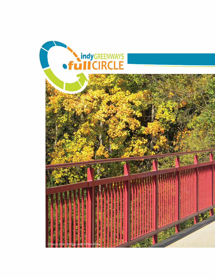
Monon Trail - Bridge over White River

INTRODUCTIONchapter one

chapter oneINTRODUCTION
inside this chapter:INTRODUCTION . . . . . . . . . . . . . . . . . . . . . . . . . . . . . . . . . . . . . . . . . . . . . . .11
HOW TO USE THIS PLANPlan Organization . . . . . . . . . . . . . . . . . . . . . . . . . . . . . . . . . . . . . . . 15Standard Defi nitions . . . . . . . . . . . . . . . . . . . . . . . . . . . . . . . . . . . . . 17Adoption Resolutions . . . . . . . . . . . . . . . . . . . . . . . . . . . . . . . . . . . . 18

11INTRODUCTION
orld-class cities have world-class greenways. They are an integral part of the community’s fabric. They provide residents with recreational resources and access to natural environments. They include amenities and facilities that promote use of the greenways by
residents. They provide connections between neighborhoods and community destinations allowing residents to use them as alternative transportation. And they are not an afterthought---they are an integral part of a community’s overall transportation and connectivity strategy. World-class cities understand that trails and greenways are a key to creating an active and vibrant community---one that retains and attracts people to live there.
The Indianapolis Greenway System is a world-class urban multi-use trail system that connects people to neighborhoods, commercial districts, schools, parks, cultural features and historic sites Indianapolis throughout Marion County. With an additional 260 miles planned, it is one of the premier greenway systems in the country.
Renowned landscape architect George Kessler fi rst understood the impact that open space linear connections could play in the community. In his Park and Boulevard System plan, many of the city’s main water courses and fl oodplains were designated as linear parks and connections throughout the community. Lawrence Sheridan’s plan of 1938 further established those linkages throughout Marion County. In the early 1990s, Indianapolis created its fi rst Greenways Master Plan. That plan expanded the system beyond Kessler’s parkways and into new corridors and portions of the city.
Act
ivity
alo
ng th
e M
onon
Tra
il - I
ndia
napo
lis.
W
CHAPTER 1introduction

12 Indy Greenways Master Plan
Today, there are over 60 miles of greenways in place. The Monon Trail was one of the fi rst greenways that was built outside of Kessler’s designated waterways. Unlike the early Fall Creek Greenway, the Monon Trail used an abandoned rail corridor and provided a link that extended from downtown to the Hamilton County line. It passed through neighborhoods, parks, commercial centers, and other public facilities along its route. Once completed, it received local, national and even international attention for its design, character, use of materials, and overall operation. It also received numerous designations, recognition, and awards from across the country. The Rails-to-Trails Conservancy describes the Monon Trail as “a colossus in the world of Midwest rail-trails.” 1
The Indiana Rails to Trails Council says this about the Monon:
“For those familiar with rail trails, the Monon in Indianapolis and its outskirts is a bit legendary. It was voted in March 2009 into the Rails-to-Trails Conservancy’s Rail-Trail Hall of Fame. In addition, it’s been cited in numerous publications as an example of the benefi cial effects trails can have on people’s health as well as the health of the micro-economies of areas through which the trail passes. For those not familiar with the Indy Monon, exploring its nearly 17 miles of length will give you a mini-vacation for tasting the arts, foods, life and culture, and history across this Midwestern city.” 2
The Monon Trail put Indy Greenways and its planned system of trail networks on the map. It truly is a world-class greenway and has brought much attention and accolades to the city.
For the next twenty-fi ve years, the city worked to implement the system that was laid out in that 1994 plan, mostly on the northern, more developed portions of the city. They built trails that expanded the system, extended the routes, and
The Greenways provide transportation and recreation choices allowing residents and visitors to access the city in a safer, more sustainable way. Currently, there are over 60 miles of trails and proposed greenways. With the addition of new bike lanes and the Cultural Trail, the greenways provide a critical role in connecting and providing a way to get around Indianapolis.
1 Traillink online trail directory, The Rails to Trails Conservancy., Washington, DC. 20122 IndianaTrails.com, Indiana Rails to Trails Council, Indianapolis, IN. 2013.
Mon
on T
rail
over
Cen
tral
Can
al.
13INTRODUCTION
broadened the overall system outlined in the master plan. In fact, Indianapolis became one of the cities that other communities looked to when trying to put their own trail systems in place.
During this time, there were also many other things in the city that changed. There was a resurgence of neighborhood development with residents moving back into older neighborhoods at the same time that new housing was expanding into the suburbs and undeveloped portions of the county. Higher densities and new subdivisions created a demand for recreational facilities such as greenways. There was increased awareness of the need for better protection and use of our
waterways as a resource. There was a growing bicycle culture that developed within the city, emphasizing the desire for transportation routes and alternatives. New mass transit routes were studied to better connect the region, and more and more emphasis was placed on providing bike and pedestrian facilities throughout Marion county. While many of these factors existed during the crafting of the 1994 master plan and the 2002 update, they are now receiving widespread support from the general public and policy makers.
The development of the Indianapolis Cultural Trail in 2008-2013 also refocused attention on the importance of having modern, safe recreational opportunities in the city and helped to reinforce that trail infrastructure could be a driving force in economic development and attracting new talent to the city.
With this context in mind, this master plan establishes a new vision for Indy Greenways. It evaluates what the system should look like in the next ten, twenty, even fi fty years. It outlines how the function of the greenways can be interwoven through all of the contextual issues and produce a plan that truly positions Indy Greenways as a world-class greenway system.
Understanding exactly what constitutes a world-class greenway can be diffi cult. This plan seeks to do that through the creation of a community-wide system of
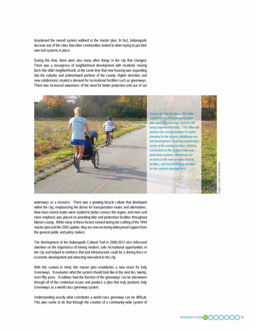
George Kessler developed the India-napolis Park and Boulevard System plan over 100 years ago, and it is still being implemented today. This effort will produce the next generation of master planning for the system, identifying new trail development, targeting maintenance needs of the existing facilities, defi ning connections to the regional bike and pedestrian systems, identifying con-nections to the new on-street bicycle facilities, and recommending priorities for the system’s development.
Eagl
e Cr
eek
Gre
enw
ay.

14 Indy Greenways Master Plan
greenway connections, the use of appropriate and modern facilities along the trails, an oversight administrative framework that will allow the system to best function, and the development of policies and guidelines that direct greenway planning in the city.
Over the past 25 years, Indy Greenways has transformed the way our community connects and interacts. The network of greenway trails that has been established provides more options for residents to travel, exercise and build stronger communities while safely interacting with vehicles. The greenways also offer opportunities for recreation and fi tness, protect vital wildlife habitats, promote open space and wetland conservation and spur economic development. Indianapolis is proud to be recognized as a “Bicycle-Friendly Community” by the League of American Bicyclists (Indianapolis Bicycle Master Plan, June 2012) and Indy Greenways is a big part of that designation.
The Indy Greenways 2014-2024 Master Plan is an effort to update the plan for the overall greenway system. This plan is the next big vision for the system, identifying new trail development, targeting maintenance needs of the existing facilities, defi ning connections to the regional bike and pedestrian systems, identifying connections to the new on-street bicycle facilities, and prioritizing the system’s development. This plan also has a greater focus on the economic development potential near and along the greenways and seeks to identify how the trails can have a positive and appropriate impact on new development in the city.
World-class cities have world-class greenways and this plan is part of the evolving vision for a well-connected, world-class Indianapolis.
Photo caption here.
Seve
ral i
nfor
mat
iona
l bro
chur
es w
ere
crea
ted
to p
rom
ote
the
plan
ning
pro
cess
, det
ails
of t
he p
lan
and
high
light
s of
pla
n re
com
men
dati
ons.
15INTRODUCTION
his Master Plan is a guide for city offi cials, decision makers, developers and residents for development of Indianapolis’ greenway system. It provides an analysis on the current system and its proposed routes. It provides the historic context of the system and past
decisions, while outlining a new long-term vision for the system. It establishes design guidelines for future construction and provides an evaluation of the economic value that can come to the city as the network of greenways is constructed. It is intended to serve as a tool that helps establish the policies and direction of trail and greenway development in the city. This document provides an overview of the process used to craft the new vision for Indianapolis’ greenways and provides the associated recommendations to implement the new system. While it is designed to provide fl exibility, the vision, goals and objectives outlined as part of this document should inform all decision making regarding the greenway system.
PLAN ORGANIZATION
The document has been divided into seven different chapters:
■ CHAPTER 1: Introduction – provides an introduction to the process and establishes the basis for the development of a new vision for Indy Greenways. It also outlines how the master plan is arranged and the intent of each chapter of the report.
■ CHAPTER 2: Overview of the System – provides an overview of the existing system. It provides the history of trail development in Indianapolis including Kessler’s early plans for
The
Full
Circ
le M
aste
r Pla
n.
T
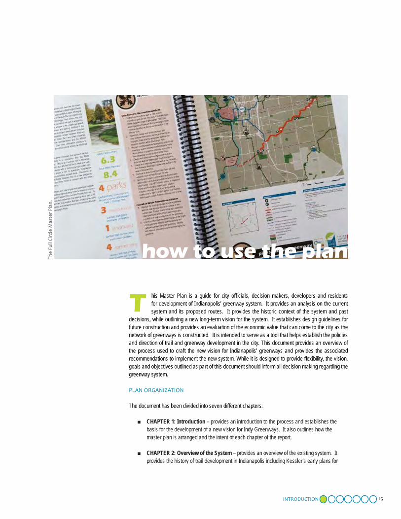
how to use the plan

16 Indy Greenways Master Plan
the Indianapolis Park and Boulevard System and Lawrence Sheridan’s 1938 expansion of that plan. It also includes a summary of the contemporary planning updates were completed in 1994 and 2002 and identifi es improvements that have been made since that last plan was completed. Finally, it highlights the current perceptions of Indy Greenways from the public survey that was conducted during the initial input gathering phase of the project.
■ CHAPTER 3: Full Circle Master Plan – describes the specifi c planning process for this master plan, the public engagement process that was used, and the recommenda-tions that resulted. It outlines improvements needed to the existing system and details out nine new greenway routes in the county. This chapter provides a detailed look at all future greenway development in Indianapolis and provides a look at the outcomes that will result from this development.
■ CHAPTER 4: Design Standards – establishes design guidelines for the system. It describes in both graphic and narrative format the intended design standards to which all trails in the Indy Greenways system should be constructed. It provides clarity as to how the greenways are to be con-structed and what they should include.
■ CHAPTER 5: Economic Impact Review – provides a review of the economic impacts that have been associated with previous greenway development and applies those economic benefi ts to future routes through a comparison of like conditions. This chapter helps to identify what economic impacts will be likely for new greenways added to the system.
■ CHAPTER 6: Implementation – summarizes the physical improvement and policy recommendations included in the plan and highlights the priorities, timelines, and responsible agencies and partnerships needed to implement the plan. This chapter also addresses several other policy recommen-dations included in the plan.
■ CHAPTER 7: Conclusion – summarizes the key concepts and projected outcomes of the plan. It establishes the metrics that will result from implementation of the plan.
The Indy Greenways Full Circle Master Plan 2014-2024 was recommended for approval by the Indianapolis Board of Parks and Recreation and adopted on DATE HERE. A copy of the General Resolution is included as part of this plan document at the end of this chapter.
In addition, a separate Appendices includes additional supporting information for the plan as well as the public input received during the planning process.
Photo caption here.
Exis
ting
and
new
gre
enw
ay c
orri
dors
are
iden
tifi e
d in
this
pla
n.A
wid
e ra
nge
of in
put g
uide
d pl
an d
evel
opm
ent.
10’ (8’ Min.)Shared use path2’-0” Clear shoulder, typ.
2’-0” Clear Should
Buffer Area
Area
8’-0” (Min.)MaintainedZone
8’-0”(Min.)MaintainedZone
Des
ign
stan
dard
s ou
tlin
e ph
ysic
al d
evel
opm
ent.

17INTRODUCTION
STANDARD DEFINITIONS
For purposes of clarity, there are several terms used throughout this document that are defi ned below. It is important to understand how the terms were used in the preparation of this plan in order to understand their intent.
■ Indy Greenways - In this document, the term Indy Green-ways is used to defi ne the City of Indianapolis’ system of offi cial greenways and greenway trails.
■ Greenway - A linear park or recreation space that typically includes a shared-use path and falls under the jurisdiction of Indy Parks and Recreation (either directly or through some sort of Memorandum of Understanding). Greenways typi-cally include a dedicated right-of-way, unique branding and identifi cation, and signage and site enhancements unique to the greenway. While most include a shared-use path, some greenways are designated as “conservation corridors” and do not include the trail component.
■ Conservation Corridors - designated corridors, usually along creeks, rivers or other natural areas, that are desig-nated for protection from development---often as a potential future greenway corridor. Previous Indy Greenways Master Plans have identifi ed conservation corridors as part of the greenway system.
■ Shared-use Path or Shared-use Trail - A bicycle and pe-destrian way physically separated from motor vehicle traffi c. Shared-use paths are typically two-way and are intended for multiple types of non-motorized users (walkers, cyclists, in-line skaters, wheelchairs, etc.). They are designed to accommodate emergency, maintenance, and operations ve-hicles, but all other motorized vehicles, including segways, are prohibited.
■ Connections - Term that defi nes any means by which someone accesses, connects to, or is connected to or from a greenway. This can include shared-use paths, sidewalks, bike lanes, on-street infrastructure, or other bike or pedes-trian facilities.
■ Indy Parks/Department of Parks and Recreation - City agency responsible for programming and operations of the greenways and all park facilities.
■ DPW/Department of Public Works - City agency that is responsible for the construction and maintenance of the greenways. The Resource Development section of DPW oversees park and greenway planning and project develop-ment.
■ Comprehensive Project Report - Often referred to as a master plan, the Comprehensive Project Report document is a planning report that identifi es and establishes an overall greenway or trail route, associated connections and en-hancements, proposed right-of-way improvements needed, and preliminary details of the route. These reports identify preliminary funding opportunities and provide planning-level cost estimates. These projects also have a public engage-ment component that seeks to work with residents to identify the route and important contextual issues.
■ Scoping Study - A study that re-evaluates a previously es-tablished route. The purpose is to more precisely determine alignment and to resolve other issues associated with the development of one or more segments of an established greenway or trail route. The scoping document will usually include a more detailed cost estimate than what would be included in a master plan. Scoping studies are more techni-cal in nature and are usually completed internal to the city.
Additional technical defi nitions associated with the specifi c design standards for all greenway trails are included in Chapter 4 Design Standards.

18 Indy Greenways Master Plan
RESOLUTION NO. xxxxx, 2014Board of Parks and Recreation for the
Consolidated City of Indianapolis, Indiana and
Be it Resolved That the Board Hereby Approves:
Approval from the Parks Board of the 2014 Indianapolis-Marion County Parks and Recreation Indianapolis Greenways Full Circle Master Plan.
Calling for:
approval from the Parks Board for the Indianapolis-Marion County Parks and Recreation Indy Greenways Full Circle Master Plan 2014-24 drafted with substantial public involvement and input, and incorporates sound planning principles and staff expertise.
The form of which is to be approved by the Department attorney, be and is hereby APPROVED.
FURTHER RESOLVED, THAT THE Director of the Department of Parks and Recreation is hereby authorized to execute such agreement for and in behalf of the Department.
BOARD OF PARKS AND RECREATION CONSOLIDATED CITY OF INDIANAPOLIS
Douglas Kowalski John Williams, ChairmanAssistant Corporation Counsel
Joshua Bowling
Louvenia Holstein, Secretary Jacqueline S. Greenwood
Date Anne Valentine
Joseph Wynns
PAGE TO BE UPDATED WITH FINAL
PARKS AND RECREATION BOARD
RESOLUTION

19INTRODUCTION
PLACEHOLDER PAGE FOR THE
METROPOLITAN DEVELOPMENT
COMMISSION FINAL RESOLUTION

20 Indy Greenways Master Plan
FACT:User groups of all ages
provided their “big ideas” for the future of the greenways through a variety of traditional
and social media outreach opportunities.

World-class citieshave world-class greenways, and
this plan is part of the evolving vision for a well-connected, world-class
Indianapolis.