huron river - ohio dnr office of coastal management · the word “huron” refers to a native...
TRANSCRIPT

132 133
The 14-mile long main branch of the Huron River begins at the confluence of the East Branch Huron and West Branch Huron rivers just west of Milan. The river empties into Lake Erie in the city of Huron. Headwaters for the branches are in Fitchville Township (Huron County) and Blooming Grove Township (Richland County), respectively, and are 30 miles and 50 miles long, respectively. The Huron River’s entire drainage basin is 403 square miles (257,921 acres).
The word “Huron” refers to a Native American tribe that was prevalent in the Great Lakes region. Variant names of the river have included Bald Eagle Creek, Notowacy Thepy and Pettquotting River, among others. Much of the river system flows through Huron and Erie counties which together comprised a large amount of the Firelands, the westernmost portion of the Connecticut Western Reserve. Established in 1792, the Firelands had been reserved for Connecticut residents whose homes were burned during the British raids of the late 1700s (Revolutionary War). In the early 1800s, settlers began populating the area.
In 1839 the Milan Canal opened. The canal paralleled the east side of the Huron River and connected the village of Milan to Lake Erie. During the canal’s prime, Milan thrived as Lake Erie’s largest inland port and as one of the busiest Great Lakes ports. Inventor Thomas Alva Edison’s birth home overlooked the canal in downtown Milan. The Milan Canal era ended in 1868, due to flooding that resulted in a feeder dam failure.
The lower Huron River near the city so named is an estuarine environment as water and habitat within the channel and adjacent marsh are influenced by Lake Erie water levels. Catfish (channel and flatheads), smallmouth bass, perch and walleye are popular fishing catches near the lake while northern pike and smallmouth bass are found farther upriver. The river offers recreational boaters many commercial and publicly-available ramps and marinas.
Huron Riverincluding the West Branch
Empties into: Lake ErieMouth: Huron, OHLength of Main Branch: 14 milesLength of East Branch: 30 milesLength of West Branch: 50 miles
Elevation at source: 1,090 feet above sea level (includes West Branch)Elevation at mouth: 573 feet above sea levelAverage fall: 8.6 feet per mile
8-digit HUC: 041000128-digit HUC name: Huron-Vermilion
Number of Access Sites: 12
OT1

134 135
HU1
Huron Harbor West Pier (Lighthouse Pier)
Amenities:Location Map:Location:Main and Wall streets
Waterbody:Huron River
Lake Erie
River Mile Location:
At RM 0
Jurisdiction:Huron, OH
County:Erie
Latitude: N 41° 23.89’
Longitude: W 082° 33.02’
Access Site Type:
RecreationScenic
Date Visited:Field Notes:
Learn More: City of Huronwww.cityofhuron.org
HU2
Flemmond’s Landing
Location:Main Street at
Wall Street
Waterbody:Huron River
River Mile Location:
Between RM 0 and RM 1
Jurisdiction:Huron, OH
County:Erie
Latitude: N 41° 23.81’
Longitude: W 082° 33.1’
Access Site Type:
Scenic
Date Visited:
Amenities:Location Map:
Field Notes:
Learn More: City of Huronwww.cityofhuron.org

136 137
HU3
Huron Municipal Boat BasinAmenities:Location Map:Location:
330 North Main Street; Main Street and Cleve-
land Road West
Waterbody:Huron River
River Mile Location:
Between RM 0 and RM 1
Jurisdiction:Huron, OH
County:Erie
Latitude: N 41° 23.68’
Longitude: W 082° 33.3’
Access Site Type:
Recreation
Date Visited: Field Notes:
Learn More: City of Huronwww.cityofhuron.org
HU4
Huron River Boat AccessLocation:
41 Cleveland Road East (US 6); at River Road
Waterbody:Huron River
River Mile Location:
Between RM 0 and RM 1
Jurisdiction:Huron, OH
County:Erie
Latitude: N 41° 23.42’
Longitude: W 082° 33.15’
Access Site Type:
Recreation
Date Visited:
Amenities:Location Map:
Learn More: City of Huron, www.cityofhuron.org ODNR Divisions of Watercraft, www.ohiodnr.com/watercraftODNR Divisions of Wildlife, www.ohiodnr.com/wildlife
Completed in 2010, the Huron River Boat Access is a four-lane boat launch facility affording access to the Huron River and Lake Erie. The site features handicapped-accessible docks, restrooms and enough parking for 135 vehicles with trailers. A courtesy dock parallel to the river bank allows for loading, unloading and temporary tie-ups. There are no launch fees or parking fees.
The site was acquired and developed by the ODNR Divisions of Watercraft and Wildlife. It is maintained by the city of Huron.

138 139
HU5
DuPont Marsh State Nature Preserve
Amenities:Location Map:Location:1805 River Road,
between Jeffries and Knight roads
Waterbody:Huron River
River Mile Location:
Between RM 3 and RM 4
Jurisdiction:Huron Township, OH
County:Erie
Latitude: N 41° 21.71’
Longitude: W 082° 32.94’
Access Site Type:
Natural
Date Visited:
Learn More: Erie MetroParks, www.eriemetroparks.org ODNR Division of Natural Areas and Preserves, www.ohiodnr.com/dnap
The 114-acre, Erie MetroParks-managed DuPont Marsh State Nature Preserve consists of marshlands situated along the east bank of the Huron River. The vegetation varies with water depth; pondweeds and water-milfoil are found in deeper waters, where bur-reed, cattail and spatter-dock can be found closer to shore.
One of the most significant species occurring in the marsh is leafy blue flag, a state endangered plant. The preserve is one of the best remaining riverine marshes in Ohio and is an excellent site for viewing wildlife. A short trail system winds through the preserve’s forested upland to the marsh.
HU6A
Huron River Greenway MetroPark North
Location(DuPont Marsh Trailhead):
Trailhead at DuPont Marsh State Nature
Preserve; River Road between Jeffries and
Knight roads
Waterbody:Huron River
Jurisdiction:Huron Township, OH
County:Erie
Latitude: N 41° 21.71’
Longitude:W 082° 32.94’
Access Site Type:
Recreation
Date Visited:
Amenities:Location Map:
DuPont Marsh Trailhead
Learn More: Erie MetroParkswww.eriemetroparks.org
The Huron River Greenway MetroPark is an approximately two-mile long, linear park, divided into two disconnected sections.
The northern trailhead is located in Huron Township at the DuPont Marsh State Nature Preserve parking lot. From DuPont Marsh, the trail travels approximately one mile south along the east bank of the Huron River via the old Wheeling and Lake Erie Railway (W&LE) corridor to River View Drive. There is no access to River View Drive. This portion of the Greenway is an improved limestone trail.
The southern trailhead is located in Milan at the end of Main Street (see HU6B).

140 141
HU7
The Coupling MetroParkAmenities:Location Map:Location:
11618 State Route 13, Mudbrook Road (SR 13)
at Hoover Road
Waterbody:Huron River
River Mile Location:
At RM 9
Jurisdiction:Milan Township, OH
County:Erie
Latitude: N 41° 19.51’
Longitude: W 082° 35.63’
Access Site Type:
RecreationNatural
Date Visited:
Learn More: Erie MetroParkswww.eriemetroparks.org
The 20-acre Coupling MetroPark provides small boat and canoe access to the Huron River and a network of nature trails that navigate through wooded areas, along the river bank and into an open meadow. The MetroPark also features an authentic, refurbished Wheeling & Lake Erie Railroad station house, which may be reserved for overnight lodging.
Field Notes:
HU6B
Huron River Greenway MetroPark South
Location(Milan Trailhead):
Trailhead at northern terminus of Main Street,
north of Front Street
Waterbody:Huron River
Jurisdiction:Milan, OH
County:Erie
Latitude: N 41° 17.99’
Longitude:W 082° 36.49’
Access Site Type:
Recreation
Date Visited:
Amenities:Location Map:
Learn More: Erie MetroParkswww.eriemetroparks.org
The Huron River Greenway MetroPark is an approximately two-mile long, linear park, divided into two disconnected sections.
The southern trailhead is located at the end of Main Street in downtown Milan. From the trailhead, the Greenway travels north and dead-ends at a private property marker, then turns on to the Oxbow Trail, a two-mile looping path. The 0.24-mile Edison-Milan Canal Basin Trail connects the Greenway to Edison’s birthplace on Edison Drive. Portions of the Greenway in Milan, like the former Wheeling and Lake Erie Railway (W&LE) before it, follow the historic Milan Canal towpath.
The northern trailhead is located at DuPont Marsh State Nature Preserve in Huron Township (see HU6A).
Milan Trailhead
142 143
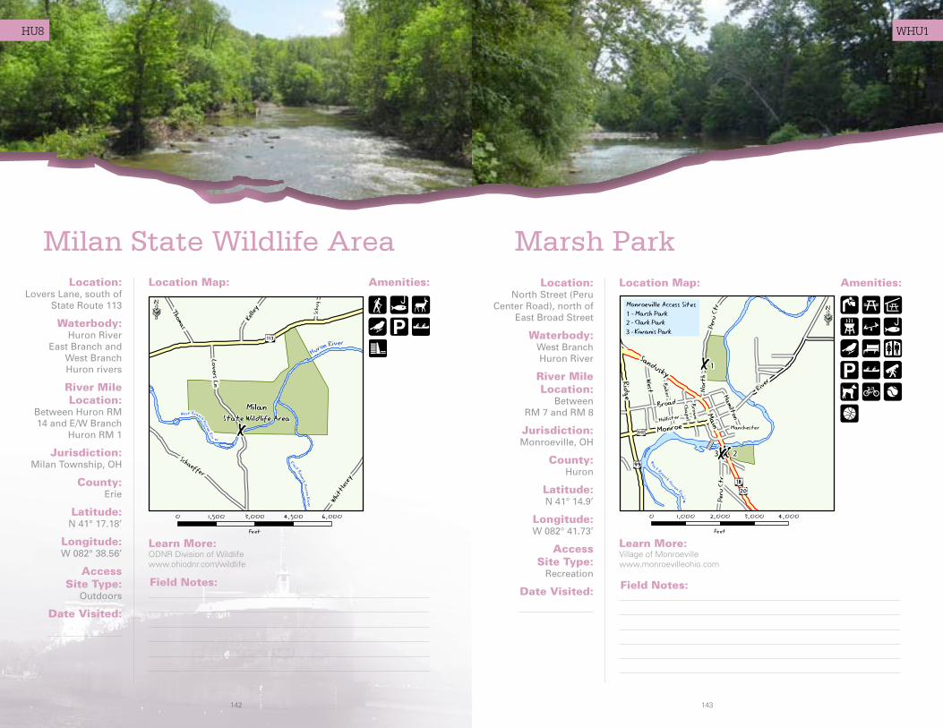
HU8
Milan State Wildlife Area Location:
Lovers Lane, south of State Route 113
Waterbody:Huron River
East Branch andWest Branch Huron rivers
River Mile Location:
Between Huron RM 14 and E/W Branch
Huron RM 1
Jurisdiction:Milan Township, OH
County:Erie
Latitude: N 41° 17.18’
Longitude: W 082° 38.56’
Access Site Type:
Outdoors
Date Visited:
Amenities:Location Map:
Learn More: ODNR Division of Wildlifewww.ohiodnr.com/wildlife
Field Notes:
Marsh ParkAmenities:Location Map:Location:
North Street (Peru Center Road), north of
East Broad Street
Waterbody:West Branch Huron River
River Mile Location:
Between RM 7 and RM 8
Jurisdiction:Monroeville, OH
County:Huron
Latitude: N 41° 14.9’
Longitude: W 082° 41.73’
Access Site Type:
Recreation
Date Visited:
Learn More: Village of Monroevillewww.monroevilleohio.com
Field Notes:
WHU1

144 145
WHU2/3
Clark Parkand Kiwanis Park
Location(Clark Park):
Main Street (US 20/SR 18), at
South Main Street
Waterbody:West Branch Huron River
River Mile Location:
Between RM 8 and RM 9
Jurisdiction:Monroeville, OH
County:Huron
Clark Park: Lat: N 41° 14.48’
Long: W 082° 41.59’
Kiwanis Park: Lat: N 41° 14.47’
Long: W 082° 41.62’
Access Site Type:
Recreation
Date Visited:
Amenities:Location Map:
Learn More: Village of Monroevillewww.monroevilleohio.com
Kiwanis Park Location: South Main Street (Peru Center Road) at Main Street (US 20/SR 18)
Field Notes:
Clark Park
Kiwanis Park
Mary Fate ParkAmenities:Location Map:Location:
Sandusky Street (SR 61), between
Parkwood and Hoffman streets
Waterbody:West Branch Huron River
River Mile Location:
Between RM 40 and RM 41
Jurisdiction:Plymouth, OH
County:Huron
Latitude: N 41° 0.1’
Longitude: W 082° 39.91’
Access Site Type:
Recreation
Date Visited:
Learn More: Village of Plymouthwww.plymouthoh.org
Field Notes:
WHU4