final united states highway 50 access control plan
TRANSCRIPT

Final United States Highway 50
Access Control Plan (West of Grand Mesa Avenue to
State Highway 141A in Whitewater)
November 2008
Prepared for:
CDOT Region 3
222 S 6th Street, #317 Grand Junction, CO 81501
544 Rood Avenue
P.O. Box 20000 Grand Junction, CO 81501
2551 River Road
Grand Junction, CO 81501
Prepared by:
4601 DTC Boulevard
Suite 700 Denver, CO 80237


US Highway 50 Access Control Plan November 2008
i
TABLE OF CONTENTS
1.0 INTRODUCTION...............................................................................................................1 1.1 STUDY LOCATION.......................................................................................................1 1.2 PURPOSE.....................................................................................................................1 1.3 OBJECTIVES................................................................................................................3 1.4 ACCESS CONTROL PLAN PROCESS........................................................................4
2.0 GENERAL ACCESS REQUIREMENTS...........................................................................5 2.1 FUNCTIONAL CHARACTERISTICS OF US 50 ...........................................................5 2.2 SPECIFIC ACCESS REQUIREMENTS FOR US 50 ....................................................5 2.3 AUXILIARY LANE REQUIREMENTS FOR US 50........................................................6
3.0 EXISTING CONDITIONS..................................................................................................7 3.1 PROPERTY INFORMATION ........................................................................................7 3.2 INTERSECTION TYPE AND SPACING .......................................................................7 3.3 ROADWAY SECTIONS AND ACCESS DESCRIPTIONS ............................................8
3.3.1 West of Grand Mesa Avenue to Unaweep Avenue.............................................13 3.3.2 Unaweep Avenue to 27 Road .............................................................................13 3.3.3 27 Road to 28 ½ Road ........................................................................................15 3.3.4 28 ½ Road to 29 ½ Road ....................................................................................17 3.3.5 29 ½ Road to 31 Road ........................................................................................20 3.3.6 31 Road to Willow Bend Road ............................................................................20 3.3.7 Willow Bend Road to SH 141A............................................................................21
3.4 EXISTING TRAFFIC VOLUMES.................................................................................22 3.5 EXISTING LEVEL OF SERVICE.................................................................................22 3.6 ACCIDENT ANALYSIS ...............................................................................................27
4.0 PROJECTED CONDITIONS FOR THE YEAR 2035......................................................29 4.1 YEAR 2035 TRAFFIC VOLUMES...............................................................................29 4.2 YEAR 2035 NO-ACTION LEVEL OF SERVICE .........................................................29
5.0 ACCESS CONTROL TECHNIQUES..............................................................................33 5.1.1 Applications of Access Control Techniques on US 50 ........................................33
6.0 PUBLIC INVOLVEMENT PROCESS .............................................................................36 6.1 INITIAL PUBLIC OPEN HOUSE .................................................................................36 6.2 SECOND PUBLIC OPEN HOUSE..............................................................................36 6.3 ONE-ON-ONE PROPERTY OWNER WORKSHOPS.................................................36 6.4 THIRD PUBLIC OPEN HOUSE ..................................................................................37 6.5 WEBSITE POSTINGS.................................................................................................37
7.0 ACCESS CONTROL PLAN RECOMMENDATIONS .....................................................38 7.1.1 West of Grand Mesa Avenue to Unaweep Avenue.............................................38 7.1.2 Unaweep Avenue to 27 Road .............................................................................39 7.1.3 27 Road to 28 ½ Road ........................................................................................49 7.1.4 28 ½ Road to 29 ½ Road ....................................................................................51 7.1.5 29 ½ Road to 31 Road ........................................................................................54 7.1.6 31 Road to Willow Bend Road ............................................................................55 7.1.7 Willow Bend Road to SH 141A............................................................................55
7.2 FUTURE TRAFFIC CONDITIONS WITH ACP IMPLEMENTATION ..........................56 8.0 NEXT STEPS..................................................................................................................59
8.1 APPROVAL PROCESS ..............................................................................................59 8.2 PLAN IMPLEMENTATION..........................................................................................60
9.0 REFERENCES................................................................................................................61

November 2008 US Highway 50 Access Control Plan
ii
LIST OF TABLES
Table 1 Summary of Existing Access Locations by Highway Category Segments....................... 8 Table 2 Existing Average Daily Traffic on US 50 ........................................................................ 22 Table 3 Intersection Level of Service Criteria ............................................................................. 23 Table 4 Arterial Segment Level of Service Criteria ..................................................................... 24 Table 5 Summary of Accident Data*........................................................................................... 28 Table 6 Comparison of 2035 to Existing Average Daily Traffic on US 50................................... 29
LIST OF FIGURES
Figure 1 Study Area ...................................................................................................................... 2 Figure 2 Access Control Plan Process ......................................................................................... 4 Figure 3 Existing Access Locations 1 through 85 ......................................................................... 9 Figure 4 Existing Access Locations 86 through 144 ................................................................... 10 Figure 5 Existing Access Locations 145 through 165 ................................................................. 11 Figure 6 Existing Intersection and Arterial Level of Service (AM Peak Hour) ............................. 25 Figure 7 Existing Intersection and Arterial Level of Service (PM Peak Hour) ............................. 26 Figure 8 2035 No-Action Intersection and Arterial Level of Service (AM Peak Hour)................. 31 Figure 9 2035 No-Action Intersection and Arterial Level of Service (PM Peak Hour)................. 32 Figure 10 Access Control Methods............................................................................................. 35 Figure 11 Recommended Access Points.................................................................................... 45 Figure 12 Recommended Access Points.................................................................................... 46 Figure 13 Recommended Access Points.................................................................................... 47 Figure 14 Traffic Conditions (Year 2035) after ACP Implementation (AM Peak Hour) ............... 57 Figure 15 Traffic Conditions (Year 2035) after ACP Implementation (PM Peak Hour) ............... 58
LIST OF APPENDICES
Appendix A Existing Roadway/Access Configuration Appendix B Recommended Roadway Access Configuration Appendix C Access Control Plan (ACP) Appendix D Draft Inter-Governmental Agreement Appendix E Property Information Appendix F Average Daily Traffic (ADT) Appendix G Turning Movement Counts (TMC) Appendix H Existing Level of Service (LOS) Appendix I Accident Data Appendix J 2035 No-Action Level of Service (LOS) Roadway Laneage Appendix K Initial Public Open House Materials Appendix L Second Public Open House Materials Appendix M Final Public Open House Materials Appendix N Future Level of Service with Recommended Changes to Access Appendix O Conceptual Design Improvements at US 50/Unaweep Avenue and US 50B ½ Road

US Highway 50 Access Control Plan November 2008
1
1.0 INTRODUCTION Recent and continued growth in the Grand Junction area, along United States Highway (US) 50, and within the local communities that make up Mesa County, has resulted in an increase in traffic on the US 50 corridor. Traffic volumes in the area are expected to at least double in the next 20 years. Without changes to the corridor, this increase in traffic volumes will result in increased delay, higher levels of congestion, and an increase in the severity and number of accidents. The Colorado Department of Transportation (CDOT), Mesa County, and the City of Grand Junction have identified the need for an Access Control Plan (ACP) on this corridor to mitigate and minimize the occurrence of these conditions. Development and implementation of the ACP will provide a binding document guiding the agency’s decisions regarding the future access conditions of US 50. The State Highway Access Code (2 Code of Colorado Regulations [CCR] §601-1) requirements were followed in preparing this plan. The ACP will provide CDOT, Mesa County, and the City of Grand Junction with roadway access plans for the study corridor in an effort to bring the corridor into conformance with its assigned access category. The ACP is also intended to achieve balance between the planning objectives for CDOT and the participating local agencies, as well as support the current and future functional purposes of the corridor. In addition, the ACP evaluates existing and proposed access points along the corridor and makes recommendations for appropriate modifications. This report contains the purpose, objectives, and process of the ACP. Some examples of discussion topics include:
• General Access Requirements • Existing Conditions • Projected Conditions for the Year 2030 • Access Control Techniques • Public Involvement Process • Access Control Plan Recommendations • Next Steps
1.1 STUDY LOCATION This ACP evaluated the portion of the US 50 corridor located just west of Grand Mesa Avenue to State Highway (SH) 141A in Whitewater. In terms of mile points the limits of the project are from a residential driveway (mile point 32.684) east to SH 141A (mile point 41.146). Altogether, the total study limits encompass approximately 8.6 miles of roadway. The study area is shown in Figure 1. 1.2 PURPOSE The purpose of the ACP is to identify the location, type, and design of access points within the study limits in order to provide reasonable access to adjacent properties while maintaining safe and efficient traffic flow on US 50.

November 2008 US Highway 50 Access Control Plan
2
Figure 1 Study Area

US Highway 50 Access Control Plan November 2008
3
1.3 OBJECTIVES Proper application of an ACP will allow traffic to move more efficiently and safely along US 50 by controlling the design, location, and frequency of access points and by better using the secondary roadway network to reduce future strain on the roadway. The objectives of the US 50 ACP are to:
• Improve traffic flow • Reduce traffic conflicts • Improve traffic safety • Provide appropriate access to adjacent properties
Traffic volumes on the US 50 corridor are projected to increase over the next several years. Projections from Mesa County indicate that traffic volumes will at least double during the next 20 years. Without better access control, the number of conflicts and the amount of delay will continue to increase until severe congestion exists on the highway for many hours of the day. Proper control of the frequency, number, and location of access points on the corridor can lead to a reduction in the following:
• The number and severity of accidents that occur • The delay experienced by motorists • The level of congestion on US 50 and the strain on the surrounding roads • The number of consumers conducting business elsewhere
There are several ways to reduce the number and severity of accidents that occur. Accidents generally occur at the locations where two vehicles conflict with each other. A potential conflict occurs each time vehicles turning left or right at an access point cross paths with other roadway users. If the number of conflict points increases, which is what occurs if additional access points are allowed, then the number of accidents on US 50 will also increase. Conversely, if the number of conflict points is reduced, the number of accidents should decrease creating a safer roadway. Some of the most severe accidents typically involve left turn movements from an approach street onto US 50 at un-signalized intersections where the turn is made without the protection of a signal. With an ACP, most of the left turn movements can be redirected to the signalized locations where, under the protection of a traffic signal, the vehicles can either turn left from the approach street or can make a u-turn on US 50 to reach their desired destination. Another option is to prohibit left turns onto US 50 from the approach streets, but still allow left turns onto the approach street from US 50 (also known as a ¾ movement intersection). Both of these options have the potential to reduce the number of severe accidents involving left turning vehicles and thus improve the overall safety for motorists on the corridor. In order to reduce congestion and delay along the corridor, it is important to control the number of access points along US 50 as traffic increases. By doing this, vehicles will not have to slow or stop to turn into or to allow vehicles to enter the roadway from as many access points. This will result in a decrease in the amount of delay and congestion on the roadway.

November 2008 US Highway 50 Access Control Plan
4
Finally, by reducing the friction along the corridor through reducing the number of access points, US 50 will become less strained by congestion and delay. Motorists will be able to experience acceptable travel times and less congestion, maintaining return-service for local businesses. In summary, the proper application of an ACP will allow traffic to move more efficiently and safely along US 50 by controlling the design, location, and frequency of access points and by better using the secondary roadway network to reduce future strain on the roadway. 1.4 ACCESS CONTROL PLAN PROCESS The process that was followed in developing the US 50 ACP is summarized in Figure 2. The process began with the data collection phase; all access locations were identified, accident data and traffic volumes were collected, copies of traffic studies for planned developments along the corridor were gathered, and information on future volume projections was collected from the Mesa County regional model. Once the data was collected, safety and operational analyses were completed. At that time, an initial public open house was conducted to introduce the project and the concept of access management to the public. After the initial open house and based on results of the previously completed analyses and the requirements of the State Highway Access Code, preliminary ACP alternatives were created. The project team evaluated the alternatives to develop a preliminary draft plan to present to the public at a second open house. Following the second open house were one-on-one property owner workshops for property owners that had additional concerns regarding the proposed recommendations. Comments from the open house and property owner workshops were received and the ACP was revised to reflect the public comments at multiple access locations. A third open house was held to present the final recommendations of the ACP to the public. Documentation of the process followed and the recommended ACP for US 50 are contained within this final report, which also signifies the start of the plan adoption process.
Figure 2 Access Control Plan Process

US Highway 50 Access Control Plan November 2008
5
2.0 GENERAL ACCESS REQUIREMENTS State highways are classified in accordance with the State Highway Access Category Assignment Schedule (2 CCR §601-1a), which was published on January 23, 2003. According to the schedule US 50 is classified as follows:
• North of Grand Mesa Avenue to 31 Road – Non-rural Regional Highway (NR-A) • 31 Road to SH 141A – Regional Highway (R-A)
Based on the classification for a highway, the State Highway Access Code provides information regarding:
• Functional characteristics • Specific access requirements for number and spacing of access points • Auxiliary lane requirements
A brief discussion on each of these topics as they relate to US 50 is provided in the following sections; a complete description of these items can be found on pages 37-38 and 40-42 of the State Highway Access Code. 2.1 FUNCTIONAL CHARACTERISTICS OF US 50 The functional characteristics of a highway provide a basic description of the highway based upon location, travel speed, traffic volumes, and type of travel. The functional characteristics for a category NR-A roadway:
• A non-rural highway with the capacity to handle medium to high speeds and provide for medium to high traffic volumes in a safe and efficient manner.
• Provide interregional, intraregional, intercity, and intra-city travel needs in suburban and urban areas as well as serving as major arterials in smaller cities and towns.
• Direct access to abutting land is secondary to providing service to through traffic.
The functional characteristics for a category R-A roadway: • A highway with the capacity to handle medium to high speeds and provide for medium to
high traffic volumes in a safe and efficient manner. • Provide interregional, intraregional, and intercity travel needs for significant regional
routes in rural areas and other routes of regional or state significance. • Direct access to abutting land is secondary to providing service to through traffic.
2.2 SPECIFIC ACCESS REQUIREMENTS FOR US 50 The number, location, and type of access to adjacent properties are also controlled by the access code depending on the type of highway. The access requirements for a category NR-A roadway:
• Typical spacing of intersecting streets, roads, and highways shall be planned for one-half mile intervals, or based upon section lines. Exceptions to the one-half mile spacing for public ways are allowed when no reasonable alternative access to the general street system exists.

November 2008 US Highway 50 Access Control Plan
6
• Direct access to private property is permitted only when reasonable access cannot be obtained from the general street system.
• Direct access to the highway should be allowed if it does not create a safety or operational problem to the highway, but would create a safety or operational problem for the general street system or alter the intended function of the general street system.
• No additional access will be provided upon the splitting or dividing of existing parcels of land or contiguous parcels under the same ownership. Additional access shall be provided internally from the existing access.
The access requirements for a category R-A roadway:
• Typical spacing of intersecting streets, roads, and highways shall be planned for one-half mile intervals, or based upon section lines. Exceptions to the one-half mile spacing for public ways is allowed when no reasonable alternative access to the general street system exists.
• Direct access to private property is permitted only when reasonable access cannot be obtained from the general street system.
• No additional access will be provided upon the splitting or dividing of existing parcels of land or contiguous parcels under the same ownership. Additional access shall be provided internally from the existing access.
2.3 AUXILIARY LANE REQUIREMENTS FOR US 50 Depending upon the volume of turning vehicles at each access location, the access code defines the thresholds for deceleration and acceleration auxiliary lanes. The auxiliary lane requirements for both a category NR-A and a category R-A roadway:
• A left-turn deceleration lane is required for any access with a projected peak hour left-turn ingress volume greater than ten vehicles per hour (vph).
• A right-turn deceleration lane is required for any access with a projected peak hour right-turning volume greater than 25 vph.
• A left-turn acceleration lane may be required if such design would be a benefit to the safety and operation of the roadway.
• A right-turn acceleration lane is required for any access with a projected peak hour right-turning volume greater than 50 vph when the posted speed is greater than 40 miles per hour (mph).

US Highway 50 Access Control Plan November 2008
7
3.0 EXISTING CONDITIONS The study corridor is approximately 8.6 miles in length and stretches between just north of Grand Mesa Avenue to SH 141A in Whitewater. The first step in developing an ACP is defining the existing conditions of the corridor. This is done by collecting the following data:
• Properties adjacent to the corridor and those potentially impacted by the ACP • Location and type of each access point • Average daily traffic (ADT) volumes • Intersection turning movement volumes • Accident data
From this data, the corridor can be analyzed to determine if any safety and operational issues exist. The following sections provide a discussion on the data collection and analysis procedures. 3.1 PROPERTY INFORMATION The data regarding property ownership was provided by Mesa County. The information was used to create the mailing list for the public involvement process (see Section 6.0). For this study, it was determined that all properties within 500 feet on both ends of the project limits (just north of Grand Mesa Avenue to SH 141A) and within 500 feet to the north and south of US 50 would be included on the mailing list. These limits were selected in an effort to inform all those that the ACP study would most directly affect, to ensure all parties received equal information, and to allow the property owners to determine whether or not they had an interest in the ACP. Appendix E contains a list of the property owner information. 3.2 INTERSECTION TYPE AND SPACING Within the study limits, there are currently five signalized intersections, 58 un-signalized full movement intersections, one ¾-movement access point, and 101 right-in, right-out access points. The result is a total of 165 access points along the 8.6-mile stretch of the corridor contained within the limits of this study. All access points can be separated into two categories: public or private. Definitions relating to types of access are covered in Section 1.5, “Definitions and Abbreviations” (pp 2-8), in the State Highway Access Code:
“Public Way” means a highway, street, or road, open for use by the general public and under the control or jurisdiction of the appropriate local authority of Department and includes private roads open to the public. “Driveway” means an access that is not a public street, road, or highway.
Based on these definitions, the access points within the study include 43 public ways and 122 driveways. Public ways can be signalized or un-signalized and may be a full-movement intersection or may have movements restricted such is the case with a right-in, right-out intersection. The following is a list of examples of public ways that intersect US 50:
• Grand Mesa Avenue • Unaweep Avenue

November 2008 US Highway 50 Access Control Plan
8
• Aspen Street • Willow Bend Road • SH 141A
The remaining access points are considered driveways or private access locations. These include some full movement and some limited access points throughout the corridor. A few examples of private access locations include Orchard Mesa Plaza Shopping Center, Trails End Trailer Park, and residential driveways. Table 1 summarizes the total existing access points within the study limits based upon the different highway category segments.
Table 1 Summary of Existing Access Locations by Highway Category Segments
Section Category Signalized
Public Ways
Un-signalized
Public Ways
Driveways Total
West of Grand Mesa Avenue to 31 Road
NR-A Non-Rural Regional Highway
4 32 107 143
31 Road to SH 141 R-A
Regional Highway
1 5 16 22
Totals 5 37 123 165 For the first segment of the study corridor (category NR-A; 5.22 miles in length), based on the access code the spacing between intersecting public ways should be at half mile intervals when no reasonable alternative access to the general street system exists. The existing average spacing between public ways is 0.145 mile (0.035 mile for all access points), which is less than the prescribed spacing in the access code for this segment. For the second segment (category R-A, 3.24 miles in length), the spacing between public ways should be one half mile, the current conditions have a public access every 0.54 mile (0.14 mile for all access points), which is within the prescribed spacing for this segment. 3.3 ROADWAY SECTIONS AND ACCESS DESCRIPTIONS Figure 3 through Figure 5 show the location of all direct access points to the US 50 corridor within the study limits of this project. Appendix A (Sheets 1 though 16) provides a much closer aerial view of the study corridor with the approximate existing roadway configuration and access locations identified. The corridor travels predominantly in the east and west direction within the study limits. The following is a brief description of the existing roadway configuration and access locations within the study limits of the ACP. The descriptions begin with the access located on the west end of the corridor and move east to the eastern limits of the study.

US Highway 50 Access Control Plan November 2008
9
Figure 3 Existing Access Locations 1 through 85

November 2008 US Highway 50 Access Control Plan
10
Figure 4 Existing Access Locations 86 through 144

US Highway 50 Access Control Plan November 2008
11
Figure 5 Existing Access Locations 145 through 165

November 2008 US Highway 50 Access Control Plan
12
This page intentionally left blank.

US Highway 50 Access Control Plan November 2008
13
3.3.1 West of Grand Mesa Avenue to Unaweep Avenue This portion of the US 50 corridor has two through lanes in each direction and is divided, with a raised center median. The speed limit in both the eastbound and westbound direction is 45 mph in this segment. This section of US 50 contains the following 15 access points.
• Access 1: This right-in, right-out access represents the westernmost limits of the study area and is a residential access to the south of US 50.
• Access 2: This right-in, right-out driveway provides access to a business south of US 50. • Access 3 (Grand Mesa Avenue/High Street): This intersection allows full movements in
all directions. Both the north and south legs of this intersection are stop controlled. • Access 4: This right-in, right-out driveway provides access to a business north of US 50. • Access 5: This right-in, right-out driveway provides access to a business south of US 50. • Access 6: This right-in, right-out driveway provides access to a business south of US 50. • Access 7: This right-in, right-out driveway provides access to a business south of US 50. • Access 8 (Clymer Way): This full movement T-intersection provides access to south of
US 50. The south leg is stop controlled. • Access 9: This access is a curb-cut only on the north of US 50. • Access 10: This access is a curb-cut only on the north of US 50. • Access 11: This right-in, right-out driveway provides access to a business north of US
50. • Access 12: This access is a curb-cut only on the south of US 50. • Access 13 (Santa Clara Avenue): This intersection allows full movements in all
directions. Both the north and south legs of this intersection are stop controlled. • Access 14: This right-in, right-out driveway provides access to the field south of US 50. • Access 15 (Unaweep Avenue/26 ¼ Road): This signalized intersection allows full
movements in all directions and provides access north and south of US 50. The south leg is designated as 26 ¼ Road and the north leg is designated as Unaweep Avenue.
3.3.2 Unaweep Avenue to 27 Road This portion of the US 50 corridor has two through lanes in each direction and is divided, with a raised center median. The speed limit in both the eastbound and westbound direction is 45 mph in this segment. This section of US 50 contains the following 44 access points.
• Access 16: This right-in, right-out driveway provides access to a business south of US 50.
• Access 17: This right-in, right-out driveway provides access to a business south of US 50.
• Access 18: This right-in, right-out driveway provides residential access to the south of US 50.
• Access 19: This full movement driveway provides residential access to the south of US 50.

November 2008 US Highway 50 Access Control Plan
14
• Access 20 (James Court): This full movement T-intersection provides access to north of US 50. The north leg is stop controlled.
• Access 21: This ¾-movement driveway provides access to a business south of US 50. • Access 22: This right-in, right-out driveway provides residential access to the north of
US 50. • Access 23: This right-in, right-out driveway provides access to multiple residences and
to a business south of US 50. • Access 24: This right-in, right-out driveway provides access to a business south of US
50. • Access 25: This right-in, right-out driveway provides residential access to the north of
US 50. • Access 26: This right-in, right-out driveway provides access to a business south of US
50. • Access 27: This right-in, right-out driveway provides residential access to the north of
US 50. • Access 28: This right-in, right-out driveway provides residential access to the south of
US 50. • Access 29: This right-in, right-out driveway provides residential access to the north of
US 50. • Access 30: This right-in, right-out driveway provides access to a business south of US
50. • Access 31: This right-in, right-out driveway provides residential access to the north of
US 50. • Access 32: This right-in, right-out driveway provides access to the field north of US 50. • Access 33: This right-in, right-out driveway provides access to multiple residences to the
south of US 50. • Access 34: This right-in, right-out driveway provides access to multiple residences to the
south of US 50. • Access 35: This full movement driveway provides access to a business north of US 50. • Access 36: This full movement driveway provides access to multiple residences to the
south of US 50. • Access 37: This full movement driveway provides access to a business north of US 50. • Access 38: This right-in, right-out driveway provides access to a business north of US
50. • Access 39: This right-in, right-out driveway provides access to multiple residences to the
south of US 50. • Access 40: This right-in, right-out driveway provides access to a business north of US
50. • Access 41: This right-in, right-out driveway provides access to a business south of US
50.

US Highway 50 Access Control Plan November 2008
15
• Access 42 (Aspen Street): This intersection allows full movements in all directions. Both the north and south legs of this intersection are stop controlled.
• Access 43 (Alley): This right-in, right-out roadway provides access to an alley to the north of US 50.
• Access 44: This right-in, right-out driveway provides access to a business south of US 50.
• Access 45 (Palmer Street): This intersection allows full movements in all directions. Both the north and south legs of this intersection are stop controlled.
• Access 46 (Palisade Street): This full movement T-intersection provides access to the north side of US 50. The north leg is stop-controlled.
• Access 47: This right-in, right-out driveway provides access to a business north of US 50.
• Access 48 (Linden Avenue): This intersection allows full movements in all directions. Both the north and south legs of this intersection are stop controlled.
• Access 49 (B ¾ Road): This full movement T-intersection provides access to B ¾ Road to the north of US 50 and forms a five-leg intersection with Access 48. The north leg is stop-controlled.
• Access 50: This right-in, right-out driveway provides access to a business north of US 50.
• Access 51: This right-in, right-out driveway provides access to a business north of US 50.
• Access 52: This right-in, right-out driveway provides access to the field south of US 50. • Access 53: This right-in, right-out driveway provides access to a business south of SH
392. • Access 54: This right-in right-out driveway provides shared access to businesses north of
US 50. • Access 55: This right-in, right-out driveway provides shared access to businesses north
of US 50. • Access 56: This right-in, right-out driveway provides access to businesses north of US
50. • Access 57: This right-in, right-out driveway provides shared access to businesses south
of US 50. • Access 58 (27 Road): This signalized intersection allows full movements in all
directions.
3.3.3 27 Road to 28 ½ Road This portion of the US 50 corridor, from 27 Road to 28 ½ Road, has two through lanes in each direction. From 27 Road to 27 ½ Road, the road is separated by a raised median. From 27 ½ Road to 28 ½ Road the road is separated by a depressed grass median. The speed limit from 27 ½ Road to just east of the Mesa County Fairgrounds entrance is 45 mph in both directions.

November 2008 US Highway 50 Access Control Plan
16
From east of the fairgrounds to 28 ½ Road, the speed limit increases to 55 mph in both directions. This portion of the corridor contains 28 access points.
• Access 59: This right-in, right-out driveway provides access to a business south of US 50.
• Access 60: This right-in, right-out driveway provides access to a business north of US 50.
• Access 61: This right-in, right-out driveway provides access to a business south of US 50.
• Access 62: This right-in, right-out driveway provides access to a business north of US 50.
• Access 63: This right-in, right-out driveway provides access to a business south of US 50.
• Access 64: This right-in, right-out driveway provides access to a business north of US 50.
• Access 65: This right-in, right-out driveway provides access to a business north of US 50.
• Access 66: This right-in, right-out driveway provides residential access to the south of US 50.
• Access 67: This right-in, right-out driveway provides access to a business south of US 50.
• Access 68: This right-in, right-out driveway provides access to a business north of US 50.
• Access 69: This right-in, right-out driveway provides access to a business south of US 50.
• Access 70: This right-in, right-out driveway provides access to a business south of US 50.
• Access 71: This right-in, right-out driveway provides access to a business south of US 50.
• Access 72 (Dorothy Avenue/Frontage Road): This intersection allows full movements in all directions. Both the north and south legs of this intersection are stop controlled. The north leg is designated as Dorothy Avenue and the south leg is designated as the Frontage Road.
• Access 73: This right-in, right-out driveway provides access to a business north of US 50.
• Access 74: This right-in, right-out driveway provides access to a business north of US 50.
• Access 75: This right-in, right-out driveway provides access to a business north of US 50.
• Access 76 (B ½ Road Eastbound Off-ramp): This intersection to the south of US 50 is the eastbound off-ramp that leads to B ½ Road.

US Highway 50 Access Control Plan November 2008
17
• Access 77: This right-in, right-out driveway provides access to a business north of US 50.
• Access 78: This right-in, right-out driveway provides access to an easement ditch north of US 50.
• Access 79 (B ½ Road Eastbound On-ramp): This intersection to the south of US 50 is the eastbound on-ramp that leads from B ½ Road. The on-ramp approach is yield controlled.
• Access 80 (B ½ Road Westbound On-ramp): This intersection to the north of US 50 is the westbound on-ramp that leads from B ½ Road. The on-ramp approach is yield controlled.
• Access 81 (Frontage Road): This intersection allows full movements in all directions and provides access to the Frontage Road to the south and to the 27 ½ Road to the north. Both the north and south legs of this intersection are stop controlled.
• Access 82 (27 ¾ Road): This intersection allows full movements in all directions. The north leg provides access to 27 ¾ Road and the south leg provides access to the Frontage Road. Both the north and south legs of this intersection are stop controlled and the north and south approaches in the median opening are yield controlled
• Access 83: This full movement T-intersection provides access to the Mesa County Fairgrounds to the south of US 50. The south leg is stop-controlled and the north and south approaches in the median opening are stop controlled.
• Access 84: This right-in, right-out driveway provides access to a business south of US 50.
• Access 85: This right-in, right-out driveway provides residential access to the south of US 50.
• Access 86 (28 ½ Road): This intersection allows full movements in all directions giving access to 28 ½ Road. Both the north and south legs of this intersection are stop controlled and the north and south approaches in the median opening are yield controlled.
3.3.4 28 ½ Road to 29 ½ Road This portion of the US 50 corridor, from 28 ½ Road to 29 ½ Road, has two through lanes in each direction. From 28 ½ Road to just east of 29 ¼ Road, the road is separated by a depressed grass median. From 29 ¼ Road to 29 ½ Road, there is no median. Between 28 ½ Road and Elm Drive, the speed limit is 55 mph in both directions, and from Elm Drive to just west of 29 ¼ Road the speed reduces to 45 mph in both directions. The speed increases to 55 mph in both directions just west of 29 ¼ Road. This portion of the corridor contains 45 access points.
• Access 87: This right-in, right-out driveway provides residential access to the north of US 50.
• Access 88: This right-in, right-out driveway provides residential access to the north of US 50.
• Access 89 (Rainbow Drive): This right-in, right-out intersection provides access to Rainbow Drive to the south of US 50. The south leg is stop-controlled.
• Access 90 (Tennessee Street): This right-in, right-out intersection provides access to Tennessee Street to the north of US 50. The north leg is stop-controlled.

November 2008 US Highway 50 Access Control Plan
18
• Access 91 (Indiana Street): This right-in, right-out intersection provides access to Indiana Street to the north of US 50. The north leg is stop-controlled.
• Access 92: This right-in, right-out driveway provides residential access to the north of US 50.
• Access 93: This right-in, right-out driveway provides residential access to the north of US 50.
• Access 94 (DeVee Drive): This full movement T-intersection provides access to the DeVee Drive to the south of US 50. The south leg is stop-controlled and the north and south approaches in the median opening are yield controlled.
• Access 95 (Elm Drive): This right-in, right-out intersection provides access to Elm Drive to the north of US 50. The north leg is stop-controlled.
• Access 96: This right-in, right-out driveway provides residential access to the north of US 50.
• Access 97: This right-in right-out driveway provides residential access to the south of US 50.
• Access 98: This right-in, right-out driveway provides residential access to the north of US 50.
• Access 99: This right-in, right-out driveway provides residential access to the north of US 50.
• Access 100: This right-in, right-out driveway provides residential access to the north of US 50.
• Access 101: This right-in, right-out driveway provides residential access to the north of US 50.
• Access 102: This right-in, right-out driveway provides residential access to the south of US 50.
• Access 103 (Reta Drive): This right-in, right-out intersection provides access to Reta Drive to the north of US 50. The north leg is stop-controlled.
• Access 104 (Landsdown Road): This right-in, right-out intersection provides access to Landsdown Road to the south of US 50. The south leg is stop-controlled.
• Access 105: This right-in, right-out driveway provides residential access to the north of US 50.
• Access 106: This right-in, right-out driveway provides residential access to the north of US 50.
• Access 107: This right-in, right-out driveway provides access to a business north of US 50.
• Access 108 (29 Road): This full movement T-intersection provides access to 29 Road to the north of US 50. This intersection is signalized.
• Access 109: This right-in, right-out driveway provides access to a business north of US 50.
• Access 110: This right-in, right-out driveway provides access to a business north of US 50.

US Highway 50 Access Control Plan November 2008
19
• Access 111 (Sundance Drive): This full movement T-intersection provides access to Sundance Drive to the south of US 50. This intersection is signalized.
• Access 112: This right-in, right-out driveway provides access to a business north of US 50.
• Access 113: This right-in, right-out driveway provides residential access to the south of US 50.
• Access 114: This right-in, right-out driveway provides residential access to the north of US 50.
• Access 115: This right-in, right-out driveway provides residential access to the north of US 50.
• Access 116: This right-in, right-out driveway provides residential access to the south of US 50.
• Access 117: This right-in, right-out driveway provides residential access to the north of US 50.
• Access 118: This right-in, right-out driveway provides residential access to the north of US 50.
• Access 119 (Red Rock Road): This right-in, right-out intersection provides access to Red Rock Road to the south of US 50. The south leg is stop-controlled.
• Access 120: This right-in, right-out driveway provides residential access to the north of US 50.
• Access 121: This right-in, right-out driveway provides residential access to the north of US 50.
• Access 122: This right-in, right-out driveway provides residential access to the north of US 50.
• Access 123: This right-in, right-out driveway provides access to a ditch south of US 50. • Access 124 (29 ¼ Road): This full movement T-intersection provides access to 29 ¼
Road to the south of US 50. The south leg is stop-controlled. • Access 125: This full movement driveway provides access to a residential property as
well as to a ditch to the north of US 50. • Access 126: This full movement driveway provides residential access to the north of US
50. • Access 127: This full movement driveway provides access to a field north of US 50. • Access 128: This full movement driveway provides residential access to the north of US
50. • Access 129: This full movement driveway provides access to a field north of US 50. • Access 130: This full movement driveway provides residential access to the north of US
50. • Access 131 (29 ½ Road): This intersection allows full movements in all directions and
provides access to 29 ½ Road to the north and the Frontage Road to the south. Both the north and south legs of this intersection are stop controlled.

November 2008 US Highway 50 Access Control Plan
20
3.3.5 29 ½ Road to 31 Road This portion of the US 50 corridor, from 29 ½ Road to 31 Road, has two through lanes in each direction and has no median. The speed limit is 55 mph in both directions on this section of US 50. This portion of the corridor contains the following twelve access points.
• Access 132: This full movement driveway provides access to a residential backyard north of US 50.
• Access 133: This full movement driveway provides access to a residential backyard north of US 50.
• Access 134: This full movement driveway provides access to a field north of US 50. • Access 135 (29 ¾ Road): This intersection allows full movements in all directions and
provides access to 29 ¾ Road. Both the north and south legs of this intersection are stop controlled.
• Access 136 (30 Road): This full movement T-intersection provides access to 30 Road to the north of US 50. This north leg is stop-controlled.
• Access 137: This full movement driveway provides residential access to the north of US 50.
• Access 138 (Frontage Road): This full movement T-intersection provides access to the Frontage Road to the south of US 50. The south leg is stop-controlled.
• Access 139: This full movement driveway provides access to a business south of US 50. • Access 140: This full movement driveway provides access to a field north of US 50. • Access 141: This full movement driveway provides residential access to the south of US
50. • Access 142: This full movement driveway provides access to a ditch north of US 50. • Access 143 (31 Road): This intersection allows full movements in all directions giving
access to 31 Road. Both the north and south legs of this intersection are stop controlled.
3.3.6 31 Road to Willow Bend Road This portion of the US 50 corridor, from 31 Road to Willow Bend Road, has two through lanes in each direction. From 31 Road to east of SH 141B there is no median, and from east of 141B to Willow Bend Road there is a grass median. The speed limit on both approaches to SH 141B is 45 mph in each direction, and the speed limit on the rest of the segment is 55 mph in both directions. This portion of the corridor contains the following eight access points.
• Access 144: This full movement driveway provides access to a field north of US 50. • Access 145 (32 Road/SH 141B): This signalized T-intersection provides access to SH
141B to the north of US 50. • Access 146: This full movement driveway provides access to a business south of US 50. • Access 147: This right-in, right-out driveway provides access to a field south of US 50. • Access 148: This right-in, right-out driveway provides access to a field north of US 50. • Access 149: This right-in, right-out driveway provides residential access to the north of
US 50.

US Highway 50 Access Control Plan November 2008
21
• Access 150: This right-in, right-out driveway provides access to a residential backyard south of US 50.
• Access 151 (Willow Bend Road/Residential Access): This intersection allows full movements in all directions. The north leg provides access to a residential property and the south leg is Willow Bend Road. Both the north and south legs of this intersection are stop controlled.
3.3.7 Willow Bend Road to SH 141A This portion of the US 50 corridor, from Willow Bend Road to SH 141A, has two through lanes in each direction. The first part of the segment until just east of Willow Bend Road has a grass median, and the remainder of the segment, from east of Willow Bend Road to SH 141A, has no median. The speed limit is 55 mph in both directions of this stretch of US 50. This portion of the corridor contains fourteen access locations.
• Access 152: This full movement driveway provides access to a field north of US 50. • Access 153: This full movement driveway provides access to a field south of US 50. • Access 154: This full movement driveway provides residential access to the north of US
50. • Access 155: This full movement driveway provides access to multiple residences south
of US 50. • Access 156: This full movement driveway provides access to a business north of US 50. • Access 157: This full movement driveway provides access to a business north of US 50. • Access 158: This full movement driveway provides access to a business north of US 50. • Access 159 (1st Street): This full movement T-intersection provides access to 1st Street to
the south of US 50. The south leg is stop-controlled. • Access 160: This full movement driveway provides access to a business north of US 50. • Access 161: This full movement driveway provides access to a business north of US 50. • Access 162: This full movement driveway provides access to a business north of US 50. • Access 163 (3rd Street): This full movement T-intersection provides access to 3rd Street
to the south of US 50. The south leg is stop-controlled. This intersection is slightly offset of Reeder Mesa Road and movements can be made to and from the north leg, as well.
• Access 164 (Reeder Mesa Road): This full movement T-intersection provides access to Reeder Mesa Road to the north of US 50. The north leg is stop-controlled. This intersection is slightly offset of 3rd Street and movements can be made to and from the south leg as well.
• Access 165 (SH 141A): The full movement T-intersection provides access to SH 141A to the south of US 50. The south leg is stop-controlled.

November 2008 US Highway 50 Access Control Plan
22
3.4 EXISTING TRAFFIC VOLUMES An analysis of the existing traffic conditions was performed during the early stages in the development of the ACP. In order to conduct the analysis, existing traffic volume data was collected on the corridor. The existing conditions data collection included intersection turning movement counts (TMC) and ADT data, which were collected in October of 2007. In addition, accident data for the corridor was provided by CDOT. ADT counts identify the hourly amount of through traffic along the corridor throughout an entire day, and is usually averaged over several typical weekdays. Table 2 shows the bi-directional (eastbound plus westbound) traffic at numerous locations along the corridor. The detailed data is available in Appendix F. These values represent a typical weekday traffic level for US 50. The volumes are highest in the urban section of the corridor on the west segment with more than 21,600 vehicles per day. The volumes drop significantly in the rural section of the corridor to approximately 9,000 vehicles per day to the west of SH 141B, and then increase to just more than 13,400 vehicles per day east of SH 141A at the eastern limits of the study area.
Table 2 Existing Average Daily Traffic on US 50
Location ADT (Bi-directional)
West of B 1/2 Road 21,636 West of SH 141B 9,044 East of SH 141A 13,418
The TMC data provides distribution information for vehicles entering and exiting the corridor at key intersections. This traffic data was input into the Synchro traffic model prepared for this study to determine levels of service (LOS). The morning (AM) and evening (PM) peak hour TMCs are presented in Appendix G. 3.5 EXISTING LEVEL OF SERVICE Traffic operations for each of the signalized and key Un-signalized access points were analyzed using the methods described in the 2000 Highway Capacity Manual (HCM) (Transportation Research Board, 2000). According to the 2000 HCM, the overall performance of an intersection is determined based on the level of control delay experienced by motorists at the intersection. Depending on the level of delay that is experienced, each intersection can be scored on an LOS scale and given a letter grade from ‘A’ to ‘F’, with ‘A’ being the best possible grade for the intersection. For signalized intersections, the delay for each individual turning movement is evaluated, then entire approaches are graded, and finally the intersection as a whole can be given a single LOS. For two-way stop controlled (TWSC) intersections, each minor approach is given a separate LOS and the worst LOS is reported as a single rating for the intersection. Table 3 shows the criteria for establishing the LOS for the signalized and TWSC intersections within the study area. The results of the LOS analysis for the existing conditions are presented in Figure 6 and Figure 7, with detailed analysis sheets provided in Appendix H.

US Highway 50 Access Control Plan November 2008
23
Table 3 Intersection Level of Service Criteria
Control Delay per Vehicle (sec/veh) LOS
Un-signalized Intersection Signalized Intersection
A 0-10 ≤ 10 B >10-15 >10-20 C >15-25 >20-35 D >25-35 >35-55 E >35-50 >55-80
F >50 >80 Based on the results of the analysis, most of the signalized intersections operate at LOS C or better for the peak hours of the day, which is considered acceptable. Some of the stop controlled intersections, such as Grand Mesa Avenue, Linden Avenue, and Dorothy Avenue, operate at unacceptable LOS (E and F). The reason that these locations operate at a low LOS is primarily due to the left-turning vehicles that want to enter the highway at these intersections. The left-turning vehicles entering the highway are forced to wait longer to make this movement due to the amount of through traffic on the highway, which results in increased delay and lower LOS. Arterial LOS is another measure used to determine corridor traffic conditions and is based on the average travel speed experienced along a segment of the corridor. Travel speeds were determined using traffic simulation software called SimTraffic. US 50 was separated into segments based upon the characteristics of the roadway including spacing between signals, free-flow speeds, and overall roadway geometry using the definitions provided in the HCM. For the purposes of this study, US 50 was separated into the following two segments: Class I Urban Highway from just north of Grand Mesa Avenue to 31 Road and a Class I Rural Highway from 31 Road to SH 141A in Whitewater. Table 4 shows the speed criteria for establishing arterial LOS for the different segments of US 50 and results of the analysis are presented in Figure 6 and Figure 7. Under existing conditions all segments of US 50 operate with an arterial LOS of C or better during both the AM and PM peak periods, which is considered acceptable.

November 2008 US Highway 50 Access Control Plan
24
Table 4 Arterial Segment Level of Service Criteria
Class I Urban Highway Class I Rural Highway LOS
Travel Speed (mph) Travel Speed (mph)
A >42 >55 B >34-42 >55-50 C >27-34 >45-50 D >21-27 >40-45 E >16-21 >35-40 F ≤ 16 ≤ 35

US Highway 50 Access Control Plan November 2008
25
Figure 6 Existing Intersection and Arterial Level of Service (AM Peak Hour)

November 2008 US Highway 50 Access Control Plan
26
Figure 7 Existing Intersection and Arterial Level of Service (PM Peak Hour)

US Highway 50 Access Control Plan November 2008
27
3.6 ACCIDENT ANALYSIS A five-year accident analysis (January 1, 2000 to December 31, 2004) was conducted using accident data provided by CDOT. Accidents were classified in ten categories:
• Rear End – This accident occurs when one vehicle strikes the rear of the vehicle in front of it because that vehicle is stopped or slowing down.
• Broadside – This type of accident occurs when a vehicle traveling through an intersection in the opposite direction strikes a left turning vehicle at a 90 degree angle.
• Sideswipe – This type of accident typically involves the side of one vehicle making contact with the side of another vehicle that is traveling in the same or opposite direction.
• Fixed Object – This type of accident occurs when a vehicle travels off the roadway and strikes an object along the roadside.
• Wild Animal – This type of accident occurs when a vehicle strikes a wild animal in the roadway.
• Overtaking Turn – This type of accident occurs when two adjacent approach vehicles, whose paths are unintended to come in conflict, collide as a result of one or both vehicles over- or under-turning. This type would also include a vehicle initially going straight, but leaving its proper lane of travel and colliding with a stopped or moving vehicle on an adjacent approach road or driveway.
• Pedestrian – This type of accident occurs when a vehicle and pedestrian collide in which the collision between the two is the first event and also took place within the roadway.
• Overturning – This type of accident occurs when a vehicle overturns on or off the roadway without first having been involved in some other type of crash.
• Head-on – This type of accident occurs when two vehicles, traveling in opposite directions, strike one another front first.
• Approach Turn – This type of accident occurs when a vehicle traveling through an intersection in the opposite direction strikes a left turning vehicle.
As part of the accident study, a weighted hazard index (WHI) was computed for the study corridor. The WHI determines if the frequency/severity of accidents on the study corridor is higher than the statewide average for similar highways. The analysis of the US 50 corridor indicated that the frequency/severity of accidents on the study corridor is less than the statewide average for similar highways. Although the accident frequency is less than average, if the number of access points increase along with increased traffic volumes, safety on US 50 is expected to become an issue.
The study concluded that broadside accidents accounted for the majority of accidents on this corridor, which could be related to several factors including the number of turning vehicles, poor signal timing, and geometric factors at intersections. Table 5 displays the total number and percentage of intersection and non-intersection related accidents for each type of accident that occurred along the corridor between 2000 and 2004. For this study corridor there were a total of 307 accidents during the five-year analysis period. The detailed accident data can be found in Appendix I.

November 2008 US Highway 50 Access Control Plan
28
Table 5 Summary of Accident Data*
Category Type Total Number of Accidents Percent of Total
At Intersection/Intersection Related 238 78% Non-Intersection Related 69 22% Location
Total 307 100% Broadside 94 30% Rear-End 68 22% Approach Turn 48 16% Fixed Object 35 11% Sideswipe 22 7% Head-on 3 1% Overturning 8 3% Bicycle 4 1% Wild Animal 3 1% Domestic Animal 3 1% Other 19 8%
Type
Total 307 100% *For the period of January 1, 2000 to December 31, 2004.

US Highway 50 Access Control Plan November 2008
29
4.0 PROJECTED CONDITIONS FOR THE YEAR 2035 In addition to analyzing the existing traffic conditions, it is important to understand future planning horizons in developing recommendations for the ACP. The year 2035 was selected as the long-range planning horizon for this project. Before the future intersection and roadway operational analyses could be performed, future traffic volumes for the year 2035 were developed. 4.1 YEAR 2035 TRAFFIC VOLUMES Future volumes were obtained from Mesa County using the 2035 regional travel demand model. The volumes obtained from the model were used as the baseline values for the future conditions analysis in the ACP study. In addition to the baseline volumes, research efforts were conducted to identify additional recent or planned development along or near the US 50 corridor that were not included as part of the long range model. According to Mesa County and CDOT, all future planned developments were included in the 2035 model, thus traffic volumes generated by the 2035 model were not in need of future adjustment. Table 6 shows a comparison between existing and 2035 bi-directional (eastbound plus westbound) traffic along the corridor. The 2035 volumes range from a high of approximately 71,000 vehicles per day (vpd) near the western end of the study area to approximately 47,000 vpd near SH 141B to 66,000 vpd in Whitewater on the eastern end of the corridor study area. Table 6 also shows the percent change in traffic volumes expected to occur between 2008 and 2035. Based on the 2035 Mesa County model, traffic volumes are expected to nearly double along the existing urban section of the corridor, and expected to quadruple near Whitewater.
Table 6 Comparison of 2035 to Existing Average Daily Traffic on US 50
Vehicle per day (vpd) Nearest Intersection
Existing 2035 Percent Change
US 50/Grand Mesa Avenue 36,600 71,000 94% US 50/B ½ Road 24,700 47,000 90% US 50/SH 141A 13,700 66,000 408%
4.2 YEAR 2035 NO-ACTION LEVEL OF SERVICE Total future traffic volumes were input into the US 50 traffic model so intersection and arterial LOS could be determined. For comparative purposes, no major changes to the existing roadway network were assumed for the future condition analysis. However, future signalized intersections were added to the roadway network and the signal timing was optimized at 11 locations where potential future signals have been identified as part of the ACP. Other changes included adding turn lanes where warranted due to the high projected volumes on the corridor. In the horizon year, the majority of signalized and Un-signalized intersections within the study
November 2008 US Highway 50 Access Control Plan
30
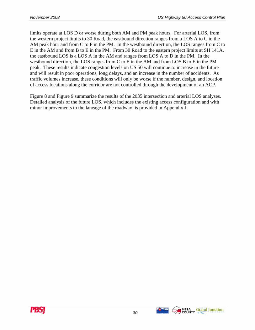
limits operate at LOS D or worse during both AM and PM peak hours. For arterial LOS, from the western project limits to 30 Road, the eastbound direction ranges from a LOS A to C in the AM peak hour and from C to F in the PM. In the westbound direction, the LOS ranges from C to E in the AM and from B to E in the PM. From 30 Road to the eastern project limits at SH 141A, the eastbound LOS is a LOS A in the AM and ranges from LOS A to D in the PM. In the westbound direction, the LOS ranges from C to E in the AM and from LOS B to E in the PM peak. These results indicate congestion levels on US 50 will continue to increase in the future and will result in poor operations, long delays, and an increase in the number of accidents. As traffic volumes increase, these conditions will only be worse if the number, design, and location of access locations along the corridor are not controlled through the development of an ACP. Figure 8 and Figure 9 summarize the results of the 2035 intersection and arterial LOS analyses. Detailed analysis of the future LOS, which includes the existing access configuration and with minor improvements to the laneage of the roadway, is provided in Appendix J.

US Highway 50 Access Control Plan November 2008
31
Figure 8 2035 No-Action Intersection and Arterial Level of Service (AM Peak Hour)

November 2008 US Highway 50 Access Control Plan
32
Figure 9 2035 No-Action Intersection and Arterial Level of Service (PM Peak Hour)

US Highway 50 Access Control Plan November 2008
33
5.0 ACCESS CONTROL TECHNIQUES Several options exist that allow changes to the existing roadway configuration or geometry to assist in the management of the number, frequency, and location of intersections/driveways along a roadway. Each option provides a different means through which access can be managed along a corridor. In addition, each option has unique benefits and can be used in conjunction with other options to help improve traffic flow, operations, and safety while maintaining adequate access to the adjacent land uses. Some of the options for access control include:
• Elimination • Conversion with median treatment • Relocation • Consolidation
Figure 10 provides a brief description of each access control option as well as schematics depicting each option. 5.1.1 Applications of Access Control Techniques on US 50 There are several areas along the US 50 corridor that each of the access control methods can be applied to. Access elimination is typically used at locations where a property has more than one access point. For example, in the more urban sections located in the west side of the study area, there are some properties having multiple access points to US 50. In order to meet the objectives of an ACP to reduce the number of access points for safety and operational reasons, all properties adjacent to US 50 should be limited to a single access in all locations where reasonable access to secondary roads is not possible. The purpose of access conversion through the use of median treatments is to eliminate some or all turning movements in order to reduce the number of conflicts between left turning vehicles and through vehicles on the highway. Based on the access code, full movement intersections should be limited to ½ mile spacing for the majority of the corridor. Santa Clara Avenue and Linden Avenue are examples of locations where future traffic volumes on US 50 will make it difficult for a vehicle to turn left from these access locations. In addition, both of these intersections are about ¼ mile from the nearest full movement intersection that is also signalized. By creating a ¾ movement accesses (left turns are allowed into the driveways, but not out) the number of conflicts will be reduced. The vehicles wanting to turn left from these locations can use parallel roads to travel to adjacent signalized intersections where left turns can be made, which are much safer than at Un-signalized locations. Access relocation is an access control method that would either align opposite approaches to create a more familiar intersection design or move an existing access point to a new location. For example, numerous properties on the eastern limits of the study area are situated close to existing or planned future roads, and currently have driveways with direct access to US 50. The planned Whitewater Frontage Road will allow many of these properties to obtain access from it instead of directly from US 50. As development occurs or as new roads are constructed, many of these direct connection driveways can be closed on US 50 and moved to the new roads. This will create better spacing of intersections and reduce the number of conflict points on US 50.

November 2008 US Highway 50 Access Control Plan
34
Finally, access consolidation is used to reduce the number of access points along the corridor. Several locations along US 50 are prime candidates where access consolidation could be applied. Some locations exist where adjacent property owners have individual driveways less than 50 feet apart, these two driveways could be consolidated into a single point to reduce conflicts, improve operations, and maintain adequate access to all properties.

US Highway 50 Access Control Plan November 2008
35
Figure 10 Access Control Methods

November 2008 US Highway 50 Access Control Plan
36
6.0 PUBLIC INVOLVEMENT PROCESS The State Highway Access Code requires at least one advertised public meeting be held during the development of an ACP. For this particular ACP, a multiple-tiered public involvement process was followed:
• Initial public open house • Second public open house • One-on-one property owner workshops • Final public open house • Website postings
6.1 INITIAL PUBLIC OPEN HOUSE The initial US 50 ACP public open house was held on November 15, 2007, at the Mesa County Fairgrounds in the City of Grand Junction. The open house was advertised via a mailed newsletter, on the project website, print advertisements, and a press release. The purpose of the open house was to introduce the project team, identify the study’s purpose, process, and schedule, and provide information about the methods and benefits of access management, as well as to gather initial comments from the public. Representatives from the City of Grand Junction, Mesa County, CDOT, and the consulting team were on hand to answer questions from those in attendance. A copy of the meeting materials and received comments is in Appendix K of this report. These comments were taken into consideration during the development of the ACP. 6.2 SECOND PUBLIC OPEN HOUSE A second public open house was held on April 3, 2008 at the Mesa County Fairgrounds, in the City of Grand Junction. The open house was advertised via mailed postcards, the project website, print advertisements, and a press release. The purpose of the open house was to share the study team’s recommendations for future changes to US 50 accesses. Representatives from the City of Grand Junction, Mesa County, CDOT, and the consulting team were on hand to answer questions from those in attendance. A copy of the meeting materials and received comments is in Appendix L of this report. In addition, this open house was used to identify individual property owners with the potential for the most significant impact caused by the proposed changes to access. Such property owners were provided the opportunity to meet one-on-one with the project team to discuss their access issues in more detail and to determine the final preferred access alternatives. 6.3 ONE-ON-ONE PROPERTY OWNER WORKSHOPS Several property owners were identified at the second open house as needed additional attention to discuss their specific access issues with the project team. To accommodate these property owners, one-on-one workshops were scheduled for April 17th and July 16th, 2008, at the Mesa County City Hall Building and at the CDOT Region 3 Traffic and Safety Office in Grand Junction. The following property owners took part in the workshops:
• Clymer Way Business Owners • Mesa County Fairgrounds

US Highway 50 Access Control Plan November 2008
37
• Bureau of Land Management Staff from the City of Grand Junction, Mesa County, CDOT, and the consultant team was on hand at the meetings to present the preliminary ACP, listen to comments from the property owners/stakeholders, and when necessary to identify additional access alternatives to address the concerns of the property owners and ensure the goals of the project were meet. The comments from the meetings were used to refine the preliminary ACP and develop a final ACP. A copy of the meeting materials and received comments is in Appendix M of this report. 6.4 THIRD PUBLIC OPEN HOUSE A third public open house was held on August 26th, 2008 at the Mesa County Fairgrounds, in the City of Grand Junction. The open house was advertised via mailed postcards, the project website, print advertisements, and a press release. The purpose of the open house was to share the study team’s final recommendations for future changes to US 50 accesses. Representatives from the City of Grand Junction, Mesa County, CDOT, and the consulting team were on hand to answer questions from those in attendance. A copy of the meeting materials and received comments is in Appendix M of this report. 6.5 WEBSITE POSTINGS A project website was developed for posting information including an overview of the project, the status of the project, newsletters, open house materials, and advertisements for upcoming open house meetings. The information was posted at www.US50Access.com.

November 2008 US Highway 50 Access Control Plan
38
7.0 ACCESS CONTROL PLAN RECOMMENDATIONS The following sections present the recommended ACP based upon the results of the operational analysis, safety study, guidelines from the State Highway Access Code, and input from the public involvement process. The US 50 ACP presented in this section contains the recommendations for the location of existing and future access points as well as the type of traffic control at each intersection. In addition, no new access locations will be allowed along this section of the US 50 corridor without modification to the access control plan. The access points are numbered in Figure 11, Figure 12, and Figure 13, and shown conceptually in Appendix B. Appendix C contains the actual ACP legal description for each access point. The appendix also contains a table that summarizes the access points by their location, by mile point, and the proposed configuration. No capacity improvements were added along the corridor, and a consistent four-lane (two lanes each direction) cross section was assumed for the entire study corridor. The intent of this study was not to identify design elements of access location, such as number, length, and types of auxiliary lanes, but rather the focus is more on where access should be located and what type of turns should be allowed at each location. The exact design elements for each access would be completed through a study conducted at the time of the final design for any access or roadway improvement project. The figures presented in Appendix B are simply for illustrative purposes only and are not to scale. It is important to keep in mind the changes recommended in this study and the legal ACP documents in the appendix will only occur when a project is identified, when funding becomes available, or as redevelopment occurs. There are currently no identified projects or funds for the changes identified within this document. Development is on-going along the corridor and may result in changes contained within this document occurring at any time in the future. 7.1.1 West of Grand Mesa Avenue to Unaweep Avenue
• Access 1: This access will be closed and access will be obtained from High Street. • Access 2: This access will be closed and access will be obtained from High Street. • Access 3 (Grand Mesa Avenue): The addition of median treatments will result in this
access being converted to a right-in, right-out movement. Vehicles wishing to turn left from this street can do so by taking Grand Mesa Avenue to Unaweep and turning left onto US 50. Drivers traveling eastbound wishing to turn onto Grand Mesa Avenue will make a u-turn at Santa Clara Avenue and will return to Grand Mesa Avenue or will turn left onto South Clara and use the adjacent street system to reach their destination.
• Access 168 (High Street): The addition of median treatments will result in this access being converted to a ¾ movement where left turns out will not be allowed. Drivers wishing to turn left from eastbound High Street will have to make a right turn and then make a u-turn at Santa Clara Avenue.
• Access 4: This access will be closed and access will be obtained from Grand Mesa Avenue or Canon Street.
• Access 5: This is a secondary access and will be closed.

US Highway 50 Access Control Plan November 2008
39
• Access 6: This access will ultimately be closed and access will be obtained from High Street.
• Access 7: This is a secondary access and will be closed. • Access 8 (Clymer Way): The addition of median treatments will result in this access
being converted to a right-in only movement. Drivers wishing to exit this area will have to do so from Santa Clara Avenue. Drivers traveling northbound wishing to turn left will have to do so from Santa Clara Avenue.
• Access 9: This existing curb cut will not be allowed as a future access. Access will be obtained from a cross-access agreement with the adjacent property to obtain access at Canon Street.
• Access 10: This existing curb cut will not be allowed as a future access. Access will be obtained from behind the business on Canon Street or on Santa Clara Avenue.
• Access 11: This access will be closed and access will be obtained from Canon Street or Santa Clara Avenue.
• Access 12: This existing curb cut will not be allowed as a future access. Access will be obtained from Santa Clara Avenue.
• Access 13 (Santa Clara Avenue): The addition of median treatments will result in this access being converted to a ¾ movement where left turns out will not be allowed. Drivers wishing to turn left from westbound Santa Clara Avenue will have to do so by traveling to Unaweep Avenue and turning left at the signalized intersection. Drivers wishing to turn left from eastbound Santa Clara Avenue will have to make a right turn and then make a u-turn at Unaweep Avenue. Potential improvement at Unaweep Avenue may be necessary to allow u-turns. Conceptual improvements can be found in Appendix O.
• Access 14: This access will be closed and access will be obtained from Santa Clara Avenue. The properties to the south of this access will need to obtain future access to Santa Clara Avenue via a cross-access agreement.
• Access 15 (Unaweep Avenue/26 ¼ Road): No change will be made to this access. 7.1.2 Unaweep Avenue to 27 Road
• Access 16: This access will be closed and access will be obtained from 26 ¼ Road. • Access 17: Efforts should be made with the property owner to close the existing access
and share an access through a cross-access agreement with the adjacent property at the proposed new Access #177.
• Access 177: A new access is proposed to provide shared access to the properties south of US 50. This location will require coordination efforts with adjacent property owners to share a single access location. The access will be a right-in, right-out driveway. Drivers traveling westbound on US 50 that wish to enter this property will make a u-turn at Unaweep Avenue and return to the driveway. Drivers wishing to turn left out of this property will turn right and will need to make a u-turn at Access #37 or Palmer Street.

November 2008 US Highway 50 Access Control Plan
40
• Access 18: Efforts should be made with the property owner to close the existing access and share an access through a cross-access agreement with the adjacent property at the proposed new Access #177.
• Access 19: Efforts should be made with the property owner to close the existing access and share an access through a cross-access agreement with the adjacent property at the proposed new Access #179.
• Access 179: A new access is proposed to provide shared access to the properties south of US 50. This location will require coordination efforts with adjacent property owners to share a single access location. The access will be a right-in right-out driveway. Drivers traveling westbound on US 50 that wish to enter this property will make a u-turn at Unaweep Avenue and return to the driveway. Drivers wishing to turn left out of this property will turn right and will need to make a u-turn at Access #37 or Palmer Street.
• Access 20 (James Court): The addition of median treatments will result in this access being converted to a right-in, right-out movement. Drivers wishing to turn left from James Court will have to travel to Unaweep Avenue and make a u-turn. Drivers travelling westbound wishing to turn left onto the street will have to make a u-turn at Palmer Street and return westbound to James Court.
• Access 21: Efforts should be made with the property owner to close the existing access and share an access through a cross-access agreement with the adjacent property at the proposed new Access #179. Alternative access should be obtained from 26 ¼ Road if possible.
• Access 22: This access will be closed and access will be obtained from James Court. • Access 23: Efforts should be made with the property owner to close the existing access
and share an access through a cross-access agreement with the adjacent property at the proposed new Access #178.
• Access 178: A new access is proposed to provide shared access to the properties south of US 50. This location will require coordination efforts with adjacent property owners to share a single access location. The access will be a right-in, right-out driveway. Drivers traveling westbound on US 50 that wish to enter this property will make a u-turn at Unaweep Avenue and return to the driveway. Drivers wishing to turn left out of this property will turn right and will need to make a u-turn at Access #37.
• Access 24: This is a secondary access and will be closed. • Access 25: This access will be closed and access will be obtained from James Court. • Access 26: Efforts should be made with the property owner to close the existing access
and share an access through a cross-access agreement with the adjacent property at the proposed new Access #178.
• Access 27: Efforts should be made with the property owner to close the existing access and share an access through a cross-access agreement with the adjacent property at the proposed new Access #181.
• Access 28: Efforts should be made with the property owner to close the existing access and share an access through a cross-access agreement with the adjacent property at the proposed new Access #180.

US Highway 50 Access Control Plan November 2008
41
• Access 180: A new access is proposed to provide shared access to the properties south of US 50. This location will require coordination efforts with adjacent property owners to share a single access location. The access will be a right-in, right-out driveway. Drivers traveling westbound on US 50 that wish to enter this property will make a u-turn at Unaweep Avenue and return to the driveway. Drivers wishing to turn left out of this property will turn right and will need to make a u-turn at Access #37 or Palmer Street.
• Access 29: This is a secondary access and will be closed. • Access 30: Efforts should be made with the property owner to close the existing access
and share an access through a cross-access agreement with the adjacent property at the proposed new Access #180.
• Access 181: A new access is proposed to provide shared access to the properties north of US 50. This location will require coordination efforts with adjacent property owners to share a single access location. The access will be a right-in, right-out driveway. Drivers traveling eastbound on US 50 that wish to enter this property will make a u-turn at Access #37 and return to the driveway. Drivers wishing to turn left out of this property will turn right and will need to make a u-turn at Unaweep Avenue.
• Access 31: Efforts should be made with the property owner to close the existing access and share an access through a cross-access agreement with the adjacent property at the proposed new Access #181.
• Access 32: This is a secondary access and will be closed. • Access 33: No changes will be made to this access. • Access 34: This is a secondary access and will be closed. • Access 35: This is a secondary access and will be closed. • Access 36: The addition of median treatments will result in this access being converted
to a ¾ movement. Drivers wishing to turn left from the property will have to turn right, travel to Palmer Street and make a u-turn.
• Access 37: The addition of median treatments will result in this access being converted to a ¾ movement. Drivers wishing to turn left from the property will turn right, travel to Unaweep Avenue and make a u-turn. Efforts should be made with property owners to create an alternative access from the adjacent property onto Aspen Street through a cross-access agreement.
• Access 38: This is a secondary access and will be closed. • Access 39: This is a secondary access and will be closed. • Access 40: This access will be closed and access will be obtained from Aspen Street. • Access 41: This access will be closed and access will be obtained from Aspen Street. • Access 42 (Aspen Street): The addition of median treatments will result in this access
being converted to a right-in, right-out movement on both the north and south sides of US 50. Drivers traveling eastbound on US 50 that wish to turn onto the north leg of Aspen Street will make a u-turn at Palmer Street and return to the intersection. Drivers wishing to make a left turn off the north leg will turn right, travel to Access #36 and make a u-turn. Drivers traveling westbound on US 50 that wish to turn onto the south leg of Aspen Street will make a u-turn at Access #36 and return to the intersection. Drivers wishing to

November 2008 US Highway 50 Access Control Plan
42
make a left turn off the south leg will turn right, travel to Palmer Street and make a u-turn.
• Access 43: This access will be closed and access will be obtained from Unaweep Avenue.
• Access 44: This access will be closed and access will be obtained from Aspen Street or Dominguez Avenue.
• Access 45 (Palmer Street): The south leg of this access will be improved to provide access to properties south of US 50. This intersection will be signalized when traffic volumes warrant it in the future.
• Access 46 (Palisade Street): The addition of median treatments will result in this access being converted to a right-in, right-out movement. Drivers wishing to turn left from the access will have to turn right, travel to Palmer Street and make a u-turn. Drivers travelling eastbound wishing to turn left will have to make a u-turn at Linden Avenue.
• Access 47: This access will be closed and access will be obtained from Linden Avenue. • Access 48 (Linden Avenue): The addition of median treatments will result in this access
being converted to a ¾ movement. Drivers on the north leg of the intersection that wish to turn left onto US 50 will turn right and make a u-turn at Palmer Street or may use the adjacent street system to turn left onto US 50 from 27 Road. Drivers on the south leg of the intersection that wish to turn left may use the future planned road that will connect Linden Avenue to Palmer Street and will turn left onto US 50 at the signal.
• Access 49 (B ¾ Road): This access will be closed and access will be obtained from Linden Avenue.
• Access 50: Efforts should be made with the property owner to close the existing access and share an access through a cross-access agreement with the adjacent property at the proposed new Access #182.
• Access 182: A new access is proposed to provide shared access to the properties north of US 50. This location will require coordination efforts with adjacent property owners to share a single access location. The access will be a right-in, right-out driveway. Drivers traveling eastbound on US 50 that wish to enter this property will make a u-turn at 27 Road and return to the driveway. Drivers wishing to turn left out of this property will turn right and will need to make a u-turn at Linden Avenue
• Access 51: This is a secondary access and will be closed. • Access 52: This access will be closed and access will be obtained from Linden Avenue,
or new shared access should be obtained through a cross-access agreement with the adjacent property at the proposed new Access #170.
• Access 170: A new access is proposed to provide shared access to multiple properties south of US 50. This location will require coordination efforts with adjacent property owners to share a single access location. The access will be a right-in, right-out driveway. Drivers traveling westbound on US 50 that wish to enter this property will make a u-turn at Linden Avenue and return to the driveway. Drivers wishing to turn left out of this property will turn right and will need to make a u-turn at 27 Road.

US Highway 50 Access Control Plan November 2008
43
• Access 53: Efforts should be made with the property owner to close the existing access and share an access through a cross-access agreement with the adjacent property at the proposed new Access #170.
• Access 54: No changes will be made to this access. • Access 55: This is a secondary access and will be closed. • Access 56: No changes will be made to this access. • Access 57: No changes will be made to this access. • Access 58 (27 Road): No changes will be made to this access.

November 2008 US Highway 50 Access Control Plan
44
This page intentionally left blank.

US Highway 50 Access Control Plan November 2008
45
Figure 11 Recommended Access Points

November 2008 US Highway 50 Access Control Plan
46
Figure 12 Recommended Access Points

US Highway 50 Access Control Plan November 2008
47
Figure 13 Recommended Access Points

November 2008 US Highway 50 Access Control Plan
48
This page intentionally left blank.

US Highway 50 Access Control Plan November 2008
49
7.1.3 27 Road to 28 ½ Road • Access 59: This is a secondary access and will be closed. • Access 60: Efforts should be made with the property owner to close the existing access
and share an access through a cross-access agreement with the adjacent property at the proposed new Access #188 or access can be obtained from Sherman Drive.
• Access 188: A new access is proposed to provide shared access to the properties north of US 50. This location will require coordination efforts with adjacent property owners to share a single access location. The access will be a right-in, right-out driveway. Drivers traveling eastbound on US 50 that wish to enter this property will make a left turn at 27 Road and access the property from Sherman Drive. Drivers wishing to turn left out of this property will turn right and will need to make a u-turn at 27 Road.
• Access 61: This access will be closed and access will be obtained through a cross-access agreement with the adjacent property from existing Access #63 or from 27 Road.
• Access 62: Efforts should be made with the property owner to close the existing access and share an access through a cross-access agreement with the adjacent property at the proposed new Access #188 or access can be obtained from Sherman Drive.
• Access 63: No changes will be made to this access. • Access 64: Efforts should be made with the property owner to close the existing access
and share an access through a cross-access agreement with the adjacent property at the proposed new Access #189 or access can be obtained from Sherman Drive.
• Access 189: A new access is proposed to provide shared access to the properties north of US 50. This location will require coordination efforts with adjacent property owners to share a single access location. The access will be a right-in, right-out driveway. Drivers traveling eastbound on US 50 that wish to enter this property will make a left turn at 27 Road and access the property from Sherman Drive. Drivers wishing to turn left out of this property will turn right and will need to make a u-turn at 27 Road.
• Access 65: Efforts should be made with the property owner to close the existing access and share an access through a cross-access agreement with the adjacent property at the proposed new Access #189 or access can be obtained from Sherman Drive.
• Access 66: This is a secondary access and will be closed. • Access 67: This access will ultimately be closed and access will be obtained from the
Frontage Road or B ½ Road. • Access 68: No changes will be made to this access. • Access 69: This is a secondary access and will be closed. • Access 70: This is a secondary access and will be closed. • Access 71: This is a secondary access and will be closed. • Access 72 (Dorothy Avenue/Frontage Road): The addition of median treatments will
result in this access being converted to a right-in, right-out movement on both the north and south sides of US 50. Drivers traveling eastbound on US 50 that wish to turn onto the north leg of Dorothy Avenue will turn at 27 Road and take Sherman Drive to reach Dorothy Avenue. Drivers wishing to make a left off the north leg of Dorothy Avenue will have to take Sherman Drive to 27 Road and can make a left turn onto US 50 at the

November 2008 US Highway 50 Access Control Plan
50
signal. Drivers traveling westbound on US 50 that wish to turn onto the south left of the Frontage Road will make a u-turn at 27 Road and return to the intersection. Drivers wishing to turn left off the south leg will have to take B ½ Road to 27 Road and make a left onto US 50 at the signal.
• Access 73: This is a secondary access and will be closed. • Access 74: Efforts should be made with the property owner to close the existing access
and share an access through a cross-access agreement with the adjacent property at the proposed new Access #171 or access can be obtained from Dorothy Avenue.
• Access 75: This is a secondary access and will be closed. • Access 171: A new access is proposed to provide shared access to the properties north of
US 50 through a cross-access agreement. This location will require coordination efforts with adjacent property owners to share a single access location. The access will be a right-in, right-out driveway. Drivers traveling eastbound on US 50 that wish to enter this property will make a u-turn at 27 ¾ Road and return to the driveway. Drivers wishing to turn left out of this property will turn right and will need to make a u-turn at 27 Road.
• Access 76 (B ½ Road/EB Off-ramp): No changes will be made to this access. • Access 190: A new access will be created to provide access to the properties north of US
50 at this location. This access will be a right-in, right-out driveway. Drivers traveling eastbound that wish to make a left turn will make a u-turn at 27 ¾ Road and return to the intersection. Drivers wishing to make a left turn out of this property will turn right, travel to 27 Road and make a u-turn.
• Access 77: Efforts should be made with the property owner to close the existing access and share an access with the adjacent property at the proposed new Access #190.
• Access 78: This access will be closed and access will be obtained from Sherman Drive. • Access 79 (B ½ Road/EB On-ramp): This ramp will be closed if improvements are made
at the intersection of B ½ Road and the US 50 ramp. Conceptual designs are shown in Appendix O, which show improvements that convert the ramp to a one-way in the eastbound direction only. Drivers wishing to travel eastbound on US 50 from B ½ Road will have to travel to 27 ¾ Road and turn left at the signal.
• Access 80 (B ½ Road/WB On-ramp): This access will be closed and access will be relocated to Access #192.
• Access 192: A new intersection has been proposed to provide access for the properties north of US 50. This access will be a right-out movement only and will provide the same level of access as Access #80, but will be a stop controlled intersection on the approach street instead of a ramp.
• Access 81 (Frontage Road): The north leg of this access will be closed as part of the improvements recommended at the US 50 Ramp and B ½ Road intersection. Drivers wishing to turn into or out of this access will have to do so from 27 ¾ Road. On the south leg of the access, the addition of median treatments will result in this access being converted to a ¾ movement, where left turns out of the intersection will not be allowed. Drivers that wish to turn left off this road will turn right, travel to 27 ¾ Road and make a u-turn.

US Highway 50 Access Control Plan November 2008
51
• Access 82 (27 ¾ Road): The south leg of this intersection will be improved to create a four-leg intersection and the South Frontage Road will be closed. This intersection will be signalized when traffic volumes warrant it in the future.
• Access 83: The addition of median treatments will result in this access being converted to a ¾ movement, where left turns out of the intersection will not be allowed. Drivers that wish to turn left from this access will do so from Access #82, which will be the future primary exit from the property.
• Access 166: A new access is proposed to provide shared access to the properties south of US 50 through a cross-access agreement. This location will require coordination efforts with adjacent property owners to share a single access location. The access will be a right-in, right-out driveway. Drivers traveling westbound on US 50 that wish to enter this property will make a u-turn at Access #83 and return to the driveway. Drivers wishing to turn left out of this property will turn right and will need to make a u-turn at 28 ½ Road.
• Access 84: This access will ultimately be closed and access will be obtained from B Road.
• Access 85: Efforts should be made with the property owner to close the existing access and share an access through a cross-access agreement with the adjacent property at the proposed new Access #172.
• Access 172: A new access is proposed to provide shared access to the properties south of US 50. This location will require coordination efforts with adjacent property owners to share a single access location. The access will be a right-in, right-out driveway. Drivers traveling westbound on US 50 that wish to enter this property will make a u-turn at Access #83 or 27 ¾ Road and return to the driveway. Drivers wishing to turn left out of this property will turn right and will need to make a u-turn at 28 ½ Road.
• Access 86 (28 ½ Road): This intersection was signalized during the US 50 ACP project. No other changes will be made to this access.
7.1.4 28 ½ Road to 29 ½ Road
• Access 87: This is a secondary access and will be closed. • Access 88: This access will be closed and access can be obtained from B Road. • Access 89 (Rainbow Drive): This access will be closed. Drivers wishing to turn into or
out of this access can do so using 28 ½ Road and South Frontage Road. • Access 90 (Tennessee Street): This access will be closed. Drivers wishing to turn into or
out of this access can do so using B Road or Indiana Street. • Access 91 (Indiana Street): No changes will be made to this access. • Access 92: This access will be closed and access will be obtained from Indiana Street. • Access 93: This access will be closed and access will be obtained from Elm Drive. • Access 94 (Dee Vee Road): The addition of median treatments will result in this access
being converted to a right-in right-out movement. Drivers travelling westbound wishing to turn left will have to travel to 28 ½ Road and make a u-turn. Drivers that wish to turn left out of the access will have to turn right, travel to 29 Road and make a u-turn or may use local streets to access 28 ½ Road and turn left at the signal.

November 2008 US Highway 50 Access Control Plan
52
• Access 95 (Elm Drive): This access will be closed and access will be obtained by turning right onto Indiana Street, right onto B Road and then accessing Elm Drive.
• Access 96: Efforts should be made with the property owner to close the existing access and share an access through a cross-access agreement with the adjacent property at the proposed new Access #184.
• Access 184: A new access is proposed to provide shared access to the properties north of US 50. This location will require coordination efforts with adjacent property owners to share a single access location. The access will be a right-in, right-out driveway. Drivers traveling eastbound on US 50 that wish to enter this property will make a u-turn at 29 Road and return to the driveway. Drivers wishing to turn left out of this property will turn right and will need to make a u-turn at 28 ½ Road.
• Access 97: This access will be closed and access will be obtained from existing Access #94.
• Access 98: Efforts should be made with the property owner to close the existing access and share an access through a cross-access agreement with the adjacent property at the proposed new Access #184.
• Access 99: Efforts should be made with the property owner to close the existing access and share an access through a cross-access agreement with the adjacent property at the proposed new Access #183.
• Access 183: A new access is proposed to provide shared access to the properties north of US 50. This location will require coordination efforts with adjacent property owners to share a single access location. The access will be a right-in, right-out driveway. Drivers traveling eastbound on US 50 that wish to enter this property will make a u-turn at 29 Road and return to the driveway. Drivers wishing to turn left out of this property will turn right and will need to make a u-turn at 28 ½ Road.
• Access 100: Efforts should be made with the property owner to close the existing access and share an access through a cross-access agreement with the adjacent property at the proposed new Access # 183.
• Access 101: This is a secondary access and will be closed. • Access 102: Efforts should be made with the property owner to close the existing access
and relocate the access to Landsdown Road. • Access 103 (Reta Drive): No changes will be made to this access. • Access 104 (Landsdown Road): No changes will be made to this access. • Access 105: This is a secondary access and will be closed. • Access 106: No changes will be made to this access. • Access 107: This access will ultimately be closed and access will be obtained from 29
Road. • Access 108 (29 Road): No changes will be made to this access. • Access 109: This access will ultimately be closed and access will be obtained from 29
Road. • Access 110: This access will be closed and access will be obtained from the north leg of
Access #111.

US Highway 50 Access Control Plan November 2008
53
• Access 111 (Sundance Drive): The north leg of this intersection will be improved to convert this intersection from a full movement T-intersection to a four-leg intersection. This access may be subject to turning movement restrictions or potential closure depending on future improvements to the south leg of 29 Road.
• Access 112: This access will ultimately be closed and access will be obtained from the north leg of Access #111.
• Access 113: No changes will be made to this access. • Access 114: Efforts should be made with the property owner to close the existing access
and share an access through a cross-access agreement with the adjacent property owner at Access #117.
• Access 115: Efforts should be made with the property owner to close the existing access and share an access through a cross-access agreement with the adjacent property owner at Access #117.
• Access 116: This access will be closed and access will be obtained from Red Rock Drive.
• Access 117: No changes will be made to this access. Efforts should be made with the property owner to share this access through a cross-access agreement with the adjacent property owners. .
• Access 118: Efforts should be made with the property owner to close the existing access and share an access through a cross-access agreement with the adjacent property owner at Access #117.
• Access 119 (Red Rock Road): No changes will be made to this access. • Access 120: This access will be closed. Drivers wishing to access this property will do
so using Lantzer Drive and local streets to the north of the property. • Access 121: This access will be closed. Drivers wishing to access this property will do
so using Lantzer Drive and local streets to the north of the property. • Access 122: This access will be closed. Drivers wishing to access this property will do
so through a cross-access agreement with the adjacent property owner and using Lantzer Drive and local streets to the north of the property.
• Access 123: This access will be closed and access will be obtained from Red Rock Drive.
• Access 124 (29 ¼ Road): The addition of median treatments will result in this access being converted to a right-in, right-out movement. Drivers travelling westbound wishing to turn left will have to make a u-turn at Sundance Road and return to the access. Drivers wishing to turn left out of the access will need to turn right, travel to 29 ½ Road and make a u-turn.
• Access 125: This access will be closed. Access to this property has been proposed to be obtained from Jon Hall Road and local streets to the north.
• Access 126: Efforts should be made with the property owner to close the existing access and share an access through a cross-access agreement with the adjacent property at the proposed new Access #173.

November 2008 US Highway 50 Access Control Plan
54
• Access 127: This field access will be converted to a shared access for the properties north of US 50. This location will require coordination efforts with adjacent property owners to share a single access location. The access will be a right-in, right-out driveway. Drivers traveling eastbound on US 50 that wish to enter this property will make a u-turn at 29 ½ Road and return to the driveway. Drivers wishing to turn left out of this property will turn right and will need to make a u-turn at Sundance Road.
• Access 128: Efforts should be made with the property owner to close the existing access and share an access through a cross-access agreement with the adjacent property at the proposed new Access #173.
• Access 129: This is a secondary access and will be closed. • Access 130: This access will be closed and access will be obtained from 29 ½ Road. • Access 131 (29 ½ Road): This intersection will be signalized when traffic volumes
warrant it in the future. This intersection will be converted to a T-intersection by removing the south leg from the existing configuration. The intersection of A ½ Road with the north leg of 29 ½ Road will be closed.
• Access 167: The south leg of the 29 ½ Road intersection will be closed. Access to and from the South Frontage Road will be obtained from Access #124 or Access #176.
7.1.5 29 ½ Road to 31 Road
• Access 132: This is a secondary access and will be closed. • Access 133: This is a secondary access and will be closed. • Access 134: This access will be closed and access will be obtained from A ½ Road. • Access 135 (29 ¾ Road): The addition of median treatments will result in the north leg
of this access being converted to a ¾ movement. Drivers wishing to turn left from the access will have to turn right, travel to 29 ½ Road and make a u-turn. The addition of median treatments will result in the south leg of this access being converted to a right-in, right-out movement. Drivers wishing to turn left from the access will have to turn right, travel to 30 Road and make a u-turn. Drivers traveling westbound wishing to turn left will travel to 29 ½ Road and make a u-turn.
• Access 136 (30 Road): This intersection will be signalized when traffic volumes warrant it in the future. A south leg will be added to improve access south of US 50.
• Access 137: This access will be closed and access will be obtained from A ½ Road. • Access 138 (Frontage Road): This access will be closed and access will be obtained
when the fourth leg is constructed at 30 Road. Drivers wishing to turn into or out of this access will have to do so from 30 Road.
• Access 139: Efforts should be made with the property owner to close the existing access and create a new, shared access through a cross-access agreement on 31 Road.
• Access 140: This access will be closed and access will be obtained from 30 ¾ Road. • Access 141: Efforts should be made with the property owner to close the existing access
and create a new, shared access through a cross-access agreement on 31 Road. • Access 142: This access will be closed and access will be obtained from 30 ¾ Road.

US Highway 50 Access Control Plan November 2008
55
• Access 143 (31 Road): This intersection will be signalized when traffic volumes warrant it in the future.
7.1.6 31 Road to Willow Bend Road
• Access 144: The addition of median treatments will result in this access being converted to a right-in, right-out movement. Drivers travelling eastbound wishing to turn left will have to travel to SH 141B and make a u-turn. Drivers wishing to turn left from the access will have to turn right, drive to 31 Road and make a u-turn.
• Access 145 (32 Road/SH 141B): No changes will be made to this access. • Access 146: This access will be closed and property access will be relocated off a future
new roadway, which will connect to US 50 at Access #174. • Access 174: A new intersection has been proposed to provide access to the properties
south of US 50. The exact location of this intersection will be determined during the property site design phase and may require modification to the ACP. This intersection will be a full movement T-intersection and may be signalized in the future when traffic volumes warrant.
• Access 147: This field access will be closed. • Access 148: No changes will be made to this access. • Access 149: This access will be closed when access to the property can be obtained from
planned future roadways through a cross-access agreement. • Access 150: This is a secondary access and will be closed. • Access 151 (Willow Bend Road/Residential Access): This intersection will be signalized
when traffic volumes warrant it in the future. 7.1.7 Willow Bend Road to SH 141A
• Access 152: This access will be closed when access to the property can be obtained from planned future roadways through a cross-access agreement.
• Access 153: This field access will be closed. • Access 175: A new intersection has been proposed to provide access to the properties
north and south of US 50. The exact location of this intersection will be determined during the project design phase and may require modification to the ACP. This intersection will be full movement and may be signalized in the future when traffic conditions warrant.
• Access 154: This access will be closed when access to the property can be obtained from planned future roadways through a cross-access agreement.
• Access 155: This access will be ultimately closed and access will be obtained from planned future roadways through a cross-access agreement.
• Access 156: This access will be closed when access to the property can be obtained from planned future roadways through a cross-access agreement.
• Access 157: This access will be closed when access to the property can be obtained from planned future roadways.

November 2008 US Highway 50 Access Control Plan
56
• Access 158: This is a secondary access and will be closed. • Access 159 (1st Street): This access will be closed and access to US 50 will be obtained
from future roadways. Drivers wishing to turn into or out of this access will have to do so from Access #175.
• Access 160: This access will be closed when access to the property can be obtained from planned future roadways.
• Access 161: This access will be closed when access to the property can be obtained from planned future roadways.
• Access 162: This access will be closed when access to the property can be obtained from planned future roadways.
• Access 163 (3rd Street): This access will be closed and access to US 50 will be obtained from future roadways. Drivers wishing to turn into or out of this access will have to do so from Access #175 or Access #165.
• Access 164 (Reeder Mesa Road): This T-intersection will be signalized when traffic volumes warrant it in the future.
• Access 165 (SH 141A): This T-intersection will be signalized when traffic volumes warrant it in the future.
7.2 FUTURE TRAFFIC CONDITIONS WITH ACP IMPLEMENTATION Once the final configuration for each access point was identified, another LOS analysis was conducted. This LOS analysis reflects the proposed access changes to the corridor. Figure 14 and Figure 15 contain the intersection and arterial LOS, and detailed analysis of the future LOS with the recommended access changes is provided in Appendix N. These results show that for the majority of intersections the LOS is projected to be better than if no ACP is implemented. There are a few intersections that still have LOS D or worse; however, these LOS are most likely related to a lack of capacity rather than access issues. This study did not focus on the operations or specific design of each individual access point. The actual design of the access will be determined at the time of final design and through the completion of a detailed traffic analysis, which may produce differing LOS values than the limited analysis performed in this study. As for the arterial LOS, most of the corridor operates at nearly an acceptable LOS values (LOS D or better) with a few exceptions, such as near the more urban sections on the west end of the study area. Again, these poor LOS values are most likely the result of limited capacity in these locations and not directly related to an access issue.

US Highway 50 Access Control Plan November 2008
57
Figure 14 Traffic Conditions (Year 2035) after ACP Implementation (AM Peak Hour)

November 2008 US Highway 50 Access Control Plan
58
Figure 15 Traffic Conditions (Year 2035) after ACP Implementation (PM Peak Hour)

US Highway 50 Access Control Plan November 2008
59
8.0 NEXT STEPS According to the State Highway Access Code, CDOT is required to provide reasonable highway access to individual properties, when no reasonable alternative access to the general street system exists, and has the ability to modify existing accesses for safety and operational reasons. In addition, recommendations may include the restriction of access to something less than existing conditions. Changes in access are covered in Section 2.6, “Changes in Land Use and Access Use” (p. 25, paragraph 7) in the State Highway Access Code:
The Department or issuing authority may, when necessary for the improved safety and operation of the roadway, rebuild, modify, remove, or relocate any access, or redesign the highway including any auxiliary lane and allowable turning movement. The permittee and or current property owner will be notified of the change. Changes in roadway median design that may affect turning movements normally will not require a license modification hearing as an access permit confers no private rights to the permittee regarding the control of highway design or traffic operation even when that design affects access turning movements.
The study corridor is in need of access control from an operational standpoint, as well as based on the standards set forth in the State Highway Access Code. According to Section 2.12, “Access Control Plans” (p. 30, paragraph 2) of the State Highway Access Code:
The access control plan shall indicate existing and future access locations and all access related roadway access design elements, including traffic signals, that are to be modified and reconstructed, relocated, removed, added, or remain.
The outcome of this study is the US 50 ACP, which identifies the number, location, and type of access points that will be allowed on US 50 within the study limits. However, future changes to the plan are allowed based upon the guidelines of the State Highway Access Code, according to Section 2.12, “Access Control Plans”, (p. 30, paragraph 3):
The plan must receive the approval of both the Department and the appropriate local authority to become effective. This approval shall be in the form of a formal written agreement signed by the local authority and the Chief Engineer of the Department. After an access control plan is in effect, modifications to the plan must receive the approval of the local authority and the Department. Where an access control plan is in effect, all action taken in regard to access shall be in conformance with the plan and current Code design standards unless both the Department and the local authority approve a geometric design waiver under the waiver subsection of the Code.
This document describes the process of developing an ACP for US 50. There are several important steps that need to occur in the short term and long range to ensure the corridor realizes the maximum benefit of the recommended ACP. These next steps start with the approval process. 8.1 APPROVAL PROCESS Before the corridor can begin to benefit from the recommendations of the ACP, a few important events must occur.

November 2008 US Highway 50 Access Control Plan
60
1. Inter-governmental Agreement (IGA) – All parties must develop and agree to an IGA. (See Appendix D for a copy of the draft IGA)
2. Plan Approval – The ACP must be approved by each entity. This includes CDOT, the County Commissioners, City Council, Mayor, and Legal Counsel.
3. Plan briefing to the State Transportation Commission. 4. Plan Adoption - All parties must sign the IGA and put the plan into law. 5. Approval by the Chief Engineer of the Department of Transportation.
Once the ACP is officially adopted by CDOT, Mesa County, and the City of Grand Junction, the adopted ACP becomes the basis for future decisions on site access. The current US 50 ACP, as identified in this document, does not have any implementation timing or schedule. 8.2 PLAN IMPLEMENTATION As for the long term, CDOT, Mesa County, and the City of Grand Junction should work together to identify opportunities to implement portions of the final ACP. Implementation of the full plan at a single time is unlikely to be feasible, but highway improvement projects or development along the corridor may provide the agencies with a means through which the plan can be implemented. The improvements recommended in the ACP will be implemented when one of the following actions occur:
1. US 50 Highway Improvement Project – This would be a publicly funded project by any combination of CDOT, County, or City. A future public project would include the access changes described in the ACP. There are currently no projects planned for this portion of US 50. This means there is not a project on the Long Range Transportation Plan, the Fiscally Constrained Plan, or the currently funded Statewide Transportation Improvement Plan. Currently, it is unlikely that a project will occur soon. Highway projects take many years to identify, fund, and construct. Under this scenario, it would be government’s responsibility to make the access changes.
2. Private Property Redevelopment – The proposed access changes would occur if any
property along US 50 was redeveloped or if a driveway experienced a traffic volume increase of 20 percent or more (per the State Highway Access Code). Under this scenario, it would be the property owner’s or the developer’s responsibility to make the access changes. Within Grand Junction city limits, private developers are required to pay the City of Grand Junction development fees that will fund necessary roadway improvements due to the impact of the development. At the time of this study, one project was in the process of potentially affecting accesses along US 50, which is the Alpine Bank development between Palmer Street and Linden Avenue.

US Highway 50 Access Control Plan November 2008
61
9.0 REFERENCES LSC Transportation Consultants, Inc. (2007). Alpine Bank Orchard Mesa Updated Traffic
Impact Analysis. State Highway Access Category Assignment Schedule. 2003. 2 CCR §601-1a. 30 October 2007. State Highway Access Code. 1998. 2 CCR §601-1. March 2002. Transportation Research Board. (2000). Highway capacity manual. Washington, D.C.: National
Academy of Sciences.

November 2008 US Highway 50 Access Control Plan
62
This page intentionally left blank.

Appendix A Existing Roadway/Access Configuration

Appendix B Recommended Roadway/Access
Configuration

Appendix C Access Control Plan (ACP)

Access Control Plan US Highway 50
West of Grand Mesa Avenue to SH 141A in Whitewater
* The type, number, and length of lanes will be determined by a separate traffic study to be done at the time of actual design and implementation of the plan.
Access Milepost Side Access Description
Existing Configuration Proposed Configuration and Conditions for Change*
1 32.684 South Driveway Un-signalized Right-in, right-out
Close driveway since this property has alternative access via an alley to High Street.
2 32.692 South Business Access
Un-signalized Right-in, right-out Close access since this property has alternative access to High Street.
3 32.700 North Grand Mesa Avenue
Un-signalized Full Movement
Add channelizing treatment to median to eliminate left turn movement onto and off of US 50 creating a right-in, right-out access.
168 32.701 South High Street Un-signalized Full Movement
Add channelizing treatment to median to eliminate left turn movement onto US 50 creating a 3/4 movement intersection.
4 32.715 North Business Access
Un-signalized Right-in, right-out Close access since this property has alternative access to Canon Street.
5 32.717 South Business Access
Un-signalized Right-in, right-out Close access since this property has alternative access to High Street.
6 32.726 South Business Access
Un-signalized Right-in, right-out Close access since this property has alternative access to High Street.
7 32.741 South Business Access
Un-signalized Right-in, right-out Close access since this property has alternative access to High Street.
8 32.743 South Clymer Way Un-signalized Full Movement
Add channelizing treatment to median to eliminate left turn movement onto and off of US 50 and convert access to right-in only.
9 32.754 North Curb-cut Un-signalized Right-in, right-out
Close access; access to this property will be via a cross-access agreement obtained at Canon Street.
10 32.785 North Curb-cut Un-signalized Right-in, right-out Close access since this property has alternative access to Canon Street.
11 32.790 North Business Access
Un-signalized Right-in, right-out Close access since this property has alternative access to Canon Street.
12 32.814 South Curb-cut Un-signalized Right-in, right-out
Close access since this property has alternative access to Santa Clara Avenue.
13 32.832 Both Santa Clara Avenue
Un-signalized Full Movement
Add channelizing treatment to median to eliminate left turn movement onto US 50 creating a 3/4 movement intersection.
14 32.858 South Field Access Un-signalized Right-in, right-out
Close access since this property has alternative access to Santa Clara Avenue.

Access Control Plan US Highway 50
West of Grand Mesa Avenue to SH 141A in Whitewater
* The type, number, and length of lanes will be determined by a separate traffic study to be done at the time of actual design and implementation of the plan.
Access Milepost Side Access Description
Existing Configuration Proposed Configuration and Conditions for Change*
15 32.949 Both Unaweep
Avenue/26 ¼ Road
Signalized Full Movement
Remains the same.
16 32.972 South Business Access
Un-signalized Right-in, right-out Close access since this property has alternative access to 26 ¼ Road.
17 33.021 South Business Access
Un-signalized Right-in, right-out Close access; access will be provided with the addition of Access 177.
177 33.037 South Combined Access Right-in, right-out access to be added through a cross-access agreement
when redevelopment of adjacent properties occurs.
18 33.041 South Business Access
Un-signalized Right-in, right-out Close access; access will be provided with the addition of Access 177.
19 33.048 South Business Access
Un-signalized Full Movement
Close access; access will be provided with the addition of Access 179.
179 33.049 South Combined Access Right-in, right-out access to be added through a cross-access agreement
when redevelopment of adjacent properties occurs.
20 33.049 North James Court Un-signalized Full Movement
Add channelizing treatment to median to eliminate left turn movement onto and off of US 50 creating a right-in, right-out access.
21 33.064 South Business Access
Un-signalized 3/4 Movement
Close access; access will be provided with the addition of Access 179 or new access via 26 ¼ Road.
22 33.073 North Driveway Un-signalized Right-in, right-out Close access since this property has alternative access to James Court.
23 33.093 South Residential Access
Un-signalized Right-in, right-out Close access; access will be provided with the addition of access 178
178 33.097 South Combined Access Right-in, right-out access to be added through a cross-access agreement
when redevelopment of adjacent properties occurs.
24 33.100 South Business Access
Un-signalized Right-in, right-out Close access; access will be provided with the addition of access 178.
25 33.101 North Driveway Un-signalized Right-in, right-out Close access; since this property has alternative access to James Court.

Access Control Plan US Highway 50
West of Grand Mesa Avenue to SH 141A in Whitewater
* The type, number, and length of lanes will be determined by a separate traffic study to be done at the time of actual design and implementation of the plan.
Access Milepost Side Access Description
Existing Configuration Proposed Configuration and Conditions for Change*
26 33.112 South Business Access
Un-signalized Right-in, right-out Close access; access will be provided with the addition of access 178.
27 33.121 North Driveway Un-signalized Right-in, right-out Close access; access will be provided with the addition of access 181.
28 33.124 South Driveway Un-signalized Right-in, right-out Close access; access will be provided with the addition of Access 180.
180 33.126 South Combined Access Right-in, right-out access to be added through a cross-access agreement
when redevelopment of adjacent properties occurs.
29 33.137 North Driveway Un-signalized Right-in, right-out Close access; access will be provided with the addition of 181.
30 33.140 South Business Access
Un-signalized Right-in, right-out Close access; access will be provided with the addition of Access 180.
181 33.143 North Combined Access Right-in, right-out access to be added through a cross-access agreement
when redevelopment of adjacent properties occurs.
31 33.149 North Driveway Un-signalized Right-in, right-out Close access; access will be provided with the addition of 181.
32 33.152 North Business Access
Un-signalized Right-in, right-out Close access; since this property has alternative access at access 37.
33 33.155 South Driveway Un-signalized Right-in, right-out Remains the same.
34 33.165 South Driveway Un-signalized Right-in, right-out Close access since this property has alternative access at Access 33.
35 33.167 South Business Access
Un-signalized Full Movement
Close access since this property has alternative access at Access 37.
36 33.177 South Driveway Un-signalized Full Movement
Add channelizing treatment to median to eliminate left turn movement onto US 50 creating a 3/4 movement intersection.
37 33.185 North Driveway Un-signalized Full Movement
Add channelizing treatment to median to eliminate left turn movement onto US 50 creating a 3/4 movement intersection.

Access Control Plan US Highway 50
West of Grand Mesa Avenue to SH 141A in Whitewater
* The type, number, and length of lanes will be determined by a separate traffic study to be done at the time of actual design and implementation of the plan.
Access Milepost Side Access Description
Existing Configuration Proposed Configuration and Conditions for Change*
38 33.214 North Business Access
Un-signalized Right-in, right-out Close access since this property has alternative access at Access 37.
39 33.237 South Mobile Home Access
Un-signalized Right-in, right-out Close access; since this property has alternative access to access 36.
40 33.252 North Motel Access Un-signalized Right-in, right-out Close access since this property has alternative access to Aspen Street.
41 33.253 South Business Access
Un-signalized Right-in, right-out Close access since this property has alternative access to Aspen Street.
42 33.275 Both Aspen Street Un-signalized Full Movement
Add channelizing treatment to median to eliminate left turn movement onto and off of US 50 creating a right-in, right-out access.
43 33.305 North Alley Un-signalized Right-in, right-out Close access since this alley has alternative access to Unaweep avenue.
44 33.314 South Business Access
Un-signalized Right-in, right-out
Close access since this property has alternative access to Aspen Street or Dominguez Avenue.
45 33.345 Both Palmer Street/
Business Access
Un-signalized Full Movement
Remains the same and signalize when meets warrants.
46 33.419 North Palisade Street
Un-signalized Full Movement
Add channelizing treatment to median to eliminate left turn movement onto and off of US 50 creating a right-in, right-out access.
47 33.488 North Business Access
Un-signalized Full Movement
Close access since this property has alternative access to Linden Avenue.
48 33.520 Both Linden Avenue
Un-signalized Full Movement
Add channelizing treatment to median to eliminate left turn movement onto US 50 creating a 3/4 movement intersection.
49 33.522 North B ¾ Road Un-signalized Full Movement
Close access since this road has alternative access to US 50 from 27 Road and Linden Avenue.
50 33.564 North Business Access
Un-signalized Right-in, right-out Close access; access will be provided with the addition of Access 182.

Access Control Plan US Highway 50
West of Grand Mesa Avenue to SH 141A in Whitewater
* The type, number, and length of lanes will be determined by a separate traffic study to be done at the time of actual design and implementation of the plan.
Access Milepost Side Access Description
Existing Configuration Proposed Configuration and Conditions for Change*
182 33.572 North Combined Access Right-in, right-out access to be added through a cross-access agreement
when redevelopment of adjacent properties occurs.
51 33.585 North Business Access
Un-signalized Right-in, right-out Close access since this property has alternative access to existing Access 54.
52 33.588 South Field Access Un-signalized Right-in, right-out
Close access; access will be provided with the addition of Access 170 or to Linden Avenue.
170 33.610 South Combined Access Right-in, right-out access to be added through a cross-access agreement
when redevelopment of adjacent properties occurs.
53 33.634 South Business Access
Un-signalized Right-in, right-out Close access; access will be provided with the addition of Access 170.
54 33.670 North Shopping Center Access
Un-signalized Right-in, right-out Remains the same.
55 33.694 North Shopping Center Access
Un-signalized Right-in, right-out Close access since this property has alternative access to existing Access 56.
56 33.735 North Shopping Center Access
Un-signalized Right-in, right-out Remains the same.
57 33.738 South Business Access
Un-signalized Right-in, right-out Remains the same.
58 33.794 Both 27 Road Signalized
Full Movement Remains the same.
59 33.819 South Business Access
Un-signalized Right-in, right-out
Close access since this property has alternative access to existing Access 63 or 27 Road.
60 33.824 North Gas Station Access
Un-signalized Right-in, right-out
Close access; access will be provided with the addition of access 188 or to Sherman Drive.
188 33.832 North Combined Access Right-in, right-out access to be added through a cross-access agreement
when redevelopment of adjacent properties occurs.
61 33.835 South Business Access
Un-signalized Right-in, right-out
Close access since this property has alternative access to existing Access 63 or 27 Road.

Access Control Plan US Highway 50
West of Grand Mesa Avenue to SH 141A in Whitewater
* The type, number, and length of lanes will be determined by a separate traffic study to be done at the time of actual design and implementation of the plan.
Access Milepost Side Access Description
Existing Configuration Proposed Configuration and Conditions for Change*
62 33.840 North Business Access
Un-signalized Right-in, right-out
Close access; access will be provided with the addition of Access 188 or from Sherman Drive.
63 33.848 South Business Access
Un-signalized Right-in, right-out Remains the same.
64 33.850 North Business Access
Un-signalized Right-in, right-out
Close access; access will be provided with the addition of Access 189 or from Sherman Drive.
189 33.860 North Combined Access Right-in, right-out access to be added through a cross-access agreement
when redevelopment of adjacent properties occurs.
65 33.871 North Business Access
Un-signalized Right-in, right-out
Close access; access will be provided with the addition of Access 189 or from Sherman Drive.
66 33.873 South Driveway Un-signalized
Right-in, right-out Close access since this property has alternative access to the Frontage Road or B ½ Road.
67 33.882 South Business Access
Un-signalized Right-in, right-out
Close access since this property has alternative access to the Frontage Road or B ½ Road.
68 33.883 North Business Access
Un-signalized Right-in, right-out Remains the same.
69 33.898 South Business Access
Un-signalized Right-in, right-out
Close access since this property has alternative access to the Frontage Road or B ½ Road.
70 33.909 South Business Access
Un-signalized Right-in, right-out
Close access since this property has alternative access to the Frontage Road or B ½ Road.
71 33.912 South Business Access
Un-signalized Right-in, right-out
Close access since this property has alternative access to the Frontage Road or B ½ Road.
72 33.937 Both
Dorothy Avenue/ Frontage
Road
Un-signalized Full Movement
Add channelizing treatment to median to eliminate left turn movement onto and off of US 50 creating a right-in, right-out access.
73 33.944 North Gas Station Access
Un-signalized Right-in, right-out
Close access since this property has alternative access to Dorothy Avenue or from the addition of Access 171.

Access Control Plan US Highway 50
West of Grand Mesa Avenue to SH 141A in Whitewater
* The type, number, and length of lanes will be determined by a separate traffic study to be done at the time of actual design and implementation of the plan.
Access Milepost Side Access Description
Existing Configuration Proposed Configuration and Conditions for Change*
74 33.971 North Gas Station Access
Un-signalized Right-in, right-out
Close access since this property has alternative access to Dorothy Avenue or from the addition of Access 171.
75 34.003 North Gas Station Access
Un-signalized Right-in, right-out
Close access since this property has alternative access to Dorothy Avenue or from the addition of Access 171.
171 34.010 North Combined Access Right-in, right-out access to be added through a cross-access agreement
when redevelopment of adjacent properties occurs.
76 34.030 South B ½ Road/
EB Off-ramp Off-ramp Remains the same.
190 34.045 North Combined Access Right-in, right-out access to be added through a cross-access agreement
when redevelopment of adjacent properties occurs.
77 34.080 North Business Access
Un-signalized Right-in, right-out Close access; access will be provided with the addition of Access 190.
78 34.085 North Easement Ditch Access
Un-signalized Right-in, right-out Close access since this property has alternative access to Sherman Drive.
79 34.130 South B ½ Road/
EB On-ramp On-ramp Close access; access will be provided at 27 ¾ Road.
80 34.135 North B ½ Road/
WB On-ramp On-ramp Close access; access will be provided with the addition of access 192.
192 34.185 North Sherman Drive Right-out access to be added when B ½ Road improvements are made.
81 34.325 Both Frontage Road
Un-signalized Full Movement
Close access on north leg; access will be provided at 27 ¾ Road. Add channelizing treatment to median on south leg to eliminate left turn movement onto US 50 creating a ¾ movement intersection.
82 34.622 Both 27 ¾ Road Un-signalized Full Movement
Remains the same and signalize when meets warrants.
83 34.844 South Fairgrounds Access
Un-signalized Full Movement
Add channelizing treatment to median to eliminate left turn movement onto US 50 creating a ¾ movement intersection.

Access Control Plan US Highway 50
West of Grand Mesa Avenue to SH 141A in Whitewater
* The type, number, and length of lanes will be determined by a separate traffic study to be done at the time of actual design and implementation of the plan.
Access Milepost Side Access Description
Existing Configuration Proposed Configuration and Conditions for Change*
166 South Combined Access Right-in, right-out access to be added through a cross-access agreement
when redevelopment of adjacent properties occurs.
84 35.149 South Business Access
Un-signalized Right-in, right-out
Close access since this property has alternative access to Access 166, Access 172, or B Road.
85 35.242 South Business Access
Un-signalized Right-in, right-out
Close access; access will be provided with the addition of Access 166 or Access 172.
172 35.243 South Combined Access Right-in, right-out access to be added through a cross-access agreement
when redevelopment of adjacent properties occurs.
86 35.425 Both 28 ½ Road Un-signalized Full Movement
Remains the same.
87 35.554 North Driveway Un-signalized Right-in, right-out Close access since this property has alternative access to B Road.
88 35.564 North Driveway Un-signalized Right-in, right-out Close access since this property has alternative access to B Road.
89 35.574 South Rainbow Drive Un-signalized Right-in, right-out Close access since this property has alternative access to 28 ½ Road.
90 35.627 North Tennessee Street
Un-signalized Right-in, right-out Close access since this road has alternative access to B Road.
91 35.702 North Indiana Street Un-signalized Right-in, right-out Remains the same.
92 35.728 North Driveway Un-signalized Right-in, right-out
Close access since this property has alternative access to existing Indiana Street.
93 35.732 North Driveway Un-signalized Right-in, right-out Close access since this property has alternative access to Elm Drive.
94 35.755 South Dee Vee Road Un-signalized Full Movement
Add channelizing treatment to median to eliminate left turn movement onto and off of US 50 creating a right-in, right-out access.
95 35.777 North Elm Drive Un-signalized Right-in, right-out Close access since this road has alternative access to B Road.

Access Control Plan US Highway 50
West of Grand Mesa Avenue to SH 141A in Whitewater
* The type, number, and length of lanes will be determined by a separate traffic study to be done at the time of actual design and implementation of the plan.
Access Milepost Side Access Description
Existing Configuration Proposed Configuration and Conditions for Change*
96 35.826 North Driveway Un-signalized Right-in, right-out Close access; access will be provided with the addition of Access 184.
184 35.830 North Combined Access Right-in, right-out access to be added through a cross-access agreement
when redevelopment of adjacent properties occurs.
97 35.832 South Driveway Un-signalized Right-in, right-out Close access since this property has alternative access at Dee Vee Road.
98 35.833 North Driveway Un-signalized Right-in, right-out Close access; access will be provided with the addition of Access 184.
99 35.865 North Driveway Un-signalized Right-in, right-out Close access; access will be provided with the addition of Access 183.
183 35.868 North Combined Access Right-in, right-out access to be added through a cross-access agreement
when redevelopment of adjacent properties occurs.
100 35.871 North Driveway Un-signalized Right-in, right-out Close access; access will be provided with the addition of Access 183.
101 35.904 North Reta Drvie Un-signalized Right-in, right-out Close access since this road has alternative access at Access 103.
102 35.926 South Driveway Un-signalized Right-in, right-out Close access since this property has alternative access at Landsdown Road.
103 35.947 North Reta Drive Un-signalized Right-in, right-out Remains the same.
104 35.950 South Landsdown Road
Un-signalized Right-in, right-out Remains the same.
105 36.007 North Driveway Un-signalized Right-in, right-out Close access since this property has alternative access at Access 106.
106 36.021 North Driveway Un-signalized Right-in, right-out Remains the same.
107 36.032 North Business Access
Un-signalized Right-in, right-out Close access since this property has alternative access to 29 Road.

Access Control Plan US Highway 50
West of Grand Mesa Avenue to SH 141A in Whitewater
* The type, number, and length of lanes will be determined by a separate traffic study to be done at the time of actual design and implementation of the plan.
Access Milepost Side Access Description
Existing Configuration Proposed Configuration and Conditions for Change*
108 36.065 North 29 Road Signalized
Full Movement Remains the same.
109 36.078 North Business Access
Un-signalized Right-in, right-out Close access since this property has alternative access to 29 Road.
110 36.140 North Business Access
Un-signalized Right-in, right-out
Close access; access will be provided with the conversion of Access 111 becoming a four-leg intersection.
111 36.178 South Sundance Drive
Signalized Full Movement
Intersection will be converted from a full movement T-intersection to full movement in all directions
112 36.201 South Business Access
Un-signalized Full Movement
Close access; access will be provided with the conversion of Access 111 to a four-leg intersection.
113 36.220 North Driveway Un-signalized Right-in, right-out Remains the same.
114 36.224 North Driveway Un-signalized Right-in, right-out
Close access when this property has alternative access via a cross-access agreement at Access 117.
115 36.243 North Driveway Un-signalized Right-in, right-out
Close access when this property has alternative access via a cross-access agreement at Access 117.
116 36.245 South Driveway Un-signalized Right-in, right-out Close access since this property has alternative access at Red Rock Drive.
117 36.258 North Driveway Un-signalized Right-in, right-out Remains the same.
118 36.277 North Driveway Un-signalized Right-in, right-out
Close access when this property has alternative access via a cross-access agreement at Access 117.
119 36.279 South Red Rock Drive
Un-signalized Right-in, right-out Remains the same.
120 36.284 North Driveway Un-signalized Right-in, right-out Close access since this property has alternative access to Lantzer Drive.
121 36.292 North Driveway Un-signalized Right-in, right-out Close access since this property has alternative access to Lantzer Drive.

Access Control Plan US Highway 50
West of Grand Mesa Avenue to SH 141A in Whitewater
* The type, number, and length of lanes will be determined by a separate traffic study to be done at the time of actual design and implementation of the plan.
Access Milepost Side Access Description
Existing Configuration Proposed Configuration and Conditions for Change*
122 36.322 North Driveway Un-signalized Right-in, right-out
Close access since this property has alternative access to Lantzer Drive through a cross-access agreement.
123 36.324 South Ditch Access Un-signalized Right-in, right-out Close access since this property has alternative access at Access 119.
124 36.348 South 29 ¼ Road Un-signalized Full Movement
Add channelizing treatment to median to eliminate left turn movement onto and off of US 50 creating a right-in, right-out access.
125 36.400 North Residential
Access/ Ditch Access
Un-signalized Full Movement
Close access since this property has alternative access to Jon Hall Road.
126 36.467 North Driveway Un-signalized Full Movement
Close access since this property has alternative access at Access 173.
127 36.495 North Field Access Un-signalized Full Movement
Right-in, right-out access to be converted from field access through a cross-access agreement when redevelopment of adjacent properties occurs.
128 36.524 North Driveway Un-signalized Full Movement
Close access since this property has alternative access at Access 173.
129 36.565 North Field Access Un-signalized Full Movement
Close access since this property has alternative access to 29 ½ Road.
130 36.587 North Driveway Un-signalized Full Movement
Close access since this property has alternative access to 29 ½ Road.
131 36.603 Both 29 ½ Road Un-signalized Full Movement
Convert to t-intersection; remove south leg of the intersection and signalize when meets warrants.
132 36.732 North Field Access Un-signalized Full Movement
Close access since this property has alternative access to A ½ Road.
133 36.742 North Field Access Un-signalized Full Movement
Close access since this property has alternative access to A ½ Road.
134 36.749 North Field Access Un-signalized Right-in, right-out Close access since this property has alternative access to A ½ Road.

Access Control Plan US Highway 50
West of Grand Mesa Avenue to SH 141A in Whitewater
* The type, number, and length of lanes will be determined by a separate traffic study to be done at the time of actual design and implementation of the plan.
Access Milepost Side Access Description
Existing Configuration Proposed Configuration and Conditions for Change*
135 36.893 Both 29 ¾ Road Un-signalized Full Movement
Add channelizing treatment to median on the north leg to eliminate left turn movement onto US 50 creating a 3/4 movement intersection. Add channelizing treatment to median on the south leg to eliminate left turn movement onto and off of US 50 creating a right-in, right-out intersection.
136 37.143 North 30 Road Un-signalized Full Movement
Intersection will be converted from a full movement T-intersection to full movement in all directions and will be signalized when meets warrants.
137 37.439 North Driveway Un-signalized Full Movement
Close access since this property has alternative access to A ½ Road.
138 37.458 South Frontage Road
Un-signalized Full Movement
Close access since this road has alternative access to 30 Road.
139 37.783 South Business Access
Un-signalized Full Movement
Close access since this property has alternative access to 31 Road through a cross-access agreement.
140 37.804 North Field Access Un-signalized Full Movement
Close access since this property has alternative access to 30 ¾ Road.
141 37.872 South Driveway Un-signalized Full Movement
Close access since this property has alternative access to 31 Road.
142 37.879 North Ditch Access Un-signalized Full Movement
Close access since this property has alternative access to 30 ¾ Road.
143 37.903 Both 31 Road Un-signalized Full Movement
Remains the same and signalize when meets warrants.
144 38.277 North Field Access Un-signalized Full Movement
Add channelizing treatment to median to eliminate left turn movement onto and off of US 50 creating a right-in, right-out access.
145 38.512 North 32 Road/ SH 141B
Signalized Full Movement
Remains the same.
146 38.844 South Business Access
Un-signalized Full Movement
Close access; access will be provided with the addition of Access 174.

Access Control Plan US Highway 50
West of Grand Mesa Avenue to SH 141A in Whitewater
* The type, number, and length of lanes will be determined by a separate traffic study to be done at the time of actual design and implementation of the plan.
Access Milepost Side Access Description
Existing Configuration Proposed Configuration and Conditions for Change*
174 38.975 South Future Road
Full movement access to be added when property develops to south and signalized when meets warrants.
147 39.209 South Field Access Un-signalized Right-in, right-out Close existing field access.
148 39.212 North Field Access Un-signalized Right-in, right-out Remains the same.
149 39.729 North Driveway Un-signalized Full Movement
Close access since this property has alternative access to future roadways.
150 39.733 South Field Access Un-signalized Full Movement
Close access since this property has alternative access to Proctor Court.
151 39.971 Both Willow Bend Road
Un-signalized Full Movement
Remains the same and signalize when meets warrants.
152 40.387 North Field Access Un-signalized Full Movement
Close access; access will be provided with the addition of future roadways.
153 40.414 South Field Access Un-signalized Full Movement
Close existing field access.
175 40.495 Both Future Road Full movement access to be added when construction of future roadways occurs; signalize when meets warrants.
154 40.584 North Driveway Un-signalized Full Movement
Close access; access will be provided with the addition of future roadways.
155 40.618 South Driveway Un-signalized Full Movement
Close access; access will be provided with the addition of future roadways.
156 40.629 North Business Access
Un-signalized Full Movement
Close access; access will be provided with the addition of future roadways.
157 40.664 North Business Access
Un-signalized Full Movement
Close access; access will be provided with the addition of future roadways.

Access Control Plan US Highway 50
West of Grand Mesa Avenue to SH 141A in Whitewater
* The type, number, and length of lanes will be determined by a separate traffic study to be done at the time of actual design and implementation of the plan.
Access Milepost Side Access Description
Existing Configuration Proposed Configuration and Conditions for Change*
158 40.674 North Business Access
Un-signalized Full Movement
Close access; access will be provided with the addition of future roadways.
159 40.694 South 1st Street Un-signalized Full Movement
Close access; access will be provided at Coffman Road
160 40.708 North Business Access
Un-signalized Full Movement
Close access; access will be provided with the addition of future roadways.
161 40.719 North Business Access
Un-signalized Full Movement
Close access; access will be provided with the addition of future roadways.
162 40.802 North Business Access
Un-signalized Full Movement
Close access; access will be provided with the addition of future roadways.
163 40.958 South 3rd Street Un-signalized Full Movement
Close access; access will be provided at Coffman Road.
164 40.963 North Reeder Mesa Road
Un-signalized Full Movement
Remains the same and signalize when meets warrants.
165 41.146 South SH 141A Un-signalized Full Movement
Remains the same and signalize when meets warrants.

Appendix D Draft Inter-Governmental Agreement

Draft – 10/28/08 INTERGOVERNMENTAL AGREEMENT
BY AND AMONG THE CITY OF GRAND JUNCTION, MESA COUNTY,
AND THE STATE OF COLORADO
BY AND THROUGH THE DEPARTMENT OF TRANSPORTATION
UNITED STATES HIGHWAY 50 ACCESS CONTROL PLAN, MP 32.684 – MP 41.146
THIS AGREEMENT is entered into effective as of the ______ day of
_________ 2008, by and among the City of Grand Junction and Mesa County (hereafter referred to collectively as the “City and County”), and the State of Colorado, Department of Transportation (hereafter referred to as the “Department”), all of the parties being referred to collectively herein as the “Agencies” or solely as an “Agency”.
WITNESSETH:
WHEREAS, the Agencies are authorized by the provisions of Article XIV,
Section 18(2)(a), Colorado Constitution, and Sections 29-1-201, et. seq., C.R.S., to enter into contracts with each other for the performance of functions which they are authorized by law to perform on their own; and
WHEREAS, each Agency is authorized by Section 43-2-147(1)(a), C.R.S., to regulate access to public highways within its jurisdiction; and
WHEREAS, the coordinated regulation of vehicular access to public highways is
necessary to maintain the efficient and smooth flow of traffic, to reduce the potential for traffic accidents, to protect the functional level and optimize the traffic capacity, to provide an efficient spacing of traffic signals, and to protect the public health, safety and welfare; and
WHEREAS, the Agencies desire to provide for the coordinated regulation of vehicular access for the section of United States Highway 50 between a residential driveway (MP 32.684) east to State Highway 141A (MP 41.146) (hereafter referred to as the “Segment”), which is within the jurisdiction of the Agencies; and
WHEREAS, the Agencies are authorized pursuant to Section 2.12 of the 2002 State Highway Access Code, 2 C.C.R. 601-1 (the “Access Code”) to achieve such objective by written agreement among themselves adopting and implementing a comprehensive and mutually acceptable highway access control plan for the Segment for the purposes above recited; and

WHEREAS, the development of this Access Control Plan adheres to the requirements of the Access Code, Section 2.12; and
NOW THEREFORE, for and in consideration of the mutual promises and undertakings herein contained, the Agencies agree as follows:
1. This Agreement and the conclusions made in accordance with the Agreement
shall constitute an approved Access Control Plan for the Segment, within the meaning of Section 2.12 of the Access Code.
2. The Agencies shall regulate access to the Segment in compliance with the Highway Access Law, Section 43-2-147, C.R.S. (the “Access Law”), the Access Code, and this Agreement including Exhibit A (“Appendix A. United States Highway 50 Access Control Plan”) – which exhibit by this reference is hereby incorporated into this document as though fully set forth herein. Vehicular access to the Segment shall be permitted only when such access is in compliance with the Access Law, the Access Code and this Agreement, including Exhibit A.
3. Accesses which were in existence and fully complied with the Access Law prior to the effective date of this Agreement may continue in existence until such time as a change in the access is required by the Access Law, the Access Code or this Agreement or in the course of highway construction. When closure, modification, or relocation of access is required, the Agency(ies) having jurisdiction shall utilize appropriate legal process to affect such action.
4. Actions taken by any Agency with regard to transportation planning and traffic operations within the areas described in Exhibit A to this Agreement shall be in conformity with this Agreement. As per Code Section 2.12 (3), design waivers may be approved if agreed upon by all of the participating Agencies. Each Agency shall conduct an independent review and all participating Agencies must concur on the design waiver in order for its approval.
5. Lots or parcels of real property created after the effective date of this Agreement that adjoin the Segment shall not be provided with direct access to the Segment unless the location, use and design thereof conform to the provisions of this Agreement.
6. This Agreement is based upon and is intended to be consistent with the Access Law and the Access Code as now or hereafter constituted. An amendment to either the Access Law or the Access Code which becomes effective after the effective date of this Agreement and which conflicts irreconcilably with an express provision of this Agreement may be grounds for revision of this Agreement. Conflicts shall be submitted to the agencies for their revision and revision of this Agreement.
7. This Agreement does not create any current financial obligation for any Agency. Any future financial obligation of any Agency shall be subject to the execution of an appropriate encumbrance document, where required. Agencies involved in or affected by any particular or site-specific undertaking provided for herein will cooperate with each other to agree upon a fair and equitable allocation of the costs associated therewith, but, notwithstanding any provision of this Agreement, no Agency shall be

required to expend its public funds for such undertaking without the express prior approval of its governing body or director as applicable. All financial obligations of the Agencies hereunder shall be contingent upon sufficient funds therefore being appropriated, budgeted, and otherwise made available.
8. Should any one or more sections or provisions of this Agreement be determined by a court of competent jurisdiction to be invalid or unenforceable, such judgment shall not affect, impair or invalidate the remaining provisions of this Agreement, the intention being that the various provisions hereof are severable.
9. This Agreement supersedes and controls all prior written and oral agreements and representations of the Agencies concerning regulating vehicular access to the Segment. No additional or different oral representation, promises or agreement shall be binding on any Agency. This agreement may be amended or terminated only in writing executed by the Agencies with express authorization from their respective governing bodies or legally designated officials. To the extent the Access Control Plan, attached as Exhibit A to this Agreement, is modified by a change, closure, relocation, consolidation or addition of an access, the Agencies may amend the attached Exhibit A so long as the amendment to the Access Control Plan is executed in writing and amended in accord with the Access Law and Access Code. The Access Control Plan Amendment Process has been included in Exhibit B.
10. By signing this Agreement, the Agencies acknowledge and represent to one another that all procedures necessary to validly contract and execute this Agreement have been performed, and that the persons signing for each Agency have been duly authorized by such Agency to do so.
11. No portion of this Agreement shall be deemed to constitute a waiver of any immunities the parties or their officers or employees may possess, nor shall any portion of this Agreement be deemed to have created a duty of care which did not previously exist with respect to any person not a party to this Agreement.
12. It is expressly understood and agreed that the enforcement of the terms and conditions of this Agreement, and all rights of action relating to such enforcement, shall be strictly reserved to the undersigned parties and nothing in this Agreement shall give or allow any claim or right of action whatsoever by any other person not included in this Agreement. It is the express intention of the undersigned parties that any entity other than the undersigned parties receiving services or benefits under this Agreement shall be an incidental beneficiary only.
13. This Agreement may be executed in counterparts, each of which shall be deemed an original and all of which together shall constitute one original Agreement. Facsimile signature shall be as effective as an original signature.

IN WITNESS WHEREOF, the Agencies have executed this Agreement effective as of the day and year first above written. City of Grand Junction, Colorado ATTEST: City Manager, City of Grand Junction City Clerk APPROVED AS TO FORM: City Attorney Mesa County, Colorado ATTEST: Chair, Mesa County Clerk and Recorder APPROVED AS TO FORM: County Attorney State of Colorado Department of Transportation ATTEST: Chief Engineer Chief Clerk CONCUR: Regional Transportation Director

“EXHIBIT – A” ACCESS CONTROL PLAN
United States Highway 50 between a residential driveway (MP 32.684) east to State Highway 141A (MP 41.146)
_________ (date)
City of Grand Junction, Mesa County, and the State of Colorado Department of Transportation
I. PURPOSE The purpose of this Access Control Plan (ACP) is to provide the Agencies with a comprehensive roadway access control plan for the pertinent segment of United States Highway 50 between a residential driveway (MP 32.684) east to State Highway 141A (MP 41.146). II. AUTHORITY
The development of this Access Control Plan was completed pursuant to the requirements of the Access Code, Section 2.12, and adopted by the foregoing Agreement. III. RESPONSIBILITIES
It is the responsibility of each of the Agencies to this Agreement to ensure that vehicular access to the Segment shall only be in conformance with this Agreement. The cost of access improvements, closures and modifications shall be determined pursuant to section 43-2-147(6)(b) C.R.S., the Agreement, and this Access Control Plan. All access construction shall be consistent with the design criteria and specifications of the Access Code. IV. EXISTING AND FUTURE ACCESS
A. The attached table provides a listing of each existing and future access point in the Segment. For each access point the following information is provided: location, description of the current access status, and the proposed configuration or condition for change (Access Plan). All access points are defined by the approximate Department mile point (in thousandths of a mile) along United States Highway 50. All access points are located at the approximate centerline of the access.
B. All highway design and construction will be based on the assumption that the
Segment will have a sufficient cross section to accommodate all travel lanes and sufficient right-of-way to accommodate longitudinal installation of utilities.
V. ACCESS MODIFICATION
Any proposed access modification including but not limited to an addition in access must be in compliance with this Agreement and the current Access Code design standards unless the Agency(ies) having jurisdiction approves a design waiver under the waiver subsection of the Code. Any access described in this section, which requires changes or

closure as part of this Agreement or if significant public safety concerns develop (including when traffic operations have deteriorated, a documented accident history pattern has occurred, or when consistent complaints are received), may be closed, relocated, or consolidated, turning movements may be restricted, or the access may be brought into conformance with this Access Control Plan, when a formal written request documenting reasons for the change is presented by the Agency having jurisdiction, with Department concurrence, or in the opinion of the Department, any of the following conditions occur:
a. The access is determined to be detrimental to the public’s health, safety and welfare;
b. The access has developed an accident history that in the opinion of the Agency having jurisdiction or Department is correctable by restricting the access;
c. The access restrictions are necessitated by a change in road or traffic conditions;
d. There is an approved (by the Agency having jurisdiction) change in the use of the property that would result in a change in the type of access operation; or
e. A highway reconstruction project provides the opportunity to make highway and access improvements in support of this Access Control Plan.
f. The existing development does not allow for the proposed street and road network.
Access construction shall be consistent with the design and specifications of the March 2002 State Highway Access Code.
Initials _______ City Manager, City of Grand Junction _______ City Attorney, City of Grand Junction _______ Chair, Mesa County _______ County Attorney, Mesa County _______ Chief Engineer, CDOT

“EXHIBIT – B”
ACCESS CONTROL PLAN AMENDMENT PROCESS United States Highway 50 between a residential driveway (MP 32.684) east to State
Highway 141A (MP 41.146) _________ (date)
City of Grand Junction, Mesa County, and the State of Colorado Department of
Transportation 1. Any request for amendment of the Access Control Plan must be submitted to the Colorado Department of Transportation, the City of Grand Junction or Mesa County staff. The amendment request shall include:
• Description of changes requested of the Access Control Plan; and • Justification for Amendment; and • Traffic Impact Study or analysis, as required by the State Highway Access Code.
Any party to the Access Control Plan may request this supporting documentation. 2. The Department shall review the submittal for completeness and for consistency with the access objectives, principles, and strategies described in the United States Highway 50 Access Control Plan report for this corridor and the State Highway Access Code. 3. Once all participating agencies (CDOT and the County/City) approve the request for the amendment, the amendment and all accompanying documentation shall be submitted if necessary to Transportation Commission for final review and approval.
Initials _______ City Manager, City of Grand Junction _______ City Attorney, City of Grand Junction _______ Chair, Mesa County _______ County Attorney, Mesa County _______ Chief Engineer, CDOT

Appendix E Property Information

Appendix F Average Daily Traffic (ADT)

Appendix G Turning Movement Counts (TMC)

Appendix H Existing Level of Service (LOS)

Appendix I Accident Data

Appendix J 2035 No-Action Level of Service (LOS)
Roadway Laneage

Appendix K Initial Public Open House Materials

Appendix L Second Public Open House Materials

Appendix M Final Public Open House Materials

Appendix N Future Level of Service with
Recommended Changes to Access

Appendix O Conceptual Design Improvements
at US 50/Unaweep Avenue and
US 50/B ½ Road